Country guide
United States
126 sacred sites across 37 regions. Use the tradition and site-type filters to narrow in.
Arizona
14 sites

Airport Mesa, Sedona
Sedona, Arizona, United States
Perched above Sedona with 360-degree views of the red rock landscape, Airport Mesa offers the most accessible encounter with vortex energy....

Antelope Canyon
Page, Arizona, United States
Deep within Navajo land, narrow sandstone passages open into chambers of flowing stone and cascading light....
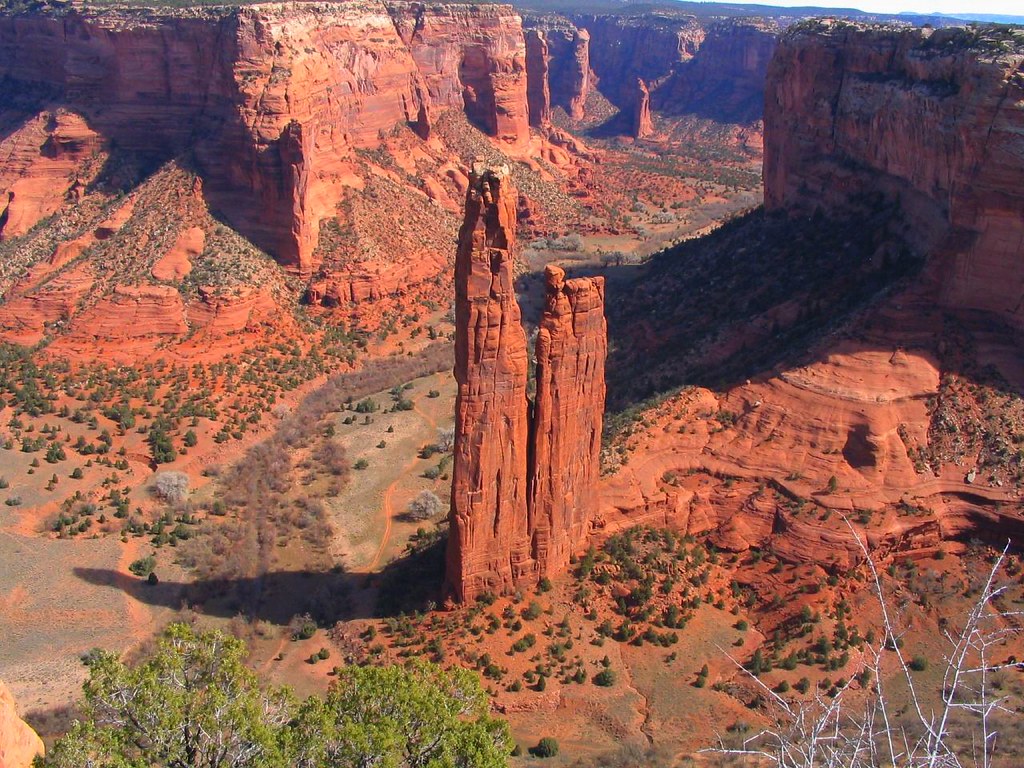
Canyon de Chelly, Arizona
Chinle Agency, Arizona, United States
Canyon de Chelly, Arizona is a canyon of sacred significance.13361, -109.46944. Attributes: natural, cultural, archaeological. Tradition: Navajo.

Grand Canyon National Park
Grand Canyon Village, Arizona, United States
For at least 12,000 years, humans have stood at the edge of this chasm and felt something shift....

Horseshoe Bend
Page, Arizona, United States
A thousand feet below the overlook, the Colorado River completes its patient arc through Navajo Sandstone, forming the near-perfect horseshoe that has drawn both...

Meteor Crater, Arizona
Coconino County, Arizona, United States
Meteor Crater, Arizona is a site of sacred significance.03070, -111.02337.

Mount Graham, Arizona
Safford, Arizona, United States
Mount Graham, Arizona is a site of sacred significance.70198, -109.87144.

Mt. Baboquivari, Arizona
Tucson, Arizona, United States
Mt. Baboquivari, Arizona is a site of sacred significance.79147, -111.57566.

Mt. Humphreys, Arizona
Flagstaff, Arizona, United States
Mt. Humphreys, Arizona is a site of sacred significance.34607, -111.67834.

Organ Pipe Cactus National Monument, Arizona
Ajo, Arizona, United States
Organ Pipe Cactus National Monument, Arizona is a site of sacred significance.08926, -112.90546.

Sedona, Arizona
Sedona, Arizona, United States
Sedona, Arizona is a site of sacred significance.88613, -111.80722. Sedona ( si-DOH-nə) is a city that straddles the county line between Coconino and Yavapai counties in...

Superstition Mountains, Arizona
Apache Junction, Arizona, United States
Superstition Mountains, Arizona is a site of sacred significance.42879, -111.41776.

Vortex at Boynton Canyon, Sedona
Sedona, Arizona, United States
Boynton Canyon holds the creation story of the Yavapai-Apache people, who understand this as the literal birthplace of their nation....

Vortex at Cathedral Rock, Sedona
Sedona, Arizona, United States
Cathedral Rock rises from the Sedona landscape like hands raised in prayer, its twin spires reflected in the waters of Oak Creek below....
California
10 sites

Joshua Tree National Park, California
Joshua Tree, California, United States
Joshua Tree, California is a natural of sacred significance.87342, -115.90099. Attributes: natural, cultural. Tradition: Native American....

Lassen Peak, California
Mineral, California, United States
Lassen Peak, California is a mountain of sacred significance.48887, -121.50484. Attributes: natural.

Mount Diablo, California
Contra Costa County, California, United States
Mount Diablo, California is a site of sacred significance.88163, -121.91408.

Mount San Jacinto, California
Riverside County, California, United States
Mount San Jacinto, California is a site of sacred significance.81448, -116.67918.

Mount Shasta
Siskiyou County, California, United States
Mount Shasta, California is a site of sacred significance.40990, -122.19486. Mount Shasta (also known as Mount Shasta City) is a city in Siskiyou County, California,...
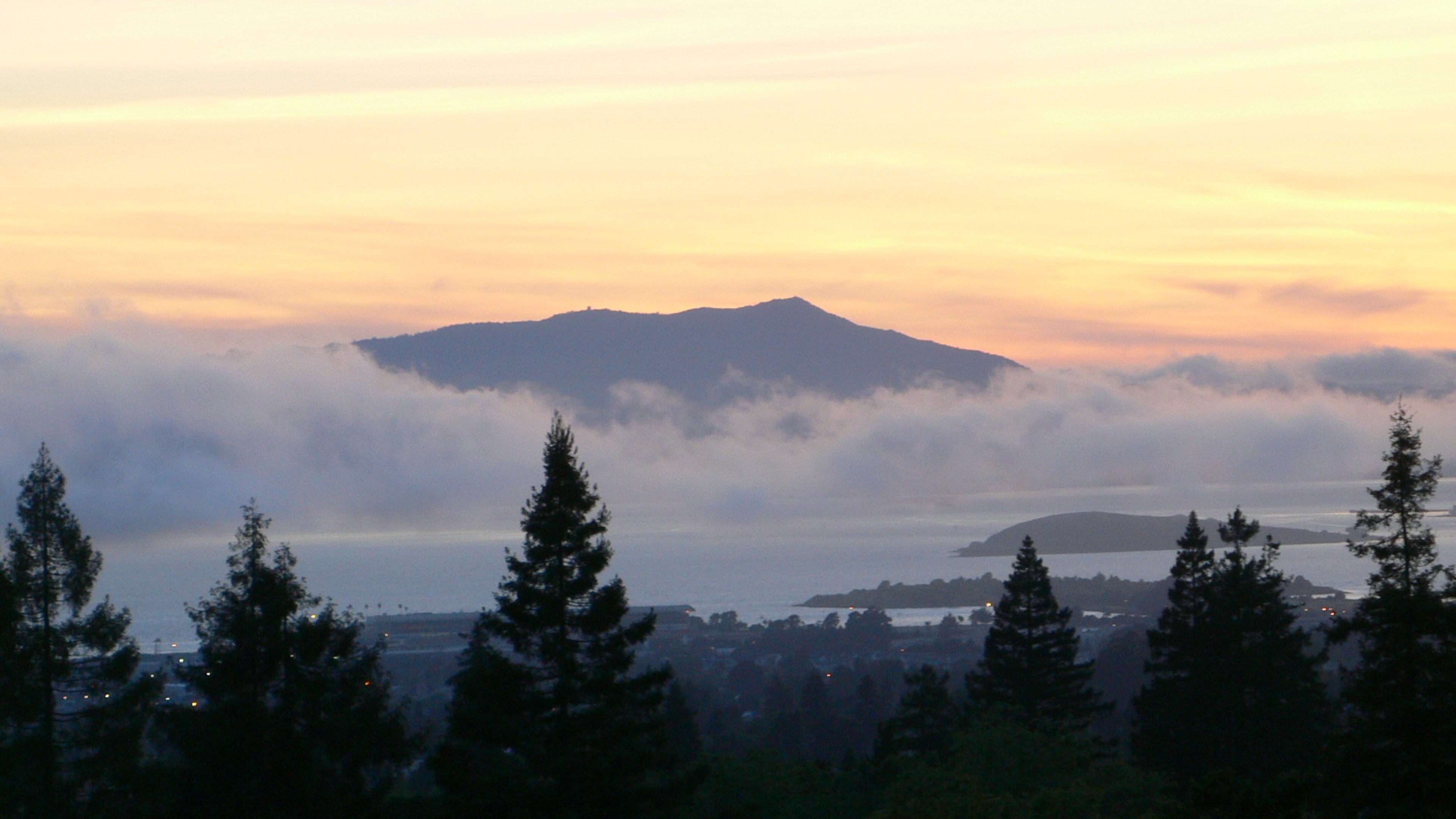
Mount Tamalpais
Marin County, California, United States
Mount Tamalpais, California is a site of sacred significance.92366, -122.59639.

Point Conception, California
Santa Barbara County, California, United States
Point Conception, California is a site of sacred significance.44884, -120.47123.

Soldier Mountain, California
Redding, California, United States
Soldier Mountain, California is a site of sacred significance.07405, -121.56360.

Tecate Peak, California
Tecate, California, United States
Tecate Peak, California is a site of sacred significance.57939, -116.68886.

Tolay Lake
Sonoma County, California, United States
Charmstone Lake - Tolay Lake, California is a lake of sacred significance.20917, -122.51389. Attributes: natural, cultural.
Champion, Wisconsin
1 site

Colorado
7 sites

Blanca Peak, Colorado
Fort Garland, Colorado, United States
Blanca Peak, Colorado is a sacred mountain of sacred significance.57723, -105.48584. Attributes: natural, cultural. Tradition: Navajo....

Crestone
Crestone, Colorado, United States
Crestone in Crestone, Colorado, United States.

Garden of the Gods, Colorado
Colorado Springs, Colorado, United States
Garden of the Gods, Colorado is a natural sacred site of sacred significance.87319, -104.88630. Attributes: natural, cultural, ceremonial. Tradition: Native American....

Great Sand Dunes, Colorado
Mosca, Colorado, United States
Great Sand Dunes, Colorado is a natural of sacred significance.77397, -105.59647. Attributes: natural, cultural. Tradition: Native American.

Island Lake, Colorado
Silverton, Colorado, United States
Island Lake, Colorado is a natural of sacred significance.82036, -107.80154. Attributes: natural, cultural. Tradition: Native American.

Mt. Hesperus, Colorado
Mancos, Colorado, United States
Mt. Hesperus, Colorado is a site of sacred significance.44517, -108.08889.

Spanish Peaks, Colorado
Walsenburg, Colorado, United States
Spanish Peaks, Colorado is a site of sacred significance.24509, -104.78725.
Florida
3 sites
Crystal River Mounds, Florida
Crystal River, Florida, United States
Crystal River Mounds, Florida is a indian mounds of sacred significance.90811, -82.64328. Attributes: built, cultural, archaeological.

Lake Jackson Mounds, Tallahassee, Florida
Tallahassee, Florida, United States
Lake Jackson Mounds, Tallahassee, Florida is a mounds of sacred significance.50001, -84.31840. Attributes: built, cultural, archaeological.

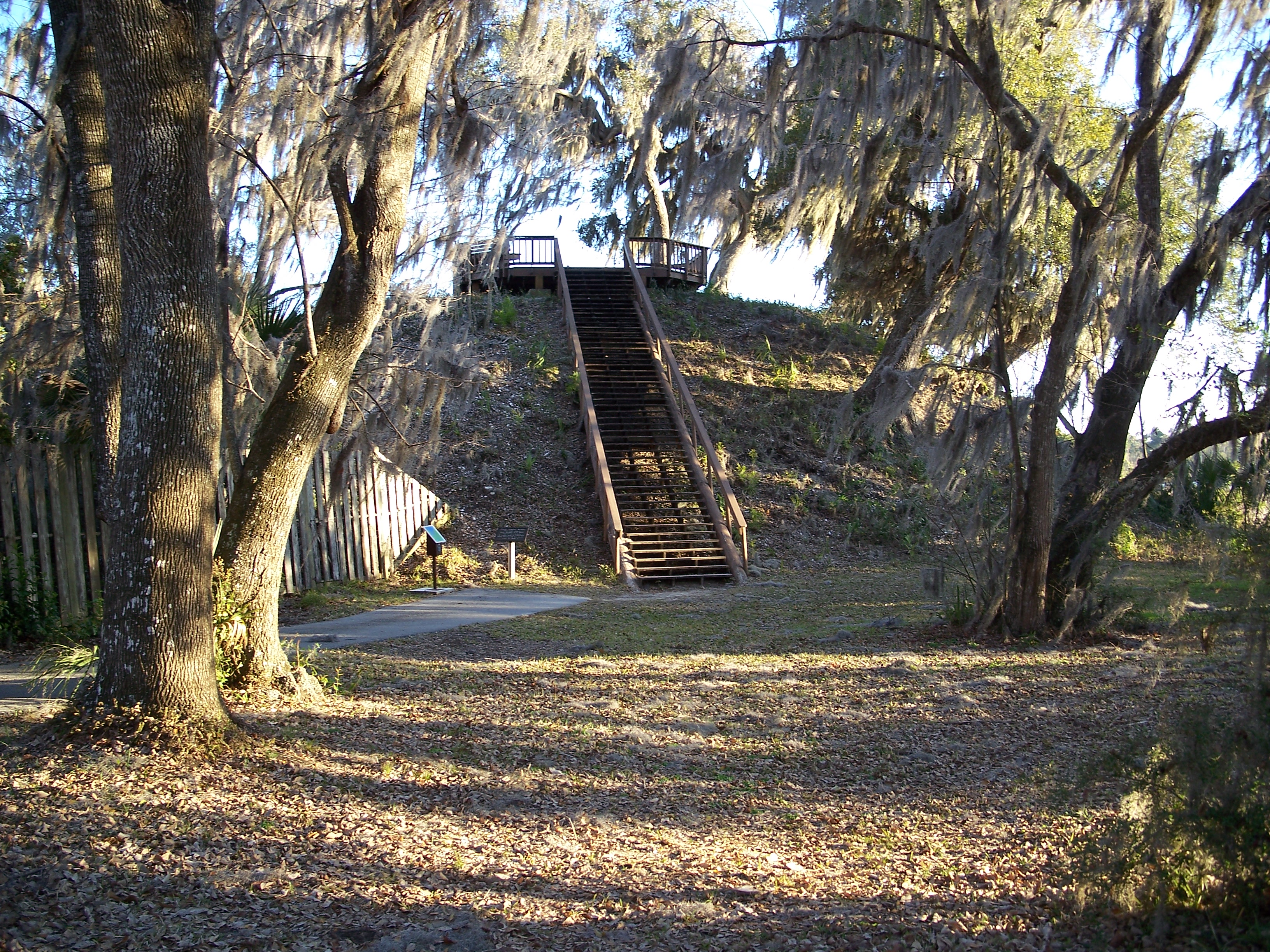
Mount Royal Mound, Florida
Welaka, Florida, United States
Mount Royal Mound, Florida is a site of sacred significance.43323, -81.65442.
Georgia
3 sites

Etowah mounds, Georgia
Cartersville, Georgia, United States
Etowah mounds, Georgia is a mound of sacred significance.12617, -84.80677. Attributes: built, cultural, archaeological, ceremonial. Tradition: Native American.

Ocmulgee Mounds, Georgia
Macon, Georgia, United States
Ocmulgee Mounds, Georgia is a site of sacred significance.84105, -83.60507.

Stone Mountain, Georgia
Stone Mountain, Georgia, United States
Stone Mountain, Georgia is a site of sacred significance.80656, -84.14806. Stone Mountain is a city in DeKalb County, Georgia, United States....
Hawaii
15 sites

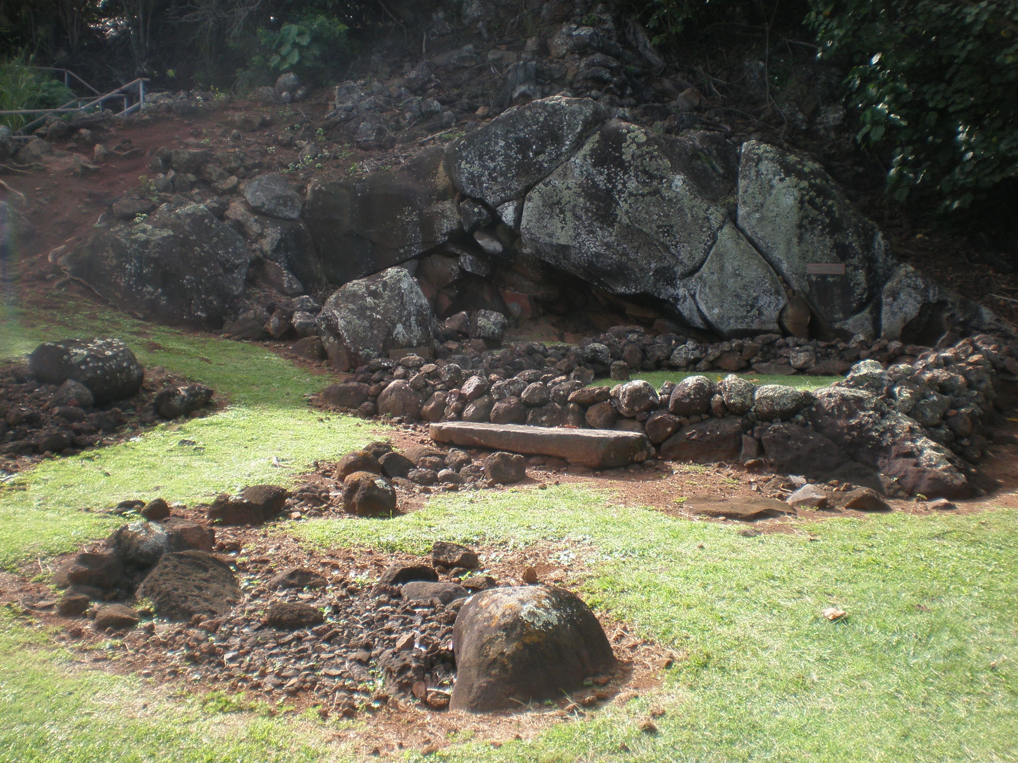
Hikiau Heiau, Hawaii
Captain Cook, Hawaii, United States
Hikiau Heiau, Hawaii is a heiau of sacred significance.47558, -155.91927. Attributes: built, cultural, archaeological, ceremonial. Tradition: Hawaiian.

Hikinaakala Heiau, Kauai
Kapaa, Hawaii, United States
Hikinaakala Heiau, Kauai is a heiau of sacred significance.04238, -159.33554. Attributes: built, cultural, archaeological, ceremonial. Tradition: Hawaiian.

Iao Valley State Park, Maui
Wailuku, Hawaii, United States
Iao Valley State Park, Maui is a natural of sacred significance.88088, -156.54518. Attributes: natural, cultural.

Keahiakawelo (Garden of the Gods), Hawaii
Lanai City, Hawaii, United States
Keahiakawelo (Garden of the Gods), Hawaii is a natural of sacred significance.87899, -156.99657. Attributes: natural, cultural. Tradition: Hawaiian....

Kilauea
Volcano, Hawaii, United States
Mt. Kilauea is a site of sacred significance.42046, -155.28728.

Kukaniloko Birthstones, Hawaii
Wahiawa, Hawaii, United States
Kukaniloko Birthstones, Hawaii is a birth site of sacred significance.50476, -158.03639. Attributes: natural, cultural, archaeological, ceremonial. Tradition: Hawaiian.

Mauna Kea, Hawaii
Hilo, Hawaii, United States
Mauna Kea, Hawaii is a mountain of sacred significance.82905, -155.47268. Attributes: natural, cultural.

Mo'okini Heiau
Hawi, Hawaii, United States
Mo' okini Luakini Heiau is a site of sacred significance.30311, -157.74949.

Mt. Haleakala, Maui
Kula, Hawaii, United States
Mt. Haleakala, Maui is a site of sacred significance.70956, -156.24876.

Piilanihale Heiau temple, Maui
Hana, Hawaii, United States
Piilanihale Heiau temple, Maui is a site of sacred significance.80508, -156.03875.
Pohaku Ho'ohanau, Kauai
Kapaa, Hawaii, United States
Pohaku Ho'ohanau, Kauai is a site of sacred significance.04927, -159.33926.

Poli'ahu Heiau, Kauai
Kapaa, Hawaii, United States
Poli'ahu Heiau, Kauai is a site of sacred significance.04647, -159.35503.

Puu Loa Petroglyphs, Hawaii
Volcano, Hawaii, United States
Puu Loa Petroglyphs, Hawaii is a site of sacred significance.29271, -155.12205.

Puuhonua o Honaunau National Historical Park, Hawaii
Honaunau, Hawaii, United States
Puuhonua o Honaunau National Historical Park, Hawaii is a site of sacred significance.42154, -155.91053.

Puukohola Heiau National Historic Site, Hawaii
Kawaihae, Hawaii, United States
Puukohola Heiau National Historic Site, Hawaii is a site of sacred significance.02562, -155.82178.
Illinois
3 sites

Cahokia Mounds, Collinsville, Illinois
Collinsville, Illinois, United States
Cahokia Mounds, Collinsville, Illinois is a mound of sacred significance.65506, -90.06182. Attributes: built, cultural, archaeological. Tradition: Native American....

Kincaid Mounds, Brookport, Illinois
Brookport, Illinois, United States
Kincaid Mounds, Brookport, Illinois is a mounds of sacred significance.08035, -88.49167. Attributes: built, cultural, archaeological. Tradition: Native American.

National Shrine of Our Lady of the Snows, Belleville, Illinois
Belleville, Illinois, United States
National Shrine of Our Lady of the Snows, Belleville, Illinois is a site of sacred significance.56130, -90.09212.
Indiana
2 sites

Iowa
1 site

Louisiana
2 sites

Marksville mounds
Marksville, Louisiana, United States
Marksville mounds is a mound of sacred significance.12343, -92.04761. Attributes: built, cultural, archaeological. Tradition: Native American.
Poverty Point Mounds, Louisiana
West Carroll Parish, Louisiana, United States
Poverty Point Mounds, Louisiana is a site of sacred significance.63616, -91.40326.
Maine
1 site

Maryland
1 site

Michigan
3 sites

National Shrine of the Cross in the Woods, Indian River, Michigan
Indian River, Michigan, United States
National Shrine of the Cross in the Woods, Indian River, Michigan is a site of sacred significance.39744, -84.63131.

Norton Mound Group
Grand Rapids, Michigan, United States
Hopewell Indian Mounds, Grand Rapids, Michigan is a mound of sacred significance.93455, -85.72884. Attributes: built, cultural, archaeological. Tradition: Native American.

Sleeping Bear Dunes, Michigan
Empire, Michigan, United States
Sleeping Bear Dunes, Michigan is a site of sacred significance.87340, -86.04666.
Minnesota
2 sites

Jeffers Petroglyphs, Comfrey, Minnesota
Comfrey, Minnesota, United States
Jeffers Petroglyphs, Comfrey, Minnesota is a archaeology site of sacred significance.09053, -95.05800. Attributes: natural, cultural, archaeological.

Pipestone National Monument, Minnesota
Pipestone, Minnesota, United States
Pipestone National Park, Minnesota is a site of sacred significance.01365, -96.32475.
Mississippi
1 site

Missouri
1 site

Montana
4 sites

Chief Mountain (Ninaistakis), Glacier County, Montana
Babb, Montana, United States
Chief Mountain (Ninaistakis), Glacier County, Montana is a mountain of sacred significance.93276, -113.60927. Attributes: natural, cultural, ceremonial....

Giant Springs, Great Falls, Montana
Great Falls, Montana, United States
Giant Springs, Great Falls, Montana is a spring of sacred significance.53496, -111.22858. Attributes: natural, cultural. Tradition: Blackfeet Indian.

Sweet Grass Hills, Montana
Whitlash, Montana, United States
Sweet Grass Hills, Montana is a site of sacred significance.84845, -111.37802.

Two Medicine Lake, Montana
East Glacier Park, Montana, United States
Two Medicine Lake, Montana is a site of sacred significance.47669, -113.38681.
Nebraska
1 site

Nevada
2 sites


New Hampshire
2 sites

Mt. Washington, New Hampshire
Gorham, New Hampshire, United States
Mt. Washington, New Hampshire is a site of sacred significance.27059, -71.30327.

Mystery Hill, New Hampshire (America’s Stonehenge)
Salem, New Hampshire, United States
Mystery Hill, New Hampshire (America’s Stonehenge) is a site of sacred significance.84282, -71.20723.
New Mexico
12 sites

Bandelier National Monument
Sandoval County, New Mexico, United States
Bandelier National Monument is a national monument of sacred significance.76467, -106.32283. Attributes: built, natural, cultural, archaeological....

Blue Lake, New Mexico
Taos County, New Mexico, United States
Blue Lake, New Mexico is a natural of sacred significance.53835, -105.39107. Attributes: natural, cultural, pilgrimage, ceremonial. Tradition: Native American.

Capitan Mountains, New Mexico
Lincoln County, New Mexico, United States
Capitan Mountains, New Mexico is a mountain of sacred significance.60675, -105.36360. Attributes: natural, cultural. Tradition: Mescalero Apache.

Chaco Canyon, New Mexico
San Juan County, New Mexico, United States
Chaco Canyon, New Mexico is a historical park of sacred significance.05909, -107.95784. Attributes: built, cultural, archaeological, ceremonial. Tradition: Anasazi Indian....
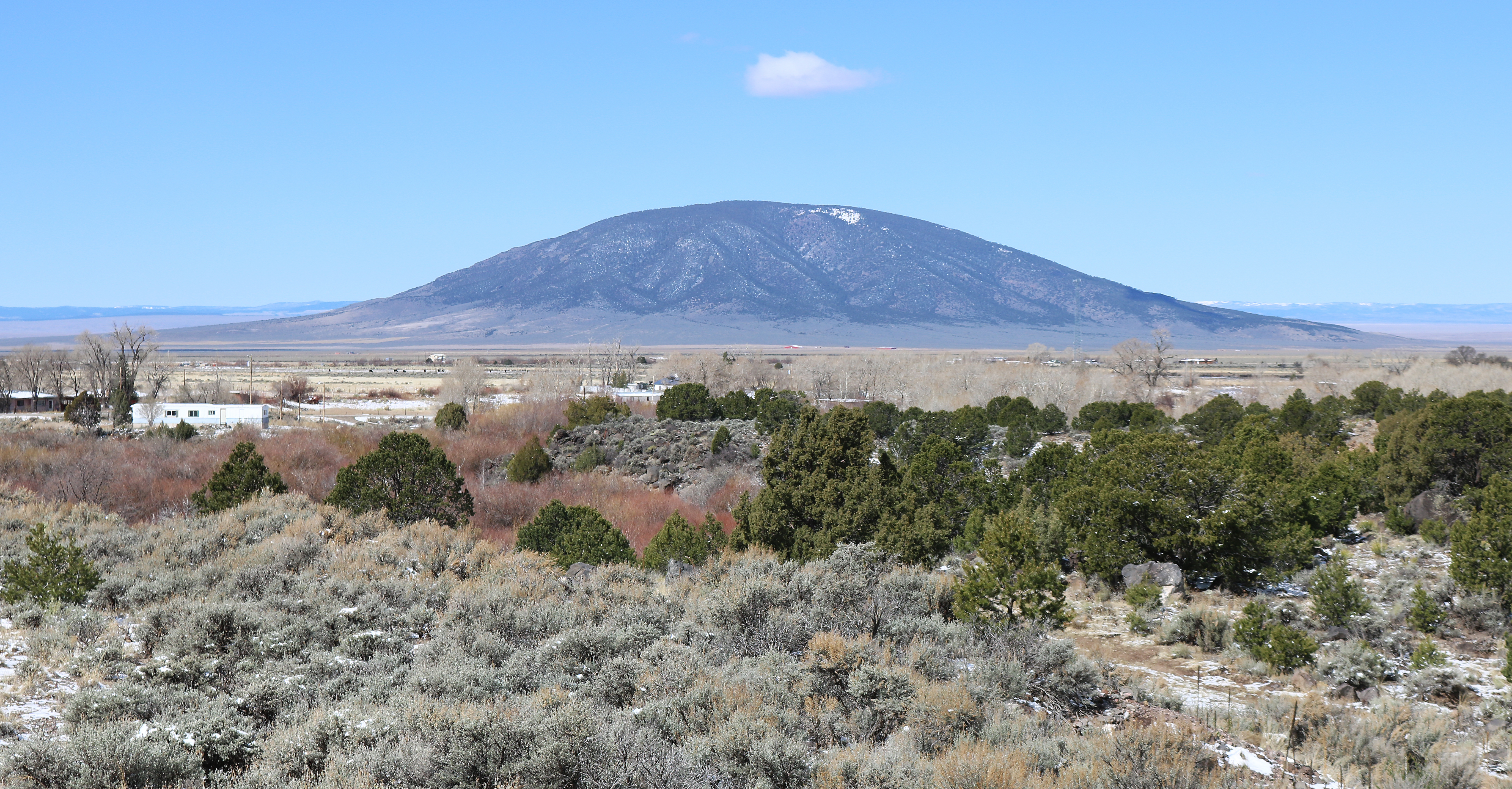
Mt. Taylor, New Mexico
Cibola County, New Mexico, United States
Mt. Taylor, New Mexico is a site of sacred significance.23866, -107.60815.

Petroglyphs National Monument
Albuquerque, New Mexico, United States
Petroglyphs National Monument is a site of sacred significance.13872, -106.71089.

Sanctuary of Chimayo, New Mexico
Santa Fe County, New Mexico, United States
Sanctuary of Chimayo, New Mexico is a site of sacred significance.98920, -105.93173.

Shiprock, New Mexico
Shiprock, New Mexico, United States
Shiprock, New Mexico is a site of sacred significance.68769, -108.83812. Shiprock (Navajo: Naatʼáanii Nééz) is an unincorporated community on the Navajo reservation in San...
Truchas Peak, New Mexico
Mora County, New Mexico, United States
Truchas Peak, New Mexico is a site of sacred significance.96269, -105.64502.
Ute Mountain, New Mexico
Taos County, New Mexico, United States
Ute Mountain, New Mexico is a site of sacred significance.93748, -105.68393.

White Sands, New Mexico
Otero County, New Mexico, United States
White Sands, New Mexico is a site of sacred significance.77977, -106.33530. White Sands is a census-designated place (CDP) in Doña Ana County, New Mexico, United States....

Zuni Lake, New Mexico
Catron County, New Mexico, United States
Zuni Lake, New Mexico is a site of sacred significance.44826, -108.76808.
New York
3 sites

Mt. Marcy, New York
Town of Keene, New York, United States
Mt. Marcy, New York is a site of sacred significance.11255, -73.92348.

Our Lady of Victory Basilica, Lackawanna, New York
City of Lackawanna, New York, United States
Our Lady of Victory Basilica, Lackawanna, New York is a site of sacred significance.82521, -78.82361.

Shrine of Saint Kateri Tekakwitha, Fonda, New York
Village of Fonda, New York, United States
Shrine of Saint Kateri Tekakwitha, Fonda, New York is a site of sacred significance.95011, -74.39277.
North Carolina
2 sites

Mt. Richland-Balsam, North Carolina
Near Waynesville, North Carolina, United States
Mt. Richland-Balsam, North Carolina is a site of sacred significance.36732, -82.99041.
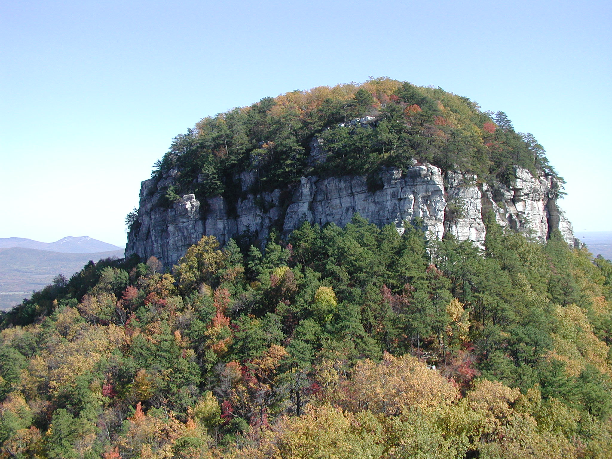
Pilot Mountain, North Carolina
Pinnacle, North Carolina, United States
Pilot Mountain, North Carolina is a site of sacred significance.34012, -80.47496.
Ohio
4 sites

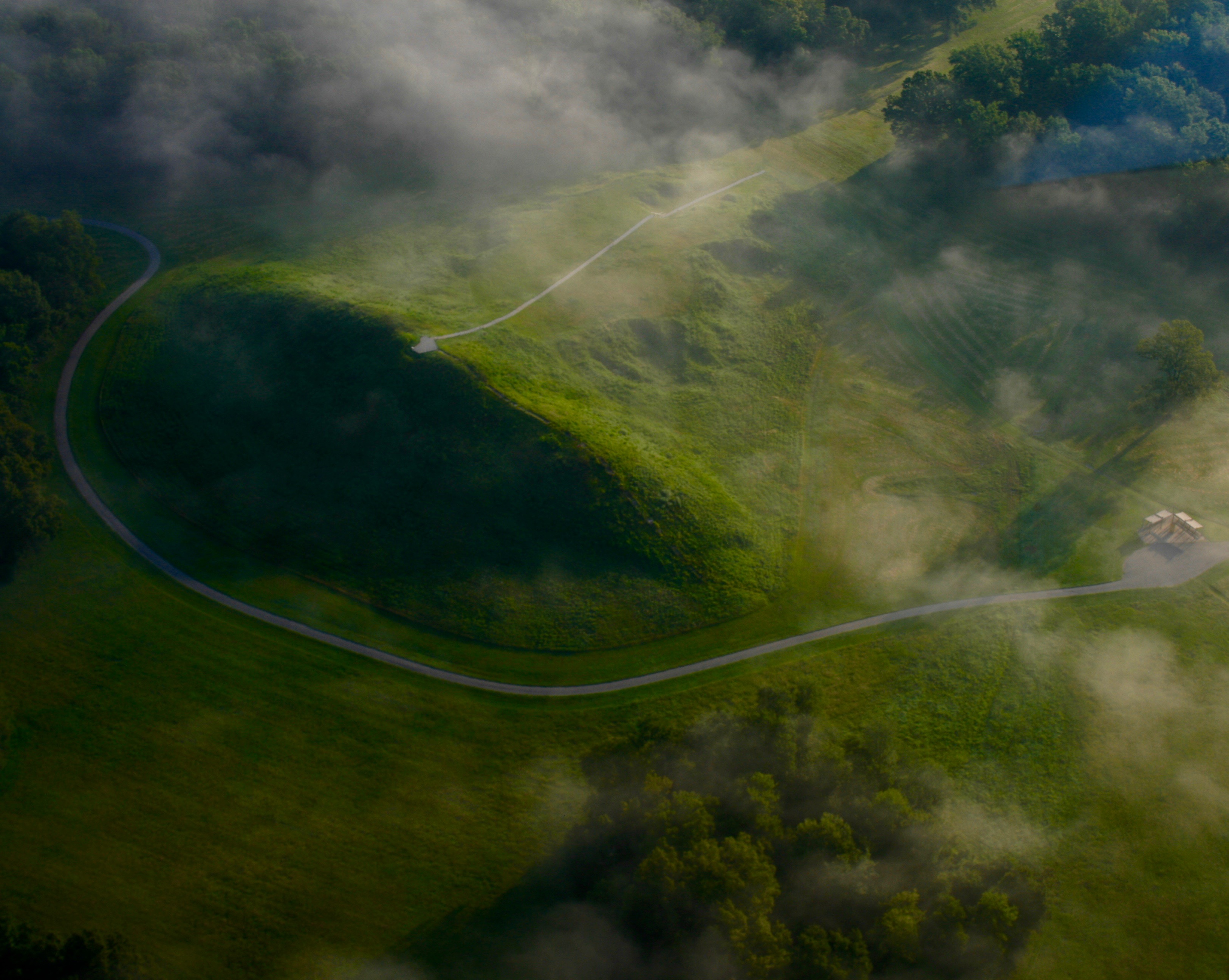
Hopewell Ceremonial Earthworks
Newark, Ohio, United States
The Hopewell Ceremonial Earthworks rise from Ohio's rolling landscape as monuments to a 2,000-year-old vision....

Maria Stein Shrine of the Holy Relics
Maria Stein, Ohio, United States
In rural western Ohio, surrounded by farmland and the steeples of over thirty cross-tipped churches, the Maria Stein Shrine of the Holy Relics holds one of the largest...

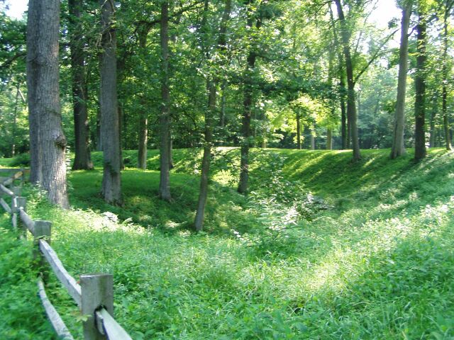
Serpent Mound, Peebles, Ohio
Bratton Township, Ohio, United States
Serpent Mound, Peebles, Ohio is a site of sacred significance.02524, -83.43020.

The Sorrowful Mother Shrine
Bellevue, Ohio, United States
The Sorrowful Mother Shrine, Bellevue, Ohio is a site of sacred significance.18400, -82.84234.
Oklahoma
2 sites

Antelope and Buffalo Springs (Chickasaw National Recreation Area)
Sulphur, Oklahoma, United States
Antelope and Buffalo Springs, Sulphur, Oklahoma is a spring of sacred significance.50265, -96.93928. Attributes: natural, cultural.

Spiro Mounds State Park
Spiro, Oklahoma, United States
Spiro Mounds State Park is a site of sacred significance.31172, -94.56843.
Oregon
4 sites

Mt. Hood, Oregon
Government Camp, Oregon, United States
Mt. Hood, Oregon is a site of sacred significance.37362, -121.69595.

Multnomah Falls, Oregon
Corbett, Oregon, United States
Multnomah Falls, Oregon is a site of sacred significance.57616, -122.11578.

Wallowa Lake, Oregon
Joseph, Oregon, United States
Wallowa Lake, Oregon is a site of sacred significance.31256, -117.20695. Wallowa Lake is a census-designated place (CDP) and unincorporated community in Wallowa County,...

Wizard Island, Crater Lake, Oregon
Klamath County, Oregon, United States
Wizard Island, Crater Lake, Oregon is a site of sacred significance.94009, -122.14703.
Pennsylvania
1 site

Puerto Rico
1 site

Santa Barbara County
1 site

South Dakota
3 sites

Bear Butte, South Dakota
Sturgis, South Dakota, United States
Bear Butte, South Dakota is a mountain of sacred significance.47446, -103.42323. Attributes: natural, cultural.

Black Elk Peak, South Dakota
Custer, South Dakota, United States
Harney Peak, South Dakota is a mountain of sacred significance.86647, -103.53181. Attributes: natural, cultural, ceremonial. Tradition: Sioux Native American....

Wind Cave, South Dakota
Hot Springs, South Dakota, United States
Wind Cave, South Dakota is a site of sacred significance.58698, -103.44074.
Texas
3 sites

Basilica of Our Lady of San Juan del Valle, San Juan, Texas
San Juan, Texas, United States
Basilica of Our Lady of San Juan del Valle, San Juan, Texas is a basilica of sacred significance.19864, -98.15759. Attributes: built, cultural, pilgrimage....

Enchanted Rock, Texas
Fredericksburg, Texas, United States
Enchanted Rock, Texas is a natural of sacred significance.50696, -98.81722. Attributes: natural, cultural. Tradition: Native American....

Guadalupe Peak, Texas
Salt Flat, Texas, United States
Guadalupe Peak, Texas is a sacred mountain of sacred significance.89123, -104.86050. Attributes: natural, cultural. Tradition: Mescalero Apache....
Utah
3 sites

Bryce Canyon National Park
Bryce Canyon City, Utah, United States
At the edge of Utah's high plateau, thousands of stone spires rise from natural amphitheaters in formations found nowhere else on Earth....

Hovenweep Ruins, Utah
Shiprock Agency, Utah, United States
Hovenweep Ruins, Utah is a ancient village of sacred significance.29928, -109.18420. Attributes: built, cultural, archaeological. Tradition: Ancient Puebloan.

Zion National Park
Springdale, Utah, United States
For over eight centuries, the Southern Paiute have known these canyon walls as sacred homeland, a landscape alive with spiritual power they call Puha....
Washington
4 sites

Mount Adams, Washington
Trout Lake, Washington, United States
Mount Adams, Washington is a site of sacred significance.20247, -121.49102.

Mt. Rainier, Washington
Ashford, Washington, United States
Mt. Rainier, Washington is a site of sacred significance.85231, -121.76032.

Snoqualmie Falls, Oregon
Snoqualmie, Washington, United States
Snoqualmie Falls, Oregon is a site of sacred significance.54186, -121.83729.

Tamanowas Rock Santuary, Washington
Port Townsend, Washington, United States
Tamanowas Rock Santuary, Washington is a site of sacred significance.02211, -122.79327.
West Virginia
1 site

Wisconsin
1 site

Wyoming
2 sites

Big Horn Medicine Wheel, Wyoming
Big Horn County, Wyoming, United States
Big Horn Medicine Wheel, Wyoming is a astronomical observation device of sacred significance.82587, -107.92153. Attributes: built, cultural, archaeological, ceremonial.

Inyan Kara Mountain, Wyoming
Sundance, Wyoming, United States
Inyan Kara Mountain, Wyoming is a mountain of sacred significance.21365, -104.34969. Attributes: natural, cultural, ceremonial. Tradition: Cheyenne and Sioux Lakota.