Mt. Washington, New Hampshire
Where Indigenous sacred geography meets the most extreme weather in the eastern United States
Gorham, New Hampshire, United States
Plan this visit
Practical context before you go
Full day for hiking round trip via any major trail route
Respect the mountain's extreme conditions and Indigenous heritage. Prepare for weather that routinely exceeds what the elevation suggests. Practice Leave No Trace in the alpine zone.
At a glance
- Coordinates
- 44.2705, -71.3033
- Suggested duration
- Full day for hiking round trip via any major trail route
Pilgrim tips
- Mountain conditions require preparation for extreme weather at any time of year. Summer summit temperatures average 40-50 degrees Fahrenheit with high winds. Layers, wind protection, rain gear, and sturdy footwear are essential. Winter conditions are Arctic in severity and require full technical mountaineering equipment.
- Permitted throughout. The summit complex, historic Tip Top House, Cog Railway, and weather phenomena are popular subjects. The alpine zone offers distinctive landscapes of krummholz and exposed granite.
- Mountain weather changes rapidly and can be deadly at any time of year. Over 150 people have died on Mount Washington. Winter summit attempts require technical mountaineering skills and equipment. The alpine zone is ecologically fragile; stay on marked trails. Hypothermia is possible even in summer if you are caught in sudden fog and wind without adequate layers. Check conditions with the Observatory before ascending.
Overview
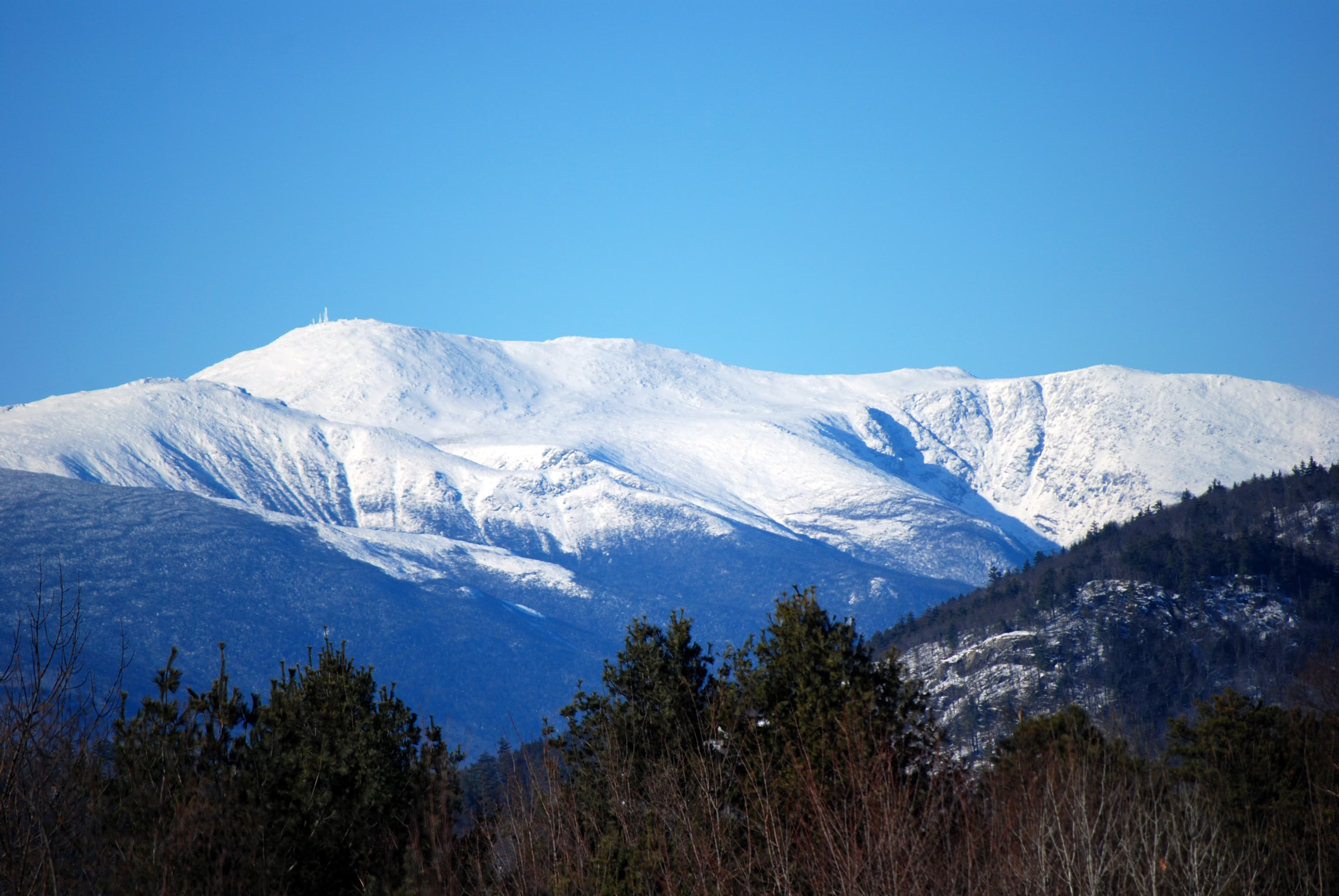
Mount Washington rises 6,288 feet above northern New Hampshire, the highest peak in the northeastern United States. The Abenaki knew it as Agiocochook, Home of the Great Spirit, and considered its summit forbidden to human feet. Storm spirits dwell there still. The mountain holds a world record for directly measured wind speed: 231 miles per hour. Hurricane-force winds occur over a hundred days each year. For those who climb or ride to the summit, the encounter with overwhelming natural force remains what the Abenaki understood: this is a place where ordinary rules do not apply.
The mountain does not reveal itself easily. Approaching through the forested valleys of the White Mountains, you catch glimpses through gaps in the ridgeline, then lose sight again. Only when you reach the open meadows of Pinkham Notch does Mount Washington declare itself fully: a summit that rises above treeline into a zone where weather systems collide and extreme becomes ordinary. For the Abenaki people, who have lived in this region since time beyond memory, the mountain was Agiocochook, Home of the Great Spirit. The name itself encodes understanding: this is where divine beings dwell, where storm spirits gather, where the boundary between the human world and something greater grows thin. The Abenaki did not climb to the summit. Not because they could not, but because they understood the summit as sacred ground that humans should not tread. When Darby Field climbed the mountain in June 1642, guided by Native Americans who accompanied him partway but would not ascend to the top, his act was explicitly transgressive. Governor John Winthrop's journal records the ascent; scholars understand it now as a demonstration to Chief Passaconaway that European colonizers were not bound by Indigenous spiritual laws. Field could enter the dwelling place of the Great Spirit and return unharmed. The message was political as much as spiritual: this land and its sacred geography could be claimed. What Field encountered at the summit, and what every visitor since has encountered, is weather of a severity that defies expectation. Mount Washington sits at the convergence of three major storm tracks. Cold air from Canada meets warm air from the Gulf of Mexico and moisture from the Atlantic. The result is conditions that exceed those of much higher mountains. The summit temperature rarely rises above 60 degrees Fahrenheit even in summer. Fog shrouds the peak 300 days per year. On April 12, 1934, the Mount Washington Observatory recorded a wind gust of 231 miles per hour, a world record that stood for over six decades. Hurricane-force winds occur on average 110 days annually. The mountain has claimed over 150 lives. Today, more than 250,000 visitors reach the summit each year by hiking trail, auto road, or cog railway. The Sherman Adams Visitor Center and Mount Washington Observatory occupy the summit, maintaining one of the longest continuous climate records in North America. But despite the buildings and tourists, despite the gift shop and cafeteria, the mountain remains what the Abenaki knew it to be: a place where human presence feels provisional, where forces beyond human control hold sway, where something persists that resists ordinary explanation.
Context and lineage
The Abenaki knew this mountain as Agiocochook, a name that carries multiple translations: Home of the Great Spirit, Mother Goddess of the Storm, the place where sacred beings dwell. Other Abenaki names include Kodaak Wadjo, Hidden Mountain Always in the Clouds, and Waumbik, White Rocks. These names encode not just description but relationship: this is a mountain of power, of mystery, of forces that humans approach with care. The traditional prohibition against climbing to the summit reflected cosmological understanding. Mountains were the dwelling places of divine beings. To climb to the summit was to enter territory that did not belong to humans, to intrude upon the sacred. This was not fear but reverence, recognition of appropriate boundaries between realms. In June 1642, Darby Field, an Irish-born English settler from the Piscataqua region, climbed the mountain guided by Native Americans. Governor John Winthrop recorded that Field was accompanied by two Indigenous guides who went partway but would not ascend to the summit. Field claimed to find precious stones at the top, returning twice more that summer with other colonists. The climb was understood in its time as a demonstration that European colonizers were not bound by Indigenous spiritual laws. Chief Passaconaway, the powerful Abenaki sagamore whose authority extended over much of present-day New Hampshire, could not prevent the violation of sacred geography. The message facilitated colonial land acquisition in the decades that followed. Mountain tourism developed through the 19th century. Abel Crawford and his son Ethan Allen Crawford built the Crawford Path in 1819, guiding visitors to the summit and establishing hospitality that continued for generations. The carriage road, now the Auto Road, opened in 1861. The Cog Railway, conceived by Sylvester Marsh after he was caught in a summit storm in 1857, opened in 1869 as the world's first mountain-climbing cog railway. Scientific observation began in 1870 when the U.S. Signal Service established a weather station. The Mount Washington Observatory, founded in 1932, has maintained continuous observation ever since, documenting extremes that have earned the summit its reputation for the worst weather in the world.
Mount Washington connects to Indigenous sacred geography that extends throughout the White Mountains, including 21 sites within the White Mountain National Forest that the U.S. Forest Service has designated as holding spiritual, agricultural, and historical significance to Native American peoples. The mountain's development as a tourist destination parallels the emergence of American nature appreciation in the 19th century, influencing the creation of national parks and wilderness preservation.
Passaconaway
Darby Field
Abel Crawford and Ethan Allen Crawford
Sylvester Marsh
Paul Bunnell
Why this place is sacred
What makes a mountain sacred? The Abenaki answer was clear: Agiocochook is the dwelling place of the Great Spirit, the home of storm spirits who manifest their power in the violent weather that gathers at the summit. Humans do not belong there. The prohibition against climbing was not superstition but relationship, recognition that some boundaries exist for good reason. Modern visitors, most arriving without knowledge of Abenaki cosmology, encounter the same phenomena the Abenaki knew, even if they lack the traditional framework to interpret them. Standing on the summit in a 100-mile-per-hour wind, unable to stand upright, watching rime ice form on every surface, experiencing temperature drops of 30 degrees in minutes, visitors confront their own smallness against forces that seem almost intentional in their intensity. The Abenaki would say this is the storm spirits making their presence known. Scientists at the Observatory document the same forces in different language, recording hourly observations that reveal extremes unprecedented for this elevation. Both perspectives converge on the same recognition: something extraordinary occurs here, something that exceeds normal experience, something that demands attention and respect. The mountain's position above treeline adds to its liminal quality. The ascent from forested lowlands through subalpine krummholz into the bare alpine zone marks a passage from the familiar into the strange. Above treeline, the landscape becomes tundra, fragile and exposed, a place where summer and winter can occur within the same hour. Visitors describe feeling they have entered another world, which in a meaningful sense they have. Perhaps what makes Mount Washington thin is simply what it is: the highest point in northeastern North America, exposed to weather systems that converge nowhere else in quite this way, a summit that humans have consistently experienced as extraordinary across cultures and centuries. The Abenaki named this quality. Science documents it. Visitors feel it. The mountain continues to offer what it has always offered: an encounter with something greater than oneself.
Sacred mountain in Abenaki cosmology, dwelling of the Great Spirit and storm spirits, traditionally forbidden to summit approach.
Indigenous sacred site since time immemorial. First documented European ascent in 1642 as an act of colonial assertion. Mountain tourism developed through the 19th century with the Crawford Path (1819), Auto Road (1861), and Cog Railway (1869). Scientific observation began in 1870 and continues at the Mount Washington Observatory (founded 1932). Contemporary period sees convergence of recreation, science, and ongoing Indigenous cultural significance, though the Abenaki heritage remains often overlooked.
Traditions and practice
The Abenaki traditionally did not climb to the summit of Agiocochook. The mountain was the dwelling place of the Great Spirit and storm spirits; humans approached its upper reaches with reverence but did not intrude upon sacred ground. The White Mountains as a whole held ceremonial, hunting, and ancestral significance. Chief Paul Bunnell has stated that the mountains are 'sacred. That is our spiritual place. That is our source of hunting, our wildlife, and our plant life. And our ancestors are buried there.' Specific contemporary ceremonial practices are not publicly documented.
The Mount Washington Observatory maintains year-round scientific observation, with staff living on the summit and recording hourly measurements. Recreational hiking draws thousands annually to trails including Tuckerman Ravine, the Crawford Path, and routes throughout the Presidential Range. The AMC operates Lakes of the Clouds Hut for overnight hikers. Educational programs at the Sherman Adams Visitor Center interpret the mountain's weather, ecology, and history. Winter EduTrips offered by the Observatory allow participants to experience summit conditions during the most extreme season.
Hike to the summit via Tuckerman Ravine Trail or Crawford Path if you are physically prepared and conditions allow. The journey through ecological zones from forest to alpine tundra offers visceral understanding of the mountain's vertical geography. If hiking is not possible, the Auto Road and Cog Railway provide summit access that has drawn visitors for over 150 years. At the summit, visit the Observatory museum to understand the extremity of conditions here. Allow time for the weather to teach you what it will. Consider the Abenaki understanding that the summit belongs to beings greater than humans, and let that perspective inform your experience of standing where storm spirits dwell.
Abenaki sacred mountain tradition
ActiveThe Abenaki have known Mount Washington as Agiocochook, Home of the Great Spirit, since time beyond memory. The mountain was considered so sacred that climbing to the summit was forbidden. Storm spirits dwell there. Chief Paul Bunnell has spoken of the White Mountains as the spiritual center of Abenaki life.
Traditional prohibition on climbing to the summit. Reverence for the mountain as sacred space. The U.S. Forest Service has designated 21 sites within the White Mountain National Forest that hold spiritual, agricultural, and historical significance for Indigenous peoples. Specific contemporary ceremonial practices are not publicly shared.
Scientific observation
ActiveMount Washington has been a center for meteorological research since 1870. The Mount Washington Observatory, founded in 1932, maintains one of North America's longest continuous climate records and has documented some of the most extreme weather conditions measured anywhere on Earth.
Year-round weather observation with hourly manual measurements. Scientific research on extreme weather phenomena. Educational programs and museum exhibits. Observatory staff live on the summit year-round, recording observations 24 hours a day.
Mountain pilgrimage and recreation
ActiveMount Washington has attracted visitors seeking to experience its summit since the early 19th century. The Crawford Path (1819) is the oldest continuously maintained hiking trail in America. The Cog Railway (1869) and Auto Road (1861) made summit access possible for the general public, creating a tradition of democratic mountain pilgrimage.
Hiking via established trails including Tuckerman Ravine and Crawford Path. Travel via the world's first mountain-climbing cog railway. Driving the Auto Road or taking guided tours. Visiting the Sherman Adams Visitor Center and Observatory museum. Spring skiing in Tuckerman Ravine.
Experience and perspectives
The experience of Mount Washington begins with the approach. From Pinkham Notch on the east side, the mountain reveals itself across the headwaters of the Peabody River, its summit often obscured by the clouds that give this range its name. The White Mountains were named not for snow but for the pale granite and frequent cloud cover that make the peaks appear white from a distance. Multiple routes lead to the summit, each offering a different encounter with the mountain. Hikers most commonly ascend via Tuckerman Ravine Trail, a 4.2-mile route that gains over 4,000 feet of elevation. The trail passes through forest, then emerges into the vast glacial cirque of Tuckerman Ravine itself, a bowl of steep headwalls that holds snow into summer and draws spring skiers from across the region. Above the ravine, the route crosses the alpine zone, exposed to weather that can change within minutes from sunshine to whiteout. The Crawford Path, built in 1819, is the oldest continuously maintained hiking trail in America. It ascends from the west, following the ridgeline of the Presidential Range, connecting Mount Washington to its neighboring peaks named for American presidents. Walking this ridge is walking into history, into a tradition of mountain appreciation that predates the national park system by decades. For those who cannot or choose not to hike, the Auto Road and Cog Railway provide summit access that has been available for over 150 years. The Auto Road, opened in 1861, climbs 7.6 miles from Pinkham Notch to the summit, gaining 4,618 feet. Drivers navigate hairpin turns with sheer drops, emerging above treeline into a landscape that feels lunar. The Cog Railway, the world's first mountain-climbing cog railway when it opened in 1869, ascends from the western approach, its steam and biodiesel engines pushing cars up grades that exceed 37 percent. At the summit, the Sherman Adams Visitor Center provides shelter from conditions that can be life-threatening any month of the year. The Observatory museum displays the wind gauge that recorded 231 miles per hour, photographs of scientists encased in rime ice, documentation of weather events that read like fiction. The historic Tip Top House, built in 1853 and the oldest surviving building on any mountaintop in the world, stands as a reminder that people have been seeking this summit for nearly two centuries. Whatever your route, the summit experience is defined by weather. On clear days, views extend to five states and Canada, the Presidentials marching north along the ridgeline, the Atlantic Ocean visible on the eastern horizon. But clear days are the exception. Fog, wind, and sudden storms are the norm. Visitors who arrive expecting a pleasant overlook often find themselves in conditions that feel Arctic in their intensity. This is the mountain's teaching: you are small, the forces at work here are large, and respect is the appropriate response.
Eastern approach via Route 16 through Pinkham Notch: AMC Pinkham Notch Visitor Center (trailhead for Tuckerman Ravine Trail), Auto Road base. Western approach via Route 302: Cog Railway base station at Marshfield, Crawford Path trailhead. Summit (6,288 feet) accessible by hiking trails, Auto Road (seasonal), or Cog Railway.
Mount Washington exists at the intersection of Indigenous sacred geography, scientific observation, and outdoor recreation. Each perspective illuminates something the others may miss.
The mountain's geological significance as the highest peak in the Northeast and its extreme weather conditions are thoroughly documented through over a century of scientific observation. The Observatory's climate records are among the longest continuous datasets in North America. Indigenous significance to the Abenaki is recognized in historical and ethnographic scholarship, though often marginalized in popular accounts that focus on weather and recreation. The 1642 ascent by Darby Field is understood in colonial context as an assertion of European authority over Indigenous sacred space. The U.S. Forest Service recognition of 21 protected Indigenous sacred sites in the White Mountain National Forest reflects contemporary acknowledgment of Native American heritage.
For the Abenaki, Agiocochook was and remains sacred. The dwelling place of the Great Spirit, the home of storm spirits who manifest in the extreme weather that gathers at the summit. Chief Paul Bunnell has spoken of the White Mountains as the spiritual center of Abenaki heritage: 'That is our spiritual place. That is our source of hunting, our wildlife, and our plant life. And our ancestors are buried there.' A 2024 proposal to officially restore the name Agiocochook was rejected by the Board on Geographic Names, though the name was approved for use alongside Mount Washington on federal products. The mountain's Indigenous significance predates any other American institution by thousands of years.
Some visitors report the mountain as a place of unusual energy or spiritual power, though Mount Washington has not developed the organized metaphysical communities seen at sites like Mount Shasta. The Abenaki attribution of storm spirits to the summit resonates with those who sense intentionality in the mountain's extreme weather. Lenticular clouds and dramatic storm formations visible from great distances have long inspired legends and speculation.
Whether Native Americans climbed the summit before Darby Field's 1642 ascent remains debated. The full extent of Abenaki ceremonial practice and sacred geography in the White Mountains is not publicly documented. Why weather conditions at Mount Washington exceed those of much higher peaks is understood scientifically but still inspires wonder. The psychological and physiological effects of the mountain's extreme atmospheric conditions on visitor experience remain incompletely studied.
Visit planning
Lodging available in Gorham, Bretton Woods, North Conway, and throughout the White Mountains region. AMC lodges at Pinkham Notch and Highland Center offer mountain-focused hospitality. Lakes of the Clouds Hut provides overnight shelter for hikers on the mountain (reservation required). Camping available throughout White Mountain National Forest.
Respect the mountain's extreme conditions and Indigenous heritage. Prepare for weather that routinely exceeds what the elevation suggests. Practice Leave No Trace in the alpine zone.
Mountain conditions require preparation for extreme weather at any time of year. Summer summit temperatures average 40-50 degrees Fahrenheit with high winds. Layers, wind protection, rain gear, and sturdy footwear are essential. Winter conditions are Arctic in severity and require full technical mountaineering equipment.
Permitted throughout. The summit complex, historic Tip Top House, Cog Railway, and weather phenomena are popular subjects. The alpine zone offers distinctive landscapes of krummholz and exposed granite.
Not customary. Practice Leave No Trace principles.
Summit facilities closed mid-October through late May. Auto Road closed to private vehicles in winter; SnowCoach tours may be available. Permits required for groups on some trails. Alpine zone above treeline is ecologically protected; stay on marked paths.
Plan your visit
Address
Mt Washington, Sargent's Purchase, NH 03846, USA
Hours, fees, and access can change — verify on the official source before you travel. Practical details last checked Jun 2026.
Nearby sacred places
Sacred places within a half-day’s reach. Pilgrims often visit them together: walk one, stay for the other.
Mystery Hill, New Hampshire (America’s Stonehenge)
Salem, New Hampshire, United States
158.9 km away

Mt. Marcy, New York
Town of Keene, New York, United States
209.6 km away
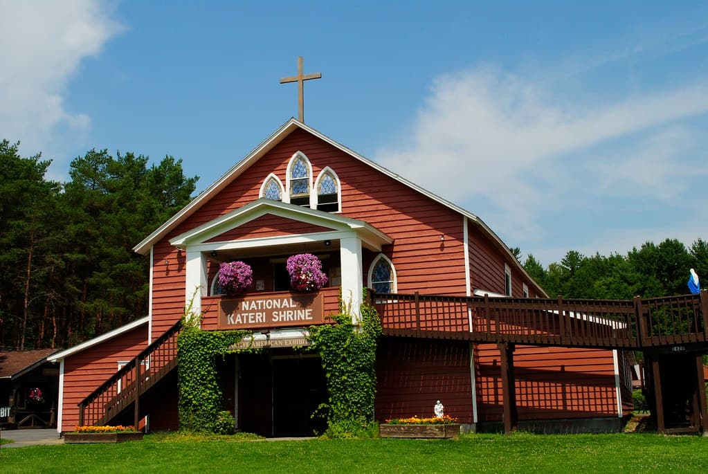
Kateri Tekakwitha Shrine
Kahnawake, Quebec, Canada
226.4 km away
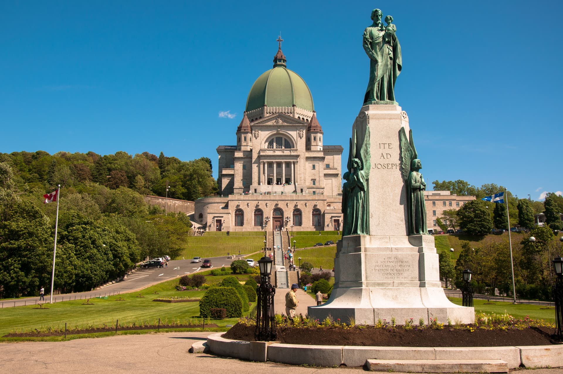
Saint Joseph's Oratory of Mount Royal
Montreal, Montreal, Quebec, Canada
227.4 km away
References
Sources consulted when researching this page. Independent verification by readers is welcome.
- 01Mount Washington - Wikipedia — Wikipediahigh-reliability
- 02Indigenous History in the White Mountains: An Interview with Abenaki Chief and Elder Paul Bunnell — Hydropower Reform Coalitionhigh-reliability
- 03The Wobanadenok — Indigenous New Hampshire Collaborative Collectivehigh-reliability
- 04Mount Washington State Park - About its Weather — NH State Parkshigh-reliability
- 05Mount Washington Observatory — Mount Washington Observatoryhigh-reliability
- 06Board Says No To Changing Mount Washington to Agiocochook — InDepthNH.orghigh-reliability
- 07The Mount Washington Cog Railway — Mount Washington Cog Railwayhigh-reliability
- 08Mt. Washington Auto Road — Mount Washington Auto Roadhigh-reliability
- 09Darby Field - Wikipedia — Wikipediahigh-reliability
- 10Presidential Range - Wikipedia — Wikipediahigh-reliability
Key questions
What pilgrims usually ask
- Why is Mt. Washington, New Hampshire considered sacred?
- Explore Mount Washington, New Hampshire's sacred peak known to the Abenaki as Agiocochook, Home of the Great Spirit. Experience the world's worst weather at 6,2
- What should I wear at Mt. Washington, New Hampshire?
- Mountain conditions require preparation for extreme weather at any time of year. Summer summit temperatures average 40-50 degrees Fahrenheit with high winds. Layers, wind protection, rain gear, and sturdy footwear are essential. Winter conditions are Arctic in severity and require full technical mountaineering equipment.
- Can I take photos at Mt. Washington, New Hampshire?
- Permitted throughout. The summit complex, historic Tip Top House, Cog Railway, and weather phenomena are popular subjects. The alpine zone offers distinctive landscapes of krummholz and exposed granite.
- How long should I spend at Mt. Washington, New Hampshire?
- Full day for hiking round trip via any major trail route
- What offerings are appropriate at Mt. Washington, New Hampshire?
- Not customary. Practice Leave No Trace principles.
- What etiquette should visitors follow at Mt. Washington, New Hampshire?
- Respect the mountain's extreme conditions and Indigenous heritage. Prepare for weather that routinely exceeds what the elevation suggests. Practice Leave No Trace in the alpine zone.
- What is the history of Mt. Washington, New Hampshire?
- The Abenaki knew this mountain as Agiocochook, a name that carries multiple translations: Home of the Great Spirit, Mother Goddess of the Storm, the place where sacred beings dwell. Other Abenaki names include Kodaak Wadjo, Hidden Mountain Always in the Clouds, and Waumbik, White Rocks. These names encode not just description but relationship: this is a mountain of power, of mystery, of forces that humans approach with care. The traditional prohibition against climbing to the summit reflected cosmological understanding. Mountains were the dwelling places of divine beings. To climb to the summit was to enter territory that did not belong to humans, to intrude upon the sacred. This was not fear but reverence, recognition of appropriate boundaries between realms. In June 1642, Darby Field, an Irish-born English settler from the Piscataqua region, climbed the mountain guided by Native Americans. Governor John Winthrop recorded that Field was accompanied by two Indigenous guides who went partway but would not ascend to the summit. Field claimed to find precious stones at the top, returning twice more that summer with other colonists. The climb was understood in its time as a demonstration that European colonizers were not bound by Indigenous spiritual laws. Chief Passaconaway, the powerful Abenaki sagamore whose authority extended over much of present-day New Hampshire, could not prevent the violation of sacred geography. The message facilitated colonial land acquisition in the decades that followed. Mountain tourism developed through the 19th century. Abel Crawford and his son Ethan Allen Crawford built the Crawford Path in 1819, guiding visitors to the summit and establishing hospitality that continued for generations. The carriage road, now the Auto Road, opened in 1861. The Cog Railway, conceived by Sylvester Marsh after he was caught in a summit storm in 1857, opened in 1869 as the world's first mountain-climbing cog railway. Scientific observation began in 1870 when the U.S. Signal Service established a weather station. The Mount Washington Observatory, founded in 1932, has maintained continuous observation ever since, documenting extremes that have earned the summit its reputation for the worst weather in the world.
- Who is associated with Mt. Washington, New Hampshire?
- Passaconaway, Darby Field, Abel Crawford and Ethan Allen Crawford, Sylvester Marsh, Paul Bunnell