Point Conception, California
The Western Gate, where the Chumash say the souls of the dead begin their passage to paradise
Santa Barbara County, California, United States

Plan this visit
Practical context before you go
The round trip from Jalama Beach is approximately 8 miles and takes 2.5 to 3 hours of walking, plus time at the headland. The entire outing requires 4 to 5 hours and must be timed precisely around low tide.
Drive Jalama Road from Highway 1, approximately 3 miles south of Lompoc, to Jalama Beach County Park. The road is narrow and winding. From the beach, walk northwest along the coast at low tide. The walk is approximately 4 miles to a view of Point Conception. You cannot reach the point itself — the bluffs above the beach are private land (Dangermond Preserve, managed by The Nature Conservancy). The lighthouse is not open to the public. No public transportation serves Jalama Beach. Mobile phone signal is unreliable along the coastal walk and at the headland. The nearest settlement with reliable signal is along Highway 1, approximately 14 miles from the beach.
Point Conception demands the highest level of cultural respect. This is an actively sacred site for a living people, not a heritage attraction. Public access is extremely limited, and visitors must stay below the high-tide line. Do not approach, photograph, or disturb any ceremonial activity. Do not climb the bluffs or enter the Dangermond Preserve without authorization.
At a glance
- Coordinates
- 34.4488, -120.4712
- Suggested duration
- The round trip from Jalama Beach is approximately 8 miles and takes 2.5 to 3 hours of walking, plus time at the headland. The entire outing requires 4 to 5 hours and must be timed precisely around low tide.
- Access
- Drive Jalama Road from Highway 1, approximately 3 miles south of Lompoc, to Jalama Beach County Park. The road is narrow and winding. From the beach, walk northwest along the coast at low tide. The walk is approximately 4 miles to a view of Point Conception. You cannot reach the point itself — the bluffs above the beach are private land (Dangermond Preserve, managed by The Nature Conservancy). The lighthouse is not open to the public. No public transportation serves Jalama Beach. Mobile phone signal is unreliable along the coastal walk and at the headland. The nearest settlement with reliable signal is along Highway 1, approximately 14 miles from the beach.
Pilgrim tips
- Dress for a coastal hike in potentially extreme wind conditions. Layers, wind protection, and sturdy footwear for rocky beach walking are essential. This is not a site with dress codes — it is a site that demands you come prepared for the elements.
- No restrictions are posted on the public beach. However, exercise extreme sensitivity. Do not photograph any Chumash individuals, ceremonies, cultural sites, or archaeological features. The landscape is photographable, but consider whether documentation is your actual purpose for being here.
- Do not attempt to reach the point itself by climbing the bluffs. The land above the beach is private conservation land. Do not remove any materials — shells, stones, artifacts — from the beach or surrounding area. Do not leave offerings or objects. If you encounter archaeological sites or features, do not touch or disturb them. If Chumash ceremonies are taking place, do not approach, photograph, or remain in the immediate area. This site belongs to a living culture, and that belonging takes precedence over your curiosity.
Overview
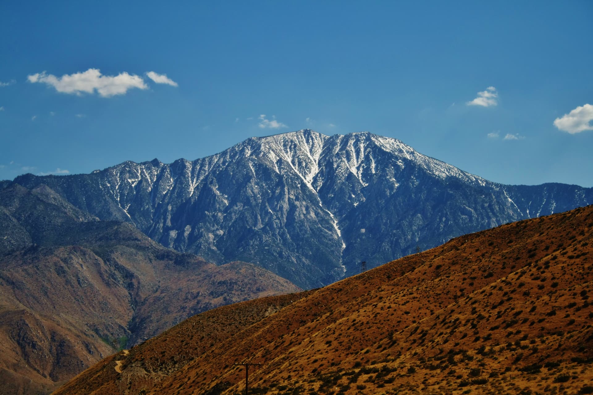
Point Conception juts westward into the Pacific at the precise bend where the California coastline pivots from north-south to east-west. For the Chumash people, whose presence here stretches back 18,000 years, this headland is Humqaq — the Western Gate, where the souls of the dead depart the mortal world and begin their journey along the Milky Way to Similaqsa, paradise. It remains one of the most sacred places on the North American coast.
The California coastline runs roughly north-south for hundreds of miles, then turns. At Point Conception, the land makes a sharp westward reach into the Pacific and the continent effectively ends. Cold northern currents collide with warm southern waters here, creating visible turbulence at the surface. Winds arrive with a ferocity that earned the headland its reputation as the Cape Horn of the Pacific. The weather itself marks a boundary.
The Chumash recognized what the geography declares. For thousands of years — the archaeological record reaches back approximately 18,000 — they understood this headland as Humqaq, the Western Gate: the place where the souls of the dead leave the world of the living. According to Chumash elder Qilikutayiwit (Maria Solares), the spirit of the dead travels to this wild and stormy point, descends to a pool below the cliff where footprints of women and children can be seen in the stone, bathes and paints itself, then sees a light to the westward and follows it through the air to reach Similaqsa.
This is not a metaphor layered onto convenient geography. The Chumash identified this specific headland — not another — as the threshold. The land cooperates with the belief. Standing where the continent bends, facing the open Pacific with nothing between you and the horizon, the sense of edge is not symbolic. It is physical, immediate, and difficult to dismiss.
Point Conception is not a tourist destination. The land is privately conserved, the access is extremely limited, and the Chumash community maintains its sacred relationship with the place. What follows is offered not as a visitor guide but as an account of why this headland matters — to those for whom it has always mattered, and to anyone willing to understand that some places hold significance that precedes and exceeds human convenience.
Context and lineage
The most detailed account of Point Conception's significance comes from Qilikutayiwit (Maria Solares), a Samala Chumash historian who shared the tradition with Smithsonian ethnographer John Peabody Harrington in the early 20th century. In her account, the soul of the dead goes first to Point Conception, a wild and stormy place. Below the cliff, reachable only by rope, there is a pool of water like a basin into which fresh water continually drips. In the stone can be seen the footprints of women and children. There the spirit of the dead bathes and paints itself. Then it sees a light to the westward and goes toward it through the air, reaching the land of Similaqsa — paradise.
The journey does not end at the point. The soul continues along the Milky Way, which the Chumash understand as the Sky Path created to guide the dead to the afterlife. Point Conception is thus not the destination but the departure gate — the place where the terrestrial journey ends and the celestial one begins.
Scholars note that Harrington's ethnographic notes require careful interpretation. Wilcoxon and others have revisited the original transcriptions and found that some details in commonly cited versions reflect Harrington's interpretations rather than direct Chumash statements. The core narrative, however — Point Conception as the Western Gate — is consistent across multiple Chumash sources and is affirmed by contemporary Chumash communities.
The Chumash relationship with Point Conception is not historical in the sense of being completed. It is ongoing. The archaeological record documents approximately 18,000 years of continuous occupation, making this one of the longest-documented relationships between a people and a specific sacred landscape in North America. That continuity has survived Spanish missions, Mexican ranchos, American ranching, and the threat of industrial development.
The 1978-1979 encampment was a turning point. When an LNG terminal threatened the site, Chumash people did not petition from a distance — they occupied the land, establishing a physical and ceremonial presence that lasted nine months. The terminal was never built. The encampment demonstrated that the Western Gate was not a historical curiosity but a living sacred site that a living people would fight to protect.
Today, the Santa Ynez Band of Chumash and other Chumash communities continue to maintain their relationship with Point Conception. The specific nature of contemporary ceremonial practice is private, as is appropriate for a tradition that has survived by protecting its knowledge. What is publicly known is that the relationship endures — formalized in part through cultural access arrangements with The Nature Conservancy and recognized in the 2024 naming of the Chumash Heritage National Marine Sanctuary.
Qilikutayiwit (Maria Solares)
historical
Samala Chumash historian who provided the most detailed surviving account of Point Conception's significance as the Western Gate. Her testimony to ethnographer J.P. Harrington preserved knowledge that might otherwise have been lost during the devastating disruptions of colonization. Her account remains the primary source for understanding the site's role in Chumash cosmology.
John Peabody Harrington
historical
Smithsonian Institution ethnographer who documented Chumash oral traditions in the early 20th century. His voluminous notes preserved irreplaceable cultural knowledge, though scholars note that his transcriptions sometimes reflect his own interpretations. His work at Point Conception was part of a decades-long effort to record California indigenous languages and traditions.
Chumash Encampment Participants (1978-1979)
historical
Tribal members who occupied the Point Conception area for nine months to prevent construction of a Western LNG Associates liquefied natural gas terminal. Their action was both political and spiritual — a defense of sacred ground that ultimately succeeded in stopping the development. The encampment stands as one of the significant acts of indigenous sacred site defense in California history.
Jack and Laura Dangermond
contemporary
Philanthropists and founders of Esri whose donation enabled The Nature Conservancy to purchase the 24,000-acre Cojo-Jalama Ranches surrounding Point Conception in 2017. The acquisition created the Dangermond Preserve, protecting the landscape and its archaeological sites from development.
Why this place is sacred
The thinness of Point Conception begins with the land itself. The headland extends westward into the Pacific at the point where the California coastline makes its decisive turn, creating a geographic singularity visible from space. North of the point, the coast runs roughly north-south and the ocean is cold, dominated by the California Current sweeping down from the Gulf of Alaska. South of the point, the coast runs east-west and the water warms. At the point itself, these two oceanic regimes collide. The turbulence is visible from shore — different colors of water, different wave patterns meeting and disrupting each other.
The ecological consequences are profound. Point Conception marks one of the most significant biogeographic boundaries on the Pacific coast. Species that thrive to the north do not cross this line. Species from the south stop here. Marine biologists call it a transition zone. The Chumash, living with this landscape for millennia before anyone named biogeographic boundaries, recognized it as something similar: a place where one world ends and another begins.
The wind reinforces the sense of threshold. Point Conception is notorious among mariners. The prevailing northwesterlies accelerate around the headland, creating conditions that have wrecked ships for centuries. The first lighthouse was built in 1856, not for aesthetics but necessity. The wildness of the weather — the Chumash description of the place as wild and stormy is meteorologically precise — strips away the comfort of civilization. You are not visiting a curated site. You are at an edge.
Layered onto this physical liminality is the cultural weight of approximately 18,000 years of human presence. Over fifty archaeological sites have been documented in the immediate area — shell middens, village sites, lithic scatters, rock art. The density of habitation speaks to a people who did not avoid this wild place but were drawn to it, found it necessary, returned generation after generation. Whatever ceremonies were performed here, they were performed repeatedly, over millennia, deepening the association between this specific headland and the passage between worlds.
The Chumash understanding of Humqaq as the Western Gate is not a folk explanation for dramatic scenery. It is a cosmological statement embedded in a complex system connecting the point to the Milky Way (the Sky Path along which souls travel), to the winter solstice (when the sun's journey reaches its own turning point), and to the broader Chumash understanding of death not as an ending but as a westward journey into light.
Point Conception's sacred function in Chumash cosmology centers on the passage of the dead. The soul of the deceased travels to this headland, which serves as the departure point for the journey to Similaqsa. According to the account preserved by Qilikutayiwit, the spirit descends below the cliff to a pool where it bathes and paints itself — a preparation ritual — before seeing a light to the westward and following it through the air. The journey continues along the Milky Way, which the Chumash understand as the Sky Path created to guide souls to the afterlife. The site's function is thus both specific and cosmic: it is a physical location on the California coast and simultaneously a doorway in the structure of existence.
The site's significance to the Chumash has been tested repeatedly. In 1978, when Western LNG Associates proposed building a liquefied natural gas terminal at the point, Chumash tribal members established a protest encampment that lasted nine months. The occupation was not merely political — it was a defense of sacred ground, carried out with ceremonial as well as practical commitment. The LNG proposal was eventually defeated.
In 2017, Jack and Laura Dangermond donated the funds for The Nature Conservancy to purchase the surrounding 24,000-acre Cojo-Jalama Ranches, creating the Dangermond Preserve. The land, previously a working ranch with restricted access, became a conservation and research property. In November 2024, the surrounding waters were designated as the Chumash Heritage National Marine Sanctuary by NOAA — the 17th national marine sanctuary in the United States, encompassing 4,543 square miles and bearing the Chumash name in official federal designation.
These protections represent partial recognition of what the Chumash have always known: this place requires guardianship. The land and waters around Point Conception now carry multiple layers of formal protection — archaeological district, nature preserve, national marine sanctuary — though none of these designations fully captures the site's significance within the living Chumash cosmology.
Traditions and practice
The site's primary ceremonial function centers on the passage of the dead. In Chumash understanding, the soul travels to Point Conception after death, undergoes a preparation ritual at the pool below the cliff, and then departs westward toward Similaqsa. The winter solstice ceremony, Kakunupmawa, involved a multiday gathering of chiefs, storytelling, dance, song, and offerings of berries and seeds cast into fire. The 'Alchuklash ceremony connected to the winter solstice involved a sun priest and twelve assistants in observing the sun's turning point. The Hutash ceremony honored Mother Earth around the autumn-winter transition.
These ceremonies existed within a sophisticated astronomical knowledge system. The Chumash tracked the sun's movement through the year, understood the relationship between solstices and the journeys of celestial bodies, and embedded that knowledge in ceremony. Point Conception's westward orientation — facing the setting sun — connected the daily death of the sun with the larger cycle of death and renewal that the ceremonies addressed.
Contemporary Chumash communities maintain ceremonial practices at sacred sites along the central coast. The Santa Ynez Band of Chumash continues to celebrate the winter solstice. Cultural stewardship arrangements with The Nature Conservancy provide Chumash access to the Dangermond Preserve. The specific details of current ceremonial practice are private, as is appropriate for sacred knowledge that has survived centuries of disruption by remaining protected.
The Chumash Heritage National Marine Sanctuary designation in 2024 represents a new form of practice — the extension of indigenous stewardship into federal policy, ensuring that the waters surrounding Point Conception carry the Chumash name and the recognition that they are part of a culturally significant landscape.
Point Conception is not a site for guided spiritual practice by non-Chumash visitors. The appropriate response to this place is respect for its sacred significance and support for the Chumash community's ongoing stewardship.
If you walk the coast from Jalama Beach, do so with awareness that you are approaching sacred ground. The walk itself, constrained by tide and weather, already functions as a kind of practice — it requires attention, timing, and the willingness to accept that the destination may not be reachable. Let that be enough. Not every sacred place needs to be entered to be honored.
Face the western Pacific from the beach and consider what it might mean to understand this headland as a gateway. You do not need to share the Chumash cosmology to recognize that some places carry a quality of edge — geographical, ecological, existential — that invites reflection on thresholds in your own life.
Chumash
ActivePoint Conception is the Western Gate (Humqaq) in Chumash cosmology — the specific geographic location where the souls of the dead depart the mortal world and begin their celestial journey to Similaqsa (paradise). The site has been continuously sacred for approximately 18,000 years, with over 50 archaeological sites documented in the immediate area. The Chumash fought to protect it from industrial development in 1978-1979 and continue to maintain ceremonial relationships with the place.
Traditional practices include mortuary and soul-journey rites centered on the Western Gate, the Kakunupmawa (winter solstice) ceremony involving multiday gatherings with storytelling, dance, song, and offerings, the Hutash ceremony honoring Mother Earth, and the 'Alchuklash astronomical ceremony involving a sun priest and twelve assistants. Contemporary practices are maintained by Chumash communities including the Santa Ynez Band, with specific details appropriately private. Cultural access to the site continues through arrangements with The Nature Conservancy.
Conservation and Marine Science
ActivePoint Conception marks one of the most significant biogeographic boundaries on the Pacific coast. The convergence of cold northern and warm southern ocean currents creates an ecological transition zone of extraordinary scientific importance. The surrounding 24,000-acre Dangermond Preserve and the 4,543-square-mile Chumash Heritage National Marine Sanctuary represent the convergence of conservation science and indigenous cultural advocacy.
Ongoing marine biological research at the biogeographic boundary. Conservation management of the Dangermond Preserve by The Nature Conservancy. Ecological monitoring and habitat protection under the National Marine Sanctuary designation. Gray whale migration monitoring along the coast.
Experience and perspectives
The walk begins at Jalama Beach, a county park reached by a winding road from Highway 1. The beach itself is beautiful but exposed — surfers and fishermen know the wind here, which arrives with intent. From the beach, at low tide only, you can walk northwest along the coast toward the point.
The journey is approximately four miles in one direction. The beach narrows and widens. Rocky outcroppings require scrambling. The bluffs rise to your right, and above them is private land — the Dangermond Preserve — which you cannot enter. You are confined to the strip between ocean and cliff, and that strip disappears when the tide comes in. This is not a metaphor for liminality; it is liminality in its most practical form. Mistime the tide and you will be trapped.
As you approach the headland, the character of the coast changes. The wind intensifies. The water color shifts where currents meet. If you are attentive, you may notice that the vegetation on the bluffs changes too — the biogeographic boundary is visible in the plants as well as the water. You are walking across a threshold that the entire California coast recognizes.
You cannot reach the point itself. The bluffs are private, the lighthouse is closed, and the sacred sites above are not for the uninvited. What you can do is stand on the beach below and look westward across the Pacific, knowing what the Chumash know: that this is where the land turns, where the currents collide, where for eighteen thousand years a people have understood the boundary between worlds to be thin.
The experience is not comfortable. The wind is not gentle. The walk is long and the tidal constraint is real. But for those who come seeking encounter with a genuine edge — geographic, ecological, spiritual — Point Conception delivers something that curated sites cannot. It is wild, and it is not yours, and that combination has its own kind of power.
If you approach from Jalama Beach, understand that you are approaching one of the most sacred places in Chumash territory. This is not a hike with a scenic payoff. It is a walk toward a threshold that a living people hold sacred. Carry that awareness from the first step.
Check tide charts meticulously before setting out. You need a low tide — ideally a negative or very low tide — and you need to be returning well before the tide turns. The coast between Jalama Beach and Point Conception is not a place to be caught by rising water. There are no facilities, no bail-out points, and limited phone signal.
If you encounter any evidence of Chumash ceremonial activity, do not approach, photograph, or disturb it. If Chumash people are present, maintain a respectful distance. This is their place first and fundamentally.
Point Conception sits at the intersection of geology, ecology, archaeology, and living sacred tradition. The academic, indigenous, and alternative perspectives on this place diverge significantly, and honest engagement requires recognizing that the Chumash understanding is not one perspective among equals — it is the perspective of the people for whom this place has been the Western Gate for eighteen thousand years.
Archaeological research confirms Point Conception as a cultural keystone place of extraordinary significance. Over 50 archaeological sites have been documented in the immediate area, representing approximately 18,000 years of continuous occupation — an exceptionally long and dense record. The site is listed as an Archaeological District on the National Register of Historic Places.
The ethnographic record, primarily from J.P. Harrington's early 20th century work with Chumash elders, provides the most detailed documentation of the Western Gate belief system. Wilcoxon's revisionary scholarship cautions that Harrington's transcriptions sometimes reflect the ethnographer's interpretations rather than direct Chumash statements, but the core narrative is consistent across multiple sources.
Marine science provides independent confirmation of the site's liminal character. Point Conception marks one of the most significant biogeographic boundaries on the Pacific coast, where the cold California Current system meets warmer southern waters. The ecological transition is dramatic and measurable. Whether the Chumash understanding of the site as a threshold between worlds drew on this ecological liminality, or whether the correspondence is coincidental, remains an open question that scholars continue to explore.
For the Chumash, Point Conception is Humqaq — the Western Gate. This is not a historical belief but a living reality. The souls of the dead travel here. The site is sacred in the present tense.
The Chumash relationship with Point Conception has been tested by colonization, missionization, ranching, and proposed industrialization. At each challenge, Chumash people have reasserted the site's significance — most dramatically in the 1978-1979 encampment that prevented an LNG terminal. The 2024 designation of the Chumash Heritage National Marine Sanctuary, bearing the Chumash name in federal designation, represents partial but meaningful recognition.
The specific ceremonial practices maintained at or near Point Conception are private. This privacy is not secrecy for its own sake but the protection of sacred knowledge that has survived precisely because the Chumash have guarded it. Outside observers should respect this boundary absolutely.
Some spiritual tourism and New Age sources describe Point Conception as an energy vortex or power point on the California coast. While the site's geographic drama, ecological liminality, and cultural weight are all real, these characterizations strip away the Chumash-specific meaning and replace it with a generic spiritual vocabulary. The result is a form of appropriation that takes the felt power of the place while discarding the tradition that names and understands it.
The appropriate response to feeling something powerful at Point Conception is not to claim it within your own framework but to recognize that you are at a place whose significance has been articulated, maintained, and defended by a specific people for eighteen thousand years. Their understanding has priority.
Much about Point Conception remains genuinely unknown, in part because the Chumash community has chosen to keep certain knowledge private. The full extent of the archaeological record is incompletely mapped — systematic excavation has been limited out of respect for the site's sacred status. The complete Chumash cosmological system connecting Point Conception to other sacred sites, to the Milky Way Sky Path, and to the journey to Similaqsa is not fully documented in public sources. How the biogeographic transition zone influenced ancient Chumash understanding of the site as a liminal threshold is a question that bridges marine science and cultural knowledge in ways not yet fully explored. These unknowns are not failures of scholarship but reflections of appropriate boundaries between public knowledge and sacred tradition.
Visit planning
Drive Jalama Road from Highway 1, approximately 3 miles south of Lompoc, to Jalama Beach County Park. The road is narrow and winding. From the beach, walk northwest along the coast at low tide. The walk is approximately 4 miles to a view of Point Conception. You cannot reach the point itself — the bluffs above the beach are private land (Dangermond Preserve, managed by The Nature Conservancy). The lighthouse is not open to the public. No public transportation serves Jalama Beach. Mobile phone signal is unreliable along the coastal walk and at the headland. The nearest settlement with reliable signal is along Highway 1, approximately 14 miles from the beach.
Jalama Beach County Park offers camping (tent and RV sites), which is the closest accommodation to the coastal approach. The park has basic facilities including a small store and restrooms. The nearest town with lodging is Lompoc, approximately 17 miles north. Santa Barbara, approximately 55 miles southeast, offers full services. No accommodations exist at or near Point Conception itself.
Point Conception demands the highest level of cultural respect. This is an actively sacred site for a living people, not a heritage attraction. Public access is extremely limited, and visitors must stay below the high-tide line. Do not approach, photograph, or disturb any ceremonial activity. Do not climb the bluffs or enter the Dangermond Preserve without authorization.
Dress for a coastal hike in potentially extreme wind conditions. Layers, wind protection, and sturdy footwear for rocky beach walking are essential. This is not a site with dress codes — it is a site that demands you come prepared for the elements.
No restrictions are posted on the public beach. However, exercise extreme sensitivity. Do not photograph any Chumash individuals, ceremonies, cultural sites, or archaeological features. The landscape is photographable, but consider whether documentation is your actual purpose for being here.
Do not leave offerings or objects at the site. This is a Chumash sacred place, and offerings from outside the tradition are not appropriate. The most meaningful thing a non-Chumash visitor can offer is respect for the site's integrity and support for the Chumash community's stewardship.
The bluffs and land above the high-tide line are private (Dangermond Preserve). The lighthouse is closed to the public. The coastal approach from Jalama Beach is possible only at low tide. Do not disturb archaeological sites, artifacts, or natural features. If Chumash ceremonial activity is occurring, maintain respectful distance and do not remain in the immediate area.
Plan your visit
Address
Point Conception, California 93436, USA
Hours, fees, and access can change — verify on the official source before you travel. Practical details last checked Jun 2026.
Nearby sacred places
Sacred places within a half-day’s reach. Pilgrims often visit them together: walk one, stay for the other.

Key questions
What pilgrims usually ask
- Why is Point Conception, California considered sacred?
- Walk toward the edge where the Chumash say souls depart. Point Conception, sacred gateway on the California coast, where land, ocean, and worlds converge.
- What should I wear at Point Conception, California?
- Dress for a coastal hike in potentially extreme wind conditions. Layers, wind protection, and sturdy footwear for rocky beach walking are essential. This is not a site with dress codes — it is a site that demands you come prepared for the elements.
- Can I take photos at Point Conception, California?
- No restrictions are posted on the public beach. However, exercise extreme sensitivity. Do not photograph any Chumash individuals, ceremonies, cultural sites, or archaeological features. The landscape is photographable, but consider whether documentation is your actual purpose for being here.
- How long should I spend at Point Conception, California?
- The round trip from Jalama Beach is approximately 8 miles and takes 2.5 to 3 hours of walking, plus time at the headland. The entire outing requires 4 to 5 hours and must be timed precisely around low tide.
- How do you visit Point Conception, California?
- Drive Jalama Road from Highway 1, approximately 3 miles south of Lompoc, to Jalama Beach County Park. The road is narrow and winding. From the beach, walk northwest along the coast at low tide. The walk is approximately 4 miles to a view of Point Conception. You cannot reach the point itself — the bluffs above the beach are private land (Dangermond Preserve, managed by The Nature Conservancy). The lighthouse is not open to the public. No public transportation serves Jalama Beach. Mobile phone signal is unreliable along the coastal walk and at the headland. The nearest settlement with reliable signal is along Highway 1, approximately 14 miles from the beach.
- What offerings are appropriate at Point Conception, California?
- Do not leave offerings or objects at the site. This is a Chumash sacred place, and offerings from outside the tradition are not appropriate. The most meaningful thing a non-Chumash visitor can offer is respect for the site's integrity and support for the Chumash community's stewardship.
- What etiquette should visitors follow at Point Conception, California?
- Point Conception demands the highest level of cultural respect. This is an actively sacred site for a living people, not a heritage attraction. Public access is extremely limited, and visitors must stay below the high-tide line. Do not approach, photograph, or disturb any ceremonial activity. Do not climb the bluffs or enter the Dangermond Preserve without authorization.
- What is the history of Point Conception, California?
- The most detailed account of Point Conception's significance comes from Qilikutayiwit (Maria Solares), a Samala Chumash historian who shared the tradition with Smithsonian ethnographer John Peabody Harrington in the early 20th century. In her account, the soul of the dead goes first to Point Conception, a wild and stormy place. Below the cliff, reachable only by rope, there is a pool of water like a basin into which fresh water continually drips. In the stone can be seen the footprints of women and children. There the spirit of the dead bathes and paints itself. Then it sees a light to the westward and goes toward it through the air, reaching the land of Similaqsa — paradise. The journey does not end at the point. The soul continues along the Milky Way, which the Chumash understand as the Sky Path created to guide the dead to the afterlife. Point Conception is thus not the destination but the departure gate — the place where the terrestrial journey ends and the celestial one begins. Scholars note that Harrington's ethnographic notes require careful interpretation. Wilcoxon and others have revisited the original transcriptions and found that some details in commonly cited versions reflect Harrington's interpretations rather than direct Chumash statements. The core narrative, however — Point Conception as the Western Gate — is consistent across multiple Chumash sources and is affirmed by contemporary Chumash communities.