Mt. Marcy, New York
New York's highest point, where billion-year-old rock meets the state's most fragile ecosystem
Town of Keene, New York, United States
Plan this visit
Practical context before you go
Day hike via Van Hoevenberg Trail: seven to ten hours round trip. Overnight trip with backcountry camping near Marcy Dam site or Lake Colden: two days. Multi-day High Peaks loop incorporating Marcy and neighboring summits: three to five days.
Primary trailhead: Adirondack Loj / High Peaks Information Center, located on Adirondack Loj Road south of Lake Placid, off Route 73. Parking fee required (currently $15 for non-ADK members on weekends). The Van Hoevenberg Trail (7.4 miles to the summit) is the most common and best-maintained route. Alternative approaches include trails from Elk Lake (south) and Upper Works at the Tahawus townsite. No shuttle service. The mountain is accessible only on foot. No permits required for day hikes. Nearest towns: Lake Placid (approximately 15 miles north) and Keene Valley (approximately 20 miles east). Nearest airport: Adirondack Regional Airport in Saranac Lake. Albany International Airport is approximately 150 miles south. Mobile phone signal is unreliable to absent on the trail and at the summit. The nearest reliable signal is at the Adirondack Loj trailhead area. For emergencies on the trail, the nearest road access is at the Loj. The DEC emergency contact is 518-891-0235 (Ray Brook dispatch). Carry a physical map and compass or GPS device.
The primary etiquette on Mt. Marcy is ecological: above treeline, walk only on exposed rock to protect alpine vegetation. Below treeline, follow Leave No Trace principles. Carry out all waste. Respect the Summit Stewards and follow their guidance. The mountain has no institutional protocol. It asks only for care.
At a glance
- Coordinates
- 44.1126, -73.9235
- Suggested duration
- Day hike via Van Hoevenberg Trail: seven to ten hours round trip. Overnight trip with backcountry camping near Marcy Dam site or Lake Colden: two days. Multi-day High Peaks loop incorporating Marcy and neighboring summits: three to five days.
- Access
- Primary trailhead: Adirondack Loj / High Peaks Information Center, located on Adirondack Loj Road south of Lake Placid, off Route 73. Parking fee required (currently $15 for non-ADK members on weekends). The Van Hoevenberg Trail (7.4 miles to the summit) is the most common and best-maintained route. Alternative approaches include trails from Elk Lake (south) and Upper Works at the Tahawus townsite. No shuttle service. The mountain is accessible only on foot. No permits required for day hikes. Nearest towns: Lake Placid (approximately 15 miles north) and Keene Valley (approximately 20 miles east). Nearest airport: Adirondack Regional Airport in Saranac Lake. Albany International Airport is approximately 150 miles south. Mobile phone signal is unreliable to absent on the trail and at the summit. The nearest reliable signal is at the Adirondack Loj trailhead area. For emergencies on the trail, the nearest road access is at the Loj. The DEC emergency contact is 518-891-0235 (Ray Brook dispatch). Carry a physical map and compass or GPS device.
Pilgrim tips
- Proper hiking gear is essential, not optional. Sturdy boots with ankle support are necessary for the rocky terrain. Carry layers for the summit, where temperatures can be twenty to thirty degrees colder than the trailhead. Rain gear is required regardless of the forecast: weather above treeline changes rapidly. Sun protection, including a hat, is important on exposed rock. In winter, full mountaineering gear including crampons and snowshoes is required.
- Photography is welcome throughout the hike. Above treeline, do not step off marked rock surfaces to compose a shot. No photograph is worth damaging the alpine zone. The plants and the views are equally subject matter: photograph both, but harm neither.
- Mt. Marcy is a serious mountain. Hikers have died from exposure, falls, and hypothermia on its slopes. Do not attempt the summit without proper gear, fitness, and preparation. Turn back if weather deteriorates above treeline: the summit is not worth your life. The alpine zone is the state's rarest ecosystem. A single careless footstep can destroy decades of plant growth. Follow the rock walk absolutely. Do not step off rock surfaces for any reason, including photography. Do not rely on cell phone signal above the trailhead. Coverage is unreliable to absent throughout the hike. Carry a physical map and know the route. Mud season, roughly late April through May, makes trails fragile and slippery. DEC requests that hikers avoid high-elevation trails during this period to prevent erosion.
Overview
Mt. Marcy stands 5,344 feet above the Adirondack wilderness, the highest point in New York State. Its summit holds the state's rarest ecosystem, an alpine tundra of Ice Age plants surviving hurricane-force winds. On its slopes, Lake Tear of the Clouds gives birth to the Hudson River. The Mohawk called it Tewawe'estha, 'it pierces.' The mountain requires a fourteen-mile round trip to reach. It gives nothing to those who will not walk.
The rock beneath your feet at the summit of Mt. Marcy is over a billion years old. The plants growing in its cracks may be killed if you step on them. Between these two facts, the unfathomable age and the heartbreaking fragility, the mountain holds its particular power.
Marcy is the highest of the Adirondack High Peaks, a range of ancient anorthosite that was old when the Appalachians were young. The summit rises above the treeline into an alpine zone that exists nowhere else in New York: 173 acres of tundra scattered across the High Peaks, hosting plants that have survived here since the last Ice Age. Fernald's Bluegrass, Boott's Rattlesnake Root, Diapensia: these species cling to the exposed bedrock in conditions approaching the Arctic, their entire growing season compressed into sixty days. A single footstep on the wrong patch of moss can destroy decades of growth.
On the mountain's southwest slope, a small pond named Lake Tear of the Clouds sits at 4,293 feet, the highest source of the Hudson River. The water that begins here as a trickle through Feldspar Brook will pass through Albany and New York City before reaching the Atlantic. One of America's most consequential rivers starts as a mountain tarn.
The Mohawk people knew this peak as Tewawe'estha, meaning 'it pierces.' The Abenaki called it Wah-um-de-neg, 'always white.' These names, spoken for centuries before the first European ascent in 1837, describe the mountain with the precision of long familiarity. The commonly used name 'Tahawus' or 'Cloudsplitter,' long attributed to Native American languages, was likely coined by a writer named Charles Fenno Hoffman shortly after that first recorded ascent. Even the mountain's names carry layers of truth and invention.
Reaching the summit requires a seven-and-a-half-mile hike through old-growth forest, past waterfalls and mountain ponds, up through the transition from hardwoods to conifers to the open rock above the trees. The round trip takes seven to ten hours. There is no shortcut, no road, no gondola. The mountain is accessible only to those willing to earn it on foot.
Context and lineage
Mountains do not have founding stories. They have naming stories, and the names people choose reveal what they see.
The Mohawk called this peak Tewawe'estha: 'it pierces.' The name describes the mountain's relationship with the sky, the way the summit pushes through the treeline into a realm where rock and weather meet without mediation. The Abenaki, approaching from the east through the Hudson Valley forests, called it Wah-um-de-neg: 'always white.' Their name records what they observed across seasons: a mountain whose summit held snow or cloud for most of the year, a persistent pale presence against the green and grey of the surrounding range.
When geologist Ebenezer Emmons led the first recorded ascent on August 5, 1837, he named the peak after William L. Marcy, the governor who had funded his survey. A month later, the writer Charles Fenno Hoffman proposed 'Tahawus,' which he attributed to the Seneca language with the meaning 'Cloudsplitter.' The name was romantic, evocative, and almost certainly invented. Adirondack historian Erik Schlimmer has found no solid evidence that any indigenous people used the word 'Tahawus' for this mountain. The summit plaque that reads 'Tahawus: Indian name meaning Cloudsplitter' perpetuates a literary fiction as though it were indigenous knowledge.
The mountain's most dramatic historical episode came on September 13, 1901, when Vice President Theodore Roosevelt, at Lake Tear of the Clouds after summiting Marcy, received word that President McKinley was dying from an assassin's bullet. Roosevelt descended the mountain in the dark and rode forty miles through the night to North Creek station, where a telegram confirmed McKinley's death. He was sworn in as president hours later. The mountain where one presidency ended and another began remains unmarked by any monument. The wilderness itself is the memorial.
The lineage at Mt. Marcy is not institutional but ecological and experiential. The mountain has been present for over a billion years. Human relationships with it span at least several thousand years, beginning with the Mohawk, Abenaki, and other indigenous peoples who knew and named the peak long before European contact.
The Euro-American lineage begins with the scientific and literary encounters of the 1830s, continues through the conservation movement that created the Adirondack Park in 1892, and extends through the 46er tradition that began in 1918. The Summit Stewardship Program, established in 1989, represents the most recent expression of a relationship with the mountain that now includes not just ascending it but protecting it.
Through all these layers, the mountain remains what it has always been: rock, weather, and the few plants tough enough to survive the summit. The lineages are human. The mountain precedes and will outlast them all.
Ebenezer Emmons
geologist and surveyor
Led the first recorded ascent of Mt. Marcy on August 5, 1837, as part of a geological survey of the Adirondack region. Named the peak after Governor William L. Marcy. His geological work documented the ancient anorthosite bedrock of the High Peaks.
Orson Schofield 'Old Mountain' Phelps
trail builder and guide
Pioneer Adirondack guide who cut the first trails to Marcy's summit in 1861 and ascended the mountain over one hundred times. His intimate knowledge of the range and his philosophy of mountain experience made him an influential figure in early Adirondack culture.
Verplanck Colvin
surveyor and conservationist
Surveyor who in 1872 discovered and named Lake Tear of the Clouds, identifying it as the highest source of the Hudson River. His poetic descriptions of the Adirondack wilderness helped build public support for the creation of the Adirondack Park.
Robert Marshall
wilderness advocate and 46er pioneer
With his brother George and friend Herbert Clark, completed the first known ascent of all 46 Adirondack High Peaks between 1918 and 1925, founding the 46er tradition. Later became a founding member of the Wilderness Society and one of the most influential wilderness advocates in American history.
Theodore Roosevelt
historical figure, U.S. president
Vice President who received word of President McKinley's death while at Lake Tear of the Clouds on Mt. Marcy's slopes on September 13, 1901. His dramatic midnight descent and subsequent presidency profoundly shaped American conservation policy, including the creation of national parks and forests.
Why this place is sacred
Mountains produce thinness through altitude. The higher you climb, the more the ordinary world falls away. On Marcy, this happens literally at the treeline, around 4,900 feet, where the boreal forest of spruce and fir gives way to exposed bedrock, alpine plants, and sky.
Below the treeline, the forest is dense and enclosing. The trail moves through it for hours, the canopy filtering light, the sound world dominated by birdsong and water. The ascent is steady but contained. You are within something.
Above the treeline, everything changes. The trees fall away. The wind, blocked below by the forest, arrives with force. The horizon expands from the immediate to the vast: on clear days, forty-three other High Peaks become visible, along with the Green Mountains of Vermont and the distant shape of Quebec's Mount Royal. The sky is no longer above you. It is around you.
The alpine plants underfoot deepen the shift. These are not ordinary plants growing in ordinary conditions. They are survivors of the Pleistocene, species that colonized these summits as the glaciers retreated and have persisted here for ten thousand years in conditions that would kill most vegetation: extreme cold, desiccating winds, ice encasement, a growing season measured in weeks. Their survival is tenuous. A human foot can destroy what a decade of Arctic-like weather could not. The awareness of this fragility, the knowledge that the ground you walk on requires your care, changes the quality of attention. You begin to step differently. You begin to see differently.
The geological substrate adds temporal depth. Adirondack anorthosite formed over a billion years ago, making it among the oldest exposed rock in the world. Standing on the summit, you stand on the basement of the continent, material that predates complex life on Earth. The mountain is not ancient in the way a cathedral is ancient. It is ancient in the way the Earth is ancient.
Lake Tear of the Clouds, visible from the trail on the descent, provides a final point of concentration. This small pond, barely a tarn, is the highest source of the Hudson River. The water that begins here will travel 315 miles to the sea, passing through one of the most densely populated regions on Earth. The disproportion between the origin and the outcome, a mountain puddle becoming a great river, carries its own quiet revelation about how large things begin.
Mt. Marcy has served no single human purpose. For the Mohawk and Abenaki peoples who knew it for thousands of years, the mountain was part of a landscape understood as alive and imbued with spirit, used for hunting, travel, and spiritual engagement whose specific forms remain largely undocumented. The first recorded European ascent in 1837 was a geological survey, not a pilgrimage. The 46er tradition, beginning in 1918, transformed the mountain into the culmination of a wilderness challenge that functions, for many, as a form of secular pilgrimage. The mountain's purpose is whatever the climber brings to it.
The human relationship with Mt. Marcy has evolved through distinct phases. For thousands of years, indigenous peoples knew the mountain by names that reflected intimate observation: 'it pierces' in Mohawk, 'always white' in Abenaki. The mountain was part of a lived landscape, not a destination.
The 1837 survey ascent by Ebenezer Emmons and the subsequent romantic literary response by writers like Charles Fenno Hoffman recast the mountain as a wilderness spectacle, a peak to be conquered and named. The colonial renaming, from indigenous descriptions to the surname of a state governor, enacted a familiar pattern of erasure.
The creation of the Adirondack Park in 1892 and the 'forever wild' clause in the New York State Constitution protected the mountain from development but also codified a particular understanding of wilderness as uninhabited nature, a concept that erased the indigenous presence that preceded the park by millennia.
The 46er tradition, born in the early twentieth century, created a structured relationship with the mountain that combines physical challenge, wilderness immersion, and a quasi-spiritual pursuit of completion. The Summit Stewardship Program, established in 1989, added an ethic of ecological care that transformed the summit from a trophy to a responsibility.
Today, over ten thousand people summit Marcy each year. The mountain holds all of these layers: indigenous territory, colonial naming, wilderness ideal, recreational challenge, ecological sanctuary.
Traditions and practice
The Mohawk, Abenaki, and other indigenous peoples who knew Mt. Marcy maintained spiritual relationships with the Adirondack landscape that included hunting practices informed by respect for the spirit of animals, seasonal travel following ecological rhythms, and what scholars describe as an understanding of the mountains as alive and imbued with spirit. Specific ceremonial practices at the mountain itself are not documented in publicly available sources. Sacred sites, vision quest locations, and burial grounds within the High Peaks region almost certainly existed but remain largely unacknowledged.
The 46er tradition is the closest thing to a structured practice at Mt. Marcy. Since 1918, when the Marshall brothers and Herbert Clark completed the first known ascent of all 46 Adirondack High Peaks, over 13,000 people have followed their path. For many, the multi-year discipline of climbing all 46 peaks functions as a wilderness pilgrimage, with Marcy as its culmination.
The Summit Stewardship Program, run jointly by ADK, DEC, and the Nature Conservancy since 1989, represents a practice of ecological reverence. Trained stewards spend the summer hiking season on the summit, educating visitors about the alpine zone, guiding people along the rock walk, and monitoring the health of the fragile plant communities. Their work is a form of devotion to the mountain's most vulnerable inhabitants.
Many individual hikers engage in personal contemplative practices at the summit: sitting in silence, writing in journals, performing breathing exercises, or simply attending to the sensory experience of being above the treeline on a billion-year-old mountain.
The mountain itself is the practice. The seven-and-a-half-mile walk to the summit is not a means of reaching a destination. It is the practice itself: sustained physical effort through a landscape that changes as you ascend, demanding increasing attention and presence as the trail steepens and the environment shifts.
In the forest below treeline, walk at a pace that allows you to notice the transition from hardwoods to conifers. The shift happens over several thousand feet and tells the story of how altitude changes what can survive. The trees grow shorter. The forest grows darker. The air cools.
At the treeline, pause. You are about to enter a different world. The transition from enclosed forest to open rock is one of the most dramatic changes available on any eastern trail. Let it register fully. Look back down at the canopy you emerged from. Look ahead at the bare summit and the sky.
In the alpine zone, adopt the rock walk without resentment. The discipline of placing each foot on exposed stone, of choosing your path with care to avoid the fragile plants, changes the quality of your movement. You become deliberate. You slow down. This is appropriate. The summit is not going anywhere.
At the top, resist the impulse to immediately document or depart. Sit on the rock. Feel the wind. Look at the plants growing in the cracks: living things that have survived here for ten thousand years in conditions that would kill most organisms on Earth. Let their tenacity speak for itself.
The descent is its own practice. Tired legs demand patience. The forest closes back around you. The summit becomes memory. The return to the trailhead is a return to the ordinary world, and the transition between the two is worth noticing.
Mohawk (Haudenosaunee)
HistoricalThe Mohawk people claimed the Adirondack region, including Mt. Marcy, as traditional territory for thousands of years. Their name for the mountain, Tewawe'estha ('it pierces'), reflects a long relationship of observation and spiritual engagement with the landscape. The mountains were understood as places alive and imbued with spirit.
Specific ceremonial practices at Mt. Marcy are not documented in publicly available sources. The Mohawk maintained spiritual relationships with the Adirondack landscape that included hunting practices informed by respect for the spirit of animals and seasonal travel following ecological cycles.
Abenaki (Algonquian)
HistoricalThe Abenaki peoples, particularly the Missisquoi, traveled into the Adirondack High Peaks and knew Mt. Marcy as Wah-um-de-neg ('always white'). Their name reflects sustained observation of the mountain's snow-covered appearance through much of the year. The broader range was called Wawobadenik ('white mountains').
Specific Abenaki ceremonial practices at Mt. Marcy are not documented in publicly available sources.
Adirondack 46er Tradition
ActiveThe 46er tradition of climbing all Adirondack High Peaks above 4,000 feet dates to 1918, when the Marshall brothers and Herbert Clark began their multi-year quest. Over 13,000 people have completed the challenge. Mt. Marcy, as the highest peak, serves as the literal and symbolic culmination. For many, the multi-year discipline functions as a form of wilderness pilgrimage.
Aspirants summit all 46 High Peaks, typically over multiple years, recording their climbs and registering with the Adirondack 46ers organization upon completion. Trail maintenance volunteer days, educational programs, and conservation advocacy are integral to the 46er community. The tradition emphasizes both achievement and stewardship.
Alpine Ecological Stewardship
ActiveThe Summit Stewardship Program, established in 1989 by ADK, DEC, and the Nature Conservancy, protects the 173 acres of alpine tundra across the High Peaks, the rarest ecosystem in New York State. Mt. Marcy's summit hosts the most visited alpine zone in the range.
Trained stewards spend the hiking season on alpine summits, educating hikers about the rock walk, monitoring alpine plant health, conducting ecological research, and building rock cairns that guide hikers along safe routes. The program represents a living practice of ecological care and education.
Experience and perspectives
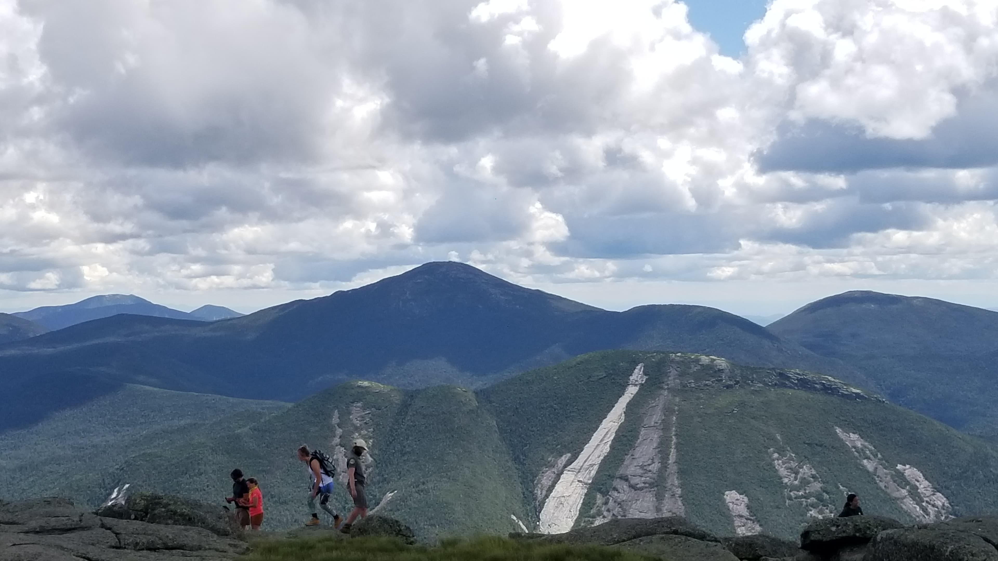
The Van Hoevenberg Trail begins at the Adirondack Loj, south of Lake Placid, and enters the forest immediately. For the first two miles, the path is wide and moderate, passing through northern hardwoods: sugar maple, yellow birch, American beech. The forest floor is soft with leaf litter. The sound world is enclosed.
At approximately two and a half miles, the trail passes the site of Marcy Dam, destroyed by Hurricane Irene in 2011. The open area where the dam once stood offers the first long views of the surrounding peaks. From here, the character of the hike changes. The trail narrows and steepens, ascending through spruce-fir forest that grows progressively smaller and more gnarled as elevation increases.
The transition happens gradually, then all at once. The trees shrink to shoulder height, then waist height, then knee height. Krummholz, the twisted, wind-stunted conifers that mark the treeline, give way to bare rock, cairns, and the open summit ridge. The wind arrives. The world opens.
Above the treeline, yellow blazes painted on rock and stone cairns mark the route. The protocol here is absolute: walk only on rock. The alpine vegetation growing in the soil pockets between stones cannot survive trampling. Summit stewards, when present during the hiking season, educate climbers about the rock walk and answer questions about the alpine ecosystem.
The summit itself is a relatively flat area of exposed bedrock at 5,344 feet. A plaque marks the highest point. On clear days, the view extends across forty-three other High Peaks in every direction, a rolling sea of ancient mountains. The exposure is total: no shelter from wind, rain, or sun. Weather moves visibly across the landscape, clouds forming and dissolving against the peaks.
The descent offers Lake Tear of the Clouds on the southwest trail option. The pond is small and unremarkable in appearance, a dark mountain tarn at 4,293 feet. Knowing that the Hudson River begins here, that the water at your feet will flow past Albany, past West Point, past Manhattan and under the Verrazzano Bridge to the Atlantic, gives the place a weight that its modest size does not suggest.
The return through the forest, legs tired, the alpine experience receding into memory, is its own kind of practice. The hours of descent require patience. The forest closes back around you. By the time you reach the trailhead, the summit feels impossibly distant, as though you imagined it.
Prepare seriously. This is not a casual hike. The 14.8-mile round trip with 3,200 feet of elevation gain takes seven to ten hours and demands fitness, proper gear, and sufficient food and water. Start early, ideally by 6:00 AM, to allow adequate time for the ascent and descent before darkness.
Carry more water than you think you need, at least three liters. Bring layers regardless of the forecast at the trailhead: summit temperatures can be twenty to thirty degrees colder than the base, and weather changes rapidly above treeline.
When you reach the alpine zone, slow down. The rock walk, stepping only on exposed stone, requires attention and changes your pace. This is not an inconvenience. It is the appropriate way to move through a landscape this fragile. Let the need for care shift your awareness from the destination to the ground beneath your feet.
At the summit, sit. The temptation to photograph, celebrate, and immediately begin the descent is strong. Resist it. You have walked seven and a half miles and gained more than three thousand feet to be here. Give the place at least fifteen minutes of quiet attention. Watch the weather move across the peaks. Feel the wind. Look at the tiny plants growing in rock cracks that would kill anything less tenacious.
If you descend via the Lake Tear of the Clouds trail, pause at the pond. The Hudson River begins here. Let that fact settle.
Mt. Marcy holds meaning across multiple frameworks: geological, ecological, indigenous, historical, and experiential. No single perspective captures what the mountain is. The scientific record describes its age and ecology. Indigenous naming traditions reveal a relationship predating European contact by millennia. The American wilderness tradition, from the Transcendentalists through the conservation movement to the 46ers, has layered the mountain with cultural significance. The mountain itself precedes and will outlast all of these interpretations.
Geologists classify the Adirondack anorthosite, the bedrock of Mt. Marcy, as over a billion years old, placing it among the oldest exposed rock on Earth. The mountains are not part of the Appalachian chain but are a separate formation, an ancient massif uplifted relatively recently in geological time. The alpine zone is recognized as the rarest ecosystem in New York State, with 173 total acres of alpine tundra across all High Peaks. Some summit plants are relict populations from the Pleistocene, species that survived the retreat of the glaciers and have persisted in alpine conditions ever since.
Adirondack historian Erik Schlimmer has established that the name 'Tahawus,' long presented as a Native American word meaning 'Cloudsplitter,' was likely coined by the writer Charles Fenno Hoffman in 1837. The actual Mohawk name, Tewawe'estha, and the Abenaki name, Wah-um-de-neg, have been documented through linguistic research. This correction of the naming record matters because it illustrates how colonial narratives can overlay indigenous knowledge even at the level of individual words.
Historians have documented the mountain's role in Theodore Roosevelt's accession to the presidency and in the development of the American conservation movement. The 'forever wild' clause in the New York State Constitution, protecting the Adirondacks from development, represents one of the earliest and most significant conservation achievements in American history.
The Mohawk, Abenaki, Oneida, and other indigenous peoples maintained relationships with the Adirondack landscape spanning thousands of years. Their names for the mountain, Tewawe'estha ('it pierces') and Wah-um-de-neg ('always white'), reflect not just physical observation but a relationship of familiarity and attention developed over generations.
Indigenous scholars have challenged the common characterization of the Adirondacks as empty wilderness at the time of European contact. The mountains were actively used for hunting, gathering, trade, travel, and spiritual purposes by multiple nations. Sacred sites, vision quest locations, and burial grounds within the High Peaks region existed but remain largely unacknowledged in the popular narrative of the Adirondacks as pristine nature.
The creation of the Adirondack Park in 1892, while a conservation achievement, was built on the dispossession of indigenous peoples and early settlers whose presence in the mountains was erased to create the fiction of untouched wilderness. The mountain's story includes this erasure, and acknowledging it is part of engaging honestly with the place.
Several dimensions of Mt. Marcy's significance remain open. The specific locations and nature of indigenous sacred sites, vision quest locations, and burial grounds within the High Peaks are largely unknown or deliberately undisclosed. Whether the summits themselves, above the treeline, were sites of indigenous ceremonial activity is archaeologically undocumented.
The linguistic origins of the name 'Tahawus' remain unresolved. Schlimmer's research suggests it was Hoffman's invention, but the possibility that it has some Seneca linguistic basis has not been conclusively ruled out.
The full diversity of alpine plant species on the summit may not be completely catalogued. Rare and undiscovered species continue to be found on northeastern alpine summits. The ecological story of the mountain is still being written.
Visit planning
Primary trailhead: Adirondack Loj / High Peaks Information Center, located on Adirondack Loj Road south of Lake Placid, off Route 73. Parking fee required (currently $15 for non-ADK members on weekends). The Van Hoevenberg Trail (7.4 miles to the summit) is the most common and best-maintained route. Alternative approaches include trails from Elk Lake (south) and Upper Works at the Tahawus townsite. No shuttle service. The mountain is accessible only on foot. No permits required for day hikes. Nearest towns: Lake Placid (approximately 15 miles north) and Keene Valley (approximately 20 miles east). Nearest airport: Adirondack Regional Airport in Saranac Lake. Albany International Airport is approximately 150 miles south. Mobile phone signal is unreliable to absent on the trail and at the summit. The nearest reliable signal is at the Adirondack Loj trailhead area. For emergencies on the trail, the nearest road access is at the Loj. The DEC emergency contact is 518-891-0235 (Ray Brook dispatch). Carry a physical map and compass or GPS device.
Lake Placid, approximately 15 miles north, offers a full range of lodging from hotels to hostels. Keene Valley, approximately 20 miles east, provides more modest options. The Adirondack Loj at the trailhead offers bunks and cabins (reservations recommended). Backcountry camping is available at designated sites and lean-tos along the trail below 4,000 feet. For those seeking multi-day immersion, camping at the Marcy Dam site area or near Lake Colden provides a base for summit attempts and exploration of surrounding peaks.
The primary etiquette on Mt. Marcy is ecological: above treeline, walk only on exposed rock to protect alpine vegetation. Below treeline, follow Leave No Trace principles. Carry out all waste. Respect the Summit Stewards and follow their guidance. The mountain has no institutional protocol. It asks only for care.
Proper hiking gear is essential, not optional. Sturdy boots with ankle support are necessary for the rocky terrain. Carry layers for the summit, where temperatures can be twenty to thirty degrees colder than the trailhead. Rain gear is required regardless of the forecast: weather above treeline changes rapidly. Sun protection, including a hat, is important on exposed rock. In winter, full mountaineering gear including crampons and snowshoes is required.
Photography is welcome throughout the hike. Above treeline, do not step off marked rock surfaces to compose a shot. No photograph is worth damaging the alpine zone. The plants and the views are equally subject matter: photograph both, but harm neither.
Leave nothing at the summit or anywhere along the trail. The Leave No Trace ethic applies without exception. The best offering to the mountain is to leave it exactly as you found it.
Walk only on exposed rock surfaces above the treeline. No camping above 4,000 feet. No fires above 4,000 feet. Dogs must be leashed. Group size is limited to 15 in the High Peaks Wilderness. No motorized vehicles or bicycles. Glass containers are prohibited. During mud season (approximately late April through May), DEC requests that hikers avoid high-elevation trails to prevent erosion damage to saturated trails.
Plan your visit
Address
Mt Marcy, Keene, NY 12943, USA
Hours, fees, and access can change — verify on the official source before you travel. Practical details last checked Jun 2026.
Nearby sacred places
Sacred places within a half-day’s reach. Pilgrims often visit them together: walk one, stay for the other.
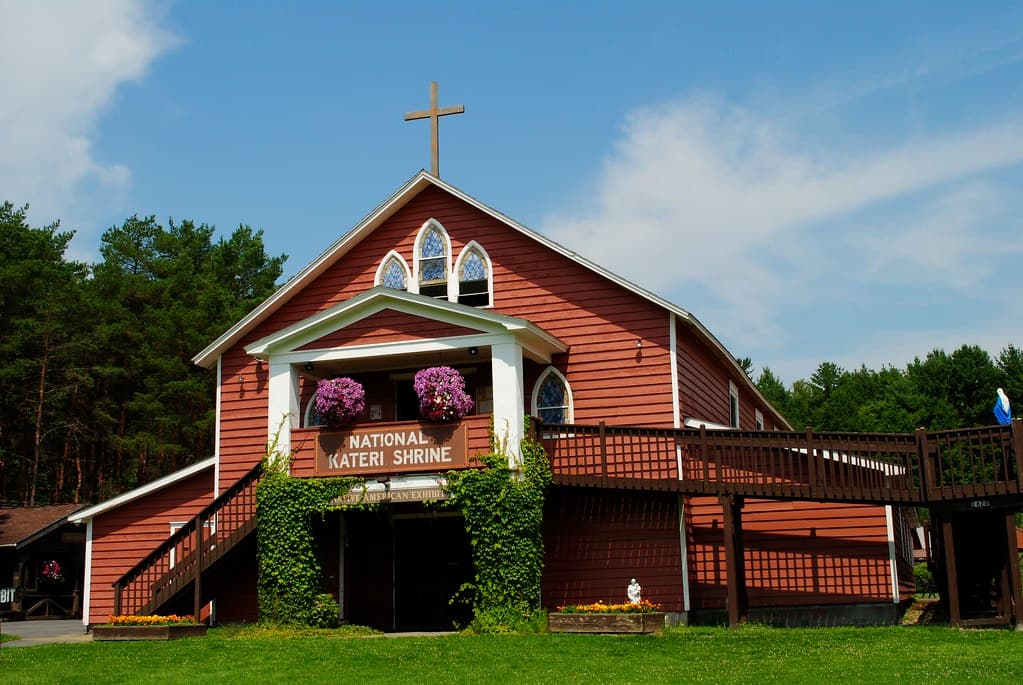
Shrine of Saint Kateri Tekakwitha, Fonda, New York
Village of Fonda, New York, United States
134.7 km away
Kateri Tekakwitha Shrine
Kahnawake, Quebec, Canada
145.9 km away
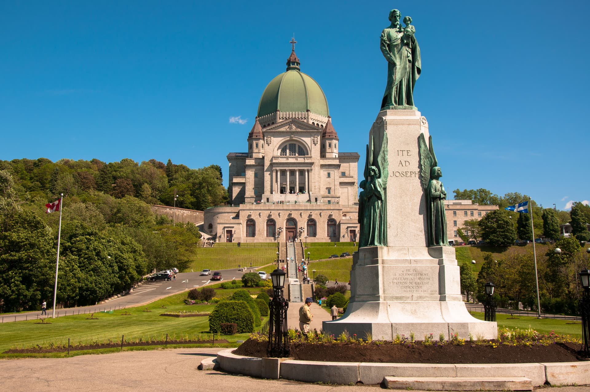
Saint Joseph's Oratory of Mount Royal
Montreal, Montreal, Quebec, Canada
155.3 km away
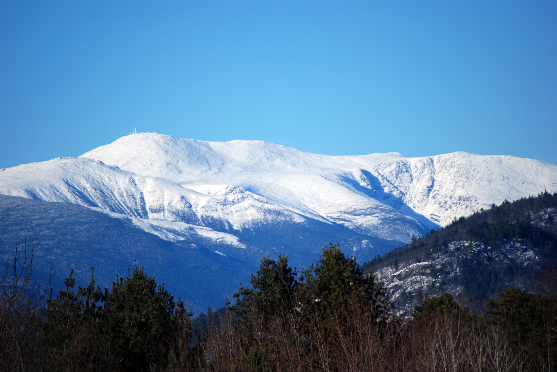
Mt. Washington, New Hampshire
Gorham, New Hampshire, United States
209.6 km away
Key questions
What pilgrims usually ask
- Why is Mt. Marcy, New York considered sacred?
- Hike to the summit of Mt. Marcy, New York's highest point, where billion-year-old rock and Ice Age alpine plants meet above the treeline.
- What should I wear at Mt. Marcy, New York?
- Proper hiking gear is essential, not optional. Sturdy boots with ankle support are necessary for the rocky terrain. Carry layers for the summit, where temperatures can be twenty to thirty degrees colder than the trailhead. Rain gear is required regardless of the forecast: weather above treeline changes rapidly. Sun protection, including a hat, is important on exposed rock. In winter, full mountaineering gear including crampons and snowshoes is required.
- Can I take photos at Mt. Marcy, New York?
- Photography is welcome throughout the hike. Above treeline, do not step off marked rock surfaces to compose a shot. No photograph is worth damaging the alpine zone. The plants and the views are equally subject matter: photograph both, but harm neither.
- How long should I spend at Mt. Marcy, New York?
- Day hike via Van Hoevenberg Trail: seven to ten hours round trip. Overnight trip with backcountry camping near Marcy Dam site or Lake Colden: two days. Multi-day High Peaks loop incorporating Marcy and neighboring summits: three to five days.
- How do you visit Mt. Marcy, New York?
- Primary trailhead: Adirondack Loj / High Peaks Information Center, located on Adirondack Loj Road south of Lake Placid, off Route 73. Parking fee required (currently $15 for non-ADK members on weekends). The Van Hoevenberg Trail (7.4 miles to the summit) is the most common and best-maintained route. Alternative approaches include trails from Elk Lake (south) and Upper Works at the Tahawus townsite. No shuttle service. The mountain is accessible only on foot. No permits required for day hikes. Nearest towns: Lake Placid (approximately 15 miles north) and Keene Valley (approximately 20 miles east). Nearest airport: Adirondack Regional Airport in Saranac Lake. Albany International Airport is approximately 150 miles south. Mobile phone signal is unreliable to absent on the trail and at the summit. The nearest reliable signal is at the Adirondack Loj trailhead area. For emergencies on the trail, the nearest road access is at the Loj. The DEC emergency contact is 518-891-0235 (Ray Brook dispatch). Carry a physical map and compass or GPS device.
- What offerings are appropriate at Mt. Marcy, New York?
- Leave nothing at the summit or anywhere along the trail. The Leave No Trace ethic applies without exception. The best offering to the mountain is to leave it exactly as you found it.
- What etiquette should visitors follow at Mt. Marcy, New York?
- The primary etiquette on Mt. Marcy is ecological: above treeline, walk only on exposed rock to protect alpine vegetation. Below treeline, follow Leave No Trace principles. Carry out all waste. Respect the Summit Stewards and follow their guidance. The mountain has no institutional protocol. It asks only for care.
- What is the history of Mt. Marcy, New York?
- Mountains do not have founding stories. They have naming stories, and the names people choose reveal what they see. The Mohawk called this peak Tewawe'estha: 'it pierces.' The name describes the mountain's relationship with the sky, the way the summit pushes through the treeline into a realm where rock and weather meet without mediation. The Abenaki, approaching from the east through the Hudson Valley forests, called it Wah-um-de-neg: 'always white.' Their name records what they observed across seasons: a mountain whose summit held snow or cloud for most of the year, a persistent pale presence against the green and grey of the surrounding range. When geologist Ebenezer Emmons led the first recorded ascent on August 5, 1837, he named the peak after William L. Marcy, the governor who had funded his survey. A month later, the writer Charles Fenno Hoffman proposed 'Tahawus,' which he attributed to the Seneca language with the meaning 'Cloudsplitter.' The name was romantic, evocative, and almost certainly invented. Adirondack historian Erik Schlimmer has found no solid evidence that any indigenous people used the word 'Tahawus' for this mountain. The summit plaque that reads 'Tahawus: Indian name meaning Cloudsplitter' perpetuates a literary fiction as though it were indigenous knowledge. The mountain's most dramatic historical episode came on September 13, 1901, when Vice President Theodore Roosevelt, at Lake Tear of the Clouds after summiting Marcy, received word that President McKinley was dying from an assassin's bullet. Roosevelt descended the mountain in the dark and rode forty miles through the night to North Creek station, where a telegram confirmed McKinley's death. He was sworn in as president hours later. The mountain where one presidency ended and another began remains unmarked by any monument. The wilderness itself is the memorial.