Wat Saphan Hin
A slate ascent leads to Phra Attharot above western Sukhothai
Understand sacred places, explore living traditions, and learn how to engage respectfully with Pilgrim Map.
Access has not been verified. Check current local guidance before planning a visit.
Mueang Kao, Sukhothai, Thailand
Read the sources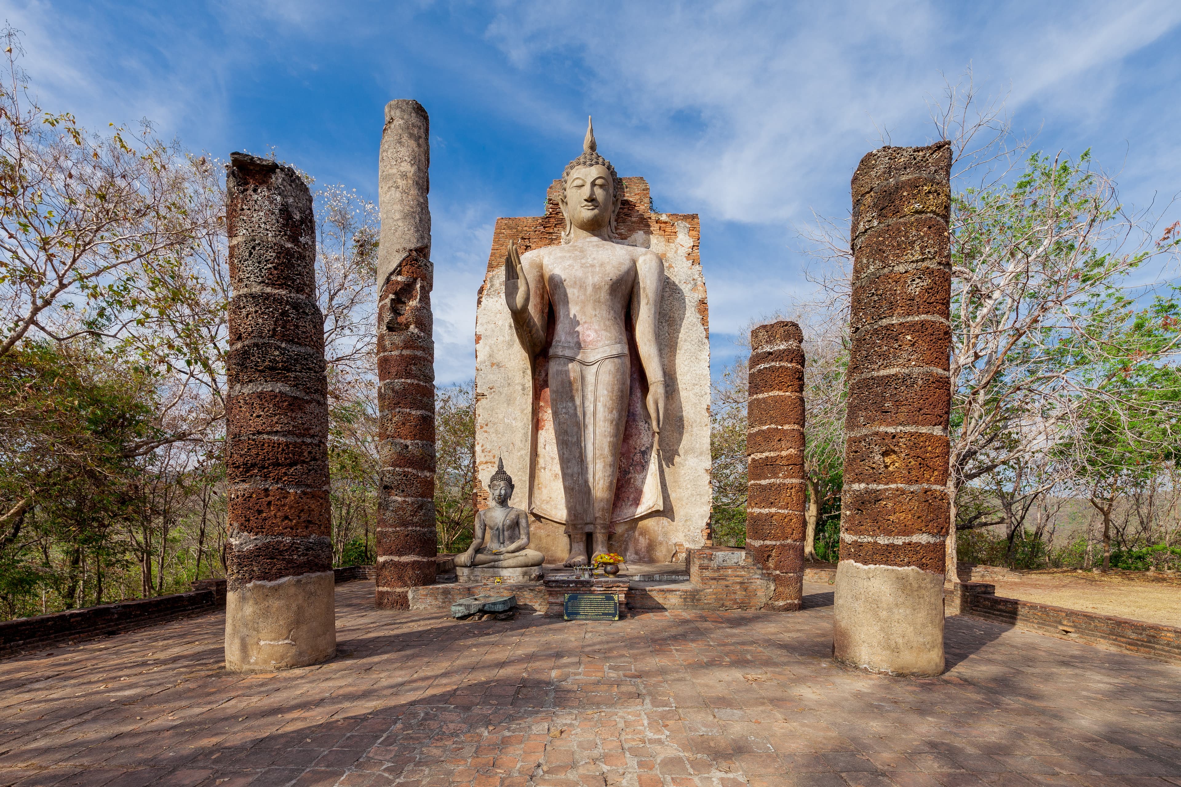
Wat Saphan Hin in Mueang Kao, Sukhothai, Thailand. Image source · CC BY 4.0
Visit essentials
A quick read before you go
- Etiquette
- Prioritize safe passage, image dignity, vegetation, and every closure on the hill route.
Overview
The temple begins before its ruined hall. A stone-laid path rises for hundreds of metres, converting distance and slope into preparation for the standing Buddha above. Phra Attharot is shown with a raised hand associated with reassurance and the dispelling of fear. Fine Arts relates the site to inscriptional language describing a great standing image in the forest precinct and a king traveling by elephant to pay homage on full- and new-moon observance days.
Even if details require historical caution, the evidence firmly joins image, ascent, forest monasticism, and recurrent worship. The hill was religious geography, not merely a viewpoint added to an archaeological park.
Why this place is sacred
Ascent can sharpen attention through exertion, changing air, and separation from the city plain. Those bodily effects do not prove supernatural elevation. The stronger sacred meaning comes from the route's documented use: stone was laid to make an approach, a hall sheltered a monumental Buddha, and inscriptional memory connected the place with lunar homage. Phra Attharot's raised hand offers a visual teaching of fearlessness or reassurance without guaranteeing protection to every climber.
Modern visitors should resist turning difficulty into a merit contest. Mobility needs, weather, and conservation conditions can change whether the route is appropriate; spiritual legitimacy does not depend on physical performance.
Experience and orientation
Check heat, rain, footwear, and park guidance before starting the slate ascent. Uneven stone can be slick, and the desire for a summit photograph should never override safety. Move aside where possible for descending visitors without stepping onto vulnerable edges. At the upper terrace, first locate the hall foundations and the Buddha's orientation before turning toward the landscape. Do not climb the image base or touch conserved surfaces.
A brief pause facing the raised hand can connect the physical climb with the historical act of homage, while the view back toward Sukhothai explains why this western forest zone felt distinct from the city centre.
Context and lineage
Fine Arts places Wat Saphan Hin in the aranyik, the forest-monastery district west of ancient Sukhothai. The name refers to the paved stone approach, and the great standing image is plausibly identified with Phra Attharot mentioned in inscription number one. That same account associates King Ramkhamhaeng with journeys to honor the Buddha on the fifteenth day of waxing and waning lunar cycles.
These are historical interpretations grounded in official archaeology and epigraphy, not proof that every visible element dates to one construction event. UNESCO inscribed Sukhothai and associated towns in 1991, protecting the hill monastery within a much larger cultural landscape.
Traditions and practice
The site no longer has a verified resident monastic community, so present conduct centres preservation and non-disruptive respect. Visitors may bow or stand quietly before Phra Attharot, but should not light fires, attach cloth, leave food, or invent a lunar rite. Keep the stone path free of litter and allow anyone using the ascent devotionally to proceed without being filmed closely. Historical royal homage demonstrates calendar significance in the past; it does not establish a current public pilgrimage program.
The appropriate contemporary practice is to follow the protected route, honor the image's dignity, and keep the forested archaeological setting intact.
Theravada Buddhism
HistoricalHistoric Theravada practice joined Phra Attharot, forest monasticism, lunar observance, and royal homage.
Heritage stewardship
ActiveTrail care links uneven slate, hillside vegetation, ruined hall, and the exposed standing Buddha as one protected approach.
Perspectives and open questions
Epigraphy, iconography, landscape history, accessibility, and conservation qualify the ascent narrative.
Scholarly perspective
Epigraphy links the hill, a standing Buddha, and royal observance, though identification remains an evidence-based interpretation rather than eyewitness certainty. Buddhist iconography reads the raised hand through reassurance and fearlessness. Landscape history places the temple in an aranyik zone associated with forest practice. Accessibility and conservation complicate romantic accounts of pilgrimage ascent by reminding us that terrain affects people differently. UNESCO management connects path, monument, vegetation, and viewshed. No reviewed source supports an energy vortex or guaranteed protective result.
The site's spiritual significance is already substantial in the documented relation among road, hill, Buddha, and repeated homage.
Plan your visit
Strong Places supports the trailhead; heat, rain, opening, and path safety need fresh confirmation.
Respectful visit
Prioritize safe passage, image dignity, vegetation, and every closure on the hill route.
Current practical details
Address
2MFG+63X, Mueang Kao, Mueang Sukhothai District, Sukhothai 64210, Thailand
Hours
Hours, fees, and access can change — verify on the official source before you travel. Practical details last checked Jul 2026.
Location
Map loads as you approach this section.
Pilgrim reflections
A portrait of encounter, not a score
Pilgrims describe what they felt, how present they could become, and whether the place would shape a journey. There are no stars and no ranking of traditions.
No reviewed reflections yet
The first pilgrims can help describe the character of being here.
Share a reflection
Available after an account-backed “Been there.” Every reflection is reviewed before publication.
Nearby sacred places
Explore other sacred places in the region. Proximity does not establish access or travel time; check each place’s guidance.


References
Sources consulted for this page. Source categories describe the publication, not a guarantee that every claim is verified. Traditional accounts and outside interpretations may differ.
- 01Western monuments outside ancient Sukhothai — Fine Arts Department, Ratchaburi National MuseumofficialExact-site ascent, standing Buddha, inscriptional identification, and lunar homage.
- 02Western archaeological monuments of Sukhothai — Fine Arts Department Archaeology DivisionofficialSecond Fine Arts exact-site record of the aranyik hill monastery.
- 03Historic Town of Sukhothai and Associated Historic Towns — UNESCO World Heritage CentreofficialAuthoritative inscription, property scope, criteria, and management context.
- 04Wat Saphan Hin — Google Maps — Google PlacesSource contextStrong name, country, locality, and coordinate match; used only for practical visitor data and identity corroboration.
Share a photo
Help visitors recognize Wat Saphan Hin. Every submission is reviewed before publication.