Country guide
France
France's sacred geography stretches from Gothic cathedrals and abbeys to Marian pilgrimage centers, prehistoric stones, monastic valleys, and mountain sanctuaries.
146 sacred sites across 63 regions. Use the tradition and site-type filters to narrow in.
Atlas summary
France sacred sites overview
France sacred sites include major cathedrals, abbeys, pilgrimage shrines such as Lourdes, prehistoric megalithic landscapes, monastic centers, and sacred places tied to local saints.
Use this country page to compare regions and traditions, then open individual sites for deeper context, map placement, and related sacred places nearby.
| Coverage | 146 sacred sites across 63 regions. |
|---|---|
| Regional clusters | |
| Traditions | |
| Site types | |
| UNESCO heritage | 4 UNESCO-tagged sites in this country guide. |
By tradition
Dates connected to France
Upcoming festivals, feast days, and pilgrimages tied to France. Add any to your calendar, or see the full observance calendar.
Showing 1-48 of 146 sites in this country guide
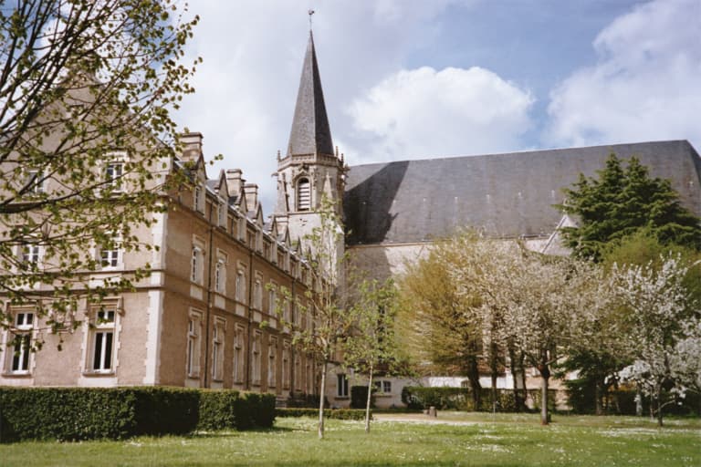
Abbaye Saint-Martin de Ligugé (Ligugé Abbey)
Ligugé, Ligugé, Nouvelle-Aquitaine (Vienne), France
South of Poitiers, a community of Benedictine monks lives today on the ground where Martin of Tours laid down his soldier's life around 361 CE to found what is widely...

Abbey of Saint-Martin-du-Canigou
Casteil, Occitanie, France
In 1005, a father haunted by the murder of his son began building a monastery on a cliff face 1,094 meters above the Pyrenees....

Abbey of Saint-Victor
Marseille, Provence-Alpes-Côte d'Azur, France
Rising fortress-like above Marseille's ancient harbor, the Abbey of Saint-Victor descends through sixteen centuries of unbroken prayer....

Aire Cathedral
Aire-sur-l'Adour, France
In the lower town of Aire-sur-l'Adour, the Cathédrale Saint-Jean-Baptiste has been a seat of bishops since the early Middle Ages....

Aix Cathedral
Provence-Alpes-Côte d'Azur, France
Rising on the site of the Roman forum of Aix and a sixth-century baptistery, Saint-Sauveur layers nearly two thousand years of sacred history into one building:...

Aléria
Aléria / Haute-Corse / Corsica, France
Aléria is the most historically layered site in Corsica — a city founded by Phocaean Greeks around 565 BCE, contested by Etruscans and Carthaginians, conquered by Rome,...
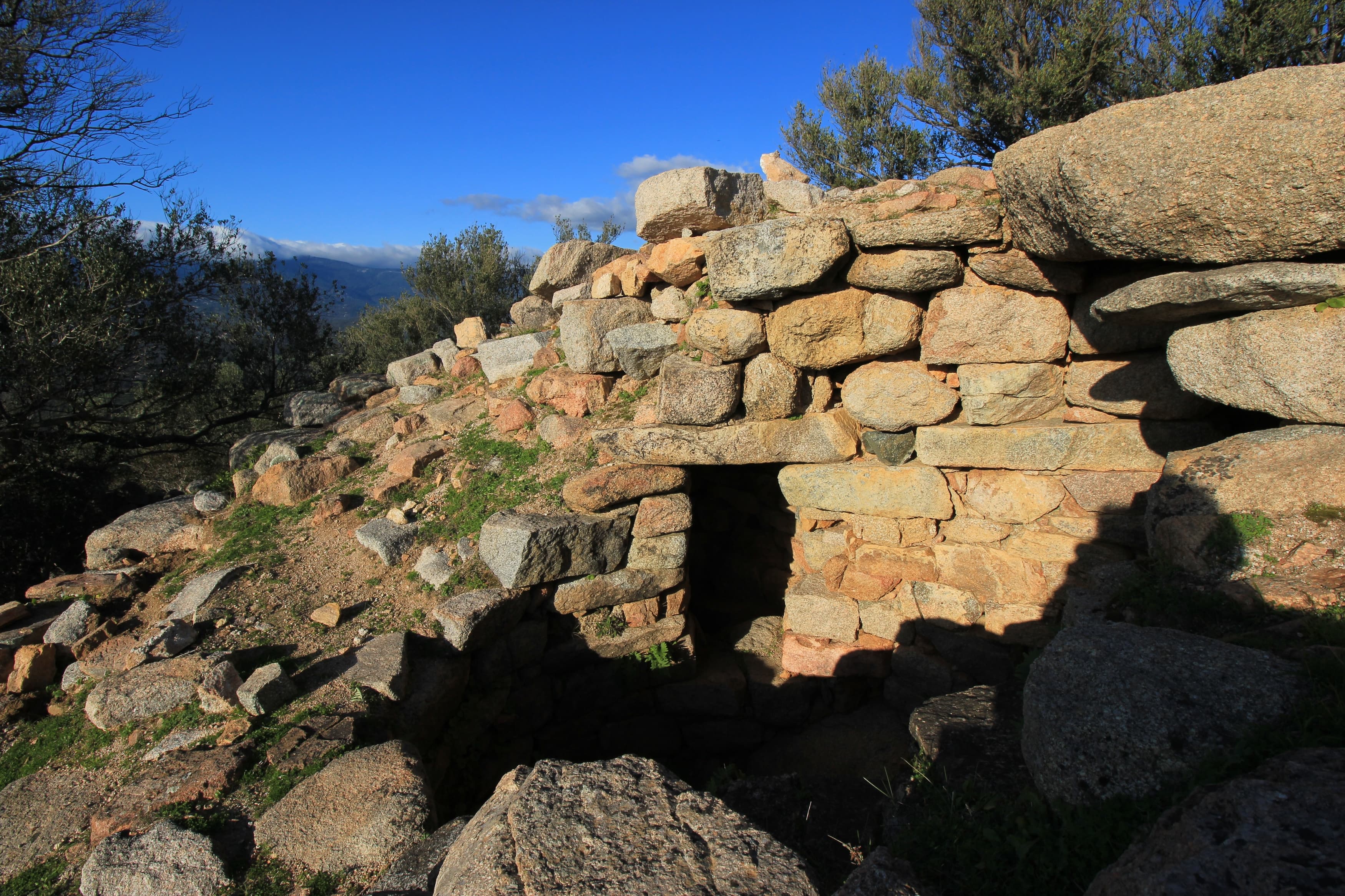
Araghju
San-Gavino-di-Carbini / Corse-du-Sud / Corsica, France
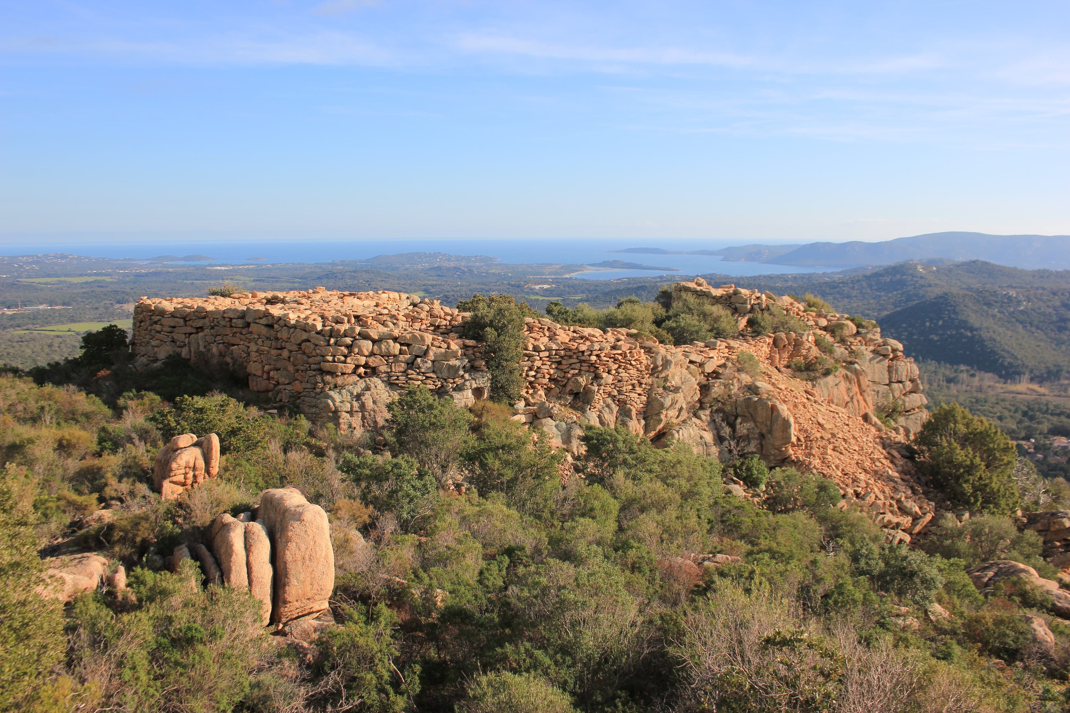
Araghju is a Torrean casteddu on a hilltop promontory above the Porto-Vecchio coastal plain — a Bronze Age circular enclosure with walls still standing three to five...

Arles
Arles, Provence-Alpes-Côte d'Azur, France
Arles preserves the full arc of Western sacred history within a single city. Roman amphitheatre and theatre gave way to a necropolis where Christians sought burial near...

Baptistère Saint-Jean de Poitiers
Poitiers, Poitiers, Nouvelle-Aquitaine (Vienne), France
A small octagonal building in central Poitiers, built atop demolished Roman structures around 360 CE and later expanded under Merovingian rule, the Baptistère Saint-Jean...

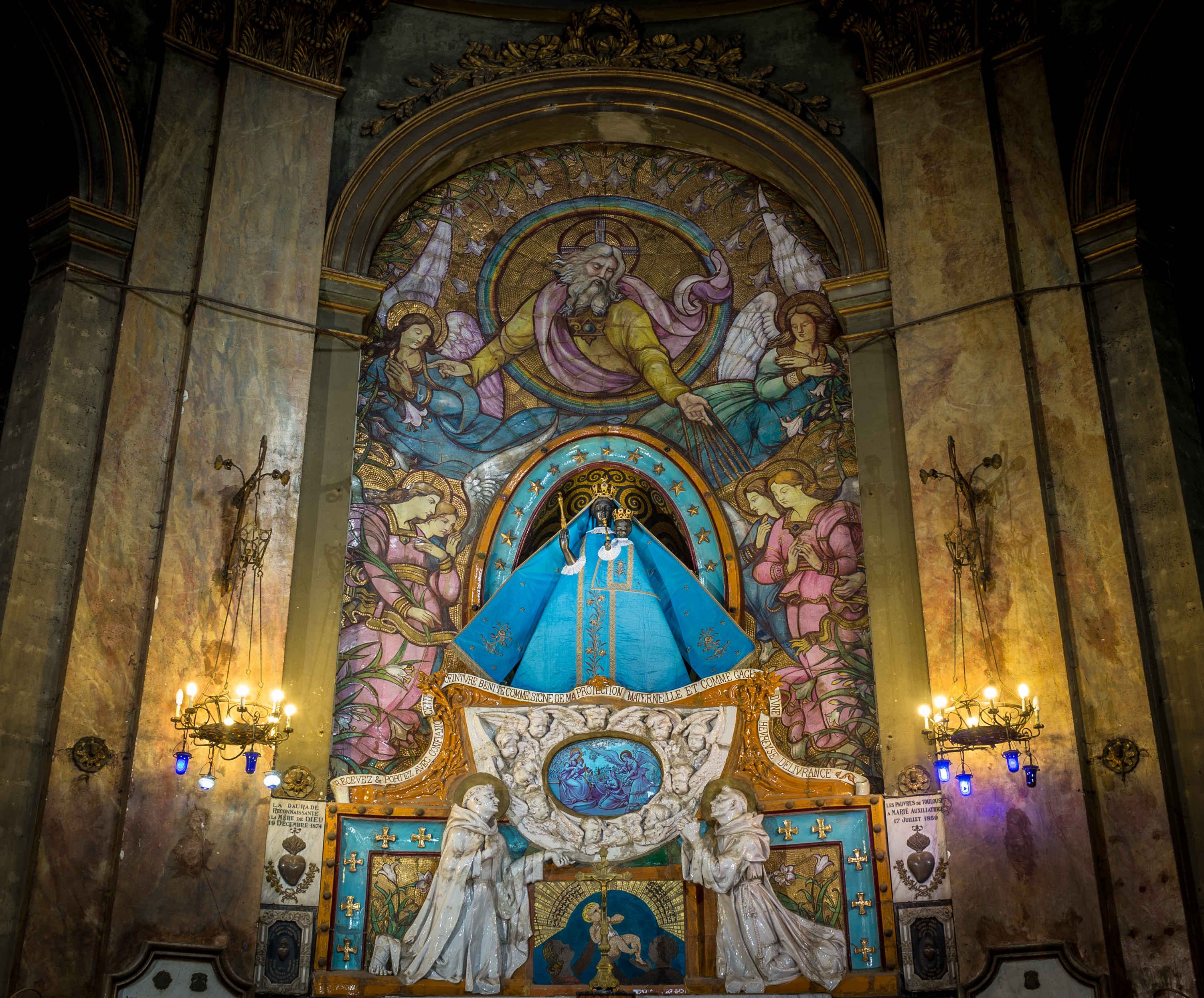
Basilica of Notre-Dame de la Daurade
Toulouse, Occitanie, France
Before it was a church, this site held a temple to Apollo. The golden mosaics that covered its early Christian walls gave it the name Daurade—from the Latin for 'gilded.'...

Basilica of Notre-Dame du Port
Clermont-Ferrand, Auvergne-Rhône-Alpes, France
Built from the dark volcanic stone of Auvergne, Notre-Dame du Port stands among the finest Romanesque churches in France—one of ten major examples within thirty kilometers....
Basilica of Notre-Dame-de-Bon-Secours, Guingamp
Guingamp, Brittany, France
For nearly a millennium, pilgrims have journeyed to Guingamp seeking the intercession of Notre-Dame de Bon-Secours, Our Lady of Good Help....

Basilica of Our Lady of Deliverance, Douvries-la-Delivrande
Douvres-la-Délivrande, Normandy, France
For over two thousand years, this ground has been sacred—first to a Celtic mother goddess, then to the Virgin Mary....
Basilica of Our Lady of Marceille
Limoux, Occitanie, France
On a hilltop outside Limoux, a Gothic basilica guards one of France's most poignant Black Madonnas....

Basilica of Saint Martin
Tours, Centre-Val de Loire, France
In the heart of Tours, pilgrims have journeyed for over sixteen centuries to honor Saint Martin, the Roman soldier who shared his cloak with a freezing beggar and later...
Basilica of Saint Martin, Tours
Tours, Tours, Centre-Val de Loire, France
A Neo-Byzantine basilica raised over the crypt of Saint Martin of Tours, whose act of cutting his cloak in half for a freezing beggar became the founding image of Western...
Basilica of Sainte-Therese of Lisieux
Lisieux, Normandy, France
Two million visitors arrive each year at Lisieux to encounter Saint Thérèse—a Carmelite nun who died at 24 and revolutionized Catholic spirituality....

Basilica of Saints Nazarius and Celsus
Carcassonne, Occitania, France
Within the fortified citadel of Carcassonne stands a basilica blessed by a pope who preached the Crusades....

Basilica of the Sacred Heart of Jesus, Paray le-Monial
Paray-le-Monial, Bourgogne-Franche-Comté, France
In a convent chapel in Burgundy, between 1673 and 1675, a young Visitation nun named Margaret Mary Alacoque received approximately thirty apparitions of Jesus Christ....
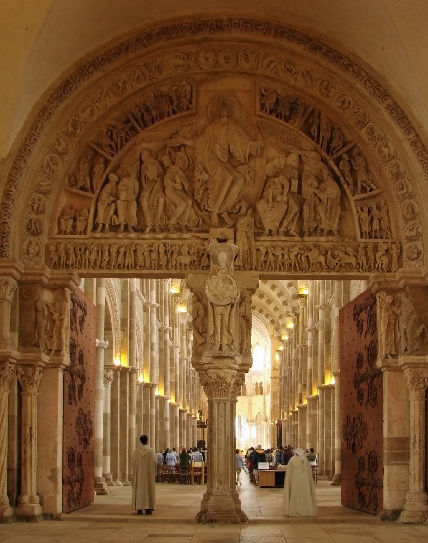
Basilique de Vézelay
Vézelay, Bourgogne-Franche-Comté, France
On this Burgundian hilltop, Bernard of Clairvaux preached the Second Crusade before Louis VII and Eleanor of Aquitaine....
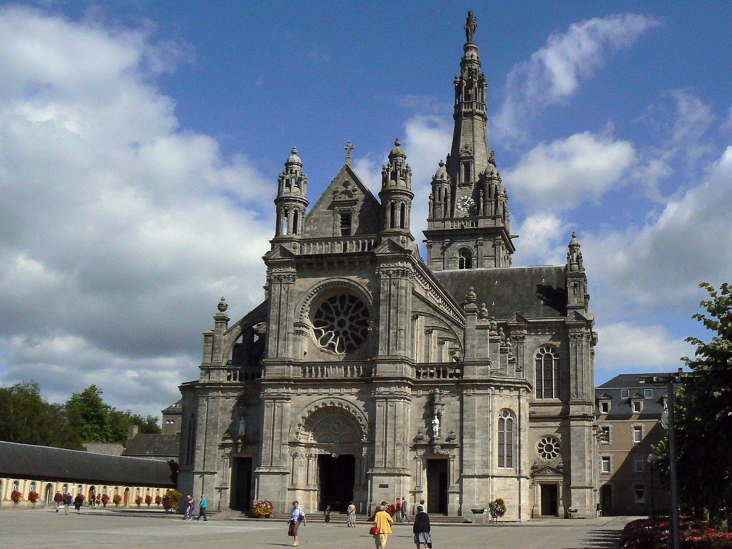
Basilique Sainte-Anne d'Auray
Sainte-Anne-d'Auray, Brittany, France
In 1624, Saint Anne appeared to a Breton farmer and spoke to him in his own language: 'I am the mother of Mary.' She asked that the ancient chapel in her honor be restored....
Black Madonna of Daurade
Toulouse, Occitania, France
Notre-Dame la Noire—Our Lady the Black One—has protected mothers in childbirth since at least the tenth century....

Black Madonna of Guingamp
Guingamp, Bretagne, France
In the basilica at Guingamp sits a Black Madonna whose origins are wrapped in Crusader legend and whose original title—Notre-Dame du Halgouët, Our Lady from under the...

Black Madonna of Moulins
Moulins, Auvergne-Rhône-Alpes, France
In Moulins Cathedral, a Black Madonna holds the Christ child who blesses the world with one hand while clutching the closed book of gospels to his chest....

Black Madonna of Pontoise
Pontoise, Metropolitan France, France
The Miraculous Virgin of Pontoise stands over two meters tall, fine and slender, carved in the thirteenth century....

Black Madonna of Vichy
Vichy, Auvergne-Rhône-Alpes, France
In November 1793, Revolutionary authorities in Vichy condemned a medieval Black Virgin—tried her like a traitor, sentenced her, beheaded her, and set her burning....

Bonneval Abbey
France
Founded in 1147 as a Cistercian house in a secluded Aveyron valley, Bonneval was ruined by plague, war, and revolution, then raised again in 1875 by Trappistine nuns who...
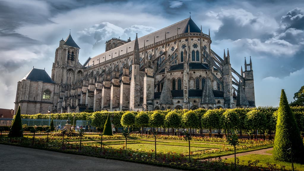
Bourges Cathedral
Bourges, Centre-Val de Loire, France
Bourges Cathedral rises from one of the earliest Christian communities in Gaul, its five naves flowing without interruption toward the altar....

Cahors Cathedral
Cahors, Occitania, France
Cahors Cathedral rises over the old town of the Lot with two vast Romanesque domes, among the largest of the medieval West....
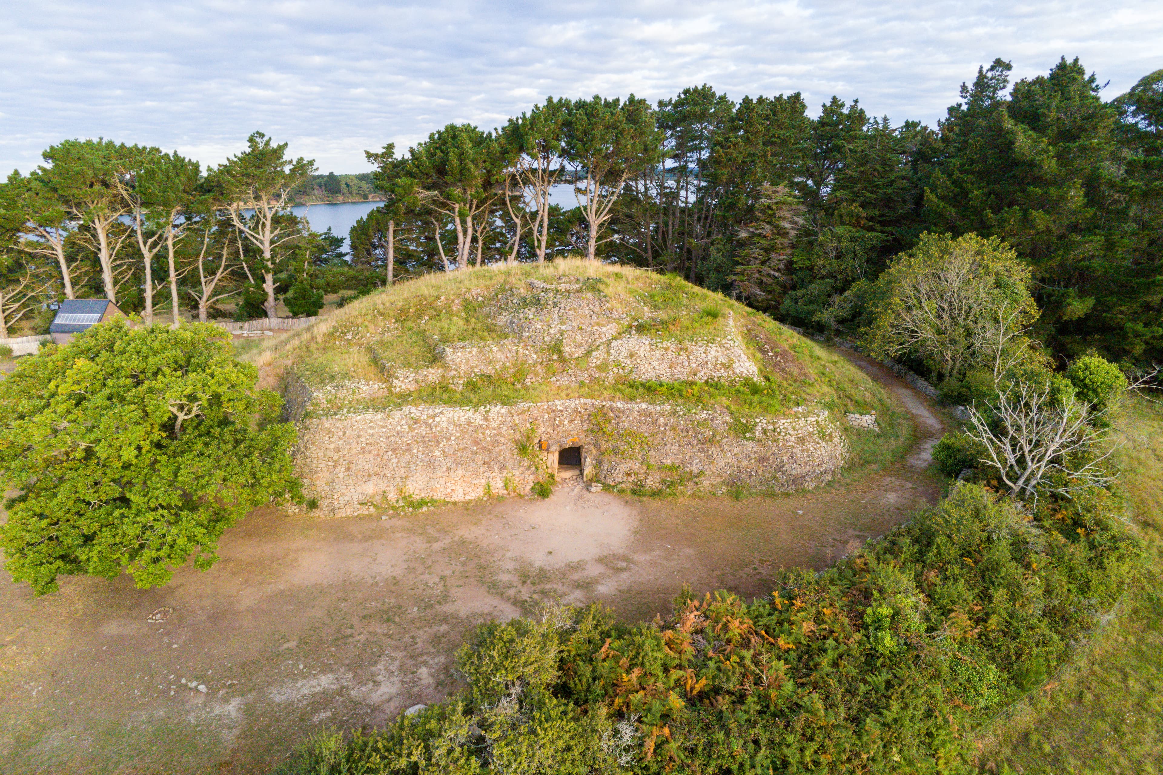
Cairn de Gavrinis
Kerners, Brittany, France
On an island in the Gulf of Morbihan, Neolithic builders created something unprecedented: a passage tomb whose every stone is carved with spirals, concentric circles, and...

Capula
Levie / Corse-du-Sud / Corsica, France
Capula is the atmospheric climax of the Cucuruzzu circuit in southern Corsica — a site where Bronze Age Torrean foundations underlie a 9th-century medieval castrum, and...

Carcassonne
Carcassonne, Occitania, France
Carcassonne rises above the Aude River as Europe's largest surviving medieval fortified city....

Casa di l’Urca
Santo-Pietro-di-Tenda, Monte Revincu / Haute-Corse / Corsica, France
Casa di l'Urca is a Neolithic passage dolmen on the rocky ridge of Cima di Suarello in Corsica's Agriates desert — built approximately 3500 BC as a collective burial...

Casteddu di Tappa
Porto-Vecchio area / Corse-du-Sud / Corsica, France
Casteddu di Tappa is one of southern Corsica's most complete Torrean Bronze Age complexes — a cyclopean-walled village crowned by a circular ceremonial torre that...
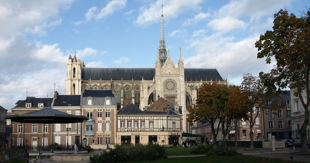
Cathedral of Our Lady of Amiens
Amiens, Hauts-de-France, France
Amiens Cathedral rose in a single generation—an audacious act of faith made stone....
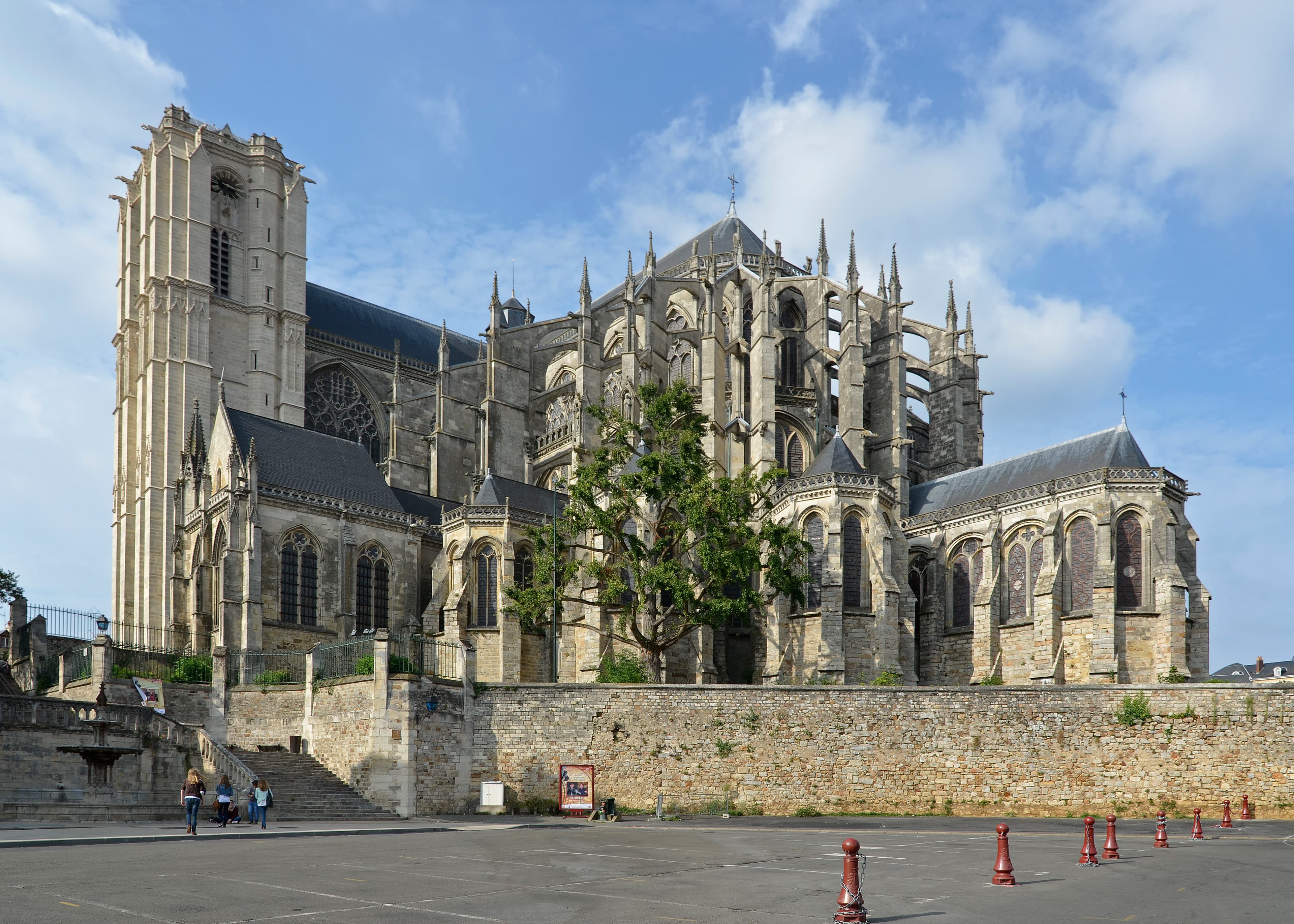
Cathedral of St. Julian, Le Mans
Le Mans, Pays de la Loire, France
Before Le Mans was a racing city, it was a cathedral city. The Cathedral of Saint Julian possesses some of France's finest medieval stained glass—windows that have...
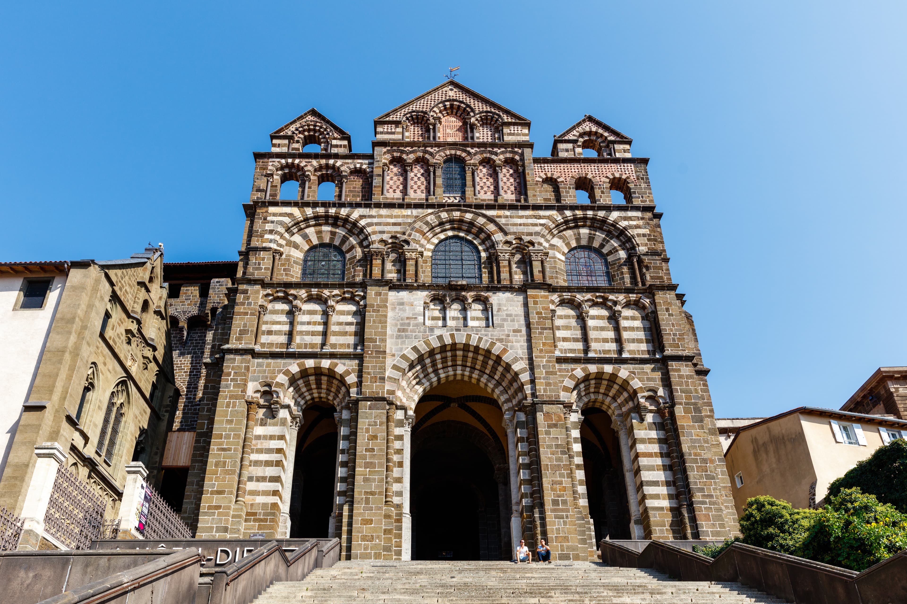
Cathédrale Notre-Dame-du-Puy
Le Puy-en-Velay, Auvergne-Rhône-Alpes, France
On Mont Anis, where a sick woman once lay upon a dolmen and was healed by the Virgin's grace, one of Europe's oldest Marian sanctuaries rises in Romanesque splendor....
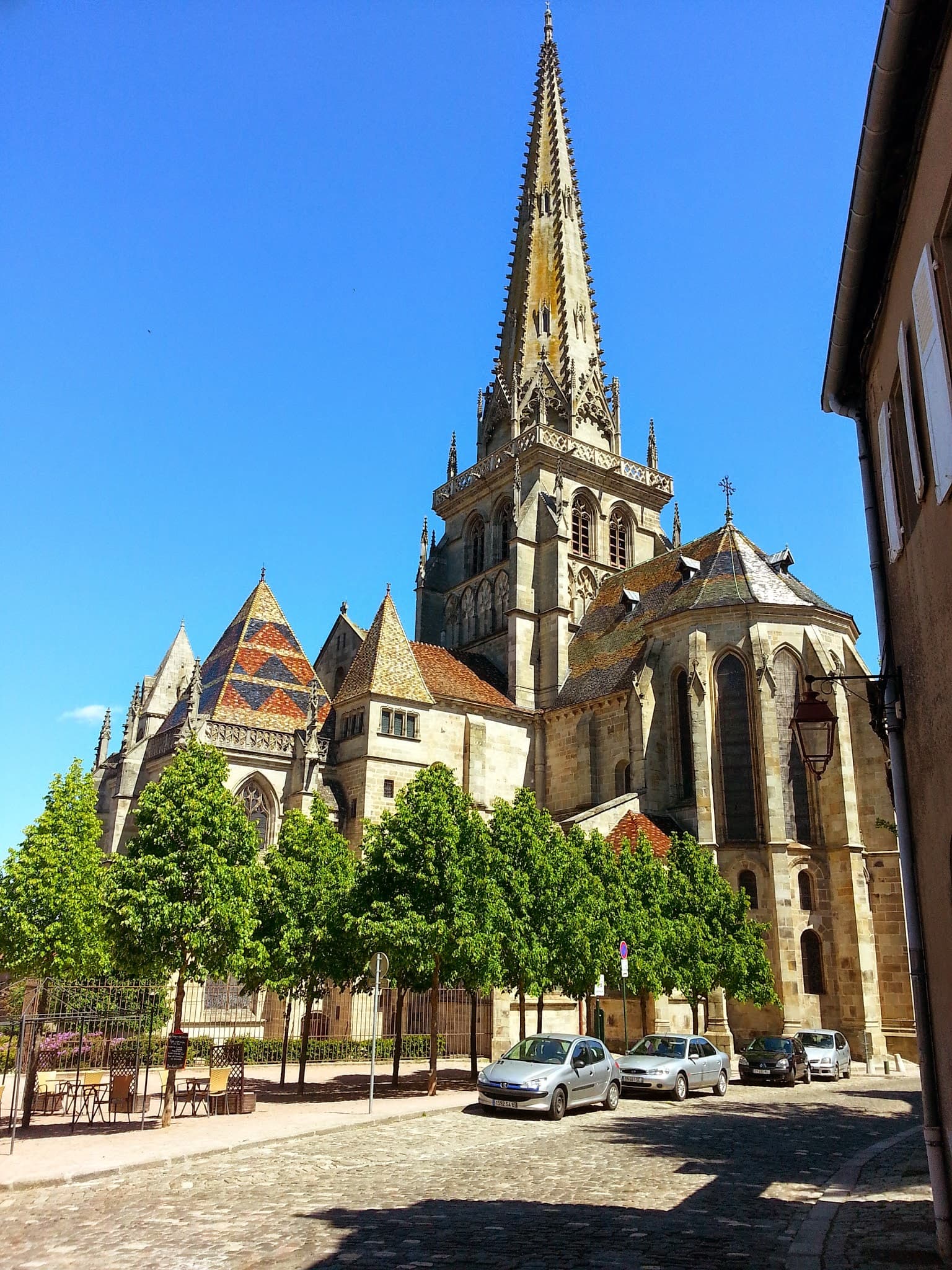
Cathédrale Saint-Lazare d'Autun
Autun, Autun, Saône-et-Loire, Burgundy, France
Built between 1120 and 1146 to shelter the relics of Lazarus of Bethany, Autun Cathedral carries one of the most concentrated programmes of Romanesque sculpture in Europe....
Ceccia
Porto-Vecchio / Corse-du-Sud / Corsica, France
Casteddu di Ceccia is a Torrean Bronze Age torra monument dating to approximately 1350 BCE, preserved on a rocky outcrop in the village of Ceccia south of Porto-Vecchio....

Chair of Isis (Throne of Isis)
Rennes-les-Bains, Occitanie, France
High above the thermal village of Rennes-les-Bains, a granite seat carved into the forest floor has drawn seekers for centuries....

Chapel of Our Lady of the Miraculous Medal
Paris, Paris, Île-de-France, France
The Chapelle Notre-Dame de la Médaille Miraculeuse stands at 140 rue du Bac in Paris, inside the motherhouse of the Daughters of Charity....

Chapel of Rochegude
Saint-Privat-d’Allier, France
Perched at around 960 metres above the Allier gorges, the small twelfth-century chapel of Saint-Jacques de Rochegude marks a dramatic threshold on the Via Podiensis, where...

Chapel of Saint Mary Magdalene
Monistrol-d'Allier, France
Above Monistrol-d'Allier, a neoclassical facade seals a basalt rock cavity to form a troglodyte chapel dedicated to Mary Magdalene, the saint of grottoes and penitence....

Chapel of Saint-Michel d’Aiguilhe
Le Puy-en-Velay, Auvergne-Rhône-Alpes, France
Set atop a sheer volcanic spire reached by 268 rock-cut steps, this small Romanesque chapel has drawn worship across millennia, from a prehistoric dolmen to a Roman cult...

Chapel of Saint-Salvayre
Alet-les-Bains, Occitanie, France
At the end of a rutted road climbing from Alet-les-Bains, a small chapel sits at the edge of sky and mountain....

Chapel of Soyartze
Uhart-Mixe, France
Crowning a hill at about 286 metres above Uhart-Mixe, this small open chapel is a Marian sanctuary descended from a twelfth-century Premonstratensian foundation....

Chapelle de Picpus in Paris
Paris, Île-de-France, France
In a quiet corner of eastern Paris lies Picpus, where 1,306 victims of the Revolution's final weeks lie in mass graves....

Chapelle du Saint-Pilon
Plan-d'Aups-Sainte-Baume, Provence-Alpes-Côte d'Azur, France
At 994 meters atop the Sainte-Baume massif, a small stone chapel marks the legendary spot where angels lifted Mary Magdalene seven times daily for divine sustenance....
Showing 1-48 of 146 sites
Key questions
France sacred-site questions
- What sacred sites can I explore in France?
- Pilgrim Map lists sacred places in France across living worship sites, heritage landmarks, pilgrimage destinations, and culturally significant landscapes. The current guide lists 146 sites organized by region, tradition, and site type.
- Which traditions are represented in France?
- The most represented traditions include Christianity, Celtic and Prehistoric, Prehistoric, Multi-tradition, Indigenous, Neolithic.
- How should I plan a sacred-site visit in France?
- Start with regional clusters, compare nearby places on the map, then open individual site pages for coordinates, etiquette, and sacred context where available.
- Can I view France sacred sites on a map?
- Yes. Switch to map view to compare geographic clusters, then open individual site pages for coordinates, visiting context, and related places.