All pilgrimages

Pilgrimage · United Kingdom · Hampshire/Surrey/Kent

Pilgrims' Way (Winchester to Canterbury)

Pilgrims' Way

A North Downs road to Becket's shrine, walked for centuries and named, in part, by Victorian imagination.

Stations
0 of 12
Traditional duration
About 10-14 days on foot for the full distance, historically and today
Founded
The underlying trackway is prehistoric; the pilgrimage association grew after Becket's 1170 murder and canonization in 1173
Focus
The shrine of Thomas Becket, murdered in Canterbury Cathedral in 1170
Best season
Spring and early autumn; the chalk downland paths can turn heavy underfoot in wet winter conditions

Key questions

What is Pilgrims' Way (Winchester to Canterbury)?
Pilgrims' Way (Winchester to Canterbury) is a Christianity pilgrimage route in United Kingdom, Hampshire/Surrey/Kent. A North Downs road to Becket's shrine, walked for centuries and named, in part, by Victorian imagination
How many stations are on Pilgrims' Way (Winchester to Canterbury)?
This guide currently maps 12 stations, with 12 total sites noted in the route metadata.
When is the best time to walk Pilgrims' Way (Winchester to Canterbury)?
Spring and early autumn; the chalk downland paths can turn heavy underfoot in wet winter conditions

Opening

The road east from Winchester follows the chalk ridge of the North Downs for most of its length, climbing along a scarp that has carried travelers across southern England since long before any pilgrim walked it toward Canterbury. A modern walker retracing this line passes through New Alresford, over the Surrey Hills at St Martha-on-the-Hill, down through Reigate and Otford, past the ancient well at Kemsing, and on through Wrotham, Boxley, Charing, and Chilham before the final descent into Canterbury and its cathedral — twelve stations across a route whose surface, in most stretches, has been walked for far longer than it has been called by a pilgrim's name.

Origins

The trackway itself is far older than any Christian pilgrimage: archaeological evidence places a route along this scarp in use since at least the early Iron Age, and likely earlier, as one of the natural east-west corridors along the North Downs. The pilgrimage association grew specifically after the murder of Archbishop Thomas Becket in Canterbury Cathedral in 1170 and his rapid canonization in 1173, which turned Canterbury into one of medieval Christendom's most visited shrine destinations and gave travelers moving along the existing Hampshire-to-Kent trackway a devotional reason to be doing so. The name "Pilgrims' Way" itself, however, is a substantially later invention: nineteenth-century antiquarians, most influentially Albert Way of the Ordnance Survey in the 1850s, formally attached the name to specific stretches of the North Downs trackway with limited direct evidence that medieval Winchester-to-Canterbury pilgrims used precisely this alignment rather than other, more direct roads; the Kent Archaeological Society and subsequent scholarship have since re-examined this Victorian and Edwardian antiquarian enthusiasm and found the continuous single-route narrative considerably less certain than the name implies, even as the underlying prehistoric trackway and the historical fact of Canterbury pilgrimage are not in question.

Why pilgrims walk it

Walkers set out along this route today for reasons spanning devout Christian pilgrimage, historical curiosity, and simple long-distance walking. Practicing pilgrims, some organized through cathedral or diocesan groups, walk toward Canterbury with Becket's shrine and the wider tradition of English cathedral pilgrimage as their explicit purpose, often timing their arrival to coincide with feast days or cathedral services. Others are drawn by the landscape and history of the North Downs specifically, walking sections rather than the whole distance, more interested in Surrey's wooded hills or Kent's orchards than in any particular devotional outcome. A third group comes specifically to test the route's own contested history — walking with Chaucer's Canterbury Tales in mind, or curious to see for themselves how convincingly a nineteenth-century invented name sits over a genuinely ancient road. Chaucer's pilgrims, notably, are usually understood to have taken the more direct road from London rather than this Winchester approach, a detail that complicates but doesn't erase the route's broader claim on English pilgrimage memory.

Significance

Canterbury Cathedral's shrine to Becket made it, for roughly three and a half centuries until the shrine's destruction during the Reformation in 1538, one of the most significant pilgrimage destinations in northern Europe, drawing travelers along multiple roads from across England and the continent, of which the Winchester approach was only one. The route's layered history — a prehistoric trackway, a genuine medieval pilgrimage destination at its endpoint, and a Victorian antiquarian construction imposed on the connecting path between them — makes it a useful case study in how pilgrimage heritage gets assembled retrospectively; contemporary walkers benefit from a route that is honestly presented today by heritage bodies as historically layered rather than continuously ancient, which has if anything deepened rather than diminished its interest for many who walk it.

The route

12 stations on the map

Click any marker to open that station. Numbered pins follow the traditional route order.

Loading map...

Stations

Walk the route in order

Each station opens onto its own page. Origins, the experience of arrival, what is held there. Stations not yet on Pilgrim Map will appear here as their pages are completed.

  1. Station —

    Archbishop's Palace, Charing

    Charing, Charing, Kent

    On the edge of Charing village stands a great medieval hall that once housed the Archbishops of Canterbury on their journeys between London and Canterbury. Founded on land granted to Christ Church Priory in AD 788 and rebuilt under Archbishop John Morton around 1500, the palace hosted Henry VIII and Catherine of Aragon in 1520 and, for pilgrims on the Pilgrims' Way, marked the last overnight halt before Becket's shrine.

  2. Station —

    Boxley Abbey

    Boxley, Boxley, Kent

    Boxley Abbey was Kent's only medieval Cistercian house, and for centuries its fame rested on the Rood of Grace, a crucifix figure whose apparent movement drew pilgrims from across England. What that movement actually was — miracle, mechanism, or manufactured story — remains genuinely disputed among historians.

  3. end

    Station end

    Canterbury Cathedral

    Canterbury, England

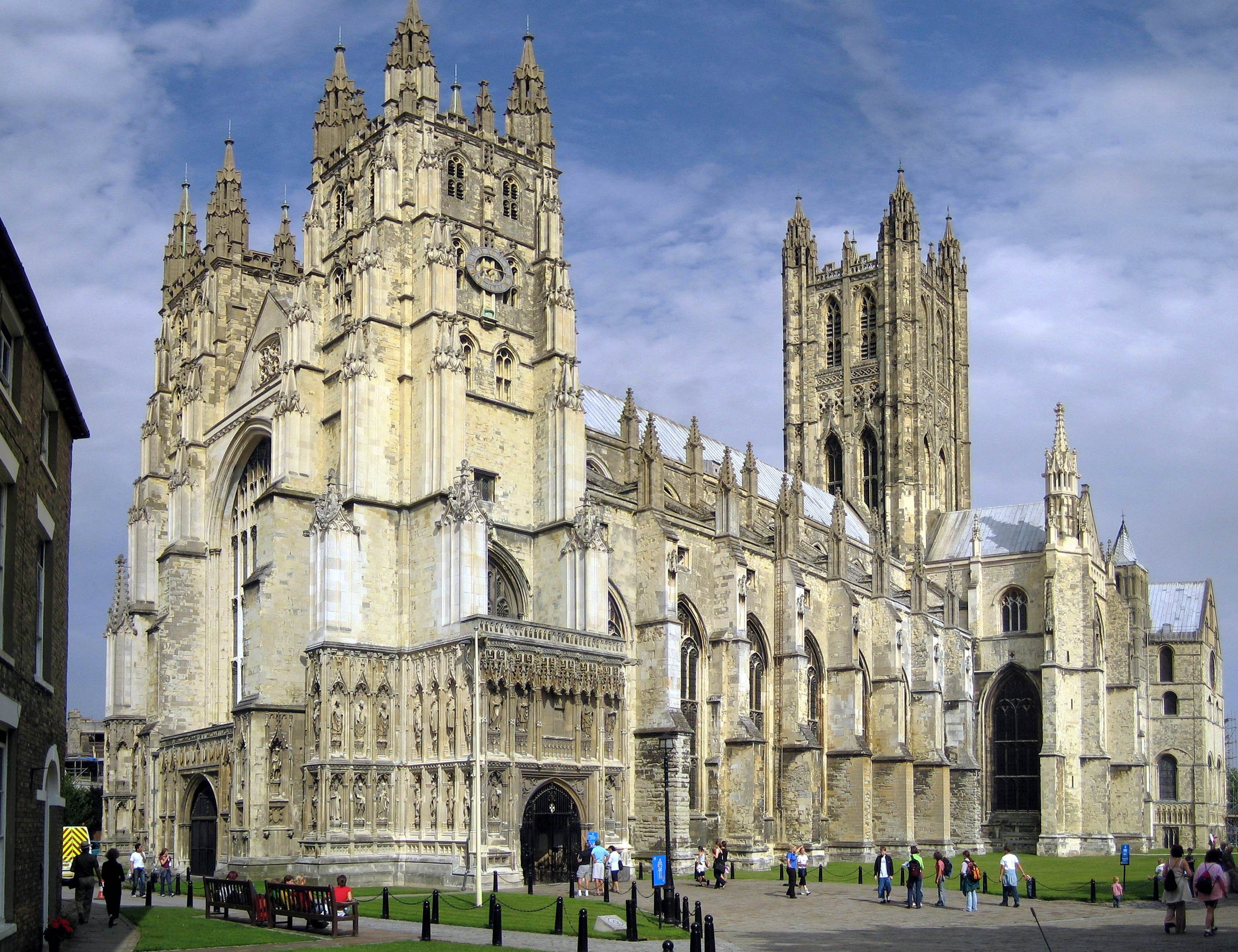
    Canterbury Cathedral has drawn pilgrims for over eight centuries, since four knights murdered Archbishop Thomas Becket at the altar in 1170. As the Mother Church of the Anglican Communion and seat of the Archbishop of Canterbury, it remains a place where the collision of sacred and political power echoes through stone, where the question Becket embodied still asks itself: what is worth dying for?

  4. Station —

    Chilham

    Chilham, Kent

    St Mary's, Chilham, is an active Church of England parish church on the Pilgrims' Way, its congregation traditionally dated to the 7th century and documented in the Domesday Book. Local heritage tradition holds that after Canterbury's St Augustine's Abbey was dissolved in 1538, the saint's shrine was brought here for safekeeping before disappearing without trace by 1541 — an account resting on parish history rather than academic corroboration, but one that leaves the church at the centre of a genuine unresolved mystery.

  5. Station —

    Farnham Castle

    Farnham, Farnham, Surrey

    Farnham grew up around a castle built in 1138 by Henry of Blois, Bishop of Winchester, and the parish church of St Andrew, whose worship continues unbroken from at least the twelfth century. The town sits on the historic road corridor between Winchester and Canterbury, though historians disagree over how central this specific route was to the medieval Becket pilgrimage it is popularly credited with carrying.

  6. Station —

    New Alresford

    New Alresford, Hampshire, near Winchester

    New Alresford is a planned medieval market town founded around 1200 by the Bishops of Winchester, its Grade II*-listed Soke Bridge still carrying the old Winchester-London road across the River Arle. The town sits near the first day's stage of the historic Pilgrims' Way and the modern Old Way, though sources differ on whether medieval Becket-bound travelers passed directly through it or skirted it for safety.

  7. Station —

    Otford

    Otford, Kent

    For nearly six hundred years, Otford's moated manor and later Tudor palace served as a residence of the Archbishops of Canterbury, standing directly on the Pilgrims' Way that medieval travelers followed toward Thomas Becket's shrine. Surrendered to Henry VIII in 1537, the palace fell into ruin; today its surviving North-West Tower and gatehouse cottages are managed by a conservation trust, while a legendary holy well associated with Becket lies nearby, unreachable by the public.

  8. Station —

    Reigate

    Reigate, Surrey

    In the thirteenth century, Reigate's High Street held a chapel dedicated to Thomas Becket and an adjoining hospice for travelers making their way toward his shrine at Canterbury. Neither survives: the chapel site now carries the town's Georgian Old Town Hall, and the hospice is only tentatively linked to the present Red Cross Inn. What remains is a documented waypoint on the broader Winchester-Canterbury pilgrim corridor, standing just south of the ridge trackway rather than directly upon it.

  9. Station —

    St Edith's Well, Kemsing

    Kemsing, Kemsing, Kent

    At a quiet junction in Kemsing village stands a small, grilled well traditionally identified as the birthplace of Saint Edith of Wilton, born here around 961. Local tradition holds its waters carried her healing power, particularly for eye ailments, though the well itself has never been formally excavated or dated. Today it anchors an annual church procession on Edith's feast day and marks the point where two branches of the Pilgrims' Way converge.

  10. Station —

    St Martha-on-the-Hill

    Guildford, Guildford, Surrey

    St Martha-on-the-Hill is an active Church of England parish church perched 573 feet above the Surrey countryside, reachable only on foot. Its name may commemorate St Martha of Bethany, unnamed early Christian martyrs, or Thomas Becket, and it sits directly on both the historic Pilgrims' Way and the modern North Downs Way, making it one of the few sites on this route where continuous worship, dramatic landscape, and pilgrimage history genuinely converge.

  11. start

    Station start

    Winchester Cathedral

    Winchester, England

    At 558 feet, Winchester Cathedral stretches further than any medieval church in the world. Within its walls, Saxon bishops established Christianity, medieval pilgrims sought St Swithun's shrine, and Jane Austen found her final rest. The Norman transepts have stood since 1093; the Perpendicular nave stretches through 12 bays of stone-ribbed vaulting. In the early 1900s, a deep-sea diver named William Walker worked underwater for six years to save the sinking building. Today, pilgrims still arrive—walking the ancient route to Canterbury or seeking a novelist's grave.

  12. Station —

    Wrotham

    Wrotham, Kent

    St George's Church stands on a downland slope in Wrotham, its Norman core and soaring 15th-century tower marking a waypoint on the Pilgrims' Way. Local memory reaches back further still, to a claimed Saxon founding — though that claim rests on tradition, not settled record.

Walking it today

The full route runs roughly 200 kilometers from Winchester to Canterbury and is typically walked over ten to fourteen days, following a combination of the modern long-distance North Downs Way National Trail, which shares substantial sections with the historic Pilgrims' Way alignment, and marked sections specific to the pilgrim route through towns including Farnham, Guildford's outskirts, Reigate, and Otford. The British Pilgrimage Trust and other heritage organizations provide current stage-by-stage guidance and note where the modern waymarked path diverges from the older, less certain historical alignment. Spring and early autumn offer the most comfortable walking; the chalk-based North Downs paths can become heavy and slippery underfoot after sustained winter rain.

Sources

Sources consulted when researching this page. Independent verification by readers is welcome.

  1. 01The Pilgrims' Way Revisited: The use of the North Downs main trackway and the Medway crossings by medieval travellersKent Archaeological Societyhigh-reliability
  2. 02The Pilgrims' Way – Winchester to Canterbury – North Downs Pilgrims WayBritish Pilgrimage Trust
  3. 03Pilgrims' Way