Brimham Rocks
Weathered gritstone forms that inspired Druid theories, now understood through deep geological time
Understand sacred places, explore living traditions, and learn how to engage respectfully with Pilgrim Map.
Access has not been verified. Check current local guidance before planning a visit.
Summerbridge, England, United Kingdom
Read the sources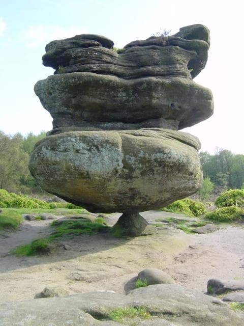
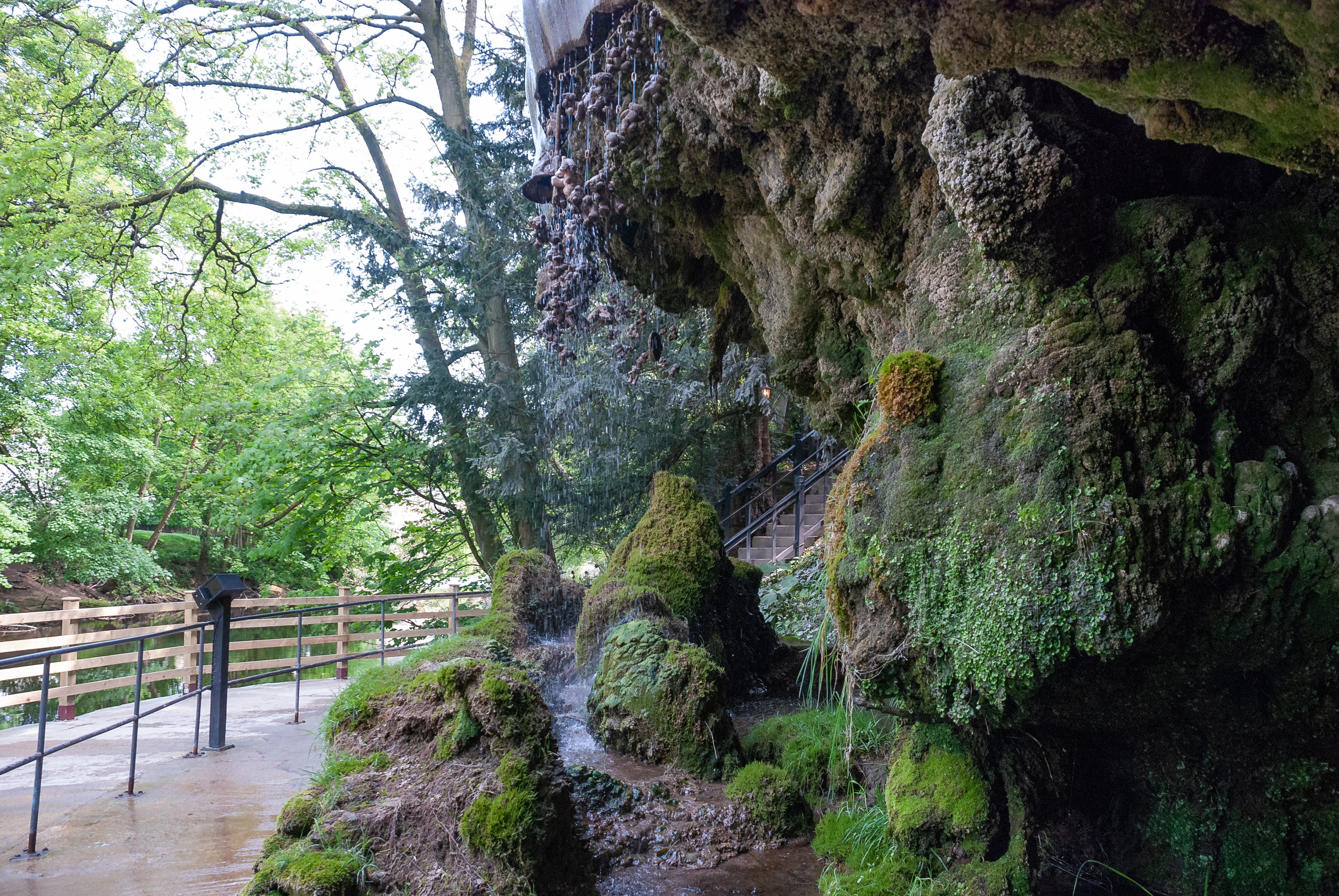
Image of Brimham Rocks. Image source
Visit essentials
A quick read before you go
- Duration
- Three to four hours
- Access
- Drive to the National Trust car park or use regional bus service to Summerbridge followed by an…
Overview
Brimham Rocks rises from heather moorland in leaning towers, balanced blocks, narrow passages, and gritstone surfaces shaped by water, ice, wind, fracture, and weathering. National Trust interpretation traces them across hundreds of millions of years through glacial and post-glacial exposure.
Eighteenth-century visitors seeking Britain's ancient religious past proposed that Druids built the forms; Major Hayman Rooke presented this theory in 1786, helping make Brimham a destination. Geology and archaeology reject it: these are natural formations, not a constructed Druid monument. Correcting that error does not empty the place of contemplation. Scale, silence, passages, wind, and shifting perspectives allow wonder while recognizing that deep time, not lost builders, made the rocks.
Why this place is sacred
The formations repeatedly disrupt ordinary scale. A gap becomes a corridor; a block seems suspended; a profile becomes an animal or a face when viewed from one angle and plain stone from another. This instability of perception encouraged names, stories, and the eighteenth-century Druid hypothesis.
Geology provides a different but equally profound account. Sediment became gritstone, tectonic pressure fractured it, glaciers exposed resistant outcrops, and weather enlarged joints and hollows. The resulting landscape asks the visitor to imagine processes far beyond a human lifespan.
Contemporary spiritual interpretations may read energy, elemental presence, or symbolic forms into the rocks. These belong to personal or community practice. They should not be backdated into prehistory without archaeological evidence.
Experience and orientation
Begin on a managed path and let the formations appear gradually. The central rocks can become busy, while quieter edges offer space for observing texture, heather, birds, and weather. A full exploration can take several hours, but a shorter accessible route reaches major viewpoints.
Do not let the playful forms obscure risk. Rock surfaces can be slick, gaps can be deeper than they appear, and drops may be unguarded. Climbing and scrambling require judgment beyond ordinary walking. Keep children close and avoid exposed heights in wind, rain, ice, or poor visibility.
For contemplation, choose stable ground beside a path rather than blocking a passage or occupying a formation others are trying to cross.
Use the National Trust map, allow more time than distance suggests, and turn back before weather or daylight becomes marginal.
Context and lineage
Modern geological interpretation attributes the formations to sedimentation, rock formation, tectonic fracture, glacial exposure, and prolonged erosion. The once-influential claim that Druids erected the rocks records eighteenth-century antiquarian imagination rather than the site’s physical origin.
The land was associated with Fountains Abbey in the medieval period, later entered estate ownership, grew as a visitor attraction after antiquarian publicity, and is now managed by the National Trust for public access, conservation, and interpretation.
Hayman Rooke
antiquarian
Presented an influential 1786 interpretation of Brimham as a Druid-made landscape; important to reception history but superseded as geology.
Traditions and practice
The Druid association is an eighteenth-century antiquarian tradition of interpretation rather than an attested ancient practice.
Visitors use the landscape for walking, climbing where appropriate, nature observation, art, and personal contemplation.
Choose one formation and observe it from several angles before reading its popular name. Notice how expectation changes perception.
Geological and Conservation Stewardship
ActiveThe landscape is protected and interpreted as an important natural geological site.
Research, habitat care, path management, education, and low-impact access.
Druidic Antiquarian Reception
HistoricalEighteenth-century theories shaped Brimham’s fame and the names and stories attached to its formations.
Historical interpretation and guide culture, not documented ancient ritual.
Perspectives and open questions
Brimham Rocks is read through geology, antiquarian history, natural heritage, and contemporary spirituality. The evidence does not support ancient Druid construction.
Scholarly perspective
Geological sources explain the forms through millstone-grit formation, fracture, glacial exposure, and weathering.
Living and traditional perspectives
The Druid theory belongs to eighteenth-century antiquarianism and the later visitor culture it generated.
Alternative interpretations
In an alternative contemporary interpretation, Matías De Stefano’s Gaia episode approaches Brimham within a spiritual itinerary. This perspective does not establish prehistoric ritual use.
Open questions
Prehistoric people may have encountered the landscape, but no reliable evidence identifies a sanctuary, ritual structure, or specific practice here.
Plan your visit
Access and arrival
Drive to the National Trust car park or use regional bus service to Summerbridge followed by an approximately 1.5-mile walk. | Difficulty: Accessible firm routes reach major rocks; other paths are steep, rough, and exposed.
Respectful visit
Footwear with grip, windproof and waterproof layers, and seasonal sun protection.
permitted: Yes | Do not obstruct paths or climb unstable formations for a photograph; drone and commercial use require current permission.
Leave no material offerings and do not alter the rocks or vegetation.
Do not carve, chalk, move rock, build cairns, light flames, block paths, or leave offerings. Avoid ritual claims that present the formations as proven Druid constructions.
Location
Map loads as you approach this section.
Pilgrim reflections
A portrait of encounter, not a score
Pilgrims describe what they felt, how present they could become, and whether the place would shape a journey. There are no stars and no ranking of traditions.
No reviewed reflections yet
The first pilgrims can help describe the character of being here.
Share a reflection
Available after an account-backed “Been there.” Every reflection is reviewed before publication.
Nearby sacred places
Explore other sacred places in the region. Proximity does not establish access or travel time; check each place’s guidance.
References
Sources consulted for this page. Source categories describe the publication, not a guarantee that every claim is verified. Traditional accounts and outside interpretations may differ.
- 01History of Brimham Rocks — National TrustofficialGeology, estate history, and eighteenth-century Druid theory.
- 02Brimham Rocks — National TrustofficialCurrent access, parking, facilities, and accessibility.
- 03Brimham Rocks — Geological Society of LondonacademicGeosite context.
- 04Brimham Rocks SSSI Citation — Natural EnglandofficialProtected natural significance.
- 05Some Account of the Brimham Rocks in Yorkshire — Hayman RookeacademicPrimary antiquarian reception source, not current geology.
- 06The Journey of Remembering S2:E5 — Reconnecting to Your True Nature — GaiaSource contextContemporary spiritual perspective only.
Share a photo
Help visitors recognize Brimham Rocks. Every submission is reviewed before publication.