Country guide
Greece
Greece brings together sacred architecture, pilgrimage traditions, and landscapes shaped by memory, ritual, and local devotion.
43 sacred sites across 11 regions. Use the tradition and site-type filters to narrow in.
Atlas summary
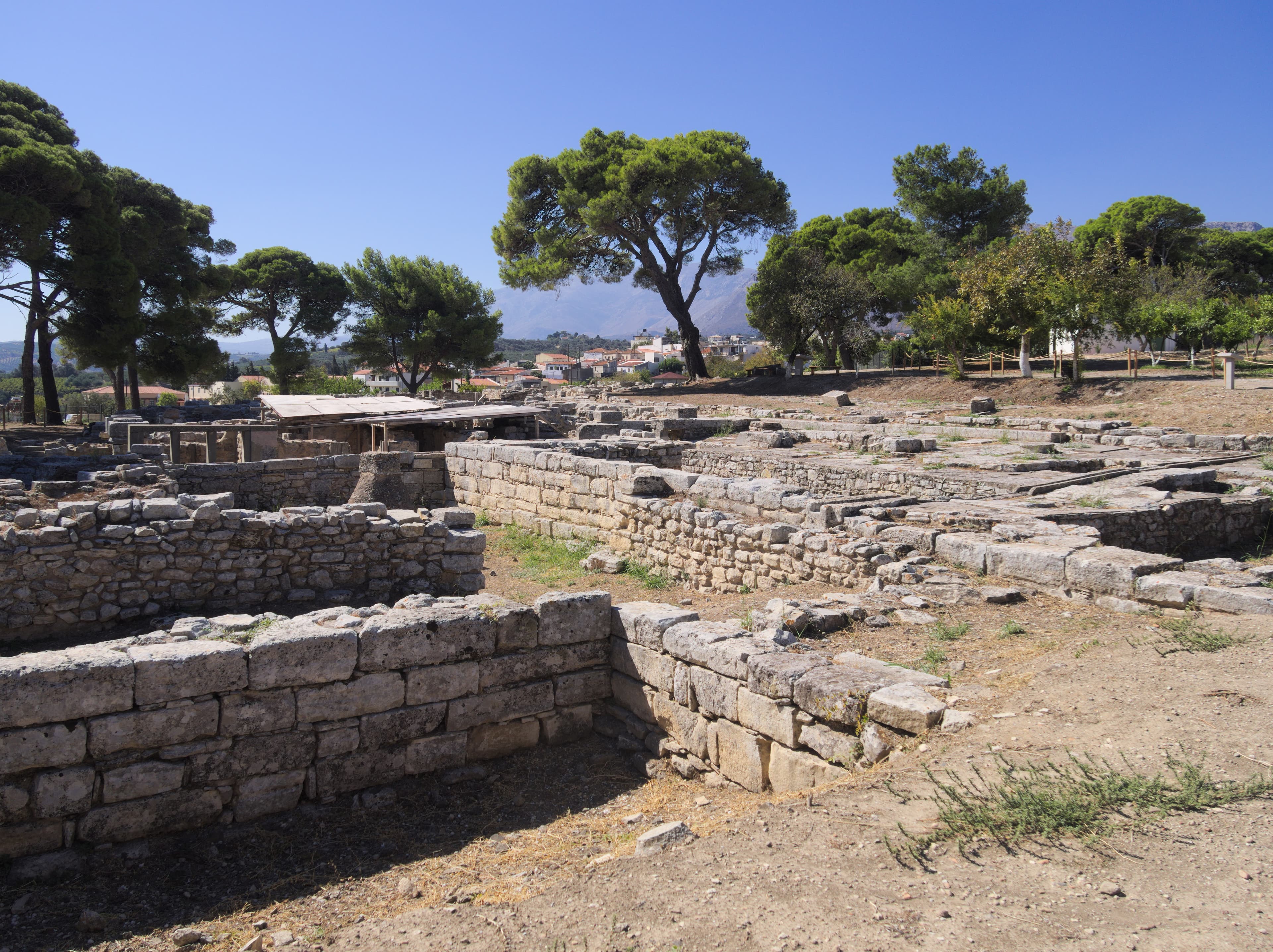
Greece sacred sites overview
Greece sacred sites include living temples, shrines, churches, pilgrimage places, ruins, and sacred landscapes indexed across the Pilgrim Map atlas.
Use this guide to compare regional clusters, represented traditions, and common site types before opening individual pages for visiting context and deeper background.
| Coverage | 43 sacred sites across 11 regions. |
|---|---|
| Regional clusters | |
| Traditions | |
| Site types | |
| UNESCO heritage | 4 UNESCO-tagged sites in this country guide. |
By tradition
Showing 1-43 of 43 sites in this country guide

Agia Triada Monastery
Chania, Region of Crete, Greece
Agia Triada Monastery rises from the Akrotiri Peninsula near Chania, a 17th-century complex where Renaissance proportions serve Orthodox devotion....

Asklepion shrine
Athens, Attica, Greece
On the south slope of the Acropolis, tucked against the rock below the Parthenon, the Asclepieion of Athens preserves the remains of a sanctuary where the sick once came...
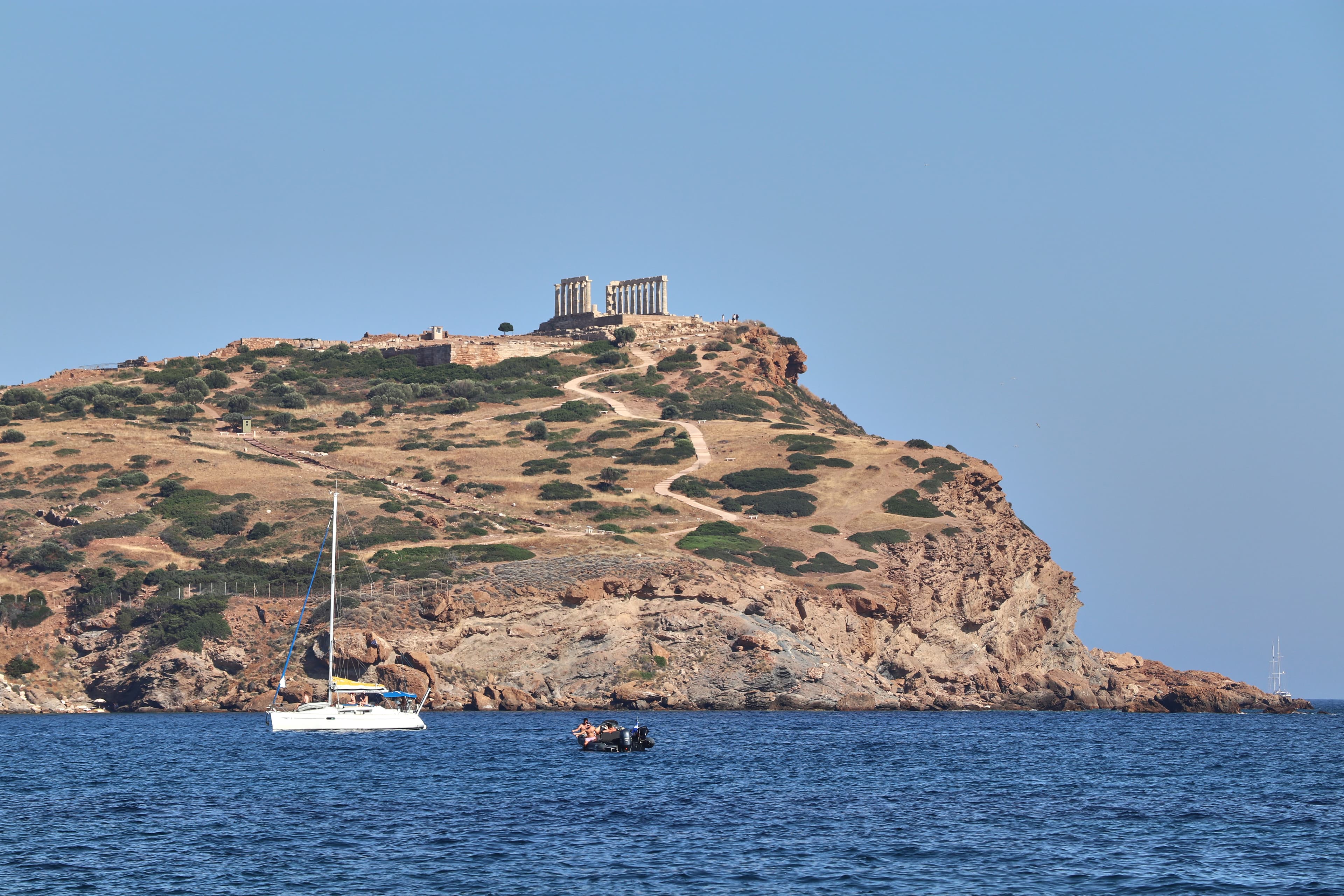
Cape Sounion
Lavreotiki Municipal Unit, Attica, Greece
Fifteen white marble columns stand on a headland sixty meters above the sea, marking the southernmost point of Attica....
Chrysoskalitissa Monastery
Chrisoskalitissa, Region of Crete, Greece
Chrysoskalitissa Monastery stands on a rock promontory thirty-five meters above the southwestern coast of Crete, overlooking the Libyan Sea toward Africa....
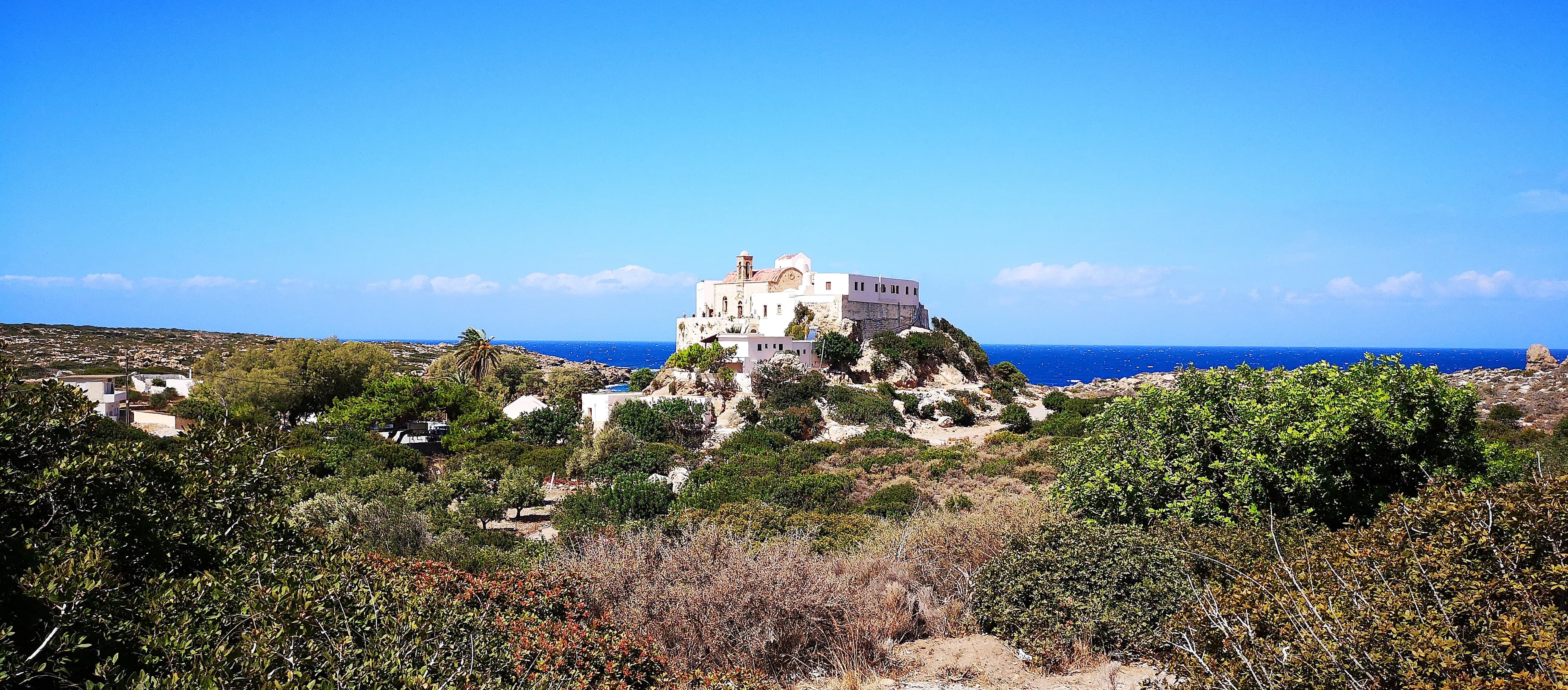
Church of Panagia Chrisopigi, Sifnos Island
Φάρος, Aegean, Greece
Panagia Chrysopigi sits on a rocky islet off the southern coast of Sifnos, connected to the island by a slender bridge....

Delos
Municipality of Mykonos, Aegean, Greece
Delos stands where light entered the world. According to Greek myth, this tiny island was floating and rootless until Leto gave birth to Apollo and Artemis here, and the...

Delphi
Municipal Unit of Delphi, Thessaly and Central Greece, Greece
Delphi stands where the Greeks placed the center of the world. Zeus sent eagles from the ends of the earth; where they crossed, he set the omphalos, the navel stone....
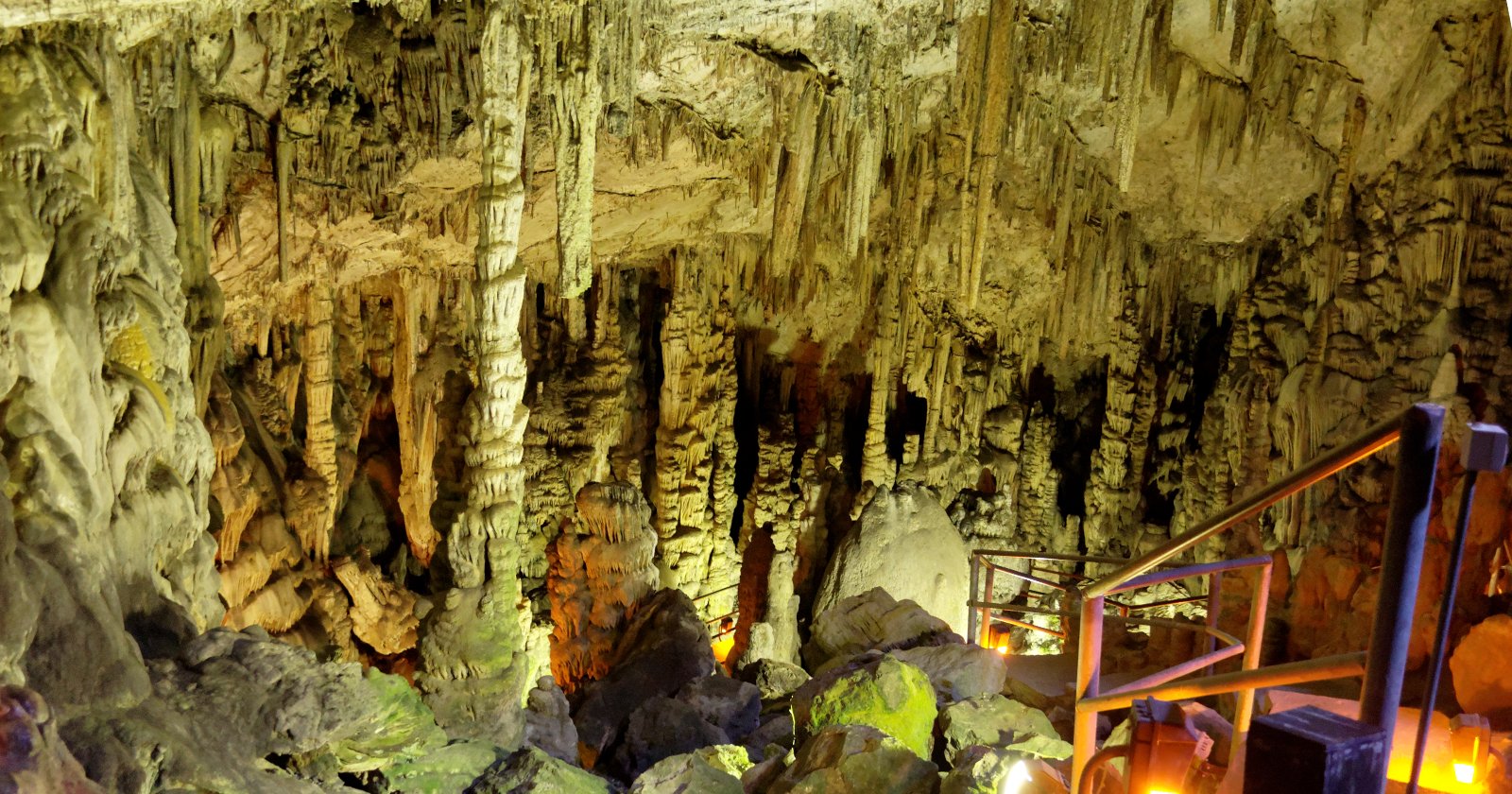
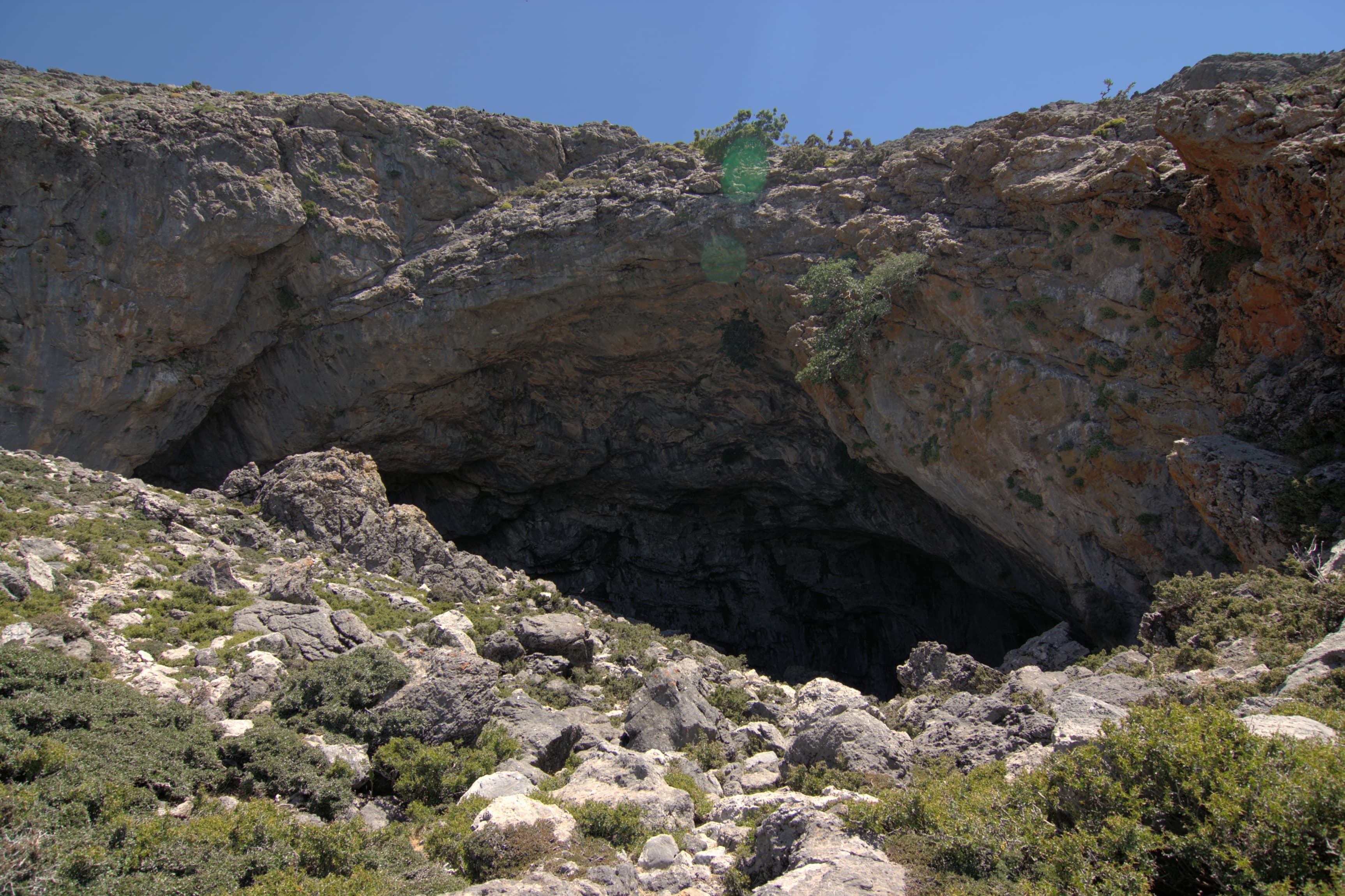
Diktaion Andron Cave
Psichro, Region of Crete, Greece
High on the slopes of Mount Dicte, above the enclosed bowl of the Lassithi Plateau, the Diktaion Andron opens into the limestone of Crete like a wound in the surface of...
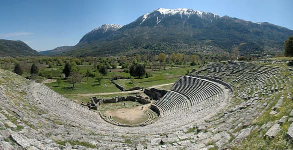
Dodona
Μαντείο, Epirus and Western Macedonia, Greece
For over a millennium, ordinary Greeks climbed to this remote Epirote valley to pose life's most urgent questions to the sacred oak of Zeus....

Epidauros
Municipal Unit of Epidavros, Peloponnese, Western Greece and the Ionian, Greece
Epidauros was the most important healing sanctuary in the ancient Greek world. Here, in an intimate valley of the Peloponnese, patients came to sleep in the sacred...

Holy Cave of the Apocalypse
Between Skala and Chora, Patmos, Greece
In this small cave on Patmos, tradition holds that Saint John received the Book of Revelation nearly two thousand years ago....

Holy Monastery of Saint John the Theologian, Patmos
Patmos, Aegean, Greece
The Monastery of Saint John the Theologian crowns the island of Patmos, built above the cave where Saint John received the visions recorded in the Book of Revelation....
Kamares Cave
Tybakio Municipal Unit, Region of Crete, Greece
High on the southern face of Mount Ida, the highest mountain in Crete, a vast arched entrance opens into the mountain at nearly 1,700 meters....

Knossos
Heraklion Municipal Unit, Region of Crete, Greece
Knossos rises from the hills south of Heraklion on Crete, the ceremonial and sacred heart of the Minoan civilization....
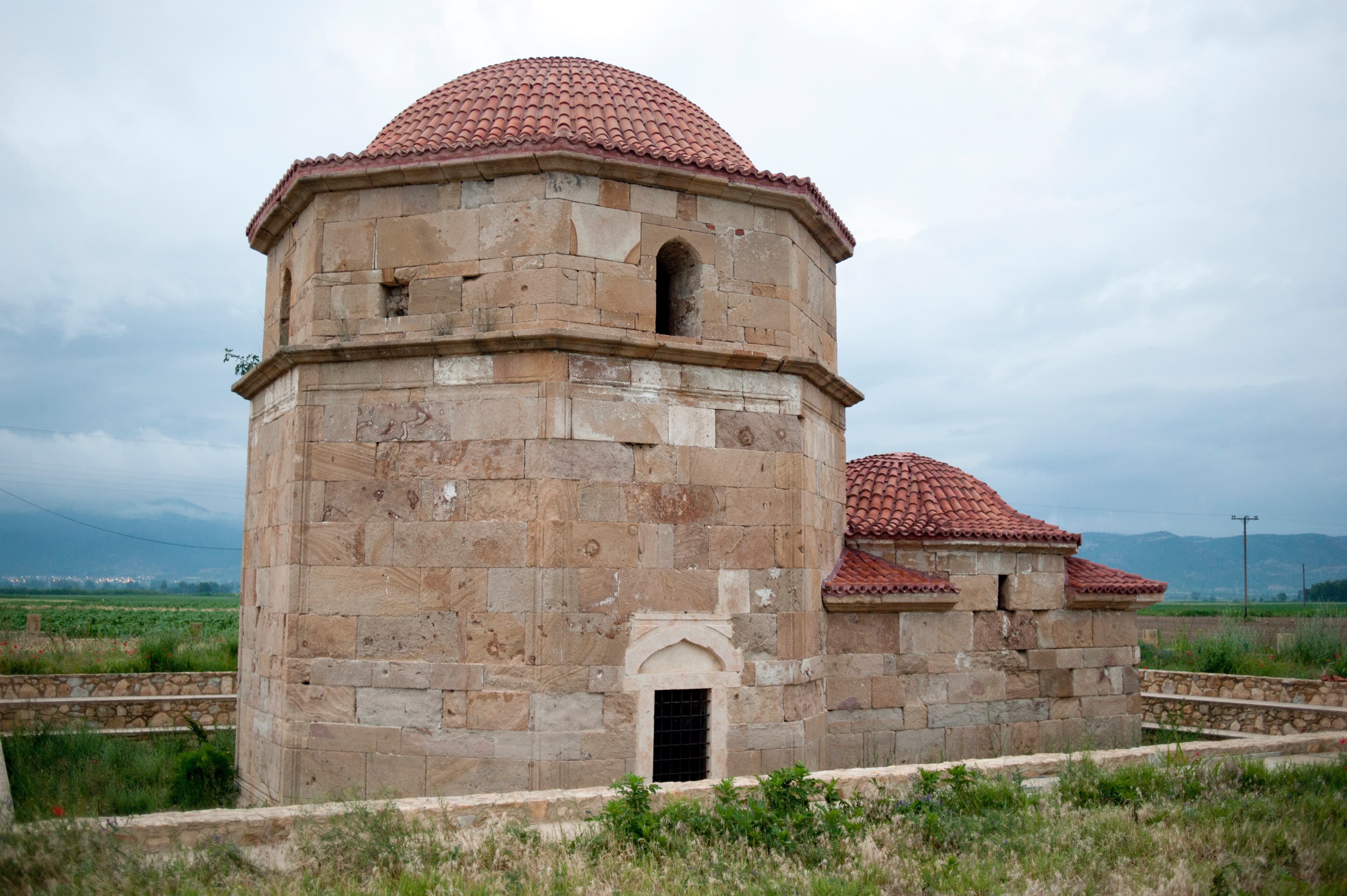
Kutuklu Baba Tekke, Selina, Greece
Συδινή, Macedonia and Thrace, Greece
On the western shore of Lake Vistonida in Greek Thrace, a small octagonal stone building holds two living faiths under one dome....
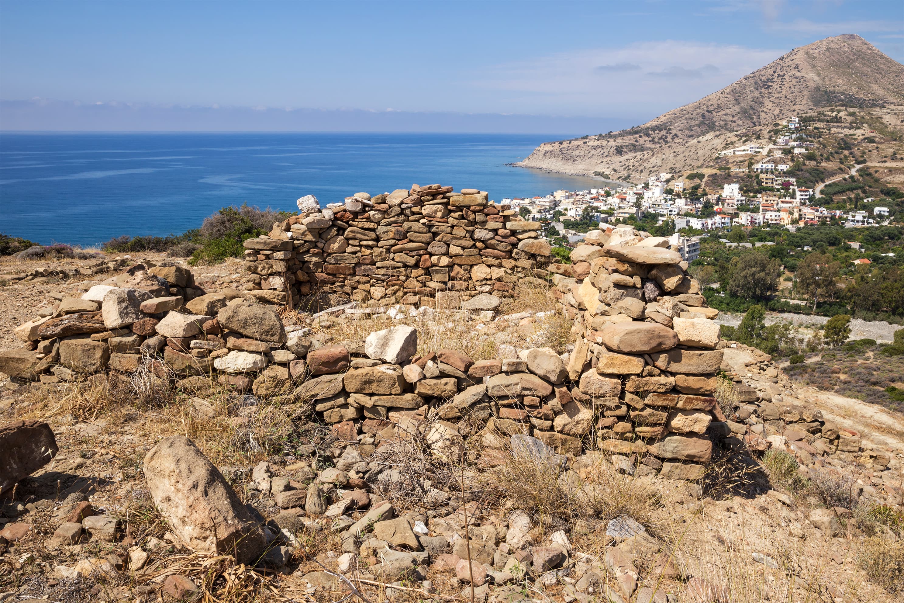
Lato
Agios Nikolaos Municipal Unit, Region of Crete, Greece
High on a mountain saddle in eastern Crete, the ruins of Lato spread across a ridge overlooking the Gulf of Mirabello....

Meteora
Kalabaka, Thessaly and Central Greece, Greece
Meteora rises from the western edge of the Thessaly plain in central Greece, a forest of sandstone pillars reaching up to 400 meters, crowned by six active Orthodox...
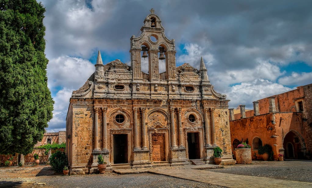
Monastery of Arkadi
Municipality of Rethymnon, Region of Crete, Greece
On a fertile plateau above the olive groves of western Crete, the Monastery of Arkadi holds two kinds of sacred weight....
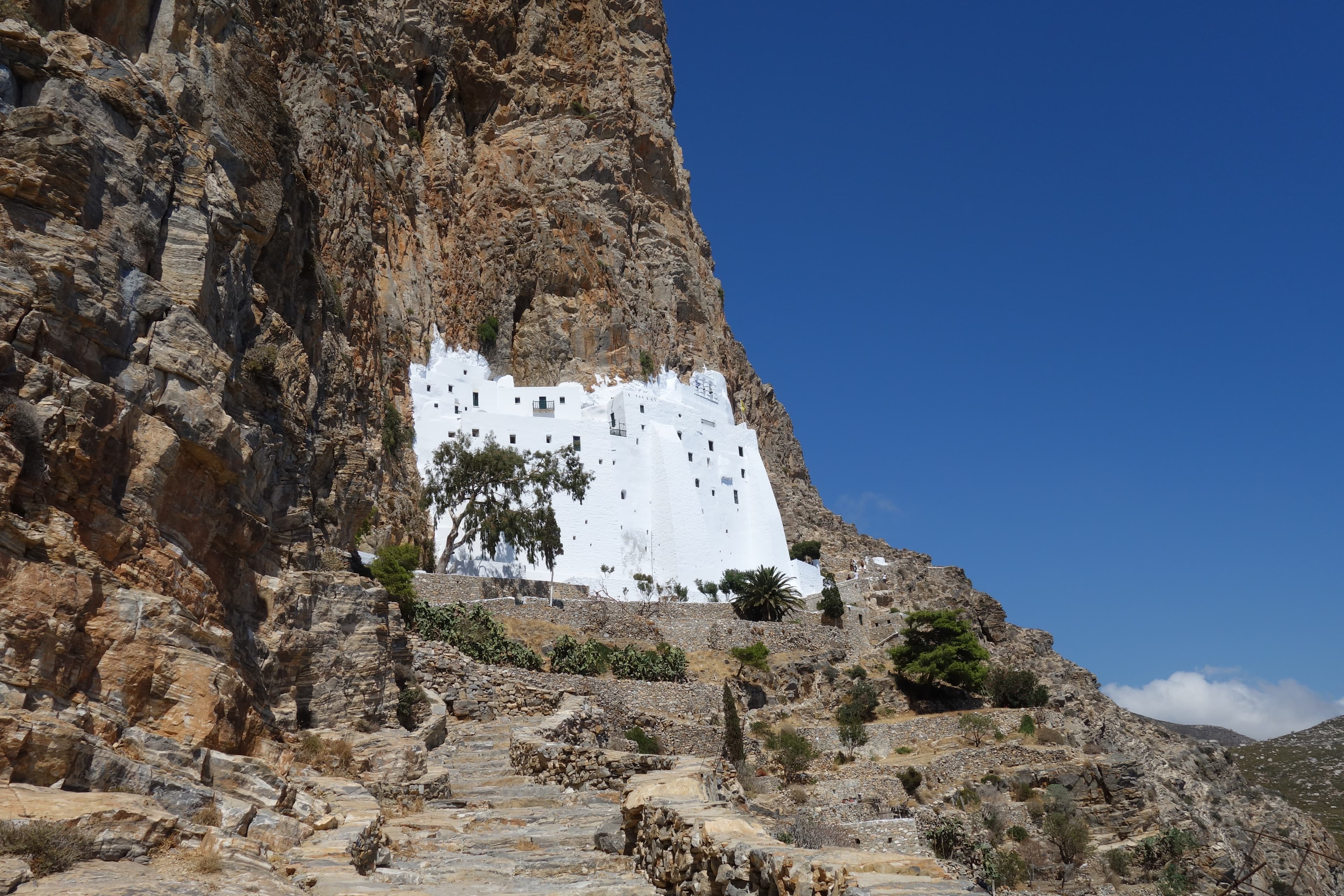
Monastery of Hozoviótissa, Amorgos Island
Amorgos, Aegean, Greece
The Monastery of Hozoviótissa clings to a sheer cliff face on Amorgos, eight levels of whitewashed stone barely five meters wide, rising 300 meters above the Aegean....
Mount Parnitha
Regional Unit of East Attica, Attica, Greece
Mount Parnitha rises as the highest peak in Attica, a forested wilderness just thirty kilometers north of Athens....
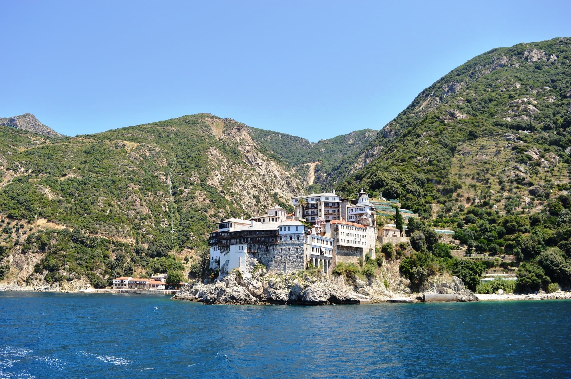
Mt. Athos
Autonomous Monastic State of the Holy Mountain, Greece
Mount Athos rises 2,033 meters above the Aegean at the tip of a forested peninsula in northern Greece....
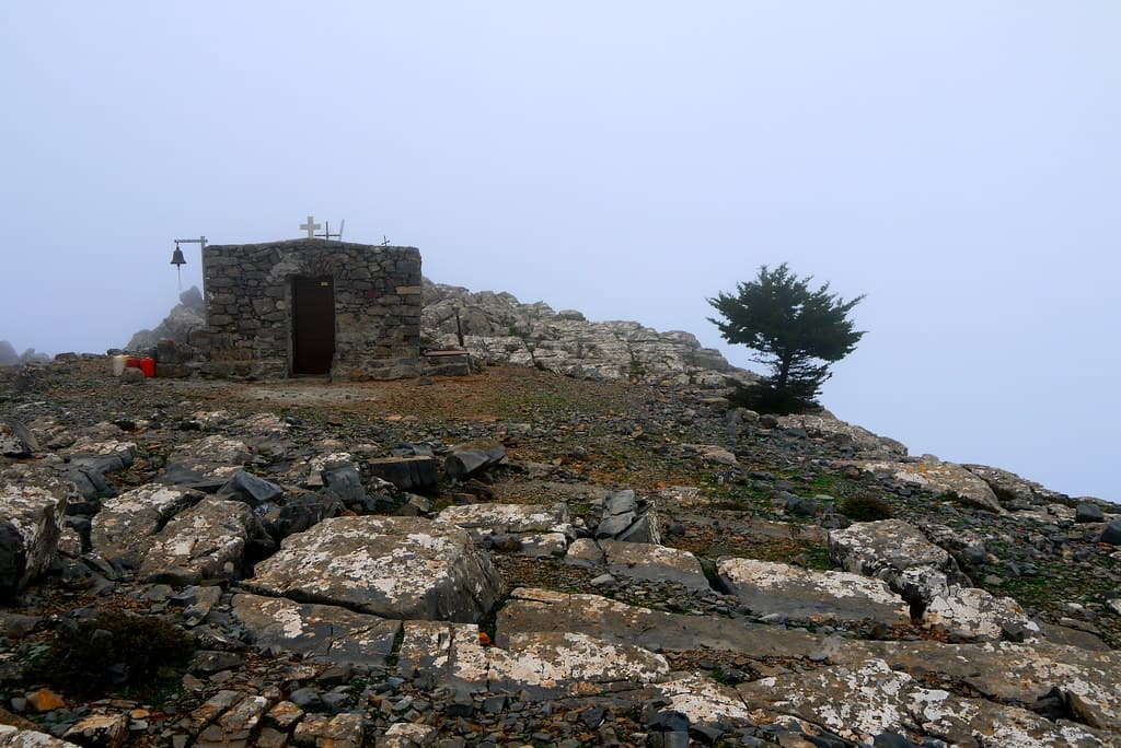
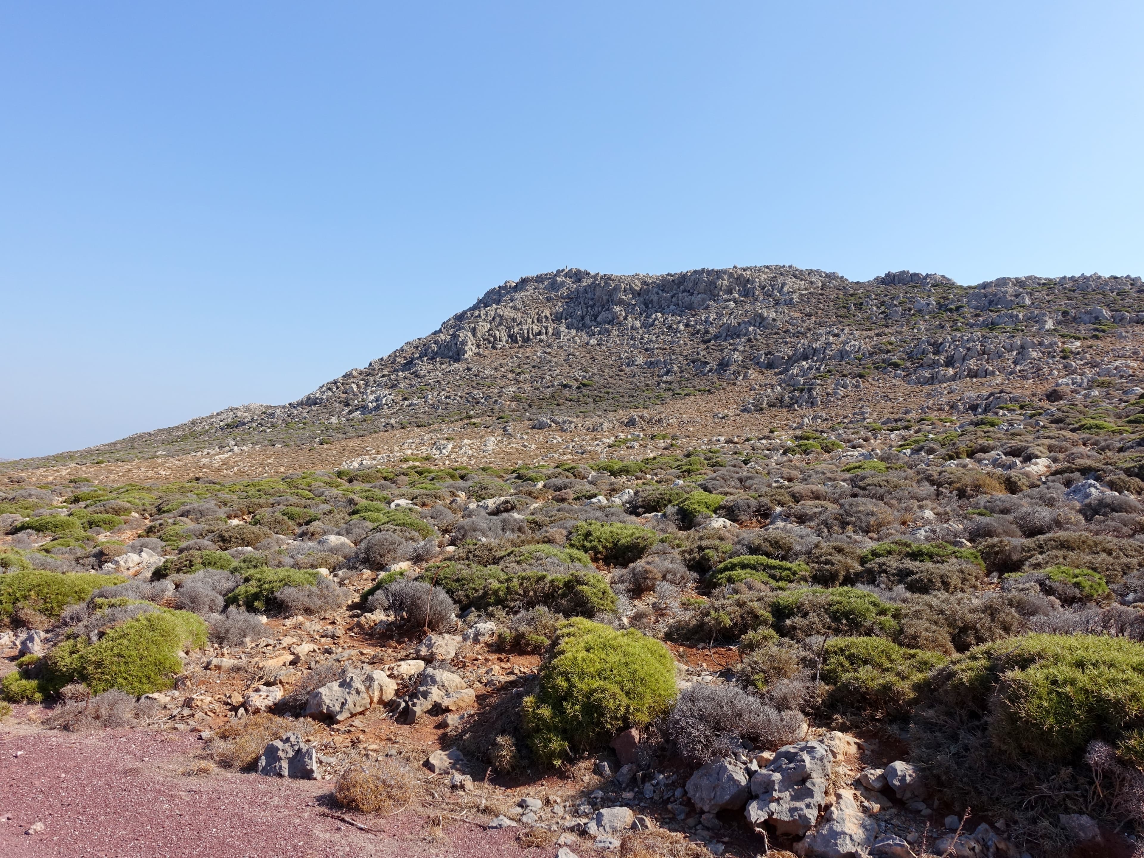
Mt. Dicti
Psichro, Region of Crete, Greece
Mount Dikti rises 2,148 meters above eastern Crete, anchoring a sacred landscape that spans eight millennia of continuous human reverence....
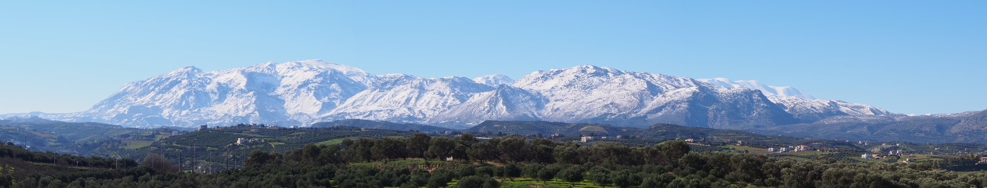
Mt. Ida
Kouroutes, Region of Crete, Greece
Mount Ida rises 2,456 meters above central Crete, the island's highest point and one of the most layered sacred landscapes in the Mediterranean....
Mt. Juktas Minoan Peak Sanctuary, Crete
Archanes Municipal Unit, Region of Crete, Greece
Mount Juktas rises 811 meters above the Cretan lowlands, its summit crowned by the remains of the most important peak sanctuary in Minoan civilization and a Venetian-era...
Mt. Kofinas Minoan Peak Sanctuary, Crete
Kofinas Municipal Unit, Region of Crete, Greece
At 1,231 metres, Mt. Kofinas rises as the highest peak of the Asterousia range, the southernmost mountain chain in Europe....

Mt. Olympus
Dion - Olympos Municipality, Macedonia and Thrace, Greece
Mount Olympus rises 2,917 meters above the Pierian plain in northern Greece, the highest peak in the country and the most mythologically significant mountain in Western...

Mt. Pelion
Municipal Unit of Zagora, Thessaly and Central Greece, Greece
Mount Pelion rises as a forested peninsula between the Pagasetic Gulf and the Aegean Sea in Thessaly, Greece....
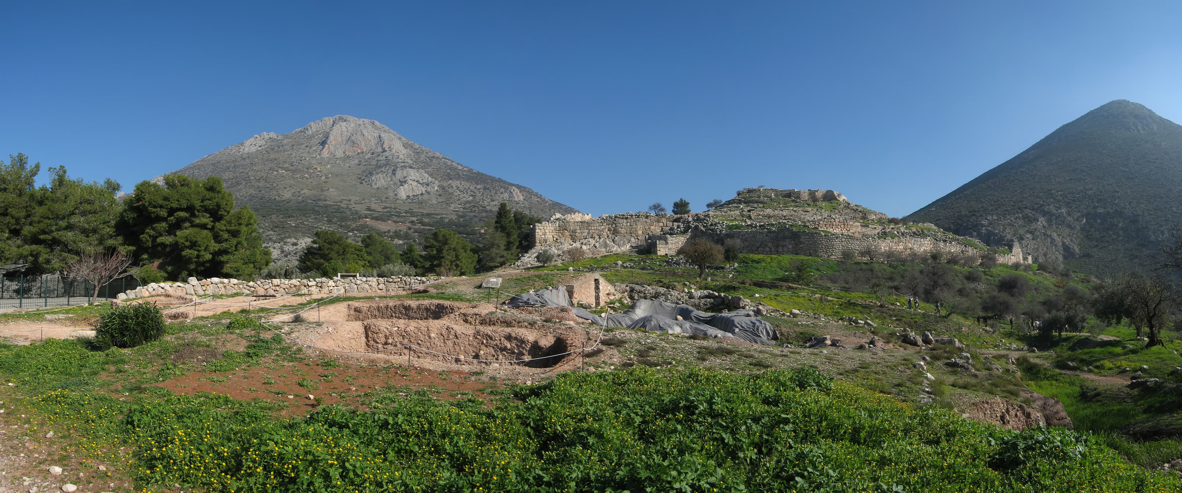
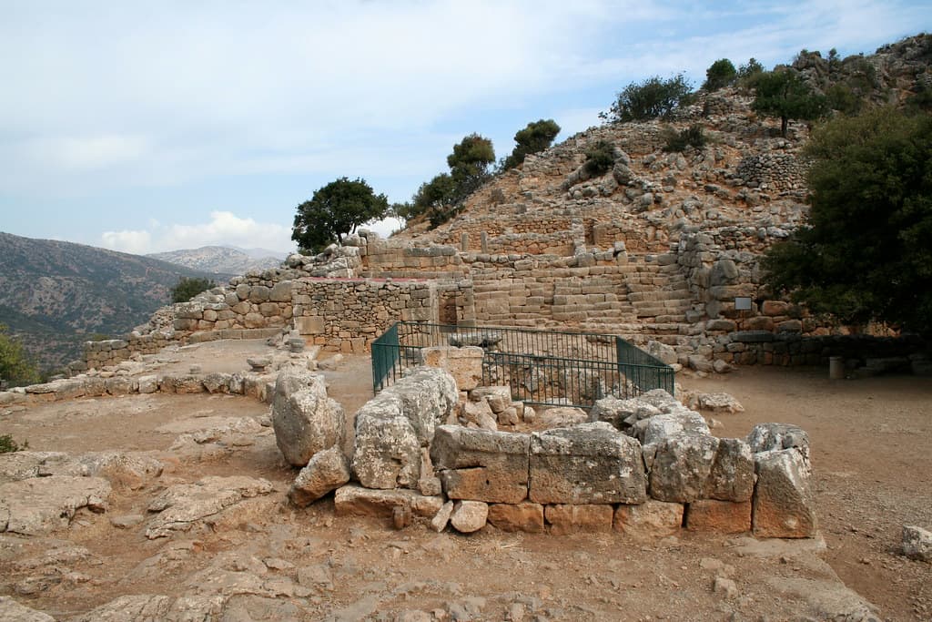
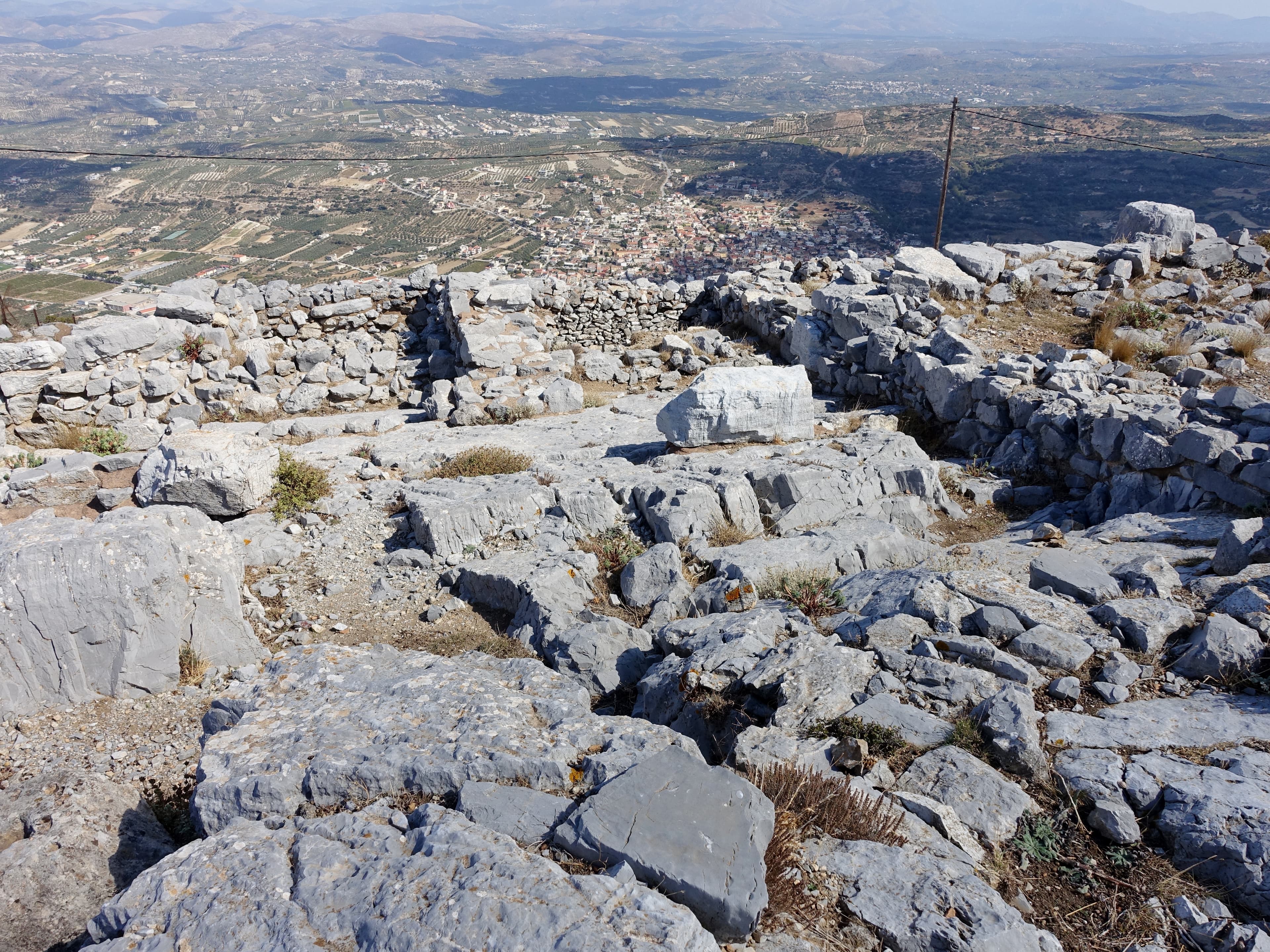
Mycenae
Municipal Unit of Mykines, Peloponnese, Western Greece and the Ionian, Greece
Mycenae rises from a rocky spur between two ravines in the northeastern Peloponnese, commanding the Argive Plain with a strategic authority that persists in the bones of...
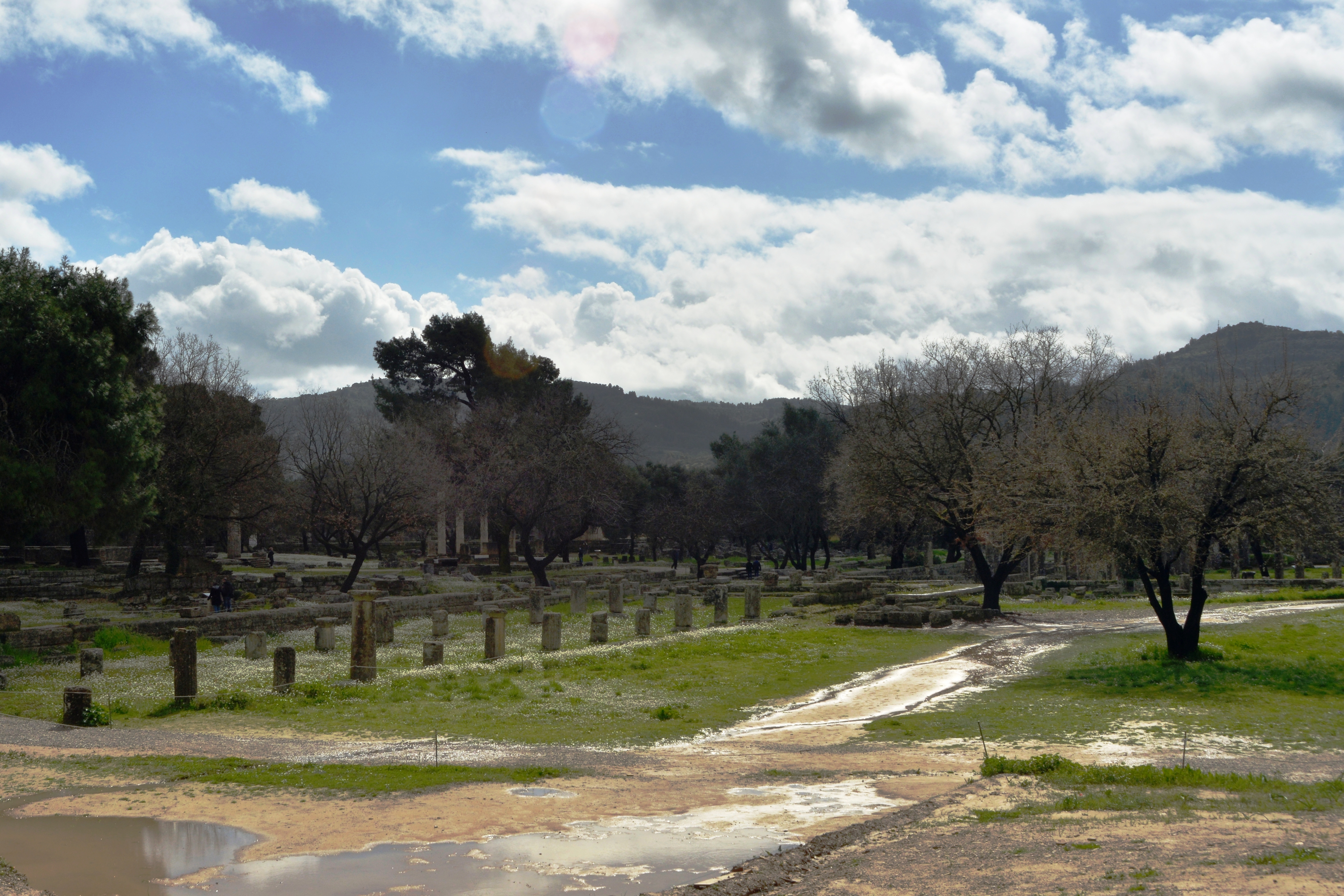
Olympia
Municipal Unit of Archea Olympia, Peloponnese, Western Greece and the Ionian, Greece
Olympia stands in the green valley of the Alpheios River in the western Peloponnese, the supreme Panhellenic sanctuary of Zeus and the site where, for over a thousand...

Omphalos Stone
Greece
In Greek belief Zeus released two eagles from opposite ends of the earth; they crossed paths above Delphi, and the omphalos was set there to mark the navel of the world....
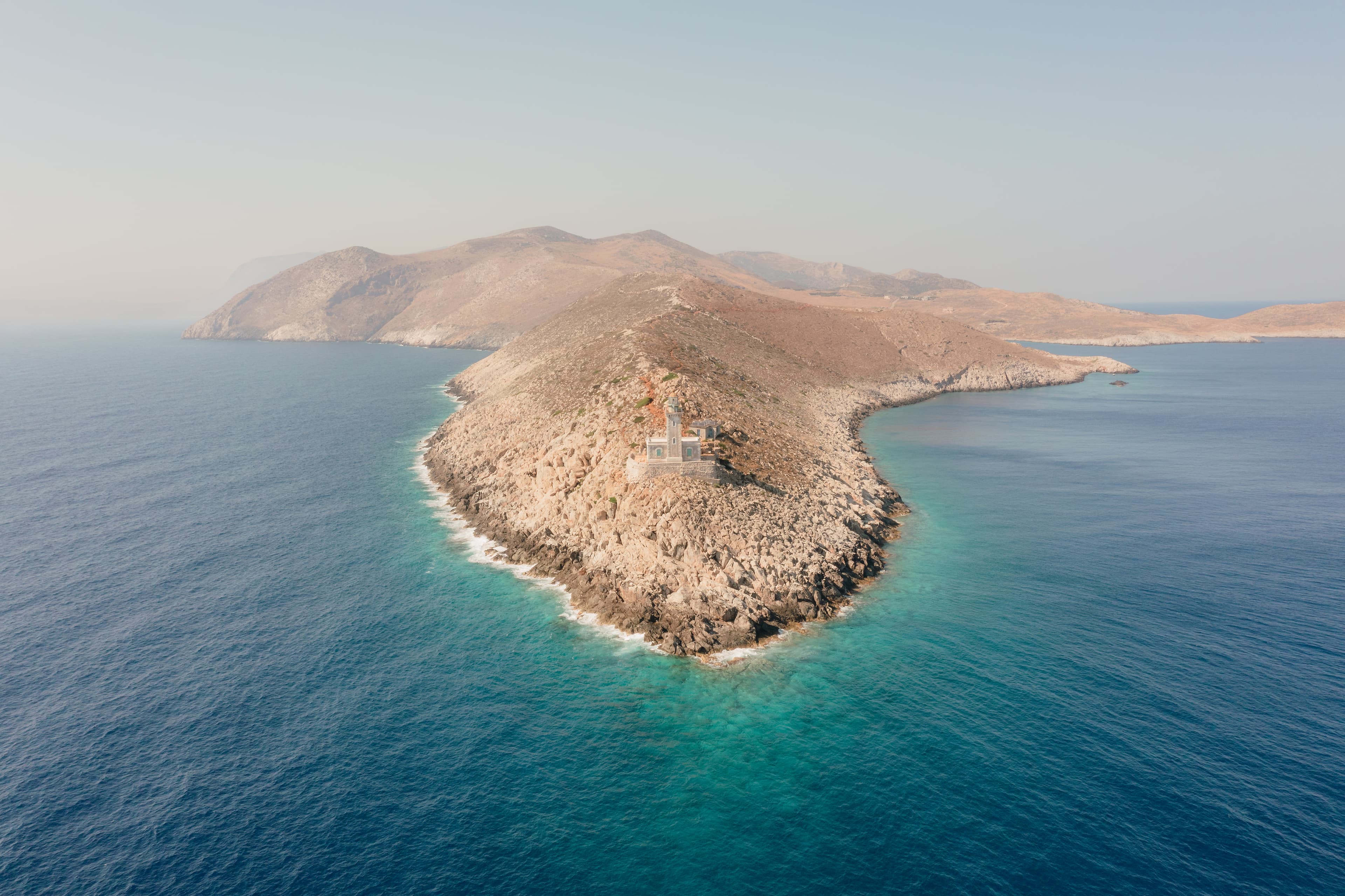
Oracle at Cape Tainaron (Mataram), Peloponnese, Greece
East Mani Municipal Unit, Peloponnese, Western Greece and the Ionian, Greece
Cape Tainaron stands at the southern tip of the Mani Peninsula, where the Greek mainland dissolves into the convergence of three seas....
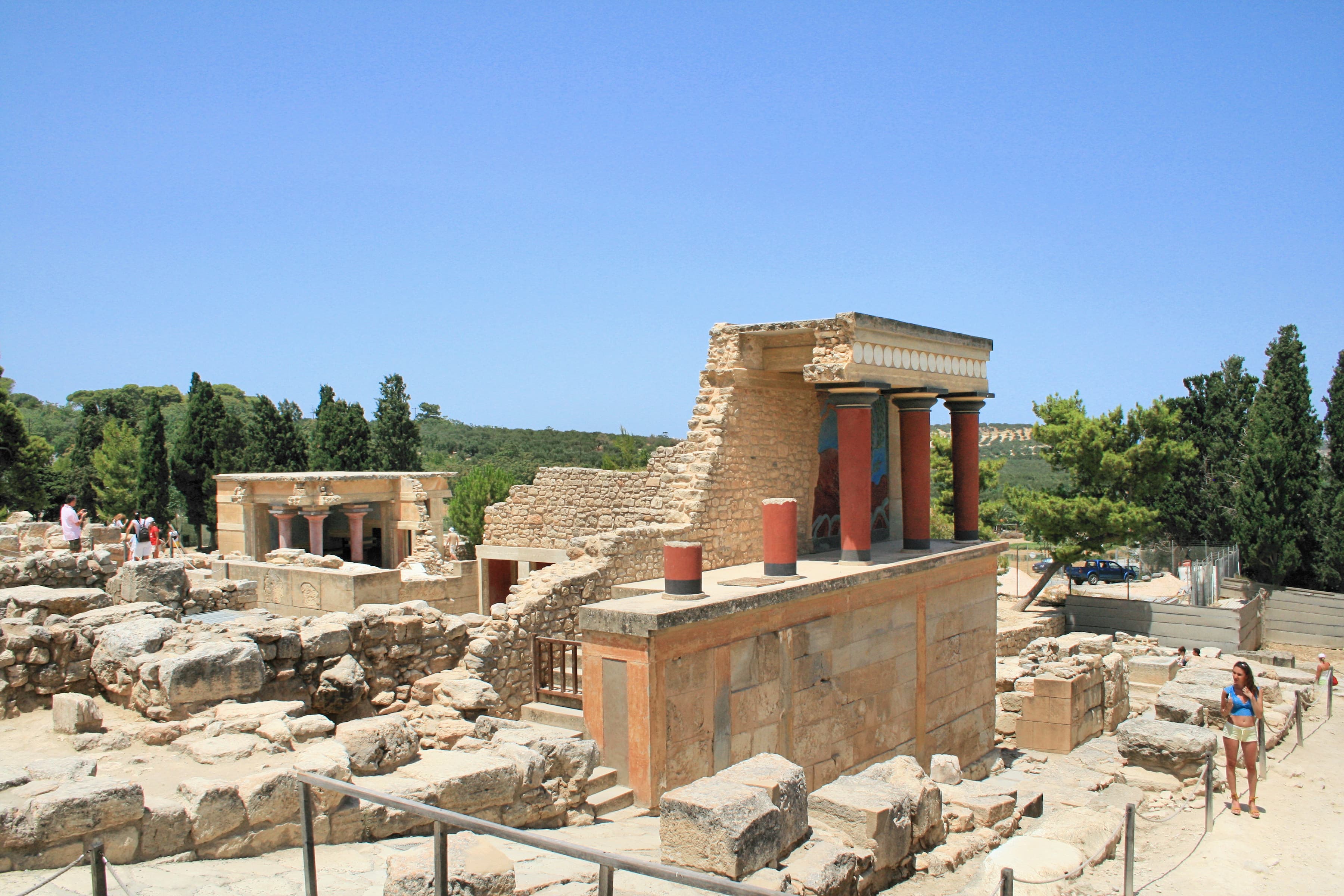
Palace of Knossos
Heraklion Municipal Unit, Region of Crete, Greece
The Palace of Knossos spreads across a low hill five kilometers south of Heraklion, the ceremonial and sacred center of the first advanced civilization to emerge in Europe....
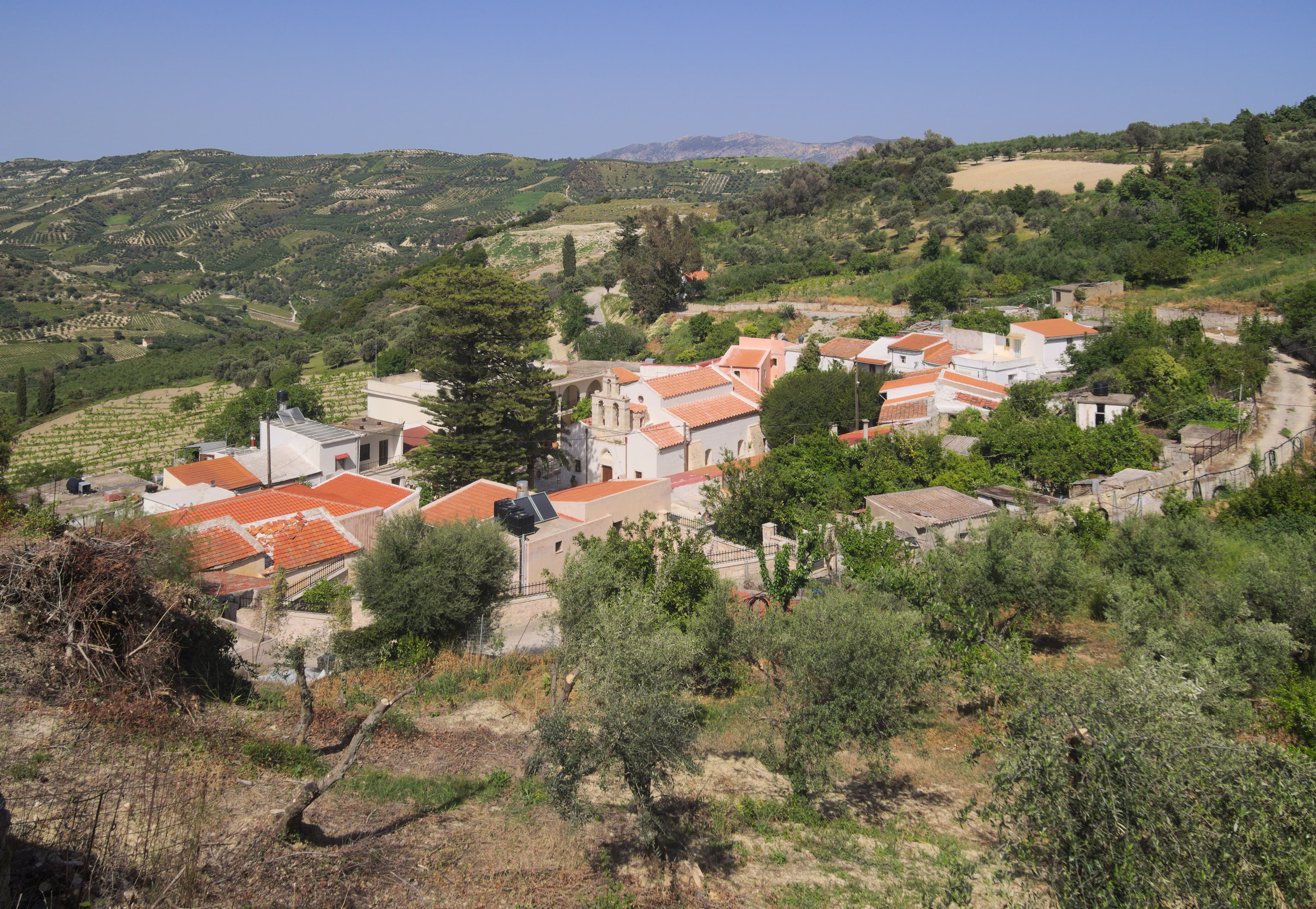
Paliani Monastery
Paliani Municipal Unit, Region of Crete, Greece
Paliani Monastery stands among olive groves near the village of Venerato, twenty kilometers southwest of Heraklion....
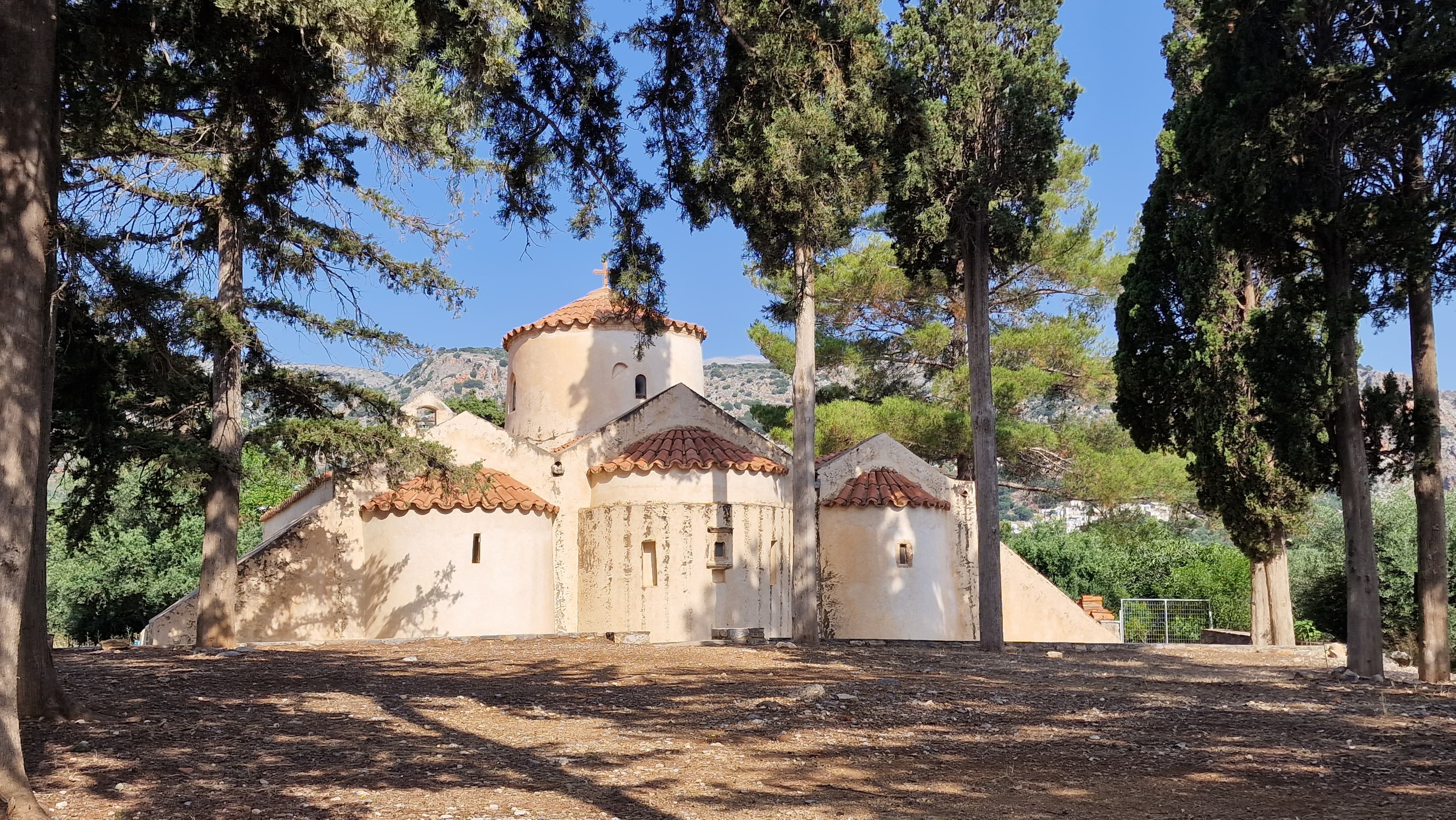
Panagia Kera
Agios Nikolaos Municipal Unit, Region of Crete, Greece
Panagia Kera stands among olive groves on the road to Kritsa in eastern Crete, a small three-aisled Byzantine church whose interior holds what scholars consider the finest...
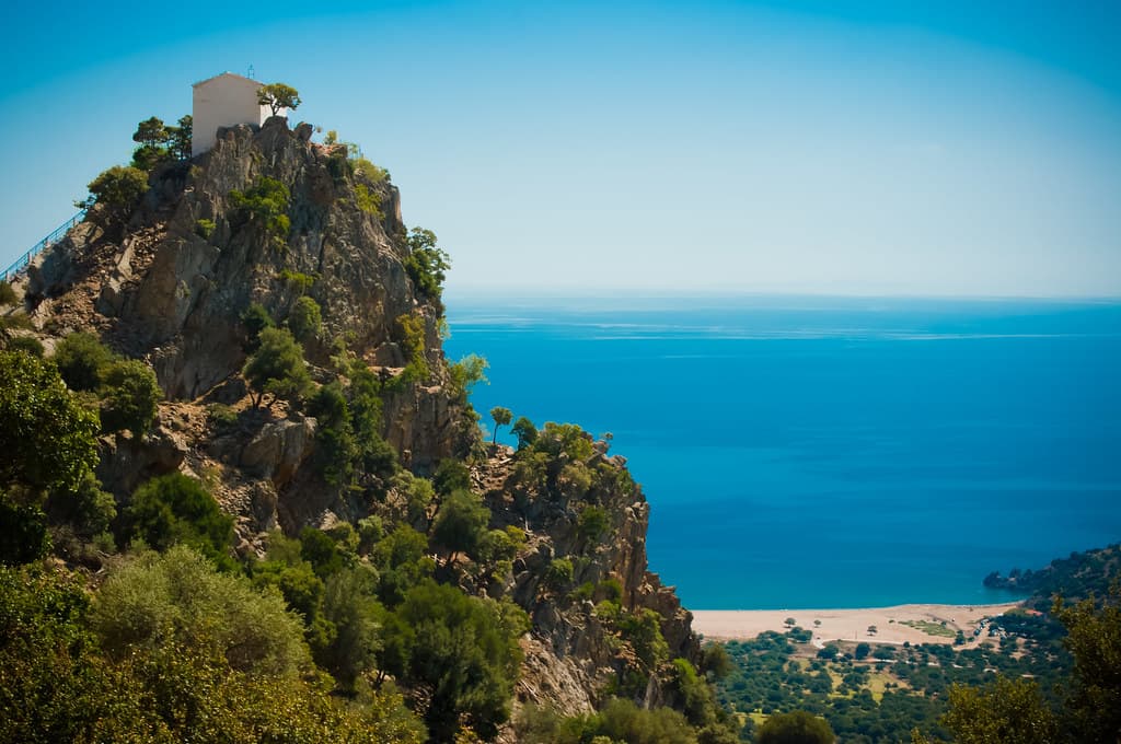
Panagia Krimniotissa
Municipality of Samothraki, Macedonia and Thrace, Greece
Panagia Krimniotissa perches at 311 meters on a cliff edge of Samothrace, a small white chapel built where a miraculous icon of the Virgin Mary refused to be moved....
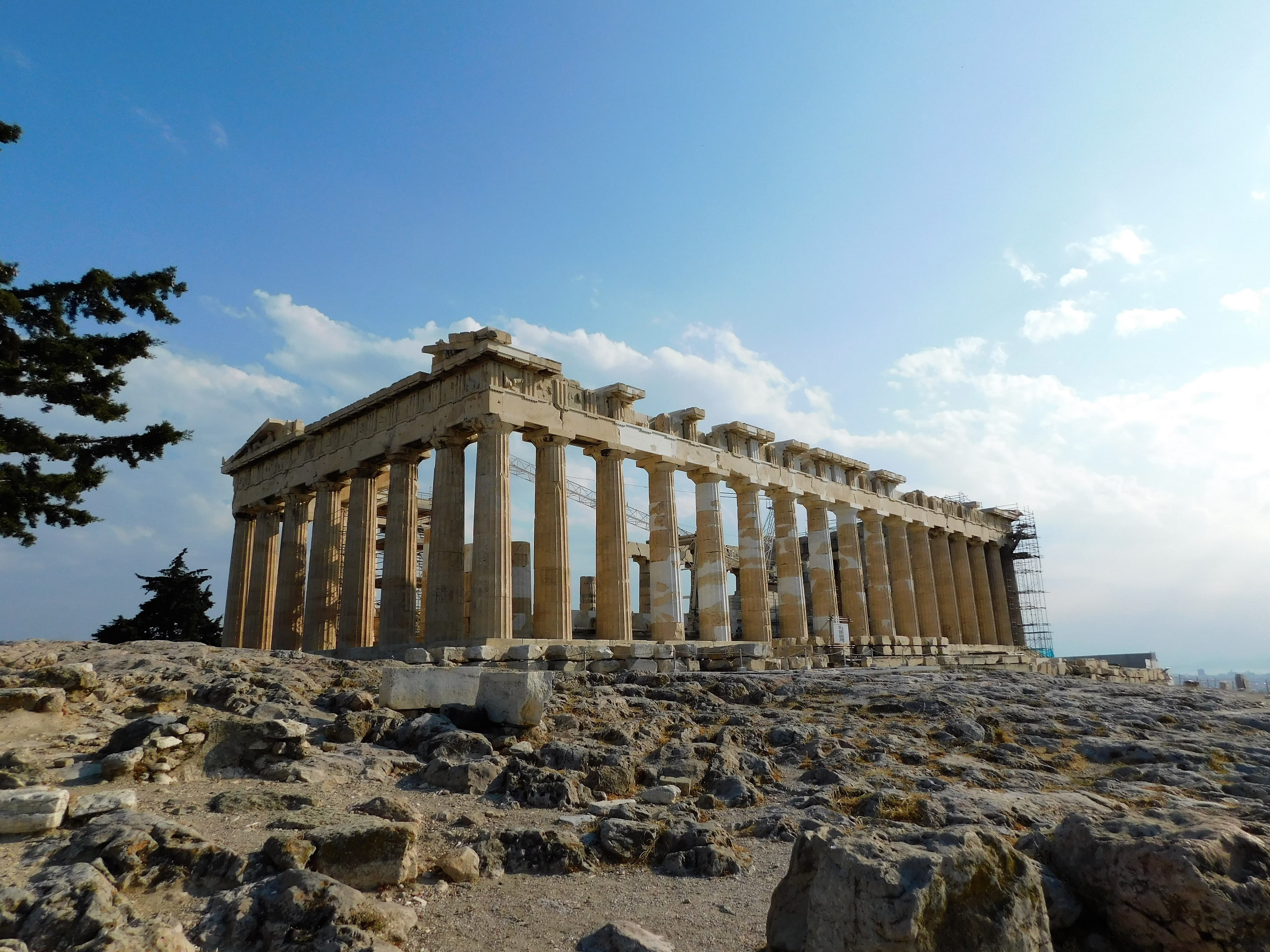
Parthenon
Athens, Attica, Greece
The Parthenon rises from the limestone summit of the Acropolis, a Doric temple of Pentelic marble built to house Athena and to declare what Athens believed a civilization...
Petsofas Minoan Peak Sanctuary
Itanos Municipal Unit, Region of Crete, Greece
Petsofas rises above the eastern Cretan coast near Palekastro, a modest summit that served for centuries as one of the most important peak sanctuaries of the Minoan...
Pyrgos Minoan Temple
Ierapetra Municipal Unit, Region of Crete, Greece
On a steep hill above the south coast of Crete, the ruins of Myrtos-Pyrgos hold the remains of a Bronze Age settlement that flourished for nearly eight centuries....
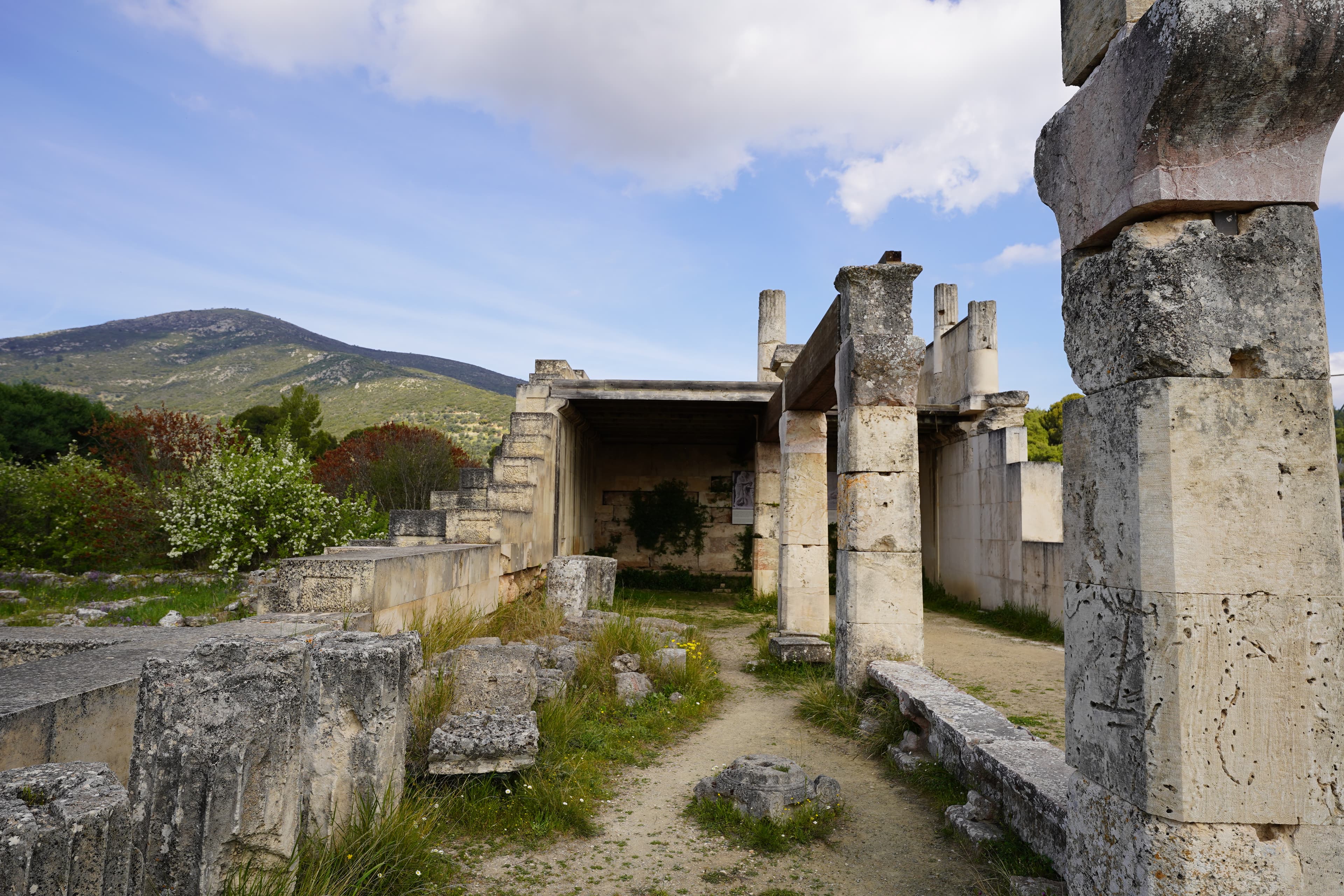
Sanctuary of Asklepios at Epidauros
Epidauros, Epidauros, Argolis, Peloponnese, Greece
Epidauros was the principal sanctuary of Asklepios, Greek god of healing, and the mother-shrine from which all other Asklepieia drew their authority....
Tinos
Tinos, Aegean, Greece
Panagia Evangelistria stands at the top of a long marble road in the port town of Tinos, holding an icon of the Annunciation unearthed in 1823 after a nun's visions....
Traostalos Minoan Peak Sanctuary
Itanos Municipal Unit, Region of Crete, Greece
On a windswept plateau at 515 meters above the southeastern coast of Crete, Minoan worshippers climbed for five hundred years to leave clay figurines, model ships, and...
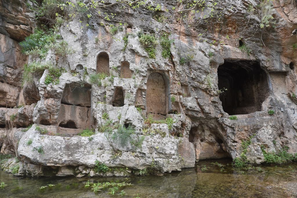
Trofonion Oracle, Livadia, Greece
Levadia Municipal Unit, Thessaly and Central Greece, Greece
In the Boeotian town of Livadia, a limestone gorge opens where the Herkyna River emerges from the rock....
Tylissos Minoan Temple
Tylissos Municipal Unit, Region of Crete, Greece
In the foothills southwest of Heraklion, the ruins of three grand Minoan villas stand among olive groves at the edge of the modern village of Tylissos....
Key questions
Greece sacred-site questions
- What sacred sites can I explore in Greece?
- Pilgrim Map lists sacred places in Greece across living worship sites, heritage landmarks, pilgrimage destinations, and culturally significant landscapes. The current guide lists 43 sites organized by region, tradition, and site type.
- Which traditions are represented in Greece?
- The most represented traditions include Ancient Greek and Roman, Christianity, Islam.
- How should I plan a sacred-site visit in Greece?
- Start with regional clusters, compare nearby places on the map, then open individual site pages for coordinates, etiquette, and sacred context where available.
- Can I view Greece sacred sites on a map?
- Yes. Switch to map view to compare geographic clusters, then open individual site pages for coordinates, visiting context, and related places.