Country guide
Peru
Peru brings together sacred architecture, pilgrimage traditions, and landscapes shaped by memory, ritual, and local devotion.
61 sacred sites across 13 regions. Use the tradition and site-type filters to narrow in.
Atlas summary
Peru sacred sites overview
Peru sacred sites include living temples, shrines, churches, pilgrimage places, ruins, and sacred landscapes indexed across the Pilgrim Map atlas.
Use this guide to compare regional clusters, represented traditions, and common site types before opening individual pages for visiting context and deeper background.
| Coverage | 61 sacred sites across 13 regions. |
|---|---|
| Regional clusters | |
| Traditions | |
| Site types | |
| UNESCO heritage | 3 UNESCO-tagged sites in this country guide. |
Showing 1-48 of 61 sites in this country guide

Amantani, Pachatata & Pachamama
Santa Rosa, Puno, Peru
Amantani rises from Lake Titicaca with two peaks — Pachatata (Father Earth) and Pachamama (Mother Earth) — each crowned with pre-Inca temples that are opened only once a...
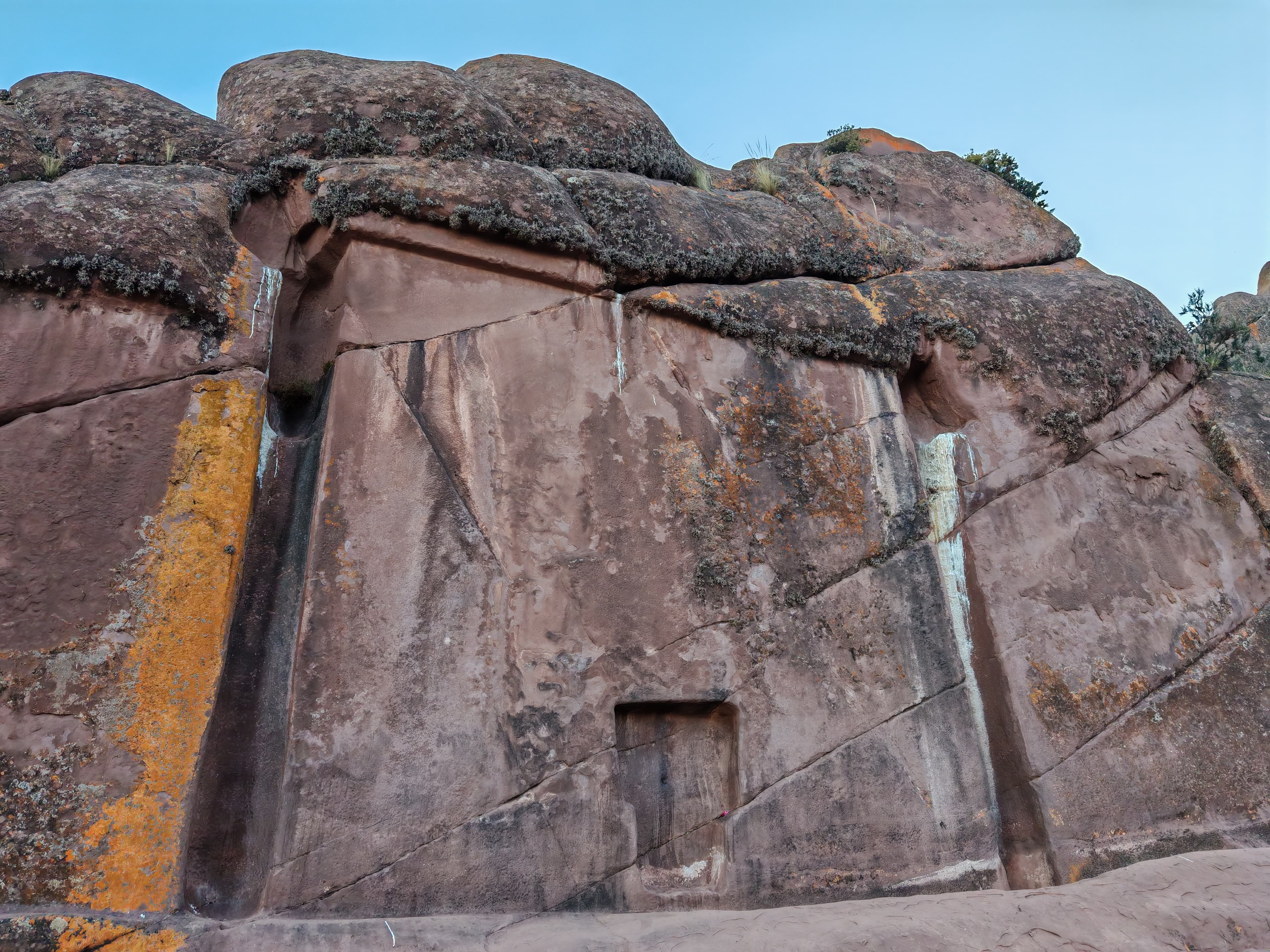
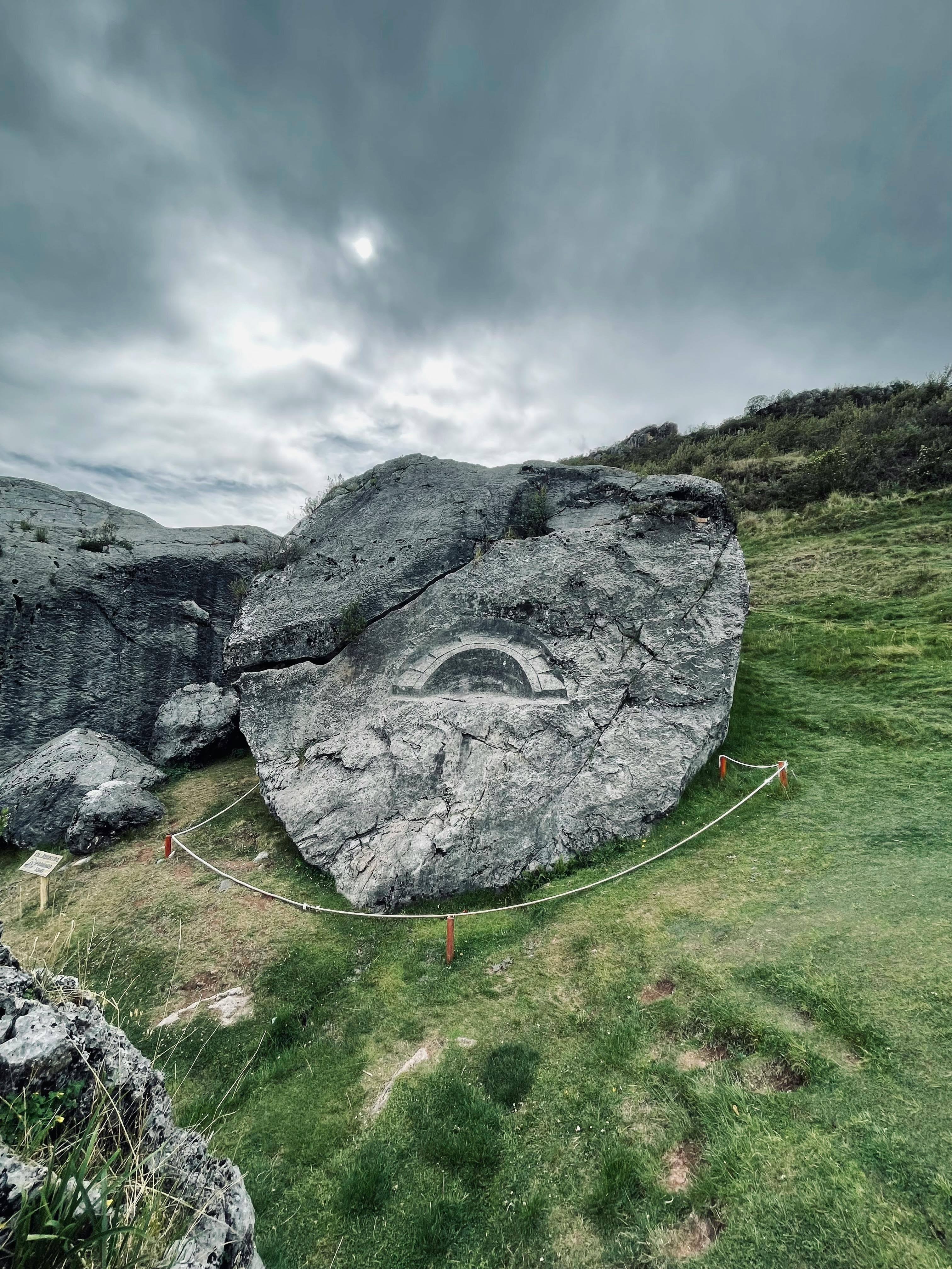
Aramu Muru
Ilave, Puno, Peru
On a volcanic hillside near Lake Titicaca, a T-shaped doorway 7 meters square is carved into solid rock—leading nowhere visible....

Archaeological Sanctuary of Pachacamac
Lurín, Lima, Peru
Pachacamac was Peru's most powerful oracle for over a millennium. Named for the creator god Pacha Kamaq—the 'Earth Maker' who could cause earthquakes with a single...
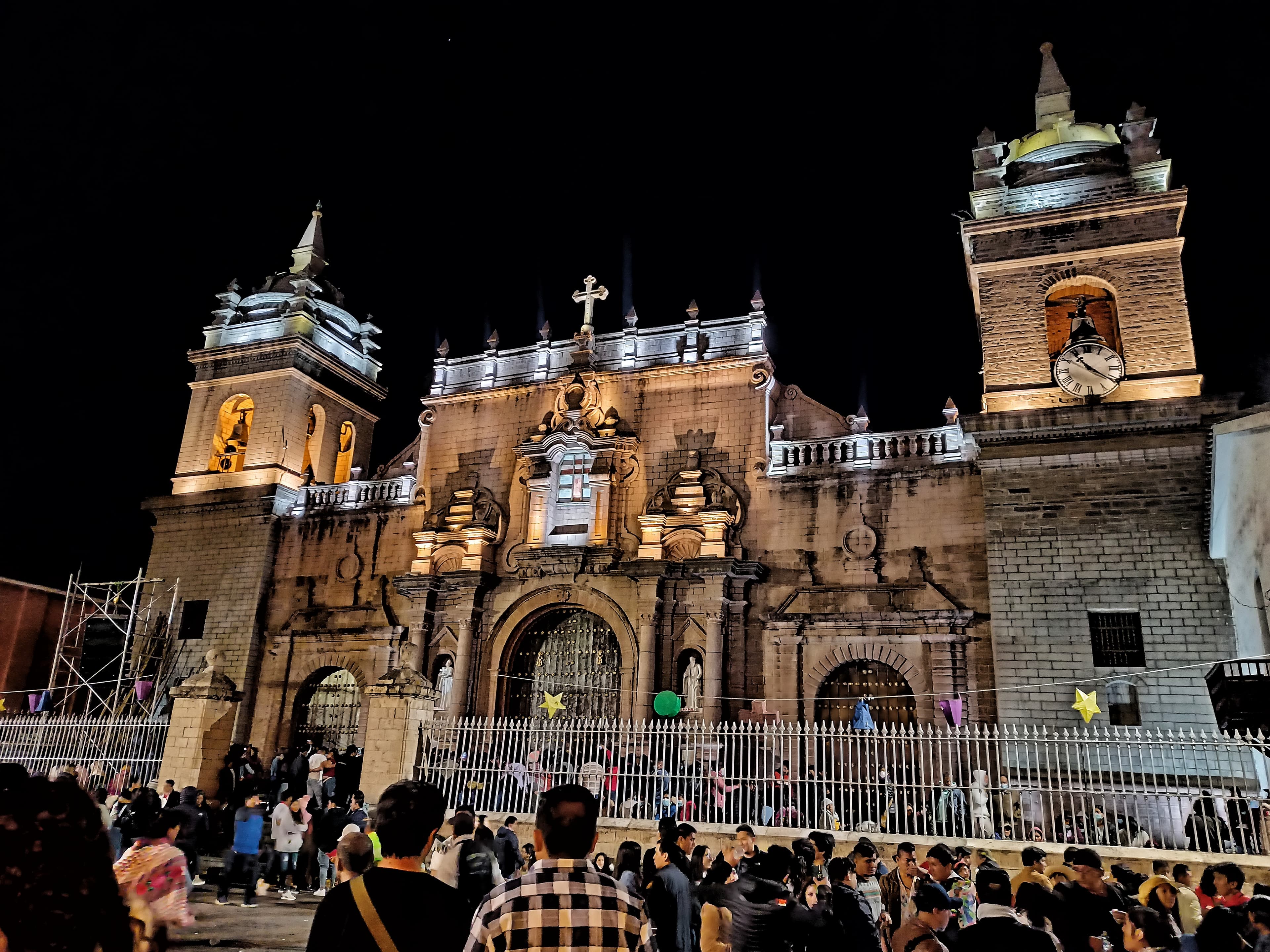
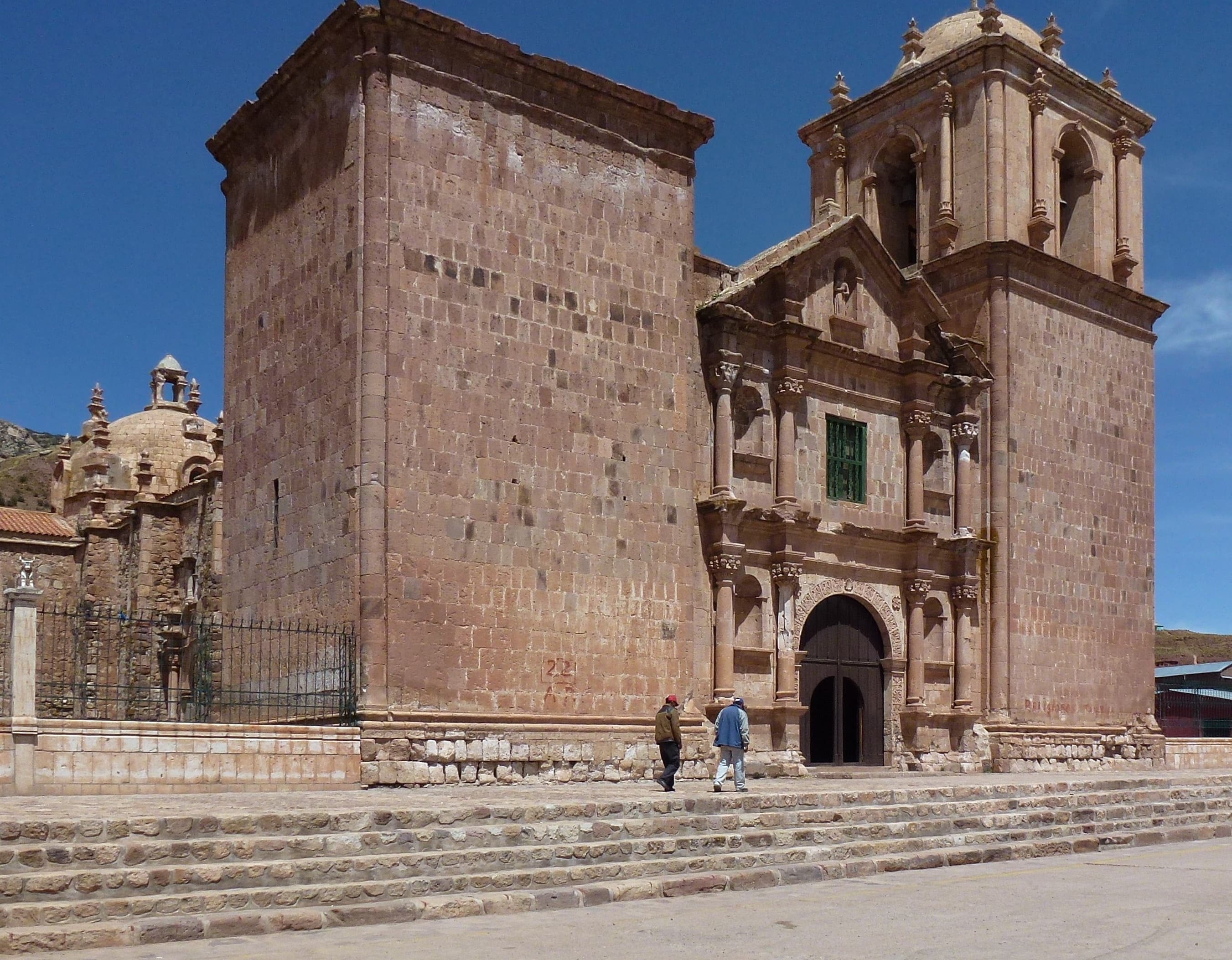
Ayacucho Cathedral
Ayacucho, Ayacucho, Peru
Built from pink and gray stone over four decades (1632-1672), the Basilica Cathedral of Santa Maria rises from Ayacucho's Plaza de Armas like a prayer made permanent....

Cahuachi Nazca site
Nazca, Ica, Peru
For five hundred years, pilgrims journeyed across the desert to Cahuachi—not to live but to worship, to bury their dead, and perhaps to participate in the creation of the...

Centro Arqueológico de Chinchero
Chinchero, Cusco, Peru
Chinchero is not a ruin. An Inca royal estate, a colonial church with syncretic murals, terraces still walked daily, and a Quechua community whose women have woven on...

Centro Arqueológico Puka Pukara
Cusco, Cusco, Peru
Puka Pukara sits on high ground 7 km from Cusco. Known as the Red Fortress for the colour its stones take at dusk.

Chavín de Huántar
Chavín de Huantar, Ancash, Peru
Rising from a high Andean valley at the confluence of two rivers, Chavin de Huantar served as the Americas' earliest pilgrimage center for over five hundred years....
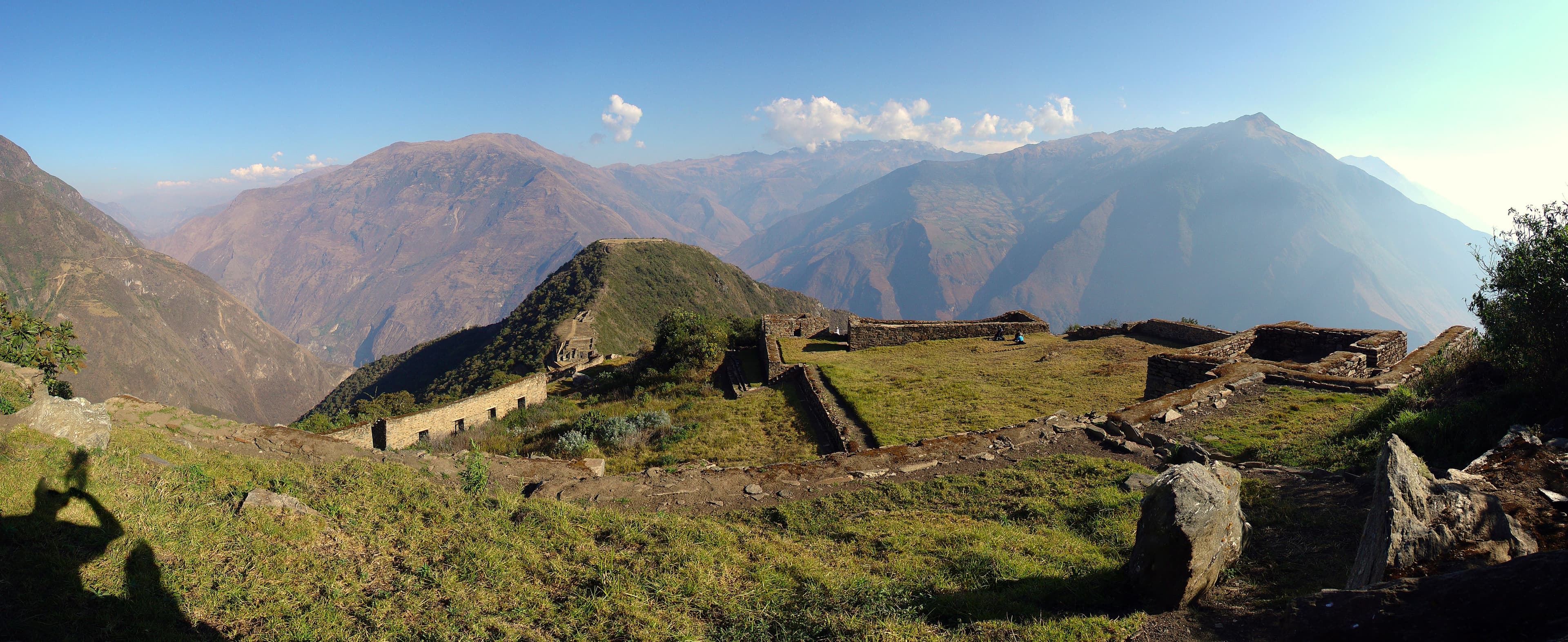
Choquequirao Archaeological Park, Peru
Santa Teresa, Cusco, Peru
While Machu Picchu receives 2,500 visitors daily, Choquequirao sees only about twelve....

Chullpa Lagarto
Sillustani, Puno, Peru
The Chullpa del Lagarto rises above the other funerary towers at Sillustani with the authority its builders intended....

Chullpas Sillustani
Sillustani, Puno, Peru
On a peninsula jutting into Lake Umayo near Puno, ninety-one stone towers stand in various states of preservation — from intact cylinders to tumbled foundations....
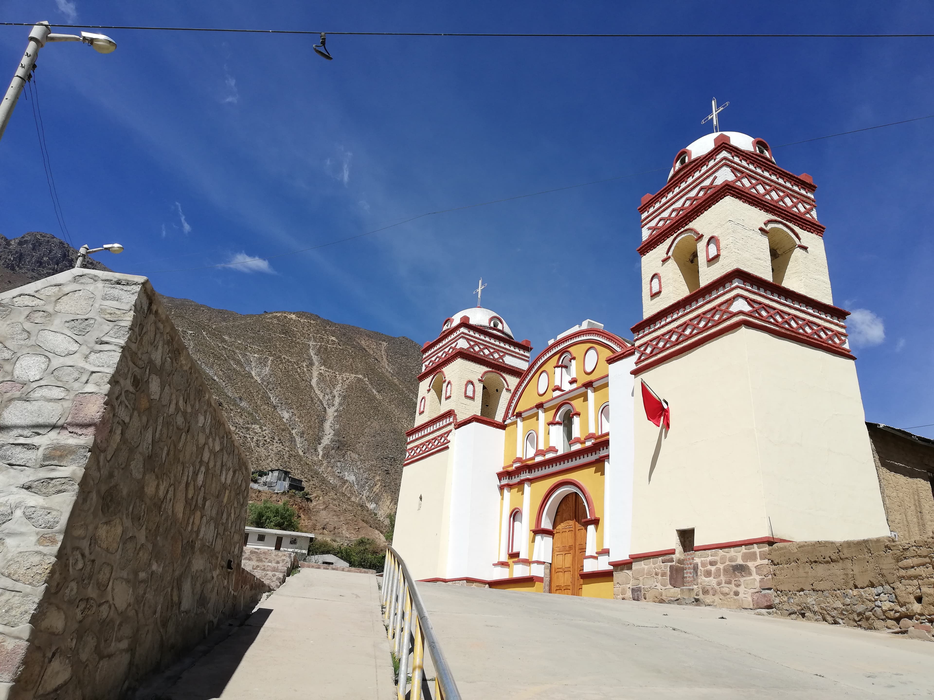
Church of Saint John the Baptist of Huaytara
Huaytará, Huancavelica, Peru
In Huaytara, colonial authorities built the Church of San Juan Bautista directly atop an Inca structure—possibly a Temple of the Sun built by Pachacutec during the...

Complejo Arqueológico Q'enqo
Cusco, Cusco, Peru
Q'enqo ('labyrinth') is an Inca ceremonial complex 4 km from Cusco at 3,580m, with an Intihuatana, underground galleries, and zigzag channels.

Diocesan Shrine of the Captive Lord of Ayabaca
Distrito de Ayabaca, Piura, Peru
In the mountains of northwestern Peru, near the border with Ecuador, stands a Christ with bound hands—the Captive Lord of Ayabaca....

El Templo de los Monos
Cusco, Cusco, Peru
Cusilluchayoc (Temple of the Monkeys) is a ceremonial centre carved from living rock 500 metres from Q'enqo Grande.
El Ushnu
Vilcashuaman, Ayacucho, Peru
At the heart of Vilcashuamán — what the Inca regarded as the geographic centre of their empire — a five-tiered stone platform rises above a trapezoidal plaza....

Huaca Pachatosa
Cusco, Cusco, Peru
Huaca Pachatosa is a sacred site in Cusco where excavations revealed evidence of burnt offerings spanning pre-Inca and Inca periods.

Huaca Sapantiana
Cusco, Cusco, Peru
Huaca Sapantiana is a sacred Inca site in Cusco's San Blas neighbourhood where a carved limestone bedrock sits in a ravine beside a colonial aqueduct....
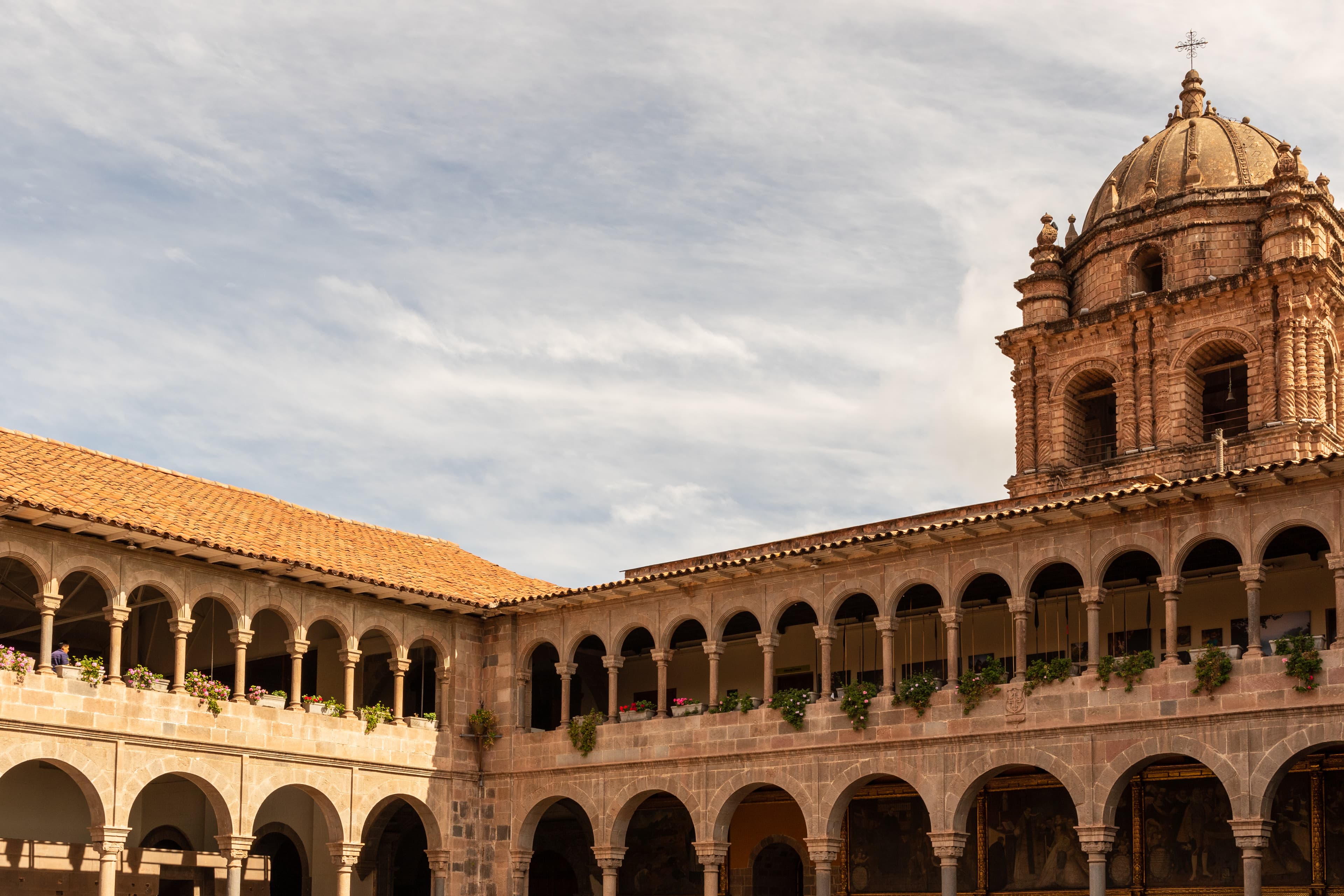
Iglesia de Santo Domingo & Korikancha
Cusco, Cusco Region, Peru
At the heart of Cusco, the foundations of the Inca Empire's holiest temple rise beneath a Spanish colonial church....
Killarumiyoq
Ancahuasi, Cusco, Peru
Hidden in the hills above Cusco, Killarumiyoq preserves the Inca's most elaborate dedication to Mama Quilla, the Moon Goddess....

Líneas de Nazca
Nazca, Ica, Peru
Across fifty square kilometres of Peruvian desert, the Nazca people etched more than a thousand kilometres of lines and hundreds of figures into the earth between 500 BC...

Llactapata
Ollantaytambo district, Ollantaytambo district, Cusco region, Peru
Llactapata sits on a forested ridge across the Aobamba gorge from Machu Picchu, its plaza and long corridor apparently aimed at the June solstice sunrise and at Machu...

Machu Picchu
Machupicchu, Cusco, Peru
For nearly four hundred years, Machu Picchu waited in the cloud forest, abandoned but not destroyed, its stones slowly embraced by jungle while Spanish conquistadors...

Machuqolqa
Chinchero, Cusco, Peru
Machuqolqa — 'old storehouse' in Quechua — sits at 3,850 metres above the left bank of the Urubamba River, a few minutes from Chinchero....
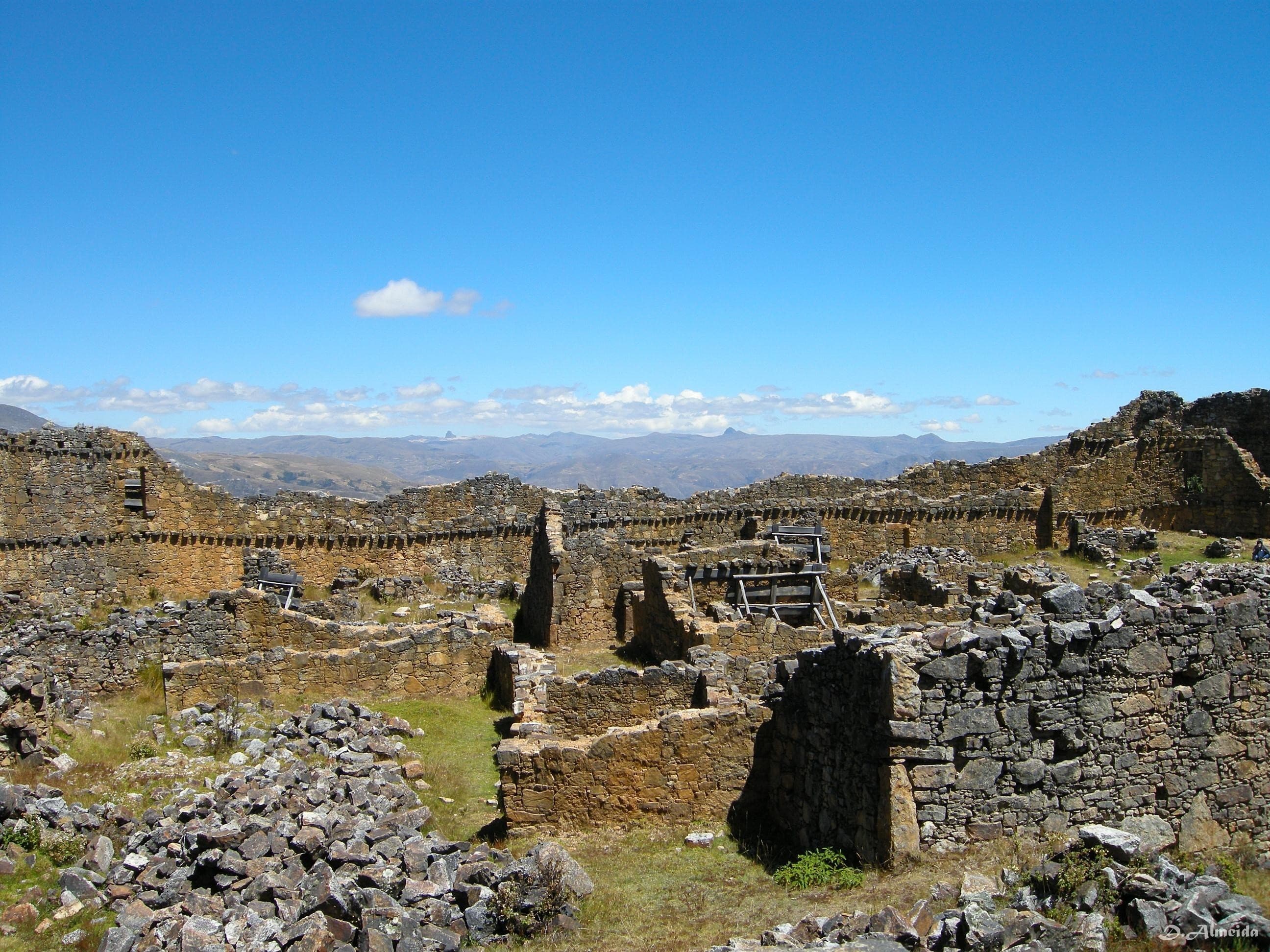
Marcahuamachuco Archaeological Complex
Huamachuco, La Libertad, Peru
On an elongated mesa dominating three mountain valleys in northern Peru, Marcahuamachuco sprawls across 260 hectares—a vast sanctuary built between 400 and 1,200 CE,...

Nasca - El Araña
Nazca, Ica, Peru
The Spider geoglyph measures forty-seven metres in length and is rendered with remarkable anatomical detail....

Nasca - El Árbol
Nazca, Ica, Peru
The Tree geoglyph consists of a short, thick trunk that splits and expands into numerous large branches decorated with smaller twig-like extensions in a lush, flourishing...

Nasca - El Astronauta
Nazca, Ica, Peru
The Astronaut is a humanoid figure etched into a hillside rather than the flat desert floor, making it unusual among Nazca geoglyphs....

Nasca - El Caracol
Nazca, Ica, Peru
The Caracol depicts a spiral form approximately sixty metres across.

Nasca - El Colibrí
Nazca, Ica, Peru
The Hummingbird is perhaps the most iconic of all Nazca geoglyphs. At ninety-three metres long, its pointed beak, well-defined wings, and elegant tail are rendered with...

Nasca - El Cóndor
Nazca, Ica, Peru
At one hundred and thirty-four metres, the Condor is one of the largest figurative geoglyphs in the Nazca corpus....

Nasca - El Garza
Nazca, Ica, Peru
The Heron geoglyph depicts a long-necked wading bird stretching across the desert floor, approximately three hundred metres in length.

Nasca - El Loro
Nazca, Ica, Peru
The Parrot depicts a tropical bird with head, beak, and crest visible. Lower portions partially erased.

Nasca - El Manos
Nazca, Ica, Peru
The Hands geoglyph depicts two human hands reaching upward, one with four fingers and one with five. Visible from the Mirador alongside the Tree.

Nasca - El Mono
Nazca, Ica, Peru
The Monkey geoglyph measures ninety-three by fifty-eight metres and is instantly recognisable by its spiralling tail and distinctive nine-fingered hands....

Nasca - El Pelícano
Nazca, Ica, Peru
At approximately two hundred and eighty-five metres, the Pelican is one of the longest figurative geoglyphs....

Nasca - El Perro
Nazca, Ica, Peru
The Dog geoglyph depicts a canine figure approximately fifty-one metres in length with straight parallel legs, an open mouth, and upright ears and tail.

Nasca - La Ballena
Nazca, Ica, Peru
The Whale geoglyph depicts a marine creature approximately twenty-seven metres in length on the desert floor....

Nasca - La Flor
Nazca, Ica, Peru
The Flower — petals radiating from a centre, approximately eighty metres across.

Nasca - La Lagartija
Nazca, Ica, Peru
The Lizard, approximately 188 metres, is bisected by the Panamericana Sur highway. Upper portion visible from the Mirador.
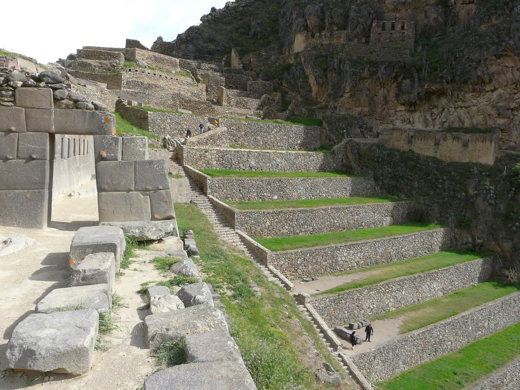
Ollantaytambo Archeological Site
Compone, Cusco, Peru
At Ollantaytambo, terraces rise like stairs for giants, and six colossal stone blocks mark an unfinished Temple of the Sun that will never be completed....

Paucartambo—Fiesta de la Virgen del Carmen
Paucartambo, Cusco, Peru
The Whale geoglyph depicts a marine creature approximately twenty-seven metres in length on the desert floor....

Phuyupatamarca
Machu Picchu district, Machu Picchu district, Cusco region, Peru
Phuyupatamarca sits at roughly 3,600 meters, often wreathed in cloud, its terraced slopes and stone fountains still fed by an underground water system that has functioned...

Pisac Incan Archaeological Complex
Pisac, Cusco, Peru
Pisac sprawls across a mountain ridge at the entrance to the Sacred Valley, its terraces forming an inverted triangle that descends toward the Urubamba River....
Pukara, Templo Santa Isabel
Pukara, Puno, Peru
Long before the Inca, Pukara dominated the northern Lake Titicaca basin. Beginning around 1,800 BCE, this was the region's first large urban center, with a ceremonial...
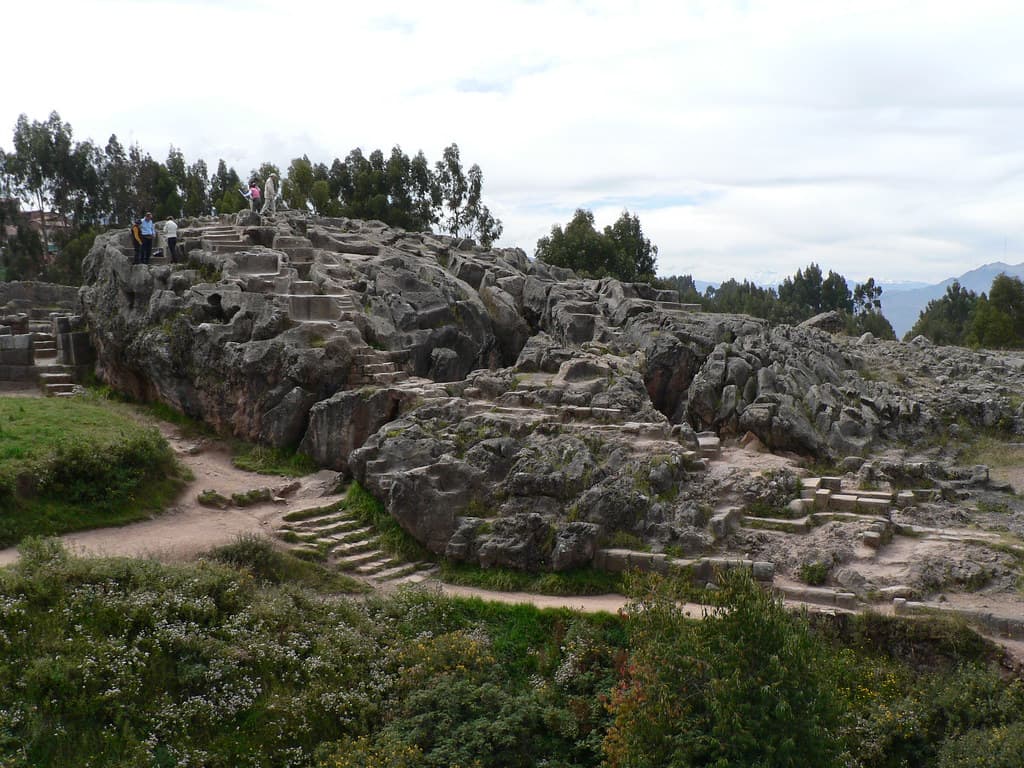
Q'enco Archeological Complex
Cuzco, Cusco, Peru
Q'enco rises from Socorro hill, four kilometers from Cusco—a huaca carved entirely from living rock....
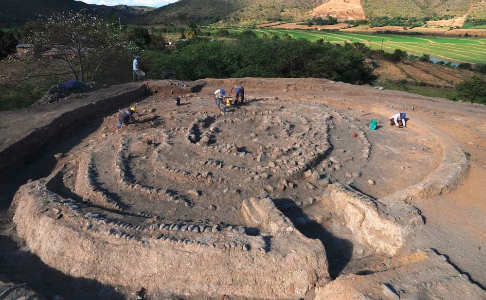
Ruins of Montegrande
Jaén, Cajamarca, Peru
Rising from the rice paddies outside Jaén, a mound as tall as a five-story building conceals one of Peru's most ancient mysteries: a spiral temple built around 3000 BCE by...

Runkurakay
Machu Picchu district, Machu Picchu district, Cusco region, Peru
Runkurakay is a compact, unusually circular Inca structure perched near a high pass on Day 2 of the Classic Inca Trail....
Showing 1-48 of 61 sites
Key questions
Peru sacred-site questions
- What sacred sites can I explore in Peru?
- Pilgrim Map lists sacred places in Peru across living worship sites, heritage landmarks, pilgrimage destinations, and culturally significant landscapes. The current guide lists 61 sites organized by region, tradition, and site type.
- Which traditions are represented in Peru?
- The most represented traditions include Pre-Columbian, Christianity, Inca, Indigenous, Multi-faith.
- How should I plan a sacred-site visit in Peru?
- Start with regional clusters, compare nearby places on the map, then open individual site pages for coordinates, etiquette, and sacred context where available.
- Can I view Peru sacred sites on a map?
- Yes. Switch to map view to compare geographic clusters, then open individual site pages for coordinates, visiting context, and related places.