Country guide
Mexico
Mexico brings together sacred architecture, pilgrimage traditions, and landscapes shaped by memory, ritual, and local devotion.
36 sacred sites across 17 regions. Use the tradition and site-type filters to narrow in.
Atlas summary
Mexico sacred sites overview
Mexico sacred sites include living temples, shrines, churches, pilgrimage places, ruins, and sacred landscapes indexed across the Pilgrim Map atlas.
Use this guide to compare regional clusters, represented traditions, and common site types before opening individual pages for visiting context and deeper background.
| Coverage | 36 sacred sites across 17 regions. |
|---|---|
| Regional clusters | |
| Traditions | |
| Site types | |
| UNESCO heritage | 2 UNESCO-tagged sites in this country guide. |
By tradition
Dates connected to Mexico
Upcoming festivals, feast days, and pilgrimages tied to Mexico. Add any to your calendar, or see the full observance calendar.
Refine the atlas
Search within Mexico
Showing 1-36 of 36 sites in this country guide

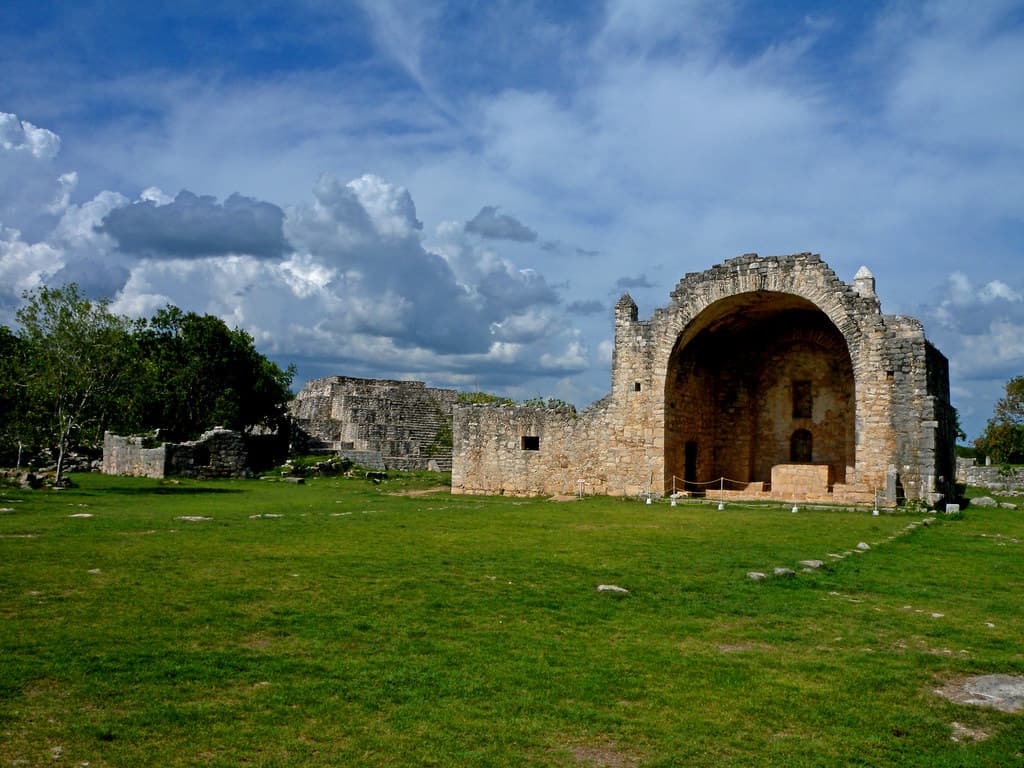
Archaeological Site of Mayapan
Tecoh, Yucatan, Mexico
Mayapan was the political and spiritual heart of the Maya world in the centuries before Spanish contact....
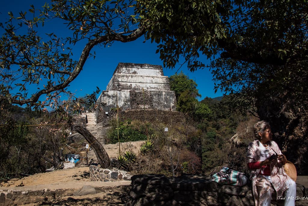
Archaeological Zone Tepozteco
Tepoztlan, Morelos, Mexico
Six hundred meters above the valley floor, on a cliff edge overlooking the town of Tepoztlan, stands a temple dedicated to Tepoztecatl, the Aztec god of pulque, fertility,...

Basilica of Nuestra Señora de la Salud, Patzcuaro
Pátzcuaro, Michoacán, Mexico
Don Vasco de Quiroga dreamed of utopia in the New World. In 1540, on a hill where Purepecha priests had performed ceremonies, he began building what would become...

Basilica of Our Lady of Guadalupe
Mexico City, Mexico City, Mexico
The world's most-visited Catholic pilgrimage site rises at Tepeyac Hill in Mexico City, where the Virgin Mary appeared to an Aztec peasant in 1531....
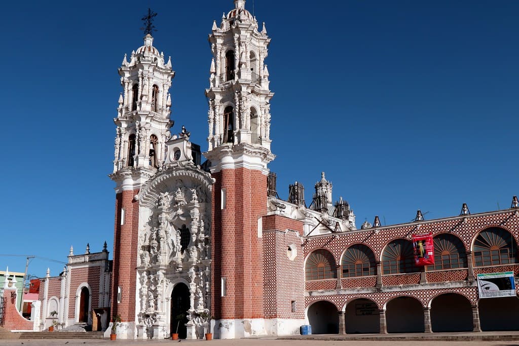
Basilica of Our Lady of Ocotlan
Otatitlán, Veracruz, Mexico
In 1541, as smallpox killed ninety percent of Tlaxcala's population, a young indigenous convert named Juan Diego Bernardino encountered the Virgin in a pine grove....
Basilica of Our Lady of Remedies, Naucalpan de Juarez
Naucalpan de Juárez, State of Mexico, Mexico
On the night of La Noche Triste in 1520, when Cortes's forces fled Tenochtitlan in defeat, a soldier named Villafuerte concealed a 27-centimeter Virgin among the magueys...

Basilica of Our Lady of Zapopan, Guadalajara
Zapopan, Jalisco, Mexico
On October 12, more than three million people accompany a 34-centimeter corn paste statue through the streets of Guadalajara....

Chichen Itza
Pisté, Yucatán, Mexico
Chichen Itza rises from the Yucatan jungle as one of the most powerful sacred sites in the Americas....

Church of Guadalupe, San Cristobal
San Cristóbal, Chiapas, Mexico
Rising above San Cristobal de las Casas on Cerro de Guadalupe, this 19th-century church draws devotees who climb its 79 stone steps to honor Mexico's most beloved sacred...

Coba
Cobá, Quintana Roo, Mexico
Coba was once one of the largest Maya cities, its white roads stretching over one hundred kilometers to connect the ancient world....

Cristo Rey, Cerro del Cubilete
Silao, Guanajuato, Mexico
Rising 2,580 meters above central Mexico, Cristo Rey stands where believers placed Christ at the geographic heart of their nation....
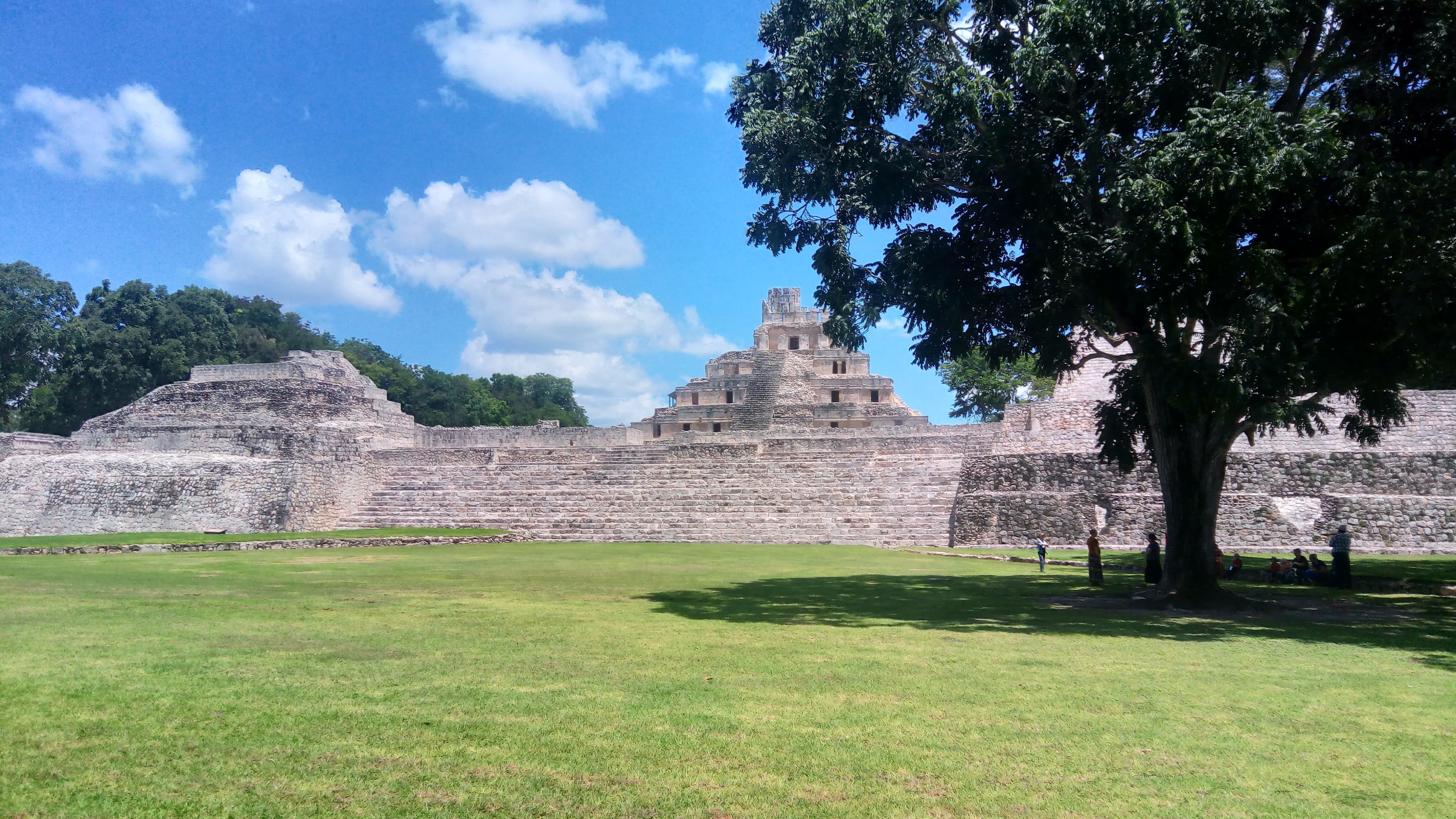
Edzna Archaeological Zone
Municipio de Campeche, Campeche, Mexico
For nearly two millennia, from 400 BCE until the Spanish arrived, Edzna commanded the Campeche lowlands....

Ex-Convento de San Miguel Arcángel, Maní
Maní, Maní, Yucatán, Mexico
The Ex-Convento de San Miguel Arcángel in Maní, Yucatán, is a functioning Franciscan-founded parish church and also the site of the 1562 auto de fe, when Bishop Diego de...
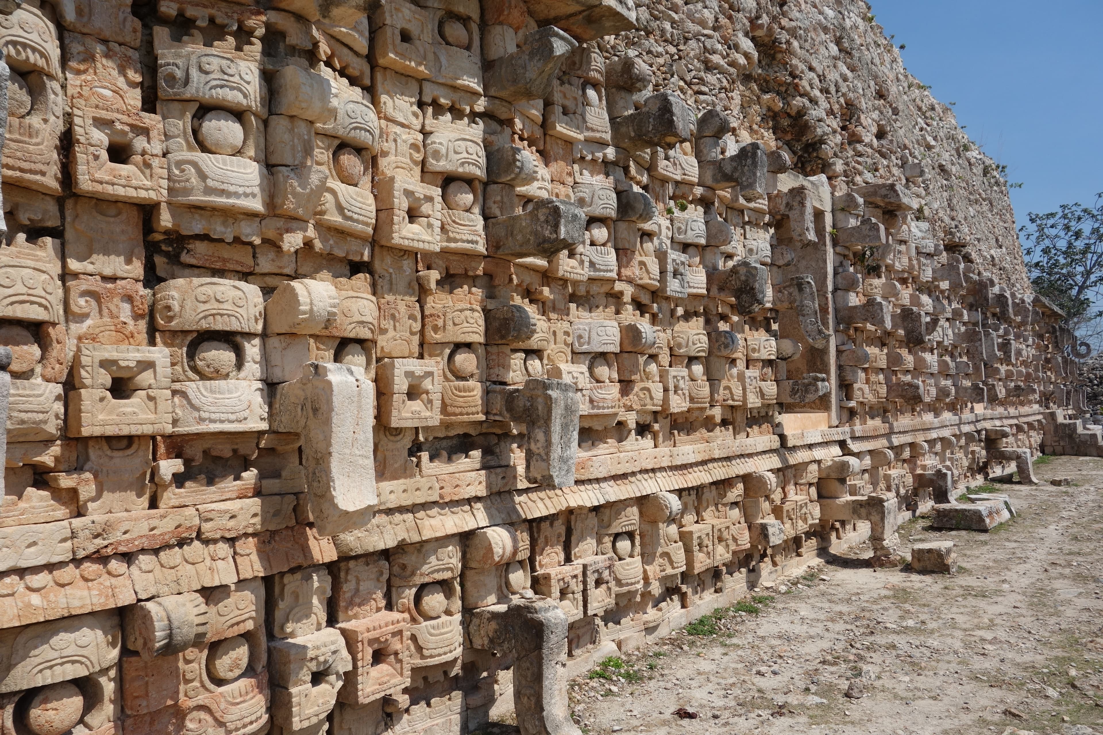
Kabah Archaeological Zone
Santa Elena, Yucatán, Mexico
In the Puuc hills of western Yucatan, where no cenotes break the limestone and rain alone sustains life, the Maya built Kabah and covered its greatest palace with the...

Labna
Santa Elena, Yucatán, Mexico
Rising from the limestone hills of the Puuc region, Labna preserves the most elaborate ceremonial arch in all Maya territory....
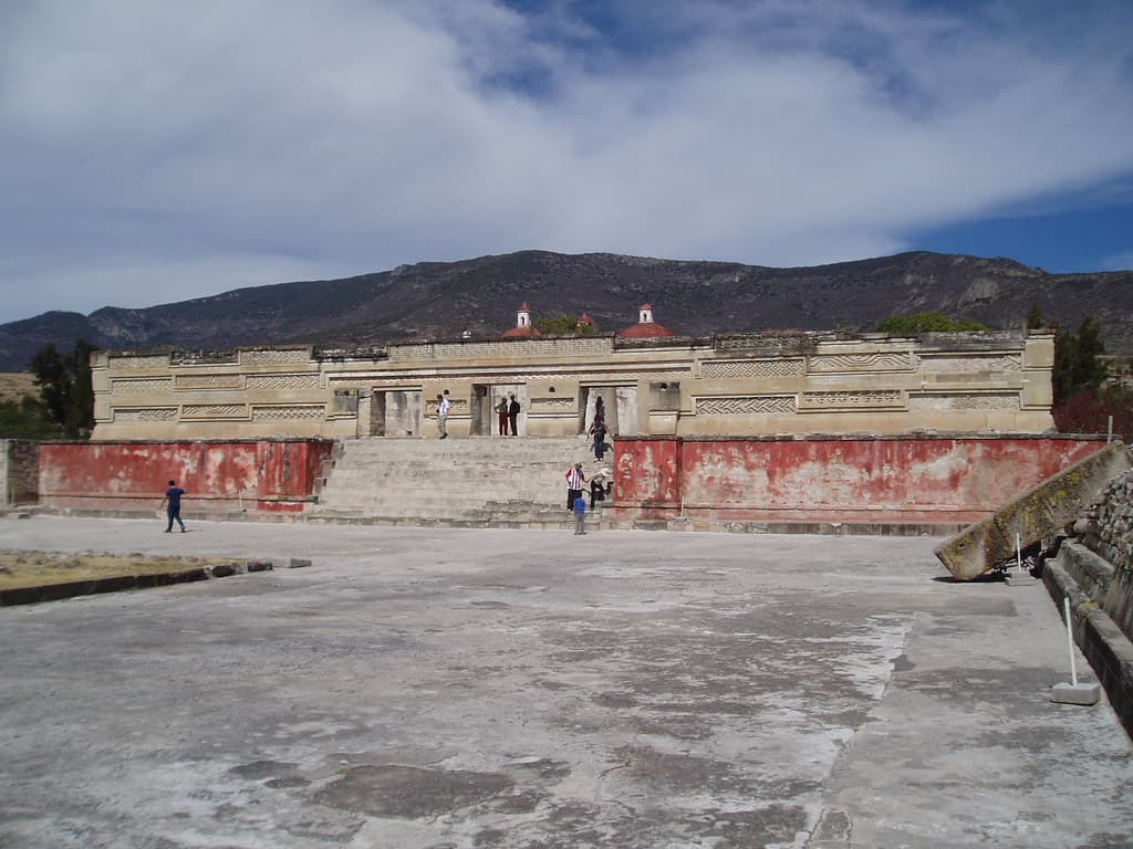
Mitla Archaeological Zone
San Pablo Villa de Mitla, Oaxaca, Mexico
Mitla—from the Nahuatl Mictlan, 'place of the dead'—served as the gateway between worlds for Zapotec civilization....
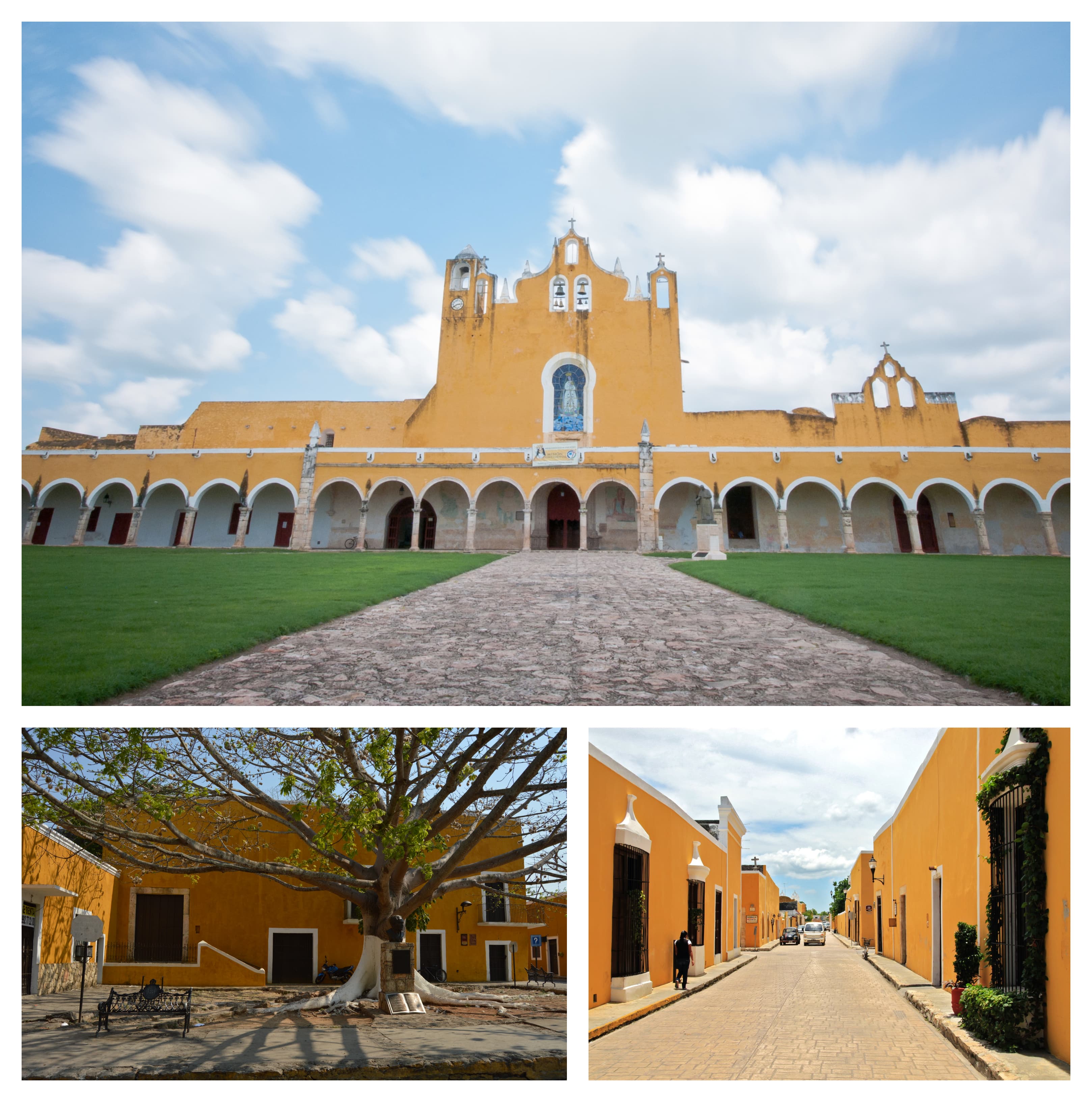
Monastery of San Antonio de Padua, Izamal
Izamal, Yucatán, Mexico
In the heart of Yucatán's Yellow City, Franciscan friars built one of Mexico's largest church atriums directly atop a leveled Maya temple platform, using its own carved...

Monte Alban Archaeological Zone
Santa Cruz Xoxocotlán, Oaxaca, Mexico
Monte Alban rises 400 meters above the Valley of Oaxaca—a mountaintop that the Zapotec literally carved into a capital city beginning around 500 BCE....
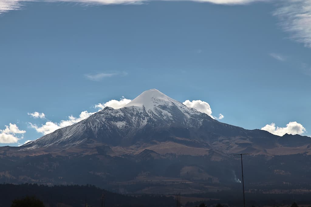
Mt. Citlatepetl Orizaba
Tlachichuca, Puebla, Mexico
Citlaltepetl—Star Mountain in Nahuatl—rises 5,636 meters above sea level, the highest peak in Mexico and third highest in North America....
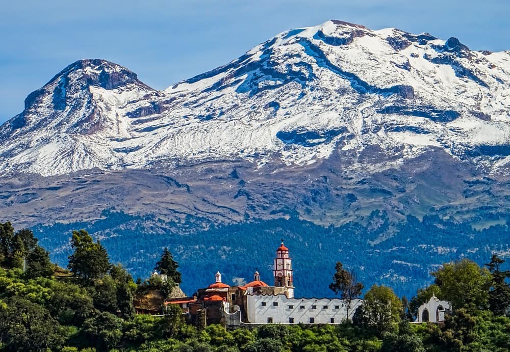
Mt. Iztaccihuatl
Tlalmanalco, State of Mexico, Mexico
Iztaccihuatl rises 5,230 meters above the Valley of Mexico, her four peaks forming the shape of a woman lying in eternal sleep—head, chest, knees, and feet draped in snow....
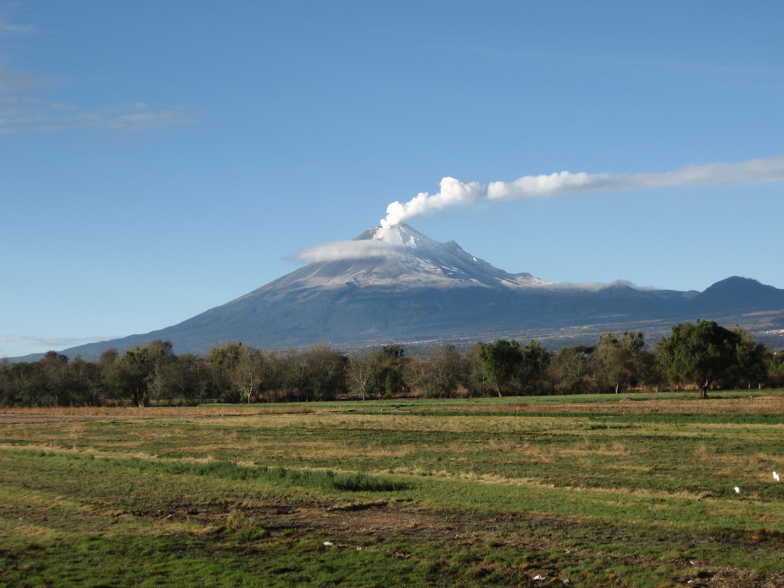
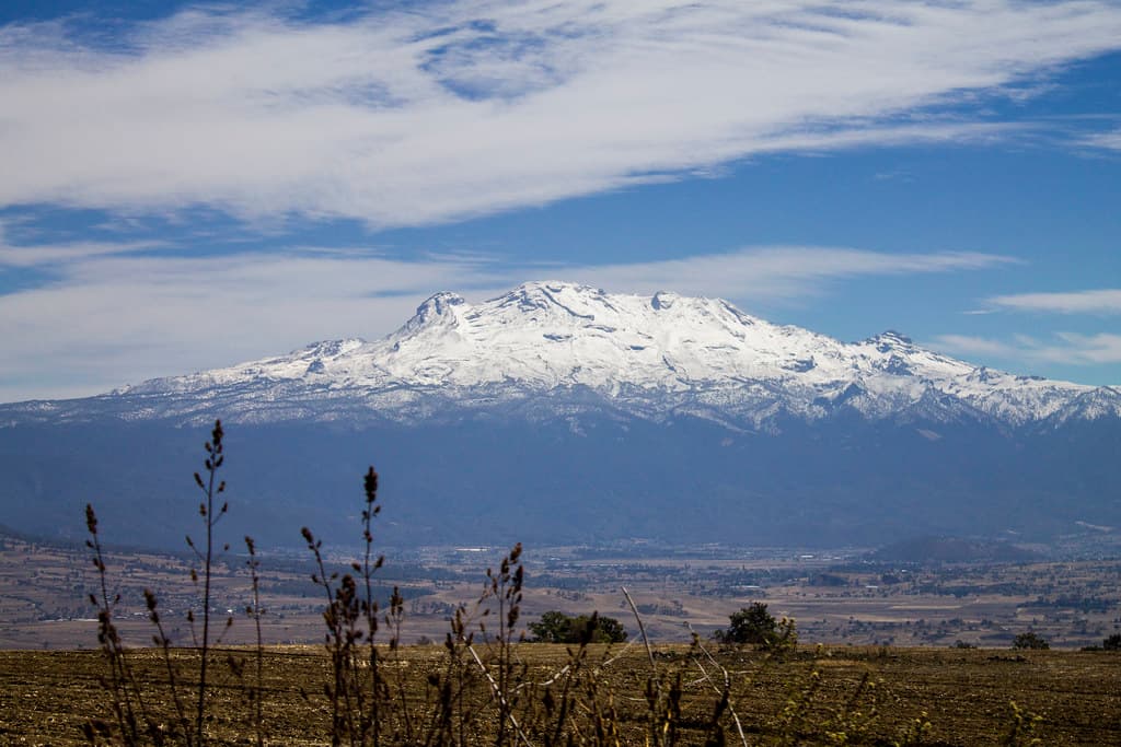
Mt. Popocatepetl
Atlautla, State of Mexico, Mexico
Popocatepetl—Smoking Mountain—is Mexico's second highest peak and one of its most active volcanoes, continuously erupting since 2005....
Museum of the Mayan Village at Dzibilchaltun
Mérida, Yucatán, Mexico
Dzibilchaltun—'the place where there is writing on the stones'—was inhabited from 1500 BCE until the Spanish Conquest, one of the longest continuously occupied sites in...

Our Lady of Guadalupe, Mexico
Mexico City, Mexico City, Mexico
At the foot of Tepeyac Hill, where an Aztec goddess once dwelt and a brown-skinned Virgin appeared to an indigenous man, the world's most visited Catholic pilgrimage site...

Palenque
Palenque, Chiapas, Mexico
The jungle encloses Palenque like a living wall, howler monkeys calling from the canopy as mist rises through ancient temples....

Pyramid of the Moon, Teotihuacán
San Juan Teotihuacan, State of Mexico, Mexico
The Pyramid of the Moon stands at the northern terminus of the Avenue of the Dead, the visual and ritual culmination of Teotihuacan's processional way....

Pyramid of the Sun, Teotihuacán
San Juan Teotihuacan, State of Mexico, Mexico
The Pyramid of the Sun rises like a man-made mountain from the ancient city of Teotihuacan....

Sanctuary of the Holy Child of Atocha in Plateros
Plateros, Zacatecas, Mexico
In the silver mines of colonial Zacatecas, an explosion trapped miners in darkness. As their wives prayed at the church of St....

Sanctuary of the Lord of Chalma
Chalma, State of Mexico, Mexico
In 1539, Augustinian friars found a shattered idol and a crucified Black Christ standing in its place....
Sanctuary of the Lord of Sacromonte
Amecameca, State of Mexico, Mexico
On the Sacred Hill of Amecameca, a cave once held an image of Tlaloc, rain god. The Dominicans replaced it in 1583 with a Black Christ made of cornstalk paste, lying in...

Sanctuary of the Virgin of Candelaria in Tlacotalpan
Tlacotalpan, Veracruz, Mexico
In 1776, sailors brought a Catalan statue of the Virgin of Candelaria to Tlacotalpan, the island town on the Papaloapan River....
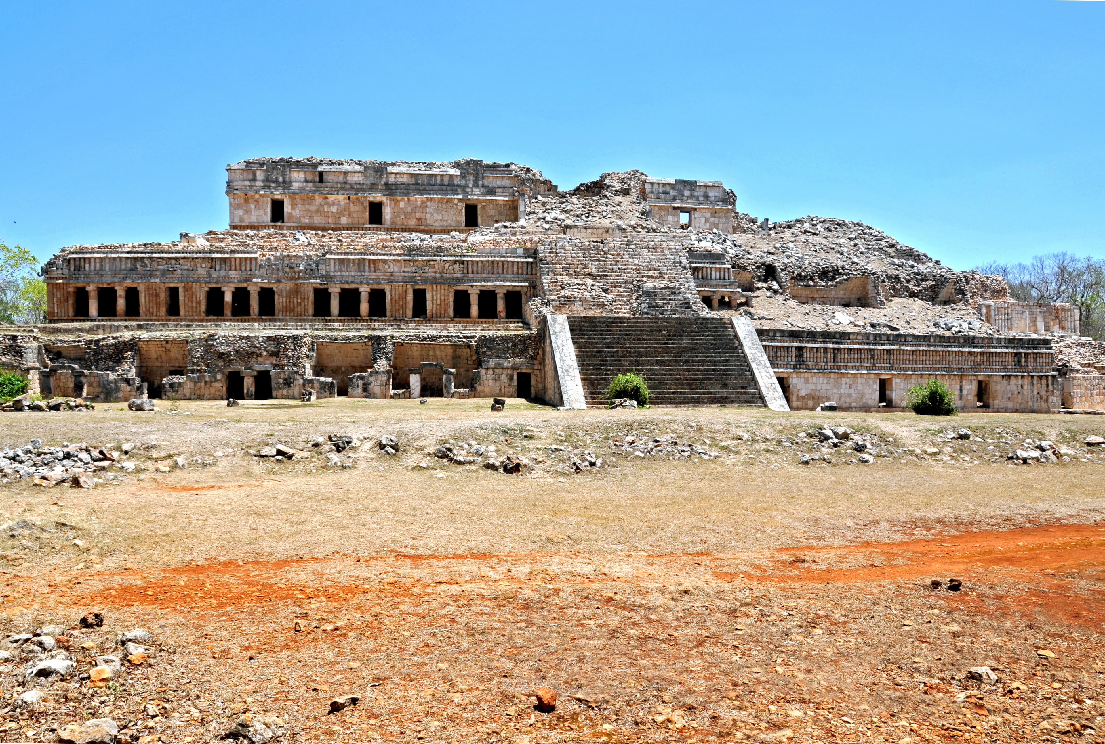
Sayil Archaeological Zone
Santa Elena, Yucatán, Mexico
Sayil—Place of the Leafcutter Ants—was once home to 10,000 people in a region with no surface water....

Templo y Ex-Convento de la Asunción, Muna
Muna, Muna, Yucatán, Mexico
The Templo y Ex-Convento de la Asunción in Muna, Yucatán, is an active Franciscan-founded parish church dedicated to the Assumption of Mary, standing on the Ruta de los...

Teotihuacan
Teotihuacán, State of Mexico, Mexico
We do not know who built Teotihuacan. This is the first mystery that greets visitors to what was once one of the largest cities in the ancient world....

Tulum
Tulum, Quintana Roo, Mexico
Tulum rises above turquoise waters at the edge of the Maya world, a walled city that once welcomed both trading canoes and the first light of morning....

Uxmal
Santa Elena, Yucatán, Mexico
Uxmal rises from the dry Puuc hills of Yucatan as a prayer made visible in stone. Unlike other Maya cities built near cenotes or rivers, Uxmal had no natural water source....
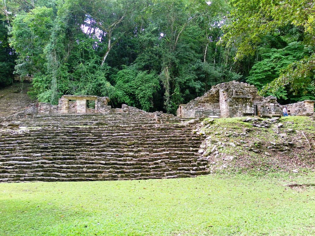
Yaxchilan Archaeological Zone
Ocosingo, Chiapas, Mexico
The Usumacinta River still guards Yaxchilan as it has for fifteen centuries. Reachable only by boat, this jungle-shrouded city preserves the most extraordinary Maya...
Key questions
Mexico sacred-site questions
- What sacred sites can I explore in Mexico?
- Pilgrim Map lists sacred places in Mexico across living worship sites, heritage landmarks, pilgrimage destinations, and culturally significant landscapes. The current guide lists 36 sites organized by region, tradition, and site type.
- Which traditions are represented in Mexico?
- The most represented traditions include Pre-Columbian, Christianity.
- How should I plan a sacred-site visit in Mexico?
- Start with regional clusters, compare nearby places on the map, then open individual site pages for coordinates, etiquette, and sacred context where available.
- Can I view Mexico sacred sites on a map?
- Yes. Switch to map view to compare geographic clusters, then open individual site pages for coordinates, visiting context, and related places.