Country guide
Ireland
Ireland brings together sacred architecture, pilgrimage traditions, and landscapes shaped by memory, ritual, and local devotion.
32 sacred sites across 24 regions. Use the tradition and site-type filters to narrow in.
Atlas summary
Ireland sacred sites overview
Ireland sacred sites include living temples, shrines, churches, pilgrimage places, ruins, and sacred landscapes indexed across the Pilgrim Map atlas.
Use this guide to compare regional clusters, represented traditions, and common site types before opening individual pages for visiting context and deeper background.
| Coverage | 32 sacred sites across 24 regions. |
|---|---|
| Regional clusters | |
| Traditions | |
| Site types |
By tradition
Dates connected to Ireland
Upcoming festivals, feast days, and pilgrimages tied to Ireland. Add any to your calendar, or see the full observance calendar.
- Add
Knock National Novena
Aug 14 – Sat, Aug 22, 2026Pilgrimage
Basilica of Our Lady of Knock, Queen of Ireland - Add
Anniversary of the Knock Apparition
Fri, Aug 21, 2026Feast day
Basilica of Our Lady of Knock, Queen of Ireland - Add
Knock National Novena
Aug 14 – Sun, Aug 22, 2027Pilgrimage
Basilica of Our Lady of Knock, Queen of Ireland - Add
Anniversary of the Knock Apparition
Sat, Aug 21, 2027Feast day
Basilica of Our Lady of Knock, Queen of Ireland
Refine the atlas
Search within Ireland
Showing 1-32 of 32 sites in this country guide
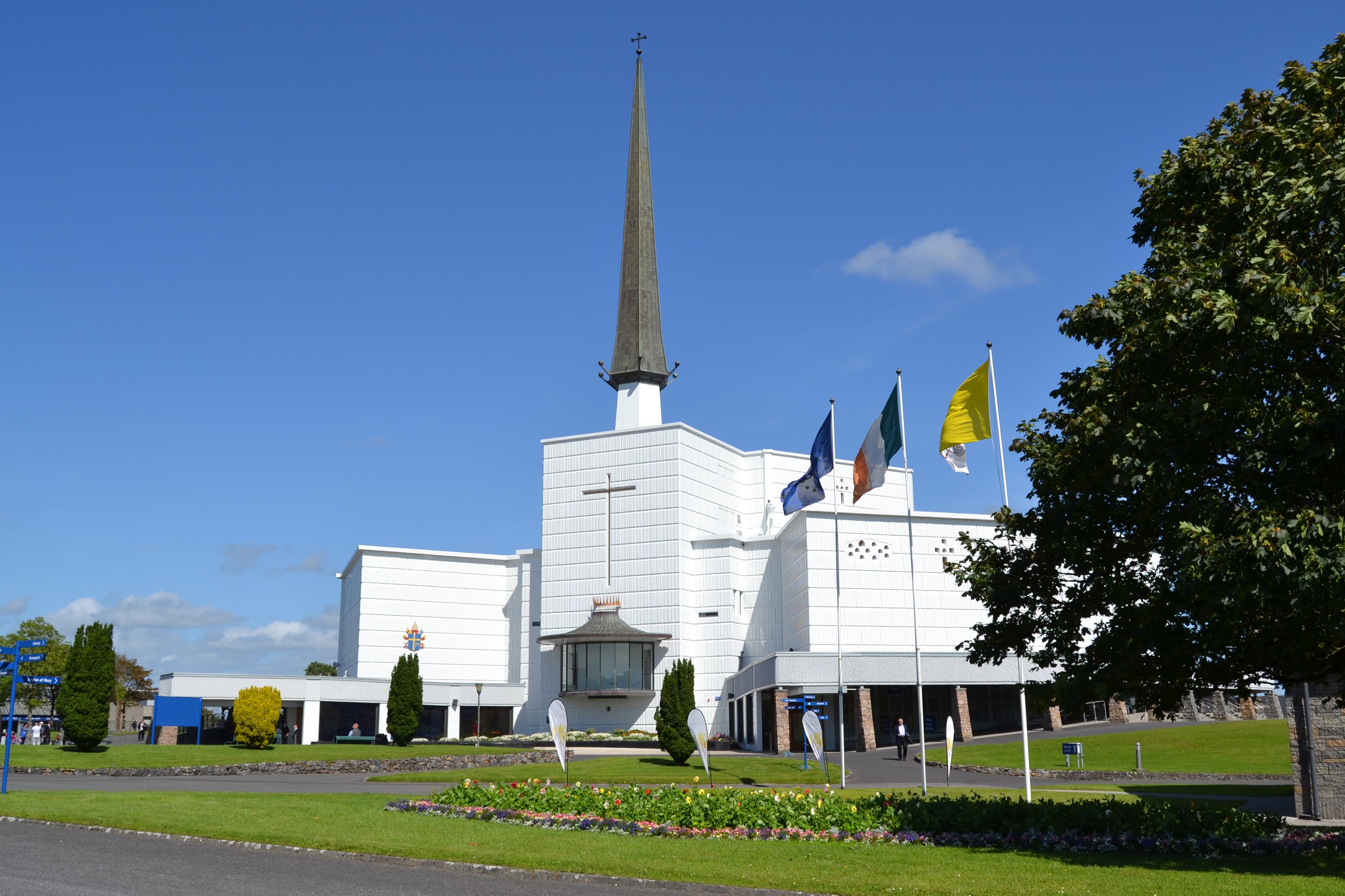
Basilica of Our Lady of Knock, Queen of Ireland
County Mayo, Claremorris-Swinford Municipal District, Ireland
On a wet evening in 1879, fifteen people watched an apparition appear at the gable of a small parish church in the west of Ireland. No words were spoken....
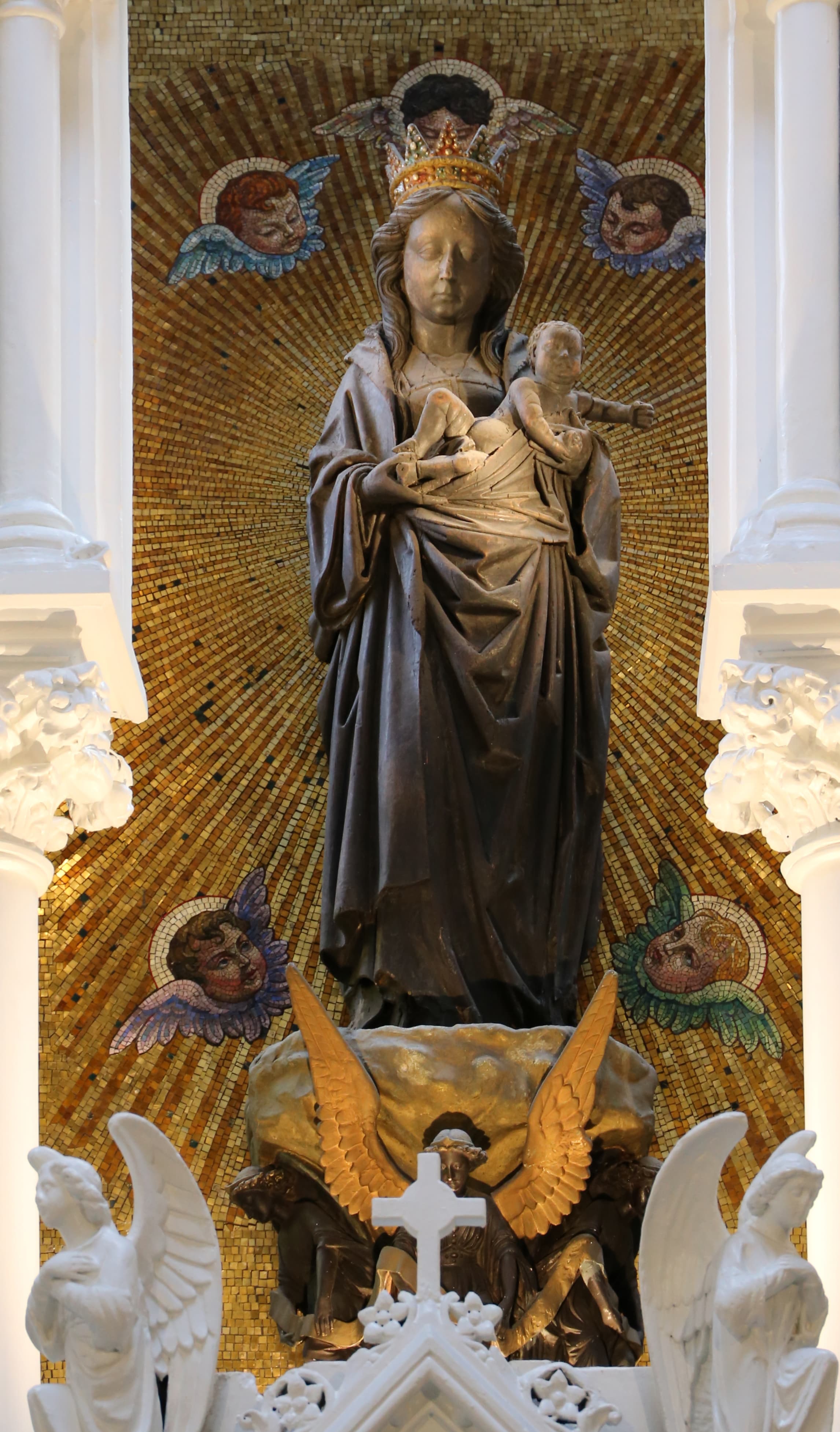
Black Madonna of Dublin
Dublin, Leinster, Ireland
In Dublin's Whitefriar Street Carmelite Church, a life-sized oak Madonna stands near the high altar, her original gold and blue paint stripped away by centuries....
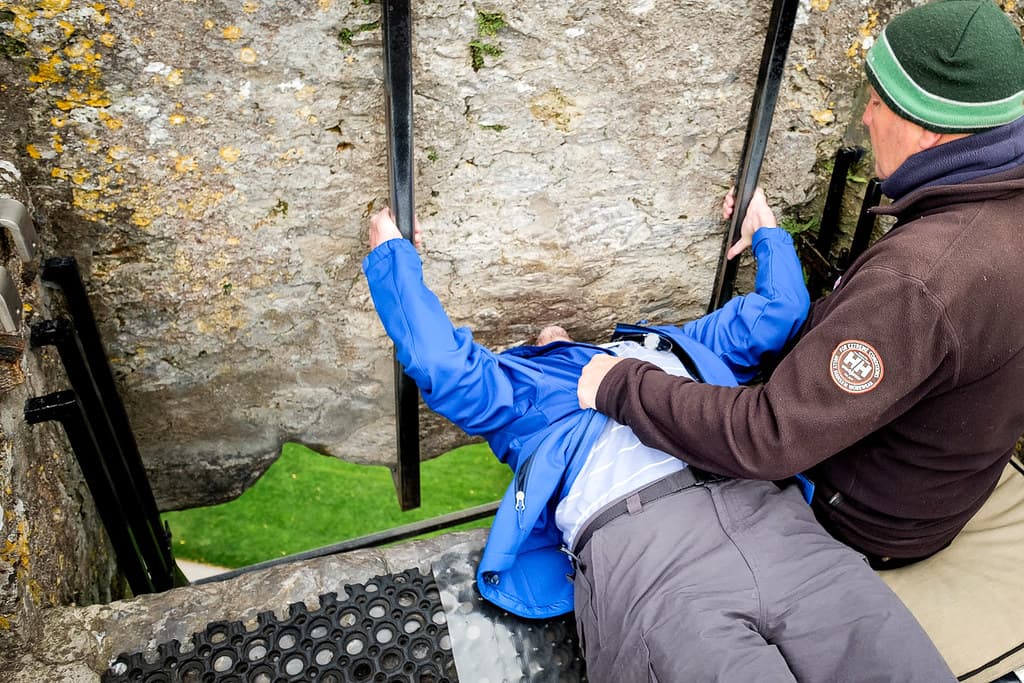
Blarney Stone
Cork, Munster, Ireland
At the top of a fifteenth-century castle tower in County Cork, visitors lie on their back, lean over the edge of the parapet, and kiss the underside of a limestone block....
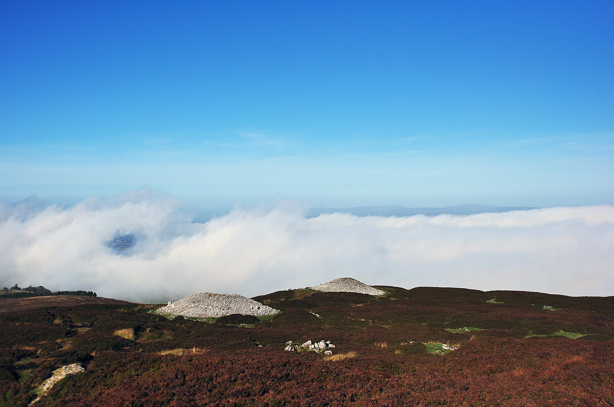
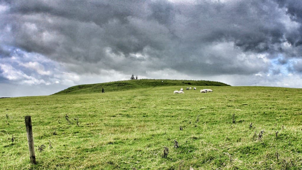
Carrowkeel
County Sligo, Ballymote-Tubbercurry Municipal District, Ireland
On the Bricklieve Mountains in County Sligo, fourteen cairns built over five thousand years ago crown the ridgeline like stone sentinels....
Carrowmore
County Sligo, Sligo Municipal Borough District, Ireland
On the Coolera Peninsula near Sligo, thirty surviving megalithic monuments mark what was once a cemetery of sixty structures, among the oldest in Ireland....
Drombeg Stone Circle, Glandore, Ireland
County Cork, West Cork, Ireland
On a gentle rise above the West Cork coast, seventeen stones form one of the finest examples of Ireland's distinctive Cork-Kerry axial stone circles....
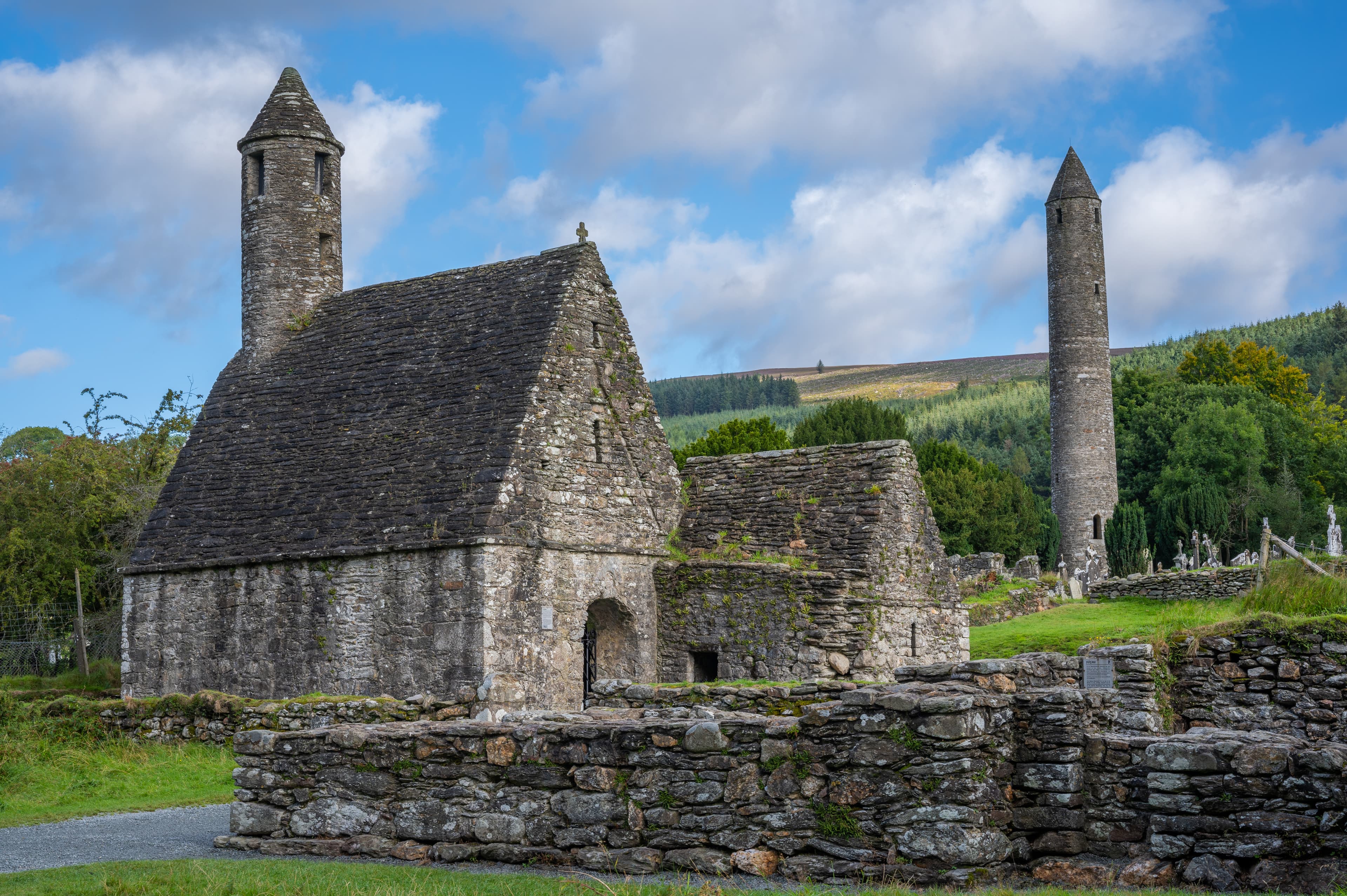
Glendalough
County Wicklow, The Municipal District of Wicklow, Ireland
Glendalough is a glacial valley in County Wicklow holding the ruins of an early medieval monastery founded by St Kevin around 600 AD....
Hill of Tara
County Meath, The Municipal District of Ashbourne, Ireland
For over five thousand years, the Hill of Tara has stood as the axis mundi of Ireland, the place where earthly power touched the divine....
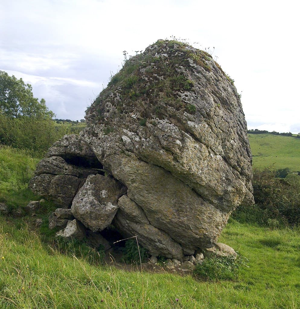
Hill of Uisnech
Loughnavalley, County Westmeath, Ireland
On a gentle hill in the heart of the Irish midlands, five provinces once met at a massive limestone boulder....
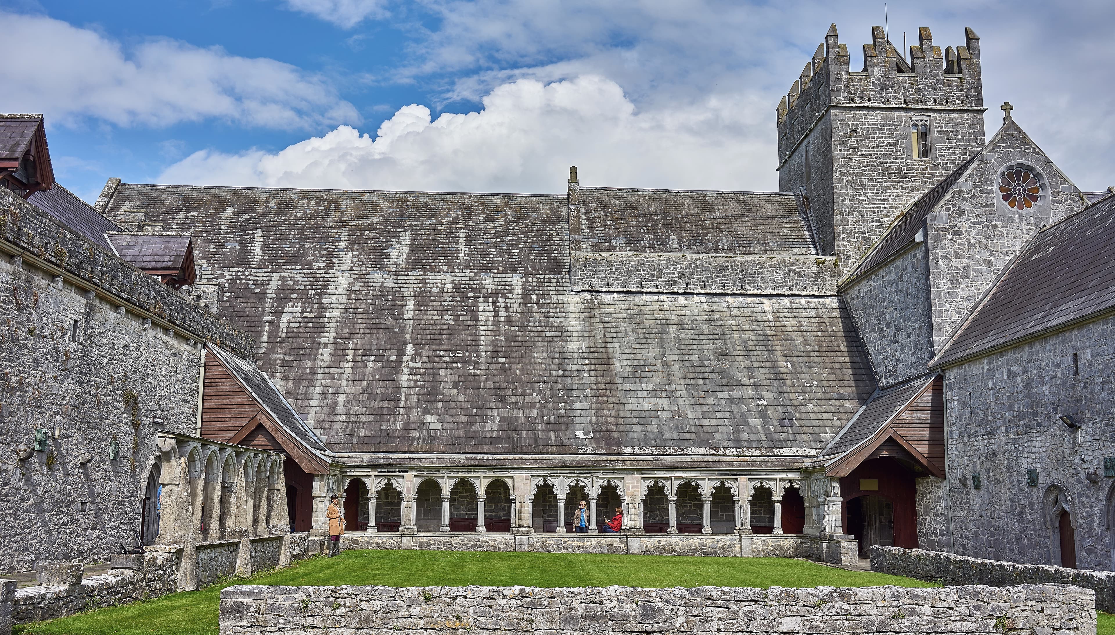
Holy Cross Abbey
County Tipperary, The Municipal District of Thurles, Ireland
Holy Cross Abbey stands as one of Ireland's rarest achievements: a 12th-century Cistercian monastery fully restored to active parish worship....
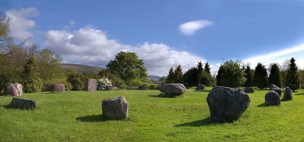
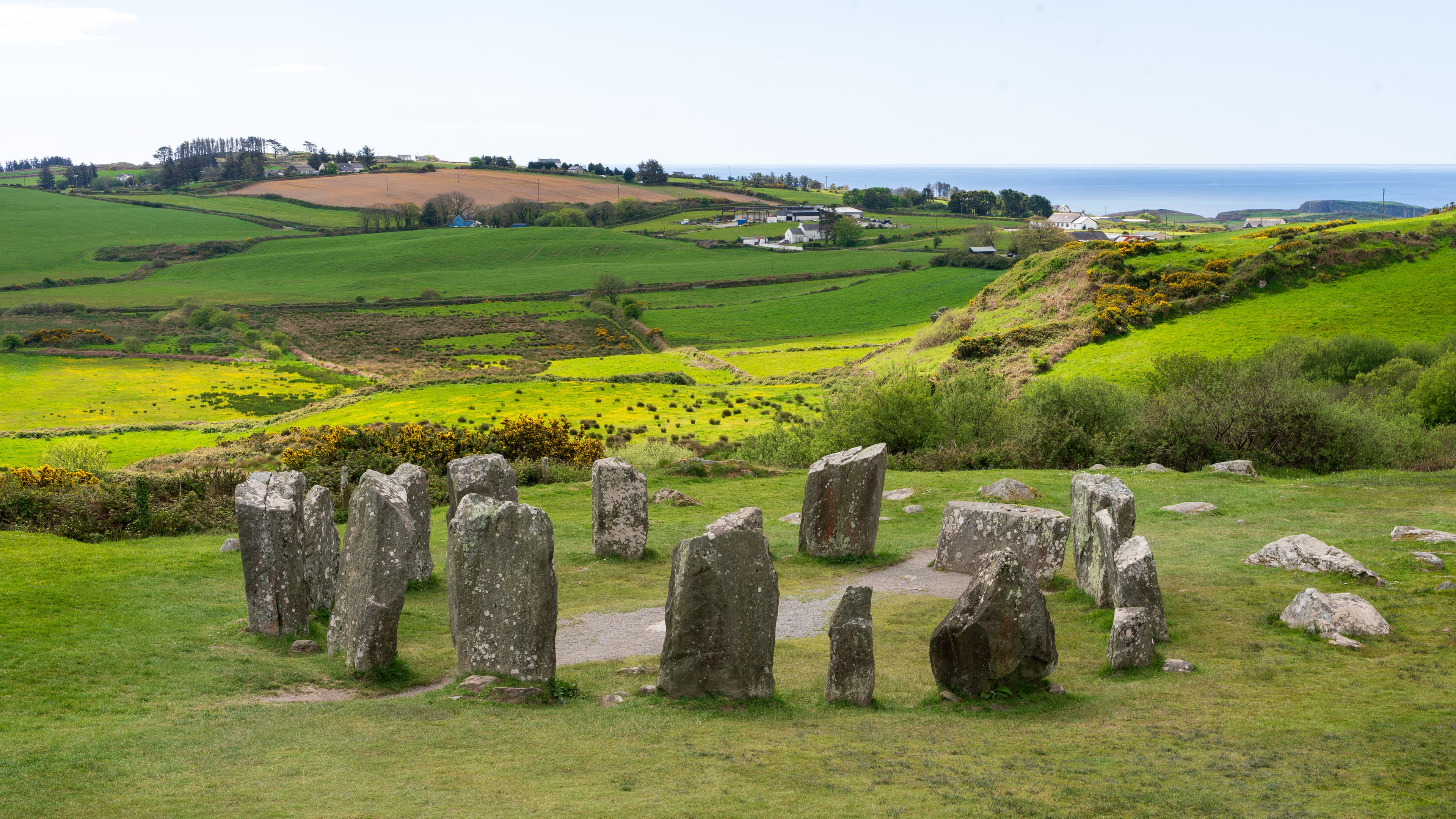
Kenmare Stone Circle, Kenmare, Ireland
Kenmare, Kenmare Municipal District, Ireland
Fifteen stones form an egg-shaped ring in the heart of Kenmare town, enclosing a massive boulder-burial with a seven-ton capstone....
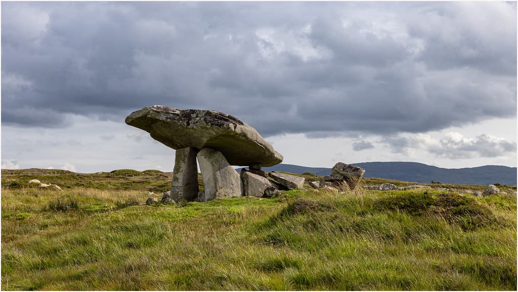
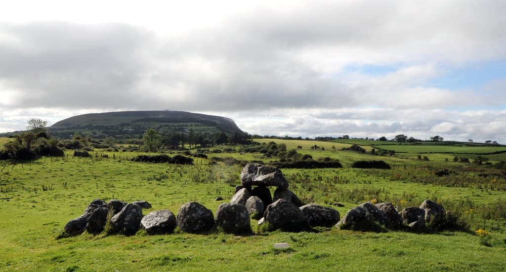
Kilclooney Dolmen, Ardara, Ireland
County Donegal, Glenties Municipal District, Ireland
On a working farm near Ardara in County Donegal, two Neolithic portal tombs stand within sight of each other, the larger crowned by a massive capstone that has balanced on...
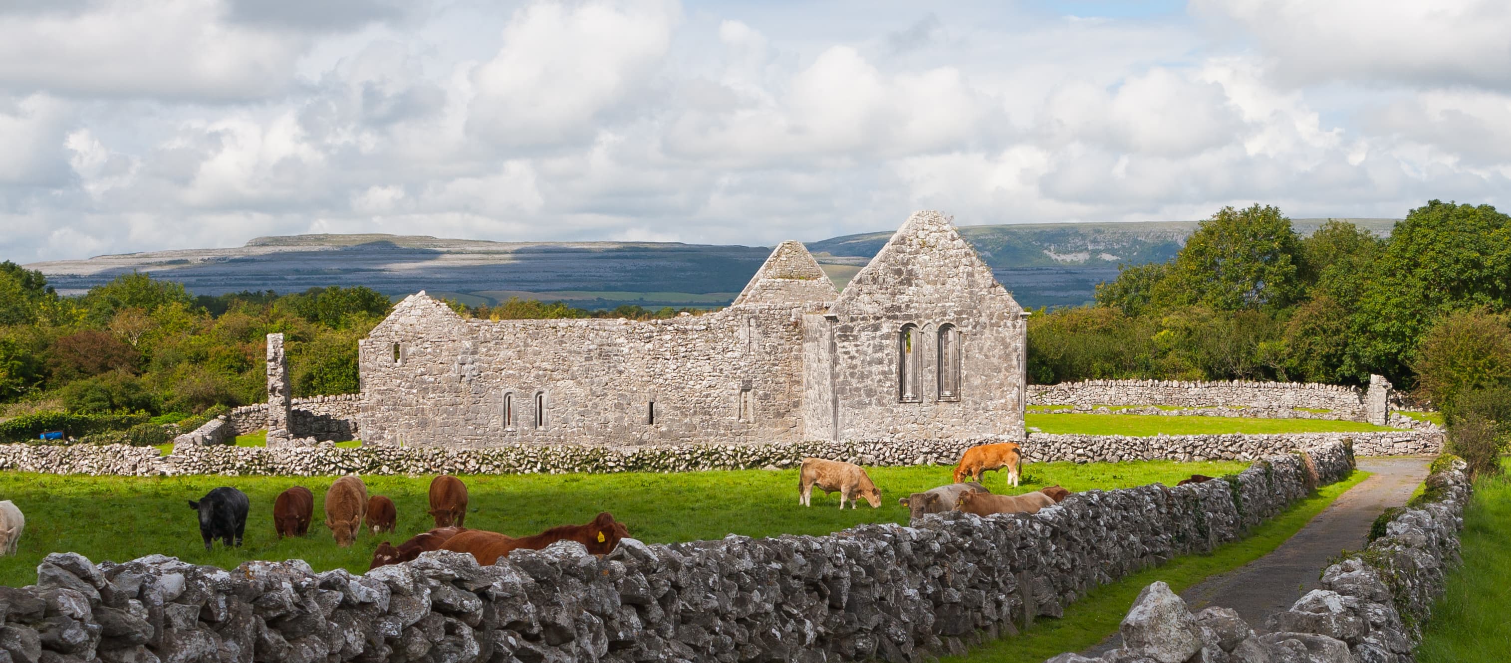
Kilmacduagh
County Galway, Loughrea Municipal District, Ireland
Kilmacduagh is a sprawling monastic settlement in south County Galway, founded around 610 AD by St Colman mac Duagh after seven years of hermitage in the Burren....
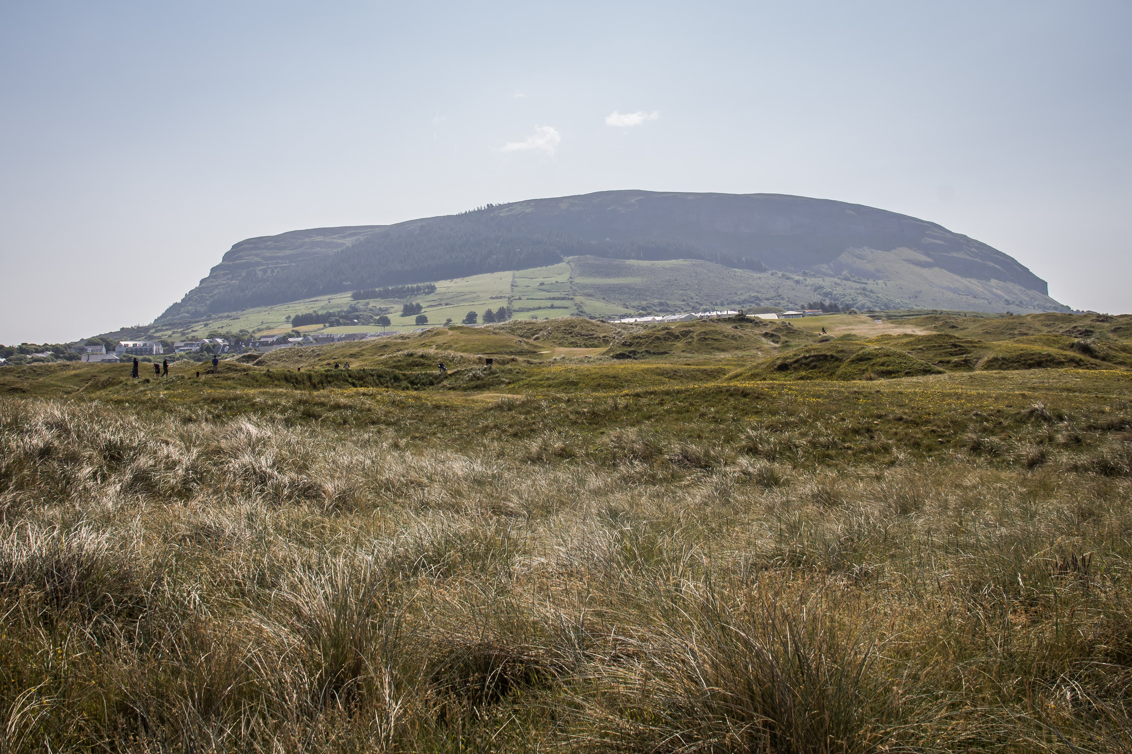
Knocknarea megalthic site, Sligo, Ireland
County Sligo, Sligo Municipal Borough District, Ireland
Knocknarea is a flat-topped mountain on the Sligo coast crowned by one of Ireland's largest unexcavated Neolithic cairns, traditionally identified as the burial place of...
Knockroe passage mound, Ireland
County Kilkenny, The Municipal District of Callan — Thomastown, Ireland
Knockroe is the only known passage tomb in Europe designed to capture both sunrise and sunset on the winter solstice....
Lough Dergh
County Donegal, Donegal Municipal District, Ireland
On a small island in a remote Donegal lake, pilgrims have been fasting, praying barefoot, and keeping vigil for over 1,500 years....

Loughcrew
County Meath, The Municipal District of Kells, Ireland
Loughcrew is one of Europe's largest concentrations of Neolithic passage tombs, spread across four hilltops named for the Cailleach, the divine hag of Irish mythology....
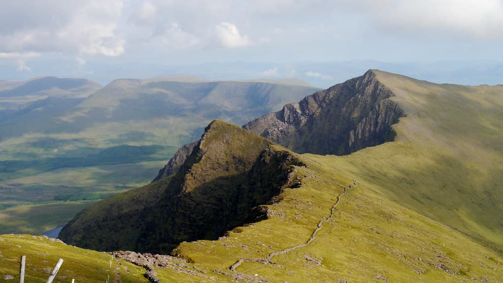
Mount Brandon, County Kerry, Ireland
County Kerry, Kenmare Municipal District, Ireland
Mount Brandon rises 952 meters above the Dingle Peninsula, carrying an unbroken pilgrimage tradition from the pre-Christian Lughnasa harvest festival through the age of...
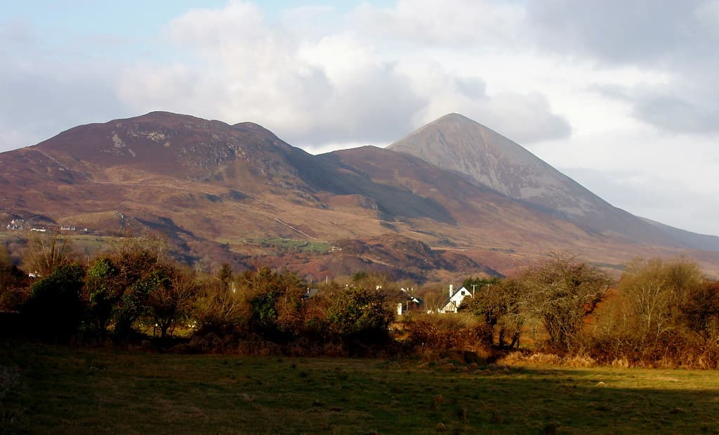
Mt. Croach Patrick
County Mayo, Westport-Belmullet Municipal District, Ireland
Croagh Patrick rises 764 meters above Clew Bay in County Mayo, carrying unbroken sacred significance from the Neolithic period to the present day....

Newgrange
Donore, County Meath, Ireland
Five thousand years ago, people moved thirty-five hundred tons of stone to build a monument aligned with a single moment of sunrise on the shortest day of the year....
Our Lady’s Island Monastery, Rosslare, Ireland
County Wexford, The Borough District of Wexford, Ireland
On the southern coast of County Wexford, a narrow causeway connects the mainland to a small peninsula between a brackish lake and the Irish Sea....
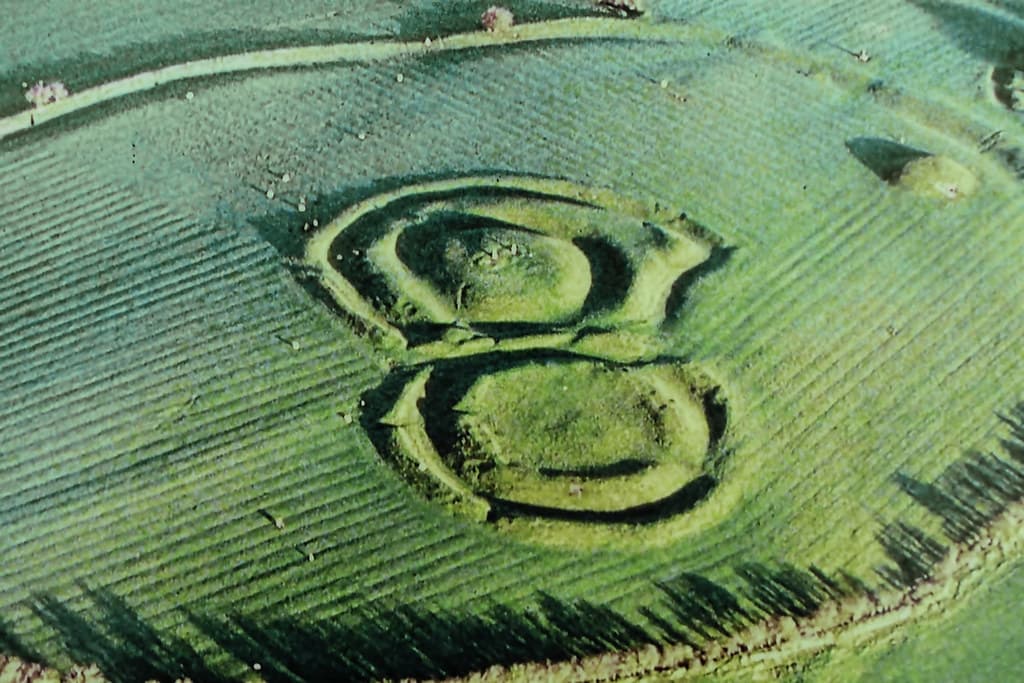
Rath Cruachan, Roscommon, Ireland
County Roscommon, Boyle Municipal District, Ireland
In the quiet farmland of County Roscommon, over 240 archaeological sites lie scattered across 6.5 square kilometres, most of them invisible to the untrained eye....

Rathcroghan
Tulsk, County Roscommon, Ireland
Rathcroghan was the sacred heart of Connacht for over 5,500 years. This ancient royal site, spread across the Roscommon plains, contains more than 240 monuments including...
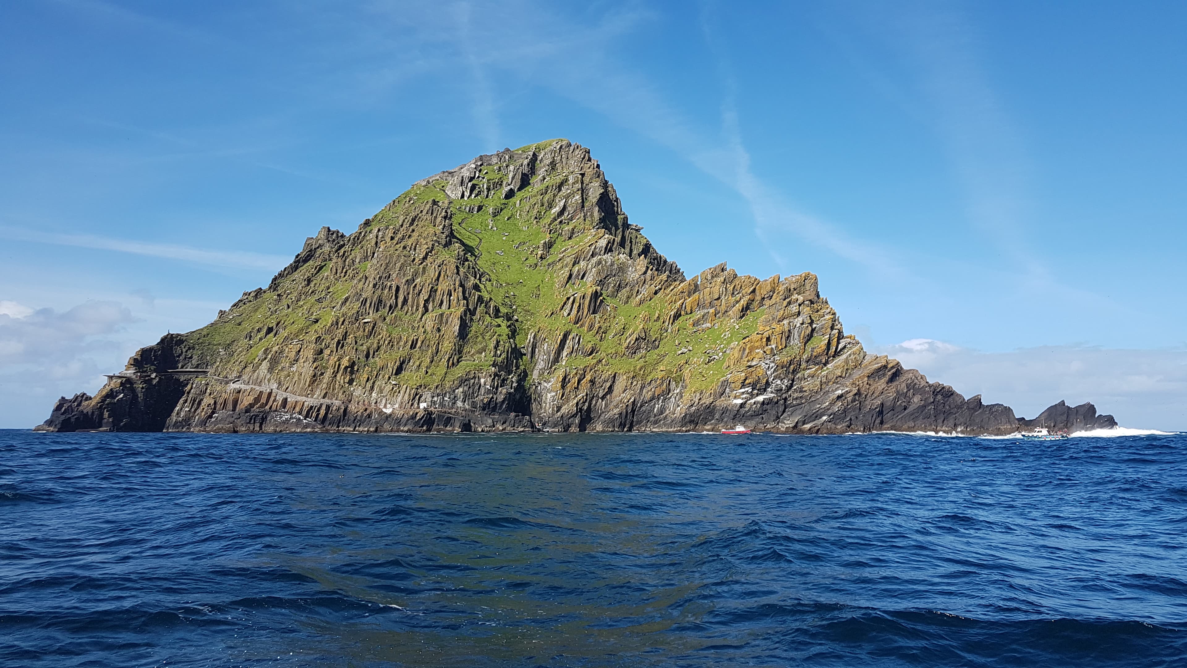
Skellig Michael
County Kerry, Kenmare Municipal District, Ireland
Twelve kilometres off the coast of Kerry, a pyramidal rock rises 218 metres from the Atlantic Ocean....
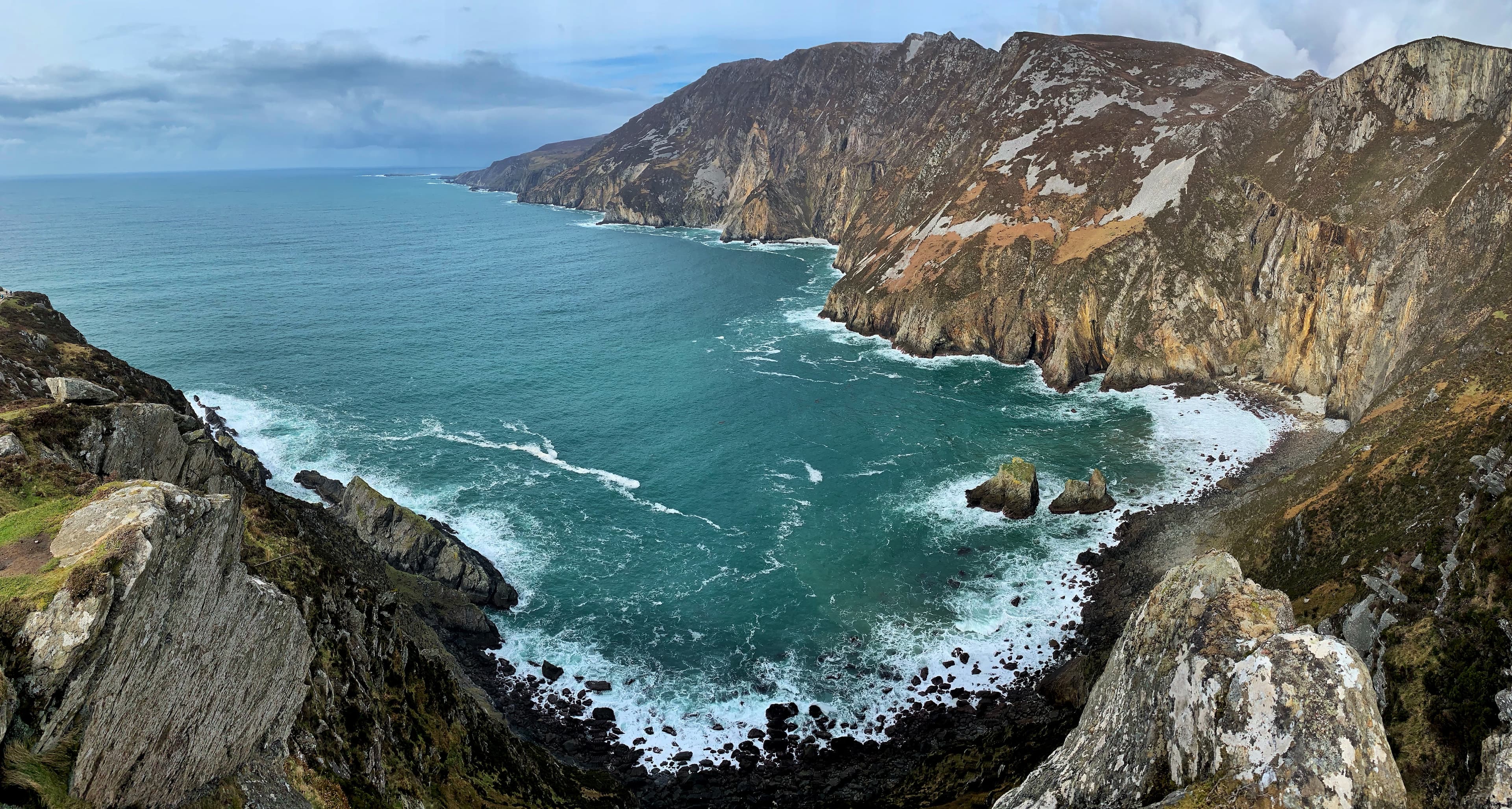
Slieve League, County Donegal, Ireland
County Donegal, Donegal Municipal District, Ireland
On the southwest coast of County Donegal, Slieve League rises 601 metres from the Atlantic Ocean in a near-vertical wall of Dalradian metamorphic rock....

St Gobnait's well (Ballyvourney)
Ballyvourney, County Cork, Ireland
An angel told Gobnait to travel until she found where nine white deer grazed together: there would be her place of resurrection....

St Kevin's Church, Hollywood
Hollywood, County Wicklow, Ireland
St Kevin's Church in Hollywood, County Wicklow — a disused 17th-century church standing on a medieval ecclesiastical site — marks the traditional starting point of the...

St. Brigid's Cathedral, Kildare
Kildare, County Kildare, Ireland
On a gentle hill in County Kildare stands a Gothic cathedral built over one of Ireland's oldest sacred sites....

St. Brigid's Garden Well
Kildare, County Kildare, Ireland
Near the horse pastures of County Kildare, a natural spring rises from the earth in a garden tended by devotion. St....

Stone Of Destiny
Navan, County Meath, Ireland
The Lia Fail stands on the Hill of Tara, a granite pillar that legend says once roared to recognize the rightful High King of Ireland....
Tobar Nalt
County Sligo, Sligo Municipal Borough District, Ireland
In a sheltered woodland south of Sligo town, a spring emerges from a cliff face into a stone basin that has held prayers for over five millennia....

Wicklow Gap
County Wicklow, Ireland
Wicklow Gap is the highest point on St Kevin's Way, a natural mountain pass between Tonelagee and Turlough Hill where pilgrims walking from Hollywood to Glendalough cross...
Key questions
Ireland sacred-site questions
- What sacred sites can I explore in Ireland?
- Pilgrim Map lists sacred places in Ireland across living worship sites, heritage landmarks, pilgrimage destinations, and culturally significant landscapes. The current guide lists 32 sites organized by region, tradition, and site type.
- Which traditions are represented in Ireland?
- The most represented traditions include Christianity, Celtic and Prehistoric.
- How should I plan a sacred-site visit in Ireland?
- Start with regional clusters, compare nearby places on the map, then open individual site pages for coordinates, etiquette, and sacred context where available.
- Can I view Ireland sacred sites on a map?
- Yes. Switch to map view to compare geographic clusters, then open individual site pages for coordinates, visiting context, and related places.