Country guide
Sweden
Sweden brings together sacred architecture, pilgrimage traditions, and landscapes shaped by memory, ritual, and local devotion.
26 sacred sites across 9 regions. Use the tradition and site-type filters to narrow in.
Atlas summary
Sweden sacred sites overview
Sweden sacred sites include living temples, shrines, churches, pilgrimage places, ruins, and sacred landscapes indexed across the Pilgrim Map atlas.
Use this guide to compare regional clusters, represented traditions, and common site types before opening individual pages for visiting context and deeper background.
| Coverage | 26 sacred sites across 9 regions. |
|---|---|
| Regional clusters | |
| Traditions | |
| Site types |
Refine the atlas
Search within Sweden
Showing 1-26 of 26 sites in this country guide
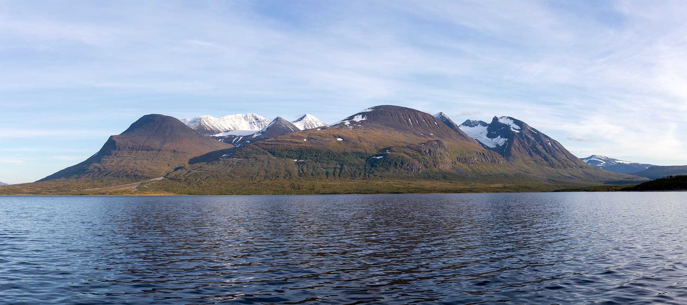
Áhkká
Jokkmokks kommun, Norrbottens län, Sweden
Twelve peaks and ten glaciers rise above Lake Akkajaure in Swedish Lapland, forming a massif the Sami named after their mother goddess Mattarahkka....
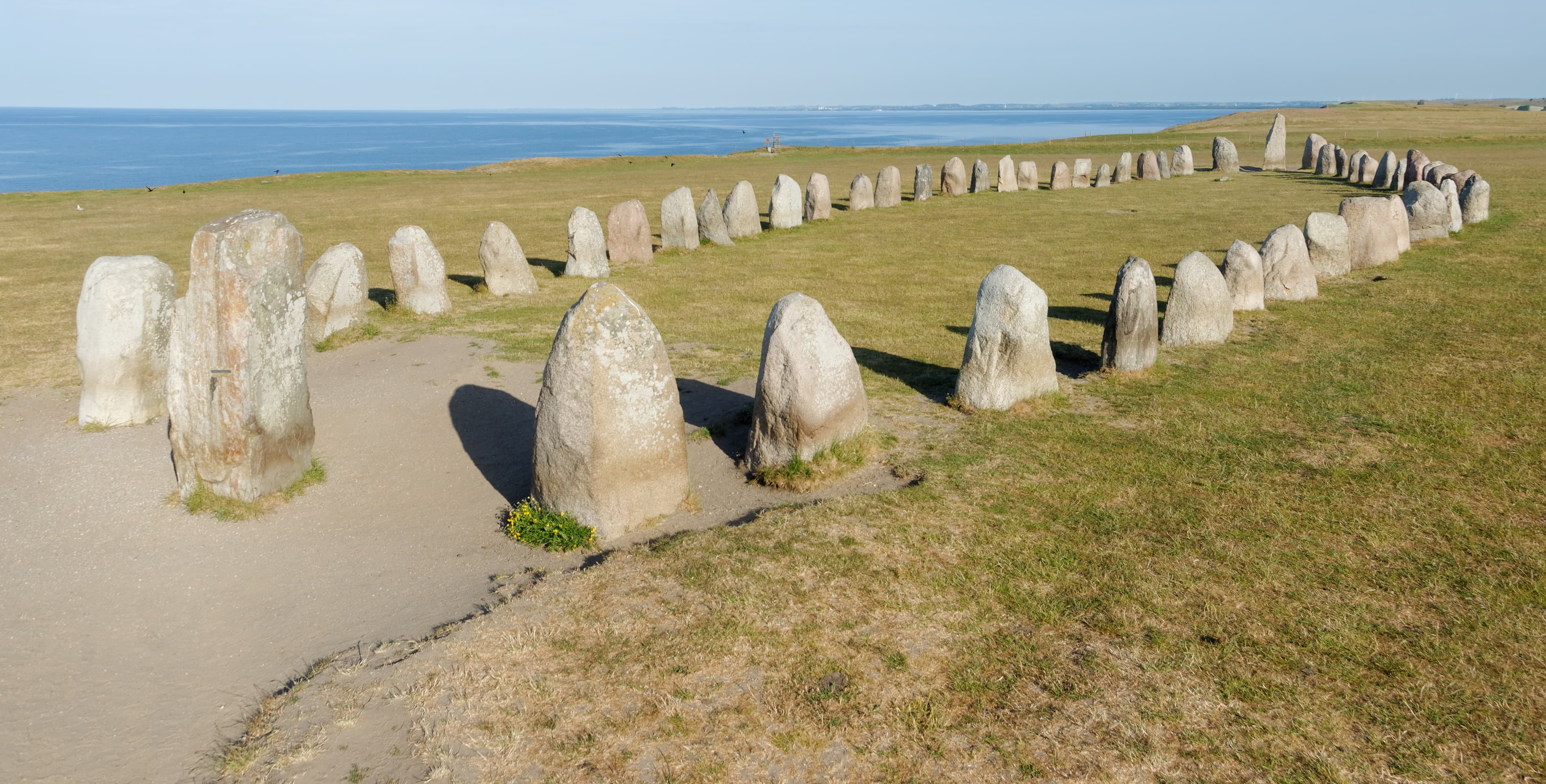
Ale's Stones (Ales Stenar)
Ystads kommun, Skåne län, Sweden
On a windswept ridge above the fishing village of Kaseberga, fifty-nine massive boulders form the outline of a ship sixty-seven metres long....

Ålleberg
Falköpings kommun, Västra Götalands län, Sweden
Alleberg rises sharply from the Falbygden plain in western Sweden, a table mountain shaped by 150 million years of geology and inhabited, according to legend, by twelve...
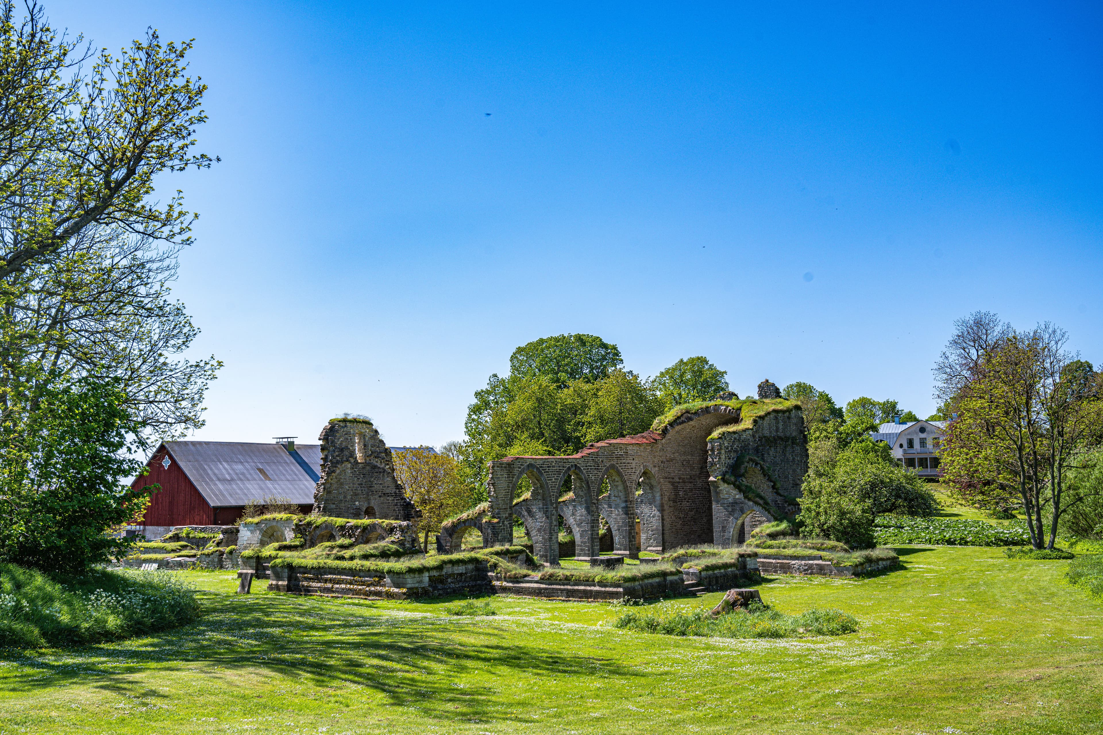
Alvastra Abbey
Västra Tollstad, Östergötlands län, Sweden
At the foot of Mount Omberg beside Lake Vattern, the ruins of Sweden's oldest and most important monastery stand open to the sky....
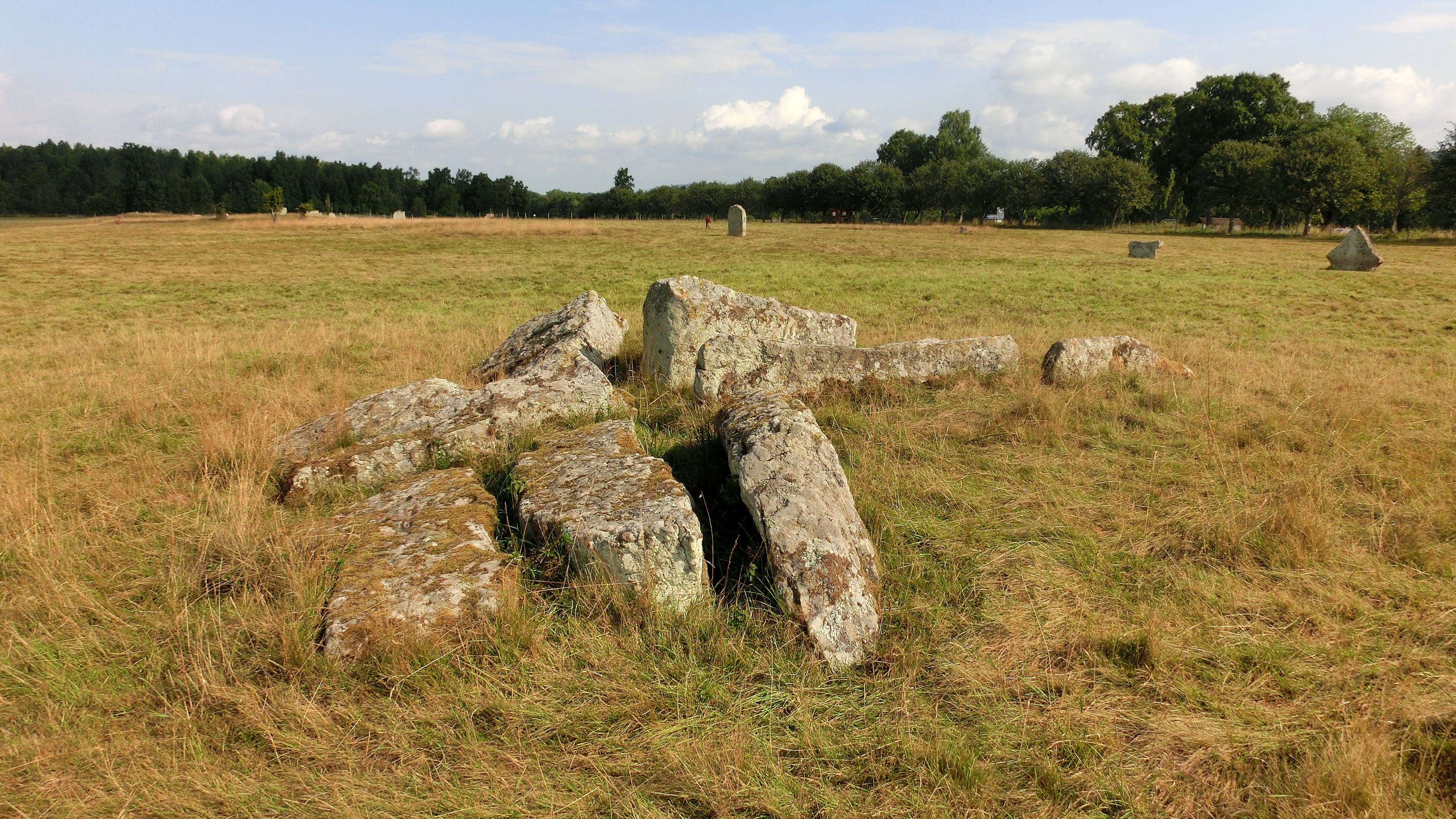
Amundtorp Grave Field
Varnhem, Västra Götalands län, Sweden
On the western slope of Billingen, overlooking Lake Hornborga, forty-two stone formations from the Iron Age Migration Period cluster across an open meadow....

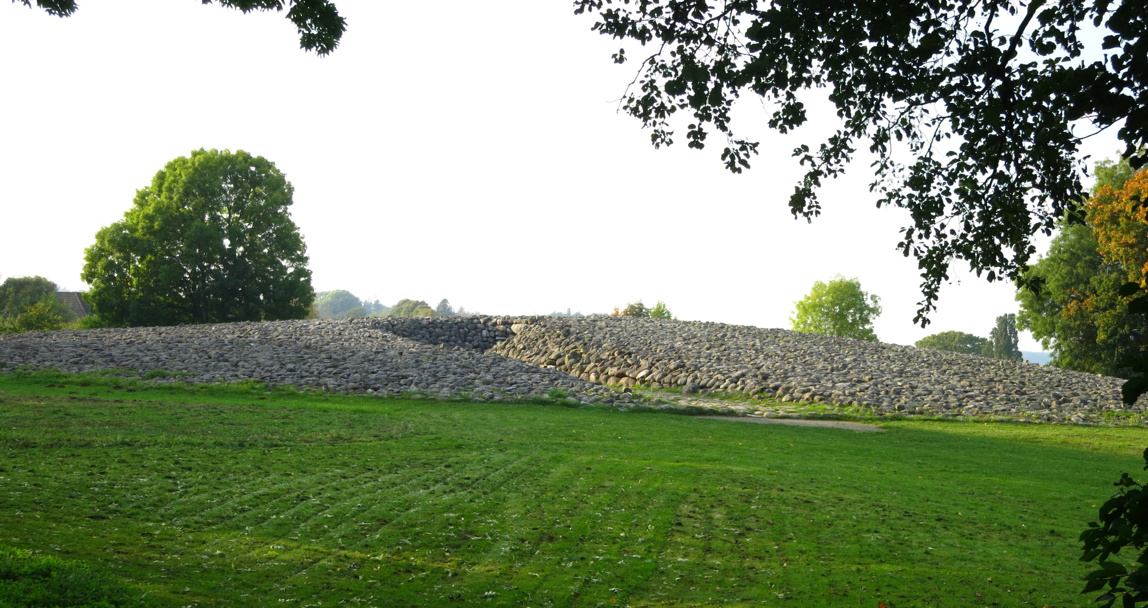
Anundshög Stone Ship
Västerås, Västmanlands län, Sweden
Five kilometres from Vasteras, Sweden's largest burial mound rises nine metres above a ridge lined with stone ships, runestones, and hundreds of Iron Age graves....
Askeberga Stone Ship
Tidan, Västra Götalands län, Sweden
Near the village of Tidan in Vastergotland, twenty-four boulders weighing up to thirty tonnes each stand arranged in an oval formation fifty-five metres long....
Ekornavallen
Falköpings kommun, Västra Götalands län, Sweden
In the pastoral landscape between Falköping and Varnhem, a single burial ground holds monuments spanning four millennia....
Greby grave field
Grebbestad, Västra Götalands län, Sweden
On a coastal hillside north of Grebbestad, more than two hundred Iron Age graves spread across the Bohuslan landscape, their burial mounds crowned by standing stones that...

Hågahögen
Uppsala, Uppsala län, Sweden
A massive earthen mound fifty metres across and three thousand years old stands in a quiet valley west of Uppsala....

Havängsdösen Dolmen
Simrishamns kommun, Skåne län, Sweden
Havangsdosen stands on the wind-swept Osterlen steppe above the Baltic Sea, a 5,500-year-old dolmen whose chamber opening faces the sunrise on the spring and autumn...

Inglinge hög
Ingelstad, Kronobergs län, Sweden
Inglinge hog dominates its Smaland landscape: a burial mound thirty-seven meters across and six meters high, crowned by a standing stone and an ornate stone sphere known...

Jättakullen Hällkista Dolmen
Vårgårda kommun, Västra Götalands län, Sweden
Jattakullen rises from a hilltop between the Nossan river and the plains of Vastergotland, its fourteen-meter stone cist making it the largest hallkista in the entire...

Luttra passage grave
Falköpings kommun, Västra Götalands län, Sweden
The Luttra passage grave sits in the Falbygden landscape of Vastergotland, where roughly two-thirds of all Sweden's passage graves are concentrated within a...
Nämforsen
Ådals-Liden District, Västernorrlands län, Sweden
Namforsen holds one of northern Europe's largest concentrations of prehistoric rock art: more than 2,500 individual carvings created over roughly three thousand years on...
Rösaring
Upplands-Bro kommun, Stockholms län, Sweden
On a gravel ridge overlooking Lake Malaren, a 540-meter ceremonial road runs almost exactly north to south, engineered so that midwinter solstice sunlight at noon creates...
Skegriedösen
Kurland, Skåne län, Sweden
Skegriedosen stands in a Skane meadow surrounded by seventeen standing stones, a peaked capstone sheltering a chamber once designed for a single seated burial....
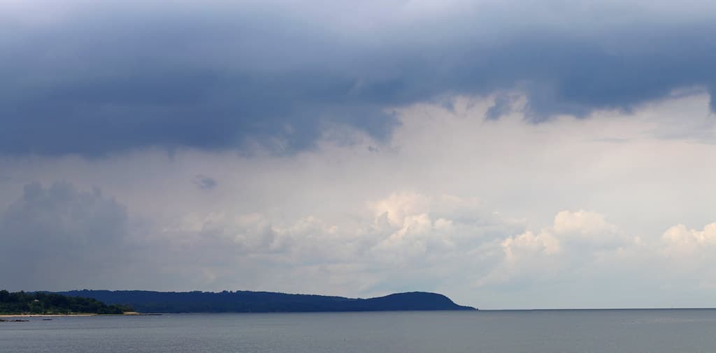
Stenshuvud's National Park
Simrishamns kommun, Skåne län, Sweden
Stenshuvud rises ninety-seven meters from the flat Skane coastline, a rocky promontory visible from great distances over land and sea....

Styrdalen Valla Dolmen
Kållekärr, Västra Götalands län, Sweden
The Valla Dos rises from a low hill on the island of Tjorn like a mushroom carved from granite, its capstone balanced on supporting stones for five millennia....
The King's Grave (Kungagraven)
Kivik, Skåne län, Sweden
The King's Grave at Kivik is singular. Beneath a cairn seventy-five meters across, a stone cist bears rock carvings depicting solar crosses, chariots, processional...

The rock carvings of Tanum
Sotenäs kommun, Västra Götalands län, Sweden
Scattered across the Swedish landscape of Tanum are over 600 rock panels bearing tens of thousands of images carved between 1700 and 500 BCE....

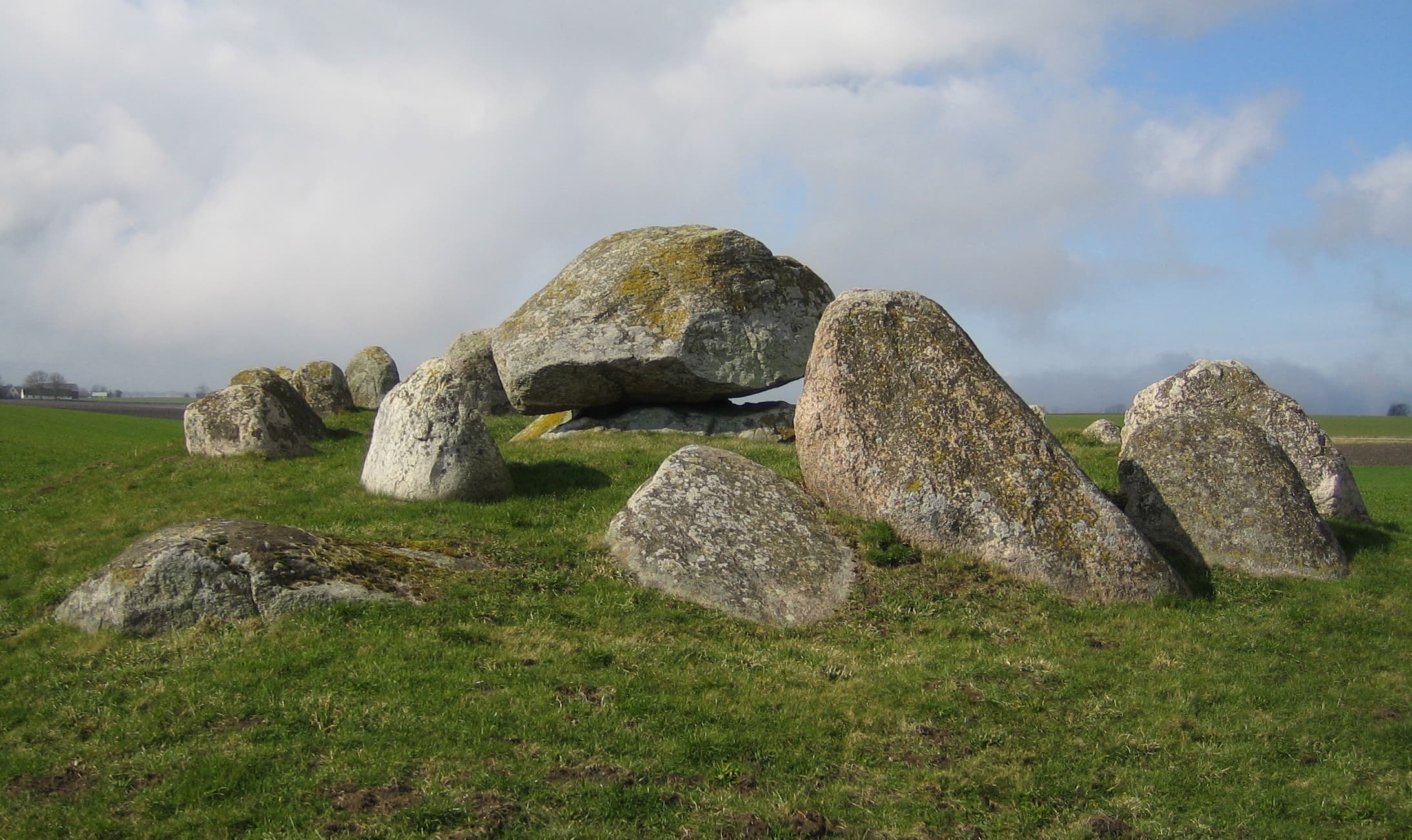
Trollasten Dos Dolmen
Köpingebro, Skåne län, Sweden
The Trollasten dolmen rises from a farmer's field near Ystad in southern Sweden, a single capstone balanced on six uprights since roughly 3300 BCE....

Vadstena Abbey
Vadstena, Östergötlands län, Sweden
On the shores of Lake Vattern in central Sweden, Vadstena Abbey holds the relics and legacy of Saint Birgitta, one of Europe's most influential mystics and a patron saint...
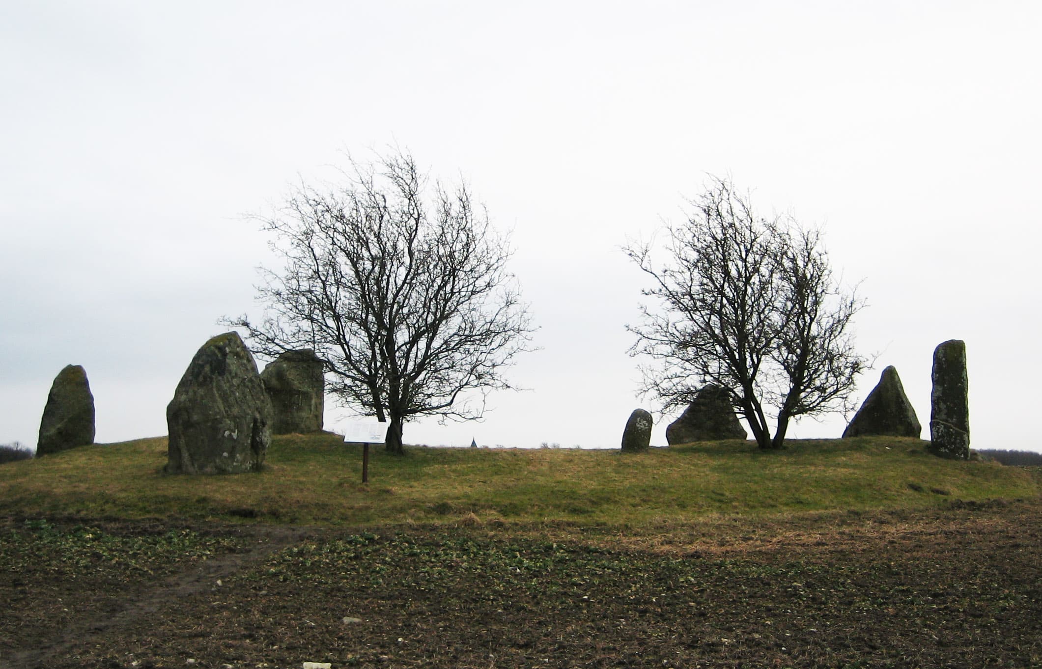
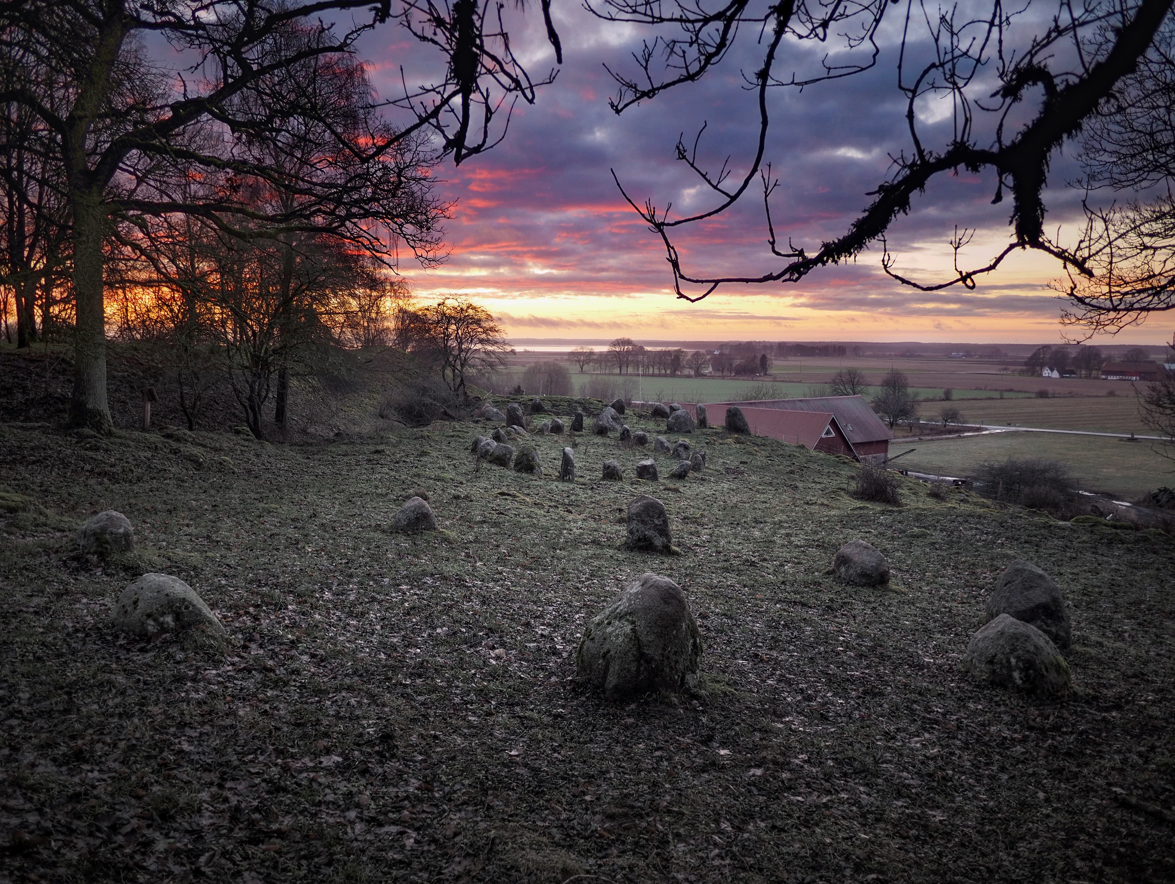
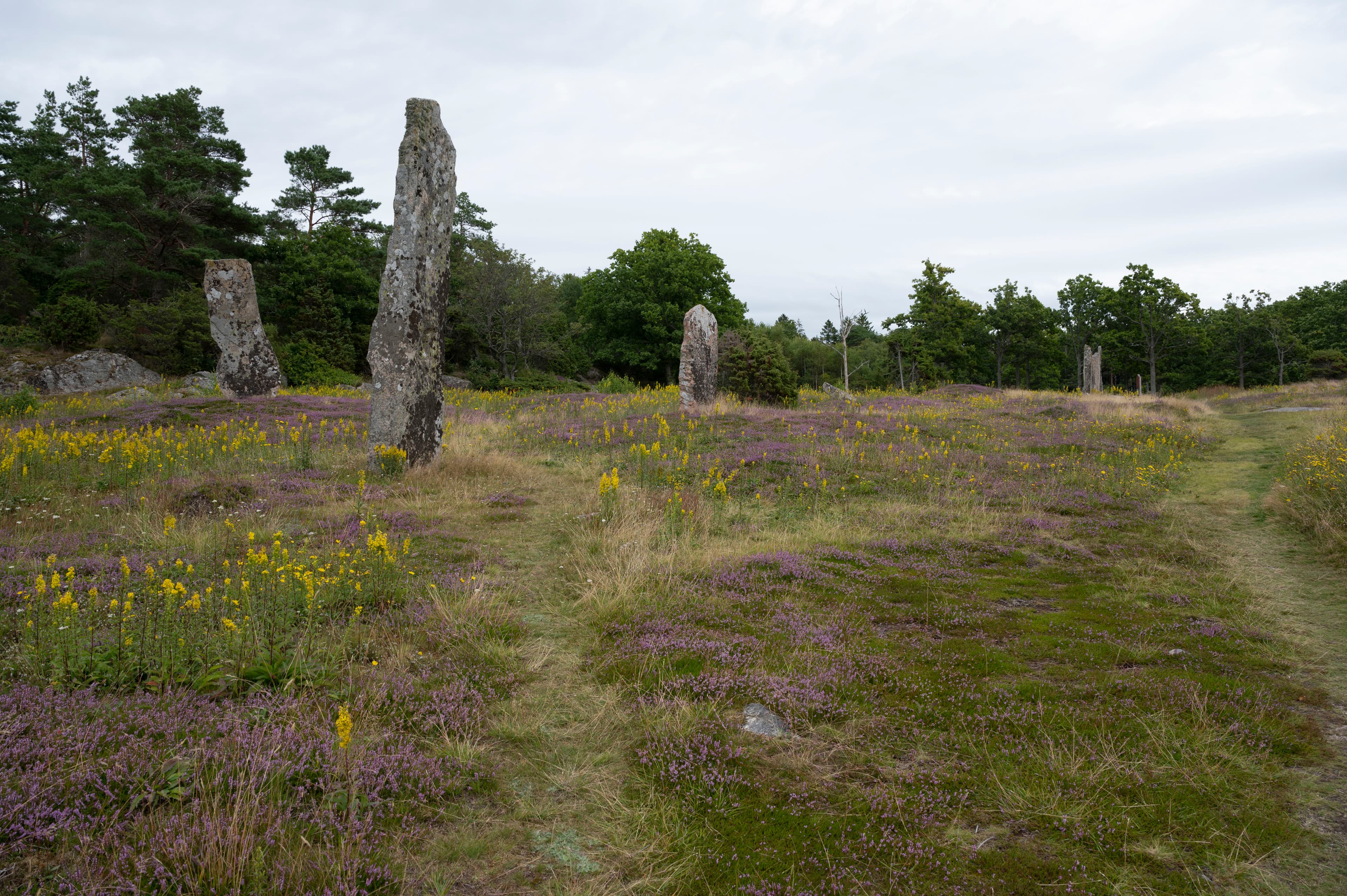
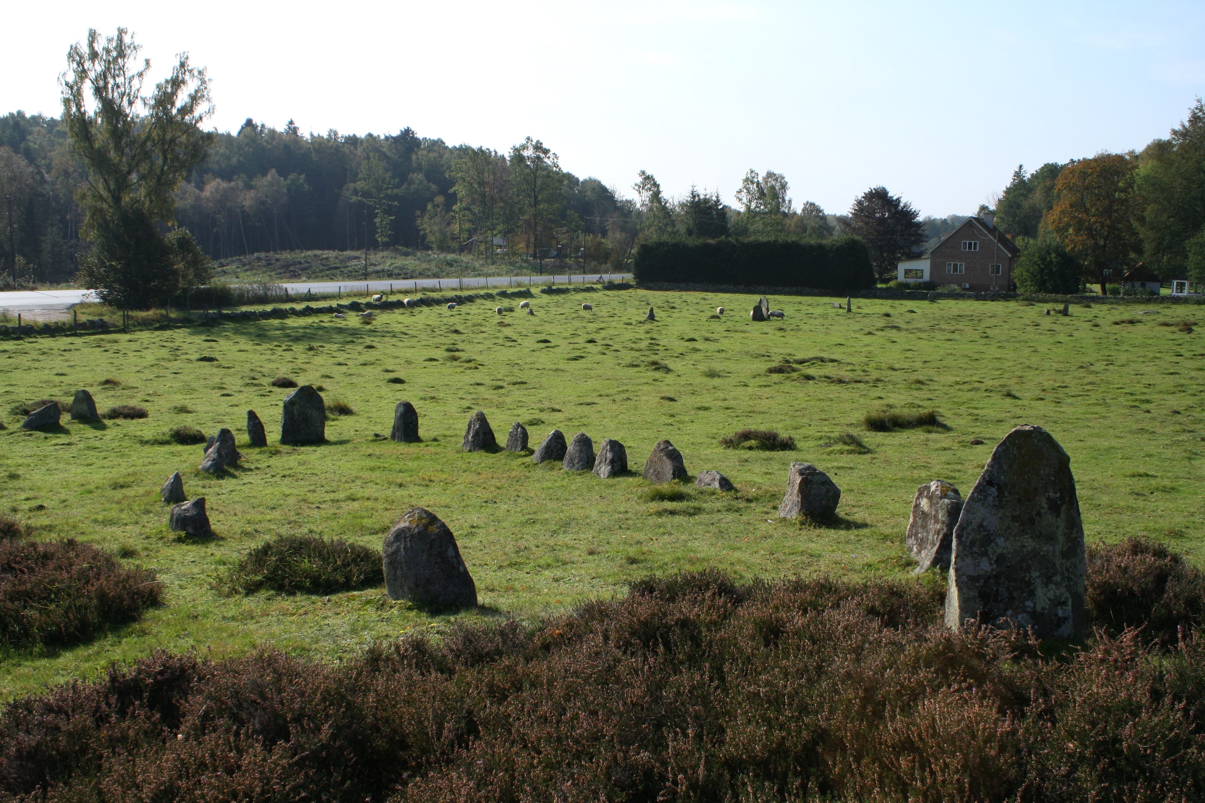
Västra Strö Stone Circle
Eslövs kommun, Skåne län, Sweden
On a low mound in the flat agricultural plain northwest of Eslov, seven stones form a circle erected by a Viking Age farmer named Fader to honor his dead brother and...
Vätteryd grave field
Tjörnarp, Skåne län, Sweden
Skane's largest Iron Age grave field spreads across open heathland between Tjornarp and Sosdala. Fifteen stone ships point toward unseen horizons....

Vrångstads Long Dolmen
Tanums kommun, Västra Götalands län, Sweden
On a rocky hilltop near Bottna in Sweden's Tanum municipality, a twenty-three-meter-long dolmen with nine surrounding menhirs has anchored the landscape in ancestral...
Key questions
Sweden sacred-site questions
- What sacred sites can I explore in Sweden?
- Pilgrim Map lists sacred places in Sweden across living worship sites, heritage landmarks, pilgrimage destinations, and culturally significant landscapes. The current guide lists 26 sites organized by region, tradition, and site type.
- Which traditions are represented in Sweden?
- The most represented traditions include Celtic and Prehistoric, Indigenous, Christianity, Nature Spirituality.
- How should I plan a sacred-site visit in Sweden?
- Start with regional clusters, compare nearby places on the map, then open individual site pages for coordinates, etiquette, and sacred context where available.
- Can I view Sweden sacred sites on a map?
- Yes. Switch to map view to compare geographic clusters, then open individual site pages for coordinates, visiting context, and related places.