Stenshuvud's National Park
A sacred mountain rising from the Baltic coast where five millennia of human presence persist
Simrishamns kommun, Skåne län, Sweden
Plan this visit
Practical context before you go
Two to four hours for a thorough visit including the summit hike and exploration of the heath landscape. A quick summit hike takes about one to one and a half hours round trip. Add time for the Naturum exhibitions.
Located just south of Kivik in Simrishamn Municipality, southeastern Skane. Accessible by car via Route 9 from Simrishamn or Kristianstad. Parking is available at the park entrance near the Naturum visitors center. Bus service runs from Simrishamn during summer. The main trail to the summit is well-marked but involves moderate climbing. No specific mobile phone signal information was available at time of writing; the park is served by standard Swedish mobile networks and the Naturum has landline contact.
Standard Swedish national park regulations apply: stay on marked trails, do not disturb flora, fauna, or archaeological remains. Dogs must be on leash. No camping or fires within park boundaries.
At a glance
- Coordinates
- 55.6562, 14.2687
- Suggested duration
- Two to four hours for a thorough visit including the summit hike and exploration of the heath landscape. A quick summit hike takes about one to one and a half hours round trip. Add time for the Naturum exhibitions.
- Access
- Located just south of Kivik in Simrishamn Municipality, southeastern Skane. Accessible by car via Route 9 from Simrishamn or Kristianstad. Parking is available at the park entrance near the Naturum visitors center. Bus service runs from Simrishamn during summer. The main trail to the summit is well-marked but involves moderate climbing. No specific mobile phone signal information was available at time of writing; the park is served by standard Swedish mobile networks and the Naturum has landline contact.
Pilgrim tips
- Sturdy hiking shoes with grip are recommended for the summit trail, which involves uneven terrain and can be slippery. Weather-appropriate layers for the exposed hilltop, where wind and temperature differ significantly from the sheltered forest below.
- Photography is encouraged throughout the national park. The summit panorama, fortress walls in low light, and orchid displays in the meadows are particularly compelling subjects.
- Stay on marked trails to protect both the archaeological remains and the fragile plant communities. The summit path involves moderate climbing and can be slippery in wet conditions. Do not disturb the stone walls, burial mounds, or stone chamber grave. Dogs must be kept on leash throughout the national park.
Overview
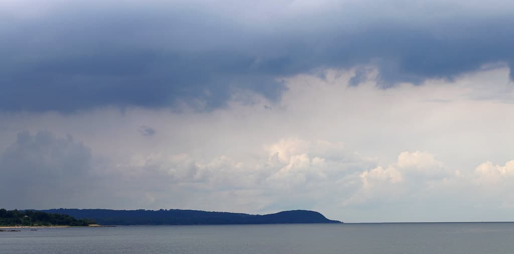
Stenshuvud rises ninety-seven meters from the flat Skane coastline, a rocky promontory visible from great distances over land and sea. For more than five thousand years, communities have buried their dead here, built fortifications on its summit, and told stories of the giant who gave the mountain its name. Today a national park protects its extraordinary biodiversity and layered human heritage.
The flatness of Skane makes Stenshuvud conspicuous. Ninety-seven meters is not a great height, but when the surrounding landscape barely breaks ten, this rocky promontory commands attention the way a standing figure commands an empty room.
People have responded to that command for a very long time. Stone Age communities chose the mountain's flanks for their dead, constructing a stone chamber grave in the heath landscape to the south. During the Migration Period, around 400 to 550 CE, someone built a fortress at the summit, enclosing it with stone walls where the cliff face did not already provide defense. Burial mounds and stone settings dot the plateau between the fortress and the village below, marking the dead of multiple eras.
The mountain accumulates meaning the way it accumulates species. Over six hundred plant varieties grow within the national park boundaries, including a dozen orchid genera, an extraordinary concentration for so small an area. Ancient hornbeam and oak forests cloak the lower slopes, opening to wind-scoured heath and exposed rock at the summit. The diversity is not incidental to the mountain's sacred character. Places where life concentrates with unusual intensity have long drawn human attention.
According to local folklore, the mountain is named for a giant called Sten who lived in a cave on its hillside. Whether the name means Stone Head or Sten's Head depends on the source consulted, and both feel appropriate. The mountain has the quality of a head lifted above the landscape, watching. Those who climb to its summit and look out over the Baltic understand why communities have gathered here for five thousand years. The view does not merely impress. It reorients.
Context and lineage
According to local folklore, Stenshuvud takes its name from a giant called Sten who lived in a cave on the hillside. The story belongs to the broader Scandinavian tradition of attributing dramatic landscape features to the work of giants, the jotnar of Norse mythology. Whether the name means Stone Head, referring to the rocky peak, or Sten's Head, referring to the giant, both etymologies appear in different sources, and both capture something true about the mountain's character.
The archaeological record tells a quieter story. Neolithic farming communities settled around the mountain at least five thousand years ago, constructing a stone chamber grave in the heath landscape and cultivating the surrounding fields. These communities recognized the mountain's significance long before anyone told stories about giants, responding to the geological fact of its prominence with the cultural fact of their dead.
The mountain has been used continuously, though not always for the same purposes, for over five millennia. Neolithic burial gave way to Bronze and Iron Age settlement, which gave way to Migration Period military fortification. Folklore traditions bridged the gap between active use and archaeological rediscovery. The national park, established in 1986, inaugurated a new phase of stewardship focused on preserving both the natural and cultural heritage.
The proximity of the King's Grave at Kivik, one of Scandinavia's most significant Bronze Age monuments, places Stenshuvud within a broader sacred landscape corridor along the southeastern Skane coast. The relationship between the mountain and the Bronze Age burial site raises questions about continuity of sacred landscape use that scholars continue to explore.
Neolithic farming communities
Earliest known inhabitants who built the Stone Age chamber grave and cultivated fields around the mountain
Migration Period fortress builders
Constructed the hilltop fortification controlling the surrounding coastline
Sten the Giant
Legendary figure from Swedish folklore who gave the mountain its name, said to dwell in a cave on the hillside
Naturvardsverket (Swedish Environmental Protection Agency)
Managing authority for the national park since its establishment in 1986
Why this place is sacred
What makes a place sacred often precedes any tradition that names it so. Stenshuvud was compelling to human communities long before anyone told stories about the giant in the cave.
The geology came first. The mountain is a remnant of harder rock that resisted the erosion that flattened the surrounding landscape. It rises with an abruptness that registers in the body before the mind, a sudden vertical interruption in a horizontal world. From the sea, it served as a navigational landmark for millennia, the first feature sailors recognized when approaching the southeastern Skane coast. From the land, it drew the eye and, apparently, the dead.
The Stone Age stone chamber grave on the southern heath testifies to Neolithic communities choosing this place for burial. Ancient field systems nearby confirm that people farmed here as well as died here, weaving the mountain into the fabric of daily life. The Migration Period fortress at the summit, with its stone walls enclosing the nearly oval hilltop, transformed the mountain from a place of the dead into a place of defense and power. Burial mounds on the plateau between the fortress and the lowland settlement demonstrate that the association with death continued alongside the military function.
The biodiversity deserves attention as more than a naturalist's footnote. Over six hundred plant species in a single national park, including orchids that bloom in precise succession through the summer months, suggest growing conditions of unusual richness. The mountain creates its own microclimates as altitude, exposure, and soil type vary across its slopes. Life does not merely survive here; it proliferates. In many sacred landscape traditions, such concentrations of biological energy are understood as evidence of the land's vitality.
Martin Gray's World Pilgrimage Guide identifies Stenshuvud as a sacred mountain of Sweden, and the designation feels earned rather than imposed. The mountain does not need the label. It has been doing what sacred mountains do, drawing human attention, holding human dead, anchoring human meaning, for longer than any living tradition can remember.
The mountain's earliest documented human use was funerary: the Stone Age stone chamber grave dates to approximately 3000 BCE or earlier. The ancient field systems surrounding the mountain indicate Neolithic farming settlement, suggesting that Stenshuvud anchored a community for whom the mountain was simultaneously home, workplace, and burial ground. The subsequent Migration Period fortress served military and possibly ceremonial functions at the summit.
From Neolithic burial ground to Iron Age fortress to folklore landmark to national park, Stenshuvud has accumulated layers of human significance without losing its fundamental character. Each era has responded to the same geological fact: this mountain rises where nothing else does, and the rising draws attention.
The national park designation in 1986, inaugurated by the Swedish royal couple, represents the latest chapter. Where Neolithic communities honored their dead and Iron Age warriors defended territory, contemporary society honors the landscape itself, protecting its biodiversity and archaeological remains for future generations. The Naturum visitors center provides interpretation, but the mountain's power needs no explanation. Visitors who climb to the summit discover this for themselves.
Traditions and practice
Neolithic communities conducted burial ceremonies at the stone chamber grave, likely involving the placement of the dead with grave goods and the construction or reopening of the stone chamber. During the Migration Period, the hilltop fortress served military and possibly ceremonial functions. Oral traditions involving the giant Sten and associated troll legends were transmitted through generations of local storytelling.
The Riksantikvarieambetet organizes guided tours to the hillfort on Archaeology Day, offering visitors expert interpretation of the fortress remains. The Naturum visitors center provides daily guided nature walks during summer and Sunday walks in spring and autumn. These programs combine natural history with archaeological context, reflecting the inseparability of Stenshuvud's natural and cultural significance.
Walk the summit trail slowly, pausing where the forest opens to views of the coast. At the fortress walls, place your hand near the stone without touching and notice the scale of the construction. Someone carried and placed each of these stones fifteen hundred years ago to defend the ground where you are standing.
At the summit, face east and let the wind arrive. The Baltic horizon has been the same for all the communities who gathered here. Allow the view to do its work without narration or analysis.
In spring or early summer, spend time in the meadows below the summit where the orchids bloom. The concentration of life here, over six hundred plant species in so small an area, is itself a form of sacred abundance. Count how many different flowers you can find within a ten-meter radius. The number will likely exceed your expectation.
Return at a different time of day or season. Stenshuvud in morning mist is a different mountain than Stenshuvud in afternoon sun. The fortress walls at sunset cast shadows that make the ancient construction suddenly legible.
Neolithic Burial Tradition
HistoricalA Stone Age stone chamber grave in the heath landscape south of the mountain testifies to Neolithic communities choosing this prominent landmark for their dead approximately five thousand years ago. The presence of ancient field systems nearby indicates sustained settlement and agricultural activity alongside the mortuary function.
Construction of stone-built burial chambers, likely with the placement of grave goods. The choice of location near a dominant mountain suggests the landscape's prominence held ritual significance for the builders. The chamber grave represents one of the earliest expressions of monumental architecture in this part of Skane.
Migration Period Fortification
HistoricalThe hilltop fortress, with its stone walls on the west and south sides and natural cliff defenses facing the sea, dates to approximately 400-550 CE. The fortress controlled the surrounding coastline and likely served as a center of local power during a turbulent period of Scandinavian history. Burial mounds on the plateau between the fortress and the lowland settlement demonstrate that the association between the mountain and death continued alongside the military function.
Military defense and territorial control from the fortified summit. Burial of prominent individuals in cairns and stone settings on the mountain plateau. The fortress may have served ceremonial or assembly functions in addition to military defense.
National Park Conservation
ActiveStenshuvud has been protected as a Swedish national park since 1986, managed by the Naturvardsverket. The park encompasses 390 hectares of extraordinary biodiversity, including over 600 plant species, as well as all the archaeological features. The Naturum visitors center provides education and interpretation.
Daily guided nature walks in summer, Sunday walks in spring and autumn, and periodic archaeological tours of the hillfort organized by the Riksantikvarieambetet on Archaeology Day. Trail maintenance, ecological monitoring, and public engagement programs ensure both conservation and access.
Experience and perspectives
The trail from the Naturum parking area enters the forest immediately, and the transition is abrupt. The light changes. The air changes. Ancient hornbeam and oak close overhead, their canopy filtering the coastal brightness into something greener and quieter. The ground softens underfoot. Before any archaeological remains appear, the forest itself has altered the quality of attention.
The climb is moderate but sustained. As elevation increases, the forest composition shifts. Hornbeam gives way to more open woodland, then to heath and exposed rock. The stone walls of the Migration Period fortress emerge from the vegetation without signage or fanfare, rough dry-stone constructions that blend into the hillside until the eye learns to distinguish human work from natural outcrop. The walls enclosed an area defended by cliff faces on the sides facing the sea, creating a stronghold that controlled the surrounding coastline.
Burial mounds appear on the plateau, round stone cairns and more subtle stone settings that require careful looking to distinguish from natural rock. These are the graves of people who lived in the shadow of the fortress, their dead placed on the mountain's shoulder as earlier communities had placed their dead on its flanks.
The summit rewards the climb with a view that explains everything. The Baltic stretches east to the horizon. The Skane coastline curves north and south, flat and cultivated. To the north, the town of Kivik is visible, its Bronze Age King's Grave hidden among the houses. The view has not fundamentally changed in five thousand years. What Stone Age communities saw from this height, minus the houses and roads, is what visitors see today: sea, coast, sky, and the irreducible fact of the mountain's prominence.
In spring and early summer, the wildflower and orchid displays on the lower meadows add a dimension of living beauty to the historical weight. The orchids bloom in succession, early purple orchids giving way to fragrant orchids and then to the rarer species that draw botanists from across Sweden. The mountain gives as well as holds.
Begin at the Naturum visitors center, where maps and exhibitions provide context for both the natural and archaeological features. Take the main summit trail and allow time for the forest passage rather than rushing through it. The shift from open parking area to closed forest canopy is itself worth attention.
At the summit, resist the urge to photograph immediately. Stand with the wind and look east over the Baltic. Consider that Iron Age warriors stood here scanning for approaching ships, and that Stone Age farmers looked out over a coastline closer to the mountain than it is today.
On the descent, detour through the heath landscape to the south where the Stone Age chamber grave lies. The contrast between the exposed summit and the sheltered heath creates a different kind of encounter, quieter and more intimate.
Sunset from the summit is particularly atmospheric, the light warming the ancient stone walls and casting long shadows across the burial mounds. Those staying overnight in the area should consider a sunset visit as a complement to a morning exploration.
Stenshuvud resists simple categorization. It is simultaneously a geological feature, an archaeological site, a nature reserve, and a place that pilgrimage researchers recognize as sacred. Each lens reveals something genuine; none captures the whole.
Archaeologists recognize Stenshuvud as a significant cultural landscape with occupation spanning from the Neolithic through the Iron Age. The hillfort dates to the Migration Period, approximately 400 to 550 CE, and controlled the surrounding coastline. The stone chamber grave and ancient field systems demonstrate earlier Neolithic farming settlement. The relationship between the hilltop fortress and the nearby King's Grave at Kivik raises questions about continuity of sacred landscape use from the Bronze Age through the Iron Age that remain subjects of ongoing research.
In Swedish folk tradition, the mountain is attributed to a giant called Sten who dwelt in a cave on its slopes. Such folklore reflects the common Scandinavian pattern of explaining dramatic landscape features through the agency of supernatural beings, particularly jotnar (giants) and trolls. While these stories postdate the archaeological remains by centuries, they represent a genuine cultural response to the mountain's commanding presence.
Martin Gray's World Pilgrimage Guide identifies Stenshuvud as one of Sweden's sacred mountains. Some visitors approach the site as a place of earth energy or natural spiritual power, drawn by its dramatic topography and layered history. The mountain's role as a navigational landmark adds to its symbolic function as a beacon or axis. The extraordinary biodiversity is sometimes interpreted as evidence of heightened earth vitality.
The exact purpose of the hillfort remains debated: whether purely military or also serving ceremonial functions cannot be determined from the surviving walls alone. The relationship between the hilltop fortress and the King's Grave at Kivik, just three kilometers to the north, raises questions about political and sacred continuity that archaeology has not yet resolved. The specific stories associated with the giant Sten's cave have not been comprehensively documented in accessible sources, and oral traditions may contain details now lost to academic record.
Visit planning
Located just south of Kivik in Simrishamn Municipality, southeastern Skane. Accessible by car via Route 9 from Simrishamn or Kristianstad. Parking is available at the park entrance near the Naturum visitors center. Bus service runs from Simrishamn during summer. The main trail to the summit is well-marked but involves moderate climbing. No specific mobile phone signal information was available at time of writing; the park is served by standard Swedish mobile networks and the Naturum has landline contact.
Kivik and the surrounding Osterlen area offer accommodations ranging from hotels to camping. Simrishamn, approximately 15 km south, provides additional options. The area is known for its summer tourism with many seasonal rentals available.
Standard Swedish national park regulations apply: stay on marked trails, do not disturb flora, fauna, or archaeological remains. Dogs must be on leash. No camping or fires within park boundaries.
Sturdy hiking shoes with grip are recommended for the summit trail, which involves uneven terrain and can be slippery. Weather-appropriate layers for the exposed hilltop, where wind and temperature differ significantly from the sheltered forest below.
Photography is encouraged throughout the national park. The summit panorama, fortress walls in low light, and orchid displays in the meadows are particularly compelling subjects.
Do not leave objects at archaeological sites or elsewhere in the park. The mountain does not require offerings, only attention.
Standard Swedish national park regulations: no camping, no fires, no motorized vehicles, no disturbing plants or animals, dogs on leash. All archaeological remains are legally protected under the Kulturmiljolagen and must not be disturbed.
Plan your visit
Address
Simrishamn N, 277 35, Sweden
Phone
Hours
Hours, fees, and access can change — verify on the official source before you travel. Practical details last checked Jun 2026.
Nearby sacred places
Sacred places within a half-day’s reach. Pilgrims often visit them together: walk one, stay for the other.


Key questions
What pilgrims usually ask
- Why is Stenshuvud's National Park considered sacred?
- Walk through ancient forests to an Iron Age fortress overlooking the Baltic. Stenshuvud holds five millennia of burial, defense, and natural wonder.
- What should I wear at Stenshuvud's National Park?
- Sturdy hiking shoes with grip are recommended for the summit trail, which involves uneven terrain and can be slippery. Weather-appropriate layers for the exposed hilltop, where wind and temperature differ significantly from the sheltered forest below.
- Can I take photos at Stenshuvud's National Park?
- Photography is encouraged throughout the national park. The summit panorama, fortress walls in low light, and orchid displays in the meadows are particularly compelling subjects.
- How long should I spend at Stenshuvud's National Park?
- Two to four hours for a thorough visit including the summit hike and exploration of the heath landscape. A quick summit hike takes about one to one and a half hours round trip. Add time for the Naturum exhibitions.
- How do you visit Stenshuvud's National Park?
- Located just south of Kivik in Simrishamn Municipality, southeastern Skane. Accessible by car via Route 9 from Simrishamn or Kristianstad. Parking is available at the park entrance near the Naturum visitors center. Bus service runs from Simrishamn during summer. The main trail to the summit is well-marked but involves moderate climbing. No specific mobile phone signal information was available at time of writing; the park is served by standard Swedish mobile networks and the Naturum has landline contact.
- What offerings are appropriate at Stenshuvud's National Park?
- Do not leave objects at archaeological sites or elsewhere in the park. The mountain does not require offerings, only attention.
- What etiquette should visitors follow at Stenshuvud's National Park?
- Standard Swedish national park regulations apply: stay on marked trails, do not disturb flora, fauna, or archaeological remains. Dogs must be on leash. No camping or fires within park boundaries.
- What is the history of Stenshuvud's National Park?
- According to local folklore, Stenshuvud takes its name from a giant called Sten who lived in a cave on the hillside. The story belongs to the broader Scandinavian tradition of attributing dramatic landscape features to the work of giants, the jotnar of Norse mythology. Whether the name means Stone Head, referring to the rocky peak, or Sten's Head, referring to the giant, both etymologies appear in different sources, and both capture something true about the mountain's character. The archaeological record tells a quieter story. Neolithic farming communities settled around the mountain at least five thousand years ago, constructing a stone chamber grave in the heath landscape and cultivating the surrounding fields. These communities recognized the mountain's significance long before anyone told stories about giants, responding to the geological fact of its prominence with the cultural fact of their dead.