Site type guide
Ancient City
Ancient City sites reveal how different traditions shape sacred space through architecture, landscape, ritual, and memory.
82 ancient city sacred sites. Use the country and tradition filters to narrow in.
Atlas summary
Ancient City sacred sites overview
Ancient City sacred sites span countries, traditions, pilgrimage routes, and sacred landscapes represented in the Pilgrim Map atlas.
Use this guide to compare major country clusters, represented traditions, UNESCO-tagged places, and the map distribution before opening individual site pages.
| Coverage | 82 ancient city sacred sites across the current atlas. |
|---|---|
| Major countries | |
| Traditions | |
| UNESCO heritage | 7 UNESCO-tagged ancient city sites appear in this browse view. |
Refine the atlas
Search within ancient city sites
All sites
82
Showing 1-48 of 82 sites in this site-type guide

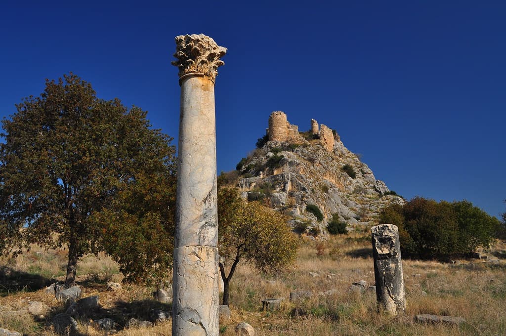
Adada
Sütçüler / Sağrak, Isparta Province, Mediterranean Region, Turkey
Adada is among the best-preserved and least-visited ancient cities of inland Turkey, its three temple facades still standing against the Taurus foothills after nearly two...

Aigai
Turkey
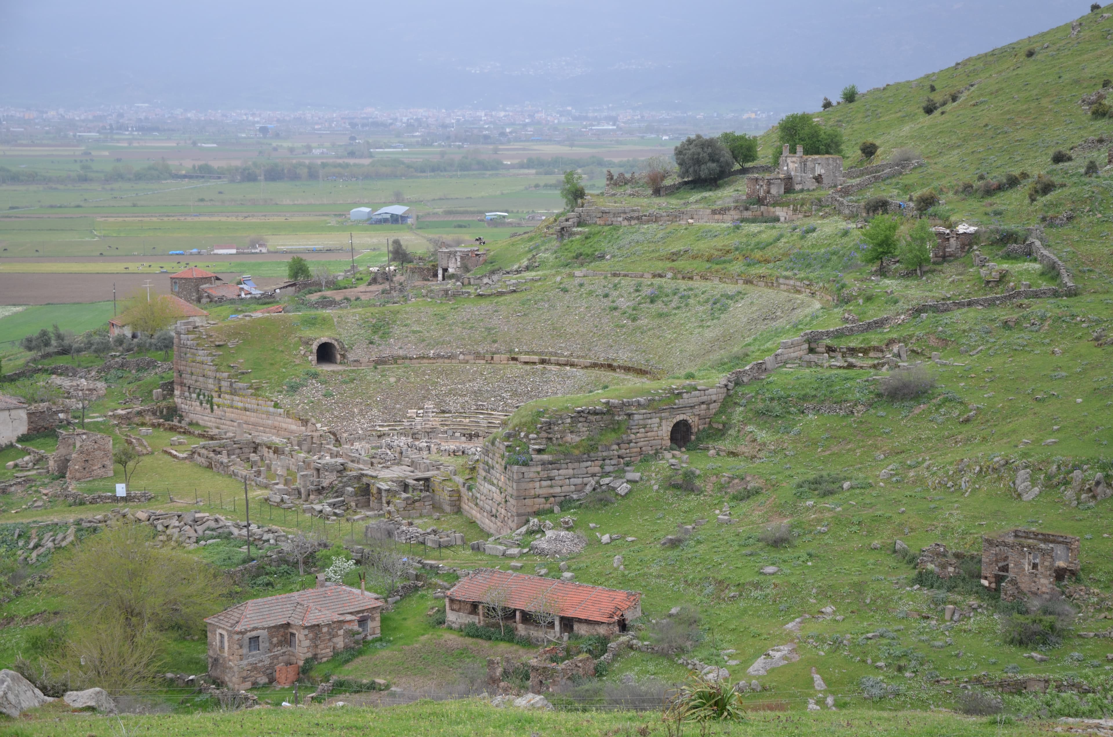
On a high shoulder of the Yunt Mountains in Manisa Province, the ancient city of Aigai held something rare: the principal oracle sanctuary of the entire Aiolis region,...
Alabanda
Aydın, Çine, Turkey
Alabanda is a quiet, largely unexcavated Carian city in the hills above the Çine plain, formally declared inviolable sacred territory by the ancient Chrysaorian League....

Aléria
Aléria / Haute-Corse / Corsica, France
Aléria is the most historically layered site in Corsica — a city founded by Phocaean Greeks around 565 BCE, contested by Etruscans and Carthaginians, conquered by Rome,...

Alexandria Troas
Ezine / Dalyan, Çanakkale, Marmara Region, Turkey
Alexandria Troas was the largest and most strategically important port on the northwest Anatolian coast — a city of four hundred thousand founded at the crossroads of...

Alinda
Aydın, Karpuzlu, Turkey
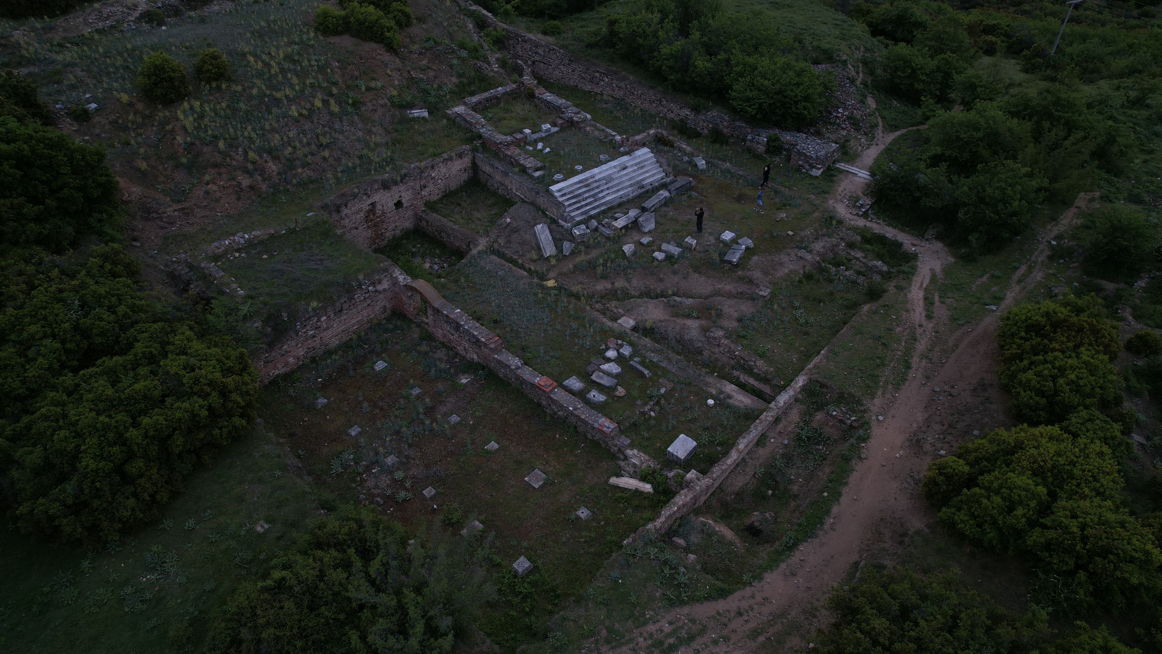
Alinda stands on a twin-acropolis hill above the town of Karpuzlu in Caria, commanding a view across one of Anatolia's most fertile plains....
Anazarbus
Kozan / Dilekkaya, Adana, Mediterranean Region, Turkey
Anazarbus rises from the Cilician plain on a rocky mesa — a city that has been fortress, oracle site, imperial metropolis, and Armenian capital in succession....
Antioch of Pisidia
Yalvaç, Isparta, Mediterranean Region, Turkey
At over a thousand meters on the Anatolian plateau, Antioch of Pisidia preserves the ruins of the Roman colonial city where Paul delivered one of his most consequential...

Antiphellos
Antalya, Kaş, Turkey
Antiphellos was a Lycian harbor city whose ancient necropolis of rock-cut tombs and sarcophagi has never been separated from daily life....

Aperlai
Antalya, Kekova region, Turkey
Aperlai was a Lycian harbor city that produced Tyrian purple — the most valuable dye of antiquity, reserved for emperors and gods — and whose fortification walls now...
Aphrodisias
Karacasu, Aydın, Turkey
Aphrodisias existed because of Aphrodite. The city took her name, lived under her protection, and created the sculptors who gave divine form to marble across the Roman...

Ariassus
Döşemealtı/Antalya, Turkey
Ariassus is a ruined Pisidian and Roman city on a steep hillside above the Döşemealtı district of Antalya, founded in the Hellenistic period and flourishing through the...

Arykanda
Antalya, Elmalı–Finike road, Turkey
Arykanda rises in five terraces against a near-vertical mountain cliff at roughly 1,000 meters in the Taurus range....

Aspendos
Serik, Antalya, Mediterranean Region, Turkey
Aspendos is the site of the most intact Roman theatre on earth — its full stage building standing two stories high as it was constructed in the 2nd–3rd century CE, still...

Assos
Turkey
A volcanic hilltop city above the Aegean, Assos holds the only Archaic Doric temple in Anatolia and the site of Aristotle's philosophical academy....

Bagan
Nyaung-U, Mandalay, Myanmar
Bagan spreads across the central plain of Myanmar: over two thousand Buddhist temples, stupas, and monasteries surviving from a time when more than ten thousand were built....

Blaundus
Uşak, Ulubey, Turkey
Blaundus was founded by veterans of Alexander the Great's army on a dramatically narrow cliff-ringed peninsula jutting into the Ulubey canyon system in western Anatolia....

Bylazora
Knezhje (Sveti Nikole), North Macedonia
Bylazora was the chief city of the ancient Paeonians, a civilization that occupied the Vardar valley before Macedonian expansion and left almost no written record....
Castabala
Kırmıtlı / Osmaniye, Mediterranean Region, Turkey
Castabala was named Hieropolis — 'holy city' — because of the goddess who dwelt within it....

Coba
Cobá, Quintana Roo, Mexico
Coba was once one of the largest Maya cities, its white roads stretching over one hundred kilometers to connect the ancient world....

Colophon
İzmir, Değirmendere area, Turkey
Colophon was one of the twelve cities of the Ionian League, founded at the end of the second millennium BCE on the hills above the Aegean coast of what is now western...
Cyaneae
Yavu / Kaş region, Antalya, Mediterranean Region, Turkey
Cyaneae stands on a hill above the village of Yavu in western Lycia, its streets lined with more sarcophagi than any other known Lycian city....

Cyme
Aliağa, İzmir, Aegean Region, Turkey
Cyme was the largest and most influential of the twelve Aeolian cities of Asia Minor — a harbor metropolis whose Apollo oracle was consulted in moments of civic crisis,...

Cyzicus
Erdek, Balıkesir, Marmara Region, Turkey
Cyzicus was once one of the most powerful and sacred cities of the ancient world — hosting the Temple of Hadrian, the largest Roman sacred structure ever built....

Elaiussa Sebaste
Ayaş / Erdemli, Mersin Province, Mediterranean Region, Turkey
Elaiussa Sebaste began on a small island in the southeastern corner of the Mediterranean's Cilician coast and grew outward until it connected to the mainland by a built...

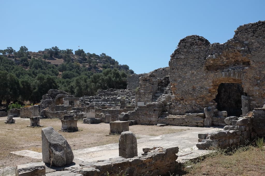
Ephesus
Selçuk, Aegean Region, Turkey
For three millennia, the hills above Ephesus have been sacred to feminine divinity—first Cybele, then Artemis whose temple was one of the Seven Wonders, and now Mary,...

Erythrai
Çeşme / Ildırı, İzmir, Aegean Region, Turkey
Erythrai stood at the intersection of Ionian, Phoenician, and proto-Christian sacred traditions: home to the Erythraean Sibyl, one of antiquity's most celebrated oracular...

Foça Castle
Foça, İzmir, Aegean Region, Turkey
Foça Castle occupies the promontory at the entrance to Foça Bay where the ancient Phocaeans built the Temple of Athena — the oldest known Ionian temple — on an even older...
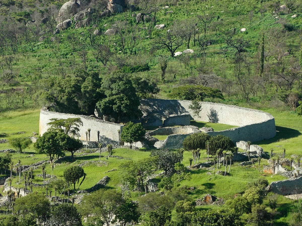
Great Zimbabwe
Nemanwa Growth Point, Masvingo Province, Zimbabwe
The largest stone structure in precolonial sub-Saharan Africa, Great Zimbabwe stands as testimony to a sophisticated Shona kingdom that flourished from the 11th to 15th...

Harran
Harran, Şanlıurfa Province, Southeastern Anatolia Region, Turkey
Harran is one of the oldest continuously inhabited sacred cities on earth — the foremost temple of the Mesopotamian moon god Sin for four millennia, the place where...

Heraclea by Latmus
Muğla / Aydın, Lake Bafa, Turkey
Heraclea by Latmus stands on the shore of Lake Bafa — a lake that was once an Aegean inlet — beneath the granite pinnacles of Beşparmak Mountain....

Heraclea Lyncestis
Bitola, North Macedonia
Founded by Philip II of Macedon around 358 BCE and abandoned after a catastrophic earthquake in 518 CE, Heraclea Lyncestis preserves nearly a millennium of sacred and...

Hierapolis-Pamukkale
Pamukkale, Denizli, Aegean Region, Turkey
Hierapolis-Pamukkale is a UNESCO World Heritage Site where three thousand years of sacred use converge: white calcium terraces formed by thermal springs, the ruins of a...
Iasos
Muğla, Kıyıkışlacık, Turkey
Iasos occupies a rocky promontory in the Gulf of Güllük that was once a true island, connected to the mainland only by a narrow causeway....
Idomenae (Isar, Marvinci)
Marvinci (Valandovo), North Macedonia
Idomenae — identified with the hilltop site of Isar above Marvinci village — was a fortified Macedonian city and later Roman settlement that commanded the Vardar valley...

Kanlıdivane
Erdemli, Mersin Province, Mediterranean Region, Turkey
At Kanlıdivane, an enormous karst sinkhole drops seventy metres into the Cilician limestone, and everything built here — a Hellenistic tower, four Byzantine basilicas, a...

Kaunos
Muğla, Dalyan, Turkey
Kaunos is an ancient Carian city whose most striking feature is a row of spectacular rock-cut tombs carved high into a vertical cliff face above the Dalyan River....

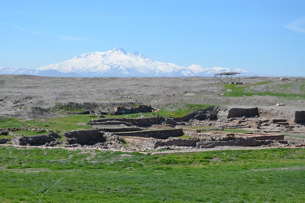
Kerkenes Dağ
Yozgat, Sorgun / Şahmuratlı, Turkey
Kerkenes Dağ is an Iron Age city that lasted barely a century before Croesus burned it to the ground and left it sealed in fire....

Kibyra
Gölhisar, Burdur, Mediterranean Region, Turkey
At the junction of four ancient Anatolian worlds — Lycia, Caria, Pisidia, and Phrygia — Kibyra built one of the most complete stadiums in the ancient world, carved...
Klazomenai
İzmir, Urla / Limantepe zone, Turkey
Klazomenai was one of the twelve cities of the Ionian League, established on the western Anatolian coast in the first millennium BCE....

Knidos
Datça Peninsula, Muğla, Aegean Region, Turkey
Knidos stands at the extreme western point of the Datça Peninsula, where the Aegean gives way to the Mediterranean....
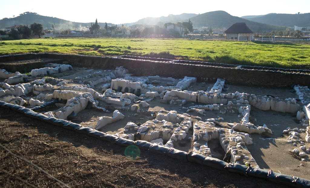
Kültepe-Kanesh
Kayseri, Kocasinan district, 20 km NE of Kayseri, Turkey
Kültepe-Kanesh is where writing came to Anatolia. Beneath an unassuming mound northeast of Kayseri lie 23,500 cuneiform tablets—the oldest written documents from this part...
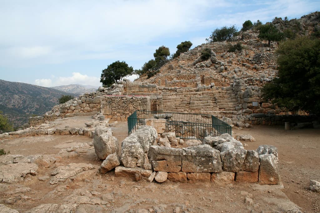
Lato
Agios Nikolaos Municipal Unit, Region of Crete, Greece
High on a mountain saddle in eastern Crete, the ruins of Lato spread across a ridge overlooking the Gulf of Mirabello....

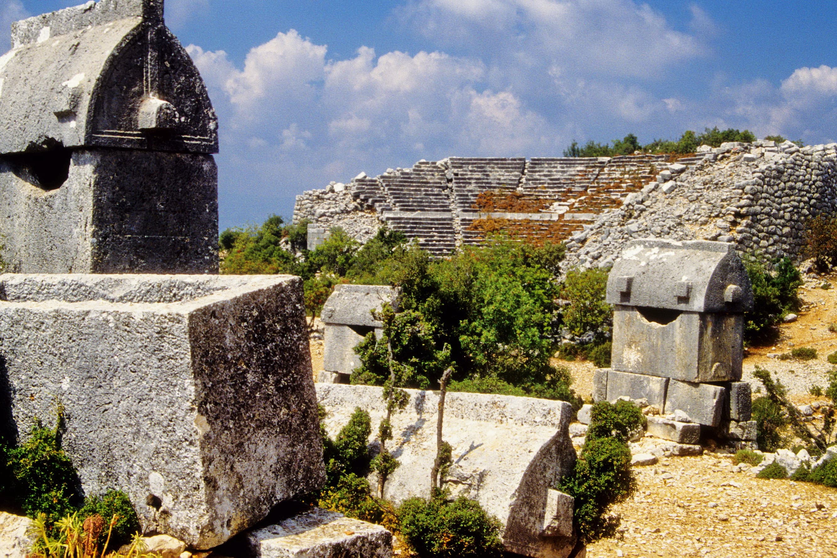
Limyra
Antalya, Finike, Turkey
Limyra was the capital of Lycia under King Pericles in the fourth century BCE — a city of more than 400 rock-cut tombs, a royal hero shrine, and a Temple of Zeus known...

Magnesia on the Maeander
Tekin / Germencik area, Aydın, Aegean Region, Turkey
Magnesia on the Maeander was the city of Artemis Leucophryene, the white-browed goddess who appeared to her people in a theophany and prompted one of the most remarkable...

Metropolis
Torbalı / Yeniköy, İzmir, Aegean Region, Turkey
Metropolis in Ionia carries an extraordinary depth of sacred history: Neolithic fertility cult, Bronze Age Hittite sacred center called Puranda, and then — uniquely among...

Miletus
Aydın, Didim / Balat, Turkey
Miletus was once the most powerful city in the Greek world—birthplace of the Milesian philosophers who first sought rational explanations for the cosmos, and the starting...
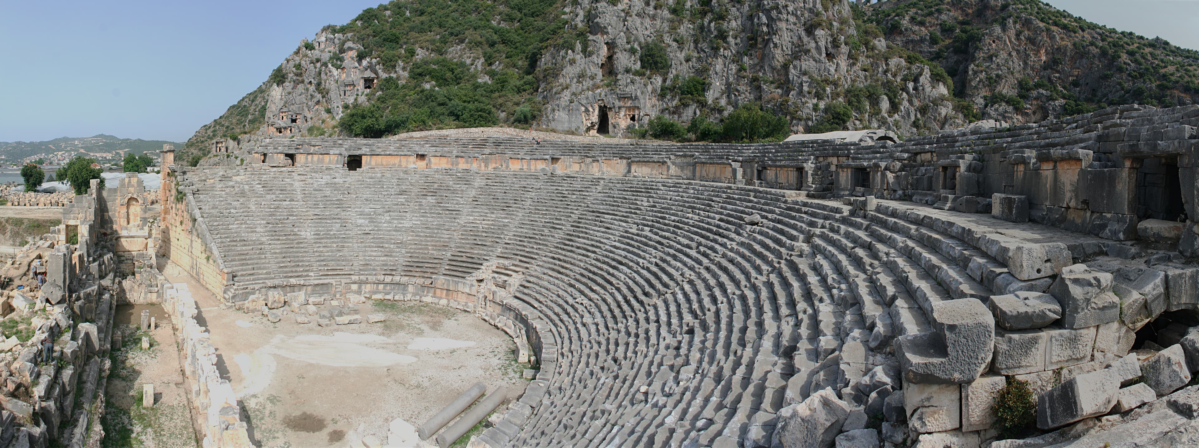
Myra
Antalya, Demre, Turkey
Myra holds two sacred registers in simultaneous view: hundreds of Lycian rock-cut tombs covering the cliff face above the Roman theatre, and the Church of Saint Nicholas...
Showing 1-48 of 82 sites
Key questions
Ancient City sacred-site questions
- What ancient city sacred sites are included?
- Ancient City sacred sites are places where this site type carries religious, ritual, cultural, or pilgrimage significance. This guide lists 82 in the current Pilgrim Map atlas.
- Where are these ancient city sites located?
- Major country clusters include Turkey, North Macedonia, France, Greece, Lebanon, Libya.
- Which traditions are represented?
- Traditions represented here include Ancient, Multi-tradition, Hellenistic Greek, Ancient Greek and Roman, Lycian, Indigenous.
- Can I view ancient city sacred sites on a map?
- Yes. Compare the country and tradition clusters, switch to map view for geography, then use site pages for practical context and related places.