Tradition guide
Maya civilization
6 sacred sites available through this shared spiritual lineage.
Countries with strong presence
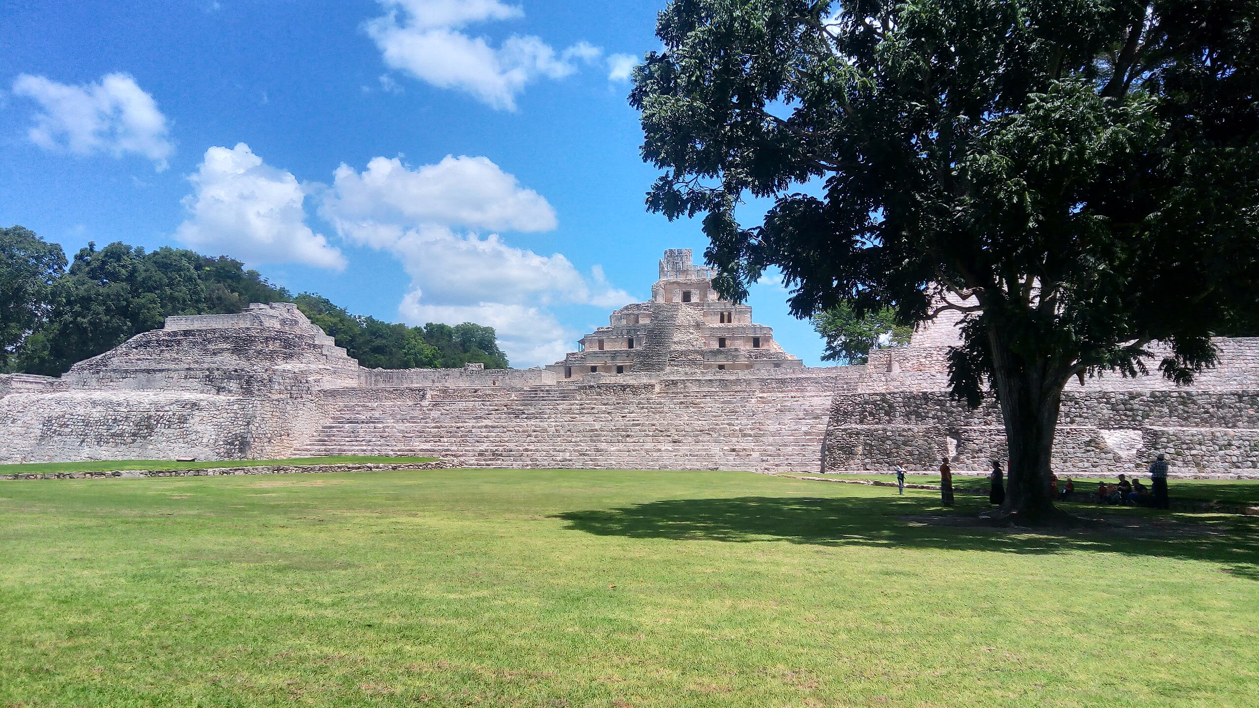
Edzna Archaeological Zone
Municipio de Campeche, Campeche, Mexico
Edzna is a archaeological site of sacred significance. Approximate coordinates: 19.59731, -90.22986. Attributes: built, cultural, archaeological, ceremonial. Tradition: Mayan. Mythological context: Mayan. Edzná ( House of the Itzaes ) is a Mayan archaeological site in the north of the Mexican state of Campeche. The site has been open to visitors since the 1970s. The most remarkable building at the site is the main temple located at the plaza. Built on a platform 40 m high, it provides a wide overview of the surroundings. Another significant building located in the plaza is the ball court, composed of two parallel structures. The top rooms of the ball court were possibly used to store images of the gods associated with the events, along with items needed for the games. Edzná was already inhabited by 400 BC, and was abandoned c. 1500 AD. During the time of occupation, a government was set up whose power was legitimized by the relationship between governors and the deities. In the Late Classic period, Edzná was part of the Calakmul polity. The city may have been inhabited by as early as 600 BC, but it took until 200 AD before it developed into a major city. The architectural style of this site shows signs of the Puuc style, although it is far from the Puuc Hills sites. The decline and eventual abandonment of Edzná remains a mystery today. Edzná was discovered in 1907, and the first organized excavations began in 1958. In 1986, coordinating agencies began to employ Guatemalan refugees in the excavation, restoration, and maintenance at Edzná. This project was funded by various international organizations. Located in Campeche, Mexico.
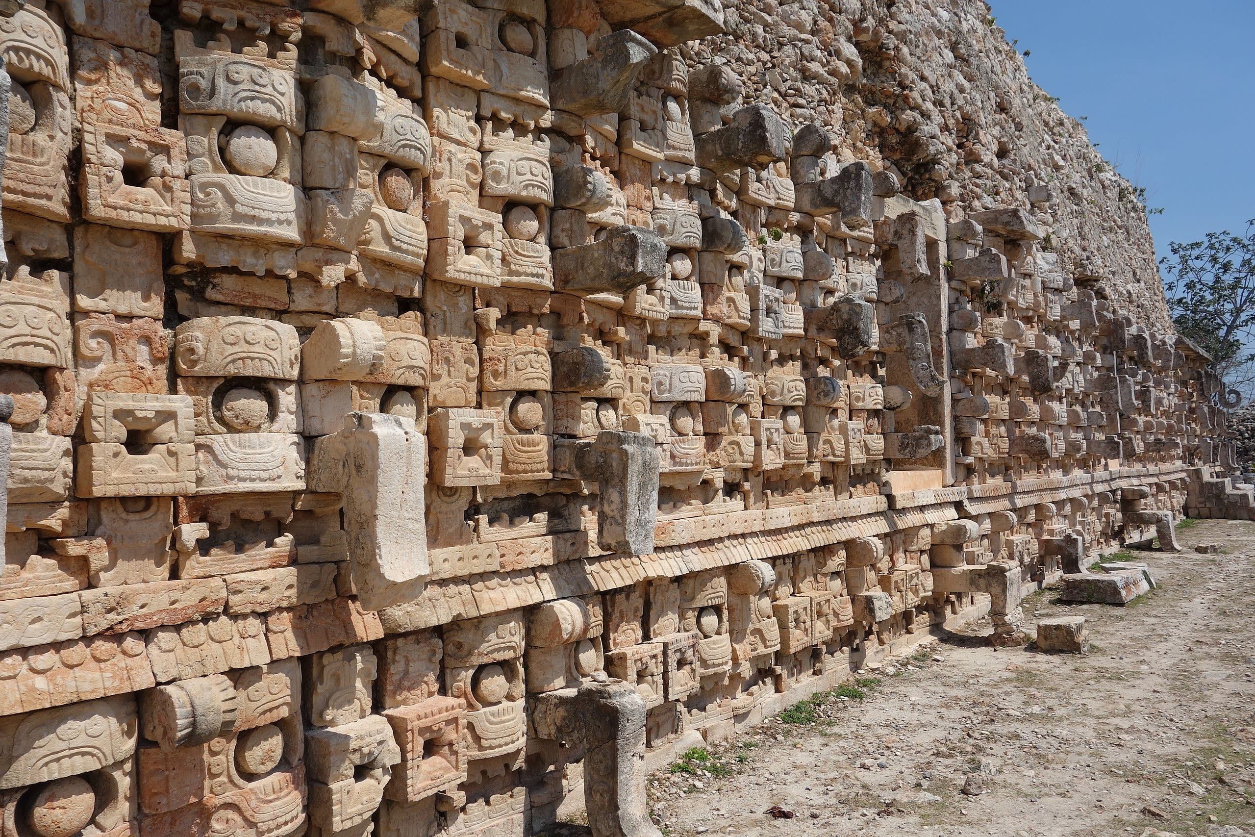
Kabah Archaeological Zone
Santa Elena, Yucatán, Mexico
Kabah is a maya civilization city of sacred significance. Approximate coordinates: 20.24996, -89.65050. Attributes: built, cultural, archaeological, ceremonial. Tradition: Maya. Kabah may refer to: Kabah (Maya site), a Maya civilization city in Yucatán, Mexico Kaaba, the holy building in Mecca, Saudi Arabia Kabah (band), a Mexican pop music group Located in Yucatán, Mexico.
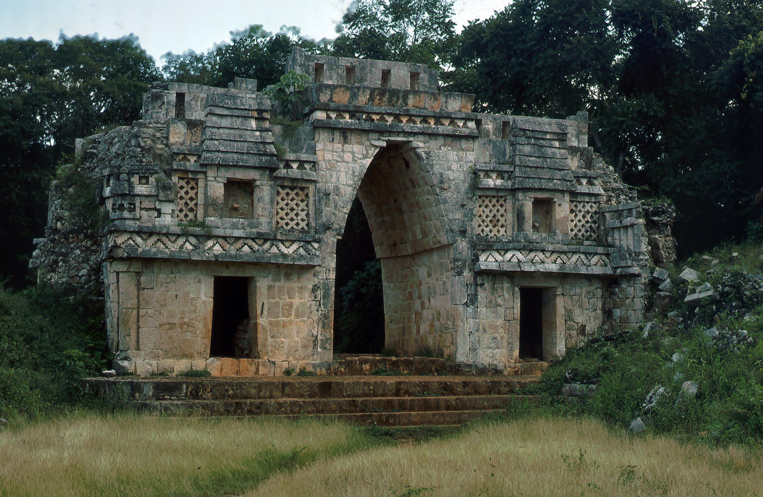
Labna
Santa Elena, Yucatán, Mexico
Labna is a mesoamerican archaeological site of sacred significance. Approximate coordinates: 20.17352, -89.57849. Attributes: built, cultural, archaeological, ceremonial. Tradition: Maya civilization. Recognized as a UNESCO World Heritage Site. Labna (or Labná in Spanish orthography) is a Mesoamerican archaeological site and ceremonial center of the pre-Columbian Maya civilization, located in the Puuc Hills region of the Yucatán Peninsula. It is situated to the south of the large Maya site of Uxmal, in the southwest of the present-day state of Yucatán, Mexico. Labna, Sayil and Kabah were incorporated with Uxmal as a UNESCO World Heritage Site in 1996. Located in Yucatán, Mexico.
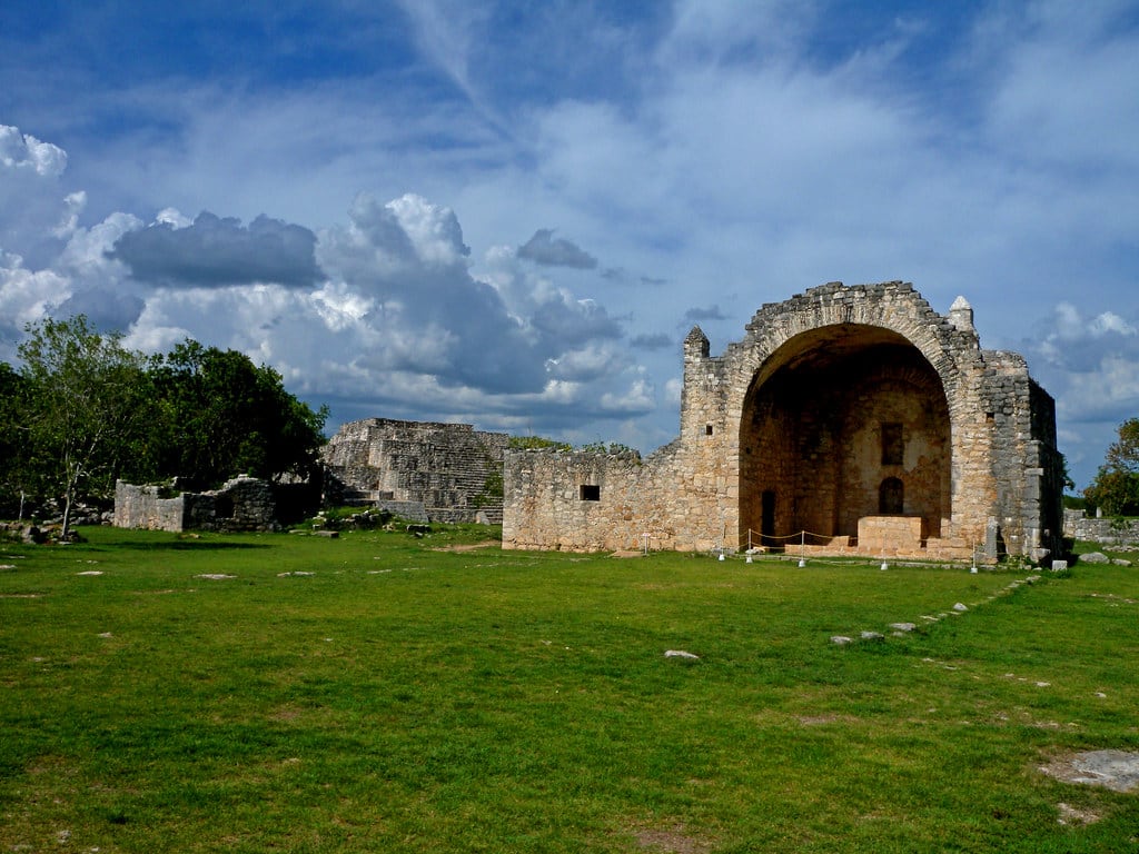
Museum of the Mayan Village at Dzibilchaltun
Mérida, Yucatán, Mexico
Dzibilchaltun is a archaeological site of sacred significance. Approximate coordinates: 21.09427, -89.59642. Attributes: built, cultural, archaeological. Tradition: Maya. Dzibilchaltún (Yucatec Maya: Ts íibil Cháaltun, [d̥z̥ʼiː˧˥biɭ tɕʰɒːl˦˥tuŋ]) is a Maya archaeological site in the Mexican state of Yucatán, approximately 10 miles (16 km) north of the state capital of Mérida. The original name for the site may have been Ch iy Chan Ti Ho. Located in Mérida, Yucatán, Mexico.
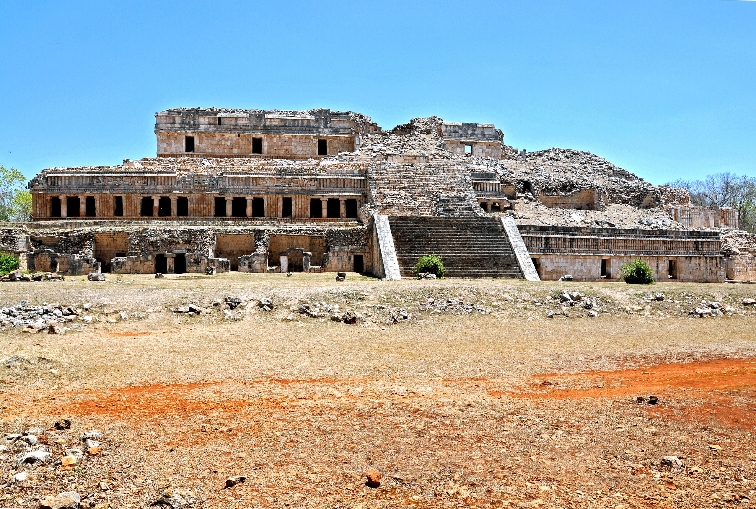
Sayil Archaeological Zone
Santa Elena, Yucatán, Mexico
Sayil is a site of sacred significance. Approximate coordinates: 20.17457, -89.65187. Sayil was a pre-Columbian city built by the Maya people of the Terminal Classic period. It is located in the Mexican state of Yucatán, in the southwest of the state, south of Uxmal. Sayil, Kabah and Labna were incorporated together with Uxmal as a UNESCO World Heritage Site in 1996. Sayil flourished principally, albeit briefly, in the Terminal Classic period. The city reached its greatest extent c. 900 and had a population of 10,000 with an additional 5,000–7,000 living in the surrounding area. A number of badly damaged monuments suggest that Sayil was governed by a local royal dynasty, with wealth among lineages based, at least in part, upon control of the best agricultural lands. The ruins of Sayil include a prominent example of monumental Puuc style architecture, the partially ruined Grand Palace of Sayil. Located in Yucatán, Mexico.
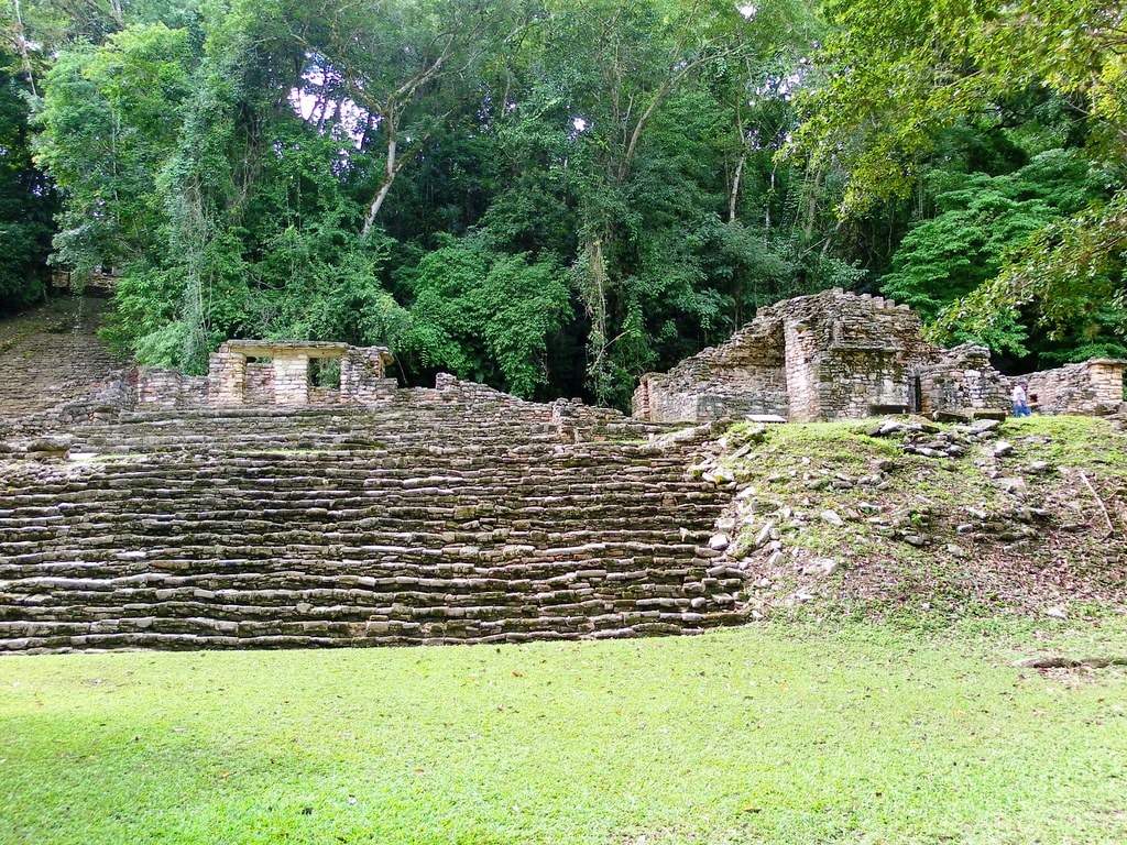
Yaxchilan Archaeological Zone
Ocosingo, Chiapas, Mexico
Yaxchilan is a site of sacred significance. Approximate coordinates: 16.90016, -90.96714. Yaxchilan (pronounced [ʝaʃtʃiˈlan]) is an ancient Maya city located on the bank of the Usumacinta River in the state of Chiapas, Mexico. In the Late Classic Period Yaxchilan was one of the most powerful Maya states along the course of the Usumacinta River, with Piedras Negras as its major rival. Architectural styles in subordinate sites in the Usumacinta region demonstrate clear differences that mark a clear boundary between the two kingdoms. Yaxchilan was a large center, important throughout the Classic era, and the dominant power of the Usumacinta River area. It dominated such smaller sites as Bonampak, and had a long rivalry with Piedras Negras and at least for a time with Tikal; it was a rival of Palenque, with which Yaxchilan warred in 654. The site is particularly known for its well-preserved sculptured stone lintels set above the doorways of the main structures. These lintels, together with the stelae erected before the major buildings, contain hieroglyphic texts describing the dynastic history of the city. Located in Chiapas, Mexico.