Yaxha
Blue-green water — a lakeside Maya city where the sun sets behind a temple over the lagoon
Understand sacred places, explore living traditions, and learn how to engage respectfully with Pilgrim Map.
Access has not been verified. Check current local guidance before planning a visit.
Flores, Petén, Guatemala
Read the sources
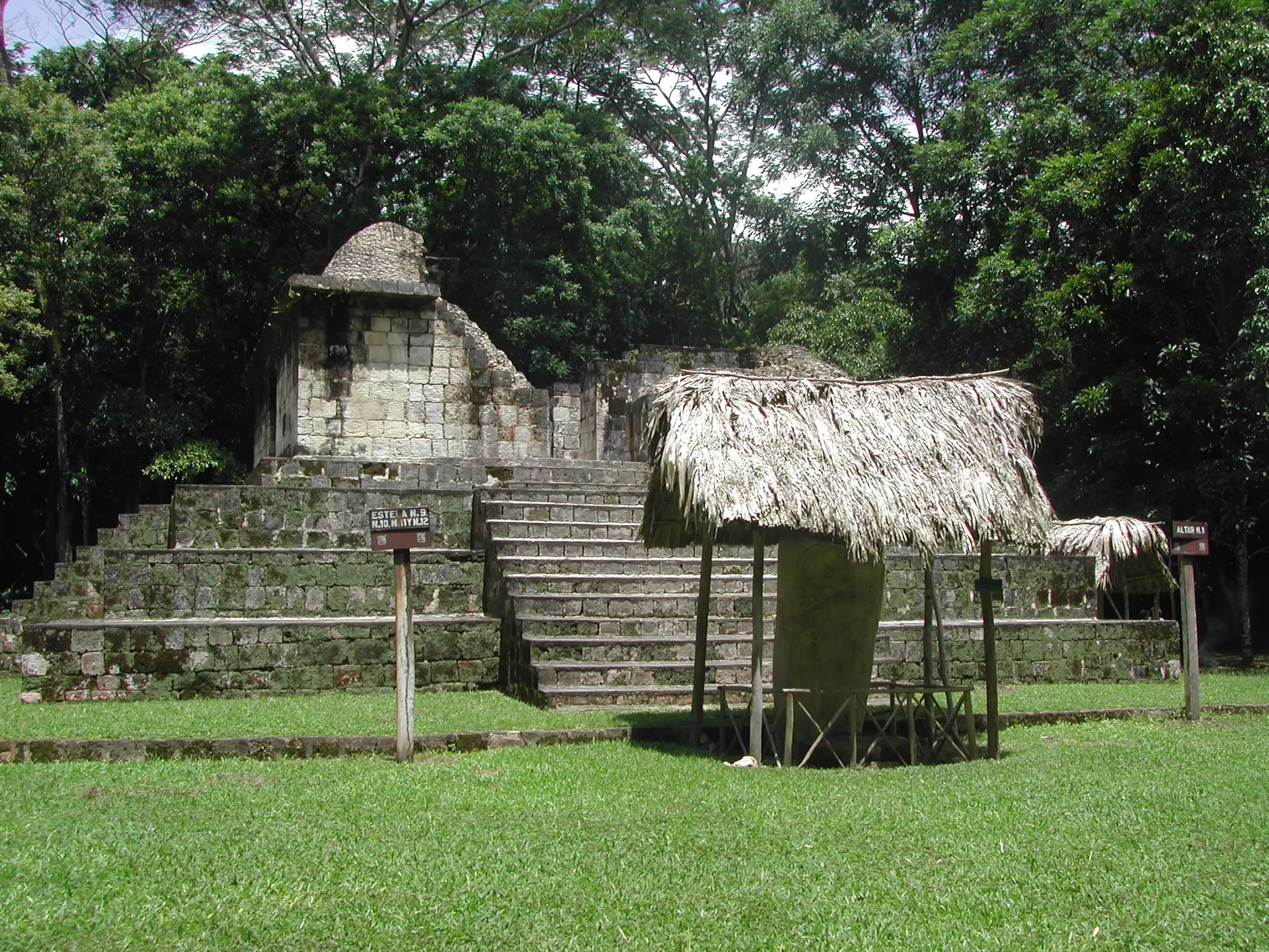
Image of Yaxha. Image source · Public Domain
Visit essentials
A quick read before you go
- Duration
- Half a day; many visitors time arrival for the late-afternoon sunset tour.
- Access
- Reached via Flores in the Petén, roughly 30 km southeast of Tikal, through a managed…
Overview
Yaxhá means the lake's 'blue-green water,' sacred in Maya cosmology. Settled by the Middle Preclassic and a major lowland center through the Classic period, it ordered cosmic time in stone: an E-Group framed the solar horizon, while a twin-pyramid complex—rare beyond Tikal—marked each twenty-year k'atun's close in the Long Count and shows ties to that powerful neighbor.
Abandoned around 1000 AD and reclaimed by forest, Yaxhá now lies within Yaxhá-Nakúm-Naranjo National Park, a protected wetland in the wider Selva Maya conservation region. Quieter than Tikal, its plazas carry howler monkeys, birdsong, and few crowds. From Temple 216, the tallest structure, late-afternoon sun falls over Lake Yaxhá; many describe the view as making deep time felt. This is not a continuously active ceremonial center but an ancestral city within a living Maya cultural landscape.
Its plazas and acropoli model sky, earth, and underworld, while lakeside dusk continues the architecture's work.
Why this place is sacred
Yaxhá's thinness is atmospheric and architectural. Set between Lakes Yaxhá and Sacnab, its temple-pyramids, plazas and astronomical complexes were laid out to order cosmic time, with stelae recording solar events and rulers mediating between humans and the gods. The combination of solitude, jungle immersion and the panoramic dusk from atop Temple 216 gives many visitors a contemplative, awe-tinged sense of the scale of the vanished city and of time itself.
It is an ancestral place rather than an active object of veneration — its power lies in setting, silence and the legible cosmology of its ruins.
A sacred-political landscape where temple-pyramids, plazas, the E-Group and the twin-pyramid complex ordered cosmic time, hosting calendar-ending commemorations, stela dedications and elite ritual.
Settled by the Middle Preclassic and a major center through the Late Preclassic and Classic periods, Yaxhá was abandoned around 1000 AD. It is now a managed archaeological national park and Ramsar-designated wetland within the broader Maya Biosphere and Selva Maya conservation region.
Experience and orientation
Visitors consistently describe Yaxhá as the calmer counterpart to Tikal: forested plazas, the calls of howler monkeys and birds, and ruins you can often have nearly to yourself. The Maler Causeway and the Blom Causeway link the city's groups; the acropoli and plazas reward unhurried walking. The twin-pyramid complex and the E-Group reveal how architecture here was tied to the solstice and equinox horizons.
The day builds toward Temple 216 — Structure 216, sometimes called the Temple of the Red Hands — the tallest at the site. Climbing it for the late afternoon, you reach a summit that looks out over Lake Yaxhá as the sun lowers. This dusk view is the experience most people return home describing: the lake catching the light, the forest darkening, and the long silence of a city that has stood empty for a thousand years.
Reached via Flores, roughly 30 km southeast of Tikal, with a managed national-park entrance, fees and rangers. Tour the plazas and acropoli, follow the causeways between groups, and time the ascent of Temple 216 for the late-afternoon sunset over the lagoon.
Context and lineage
Yaxhá was settled by the Middle Preclassic, roughly 1000–350 BC, and grew into a major center through the Late Preclassic and Classic periods before its abandonment around 1000 AD. Its name, meaning 'blue-green water', references the adjacent lake, water and color carrying sacred connotations in Maya cosmology. Its twin-pyramid complex — rare outside Tikal — was built to commemorate the close of the twenty-year k'atun within the Long Count calendar, marking the city's close ties to its dominant neighbor.
Classic and Preclassic Maya civic-ceremonial religion, set within a living regional Maya cultural landscape that continues to regard ancestral cities with reverence.
Ancient Maya of the central Petén
Builders
Teobert Maler
Early documenter (1904)
Carnegie Institution surveyors
1930s mappers
Cultural Triangle restoration project
Conservators (founded 1994)
Contemporary Maya communities of the Petén
Living cultural inheritors
Traditions and practice
In the Classic and Preclassic periods, ritual at Yaxhá included k'atun-ending commemorations, stela dedications recording rulers and astronomical events — among them Stela 13's equinox reference — and elite ritual centered on the temple-pyramids.
Yaxhá is managed as an archaeological national park. Living Maya communities of the Petén and the wider region maintain ceremonial traditions honoring ancestors, the ceiba and cosmic order, though these occur in the region rather than as formal rites at the Yaxhá ruins themselves.
Walk the causeways and acropoli slowly, reading the E-Group and twin-pyramid complex as instruments for marking cosmic time. Save the climb of Temple 216 for late afternoon and sit at the summit as the sun sets over the lake; let the silence and the scale register. Listen for the dawn and dusk forest chorus, which carries the place as much as the stone.
Classic Maya civic-ceremonial religion
HistoricalYaxhá was a major Maya city whose pyramids, plazas, E-Group and twin-pyramid complex embodied a cosmology linking sky, earth and underworld, and tracked the Long Count calendar and solar year.
Calendar-ending k'atun commemorations, stela dedications recording rulers and astronomical events such as Stela 13's equinox reference, and elite ritual centered on the temple-pyramids.
Contemporary Maya spirituality (regional)
ActiveLiving Maya communities of the Petén and wider region maintain ceremonial traditions honoring ancestors, the ceiba and cosmic order; ancestral cities like Yaxhá hold heritage and spiritual resonance.
Fire ceremonies, offerings and observances led by Maya spiritual guides, not formally institutionalized at the Yaxhá ruins themselves.
Perspectives and open questions
Yaxhá is read as a documented Classic Maya city, as part of a living Maya cosmological landscape, and as a famously atmospheric jungle ruin.
Scholarly perspective
Yaxhá was a major Preclassic-through-Classic Maya city, ranked in some popular framings among the largest lowland centers after Tikal and El Mirador. Its twin-pyramid complex and E-Group indicate strong political and ritual ties to Tikal and a sophisticated calendrical and astronomical practice. Peak-population and city-extent figures vary widely in popular sources and should be treated as approximate.
Living and traditional perspectives
Contemporary Maya regard ancestral cities as part of a living cosmological landscape connecting sky, earth and underworld, symbolized by the sacred ceiba, the yaxche'.
Alternative interpretations
Popular and esoteric accounts emphasize the atmosphere of the jungle ruins and the astronomical precision of Maya architecture.
Open questions
The precise dynastic history of Yaxhá, and the reasons for the regional Maya collapse and the city's abandonment around 1000 AD, remain incompletely understood.
Plan your visit
Access and arrival
Reached via Flores in the Petén, roughly 30 km southeast of Tikal, through a managed national-park entrance with fees and rangers.
Respectful visit
Practical, modest clothing with sturdy footwear and sun protection for jungle terrain and temple climbs.
Permitted; respect any signed restrictions and avoid disturbing wildlife.
No formal offering tradition for visitors; do not leave litter or disturb structures or any informal offerings.
Stay on designated paths and only climb temples where permitted; protected national-park rules on flora, fauna and artifacts apply.
There is no formal offering tradition for visitors at the ruins; do not leave litter or disturb structures or any informal offerings you may find. Stay on designated paths and climb only where permitted. Protected national-park rules on flora, fauna and artifacts apply.
Current practical details
Address
Laguna Yaxjá, Guatemala
Phone
Hours
Hours, fees, and access can change — verify on the official source before you travel. Practical details last checked Jun 2026.
Location
Map loads as you approach this section.
Pilgrim reflections
A portrait of encounter, not a score
Pilgrims describe what they felt, how present they could become, and whether the place would shape a journey. There are no stars and no ranking of traditions.
No reviewed reflections yet
The first pilgrims can help describe the character of being here.
Share a reflection
Available after an account-backed “Been there.” Every reflection is reviewed before publication.
Nearby sacred places
Explore other sacred places in the region. Proximity does not establish access or travel time; check each place’s guidance.



References
Sources consulted for this page. Source categories describe the publication, not a guarantee that every claim is verified. Traditional accounts and outside interpretations may differ.
- 01Yaxha — Wikipedia — Wikipedia contributorsacademicConfirms location on north shore of Lake Yaxha, ~1700 structures, Preclassic origins, twin-pyramid complex (Plaza A, 8th c. AD), E-Group astronomical commemoration, Stela 13 equinox text, Maler 1904 report, Carnegie 1930s mapping.
- 02Cultural Triangle Yaxha-Nakum-Naranjo National Park — Wikipedia — Wikipedia contributorsacademicConfirms the protected national park encompassing three Maya cities plus sub-centers; conservation/restoration project context.
- 03Twin-pyramid complex — Wikipedia — Wikipedia contributorsacademicExplains twin-pyramid complexes mark the end of the 20-year kʼatun cycle of the Maya Long Count; rare outside Tikal; Yaxha example signals political linkage to Tikal.
- 04Parque Nacional Yaxhá-Nakum-Naranjo | Ramsar Sites Information Service — Ramsar ConventionofficialOfficial wetland/protected-area designation covering the lakes and forest around Yaxha; documents ecological and conservation status.
- 05Selva Maya II conservation effort — IUCN News — IUCNofficialConfirms Yaxhá-Nakúm-Naranjo as one of 33 priority protected areas in the trinational Selva Maya conservation program.
- 06Yaxha — History and Facts | History Hit — History HitSource contextSummarizes site scale, ranking among large Maya cities, abandonment ~1000 AD.
- 07Unveiling the Mysteries of the Cultural Triangle — LAC Geo — LAC GeoSource contextDescribes the Cultural Triangle restoration project founded 1994, ~300 Guatemalan workers and scientists, restoration sequencing across Topoxte/Yaxha/Nakum/Naranjo.
- 08Yaxha Guatemala: The Magical Mayan Ruins You Need To See — Passport & PixelsSource contextVisitor detail: Temple 216 (Structure 216 / 'Temple of the Red Hands') is the tallest, famed for sunset views over the lagoon; Blom Causeway to the Maler Group; dry season Nov–Apr.
Photo gallery
3 curated photos
Share a photo
Help visitors recognize Yaxha. Every submission is reviewed before publication.