Country guide
Guatemala
Guatemala brings together sacred architecture, pilgrimage traditions, and landscapes shaped by memory, ritual, and local devotion.
8 sacred sites across 5 regions. Use the tradition and site-type filters to narrow in.
Atlas summary
Guatemala sacred sites overview
Guatemala sacred sites include living temples, shrines, churches, pilgrimage places, ruins, and sacred landscapes indexed across the Pilgrim Map atlas.
Use this guide to compare regional clusters, represented traditions, and common site types before opening individual pages for visiting context and deeper background.
| Coverage | 8 sacred sites across 5 regions. |
|---|---|
| Regional clusters | |
| Traditions | |
| Site types |
By tradition
Refine the atlas
Search within Guatemala
Showing 1-8 of 8 sites in this country guide

Abaj Takalik
El Asintal, Retalhuleu, Guatemala
Tak'alik Ab'aj is a Preclassic city in Guatemala's Pacific piedmont, inscribed by UNESCO in 2023....

El Ceibal
Sayaxché, Petén, Guatemala
Ceibal sits on forested bluffs above the Pasión River in Petén, Guatemala. It preserves the earliest known formal Maya ceremonial complex, built around 1000 BC, where...
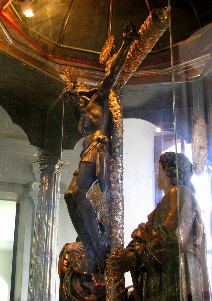
Esquipulas
Esquipulas, Chiquimula, Guatemala
The Basilica of the Black Christ stands in a green Guatemalan valley near the Honduran border, holding a small dark wooden Christ carved by Quirio Cataño in 1594....

Kaminaljuyu
Guatemala City, Guatemala Department, Guatemala
Kaminaljuyu was the greatest city of the southern Maya highlands in the Preclassic, its name meaning Hill of the Dead....

Quirigua
Finca Quirigua D.M., Izabal, Guatemala
Quiriguá, in Guatemala's lower Motagua valley, holds the tallest carved stone monuments of the ancient Maya world....

Tikal
Flores, Petén, Guatemala
In the Petén jungle, the towering pyramids of Tikal — Yax Mutal to the Maya — break through an immense canopy....

Uaxactun
Flores, Petén, Guatemala
North of Tikal in the Maya Biosphere Reserve lies Uaxactún — Siaan K'aan, 'Born in Heaven'....

Yaxha
Flores, Petén, Guatemala
Yaxhá — 'blue-green water' — was a major Classic Maya city set between two lakes in the Petén....
Key questions
Guatemala sacred-site questions
- What sacred sites can I explore in Guatemala?
- Pilgrim Map lists sacred places in Guatemala across living worship sites, heritage landmarks, pilgrimage destinations, and culturally significant landscapes. The current guide lists 8 sites organized by region, tradition, and site type.
- Which traditions are represented in Guatemala?
- The most represented traditions include Pre-Columbian, Christianity.
- How should I plan a sacred-site visit in Guatemala?
- Start with regional clusters, compare nearby places on the map, then open individual site pages for coordinates, etiquette, and sacred context where available.
- Can I view Guatemala sacred sites on a map?
- Yes. Switch to map view to compare geographic clusters, then open individual site pages for coordinates, visiting context, and related places.