Washinoki Stone Circle
Hokkaido's largest stone circle, preserved beneath the highway that nearly destroyed it
Mori, Hokkaidō, Japan

Plan this visit
Practical context before you go
Allow 1-2 hours for a thorough visit to the educational facilities and interpretation of the site.
Located in Mori Town, Kayabe District, southwestern Hokkaido, about one kilometer inland from Uchiura Bay. Access by car is recommended; public transportation options are limited in this rural area. The site is positioned on a river terrace at approximately 70 meters elevation. Part of the Jomon heritage tourism routes connecting the seventeen UNESCO component sites across Hokkaido and northern Tohoku.
Follow heritage site guidelines. The original stone circle is preserved underground, so visitor interaction focuses on educational facilities. Photography is permitted at visitor facilities. Respect the site as a burial ground, even though 4,000 years have passed.
At a glance
- Coordinates
- 42.1161, 140.5263
- Type
- Stone Circle
- Suggested duration
- Allow 1-2 hours for a thorough visit to the educational facilities and interpretation of the site.
- Access
- Located in Mori Town, Kayabe District, southwestern Hokkaido, about one kilometer inland from Uchiura Bay. Access by car is recommended; public transportation options are limited in this rural area. The site is positioned on a river terrace at approximately 70 meters elevation. Part of the Jomon heritage tourism routes connecting the seventeen UNESCO component sites across Hokkaido and northern Tohoku.
Pilgrim tips
- No specific dress code. Dress appropriately for the weather and comfortable walking.
- Photography is permitted at visitor facilities. No flash if viewing displayed artifacts. Respect any restrictions posted at the site.
- The original stone circle is not directly accessible; it remains preserved underground. Visitors should understand that the experience focuses on interpretation rather than viewing exposed ruins. This approach protects the site's integrity while allowing its story to be shared.
Overview
Beneath a highway tunnel in southwestern Hokkaido lies Japan's largest stone circle, a 4,000-year-old Jomon burial site that was nearly destroyed by modern construction. Discovered in 2003, the Washinoki Stone Circle contains 602 carefully arranged stones in a double-ring formation, with outer stones aligned on their long axes and inner stones pointing toward the center. The volcanic ash that buried it for centuries preserved evidence of sophisticated ritual architecture.
The story of Washinoki Stone Circle is one of accidental discovery and deliberate preservation. In 2003, construction crews building an expressway through southwestern Hokkaido uncovered what no one expected to find: a massive stone circle from the Late Jomon period, buried and protected for centuries beneath volcanic ash from Mount Komagatake's 1640 eruption. The discovery halted construction. The highway was rerouted underground, passing through a tunnel built specifically to preserve the sacred site above.
What lies preserved on that river terrace, about one kilometer from Uchiura Bay, is Hokkaido's largest stone circle. The Jomon people arranged 602 stones in a double-ring formation approximately 4,000 years ago. The precision of the arrangement speaks to deliberate purpose: outer ring stones were placed with their long axes aligned in the same direction, while inner ring stones point toward the center like the spokes of a wheel. This was not casual placement but sacred geometry enacted in stone.
Burial pits discovered beneath and around the stones confirm the circle's function as a ceremonial cemetery. The Jomon people interred their dead within this consecrated ground, maintaining connection between the living and the ancestors through the intermediary of carefully placed stone. Miniature clay bells found at the site suggest rituals involving sound, perhaps calling to or honoring the dead.
Washinoki represents a cultural bridge between southern Hokkaido and northern Tohoku, demonstrating shared spiritual practices across the Tsugaru Strait. The site now forms part of the UNESCO World Heritage property recognizing the sophisticated culture of Japan's prehistoric hunter-fisher-gatherers. That a highway tunnel runs beneath it speaks both to the cost of progress and to the possibility of choosing preservation when we recognize what we are about to destroy.
Context and lineage
No written records exist from the Jomon period, and no continuous oral tradition connects to this specific site. What we know comes from the stones themselves and the material culture preserved with them.
The Jomon people who built Washinoki lived as hunter-fisher-gatherers, drawing sustenance from the forests, rivers, and seas of their region. This economic pattern persisted for over 10,000 years in the Japanese archipelago, far longer than agricultural societies have existed anywhere on Earth. Within this long continuity, the Late Jomon period saw increasing investment in ceremonial architecture, including the stone circles that mark the landscape of Hokkaido and northern Tohoku.
The choice of location—a river terrace about one kilometer from Uchiura Bay—placed the burial ground in relationship to both land and sea. The bay provided marine resources; the rivers provided freshwater; the forests provided game and plants. The stone circle marked a place within this sustaining landscape where the dead would rest and the living would gather to honor them.
The 602 stones were brought from elsewhere—exactly where is not fully documented, but moving stones of this number and size required sustained community effort. The arrangement shows careful planning: the double-ring structure, the alignment of outer stones on their long axes, the pointing of inner stones toward the center. This was sacred geometry, encoding meaning that we can observe but not fully interpret.
Washinoki belongs to the Late Jomon tradition of stone circle construction, which produced similar sites across Hokkaido and northern Tohoku. The cultural connections across the Tsugaru Strait demonstrate that Jomon peoples maintained relationships across considerable distances, sharing practices for honoring the dead within stone-marked sacred ground.
No continuous tradition connects modern peoples to the specific practices at Washinoki. The Jomon population eventually gave way to new peoples and cultures—the Ainu in Hokkaido, the Yamato culture farther south. Yet patterns visible in Jomon practice—ancestor veneration, the marking of sacred ground, the creation of ceremonial landscapes—anticipate patterns in later Japanese religious traditions.
The archaeological study of Washinoki began with its discovery in 2003 and continues through its role in the UNESCO World Heritage property. The site contributes to scholarly understanding of Jomon ceremonial architecture and the spread of stone circle traditions across northern Japan.
Why this place is sacred
What makes Washinoki distinctive among Jomon sites is its exceptional preservation. When Mount Komagatake erupted in 1640, the volcanic ash that buried the stone circle became an inadvertent guardian, sealing the site against erosion, against disturbance, against the long accumulation of changes that obscure most ancient places. When archaeologists uncovered the stones in 2003, they found them essentially as the Jomon had left them 4,000 years earlier.
This preservation reveals details that other sites cannot show. The double-ring structure—an outer circle and an inner circle—appears complete and undisturbed. The orientation of individual stones demonstrates intentionality: outer stones aligned on their long axes, inner stones pointing toward the center. The Jomon who built this were not simply placing stones but encoding meaning in their arrangement, creating a sacred geometry that expressed their understanding of the relationship between the living, the dead, and the cosmos.
The burial pits beneath the stones anchor this geometry in the reality of death and remembrance. This was a cemetery, a place where the dead were interred within a specially consecrated enclosure. The stones may have marked individual graves or commemorated lineages. They may have created boundaries between the world of the living and the realm of the ancestors. Whatever their specific meaning, they transformed this terrace above the bay into a threshold between worlds.
The miniature clay bells found at the site add another dimension. Sound was part of the ritual practice here—bells ringing across the burial ground, perhaps calling the spirits, perhaps accompanying ceremonies for the dead. The silence of the site today holds the memory of that sound.
That Washinoki was discovered by highway construction adds a modern layer to its thinness. The decision to build a tunnel beneath the site rather than destroy it represents a contemporary recognition that some places hold value beyond economic calculation. The highway runs beneath; the stones remain above. Past and present share the same ground without quite touching.
Washinoki Stone Circle functioned as a communal cemetery and ceremonial center for the Late Jomon people of southern Hokkaido. The double-ring structure with its precisely oriented stones created a consecrated enclosure for the interment of the dead. The burial pits beneath and around the stones demonstrate sustained use over time—generations of the dead gathered in one sacred ground. The presence of miniature clay bells suggests that burial ceremonies included ritual sound. The site's scale—602 stones arranged with deliberate precision—indicates a community that invested significant effort in honoring their ancestors.
The stone circle was constructed approximately 4,000 years ago, during the Late Jomon period, when the people of this region lived as hunter-fisher-gatherers with sophisticated material culture and spiritual practices. For how long it remained in active use is unknown, but the number of burials suggests centuries of continuity.
In 1640, Mount Komagatake erupted catastrophically, burying the site beneath volcanic ash. This destruction became preservation: the ash layer protected the stones from disturbance for nearly four centuries.
The site remained unknown until 2003, when expressway construction exposed the stones. The discovery prompted a remarkable decision: rather than destroy the site or relocate the stones, the highway was rerouted underground. A tunnel was built specifically to preserve the stone circle in its original location.
In 2021, Washinoki was inscribed as part of the UNESCO World Heritage property 'Jomon Prehistoric Sites in Northern Japan,' joining sixteen other sites across Hokkaido and northern Tohoku that together demonstrate the cultural sophistication of Japan's prehistoric peoples.
Traditions and practice
The Jomon people of Washinoki practiced burial ceremonies within the stone circle, interring their dead in the consecrated ground marked by precisely arranged stones. The double-ring structure with oriented stones suggests ceremonial movements or processions—outer and inner, approaching the center. Miniature clay bells found at the site indicate that sound played a role in ritual practice, perhaps marking stages of ceremony or calling to the spirits of the dead.
The construction and maintenance of the stone circle was itself a form of practice, requiring sustained community effort across generations. Arranging 602 stones in deliberate patterns was not a task completed quickly; it represented ongoing commitment to honoring the ancestors and maintaining the sacred ground where they rested.
No active religious practices occur at Washinoki today. The site is managed for preservation and education as part of Japan's UNESCO World Heritage heritage. The stone circle remains underground, protected in its excavated state. Visitor facilities provide interpretation of Jomon culture and the site's remarkable story of discovery and preservation.
The broader network of Jomon UNESCO sites offers opportunities for heritage tourism, with visitors traveling among the seventeen component sites to understand the range of Jomon cultural expression.
Approach Washinoki with awareness that you are visiting a burial ground. Though 4,000 years have passed since the last interments and the stones remain underground, the site's fundamental purpose was to honor the dead. Let this knowledge shape your presence.
Take time with the interpretive materials. The story of Washinoki's preservation—the decision to tunnel beneath rather than destroy—rewards reflection. Consider what this decision cost, what it preserved, and what it says about contemporary values.
If visiting as part of broader Jomon heritage tourism, note the connections between Washinoki and other stone circles in the region. The shared practices across Hokkaido and northern Tohoku reveal a cultural network that spanned the Tsugaru Strait.
Jomon Spirituality
HistoricalWashinoki Stone Circle represents sophisticated Jomon ritual and burial practices from approximately 2000 BCE. As Hokkaido's largest stone circle, the site demonstrates cultural connections between southern Hokkaido and northern Tohoku during the Late Jomon period. The double-ring structure with 602 stones arranged in specific orientations—outer ring stones aligned on long axes, inner ring stones oriented toward the center—indicates deliberate ritual design. Burial pits found beneath and around the stones confirm its function as a sacred cemetery where the living maintained connection with ancestors. The discovery of miniature clay bells suggests ritual practices involving sound. The site forms part of the UNESCO World Heritage property recognizing the sophisticated spiritual culture of Jomon hunter-fisher-gatherers.
Burial ceremonies and ancestor veneration formed the core practices at Washinoki. The construction and maintenance of the stone circle—arranging 602 stones with precise orientations—was itself a form of practice requiring sustained community effort. Rituals may have involved the miniature clay bells found at the site, introducing sound into ceremonial proceedings. The double-ring structure suggests processional or circumambulatory movements as part of burial rites.
Experience and perspectives
The experience of Washinoki is unlike other archaeological sites. You do not walk among exposed ruins or peer into excavated trenches. The stone circle remains in the ground, preserved in the state that protected it for centuries and continues to protect it now. What you encounter instead is the story—told through educational facilities and interpretive materials—of discovery, decision, and preservation.
This approach to presenting the site invites a different kind of engagement. Rather than viewing stones as artifacts, you are invited to contemplate what those stones mean and why they were preserved at such cost. The highway runs beneath your feet through its tunnel; the burial ground lies above, undisturbed. The relationship between past and present becomes tangible in this layering of purposes.
For those interested in Jomon culture, Washinoki offers connections to the broader network of UNESCO sites across Hokkaido and northern Tohoku. The stone circle represents one expression of practices shared across this region: the use of stone to mark sacred ground, the interment of the dead within carefully constructed enclosures, the creation of ceremonial landscapes that spoke to the relationship between humans and the cosmos.
The site's location—about one kilometer inland from Uchiura Bay on a river terrace—places it in the landscape the Jomon knew. The bay, the rivers, the volcanic mountains that would eventually bury and preserve the site: these features remain, connecting the contemporary visitor to the geography that shaped Jomon life.
The story of Washinoki's preservation resonates with visitors concerned about heritage and development. That the highway was rerouted, that a tunnel was built specifically to protect the site, demonstrates that preservation is possible when the will exists. The cost was significant; the choice was made anyway.
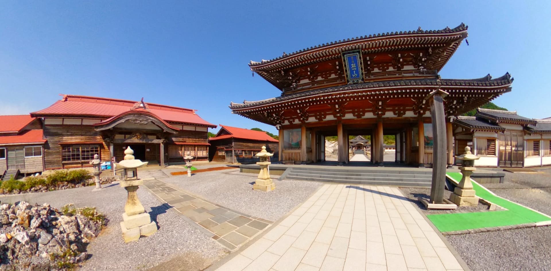
Washinoki Stone Circle is located in Mori Town, Kayabe District, southwestern Hokkaido. The site includes educational facilities with exhibits explaining the stone circle, its discovery, and the decision to preserve it beneath the highway. Begin at the visitor facilities to understand the site's significance before exploring. The original stones remain underground, preserved in their excavated state, so the experience focuses on interpretation rather than direct viewing of ruins. The site connects to other Jomon UNESCO sites in Hokkaido, and visitors often combine Washinoki with nearby sites as part of broader Jomon heritage tourism.
Understanding Washinoki Stone Circle requires recognizing what we can know from the archaeological record and what remains beyond our understanding. The stones and their arrangement are tangible; the beliefs that motivated their placement are not. Scholarly interpretation provides frameworks for understanding the site within Jomon culture, but the specific meanings encoded in the double-ring structure and oriented stones remain matters of inference rather than certainty.
Archaeologists recognize Washinoki as a significant example of Late Jomon ritual architecture, demonstrating the cultural connections between southern Hokkaido and northern Tohoku across the Tsugaru Strait. The site's exceptional preservation under volcanic ash provides data unavailable at more disturbed locations.
The double-ring structure with oriented stones—outer stones aligned on their long axes, inner stones pointing toward the center—indicates deliberate sacred geometry. This was not random placement but meaningful arrangement, though the specific meanings are not fully understood. Comparative analysis with other Jomon stone circles in the region suggests shared ceremonial practices across this cultural area.
The burial pits beneath and around the stones confirm the site's function as a communal cemetery. The scale of construction—602 stones—indicates sustained community investment in maintaining sacred ground for the dead. The miniature clay bells suggest ritual practices involving sound, though their specific use remains unclear.
UNESCO inscription in 2021 confirms the outstanding universal value of the Jomon Prehistoric Sites as evidence of the cultural sophistication of Japan's prehistoric peoples.
No continuous tradition connects to Washinoki Stone Circle. The Jomon population gradually gave way to later peoples—the Ainu in Hokkaido, the Yamato culture farther south—and the specific practices of the stone circle builders did not survive in transmitted form.
Yet patterns visible at Washinoki anticipate later Japanese religious traditions: the honoring of ancestors, the marking of sacred ground, the creation of ceremonial landscapes. These patterns suggest continuities of cultural logic even where specific traditions were not maintained.
The specific beliefs that motivated the careful stone arrangements at Washinoki remain unknown. Why were outer stones aligned on their long axes while inner stones pointed toward the center? What ceremonies occurred within the double ring? What did the miniature clay bells signify? How did the Jomon understand the relationship between the living who conducted ceremonies and the dead who rested beneath the stones?
These questions may never be answered. The Jomon left no written records, and no oral tradition has preserved their beliefs in transmittable form. The stones speak, but not in a language we can fully translate.
Visit planning
Located in Mori Town, Kayabe District, southwestern Hokkaido, about one kilometer inland from Uchiura Bay. Access by car is recommended; public transportation options are limited in this rural area. The site is positioned on a river terrace at approximately 70 meters elevation. Part of the Jomon heritage tourism routes connecting the seventeen UNESCO component sites across Hokkaido and northern Tohoku.
Accommodations are available in nearby towns and in the Hakodate area. The site is best visited as a day trip combined with exploration of other Jomon sites in southern Hokkaido.
Follow heritage site guidelines. The original stone circle is preserved underground, so visitor interaction focuses on educational facilities. Photography is permitted at visitor facilities. Respect the site as a burial ground, even though 4,000 years have passed.
No specific dress code. Dress appropriately for the weather and comfortable walking.
Photography is permitted at visitor facilities. No flash if viewing displayed artifacts. Respect any restrictions posted at the site.
Not applicable. This is an archaeological site, not an active place of worship.
The original stone circle is preserved underground and is not directly accessible to visitors. Follow all posted guidelines and stay within designated areas.
Plan your visit
Address
Washinokicho, Mori, Kayabe District, Hokkaido 049-2321, Japan
Hours, fees, and access can change — verify on the official source before you travel. Practical details last checked Jun 2026.
Nearby sacred places
Sacred places within a half-day’s reach. Pilgrims often visit them together: walk one, stay for the other.


References
Sources consulted when researching this page. Independent verification by readers is welcome.
- 01Washinoki Stone Circle - Jomon Prehistoric Sites in Northern Japan — World Heritage Jomon Prehistoric Siteshigh-reliability
- 02Washinoki Stone Circle - Northern Jomon Portal — Northern Jomon Portalhigh-reliability
- 03Jomon Prehistoric Sites in Northern Japan - UNESCO — UNESCO World Heritage Centrehigh-reliability
- 04Washinoki Stone Circle - Japan Tourism Agency — Japan Tourism Agencyhigh-reliability
- 05Washi-no-ki Stone Circle - Megalithic Portal — The Megalithic Portal
Key questions
What pilgrims usually ask
- Why is Washinoki Stone Circle considered sacred?
- Discover Washinoki Stone Circle, Hokkaido's largest Jomon burial site preserved beneath a highway tunnel. UNESCO World Heritage, 4,000-year-old sacred geometry.
- What should I wear at Washinoki Stone Circle?
- No specific dress code. Dress appropriately for the weather and comfortable walking.
- Can I take photos at Washinoki Stone Circle?
- Photography is permitted at visitor facilities. No flash if viewing displayed artifacts. Respect any restrictions posted at the site.
- How long should I spend at Washinoki Stone Circle?
- Allow 1-2 hours for a thorough visit to the educational facilities and interpretation of the site.
- How do you visit Washinoki Stone Circle?
- Located in Mori Town, Kayabe District, southwestern Hokkaido, about one kilometer inland from Uchiura Bay. Access by car is recommended; public transportation options are limited in this rural area. The site is positioned on a river terrace at approximately 70 meters elevation. Part of the Jomon heritage tourism routes connecting the seventeen UNESCO component sites across Hokkaido and northern Tohoku.
- What offerings are appropriate at Washinoki Stone Circle?
- Not applicable. This is an archaeological site, not an active place of worship.
- What etiquette should visitors follow at Washinoki Stone Circle?
- Follow heritage site guidelines. The original stone circle is preserved underground, so visitor interaction focuses on educational facilities. Photography is permitted at visitor facilities. Respect the site as a burial ground, even though 4,000 years have passed.
- What is the history of Washinoki Stone Circle?
- No written records exist from the Jomon period, and no continuous oral tradition connects to this specific site. What we know comes from the stones themselves and the material culture preserved with them. The Jomon people who built Washinoki lived as hunter-fisher-gatherers, drawing sustenance from the forests, rivers, and seas of their region. This economic pattern persisted for over 10,000 years in the Japanese archipelago, far longer than agricultural societies have existed anywhere on Earth. Within this long continuity, the Late Jomon period saw increasing investment in ceremonial architecture, including the stone circles that mark the landscape of Hokkaido and northern Tohoku. The choice of location—a river terrace about one kilometer from Uchiura Bay—placed the burial ground in relationship to both land and sea. The bay provided marine resources; the rivers provided freshwater; the forests provided game and plants. The stone circle marked a place within this sustaining landscape where the dead would rest and the living would gather to honor them. The 602 stones were brought from elsewhere—exactly where is not fully documented, but moving stones of this number and size required sustained community effort. The arrangement shows careful planning: the double-ring structure, the alignment of outer stones on their long axes, the pointing of inner stones toward the center. This was sacred geometry, encoding meaning that we can observe but not fully interpret.