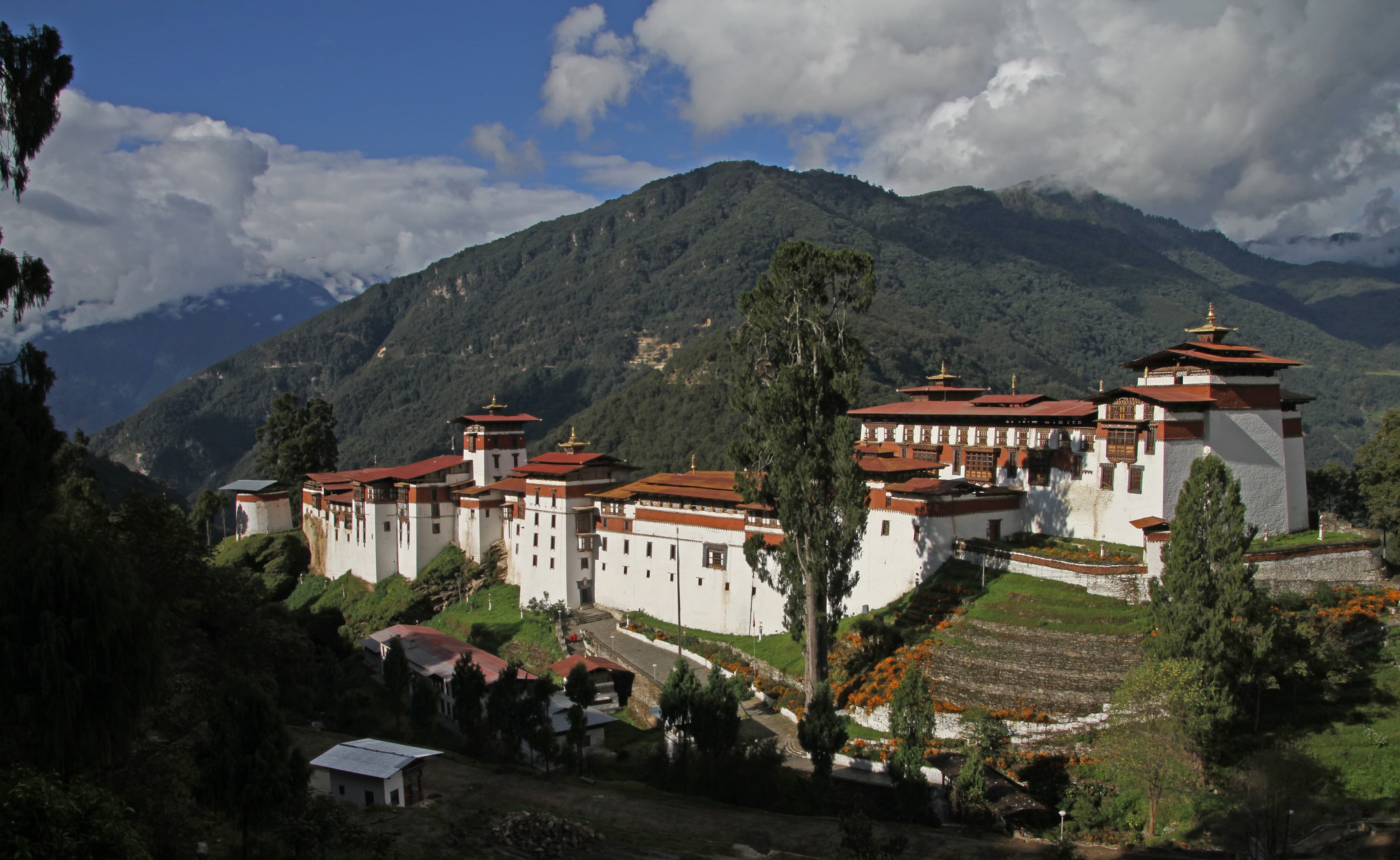
Trongsa Dzong
A 17th-century watchtower above Trongsa Dzong, now housing the royal and Buddhist heritage of the Wangchuck dynasty
Bagochen Boolingpang Ueling, Trongsa District, Bhutan
Plan this visit
Practical context before you go
1 to 2 hours. Combine with a visit to Trongsa Dzong below for a half-day experience.
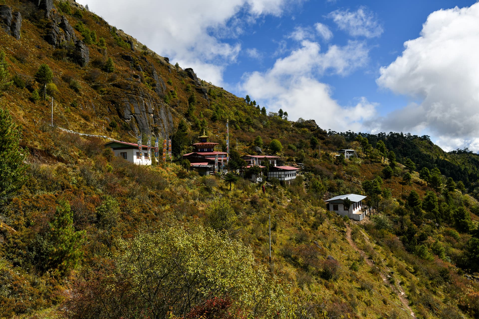
Short uphill walk from Trongsa town. Trongsa is approximately 6-7 hours by road from Thimphu in central Bhutan, on the route between western and eastern Bhutan.
Standard museum etiquette applies, with additional reverence required in the two active chapels.
At a glance
- Coordinates
- 27.4997, 90.5050
- Suggested duration
- 1 to 2 hours. Combine with a visit to Trongsa Dzong below for a half-day experience.
- Access
- Short uphill walk from Trongsa town. Trongsa is approximately 6-7 hours by road from Thimphu in central Bhutan, on the route between western and eastern Bhutan.
Pilgrim tips
- Modest dress appropriate for a museum with sacred spaces.
- May be restricted in certain galleries and is prohibited in the chapels. Check current policy at the entrance.
- The steep internal stairs may be challenging for those with mobility limitations. Natural light is best between 9 AM and 2 PM.
Overview
The Ta Dzong of Trongsa was built in 1652 as a watchtower to guard the largest dzong in Bhutan. Its four surveillance points were shaped to resemble the Dragon, Garuda, Tiger, and Lion — the four celestial animals. In 2008, it was inaugurated as the Royal Heritage Museum, housing eleven galleries and two active chapels within a structure that bridges military vigilance and spiritual preservation.
Above Trongsa Dzong, on a spur commanding views in every direction, a cylindrical watchtower has stood since 1652. Built by Chogyal Minjur Tenpa, the first Governor of Trongsa, the Ta Dzong served as the eyes of the dzong below — four surveillance points aligned to the Dragon, Garuda, Tiger, and Lion, the celestial animals of Bhutanese cosmology that guard the four directions.
For three and a half centuries, the tower watched. In 2008, it was reborn. Restored with Austrian technical support and inaugurated by King Jigme Khesar Namgyel Wangchuck, the Ta Dzong became the Royal Heritage Museum — the Tower of Trongsa. Eleven galleries spread across five floors now present the intertwined history of Buddhism and monarchy in Bhutan. Two active chapels — one dedicated to King Gesar of Ling, the other to Buddha Maitreya — maintain the structure's sacred dimension.
The collection moves from the guardians of the four directions on the ground floor through Buddhist ritual practice, royal regalia, and the personal artifacts of the Wangchuck kings. The first king's Raven Crown, ceremonial robes, ancient armour, and 17th-century clay statues share space with a diamond scepter and ritual dagger. What emerges is not a simple historical narrative but a demonstration of the Bhutanese principle that spiritual authority and governance have never been separate things.
Context and lineage
Chogyal Minjur Tenpa, the first Governor of Trongsa, built the watchtower in 1652 to guard the dzong that would become the seat of the Wangchuck dynasty. Its four surveillance points, shaped to resemble the four celestial animals, aligned the structure with Bhutanese cosmological principles of directional protection.
The Ta Dzong belongs to the Drukpa Kagyu lineage through its association with Trongsa Dzong. The museum preserves artifacts from the Wangchuck dynasty, whose authority is rooted in the Drukpa Kagyu tradition.
Chogyal Minjur Tenpa
1st Governor of Trongsa, builder of the Ta Dzong in 1652
King Jigme Khesar Namgyel Wangchuck
Inaugurated the Royal Heritage Museum on December 10, 2008
Why this place is sacred
A watchtower is built to see without being seen. Its purpose is surveillance — the scanning of horizons for threat. The Ta Dzong performed this function for over three centuries, its four points oriented to the four celestial animals, each guarding a direction. The building was an instrument of attention.
That quality of attention has not disappeared; it has been redirected. The eleven galleries ask the visitor to look carefully — at a clay statue from the 17th century, at the Raven Crown of the first king, at a ritual dagger used in Buddhist ceremonies. The act of seeing, which was once military, becomes contemplative. The chapels of King Gesar and Buddha Maitreya ensure that the building's sacred function endures alongside its new role as museum.
There is something appropriate about a watchtower becoming a place of reflection. Both activities require sustained attention. Both ask you to look longer and more carefully than comfort demands.
Built in 1652 as a military watchtower to protect Trongsa Dzong, with four surveillance points aligned to the four celestial animals of Bhutanese cosmology.
From watchtower to museum (2005-2008 restoration and conversion). The addition of two active chapels ensures the building continues to serve a devotional function alongside its educational role.
Traditions and practice
The two chapels — Gesar Lhakhang and Maitreya Lhakhang — remain active for prayer and devotion. Buddhist ritual objects in the galleries are presented in their devotional context rather than as purely aesthetic artifacts.
Functions as a state-of-the-art museum with English-language interpretation. Rotating exhibitions complement the permanent collection.
Allow the Buddhist ritual gallery (sixth gallery) time. The diamond scepter, bell, and dagger are not merely objects but instruments of practice. The chapels offer space for quiet reflection after the galleries.
Drukpa Kagyu
ActiveHouses artifacts of the Wangchuck dynasty, whose authority derives from the Drukpa Kagyu lineage. Two active chapels maintain the devotional function.
Museum exhibition, chapel worship, preservation of royal-Buddhist heritage
Experience and perspectives
The approach is uphill from Trongsa town, and the panorama that opens as you reach the Ta Dzong is the first exhibit. Below, Trongsa Dzong spreads across its spur in all its labyrinthine complexity — the largest dzong in Bhutan, the cradle of the monarchy. Beyond, the Mangde Chhu gorge drops away and the Black Mountains rise in the distance. This view was the watchtower's purpose, and it remains extraordinary.
Inside, the galleries ascend through five floors. The ground floor introduces the four guardian kings, setting the cosmological frame. Higher floors move through Buddhist ritual practice — sculptures of Shakyamuni, a diamond scepter, a ritual bell and dagger — to the personal realm of the Wangchuck dynasty. The first king's possessions, photographs, and ceremonial robes are displayed with a restraint that allows the objects to speak for themselves.
The two chapels offer a different register. The Gesar Lhakhang honors the legendary warrior-king whose exploits are central to Tibetan and Bhutanese epic tradition. The Maitreya Lhakhang looks forward, housing the Buddha of the future. Between these two — past legend and future hope — the museum holds the present.
Visit the Ta Dzong before or after Trongsa Dzong to understand the relationship between watchtower and fortress. Begin on the ground floor with the guardian kings and ascend through the galleries in sequence. Spend time with the view from the upper floors. Visit the chapels last, allowing the devotional register to conclude the experience.
The Ta Dzong can be understood as military architecture repurposed for contemplation, as a repository of Bhutan's inseparable spiritual and political heritage, and as a cosmological structure aligned to the four directions.
The museum is well-curated and effectively presents the relationship between Buddhism and governance in Bhutan. The Austrian-supported restoration preserved the traditional architecture while adding modern conservation infrastructure.
The four celestial animals — Dragon, Garuda, Tiger, Lion — are not decorative motifs but expressions of directional protection rooted in Buddhist cosmology. Their presence on a military structure extends this protection from the spiritual plane to the physical.
The transformation from watchtower to museum mirrors a broader shift in Bhutan: from a society organized around military defense to one that seeks to preserve and transmit its heritage through education and cultural institutions.
Some royal artifacts in the collection are not publicly displayed. The full inventory of the museum's holdings is not available in public sources.
Visit planning
Short uphill walk from Trongsa town. Trongsa is approximately 6-7 hours by road from Thimphu in central Bhutan, on the route between western and eastern Bhutan.
Guesthouses and small hotels in Trongsa town.
Standard museum etiquette applies, with additional reverence required in the two active chapels.
Modest dress appropriate for a museum with sacred spaces.
May be restricted in certain galleries and is prohibited in the chapels. Check current policy at the entrance.
Possible in the chapels.
Do not touch artifacts | Shoes removed in chapels | Quiet throughout | Follow gallery route
Plan your visit
Address
FGX3+VXG, Trongsa, Bhutan
Hours
Hours, fees, and access can change — verify on the official source before you travel. Practical details last checked Jun 2026.
Nearby sacred places
Sacred places within a half-day’s reach. Pilgrims often visit them together: walk one, stay for the other.

Tadzong National Museum, Trongsa
Bagochen Boolingpang Ueling, Trongsa District, Bhutan
0.3 km away
Choedrak Monastery
Gyaltsa, Bumthang District, Bhutan
18.4 km away
Choeje Dra Monastery
Gyaltsa, Bumthang District, Bhutan
18.4 km away

Jampa Lhakhang
Dawathang_Dorjibi_ Kashingtsawa, Bumthang District, Bhutan
24.1 km away
References
Sources consulted when researching this page. Independent verification by readers is welcome.
- 01Trongsa Dzong - Wikipedia — Varioushigh-reliability
- 02UNESCO World Heritage Centre - Tentative List — UNESCOhigh-reliability
- 03Trongsa Dzong - Atlas Obscura — Atlas Obscura
- 04Trongsa Dzong - Druk Asia — Druk Asia
- 05Trongsa Dzong - Bhutan Cultural Travel — Bhutan Cultural Travel
- 06Lonely Planet - Trongsa Dzong — Lonely Planet
Key questions
What pilgrims usually ask
- Why is Trongsa Dzong considered sacred?
- The Ta Dzong watchtower above Trongsa Dzong houses Bhutan's Royal Heritage Museum — eleven galleries of Buddhist and royal artifacts. Visitor guide.
- What should I wear at Trongsa Dzong?
- Modest dress appropriate for a museum with sacred spaces.
- Can I take photos at Trongsa Dzong?
- May be restricted in certain galleries and is prohibited in the chapels. Check current policy at the entrance.
- How long should I spend at Trongsa Dzong?
- 1 to 2 hours. Combine with a visit to Trongsa Dzong below for a half-day experience.
- How do you visit Trongsa Dzong?
- Short uphill walk from Trongsa town. Trongsa is approximately 6-7 hours by road from Thimphu in central Bhutan, on the route between western and eastern Bhutan.
- What offerings are appropriate at Trongsa Dzong?
- Possible in the chapels.
- What etiquette should visitors follow at Trongsa Dzong?
- Standard museum etiquette applies, with additional reverence required in the two active chapels.
- What is the history of Trongsa Dzong?
- Chogyal Minjur Tenpa, the first Governor of Trongsa, built the watchtower in 1652 to guard the dzong that would become the seat of the Wangchuck dynasty. Its four surveillance points, shaped to resemble the four celestial animals, aligned the structure with Bhutanese cosmological principles of directional protection.