Topada Rock Inscription
Eight lines of Luwian carved into cliff-face — the longest Iron Age royal text in central Anatolia
Acıgöl area, Nevşehir, Central Anatolia Region, Turkey

Plan this visit
Practical context before you go
30–60 minutes at the inscription itself. Half-day including travel from Nevşehir or Aksaray and the rural approach.
Near Ağıllı village, Acıgöl district, Nevşehir Province — approximately 3km northeast of the village. Acıgöl town is approximately 50km west of Nevşehir city. Rural roads to the area; no public transport to the inscription itself. Nevşehir (Cappadocia gateway) has extensive accommodation.
A protected open-air rock inscription in a rural landscape. No contact with carved surfaces.
At a glance
- Coordinates
- 38.5680, 34.5120
- Type
- Luwian Rock Inscription
- Suggested duration
- 30–60 minutes at the inscription itself. Half-day including travel from Nevşehir or Aksaray and the rural approach.
- Access
- Near Ağıllı village, Acıgöl district, Nevşehir Province — approximately 3km northeast of the village. Acıgöl town is approximately 50km west of Nevşehir city. Rural roads to the area; no public transport to the inscription itself. Nevşehir (Cappadocia gateway) has extensive accommodation.
Pilgrim tips
- Outdoor clothing appropriate for rural Central Anatolian terrain and the cliff-face setting.
- Photography permitted. Morning light recommended for best legibility of carved characters.
- No visitor infrastructure. Rural location requiring local knowledge to find the specific cliff. The Acıgöl region can be very hot in summer and cold in winter. Carry water and navigation support.
Overview
On a natural cliff plateau in the Cappadocian borderlands, King Wasusarma of Tabal carved the most historically detailed royal inscription from Iron Age central Anatolia: an eight-line Luwian account of a multi-kingdom war, eight rival rulers, and the campaign against a city named Parzuta. The rock remains, the text survives, and the kings it describes are otherwise almost unknown.
In the second half of the 8th century BC, Wasusarma — Great King of the Luwian state of Tabal, son of the Great King Tuwati — chose a projecting cliff face in the borderlands west of Cappadocia and inscribed on it the most detailed surviving account of Iron Age Anatolian politics. The Topada inscription records a war involving eight rival kings, the defeat of the city of Parzuta, and the assertion of Wasusarma's divine mandate as he navigated the political world taking shape around the expanding Assyrian Empire. Scholars have used this text alongside Assyrian imperial records to reconstruct the fragmented political landscape of 8th-century central Anatolia — a world of small Luwian successor kingdoms maneuvering for survival. The cliff face is still there. The eight lines are still legible, partly damaged but substantially intact. In an undeveloped rural landscape near what was once called Topada and is now the Acıgöl district of Nevşehir, this inscription offers something direct: the words of a king from 2,700 years ago, in a language his people used, on the rock he chose to make permanent.
Context and lineage
Wasusarma's inscription opens with full dynastic authority: 'The Heroic Great King Wasusarma, son of the Heroic Great King Tuwati.' The text proceeds to describe a coalition war involving eight rival Anatolian kings and the victorious campaign against the city of Parzuta — events that scholars have connected to Assyrian imperial records of the same period. The timing matters: the 8th century BC was the era when Assyrian expansion under Tiglath-Pileser III was beginning to bring pressure on the Neo-Hittite successor kingdoms of Anatolia. Wasusarma's inscription, with its careful account of military alliance and victory, reads as a declaration of continued Tabalean sovereignty carved at a moment when that sovereignty was under pressure from the east.
The Topada inscription belongs to the broader tradition of Neo-Hittite Luwian royal inscription-making across central and southeastern Anatolia in the Iron Age. It is the most historically detailed example from the western Neo-Hittite zone — the network of small Luwian successor states that preserved Hittite cultural forms after the empire's collapse. The kingdom of Tabal, based in the Kayseri-Nevşehir region, was one of these states, and the Topada inscription is its primary surviving royal monument.
Why this place is sacred
In the Luwian tradition, the act of carving a royal text into a natural rock face was itself a sacred performance. The rock was not a blank medium — it was a part of the earth, enduring by definition, and writing on it bound the king's deeds to that endurance. The choice of location at Topada was deliberate: a projecting cliff face on a low plateau, facing east, visible in the landscape. It was not carved in a protected interior space or an urban setting, but at the edge of political geography — the borderlands between Tabal and its neighbours, the volcanic transition zone between the Cappadocian landscape to the east and the central Anatolian steppe to the west. Some researchers in sacred geography have noted that the Neo-Hittite inscription sites cluster at landscape transition zones — volcanic craters, lake margins, mountain passes — as if the act of inscription was most powerful precisely at the boundaries between different kinds of terrain and territory. The Topada cliff, projecting from a plateau above the Acıgöl basin, occupies exactly this kind of transitional threshold.
A royal political and religious commemoration by King Wasusarma of Tabal (8th century BC), recording a multi-kingdom war and asserting his divine mandate in permanent carved script on a natural cliff face.
The inscription was known to scholars through early documentation in the modern period. J. David Hawkins and colleagues undertook the definitive epigraphic study, establishing the text, its translation, and its historical context. The scribe's signature line — carved on a separate piece of rock to the right of the main text — was destroyed before 1986, a heritage loss similar to (though less complete than) the Burunkaya destruction. The main eight-line inscription survives. The site is now documented by Koç University's digital exhibition on inscribed rocks of Anatolian civilization.
Traditions and practice
The commissioning of a royal rock inscription in the Luwian tradition was a public ceremonial act: the inscription was carved at a chosen location, with the king's titles, genealogy, divine invocations, and military achievements permanently bound to the rock. The ceremony of composition and carving — and the subsequent royal declaration at the inscribed site — constituted a form of territorial claiming with religious force. The Storm God's implicit presence in the royal formula gave the text divine standing.
No active religious or political use. Open-air heritage site visited by scholars and occasional heritage tourists interested in Neo-Hittite civilization. Featured in Koç University's digital exhibition on inscribed rocks of Anatolian civilization.
Arrive in the morning when the eastern light falls across the carved surface. Before approaching the cliff face, stand back and observe the setting: the low plateau, the projecting cliff, the Acıgöl basin terrain around it. This spatial context — a natural rock threshold at a landscape boundary — was the deliberate choice of Wasusarma's scribes. Then approach the inscription and read the lines from right to left (Luwian hieroglyphic direction). Even without the language, follow the visual structure: the opening formula, the narrative lines, the conclusion. If you have brought the published translation, read it against the stone. The eight lines that record a 2,700-year-old Anatolian war — eight rival kings, a city named Parzuta, a dynasty asserting its survival — become something different when read in the landscape where they were carved than when read in a library. The partial damage on the right side (where the scribe's signature once stood) is itself part of the site's story: a smaller but still real act of heritage loss.
Neo-Hittite / Iron Age Luwian Royal Political-Religious Commemoration
HistoricalThe Topada inscription is the primary surviving monument of the Iron Age Luwian kingdom of Tabal — an eight-line carved account of a multi-kingdom war that simultaneously asserts royal authority, divine mandate, and permanent territorial claim.
Royal commemoration inscription; divine invocation; military victory proclamation; permanent territorial marking at a landscape boundary.
Archaeological Epigraphy
ActiveThe Topada inscription is one of the longest and most historically detailed Neo-Hittite Luwian hieroglyphic texts known. Its study has been central to understanding the political landscape of central Anatolia in the 8th century BC, during the period of Assyrian expansion.
Epigraphic documentation; historical analysis; comparative study with Assyrian imperial records.
Experience and perspectives
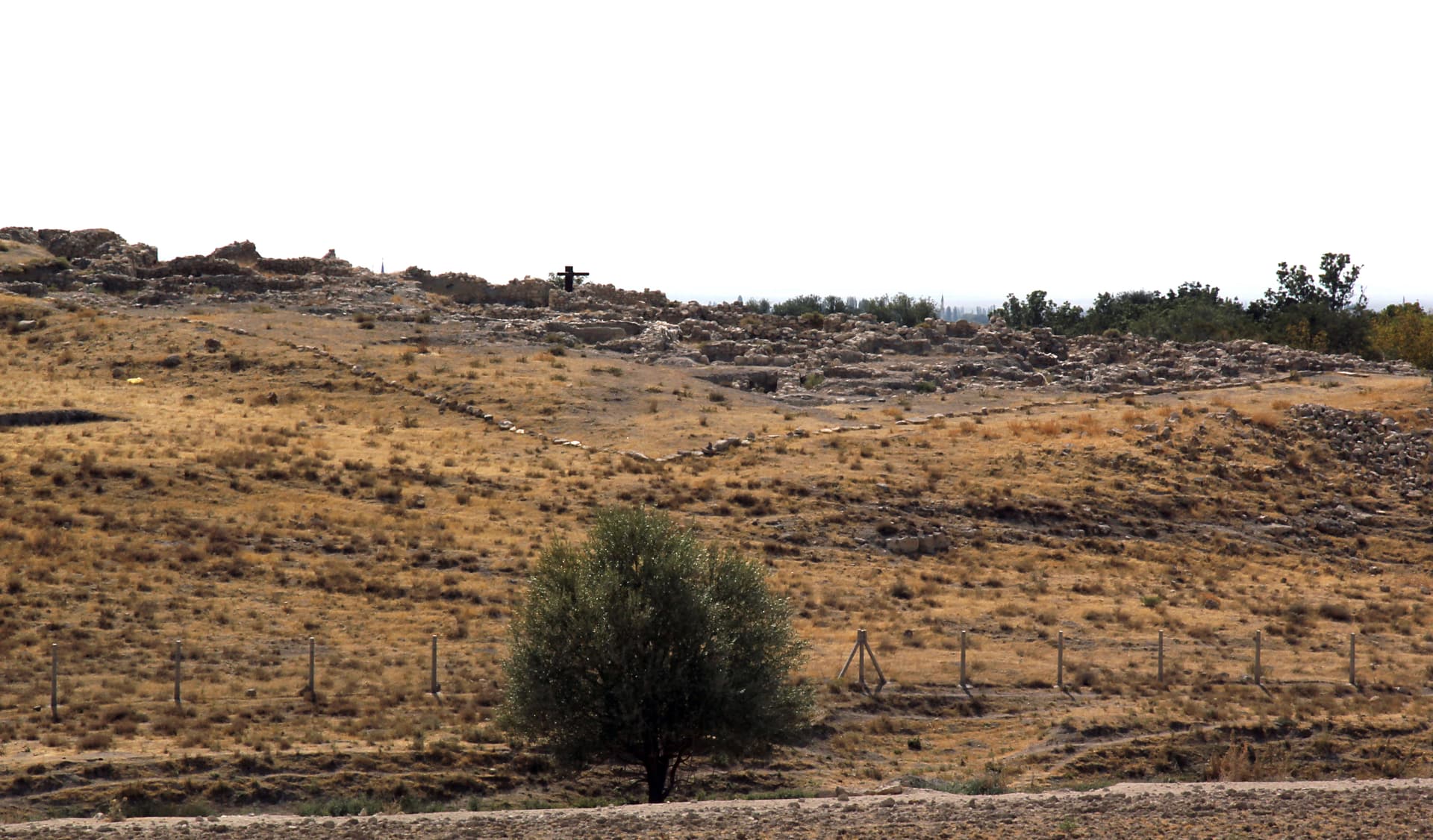
The Topada inscription sits approximately 3km northeast of Ağıllı village in the Acıgöl district of Nevşehir — a rural location with no formal visitor infrastructure, no signage, and no management that would mediate the encounter. This is part of its character. You arrive in a landscape of low volcanic plateau and agricultural fields, find the cliff face, and stand before the eight carved lines. The eastern orientation of the inscription means morning light illuminates the carved characters most clearly — if you can time your arrival accordingly, the low sun brings out the relief in the Luwian hieroglyphs with considerably more legibility than midday light. The inscription is carved on a smoothed and leveled portion of the natural rock face, approximately 5 metres high — a modest cliff that nonetheless frames the text with natural authority. Take time to read the lines even without Luwian: the hieroglyphic characters are pictorial enough that you can follow the visual rhythm of the text, understand where one line ends and another begins, and appreciate the spatial organisation of the carving. The area around the Acıgöl basin is geologically striking — volcanic crater terrain, an ancient lake bed, formations in tuff and basalt that give the broader landscape a quality distinct from the Cappadocian formations to the east but clearly related to the same geological history. The inscription sits within this landscape rather than apart from it.
The inscription is on a cliff face projecting from the eastern side of a low plateau, approximately 5 metres high, near Ağıllı village. Face east; morning light is optimal for reading the carved characters. The scribe's signature line to the right of the main text is damaged beyond legibility.
The Topada inscription is primarily a historical document that functions secondarily as a sacred site — but the two dimensions are not separable, because in the Luwian world, royal history and sacred geography were the same thing.
The Topada inscription is recognized as one of the most historically significant Neo-Hittite texts, providing detailed information about the political fragmentation of central Anatolia in the 8th century BC. Scholars including J. David Hawkins have used it to reconstruct the political map of Tabal and its neighbours, and it has been cross-referenced with Assyrian imperial records to place the events it describes in a broader historical framework. Koç University's digital exhibition on inscribed rocks of Anatolian civilization places Topada alongside Hattusa and Midas — a significant recognition of its importance within the wider tradition of Anatolian rock inscription.
No surviving local religious tradition is connected to the inscription. The Acıgöl region is now inhabited by Turkish-Muslim communities with no documented connection to pre-Islamic practices at the rock.
Researchers in sacred geography have noted a consistent pattern in Neo-Hittite inscription placement: landscape transition zones — volcanic craters, lake margins, passes, cliff edges — were preferred over flat central terrain. The Topada cliff, on the volcanic borderland between Cappadocia and the central Anatolian steppe, participates in this pattern. The liminal geography — between different kinds of landscape, between different kinds of political territory — was the appropriate context for an inscription that was itself a boundary declaration.
The city of Parzuta mentioned in the inscription has not been located archaeologically. The eight rival kings named remain largely unidentified in the historical record. Whether additional related inscriptions exist in the Acıgöl region is unknown. The precise boundaries of Wasusarma's Tabal kingdom remain debated.
Visit planning
Near Ağıllı village, Acıgöl district, Nevşehir Province — approximately 3km northeast of the village. Acıgöl town is approximately 50km west of Nevşehir city. Rural roads to the area; no public transport to the inscription itself. Nevşehir (Cappadocia gateway) has extensive accommodation.
Nevşehir and the Cappadocia region (~50km east) have extensive accommodation across all price ranges. Aksaray (~65km east) has more modest options. Both are practical bases for combining Topada with the wider region.
A protected open-air rock inscription in a rural landscape. No contact with carved surfaces.
Outdoor clothing appropriate for rural Central Anatolian terrain and the cliff-face setting.
Photography permitted. Morning light recommended for best legibility of carved characters.
Not applicable.
Do not touch the carved inscription. Do not attempt to clean or treat the rock surface. The inscription is protected under Turkish cultural heritage law; note that partial damage already occurred before 1986.
Nearby sacred places
Sacred places within a half-day’s reach. Pilgrims often visit them together: walk one, stay for the other.

Aşıklı Höyük
Aksaray, Central Anatolia / Cappadocia, Turkey
34.5 km away

Burunkaya Inscription
Near Gücünkaya / Mamasın Barajı, Aksaray, Central Anatolia Region, Turkey
36.3 km away

Acemhöyük
Aksaray, Yeşilova, c. 20 km from Aksaray, Turkey
61.6 km away
Köşk Höyük
Niğde, Central Anatolia / Bor plain, Turkey
80.5 km away
References
Sources consulted when researching this page. Independent verification by readers is welcome.
- 01Hittite Monuments — Topadahigh-reliability
- 02Topada Inscription — Cultural Inventoryhigh-reliability
- 03A Kingdom in the Shadow of Assyria: The Topada Inscription and the Politics of War in 8th-Century Anatoliahigh-reliability
- 04A Different Viewpoint for Topada Inscription: Balance of Power in Central Anatolian Late Hittite Periodhigh-reliability
- 05Neo-Hittite rock monument with inscription at Topada — Koç University Hittite Collection — Hatice Gonnet-Bağanahigh-reliability
- 06Inscribed rocks of Anatolian civilizations: Hattusa, Midas and Topadahigh-reliability
- 07Topada Inscriptions — Vici.org
- 08Wasusarmas — Wikipedia
Key questions
What pilgrims usually ask
- Why is Topada Rock Inscription considered sacred?
- The longest Iron Age Luwian royal inscription in central Anatolia — King Wasusarma carved eight lines of political history and divine mandate into a Nevşehir cl
- What should I wear at Topada Rock Inscription?
- Outdoor clothing appropriate for rural Central Anatolian terrain and the cliff-face setting.
- Can I take photos at Topada Rock Inscription?
- Photography permitted. Morning light recommended for best legibility of carved characters.
- How long should I spend at Topada Rock Inscription?
- 30–60 minutes at the inscription itself. Half-day including travel from Nevşehir or Aksaray and the rural approach.
- How do you visit Topada Rock Inscription?
- Near Ağıllı village, Acıgöl district, Nevşehir Province — approximately 3km northeast of the village. Acıgöl town is approximately 50km west of Nevşehir city. Rural roads to the area; no public transport to the inscription itself. Nevşehir (Cappadocia gateway) has extensive accommodation.
- What offerings are appropriate at Topada Rock Inscription?
- Not applicable.
- What etiquette should visitors follow at Topada Rock Inscription?
- A protected open-air rock inscription in a rural landscape. No contact with carved surfaces.
- What is the history of Topada Rock Inscription?
- Wasusarma's inscription opens with full dynastic authority: 'The Heroic Great King Wasusarma, son of the Heroic Great King Tuwati.' The text proceeds to describe a coalition war involving eight rival Anatolian kings and the victorious campaign against the city of Parzuta — events that scholars have connected to Assyrian imperial records of the same period. The timing matters: the 8th century BC was the era when Assyrian expansion under Tiglath-Pileser III was beginning to bring pressure on the Neo-Hittite successor kingdoms of Anatolia. Wasusarma's inscription, with its careful account of military alliance and victory, reads as a declaration of continued Tabalean sovereignty carved at a moment when that sovereignty was under pressure from the east.