Burunkaya Inscription
A Luwian inscription that survived 2,800 years and was deliberately destroyed within living memory
Near Gücünkaya / Mamasın Barajı, Aksaray, Central Anatolia Region, Turkey

Plan this visit
Practical context before you go
30–60 minutes at the site. Mainly of interest as part of a broader engagement with the Hartapu monument network or Anatolian heritage issues.
On Burunkaya hill near Gücünkaya village, approximately 20km east of Aksaray city centre. Aksaray is accessible by highway and has accommodation. No public transport to the site itself.
A site where the primary monument was destroyed. Treat the location with the respect appropriate to a place of heritage loss.
At a glance
- Coordinates
- 38.3852, 34.1664
- Type
- Luwian Rock Inscription
- Suggested duration
- 30–60 minutes at the site. Mainly of interest as part of a broader engagement with the Hartapu monument network or Anatolian heritage issues.
- Access
- On Burunkaya hill near Gücünkaya village, approximately 20km east of Aksaray city centre. Aksaray is accessible by highway and has accommodation. No public transport to the site itself.
Pilgrim tips
- Outdoor clothing appropriate for rural Central Anatolian terrain.
- Photography of the rock surface permitted.
- There is nothing to see of the original inscription. A visit here is meaningful only for those who engage with the site's history, not its physical remains. No facilities of any kind.
Overview
On a rock outcrop near Aksaray, King Hartapu once declared his divine mandate in Luwian hieroglyphs: 'Great King Hartapu, beloved of the Storm-God... he did/will smite.' The inscription survived three millennia. It was deliberately destroyed sometime before 2011. What remains is a rock, a documented text, and the question of why.
The Burunkaya inscription existed for over two thousand eight hundred years. It was a single line of Luwian hieroglyphic text carved into a natural rock outcrop on a hill in what is now the Aksaray region of central Anatolia — part of the network of royal monuments by which Iron Age Luwian king Hartapu marked his territory and proclaimed his divine favour. The epigrapher J. David Hawkins documented and deciphered it. Photographs were taken. The text was published in the scholarly record. Then, at some point before 2011, someone destroyed it. The carved surface is gone. Only the rock remains, and the documentation, and the knowledge of what was there. Burunkaya is now a site of cultural grief as much as cultural heritage — a place that asks you to think about the fragility of what survives from antiquity, and about the particular violence of destroying something irreplaceable that has lasted through every intervening century.
Context and lineage
Hartapu's inscription at Burunkaya followed the formula he used across his monument network: identification as 'Great King, beloved of the Storm-God,' dynastic claim as 'son of Mursili, Great King, Hero,' and a statement of military or territorial authority. The Burunkaya inscription's location in the Aksaray region — east of his Konya plain capital and the Kızıldağ-Karadağ mountain sanctuaries — placed it at the edge of his political geography, functioning as a territorial marker asserting his reach into the central Anatolian zone between the Salt Lake and Cappadocia.
The Burunkaya inscription belongs to the Hartapu monument network — a group of Luwian hieroglyphic inscriptions distributed across central Anatolia (Kızıldağ, Karadağ, Burunkaya, Topada) that together defined the territorial extent and sacred geography of Hartapu's Iron Age Luwian state. Its destruction has removed one node of this network from the physical landscape.
Why this place is sacred
In the Luwian tradition, rock inscriptions were not simply informational. They were acts of sacred territorial claiming — permanent, divinely witnessed statements that bound a king's name and authority to the landscape itself. The text that once occupied the Burunkaya rock declared: '[In] this place Great King Hartapu beloved(?) of the Storm-God, [son] of Mursili, Great King, Hero... he did/will smite.' The formula invokes the Storm God as the source of the king's legitimacy, and positions the carved rock as a threshold marker — a place where Hartapu's divine mandate was physically inscribed into the territory. The Aksaray location, between the Tuz Gölü salt lake basin and the edge of Cappadocian volcanic country, suggests Burunkaya was a boundary monument — the eastern or northeastern extent of Hartapu's kingdom, where the landscape itself was being told who ruled it. This sacred territorial function — the idea that carving a king's name in stone was itself an act of divine sanction — makes the inscription's destruction something more than property damage. It was the erasure of a 2,800-year-old claim on a piece of landscape.
A Luwian hieroglyphic royal inscription by King Hartapu, marking the extension of his storm-god-blessed authority into the Aksaray region and connecting this site to his broader network of monuments at Kızıldağ, Karadağ, and Topada.
The inscription was discovered by Oğuz Demir in 1971, then documented and deciphered by J. David Hawkins, who photographed it and published the text. Photographs were also made for the Hatice Gonnet-Bağana Hittite Collection at Koç University, which preserves both the text and an image of Hawkins himself standing at the inscription. At some point before 2011, the carved rock surface was deliberately destroyed. The cause and perpetrators are undocumented.
Traditions and practice
Iron Age Luwian: royal proclamation inscription as sacred territorial claiming; invocation of the Storm God's authority; boundary marking at the edge of the kingdom.
No active religious or cultural practices at the site. Occasional scholarly visits to document the current state of the rock surface. The site's story has been discussed in heritage conservation contexts as an example of irreversible loss.
If you visit Burunkaya hill, bring the published text and a photograph of the inscription. Read the words — '[In] this place Great King Hartapu beloved(?) of the Storm-God, [son] of Mursili, Great King, Hero... he did/will smite' — and then look at the rock surface where they were carved. The gap between the text and the surface is the site's experience. Allow time for what that gap means: not as a tourist moment but as a genuine confrontation with the fact that ancient heritage is neither permanent nor protected by its age. The nearby Mamasın Reservoir is part of the same landscape; the region has a long history of human modification of terrain. The inscription survived all of it until it didn't.
Neo-Hittite / Iron Age Luwian Royal Religion
HistoricalThe Burunkaya inscription connected the Aksaray region to Hartapu's storm-god-blessed kingdom, marking the landscape with the king's divine authority. Rock inscriptions in the Luwian tradition were sacred territorial acts — not merely informational but performatively divine.
Royal proclamation inscription; Storm God invocation; territorial boundary marking.
Experience and perspectives
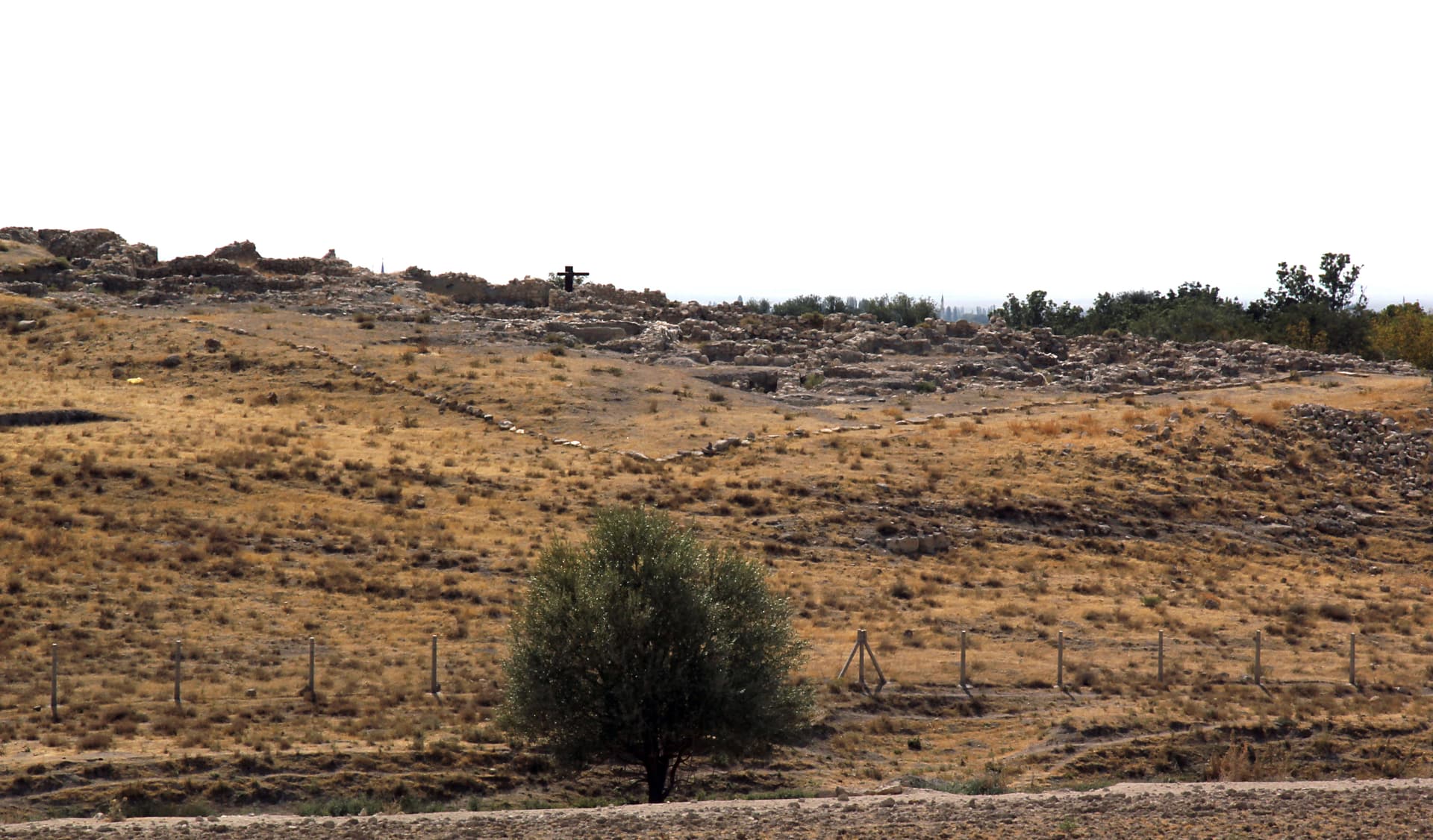
There is a specific kind of encounter available at Burunkaya that is not available at intact archaeological sites: the experience of standing where something was, knowing precisely what was there, and confronting its deliberate removal. The Burunkaya hill near Gücünkaya village is not a dramatic landscape — it is a modest rocky outcrop in the open Central Anatolian terrain east of Aksaray. What made it significant was the inscription, and the inscription is gone. A visitor arriving with knowledge of what stood here will find the rock surface — possibly still showing traces of where the carved text was cut, possibly not. The experience is not one of discovery but of loss. This is not a deficiency in the site; it is the site's specific contribution to understanding what sacred heritage means. The Burunkaya hill is now a place to sit with the question of why things survive and why they don't — and with the knowledge that J. David Hawkins stood here, photographed this inscription, decoded its meaning, and that the stone text he documented will never be read again in situ.
The site is on Burunkaya hill near Gücünkaya village, approximately 20km east of Aksaray city centre. No formal visitor infrastructure. The rock outcrop where the inscription stood is the site's focus. There is nothing to see of the inscription itself, but the topographic setting — a modest hill rising from the Central Anatolian plain, near the Mamasın Reservoir — provides context for the site's function as a boundary marker.
Burunkaya's interpretive weight lies less in what it still holds than in what it demonstrates: about the contingency of survival, the politics of heritage destruction, and the unique value of epigraphic documentation.
The Burunkaya inscription was a significant contribution to the epigraphic record of Hartapu's Iron Age Luwian kingdom. Its discovery in 1971 and subsequent study by Hawkins added evidence to the understanding of Hartapu's territorial reach and the formula of his royal inscriptions. Its destruction before 2011 was condemned by the scholarly community as an irreplaceable loss — particularly because the text, though documented, can no longer be read in its original context.
No surviving local religious tradition is connected to the inscription or the site.
The Aksaray region occupies a liminal geographical position in ancient Anatolian cultural geography — the borderland between the Hittite heartland and the frontier territories, between the Tuz Gölü salt lake basin and the volcanic formations of Cappadocia. In sacred geography terms, boundary zones were often chosen for territorial inscription precisely because they were liminal — places where authority needed to be declared, not assumed. The Burunkaya inscription, on its rock at the edge of Hartapu's domain, may have participated in this tradition of marking the threshold between controlled and uncontrolled space.
Whether the destruction was ideologically motivated or vandalism remains undocumented. Whether additional related inscriptions exist in the Aksaray region is unknown. The precise territorial logic of Burunkaya's placement within Hartapu's kingdom — whether it marked the eastern extent of his authority — cannot be definitively established with the physical text gone.
Visit planning
On Burunkaya hill near Gücünkaya village, approximately 20km east of Aksaray city centre. Aksaray is accessible by highway and has accommodation. No public transport to the site itself.
Aksaray city (~20km west) has hotels and full services. Nevşehir / Cappadocia (~65km east) has extensive accommodation for visitors combining this with the broader region.
A site where the primary monument was destroyed. Treat the location with the respect appropriate to a place of heritage loss.
Outdoor clothing appropriate for rural Central Anatolian terrain.
Photography of the rock surface permitted.
Not applicable.
Treat the site with care despite — and because of — the destruction of the original inscription. The location retains historical significance under Turkish cultural heritage law.
Nearby sacred places
Sacred places within a half-day’s reach. Pilgrims often visit them together: walk one, stay for the other.


References
Sources consulted when researching this page. Independent verification by readers is welcome.
- 01Hittite Monuments — Burunkayahigh-reliability
- 02The hieroglyphic Luwian rock inscription, Burunkaya — Koç University Hittite Collection — Hatice Gonnet-Bağanahigh-reliability
- 03J. David Hawkins by the hieroglyphic Luwian rock inscription, Burunkaya — Hatice Gonnet-Bağanahigh-reliability
- 042800-year-old Burunkaya Inscription written in Luwian Hieroglyphic
- 05Burunkaya Inscription Archives — Anatolian Archaeology
- 06Burunkaya Yazıtı — Vici.org
- 07Ḫartapus — Wikipedia
- 08Category:Burunkaya Inscription — Wikimedia Commons
Key questions
What pilgrims usually ask
- Why is Burunkaya Inscription considered sacred?
- King Hartapu's Luwian hieroglyphic inscription near Aksaray survived 2,800 years before deliberate destruction before 2011 — a site where absence is the monumen
- What should I wear at Burunkaya Inscription?
- Outdoor clothing appropriate for rural Central Anatolian terrain.
- Can I take photos at Burunkaya Inscription?
- Photography of the rock surface permitted.
- How long should I spend at Burunkaya Inscription?
- 30–60 minutes at the site. Mainly of interest as part of a broader engagement with the Hartapu monument network or Anatolian heritage issues.
- How do you visit Burunkaya Inscription?
- On Burunkaya hill near Gücünkaya village, approximately 20km east of Aksaray city centre. Aksaray is accessible by highway and has accommodation. No public transport to the site itself.
- What offerings are appropriate at Burunkaya Inscription?
- Not applicable.
- What etiquette should visitors follow at Burunkaya Inscription?
- A site where the primary monument was destroyed. Treat the location with the respect appropriate to a place of heritage loss.
- What is the history of Burunkaya Inscription?
- Hartapu's inscription at Burunkaya followed the formula he used across his monument network: identification as 'Great King, beloved of the Storm-God,' dynastic claim as 'son of Mursili, Great King, Hero,' and a statement of military or territorial authority. The Burunkaya inscription's location in the Aksaray region — east of his Konya plain capital and the Kızıldağ-Karadağ mountain sanctuaries — placed it at the edge of his political geography, functioning as a territorial marker asserting his reach into the central Anatolian zone between the Salt Lake and Cappadocia.