Tell Tayinat
The closest known parallel to Solomon's Temple stands in a plowed field in southern Turkey
Hatay, Amik Valley, c. 25–30 km E/SE of Antakya, Turkey

Plan this visit
Practical context before you go
1–3 hours depending on depth of interest and access level.
Located approximately 25–30 km east/southeast of Antakya (Hatay) in the Amik Valley. Reachable by private car from Antakya via the Amik Plain. The site is not open to casual public tourism — contact the Tayinat Archaeological Project (tayinat.artsci.utoronto.ca) in advance for researcher access.
An active research site on agricultural land; respectful coordination with the University of Toronto project is the primary requirement.
At a glance
- Coordinates
- 36.2418, 36.3725
- Type
- Iron Age Temple Complex
- Suggested duration
- 1–3 hours depending on depth of interest and access level.
- Access
- Located approximately 25–30 km east/southeast of Antakya (Hatay) in the Amik Valley. Reachable by private car from Antakya via the Amik Plain. The site is not open to casual public tourism — contact the Tayinat Archaeological Project (tayinat.artsci.utoronto.ca) in advance for researcher access.
Pilgrim tips
- Practical field clothing for outdoor walking in an agricultural landscape. Sun protection and sturdy footwear are essential.
- Generally permitted during academic visits. Check with project staff before photographing excavation trenches or ongoing work.
- Public access is not formally established; coordinate with the Tayinat Archaeological Project before visiting. Do not disturb excavation features. The region's agricultural land should be respected — do not cross planted fields.
Overview
Tell Tayinat was the royal capital Kunulua of the Neo-Hittite Kingdom of Patina — a city of carved lion-flanked temples whose tripartite sacred architecture mirrors, in stone, the design described for Solomon's Temple in Jerusalem. Here, kings ratified treaties in the presence of gods, and centuries later Assyrian conquerors stored loyalty oaths in the same holy of holies.
In 1935, Robert Braidwood of the University of Chicago Oriental Institute began excavating a tell in the Amik Valley, roughly 25 kilometers east of what was once Antioch. What he found — and what Timothy Harrison's University of Toronto team has continued revealing since 1999 — is one of the most significant religious sites in the ancient Near East. Tell Tayinat is the probable site of Kunulua, capital of the Neo-Hittite Kingdom of Patina (later Unqi), which ruled this corner of Syria-Anatolia from roughly 900 to 738 BCE. The city's temples — at least two of them — were built in the tripartite architectural form now known from the Hebrew Bible: a columned porch (the ulam), a main hall (the hekhal), and an inner sanctuary, the holy of holies (the devir). This is the same design described for Solomon's Temple in Jerusalem. The parallel is not merely architectural; it reflects a shared theology of divine presence in which the god physically inhabited the innermost room of the temple, accessible only to the king and high priest, where the most binding oaths were sworn and the most sacred objects kept. Tell Tayinat demonstrates that this theology was not uniquely Israelite but was the common religious architecture of the Iron Age Levantine world. When Tiglath-Pileser III of Assyria conquered Kunulua around 738 BCE, his forces repurposed Building XVI — the innermost sacred precinct — and deposited cuneiform tablets containing loyalty oaths sworn to the Assyrian king Esarhaddon. The oaths were stored precisely where the local god had dwelled, exploiting the site's sacred power to bind a conquered people. This layering of sacred use across conquerors is one of the most eloquent documents of ancient religious politics yet found.
Context and lineage
The tell's earliest significant occupation in the historical record dates to the late 3rd millennium BCE, with a possible connection to the site of Alalaḫu mentioned in early Mesopotamian texts. Its fullest flowering was as Kunulua, capital of the Neo-Hittite Kingdom of Patina, established by a dynasty associated with the legendary Taita. By the 10th and 9th centuries BCE, Kunulua was a substantial royal city: the bit hilani palaces — a distinctively North Syrian palatial form with columned porticos and ceremonial reception halls — were decorated with carved basalt orthostats. The temples followed the tripartite Levantine plan. A magnificent female statue discovered in 2017, possibly depicting the goddess Kubaba or the royal ancestress Kupapiyas, suggests that the founding mythology of Kunulua involved divine or semi-divine feminine authority. The city's fall came with the Assyrian campaigns of Tiglath-Pileser III, who conquered the Patina kingdom around 738 BCE, deported its population, and installed Assyrian administrative infrastructure — including the reuse of the city's own holiest sanctuary as a repository for imperial loyalty oaths.
Late Bronze Age Syro-Anatolian urban tradition; Neo-Hittite Aramaean dynastic tradition; Neo-Assyrian imperial administration; abandoned after Assyrian conquest, c. 738–600 BCE
Why this place is sacred
The theology that animated Tell Tayinat is difficult to access from within a modern secular or even monotheistic framework, because it rests on a premise that most contemporary people do not hold: that gods physically inhabited their temples. In the ancient Near Eastern worldview, the deity did not merely observe the proceedings from a transcendent distance. The god was present in the cult statue in the inner sanctuary. Feeding the god (ritual meals), clothing the god (dressing the statue), and sheltering the god (building and maintaining the temple) were acts of cosmic maintenance, without which the social and natural order would deteriorate. When Tell Tayinat's temples were constructed with lion-guarded entrances, columned porches, and tripartite interiors — when the storm god's cult statue was installed in the innermost room — this was not religious theater. It was the establishment of a divine residency. The building was understood as the god's home. This makes Tell Tayinat's architectural parallel to Solomon's Temple profound in a different way than archaeologists sometimes frame it. The parallel suggests not merely shared architectural conventions but a shared theology of divine immanence: the belief that the sacred is not everywhere equally but is concentrated in particular places, in particular forms, accessible through particular rites. The site still holds that quality of concentrated sacred potential, though what it evokes now is not the presence of the storm god but the weight of a civilization's attempt to locate the divine in architecture. The Orontes River, which curves to the north of the site, was in antiquity a sacred waterway — its Greek name, which means 'the river that flows backwards' (northward to the Mediterranean), set it apart from other rivers and gave it a quality of geographic uncanniness that would have been spiritually significant.
Royal capital and sacred center of the Neo-Hittite Kingdom of Patina/Unqi; seat of divine kingship ratified through temple-based treaty ceremonies
From Neo-Hittite royal capital (c. 900–738 BCE) with temples to the Storm God and consort, to Neo-Assyrian provincial administrative center with cuneiform oath-archives stored in the repurposed sanctuary; subsequently abandoned and buried; partially excavated by Oriental Institute (1935–1938) and ongoing University of Toronto excavation since 1999
Traditions and practice
The temples of Kunulua served as the primary theaters of royal religious life. Libation ceremonies — the pouring of water, wine, or oil before the divine statue — were the most common form of address to the gods and were performed daily. Animal sacrifice, including cattle, sheep, and birds, accompanied major ceremonies. The most binding category of ritual at Tell Tayinat's temples was the ratification of treaties: in the ancient Near East, oaths sworn before the gods in their own house were understood as irrevocable, witnessed by the deity who physically dwelled in the sanctuary. The Neo-Assyrian cuneiform tablets found in Building XVI's holy of holies preserve loyalty oath documents sworn to Esarhaddon — demonstrating that even the Assyrian conquerors understood the site's sacred authority as a venue for binding commitment. This is a place where the power of place and the power of oath-swearing were understood as one.
Annual University of Toronto archaeological field seasons; scholarly publication of finds including the goddess statue and cuneiform texts; ongoing multidisciplinary analysis.
Approach the site with specific preparation: read the scholarly summary of the tripartite temple plan and its relationship to the Hebrew Bible's description of Solomon's Temple before you go. When you stand before the exposed architectural remains, you will then be able to hold both the physical stones and the textual tradition simultaneously — and the convergence of these two streams of knowledge produces a quality of understanding that neither alone can offer. Pay attention to the quality of the light in the Amik Plain. Ancient sacred sites were rarely placed accidentally; the open, fertile valley floor, framed by mountains on three sides and watered by the Orontes, would have been understood as a location of divine abundance. Consider what it meant to build a god's house in this place — to say, by act of construction, that the divine chose to live here.
Neo-Hittite / Aramaean (Kingdom of Patina/Unqi)
HistoricalTell Tayinat was Kunulua, royal capital of the Neo-Hittite Kingdom of Patina. Its temples followed the tripartite plan — identical in form to Solomon's Temple — and housed the Storm God and consort in lion-flanked sanctuaries. Libation, sacrifice, and treaty ratification before the divine statue defined the religious life of the city.
Libation ceremonies, animal sacrifice, treaty ratification oaths sworn before divine witnesses, royal ancestor veneration
Neo-Assyrian Imperial Cult
HistoricalAfter Tiglath-Pileser III's conquest c. 738 BCE, Building XVI was repurposed as a Neo-Assyrian sacred precinct. Loyalty oath tablets to Esarhaddon were stored in the holy of holies — the Assyrians exploiting the sacred authority of the conquered city's own temple to bind its population.
Imperial oath-taking in the sanctified space, cuneiform tablet deposition as sacred-legal act
Archaeological / Scholarly
ActiveThe University of Toronto's Tayinat Archaeological Project is one of the most important active excavations in the ancient Near East. Tell Tayinat is the closest known parallel to Solomon's Temple and a key site for understanding Iron Age Levantine sacred architecture and covenant theology.
Annual excavation field schools, multidisciplinary analysis, international scholarly publication
Experience and perspectives
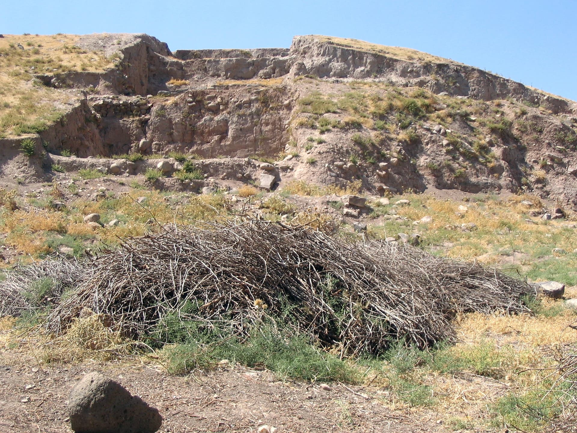
Tell Tayinat is not a developed heritage site. It sits in the agricultural plain east of Antakya (ancient Antioch), largely unimproved for visitors, accessible primarily to researchers and those who specifically seek it out. This is both its limitation and its singular quality: you encounter the remains of a Neo-Hittite royal city without interpretive infrastructure, without crowds, without the mediating apparatus of heritage tourism. What there is, is the land itself — the flat expanse of the Amik Valley, extraordinary in its fertility and in its long human memory. The Amik Plain was one of the most densely occupied regions of the ancient Near East for nearly four thousand years; to stand within it is to stand inside a deep continuity of human habitation. Where excavation has exposed architectural remains, you can see walls of basalt orthostats, stone bases that once supported the columns of a temple porch, the outline of rooms that replicated, in their proportions and sequence, the sacred architecture of Jerusalem and Aleppo and a dozen other ancient cities. For those with knowledge of the Biblical parallel, the experience carries a particular quality: this is where abstraction becomes stone. The textual description in 1 Kings of Solomon's Temple — ulam, hekhal, devir — finds its clearest physical counterpart not in Jerusalem but here. In the mornings, the valley fills with a low mist from the Orontes. By midday in summer, the heat is intense and the plain shimmers. The best time to visit is spring, when the grain is green and the light is clear, and the mountains of the Amur are visible to the north.
Coordinate access in advance with the Tayinat Archaeological Project at the University of Toronto. The site is on agricultural land approximately 25–30 km east/southeast of Antakya. Private vehicle is necessary. Researchers may be present during summer field seasons.
Tell Tayinat is located at the intersection of Biblical studies, Syro-Anatolian archaeology, and ancient Near Eastern religious history — making it a site where different interpretive traditions find very different things to illuminate.
Archaeologists identify Tell Tayinat as Kunulua, capital of the Neo-Hittite Kingdom of Patina/Unqi, and recognize the site's tripartite temple (Building XVI) as the closest known architectural parallel to Solomon's Temple. The discovery of cuneiform loyalty oath tablets stored in the holy of holies has transformed scholarly understanding of how ancient Near Eastern temples functioned as repositories of binding political-religious power. The 2017 goddess statue remains under analysis, with its identification — Kubaba, the mother of the gods; or Kupapiyas, the dynasty's founding queen — still debated.
No surviving community with direct religious continuity exists. The Hatay region's diverse communities — Alawite, Armenian Christian, Sunni Muslim, Arab — each carry fragments of the region's extraordinarily deep sacred history, though none claim continuous connection to Neo-Hittite Kunulua. The site carries particular resonance for Jewish and Christian visitors aware of the Biblical parallel, and for anyone drawn to the theological question of how ancient peoples understood divine presence in architecture.
The 2017 discovery of the goddess statue has reinvigorated discussion about the role of divine feminine power in the founding mythologies of ancient Syro-Anatolian states. The possibility that Kunulua's founding was legitimized through a divine or semi-divine queen — Kubaba, the mother of gods in the Anatolian tradition later transmitted to Cybele — connects this site to one of the ancient world's most enduring theological currents.
The identity of the 2017 female statue remains debated. The full extent of the Bronze Age settlement and its possible identity as the early 3rd-millennium Alalaḫu are unresolved. The fate of Kunulua's population after the Assyrian conquest — whether deported, absorbed, or dispersed — has not been determined. Whether the site served any continued sacred function after the Assyrian period is unknown.
Visit planning
Located approximately 25–30 km east/southeast of Antakya (Hatay) in the Amik Valley. Reachable by private car from Antakya via the Amik Plain. The site is not open to casual public tourism — contact the Tayinat Archaeological Project (tayinat.artsci.utoronto.ca) in advance for researcher access.
Antakya (Hatay city) offers a range of hotels and is the natural base for the region. The city's own heritage — ancient Antioch, Saint Peter's Church, the Antakya mosaic museum — makes it worth extended stay.
An active research site on agricultural land; respectful coordination with the University of Toronto project is the primary requirement.
Practical field clothing for outdoor walking in an agricultural landscape. Sun protection and sturdy footwear are essential.
Generally permitted during academic visits. Check with project staff before photographing excavation trenches or ongoing work.
Not applicable.
Do not enter or disturb excavation features. Access may require permission from the project or local landowners. The site is on private agricultural land — arrive via coordination, not uninvited.
Nearby sacred places
Sacred places within a half-day’s reach. Pilgrims often visit them together: walk one, stay for the other.


References
Sources consulted when researching this page. Independent verification by readers is welcome.
- 01About the Site - Tayinat Archaeological Project — University of Toronto, Timothy Harrison (PI)high-reliability
- 02The Tell Tayinat Archaeological Project - Department of Near & Middle Eastern Civilizationshigh-reliability
- 03Tell Tayinat, Turkey: 'Dark Age' Templehigh-reliability
- 04Tayinat's Building XVI: The Religious Dimensions and Significance of a Tripartite Temple at Neo-Assyrian Kunuluahigh-reliability
- 05Tell Tayinat - Wikipedia
- 06Tell Tayinat and the Judean Temple — Design and Placing the Treaty/Covenant Document in the Holy of Holies
- 07Hittite Monuments - Tell Tayinat
- 08GPS coordinates of Tell Tayinat, Turkey
Key questions
What pilgrims usually ask
- Why is Tell Tayinat considered sacred?
- The closest known parallel to Solomon's Temple: Tell Tayinat's tripartite Iron Age sanctuary in Turkey's Amik Valley reveals how ancient gods were understood to
- What should I wear at Tell Tayinat?
- Practical field clothing for outdoor walking in an agricultural landscape. Sun protection and sturdy footwear are essential.
- Can I take photos at Tell Tayinat?
- Generally permitted during academic visits. Check with project staff before photographing excavation trenches or ongoing work.
- How long should I spend at Tell Tayinat?
- 1–3 hours depending on depth of interest and access level.
- How do you visit Tell Tayinat?
- Located approximately 25–30 km east/southeast of Antakya (Hatay) in the Amik Valley. Reachable by private car from Antakya via the Amik Plain. The site is not open to casual public tourism — contact the Tayinat Archaeological Project (tayinat.artsci.utoronto.ca) in advance for researcher access.
- What offerings are appropriate at Tell Tayinat?
- Not applicable.
- What etiquette should visitors follow at Tell Tayinat?
- An active research site on agricultural land; respectful coordination with the University of Toronto project is the primary requirement.
- What is the history of Tell Tayinat?
- The tell's earliest significant occupation in the historical record dates to the late 3rd millennium BCE, with a possible connection to the site of Alalaḫu mentioned in early Mesopotamian texts. Its fullest flowering was as Kunulua, capital of the Neo-Hittite Kingdom of Patina, established by a dynasty associated with the legendary Taita. By the 10th and 9th centuries BCE, Kunulua was a substantial royal city: the bit hilani palaces — a distinctively North Syrian palatial form with columned porticos and ceremonial reception halls — were decorated with carved basalt orthostats. The temples followed the tripartite Levantine plan. A magnificent female statue discovered in 2017, possibly depicting the goddess Kubaba or the royal ancestress Kupapiyas, suggests that the founding mythology of Kunulua involved divine or semi-divine feminine authority. The city's fall came with the Assyrian campaigns of Tiglath-Pileser III, who conquered the Patina kingdom around 738 BCE, deported its population, and installed Assyrian administrative infrastructure — including the reuse of the city's own holiest sanctuary as a repository for imperial loyalty oaths.