Yli-Ii Kierikki Settlement Area
Forty house-hollows along the Iijoki, still mostly unexcavated
Yli-Ii (Oulu), Oulu / Yli-Ii – North Ostrobothnia, Finland

Plan this visit
Practical context before you go
1-2 hours to explore beyond the Centre and reconstructed village into the documented wider settlement area, if using a guide or trail map to identify dwelling depressions.
Extends along several kilometres of the Iijoki river around Yli-Ii, with additional significant site concentrations roughly 5 km east and west of the core area near the Kierikki Stone Age Centre (Pahkalantie 447, Yli-Ii). Best approached via the Centre, which provides orientation and, for some areas, marked access; independent exploration of outlying dwelling sites may cross forestry or private land and is not uniformly signposted. Mobile phone signal across this rural riverside landscape is not confirmed in sources consulted.
The wider settlement area calls for the same protected-monument etiquette as any unexcavated archaeological site, with particular care around unexcavated dwelling depressions and the known burial location.
At a glance
- Coordinates
- 65.3625, 25.9450
- Type
- Stone Age Settlement
- Suggested duration
- 1-2 hours to explore beyond the Centre and reconstructed village into the documented wider settlement area, if using a guide or trail map to identify dwelling depressions.
- Access
- Extends along several kilometres of the Iijoki river around Yli-Ii, with additional significant site concentrations roughly 5 km east and west of the core area near the Kierikki Stone Age Centre (Pahkalantie 447, Yli-Ii). Best approached via the Centre, which provides orientation and, for some areas, marked access; independent exploration of outlying dwelling sites may cross forestry or private land and is not uniformly signposted. Mobile phone signal across this rural riverside landscape is not confirmed in sources consulted.
Pilgrim tips
- Practical outdoor or hiking clothing suited to forest and riverside terrain beyond the maintained museum grounds.
- Permitted.
- Much of the settlement area lies outside the fenced, staffed museum grounds and may cross forestry or private land; it is not uniformly signposted, and independent exploration without guidance is not recommended. As a protected fixed ancient monument, no digging, metal-detecting, or removal of material anywhere in the area is permitted.
Overview
Beyond the reconstructed village at the Kierikki Stone Age Centre lies the real thing: an extensive Neolithic settlement landscape along the Iijoki river with more than forty documented dwelling depressions at its core and further significant site concentrations five kilometres in each direction. Only nineteen of these locations have been excavated since 1993 — most of this settlement area remains exactly as archaeologists found it.
Most visitors to Kierikki experience the Stone Age through reconstruction — a rebuilt pit-house village where you can knap flint and paddle a canoe. The settlement area is what lies beyond that: the actual ground where a community lived, built, and buried its dead across several centuries of the fourth millennium BC, largely undisturbed since archaeologists first began recording it in 1960.
The scale is the first thing worth registering. More than forty individual dwelling depressions are documented at the core site alone, and further significant concentrations of Neolithic settlement extend roughly five kilometres both east and west along the river. Of everything mapped here, only nineteen locations have been excavated since a systematic survey campaign began in 1993 — meaning the great majority of this landscape has been identified and recorded but not dug, its contents still exactly where they were left.
One of the excavated features near the core site is a red-ochre burial — a grave marked with mineral pigment in a manner consistent with the wider Comb Ceramic-culture mortuary tradition documented across the region. It sits in the ground much as it was found, a short distance from the museum built to interpret it, offering a plainer, less mediated encounter with the same fact the reconstructed village dramatizes: that this was a community that returned to this river, generation after generation, to live and to bury its dead.
Context and lineage
No myth or origin narrative survives from the Neolithic community that built and used this landscape; everything known is inferred from the dwelling depressions, artefacts, and the documented red-ochre burial recovered through excavation.
Neolithic settlement occupation across the wider area, c. 4000-3100 BC → abandonment as the shoreline receded inland → initial excavation from 1960 → systematic survey campaign from 1993, with 19 sites excavated to date → ongoing documentation of a landscape still largely unexcavated.
Excavation teams active since 1960
Conducted the initial archaeological work identifying the settlement's Neolithic character and beginning the long process of mapping its dwelling depressions
Survey teams since the 1993 campaign
Carried out the systematic survey that has documented the area's full extent — over 40 dwelling depressions at the core site and further concentrations 5 km east and west — and excavated 19 of these sites to date
Kyösti Julku and Pentti Koivunen
Recognised the settlement area's exceptional importance and initiated the project that led to the creation of its adjacent interpretive centre
Why this place is sacred
What the settlement area offers that the reconstructed village cannot is scale made physically legible: walking from one documented dwelling depression to another along the Iijoki gives a direct sense of how extensive this community's presence was, in a way that a single rebuilt pit-house or two, however faithful, cannot convey. Forty-plus depressions at the core site, with further clusters five kilometres in either direction, describe a settlement pattern of real duration and density rather than a single isolated camp.
The fact that only nineteen of these documented locations have been excavated since the 1993 survey campaign began is itself part of the site's significance. This is not a fully known landscape awaiting only better presentation; it is one where most of the evidence remains in the ground, meaning future excavation seasons could still meaningfully revise what is understood about how this community lived, traded, and died. The red-ochre burial identified near the core site is a preview of what unexcavated ground elsewhere in the area may still hold.
An extensive riverside settlement landscape supporting permanent Neolithic dwelling, subsistence fishing and sealing, long-distance exchange, and mortuary practice across several kilometres of the Iijoki, of which only a fraction has been formally excavated.
Settlement occupation across the wider area, c. 4000-3100 BC → gradual abandonment as the ancient shoreline receded inland through post-glacial land uplift → initial excavation and survey work from 1960 → systematic survey campaign beginning 1993, with 19 of the documented sites excavated since → creation of the adjacent Kierikki Stone Age Centre as an interpretive gateway → ongoing periodic excavation, with the majority of documented dwelling sites still unexcavated.
Traditions and practice
The wider settlement area preserves evidence of permanent pit-house dwelling, fishing and seal-hunting subsistence, participation in long-distance amber and flint exchange, and at least one documented instance of red-ochre burial, consistent with broader Comb Ceramic-culture mortuary custom in the region.
Periodic archaeological survey and excavation continue across the documented dwelling sites, with only nineteen of the known locations investigated since the 1993 campaign; public participation in excavation seasons is occasionally organised in connection with the adjacent Kierikki Stone Age Centre.
If visiting the wider settlement area beyond the Centre's reconstructed village, go slowly and look for subtle changes in ground level rather than expecting visible structures — the shallow depressions marking former dwellings are easy to walk past unnoticed. Consider the deliberate contrast with the Centre's hands-on village: here, the appropriate mode of engagement is observation and restraint rather than participation, since this ground (and whatever it still holds, unexcavated) is the primary evidentiary record rather than a space designed for visitor activity.
Finnish Prehistoric / Comb Ceramic Neolithic Settlement
HistoricalThe Yli-Ii Kierikki settlement area is one of the most extensive and important Neolithic residential landscapes documented in Finland: more than 40 dwelling depressions are known at the core site alone, with further significant concentrations roughly 5 km both east and west along the Iijoki, of which 19 individual locations have been excavated since 1993.
Permanent pit-house dwelling; fishing and seal-hunting subsistence; long-distance exchange bringing Baltic amber and Russian flint into the settlement; red-ochre burial of the dead with modest grave goods, as evidenced by a burial documented near the core site.
Archaeological Research and Protection
ActiveThe settlement area's scale and preservation prompted its formal recognition as an archaeological zone of major importance, underpinning both its legal protection and the creation of the adjacent Kierikki Stone Age Centre as an interpretive gateway.
Systematic and periodic excavation (19 of the known sites investigated since 1993, following earlier work from 1960), site surveying, and heritage-protection management.
Experience and perspectives
Visitors who move past the reconstructed village into the documented wider settlement area encounter something considerably less legible at first glance: shallow hollows in grass or forest floor that require a guide, an interpretive panel, or prior knowledge to recognise as the remains of Neolithic pit-houses. There is little here to signal 'archaeological site' in the way a ruin or standing structure would.
That plainness is, in its way, the point. The reconstructed village at the Centre necessarily interprets and dramatizes the evidence for a visiting public; the settlement area itself is the evidence, largely unmediated. Standing at the location of the documented red-ochre burial, or beside one of the many still-unexcavated depressions extending east and west along the river, asks for a slower, more attentive kind of looking than the hands-on activities at the Centre invite — and rewards it with a much closer approximation of what an archaeologist actually confronts before any interpretation begins.
Begin at the Kierikki Stone Age Centre for orientation, a map or guide to the documented dwelling sites, and any current information on which areas are accessible. Approach the wider settlement area with the expectation of subtle, easily missed topography rather than dramatic ruins, and allow more time than the reconstructed village alone requires if you intend to look for individual depressions.
The settlement area is best understood through the specific question of scale versus knowledge — how much of this landscape has been formally excavated (a small fraction) against how much has been mapped and identified (a great deal) — since this gap defines what the site can and cannot yet tell us.
Archaeologists regard the Yli-Ii Kierikki settlement area as one of the most important documented concentrations of Neolithic dwelling sites in Finland, central to revising Finnish Stone Age settlement models from seasonal mobility to permanent, year-round village life supported by fishing, sealing, and long-distance exchange. The fact that only 19 of the more than 40 core-area dwelling sites (plus further clusters 5 km in each direction) have been excavated since 1993 is treated by researchers as evidence of significant remaining research potential rather than a completed picture.
No living community traces direct ritual or ancestral claim to the site; interpretation rests on archaeological authority built up through survey and excavation since 1960.
The full extent of the settlement area — how many further dwelling sites remain undocumented beyond the roughly 40 depressions and 19 excavated locations recorded to date — is not fully known, and ongoing survey work continues to refine the picture; what, if anything, further excavation might reveal about mortuary practice beyond the one documented red-ochre burial is similarly open.
Visit planning
Extends along several kilometres of the Iijoki river around Yli-Ii, with additional significant site concentrations roughly 5 km east and west of the core area near the Kierikki Stone Age Centre (Pahkalantie 447, Yli-Ii). Best approached via the Centre, which provides orientation and, for some areas, marked access; independent exploration of outlying dwelling sites may cross forestry or private land and is not uniformly signposted. Mobile phone signal across this rural riverside landscape is not confirmed in sources consulted.
No accommodation within the settlement area itself; lodging available via the Kierikki Stone Age Centre and in Yli-Ii village.
The wider settlement area calls for the same protected-monument etiquette as any unexcavated archaeological site, with particular care around unexcavated dwelling depressions and the known burial location.
Practical outdoor or hiking clothing suited to forest and riverside terrain beyond the maintained museum grounds.
Permitted.
Not applicable.
As a protected fixed ancient monument, no digging, metal-detecting, or removal of material is permitted anywhere in the settlement area. Unexcavated dwelling depressions and the documented burial location should not be disturbed; stay to any marked paths or guided routes.
Nearby sacred places
Sacred places within a half-day’s reach. Pilgrims often visit them together: walk one, stay for the other.
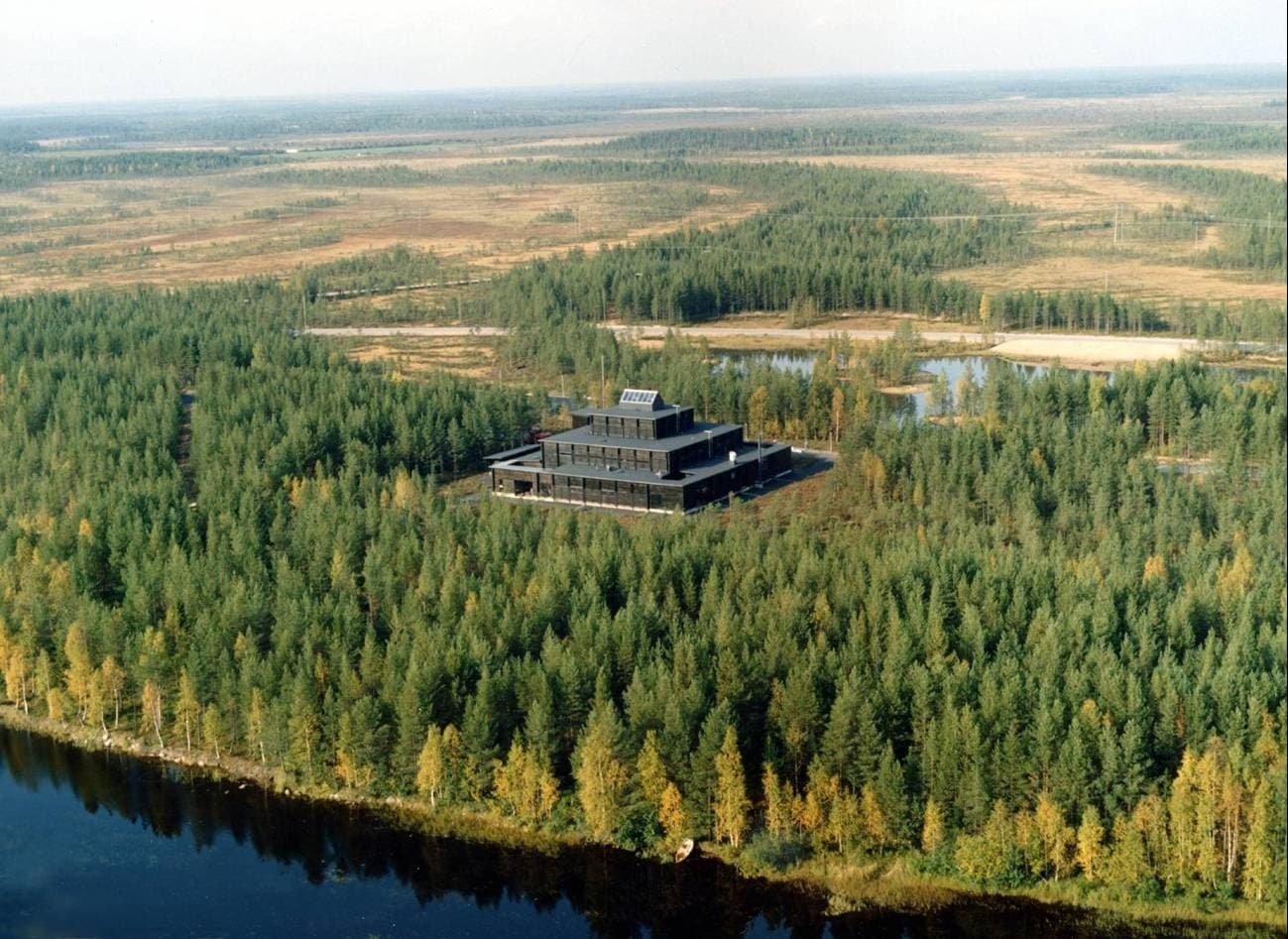
Kierikki Stone Age Centre
Yli-Ii (Oulu), Oulu / Yli-Ii – North Ostrobothnia, Finland
0.4 km away

Rajakangas Giant’s Church
Haukipudas (Oulu), Oulu / Haukipudas – North Ostrobothnia, Finland
18.3 km away

Kastelli Giant’s Church
Raahe, Raahe / Pattijoki – North Ostrobothnia, Finland
99.8 km away

Värikallio Rock Paintings
Suomussalmi (Hossa), Suomussalmi / Hossa – Kainuu, Finland
158.3 km away
References
Sources consulted when researching this page. Independent verification by readers is welcome.
- 01Stone Age Village — Kierikkikeskus / City of Ouluhigh-reliability
- 02Kierikki Stone Age Centre in Yli-Ii — European Heritage Awards / Europa Nostra Awardshigh-reliability
- 03Kierikkikeskus / Kierikki Stone Age Centre — EXARChigh-reliability
- 04Kierikki - Wikipedia — Wikipedia contributors
- 05Comb Ceramic culture - Wikipedia — Wikipedia contributors
- 06Presentation of Kierikki Stone Age Centre — The Best in Heritage
Key questions
What pilgrims usually ask
- Why is Yli-Ii Kierikki Settlement Area considered sacred?
- Beyond Kierikki's reconstructed village lies real ground: forty Neolithic dwelling hollows along the Iijoki, most still unexcavated after 6,000 years.
- What should I wear at Yli-Ii Kierikki Settlement Area?
- Practical outdoor or hiking clothing suited to forest and riverside terrain beyond the maintained museum grounds.
- Can I take photos at Yli-Ii Kierikki Settlement Area?
- Permitted.
- How long should I spend at Yli-Ii Kierikki Settlement Area?
- 1-2 hours to explore beyond the Centre and reconstructed village into the documented wider settlement area, if using a guide or trail map to identify dwelling depressions.
- How do you visit Yli-Ii Kierikki Settlement Area?
- Extends along several kilometres of the Iijoki river around Yli-Ii, with additional significant site concentrations roughly 5 km east and west of the core area near the Kierikki Stone Age Centre (Pahkalantie 447, Yli-Ii). Best approached via the Centre, which provides orientation and, for some areas, marked access; independent exploration of outlying dwelling sites may cross forestry or private land and is not uniformly signposted. Mobile phone signal across this rural riverside landscape is not confirmed in sources consulted.
- What offerings are appropriate at Yli-Ii Kierikki Settlement Area?
- Not applicable.
- What etiquette should visitors follow at Yli-Ii Kierikki Settlement Area?
- The wider settlement area calls for the same protected-monument etiquette as any unexcavated archaeological site, with particular care around unexcavated dwelling depressions and the known burial location.
- What is the history of Yli-Ii Kierikki Settlement Area?
- No myth or origin narrative survives from the Neolithic community that built and used this landscape; everything known is inferred from the dwelling depressions, artefacts, and the documented red-ochre burial recovered through excavation.