Sulkava Linnavuori
A near-vertical Iron Age refuge above Lake Saimaa
Sulkava, Sulkava – South Savo, Finland

Plan this visit
Practical context before you go
A short visit: roughly 400–500 meters of walking from the car park to the base, plus the stairway climb to the summit. Visitor accounts suggest 30–60 minutes for the hike itself, longer with time at the harbor and grill area.
By road: signposted from Sulkava village via Uitonrinne and Saareentie onto Linnavuorentie (Linnavuorentie 306, 58700 Sulkava), roughly 5 km from Sulkava church, with a car park about 400–500 meters from the hill. By water: a small guest harbor and dock sit at the base (approximate coordinates 61°45'02" N, 28°19'03" E). No public transit route to the site is documented. Mobile phone signal at the site itself was not documented in any source consulted during research; given the site's proximity (roughly 5 km) to Sulkava village, some coverage is plausible, but this is an inference, not a verified fact — visitors relying on a phone for safety in a fall or injury on the stairway should treat this as an open gap and plan accordingly. No keyholder or booking contact is required — the site is an unstaffed, freely accessible outdoor monument with no gate, ticket, or posted opening hours found in any source; for current access conditions, contact the Sulkava municipality directly or consult Museovirasto's cultural-environment service (kyppi.fi), since no source reviewed here confirms whether any seasonal restriction is ever applied.
No dress or ritual code applies; the governing etiquette here is heritage-protective rather than devotional.
At a glance
- Coordinates
- 61.7531, 28.3194
- Type
- Iron Age Hill Fort
- Suggested duration
- A short visit: roughly 400–500 meters of walking from the car park to the base, plus the stairway climb to the summit. Visitor accounts suggest 30–60 minutes for the hike itself, longer with time at the harbor and grill area.
- Access
- By road: signposted from Sulkava village via Uitonrinne and Saareentie onto Linnavuorentie (Linnavuorentie 306, 58700 Sulkava), roughly 5 km from Sulkava church, with a car park about 400–500 meters from the hill. By water: a small guest harbor and dock sit at the base (approximate coordinates 61°45'02" N, 28°19'03" E). No public transit route to the site is documented. Mobile phone signal at the site itself was not documented in any source consulted during research; given the site's proximity (roughly 5 km) to Sulkava village, some coverage is plausible, but this is an inference, not a verified fact — visitors relying on a phone for safety in a fall or injury on the stairway should treat this as an open gap and plan accordingly. No keyholder or booking contact is required — the site is an unstaffed, freely accessible outdoor monument with no gate, ticket, or posted opening hours found in any source; for current access conditions, contact the Sulkava municipality directly or consult Museovirasto's cultural-environment service (kyppi.fi), since no source reviewed here confirms whether any seasonal restriction is ever applied.
Pilgrim tips
- No specific dress code; sturdy, grippy footwear is advisable given the steep stairway and uneven rock, especially if the ground is wet, icy, or snow-covered.
- No restrictions are documented. The site is openly promoted for visitors and photography by the Sulkava municipality and regional tourism bodies.
- The stairway can be difficult and potentially hazardous when covered in snow or ice, particularly in early spring; footing should be treated with care in those conditions. As a protected ancient monument, the surviving stones and ramparts must not be climbed on, moved, or otherwise disturbed.
Continue exploring
Overview
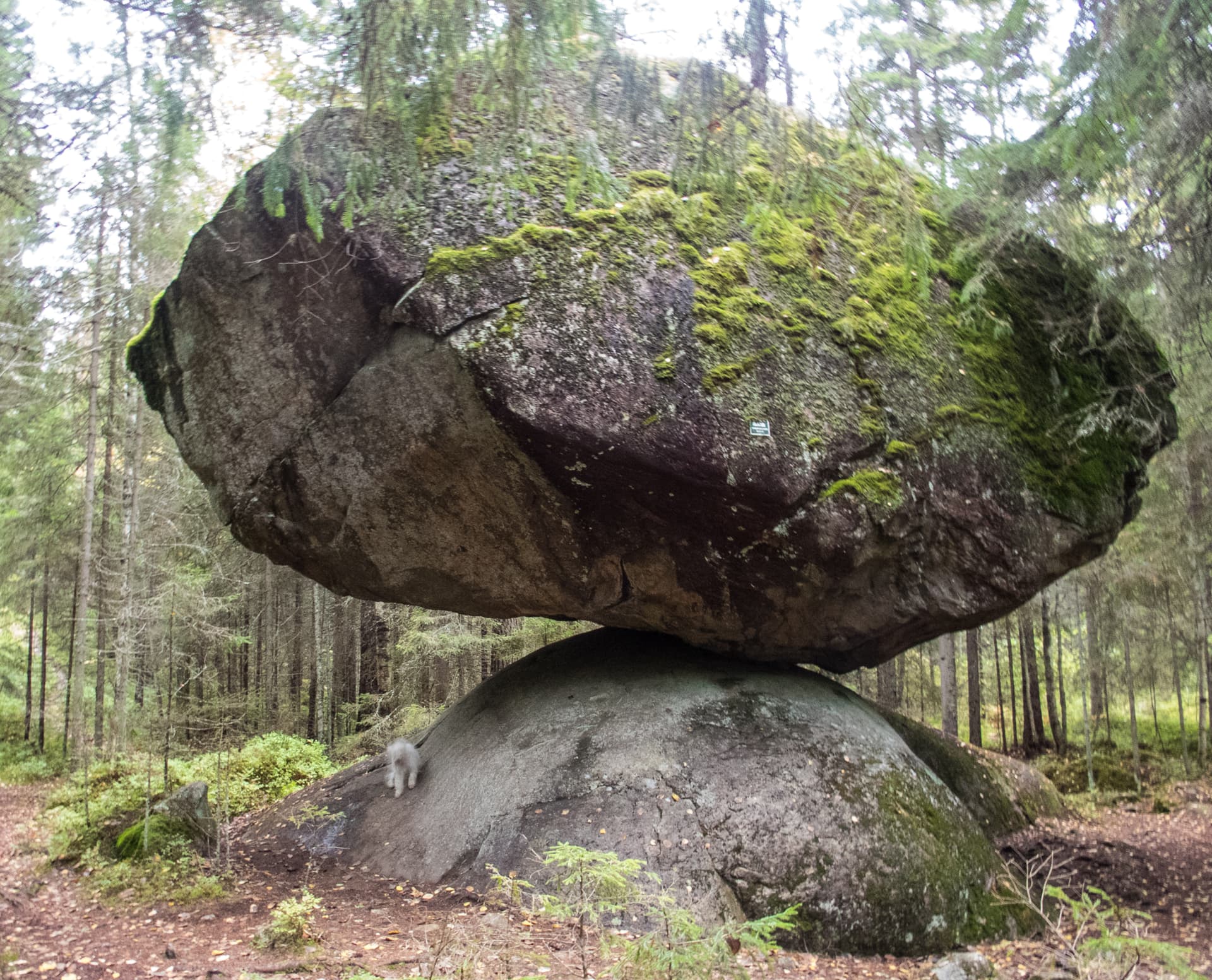
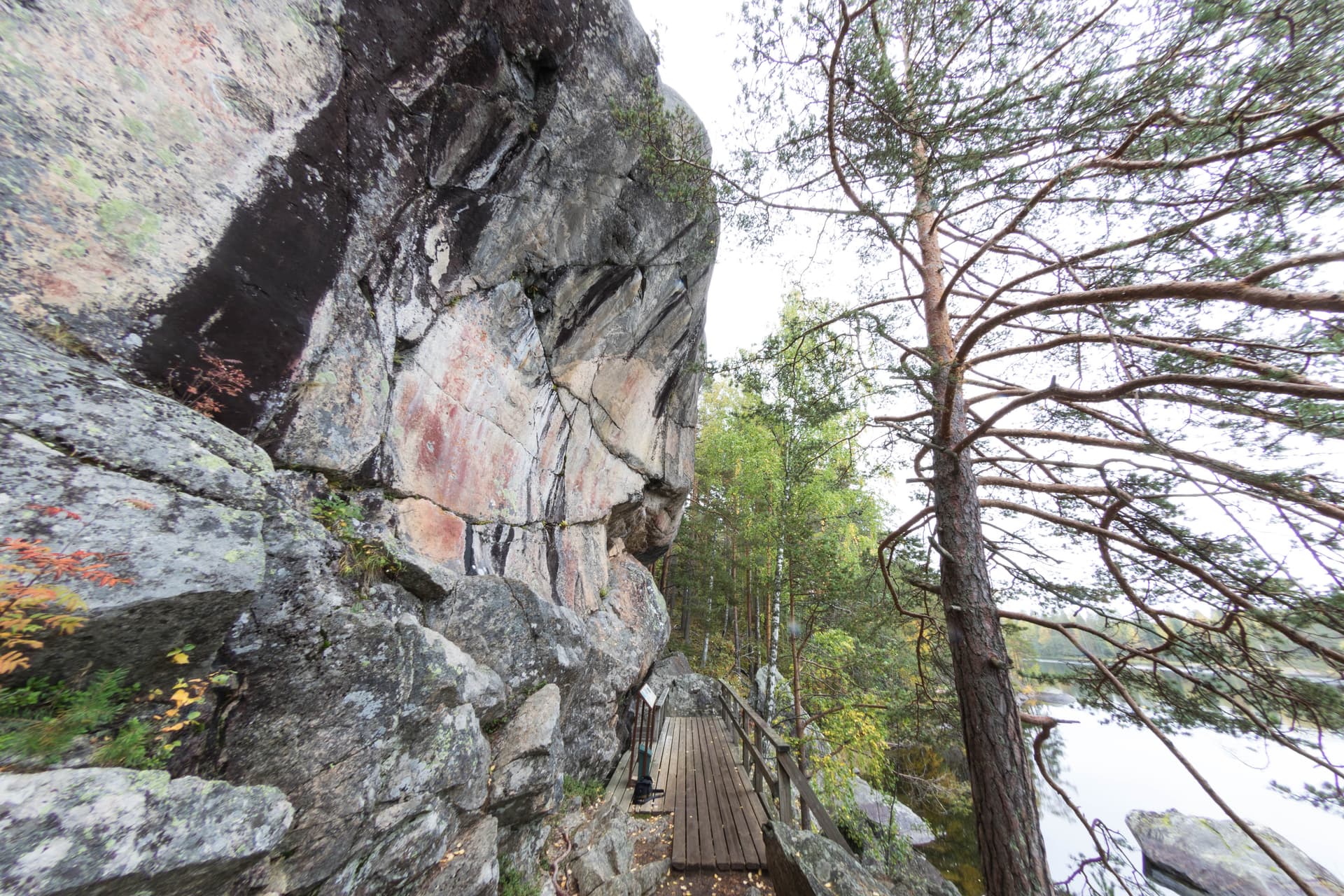
Sulkava Linnavuori is a hill fort on Lake Saimaa's Pisamalahti bay, where a rock face rises some 55 meters almost straight from the water. Stone ramparts on its gentler eastern flank, conventionally linked to the 12th century, mark it as one of Finland's most striking surviving ancient fortifications.
On the Pisamalahti bay of Lake Saimaa's Enonvesi, opposite Partalansaari island, a slab of bedrock climbs nearly 55 meters out of the water on three sheer sides. On the fourth, gentler side, a stone rampart roughly three meters wide and, in places, over two meters high still runs along the summit's edge — the remains of a fortification local historiography associates with the Iron Age or early medieval period, built, tradition holds, against threats from the Häme people to the west. The site's documented history begins only in 1561, in a tax register naming two farmers of Sääminki parish as its overseers, leaving several centuries between the presumed construction and the first written trace. Today it stands as a protected ancient monument, reached by a short trail or by boat, valued less for any surviving ritual than for the raw drama of stone meeting water and for what its walls still ask a visitor to imagine.
Context and lineage
No single origin narrative is documented with certainty. The most commonly repeated account, found in Finnish-language heritage and travel sources, holds that the hill was fortified during the Iron Age or Middle Ages as a defensive stronghold against incursions from the Häme (Tavastian) people to the west, and that it later served as a refuge for Savonian inhabitants fleeing unrest. This account is treated in the sources as plausible regional tradition rather than an excavation-confirmed history; the earliest surviving documentary trace is a 1561 tax register recording the fortification as belonging to the Iitlahti-district farmers Hannu and Heikki Kontiainen of Sääminki parish — many centuries after the presumed construction, and describing land tenure rather than the fort's original military use.
Matti Bergström
Archaeologist; authored the 1983 Museovirasto (Finnish Heritage Agency) site survey report registering the hill fort in Finland's national ancient monuments register (muinaisjäännösrekisteri).
Hannu and Heikki Kontiainen
Farmers of Sääminki parish's Iitlahti district, named in the 1561 tax register as the earliest documented individuals associated with the site — as land tenants, not as its builders.
Museovirasto (Finnish Heritage Agency)
The national body responsible for registering, protecting, and archiving the site under Finland's Antiquities Act; maintains the site's official monument record and archival photography.
Why this place is sacred
Sulkava Linnavuori was never, so far as the sources reviewed here indicate, a place of worship or ritual. Its significance lies in the fusion of two things: an already dramatic natural feature — a nearly vertical 55-meter rock face standing over Enonvesi bay — and the human decision to make that feature harder still to take, by walling its one accessible slope with a rampart of large stones now nearly a millennium old in the most common estimate. What holds attention here is the visible evidence of defensive intention pressed onto a landscape that hardly needed it: three sides were already unassailable, and the builders spent their effort entirely on the fourth. The stones are still stacked where they were laid. That persistence, more than any legend, is the site's quiet claim on a visitor's imagination.
A defensive refuge and fortified lookout, exploiting the natural cliff of the Pisamalahti headland and reinforcing its one vulnerable approach with a stone-founded rampart.
From a presumed Iron Age or medieval defensive stronghold — associated in local tradition with conflict against the Häme people and later used as a refuge by Savonians fleeing regional unrest — the site passed centuries as agricultural land under named farming tenants (first recorded in 1561), before its 20th-century designation as a protected ancient monument (muinaisjäännös) and, more recently, its incorporation into the Saimaa Geopark's network of geological and heritage attractions.
Traditions and practice
Present-day use is entirely secular and recreational: hiking the marked trail and stairway to the summit, mooring at the small boat harbor at the base, grilling at the designated shelter, and — for a stretch each July — the site serving as a landmark along the route of the Sulkava rowing race (Sulkavan suursoudut), one of Finland's largest traditional rowing events.
Slow the visit at two points rather than treating the summit as the only destination: pause at the eastern rampart to look closely at how the stones were fitted and stacked without mortar, and pause again at the base among the boulder caves, where the same rock that offered a lookout above offered shelter below. At the summit itself, facing the open exposure and the absence of any barrier or interpretive clutter can be its own form of attention — there is little to read here, only to see.
Finnish Iron Age / Medieval Frontier Fortification
HistoricalThe presumed original purpose of the site: a defensive stronghold exploiting a naturally near-vertical rock over Lake Saimaa, reinforced on its one accessible slope, and associated in local tradition with conflict against the Häme people and with sheltering Savonians during periods of regional unrest.
Archaeological and Heritage-Register Stewardship
ActiveThe site is an actively maintained entry in Finland's national ancient monuments register (muinaisjäännösrekisteri), first surveyed by archaeologist Matti Bergström in 1983 and continuously protected under the Antiquities Act by Museovirasto (Finnish Heritage Agency), which governs what may and may not be done to the surviving stonework.
Ongoing legal protection, register maintenance, and archival documentation (including photographic records) by Museovirasto; periodic archaeological survey inventories of the broader Sulkava shoreline area, including a 2007 zoning-related inventory covering the Pisamalahti area.
Saimaa Geopark Heritage Tourism
ActiveThe hill fort is promoted as a flagship site within the Saimaa Geopark network, which interprets the region's fractured bedrock landscape — of which the fort's sheer cliff is a striking example — for visitors alongside its human history.
Marked trails, municipal signage and interpretation, harbor and picnic facilities, and inclusion in regional tourism and geopark promotional materials.
Experience and perspectives
The approach begins at a small car park roughly 400 to 500 meters from the hill, along a marked path through Saimaa's rocky, lake-fractured terrain — the same fault-line geology that gives the entire Saimaa Geopark its scarps and gorges. From the water, the impression is more sudden: a wall of rock rising almost straight out of the lake, with no obvious way up. On land, that way up is a stairway built against the cliff, which visitor accounts describe as demanding underfoot, and treacherous when spring snow or ice has not fully cleared. At the summit the ground opens into a largely bare, wind-exposed platform — no trees to soften the view — from which Enonvesi bay, Partalansaari island, and the wider patchwork of the Saimaa lake district spread out in most directions. The one gentler slope, to the east, is where attention should slow: here the old rampart survives, a run of large stones still holding formation after however many centuries, worth tracing with the eye or the hand rather than photographing and moving on. Boulder caves at the base, some of them accessible partway on foot and, per local reporting, occasionally by an adventurous swim into a submerged opening, add a second register to the visit — the same rock that shelters at the top also hollows out at the bottom. A grill shelter and outhouse at the base make it possible to end the visit slowly, with food, rather than turning straight back to the car.
Arrive expecting a short, physically active visit rather than a long one: the reward is concentrated in the climb, the summit view, and close attention to the eastern rampart, not in extended wandering.
Interpretations of Sulkava Linnavuori diverge less over what the site is than over how firmly its story can be dated and told.
Finland's Heritage Agency (Museovirasto) registers the site as a protected ancient monument, with the surviving stone rampart on the eastern slope most often associated with construction around the 12th century in register-adjacent and popular-heritage sources; the broader claim that the fortification originated in the Iron Age is treated in these same sources as a reasonable but not conclusively proven hypothesis, resting more on comparison with other Finnish hill forts than on excavation evidence specific to this site.
Regional oral and local-history tradition frames the fort as a bulwark against the Häme people and, in later use, a refuge for Savonians escaping unrest — a story of a border landscape under pressure, passed down through local retellings and repeated in municipal and travel accounts rather than documented in a primary medieval source.
The gap between the fort's presumed construction and its first written mention in 1561 spans several centuries with no direct documentary record, leaving open whether the site saw actual siege or combat, served mainly as a deterrent and refuge, or shifted purpose entirely between its first use and the tax register that finally names it.
Visit planning
By road: signposted from Sulkava village via Uitonrinne and Saareentie onto Linnavuorentie (Linnavuorentie 306, 58700 Sulkava), roughly 5 km from Sulkava church, with a car park about 400–500 meters from the hill. By water: a small guest harbor and dock sit at the base (approximate coordinates 61°45'02" N, 28°19'03" E). No public transit route to the site is documented. Mobile phone signal at the site itself was not documented in any source consulted during research; given the site's proximity (roughly 5 km) to Sulkava village, some coverage is plausible, but this is an inference, not a verified fact — visitors relying on a phone for safety in a fall or injury on the stairway should treat this as an open gap and plan accordingly. No keyholder or booking contact is required — the site is an unstaffed, freely accessible outdoor monument with no gate, ticket, or posted opening hours found in any source; for current access conditions, contact the Sulkava municipality directly or consult Museovirasto's cultural-environment service (kyppi.fi), since no source reviewed here confirms whether any seasonal restriction is ever applied.
No dress or ritual code applies; the governing etiquette here is heritage-protective rather than devotional.
No specific dress code; sturdy, grippy footwear is advisable given the steep stairway and uneven rock, especially if the ground is wet, icy, or snow-covered.
No restrictions are documented. The site is openly promoted for visitors and photography by the Sulkava municipality and regional tourism bodies.
None; the site has no tradition of ritual offerings.
As a legally protected ancient monument (muinaisjäännös) under Finland's Antiquities Act, visitors must not dig, disturb, or remove any stones from the ramparts or cairns, and open fires are prohibited on the hill itself — the designated grill shelter at the base exists specifically as the permitted alternative.
Nearby sacred places
Sacred places within a half-day’s reach. Pilgrims often visit them together: walk one, stay for the other.
Syrjäsalmi Rock Painting
Puumala, Puumala / Saimaa area – South Savo, Finland
24.6 km away
Kummakivi
Ruokolahti, Ruokolahti – South Karelia, Finland
29.5 km away
Astuvansalmi Rock Paintings
Mikkeli (Ristiina), Mikkeli / Ristiina – South Savo, Finland
54.2 km away

Kolmiköytisienvuori Rock Painting
Ruokolahti, Ruokolahti – South Karelia, Finland
56.1 km away
References
Sources consulted when researching this page. Independent verification by readers is welcome.
- 01Pisamalahti Hill Fort – Visit Sulkava — Sulkava Municipality / Visit Sulkavahigh-reliability
- 02Pisamalahti Hillfort (Linnavuori) – Sulkava / Saimaa Geopark — Sulkava Municipalityhigh-reliability
- 03Sulkava Pisamalahden linnavuori. Näkymä linnavuorelta länteen. — Museovirasto (Finnish Heritage Agency), via Finna.fihigh-reliability
- 04SULKAVA Linnavuori Va 1 - okuv (site report), Matti Bergström, 1983 — Matti Bergström / Museovirasto kyppi.fi registerhigh-reliability
- 05SULKAVA Saimaan ja Siikajärven alueen rantaosayleiskaavan muinaisjäännösinventointi 2007 — Museovirasto-affiliated archaeological survey (via Docplayer)
- 06Sulkavan Linnavuori – Wikipedia — Wikipedia contributors
- 07Ehkäpä Suomen komein linnavuori sijaitsee Saimaalla: tällainen on Pisamalahden eli Sulkavan linnavuori — Retkipaikka.fi
- 08Pisamalahti hill fort • Biotope and geotope — Outdooractive
Key questions
What pilgrims usually ask
- Why is Sulkava Linnavuori considered sacred?
- Climb the near-vertical rock at Sulkava's Pisamalahti hill fort, where a stone rampart from around the 1100s still guards views over Lake Saimaa.
- What should I wear at Sulkava Linnavuori?
- No specific dress code; sturdy, grippy footwear is advisable given the steep stairway and uneven rock, especially if the ground is wet, icy, or snow-covered.
- Can I take photos at Sulkava Linnavuori?
- No restrictions are documented. The site is openly promoted for visitors and photography by the Sulkava municipality and regional tourism bodies.
- How long should I spend at Sulkava Linnavuori?
- A short visit: roughly 400–500 meters of walking from the car park to the base, plus the stairway climb to the summit. Visitor accounts suggest 30–60 minutes for the hike itself, longer with time at the harbor and grill area.
- How do you visit Sulkava Linnavuori?
- By road: signposted from Sulkava village via Uitonrinne and Saareentie onto Linnavuorentie (Linnavuorentie 306, 58700 Sulkava), roughly 5 km from Sulkava church, with a car park about 400–500 meters from the hill. By water: a small guest harbor and dock sit at the base (approximate coordinates 61°45'02" N, 28°19'03" E). No public transit route to the site is documented. Mobile phone signal at the site itself was not documented in any source consulted during research; given the site's proximity (roughly 5 km) to Sulkava village, some coverage is plausible, but this is an inference, not a verified fact — visitors relying on a phone for safety in a fall or injury on the stairway should treat this as an open gap and plan accordingly. No keyholder or booking contact is required — the site is an unstaffed, freely accessible outdoor monument with no gate, ticket, or posted opening hours found in any source; for current access conditions, contact the Sulkava municipality directly or consult Museovirasto's cultural-environment service (kyppi.fi), since no source reviewed here confirms whether any seasonal restriction is ever applied.
- What offerings are appropriate at Sulkava Linnavuori?
- None; the site has no tradition of ritual offerings.
- What etiquette should visitors follow at Sulkava Linnavuori?
- No dress or ritual code applies; the governing etiquette here is heritage-protective rather than devotional.
- What is the history of Sulkava Linnavuori?
- No single origin narrative is documented with certainty. The most commonly repeated account, found in Finnish-language heritage and travel sources, holds that the hill was fortified during the Iron Age or Middle Ages as a defensive stronghold against incursions from the Häme (Tavastian) people to the west, and that it later served as a refuge for Savonian inhabitants fleeing unrest. This account is treated in the sources as plausible regional tradition rather than an excavation-confirmed history; the earliest surviving documentary trace is a 1561 tax register recording the fortification as belonging to the Iitlahti-district farmers Hannu and Heikki Kontiainen of Sääminki parish — many centuries after the presumed construction, and describing land tenure rather than the fort's original military use.