Mount Yengo
The flat-topped mountain where Baiame stepped back into the sky
Understand sacred places, explore living traditions, and learn how to engage respectfully with Pilgrim Map.
Access has not been verified. Check current local guidance before planning a visit.
Wollombi / Yengo National Park, New South Wales, New South Wales, Australia
Read the sources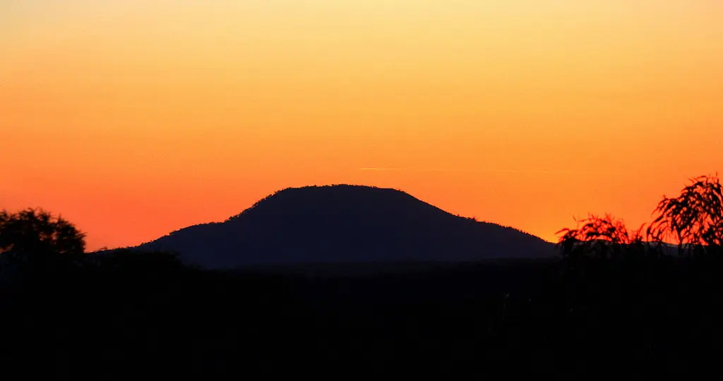
Image of Mount Yengo. Image source
Visit essentials
A quick read before you go
- Duration
- Not specified in available sources.
- Access
- Mount Yengo sits within the Big Yango precinct of Yengo National Park, approximately 17 km…
Overview
Mount Yengo rises above the Wollombi Valley in New South Wales' Lower Hunter region. According to a Dreaming narrative shared by several custodian peoples, Baiame's final act of creation flattened its summit. NSW National Parks and Wildlife Service names the Darkinjung and Wonnarua as peoples with spiritual and cultural connections to the mountain.
Other sources, including a 2009 community heritage forum, add the Awabakal and Worimi and, in one instance, the Guringay; this remains an open question of shared custodianship, not a settled hierarchy.
The mountain lies in Yengo National Park's Big Yango precinct, part of the Greater Blue Mountains World Heritage Area, within a landscape holding more than 640 recorded Aboriginal cultural sites. Its Baiame Dreaming connection places it in the same restricted-knowledge category as nearby Baiame Cave at Milbrodale, where traditional gender-based restrictions on viewing depictions of Baiame have long applied. This boundary is stated without disclosing what lies behind it.
Why this place is sacred
The mountain's flat top is, in itself, treated by sourced material as evidence. According to the Dreaming narrative recounted across several official and traditional sources, Baiame descended to the land, shaped the mountains, rivers, waterways, caves, plants, and coastlines around Wollombi, and established the first laws, traditions, and the earliest bora ground for initiation.
Having completed this work, Baiame stepped or leapt from Mount Yengo's summit back into the sky world, and the force of that departure is said to have flattened the mountain's top — a feature still visible today, and visible from a considerable distance across the surrounding ridgelines.
One variant account, recorded by the Dictionary of Sydney, instead describes an unnamed ancestral being stepping onto the mountain from the nearby Burragurra, or Devil's Rock, leaving footprints; this account holds both tellings as documented rather than resolving which is more original.
What both versions share is a treatment of the landscape as ongoing testimony rather than closed history — the mountain's unusual shape is read, by the people for whom it is sacred, as a permanent physical record of an act that continues to define the place rather than something merely commemorated by it.
Mount Yengo functioned historically as a focal ceremonial gathering point, drawing multiple clans together from a wide catchment spanning northern Sydney to north of Newcastle and the upper Hunter Valley for shared ceremonial business, in addition to its role as the origin and departure point for the Baiame creation narrative.
Yengo National Park, within which the Big Yango precinct and Mount Yengo sit, was inscribed as part of the Greater Blue Mountains World Heritage Area in December 2000, a natural-heritage listing recognizing geographic and botanical values rather than a cultural inscription specific to Aboriginal significance. Darkinjung Local Aboriginal Land Council has since outlined plans for a cultural tourism precinct intended to let community members share creation and Dreaming stories with visitors on their own terms.
Experience and orientation
Direct access to Mount Yengo is restricted by park management rather than freely available: the Big Yango precinct requires a permit from the NSW National Parks and Wildlife Service Bulga office, and permits are generally issued only to those staying overnight at Big Yango house or the Blue Gums and Mountain Arm campgrounds.
For visitors without that booking, the Finchley cultural walk and Finchley lookout, elsewhere within Yengo National Park, offer publicly accessible views of Aboriginal rock art and heritage interpretation without requiring entry to the locked precinct.
From a distance, Mount Yengo's flat summit is visible along the Boree Track, from Putty Road, and from ridges above Wisemans Ferry — a prominence on the regional skyline that sourced material treats as part of the mountain's function, marking the Dreaming narrative at landscape scale rather than requiring a summit visit to be legible.
No first-person visitor account of approaching or summiting Mount Yengo itself was located in available sources, which may reflect the genuinely limited public access rather than an absence of meaningful visitor experience.
Most travelers will encounter Mount Yengo from a distance — from the Boree Track, Putty Road, or the ridgelines above Wisemans Ferry — rather than by entering the Big Yango precinct directly. For a closer, guided cultural experience, the Finchley cultural walk or Wollombi-based Aboriginal-led tours and camps are the more accessible starting points.
Context and lineage
According to the Dreaming narrative recounted by Darkinjung and Wonnarua sources, Baiame descended to the land and created the mountains, rivers, waterways, caves, plants, and coastlines of the region, and established law, tradition, and the first bora ground for initiation. Having completed this creative work, Baiame stepped from the flat summit of Mount Yengo back into the sky world, an act said to have flattened the mountain's top.
One source also names Daramulan alongside Baiame in connection with this narrative, and a variant recorded by the Dictionary of Sydney instead describes an unnamed ancestral being stepping onto the mountain from nearby Burragurra, leaving footprints. This account presents both as documented tellings rather than adjudicating between them.
The Darkinjung Local Aboriginal Land Council describes Darkinjung people as custodians of Mount Yengo specifically; the Wonnarua Nation Aboriginal Corporation represents Wonnarua people as Traditional Landowners of the Hunter Valley, within which the mountain and the related Baiame Cave sit. No dedicated statement from an Awabakal or Worimi organization specific to Mount Yengo was located, so their connection, while named in secondary sources, remains less directly documented in available materials.
Baiame
creator ancestral being / sky father
The creator being said to have shaped the surrounding mountains, rivers, and coastlines before returning to the sky world from Mount Yengo's summit; Baiame is venerated across a wide region including Kamilaroi, Guringay, Eora, Darkinjung, and Wiradjuri traditions.
Arthur Fletcher
Wonnarua Nation representative
Contributor to a 2009 community heritage forum documented by Hunter Living Histories, whose account of the Wollombi Valley's Aboriginal heritage names Darkinjung, Guringay/Gurringai, Awabakal, and Wonnarua connections to the area.
Traditions and practice
Historically, Mount Yengo and its surrounding landscape functioned as a gathering point where multiple clans convened for shared ceremonial business. The broader Baiame-associated cultural landscape, including nearby Baiame Cave, is linked in sourced material to initiation practices; the specific ceremonial content of these practices is not detailed here, in keeping with cultural-sensitivity requirements documented by the sources themselves.
Darkinjung Aboriginal Land Council has outlined plans for a cultural tourism precinct intended to let community members share creation and Dreaming stories and cultural practices with visitors on the Central Coast, near Mount Yengo's cultural landscape, on terms set by the community itself.
Aboriginal-led options exist nearby, including Wollombi-based Aboriginal culture tours and camps, that allow visitors to engage with this cultural landscape through guided, community-sanctioned experiences. Direct visitor participation in ceremony at Mount Yengo itself is not documented in available sources and should not be assumed available without explicit guidance from custodian groups.
Darkinjung
ActiveDarkinjung Local Aboriginal Land Council material describes Darkinjung people as custodians of Mount Yengo, a mountain of major spiritual importance and the origin point of the widely shared Baiame and Daramulan creation narrative.
Contemporary custodianship, cultural heritage programs, and a planned cultural tourism precinct intended to let community share creation and Dreaming stories and cultural practices with visitors on the Central Coast.
Wonnarua
ActiveNamed across nearly all sources as one of the peoples for whom Mount Yengo holds spiritual and ceremonial importance; the Wonnarua Nation Aboriginal Corporation represents Wonnarua people as Traditional Landowners of the Hunter Valley, within which Mount Yengo and the related Baiame Cave sit.
Contemporary cultural representation through the Wonnarua Nation Aboriginal Corporation, and historical and ongoing connection to associated rock art sites including Baiame Cave.
Awabakal
HistoricalNamed in several secondary and tertiary sources as one of the peoples for whom Mount Yengo is spiritually and ceremonially significant, though not confirmed via a dedicated Awabakal-authored statement in available sources.
Worimi
HistoricalNamed in several secondary and tertiary sources alongside Wonnarua, Awabakal, and Darkinjung as holding spiritual or ceremonial connection to Mount Yengo, though not confirmed via a dedicated Worimi-authored statement in available sources.
Perspectives and open questions
Mount Yengo is read through the shared Dreaming narrative recounted by its Aboriginal custodian peoples, through an academic-adjacent heritage literature that has not produced a dedicated peer-reviewed study of the mountain itself, and through a popular media shorthand that risks flattening its specific significance.
Scholarly perspective
Secondary and tertiary academic-adjacent sources, including a university-hosted local history project and the Dictionary of Sydney, converge on Mount Yengo as a significant multi-clan ceremonial and creation site tied to the Baiame Dreaming, situated within a densely recorded Aboriginal archaeological landscape of more than 640 sites and now partly protected through its inclusion in the Greater Blue Mountains World Heritage Area.
No dedicated peer-reviewed anthropological study specific to Mount Yengo was identified in this account's sources; existing academic-adjacent treatment draws on named contributors, including a university-affiliated archaeologist, cited through a 2009 community heritage forum.
Living and traditional perspectives
Darkinjung Local Aboriginal Land Council material affirms Darkinjung custodianship of Mount Yengo and identifies it as the origin point of the shared Baiame and Daramulan creation narrative. Wonnarua Nation Aboriginal Corporation material and Wonnarua-linked heritage records, including Baiame Cave, affirm a Wonnarua connection to the broader Baiame cultural landscape. Both groups frame the mountain as living cultural heritage rather than historical curiosity, with Darkinjung outlining active plans to share this heritage through cultural tourism on its own terms.
Alternative interpretations
Popular and travel-media coverage, including regional newspaper reporting, commonly describes Mount Yengo using the comparative shorthand 'Uluru of the east,' emphasizing its visual distinctiveness as tangible evidence of the creation narrative. This framing draws attention to the mountain but originates from media and tourism convention rather than from the traditional owners themselves, and this account uses it cautiously so as not to flatten a significance that is locally specific.
Open questions
The precise ranking or delineation of custodianship among the Darkinjung, Wonnarua, Awabakal, and Worimi peoples in relation to Mount Yengo specifically is not resolved by available sources — this reflects the mountain's likely role as a shared, multi-clan site rather than a gap to be filled by outside researchers. The exact scope and current administration of gender-based or initiation-related restrictions tied to Baiame sites in this landscape is similarly left unresolved here, consistent with cultural-sensitivity requirements.
Plan your visit
Access and arrival
Mount Yengo sits within the Big Yango precinct of Yengo National Park, approximately 17 km east-southeast of Putty and 3 km east of the Macdonald River, in the Lower Hunter region of NSW. The precinct is behind locked gates and requires a permit from the NPWS Bulga office (02 6574 5555, Monday to Friday 9:30am–4pm; email npws.wollemiyengo@environment.nsw.gov.au), typically issued to those booked into Big Yango house or the Blue Gums or Mountain Arm campgrounds.
Overnight stays within the precinct are limited to Big Yango house and the Blue Gums and Mountain Arm campgrounds, bookable through NSW National Parks and Wildlife Service; no other accommodation exists within the precinct itself.
Respectful visit
Not specified in available sources; general bushwalking preparedness for a remote national park precinct is a reasonable default.
Not specified in available sources; given the site's status as an Aboriginal Place with associated restricted, initiation-linked content in its wider cultural landscape, visitors should exercise caution around photographing rock art or culturally sensitive features and follow any posted signage.
Not specified in available sources.
Physical access to the Big Yango precinct containing Mount Yengo requires a permit and is generally limited to those staying at designated overnight accommodation — Big Yango house, or the Blue Gums or Mountain Arm campgrounds — obtained through the NPWS Bulga office.
Separately, portions of the associated Baiame-linked cultural landscape are subject to traditional gender-based access and viewing restrictions; the specific content and scope of these restrictions is not detailed in available sources and is not something this account attempts to resolve.
Do not attempt to enter the Big Yango precinct without a valid permit, and do not seek out or ask about restricted content connected to Baiame imagery or initiation practice — this is knowledge that traditional owners have chosen, as a matter of ongoing cultural protocol, not to share outside the community.
Location
Map loads as you approach this section.
Pilgrim reflections
A portrait of encounter, not a score
Pilgrims describe what they felt, how present they could become, and whether the place would shape a journey. There are no stars and no ranking of traditions.
No reviewed reflections yet
The first pilgrims can help describe the character of being here.
Share a reflection
Available after an account-backed “Been there.” Every reflection is reviewed before publication.
Nearby sacred places
Explore other sacred places in the region. Proximity does not establish access or travel time; check each place’s guidance.
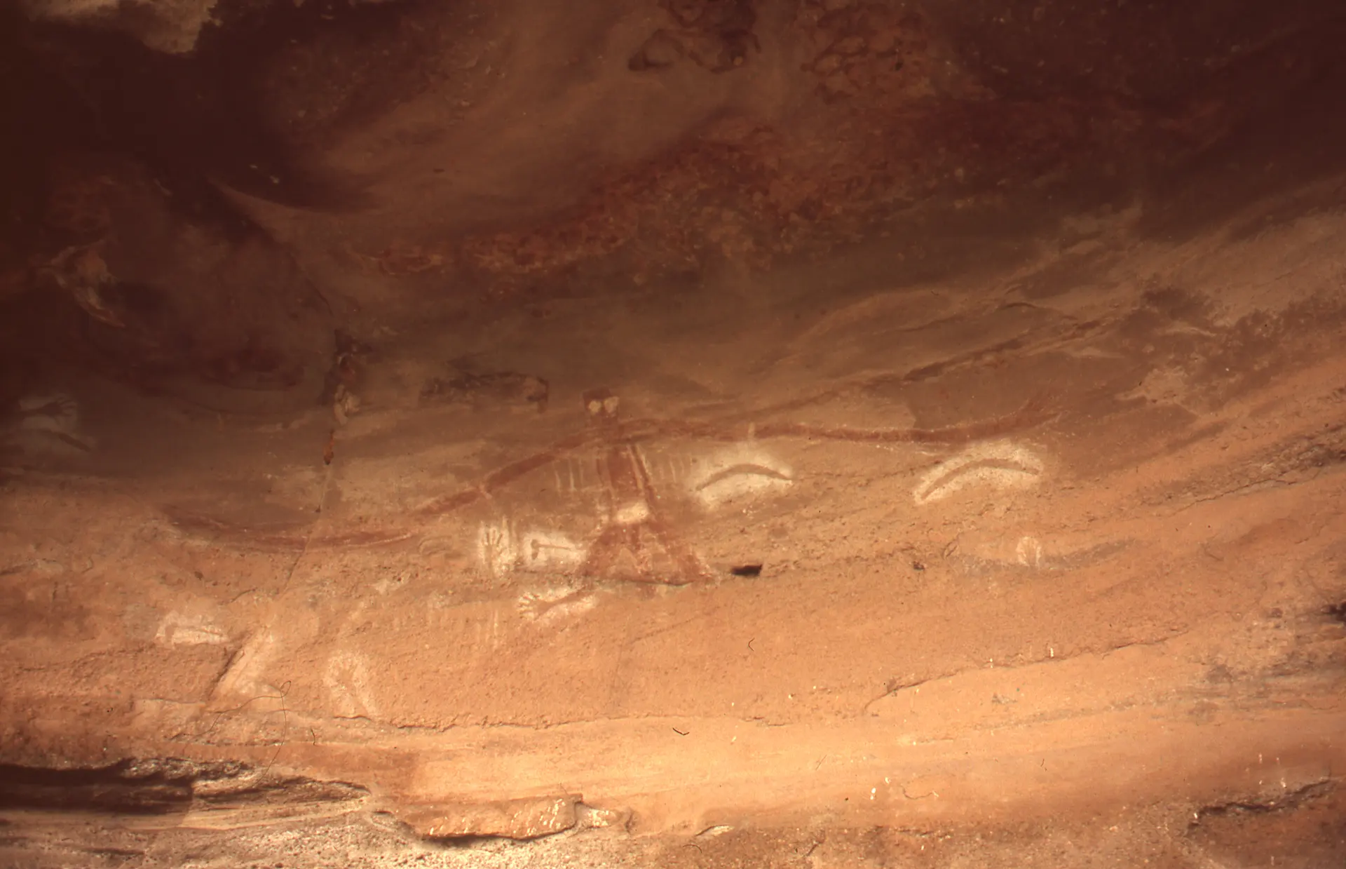
Baiame Cave
Milbrodale / Singleton, New South Wales, New South Wales, Australia
29.3 km away

Ku-ring-gai Chase Aboriginal Heritage Walk
Sydney / Ku-ring-gai Chase, New South Wales, New South Wales, Australia
88.8 km away

Red Hands Cave
Glenbrook / Blue Mountains, New South Wales, New South Wales, Australia
103.0 km away
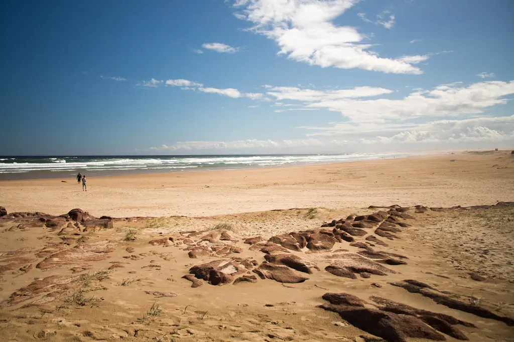
Worimi Conservation Lands
Nelson Bay, New South Wales, Australia
112.7 km away
References
Sources consulted for this page. Source categories describe the publication, not a guarantee that every claim is verified. Traditional accounts and outside interpretations may differ.
- 01Yengo National Park | Learn more | NSW National Parks — NSW National Parks and Wildlife Service (NSW Dept of Climate Change, Energy, the Environment and Water)officialOfficial park authority page; names Darkinjung and Wonnarua as the peoples with spiritual/cultural connection; references creation story of 'Biamie'; lists 640+ recorded Aboriginal cultural sites; no explicit etiquette/restriction content found on this page.
- 02Yengo National Park | NSW National Parks — NSW National Parks and Wildlife ServiceofficialOfficial landing page; confirms Greater Blue Mountains World Heritage listing (Dec 2000) and general park framing.
- 03Yengo National Park | Visitor info | NSW National Parks — NSW National Parks and Wildlife ServiceofficialSource for Big Yango precinct locked-gate/permit access rules and Bulga office contact details.
- 04Culture and Heritage | Darkinjung Aboriginal Land Council — Darkinjung Local Aboriginal Land CouncilSource contextStatement from the Darkinjung Local Aboriginal Land Council describing Darkinjung people as custodians of Mt Yengo and referencing the shared Baiame/Daramulan creation narrative; also outlines a planned cultural tourism precinct.
- 05WNAC — Wonnarua Nation Aboriginal Corporation (Home) — Wonnarua Nation Aboriginal CorporationSource contextConfirms Wonnarua Nation Aboriginal Corporation as the representative body for Wonnarua People, Traditional Landowners of the Hunter Valley; general corporate/representative confirmation rather than a Mount Yengo–specific statement.
- 06Yengo National Park | What we're doing | NSW National Parks — NSW National Parks and Wildlife ServiceofficialConfirms general management-strategy framing; did not yield specific joint-management-with-Aboriginal-groups detail on the page as fetched.
- 07Mount Yengo — Wikipedia contributorsacademicTertiary source citing Geographical Names Register of NSW, NSW NPWS, Office of Environment & Heritage, and Wollombi Valley Arts Council; names Wonnarua, Awabakal, Worimi, Darkinjung; confirms Big Yango precinct permit requirement; references OEH Atlas of Aboriginal Places entry.
- 08Mount Yengo — Dictionary of Sydney TrustacademicCurated academic/historical reference project; cites NSW Office of Environment and Heritage and Hunter Living Histories; provides variant creation-story phrasing and place-name etymology discussion (uncertain meaning of 'Yungo').
- 09Aboriginal Heritage of Mount Yengo and the Wollombi Valley — University of Newcastle Special Collections / Hunter Living HistoriesacademicUniversity-hosted local history project documenting a 2009 community heritage forum; cites named contributors including a Wonnarua Nation representative (Arthur Fletcher) and a University of Sydney archaeologist (John Clegg); adds Guringai/Gurringai to the group list.
- 10Mount Yengo, Uluru of the East, protection bid — Newcastle HeraldSource contextRegional news article; source of the popular 'Uluru of the East' framing and general protection-advocacy context.
- 11Baiame Cave — Wikipedia contributorsacademicConfirms heritage-listed status of Baiame Cave (Milbrodale) as a Wonnarua cultural site with rock art possibly depicting Baiame; used to corroborate gender-restricted/secret-knowledge protocols historically associated with Baiame imagery and initiation sites in this cultural landscape. Restricted content itself is not reproduced in this research file.
- 12Baiame — Wikipedia contributorsacademicGeneral background on Baiame as creator/sky-father figure shared across Wonnarua, Kamilaroi, Guringay, Eora, Darkinjung and Wiradjuri Dreaming traditions.
Share a photo
Help visitors recognize Mount Yengo. Every submission is reviewed before publication.