Hill of the Avocado
A ridgeline of the dead above the clouds of Tierradentro, where sixty tombs line a mountain spine
Tierradentro, Cauca, Colombia

Plan this visit
Practical context before you go
Three to four hours round trip, including hiking time and exploration of the ridge. Best allocated to the second day of a two-day Tierradentro itinerary.
Alto del Aguacate requires the respect appropriate to a burial ground on indigenous territory. Tread carefully, leave nothing behind, take nothing, and acknowledge that you are a guest in two senses: on Nasa land and among the ancient dead.
At a glance
- Coordinates
- 2.5900, -76.0300
- Type
- archaeological_site
- Suggested duration
- Three to four hours round trip, including hiking time and exploration of the ridge. Best allocated to the second day of a two-day Tierradentro itinerary.
Pilgrim tips
- Sturdy hiking boots are essential, not optional. The trail is steep, uneven, and often muddy. Long pants protect against brush along the path. Bring rain gear regardless of the forecast. Sun protection for the exposed ridgeline.
- Photography is permitted. The deteriorated condition of the tombs makes flash unlikely to cause additional damage, but approach with the restraint appropriate to a burial ground.
- Do not enter unstable or collapsing tombs. Do not add graffiti or damage painted surfaces. Do not remove any objects from the site. Be aware of the edge of the ridge and tomb openings for personal safety. The trail can be slippery and muddy, particularly in wet season. There are no facilities, cell signal, or emergency services at the ridge. Tell someone your plans before hiking.
Overview
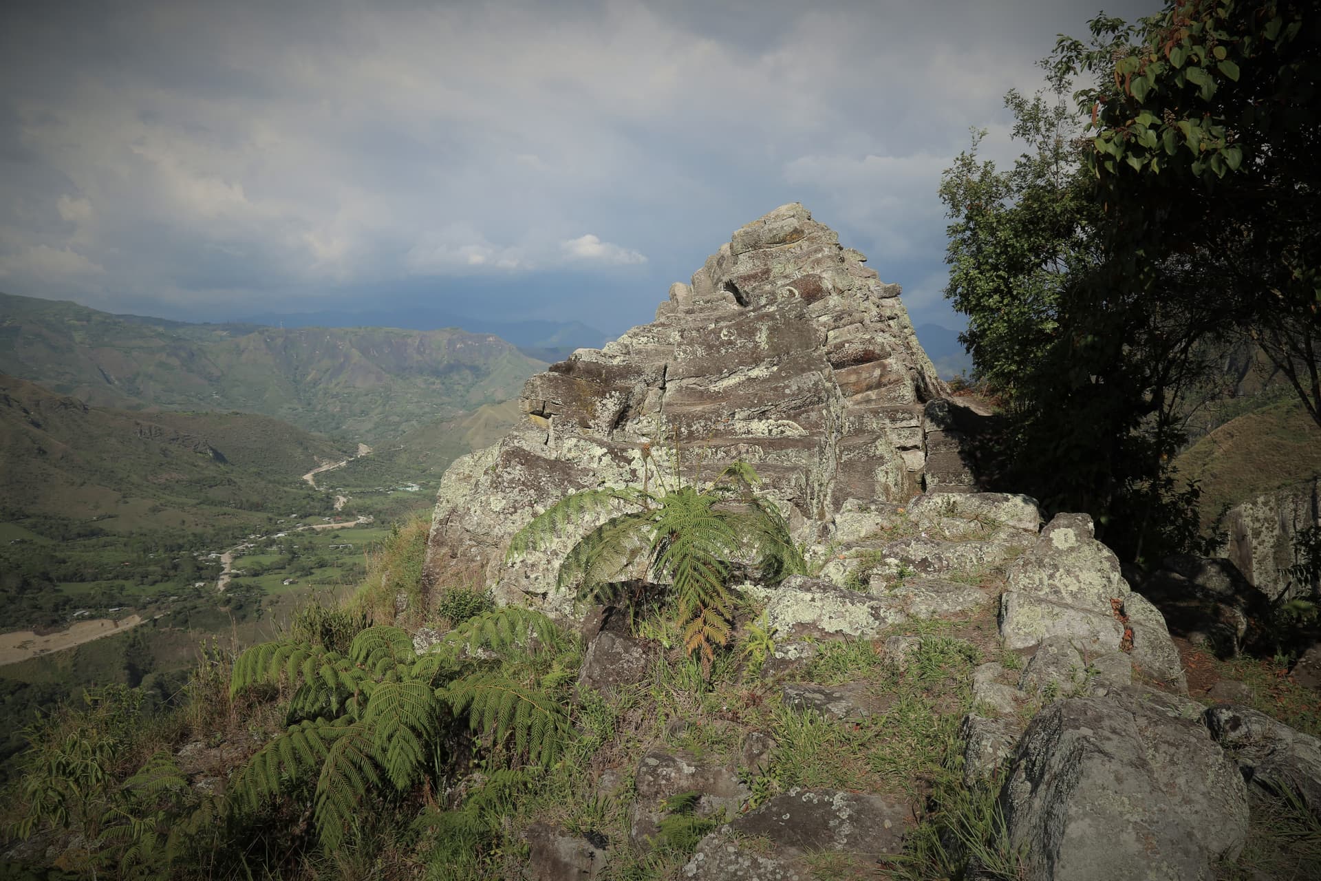
Sixty-two to seventy underground burial chambers pierce a 250-meter ridgeline at the highest point of the Tierradentro landscape. Dating to approximately 850 CE, Alto del Aguacate holds the largest single concentration of pre-Columbian hypogea in the Americas. The steep hike to reach it ensures that those who arrive have earned their presence through physical effort, echoing what may have been the original mourners' journey.
Alto del Aguacate sits at the summit of the Tierradentro world. The ridgeline, the highest point in this archaeological landscape of southwestern Colombia, runs for 250 meters along a mountain spine pierced by the openings of sixty-two to seventy underground burial chambers. These hypogea, carved into volcanic rock around 850 CE, were painted inside with geometric and figurative designs, their walls holding the secondary remains of the dead in ceramic urns.
The builders chose this ridge with deliberation. The densest concentration of tombs in the entire Tierradentro complex occupies its most elevated, most exposed location, a place where the mountain meets the sky. Whether this reflects the status of those buried here, the significance of the ridgeline itself, or some understanding of proximity to the heavens that the builders took with them into silence, scholars cannot say with certainty.
What visitors encounter today is not the pristine necropolis of a millennium ago. Weather, moss, graffiti, and the slow erosion of time have taken their toll. Some chambers are collapsed or inaccessible. The painted surfaces fade. This deterioration is itself part of what makes Aguacate significant: here, the grandeur of human effort to honor the dead meets the patient indifference of geological time. The ridge sits on Nasa indigenous territory, and the tension between archaeological preservation and indigenous land use adds a living dimension to an ancient place.
Part of Tierradentro Pyramid.
Context and lineage
No written accounts survive from the builders of the Aguacate hypogea, and the site's modern name, Hill of the Avocado, is a Spanish designation that tells us nothing about its original meaning. What the archaeological evidence reveals is a culture that invested extraordinary labor in honoring their dead: carving shaft tombs into volcanic rock along an exposed ridgeline, painting the chambers with mineral pigments, and depositing cremated or defleshed remains in ceramic urns. The choice of the highest point in the landscape for the densest concentration of burials suggests this was not a utilitarian cemetery but a sacred necropolis, a place selected for its symbolic relationship to the sky, the mountains, and the valley below.
The cultural lineage at Alto del Aguacate is interrupted. The builders of the hypogea vanished as a distinct culture before the arrival of Europeans, and the Nasa people who now govern the territory are not their direct descendants. This discontinuity means that the tombs exist in a double silence: the builders left no written record, and no living tradition preserves their funerary theology. What remains is the physical evidence of their devotion to the dead, carved into rock at the highest point they could reach.
The Tierradentro Builders
The unnamed pre-Columbian culture that carved and painted the hypogea across the Tierradentro landscape, including the concentration at Alto del Aguacate. Their specific cultural identity remains debated by scholars.
The Nasa (Paez) People
The indigenous community that currently holds territorial governance over the land surrounding Alto del Aguacate. Their presence in Tierradentro postdates the tomb builders, but they are the living stewards of this landscape.
UNESCO and ICANH
The international and Colombian national bodies responsible for the site's World Heritage designation (1995) and ongoing conservation efforts, navigating the tension between preservation and indigenous land rights.
Why this place is sacred
The builders of the Tierradentro hypogea chose their burial sites with a consistency that suggests cosmological reasoning. The lower sites, Alto de San Andres and Alto de Segovia, sit on accessible hills with well-preserved painted chambers. But the largest concentration of tombs, they placed at the highest and most remote point, along a ridgeline that requires strenuous climbing to reach.
This choice invites interpretation but resists certainty. Perhaps the ridge burials represented the most honored dead. Perhaps the elevation itself carried spiritual significance, placing the deceased closer to whatever the builders understood as the realm above. Perhaps the ridgeline's visibility from the valleys below served as a permanent marker of ancestral presence against the sky.
What is certain is the physical experience. Walking along the ridge, with tomb openings on either side and the Tierradentro valley spread below, one walks a corridor between worlds. The underground chambers extend beneath one's feet, hollowed spaces holding the remains of people who lived twelve centuries ago. The moss reclaiming the carved stone, the rain wearing at painted surfaces, the graffiti left by careless visitors, all testify to the fragility of human memorial. The earth absorbs what was placed within it, slowly, inexorably. Standing here, the visitor witnesses that process in real time.
Alto del Aguacate served as a necropolis, likely during the peak period of the Tierradentro burial tradition around 850 CE. The pre-Columbian inhabitants carved shaft tombs along the ridgeline into volcanic rock, then painted the interior chambers with geometric and figurative designs using mineral pigments. The dead were given secondary burial: remains were prepared, likely through cremation or defleshing, placed in ceramic urns, and deposited in the painted chambers. The concentration of so many tombs along a single elevated ridge suggests this was a site of particular importance within the Tierradentro funerary landscape.
The identity of the builders themselves remains debated by scholars. They are not the Nasa people who now occupy the territory but a distinct pre-Columbian culture whose name has been lost. After the burial tradition ceased, the ridgeline gradually returned to forest and grassland. The Nasa people established their presence in the Tierradentro region in later centuries. In the 20th century, the site was identified as part of the broader Tierradentro archaeological complex and formally included in the UNESCO World Heritage inscription of 1995. Today, the tension between Nasa agricultural land use and archaeological preservation creates an ongoing negotiation about the meaning and ownership of this ancient landscape.
Traditions and practice
The Tierradentro funerary tradition involved a complex sequence of treatment for the dead. Bodies appear to have undergone secondary burial, meaning the remains were first processed through cremation or defleshing, then placed in ceramic urns and deposited in the underground chambers. The tomb builders carved shaft entries into the volcanic ridgeline, then excavated chambers below, sometimes creating multi-room layouts with pillars. The interiors were painted with geometric patterns and figurative designs using mineral pigments, colors that once glowed in the darkness of sealed chambers. Whether processions accompanied the dead along the ridgeline, whether music or chanting marked the interment, whether the community gathered at the summit or the burial was performed by specialists alone, these details have been lost entirely.
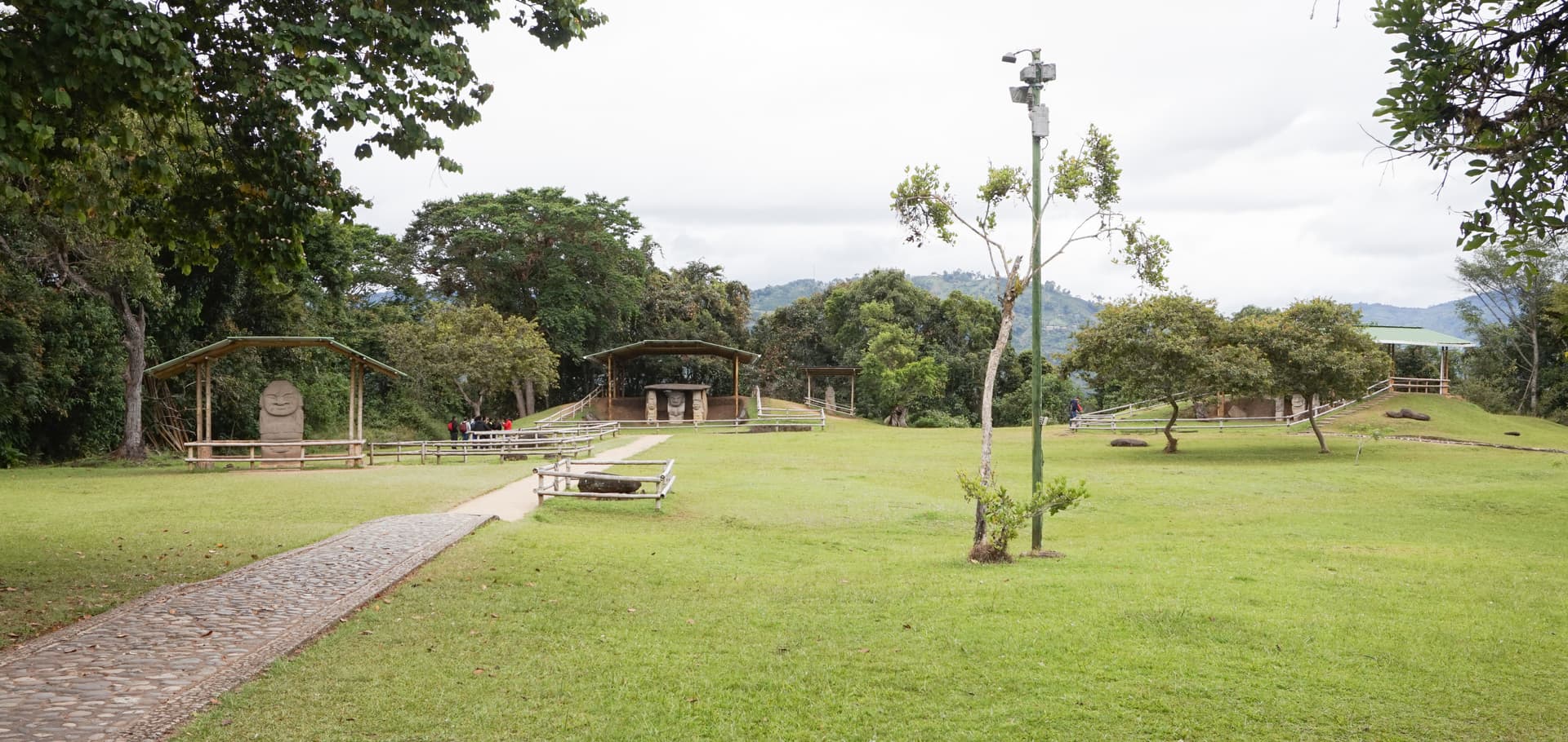
Alto del Aguacate is accessible as part of the Tierradentro Archaeological Park circuit. ICANH, the Colombian Institute of Anthropology and History, manages the broader park, though conservation resources for the remote Aguacate ridge remain limited. The Nasa community continues to use the surrounding land for agriculture, and this ongoing land use exists in tension with preservation mandates. No formal interpretive programs or guided tours operate at the ridge itself. Visitors arrive on their own.
Approach the ridge as the builders' mourners may have approached it: with effort and intention. The hike is the preparation. When you reach the ridgeline, slow down. Walk the full 250-meter spine, observing how the tomb openings line the path on both sides. Peer into accessible chambers with a flashlight, noting whatever painted surfaces survive. Pay attention to the quality of silence at the summit, broken only by wind and birdsong. Notice how the valley opens below, how the mountains rise around you, how the ridge itself feels like a threshold between the inhabited world below and the open sky above. Sit with the deterioration rather than lamenting it. The moss, the erosion, the slow reclamation of carved stone by weather and earth are themselves a teaching about impermanence.
Pre-Columbian Tierradentro Funerary Tradition
HistoricalAlto del Aguacate contains the largest single concentration of hypogea in the Tierradentro complex and possibly in the Americas. The sixty-two to seventy underground burial chambers, distributed along a 250-meter ridgeline at the highest point of the landscape, represent the peak of the Tierradentro burial tradition around 850 CE. The concentration of so many tombs along an elevated ridge suggests deliberate cosmological reasoning about the placement of the dead in relation to earth and sky.
Carving of shaft tombs along the ridgeline into volcanic rock. Painting of chamber interiors with geometric and figurative designs using mineral pigments. Secondary burial of cremated or defleshed remains in ceramic urns. The selection of the highest ridge as the site for the densest concentration of burials.
Nasa (Paez) Indigenous Territorial Governance
ActiveThe Nasa people hold territorial governance over the land surrounding Alto del Aguacate. While they are not descendants of the tomb builders, they are the living stewards of this landscape. The tension between archaeological preservation and indigenous land use is ongoing and reflects broader questions across the Americas about who has authority over pre-Columbian heritage.
Agricultural use of land surrounding the archaeological site. Community governance through Nasa territorial councils. Negotiation with ICANH and UNESCO regarding site management and access.
Archaeological Conservation and Research
ActiveThe inclusion of Alto del Aguacate in the 1995 UNESCO World Heritage inscription recognizes its importance within the broader Tierradentro funerary landscape. ICANH manages the site as part of the national archaeological park. However, conservation resources for the remote Aguacate ridge remain limited compared to the more accessible sites, and the ongoing deterioration of the hypogea is a significant concern.
Limited conservation interventions by ICANH. Monitoring of structural stability and painted surface deterioration. Integration of the site into the broader Tierradentro park visitor circuit. Ongoing archaeological documentation.
Experience and perspectives
The path to Alto del Aguacate begins where the easier Tierradentro circuits end. While most visitors to the archaeological park explore the well-maintained tombs at Alto de San Andres and Alto de Segovia, the route to Aguacate demands commitment. The trail is steep, unpaved, and often muddy. It climbs through landscapes that shift between Nasa agricultural fields and dense vegetation, gaining significant elevation before opening onto the ridgeline.
The arrival is gradual rather than dramatic. Tomb openings begin to appear along the ridge, dark mouths in the earth partially obscured by grass and moss. As you walk further along the 250-meter spine, their number becomes overwhelming. Sixty or more shaft tombs, distributed along a ridge barely wide enough for a path, creating the sense of walking along an avenue where every step crosses above a burial chamber.
Some openings are accessible for peering into with a flashlight. The painted surfaces, where they survive, show geometric patterns in mineral pigments, though many chambers have suffered from water infiltration, moss growth, and human damage. The deterioration is honest, unvarnished. There is no interpretive center at the ridge, no rope barriers, no signage to mediate the encounter. It is you, the mountain, and the dead.
The panoramic views from the ridge, across the Tierradentro valley and surrounding peaks, are striking. But they serve a more-than-scenic purpose: they reveal the landscape as the builders saw it, a world of mountains and valleys where the highest point was reserved for the most concentrated act of memorialization.
Begin from the Tierradentro Archaeological Park area near San Andres de Pisimbala. The hike is strenuous with significant elevation gain on unpaved trails. Allow three to four hours round trip including exploration of the ridge. Bring water, snacks, a flashlight, and rain gear. Sturdy hiking boots are essential. There are no facilities at the ridge. Best attempted in the morning before afternoon cloud cover. This is typically visited on the second day of a two-day Tierradentro itinerary, after the easier sites.
Alto del Aguacate invites contemplation from multiple angles: archaeological, ecological, indigenous, and existential. Each perspective illuminates something different about a place where human memorial meets geological indifference.
Archaeologists recognize Alto del Aguacate as the largest single concentration of Tierradentro hypogea, dating to the peak period of the burial tradition around 850 CE. The ridgeline location is understood as significant within the sacred geography of the Tierradentro complex, though the specific reasons for concentrating the most tombs at the highest, most exposed location remain debated. Conservation concerns have been raised by both UNESCO and ICANH regarding deterioration from weather exposure, limited resources, and ongoing land-use conflicts with the Nasa community. The builders' specific cultural identity remains unresolved; they are distinct from the Nasa but their ethnic and linguistic affiliations are uncertain.
The Nasa people's relationship to Alto del Aguacate is shaped by their broader territorial sovereignty over the Tierradentro landscape. The tombs were not made by their ancestors, but the land is theirs. This creates a complex dynamic: the international community values the site for its archaeological significance, while the Nasa value the land for its agricultural utility and its place within their territorial governance. Neither claim is illegitimate, and the tension between them is itself a form of living history.
The ridgeline placement of sixty or more tombs has attracted speculation about ley line alignments or astronomical orientations. These interpretations are not supported by published archaeological research. The site's power lies in what is documented: the sheer concentration of human burial along a single mountain spine, the labor invested in carving and painting underground chambers, and the builders' evident belief that this high, exposed ridge was the appropriate place to house their dead.
Why this particular ridge was chosen for the densest concentration of tombs is debated. Whether the ridge burials represent a different social class, time period, or community than the valley sites has not been determined. The original name and meaning of the site to its builders is completely unknown. How many hypogea may remain undiscovered beneath the surface of the ridge is a question that only future excavation can answer.
Visit planning
Basic accommodations available in San Andres de Pisimbala and the Tierradentro park area. Popayan, the nearest major city, is approximately 5 hours by road. Mobile phone signal is unreliable in the Tierradentro area and absent on the Aguacate ridge. The nearest settlement with reliable communications is Inza, approximately 1.5 hours by road.
Alto del Aguacate requires the respect appropriate to a burial ground on indigenous territory. Tread carefully, leave nothing behind, take nothing, and acknowledge that you are a guest in two senses: on Nasa land and among the ancient dead.
Sturdy hiking boots are essential, not optional. The trail is steep, uneven, and often muddy. Long pants protect against brush along the path. Bring rain gear regardless of the forecast. Sun protection for the exposed ridgeline.
Photography is permitted. The deteriorated condition of the tombs makes flash unlikely to cause additional damage, but approach with the restraint appropriate to a burial ground.
Do not leave offerings or objects at the tombs.
Do not enter unstable or collapsing tomb chambers | Do not add graffiti or damage remaining painted surfaces | Do not remove any objects from the site | Do not disturb the surrounding landscape or agricultural areas | Stay aware of ridge edges and tomb openings for personal safety | Carry all waste out with you
Plan your visit
Address
Inza, Cauca, Colombia
Hours
Hours, fees, and access can change — verify on the official source before you travel. Practical details last checked Jun 2026.
Nearby sacred places
Sacred places within a half-day’s reach. Pilgrims often visit them together: walk one, stay for the other.


Key questions
What pilgrims usually ask
- Why is Hill of the Avocado considered sacred?
- Walk the ridgeline of Alto del Aguacate in Tierradentro, Colombia, where 62-70 pre-Columbian burial chambers line a mountain spine at the highest point.
- What should I wear at Hill of the Avocado?
- Sturdy hiking boots are essential, not optional. The trail is steep, uneven, and often muddy. Long pants protect against brush along the path. Bring rain gear regardless of the forecast. Sun protection for the exposed ridgeline.
- Can I take photos at Hill of the Avocado?
- Photography is permitted. The deteriorated condition of the tombs makes flash unlikely to cause additional damage, but approach with the restraint appropriate to a burial ground.
- How long should I spend at Hill of the Avocado?
- Three to four hours round trip, including hiking time and exploration of the ridge. Best allocated to the second day of a two-day Tierradentro itinerary.
- What offerings are appropriate at Hill of the Avocado?
- Do not leave offerings or objects at the tombs.
- What etiquette should visitors follow at Hill of the Avocado?
- Alto del Aguacate requires the respect appropriate to a burial ground on indigenous territory. Tread carefully, leave nothing behind, take nothing, and acknowledge that you are a guest in two senses: on Nasa land and among the ancient dead.
- What is the history of Hill of the Avocado?
- No written accounts survive from the builders of the Aguacate hypogea, and the site's modern name, Hill of the Avocado, is a Spanish designation that tells us nothing about its original meaning. What the archaeological evidence reveals is a culture that invested extraordinary labor in honoring their dead: carving shaft tombs into volcanic rock along an exposed ridgeline, painting the chambers with mineral pigments, and depositing cremated or defleshed remains in ceramic urns. The choice of the highest point in the landscape for the densest concentration of burials suggests this was not a utilitarian cemetery but a sacred necropolis, a place selected for its symbolic relationship to the sky, the mountains, and the valley below.
- Who is associated with Hill of the Avocado?
- The Tierradentro Builders (The unnamed pre-Columbian culture that carved and painted the hypogea across the Tierradentro landscape, including the concentration at Alto del Aguacate. Their specific cultural identity remains debated by scholars.), The Nasa (Paez) People (The indigenous community that currently holds territorial governance over the land surrounding Alto del Aguacate. Their presence in Tierradentro postdates the tomb builders, but they are the living stewards of this landscape.), UNESCO and ICANH (The international and Colombian national bodies responsible for the site's World Heritage designation (1995) and ongoing conservation efforts, navigating the tension between preservation and indigenous land rights.)