Bruan Broch
An Iron Age tower on the Caithness coast, standing among the densest broch landscape in Scotland
Lybster, Caithness, United Kingdom

Plan this visit
Practical context before you go
Thirty to forty-five minutes to examine the orthostats, defensive features, and landscape context.
The broch sits directly alongside the A99 road between Lybster and Ulbster, near the village of Bruan. There is no dedicated car park; park carefully on the roadside. A gate in the enclosure wall provides access to the site. Public transport is very limited; Stagecoach buses run between Wick and Thurso via the A99 but service is infrequent. Nearest railway station: Wick, approximately eleven miles northeast.
Bruan Broch is publicly accessible via a gate in the enclosure wall but sits on private farmland. The key principles are respect for the monument's fabric, consideration for the landowner and livestock, and practical preparation for Caithness conditions.
At a glance
- Coordinates
- 58.3385, -3.1798
- Type
- Broch
- Suggested duration
- Thirty to forty-five minutes to examine the orthostats, defensive features, and landscape context.
- Access
- The broch sits directly alongside the A99 road between Lybster and Ulbster, near the village of Bruan. There is no dedicated car park; park carefully on the roadside. A gate in the enclosure wall provides access to the site. Public transport is very limited; Stagecoach buses run between Wick and Thurso via the A99 but service is infrequent. Nearest railway station: Wick, approximately eleven miles northeast.
Pilgrim tips
- No specific requirements beyond practical outdoor clothing. Sturdy footwear recommended for the uneven ground. Windproof and waterproof layers advisable given the exposed coastal location.
- Photography is permitted throughout. The prominent mound makes an atmospheric subject, particularly in dramatic weather or low-angle light. Views from the mound encompass the surrounding archaeological landscape.
- The site is on private agricultural land. Close gates after entering. Do not disturb stones, dig, or remove anything. Respect any livestock in surrounding fields. The mound is uneven and can be slippery when wet.
Overview
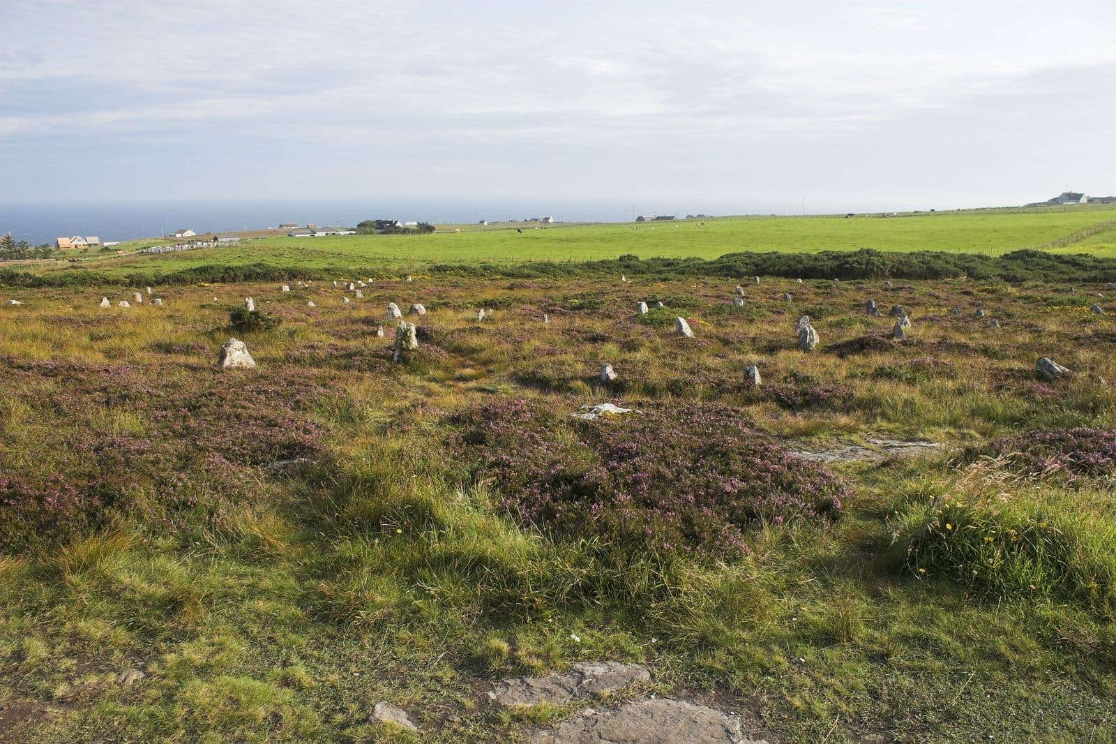
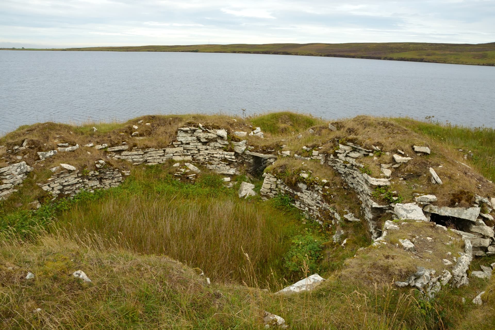
On a low rise beside the A99 in Scotland's far north, a grass-covered mound conceals the remains of an Iron Age broch. Bruan Broch was once a drystone tower perhaps sixteen metres tall, the centrepiece of a small settlement that included outbuildings, a defensive ditch, and a counterscarp bank. Built sometime between 400 BCE and 100 CE by communities whose names and languages are lost, it survives today as a conspicuous mound roughly three metres high, with orthostats still visible around its platform edge. In a county that contains more broch sites than any other in Scotland, Bruan represents the everyday monumentality of Iron Age life.
Bruan Broch does not hide. It rises beside the A99, a grass-covered dome that has watched over this stretch of Caithness coastline for more than two thousand years. Most travellers pass it without stopping, but those who do step through the gate in the enclosure wall and climb the mound find themselves standing on the remains of something remarkable: a drystone tower that may once have risen higher than a modern four-storey building, constructed entirely without mortar by people whose engineering skills we are still working to understand.
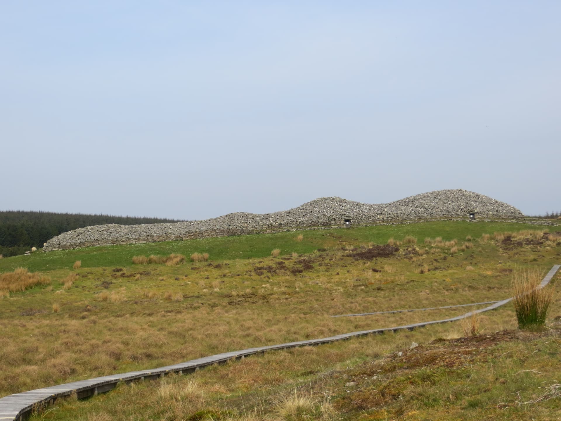
Caithness holds over two hundred broch sites, the highest concentration in Scotland. This was broch country in the Iron Age, a landscape dominated by these circular towers at intervals of a mile or two. Bruan sits within this dense web of ancestral architecture. Cairn of Get lies two kilometres west. Whaligoe Steps are a kilometre to the north. The Hill o' Many Stanes stands three miles to the south. To visit Bruan is to enter a landscape where human presence stretches back millennia without interruption.
Geophysical surveys conducted by ORCA in 2017, as part of the Caithness Broch Project, revealed previously unknown settlement features south of the broch, confirming that this was not an isolated tower but a multi-building settlement. Trial trenching the following year uncovered a possible prehistoric structure near an adjacent cairn. The broch mound itself has never been fully excavated. What lies beneath the turf and stone remains, for now, a matter for conjecture and careful future investigation.
Context and lineage
The Iron Age communities who built Bruan Broch left no written records. Their tower rose from the Caithness landscape at a time when communities across northern Scotland were constructing these distinctive circular structures, a building form found nowhere else in the world. The investment required, quarrying and transporting stone, engineering the double-wall construction with internal galleries and stairways, raising the tower course by course, indicates a society with sophisticated technical knowledge and the social cohesion to direct sustained communal labour toward a single monumental project. Whether the impulse was defensive, residential, or symbolic, or some combination of all three, cannot be determined from the archaeological evidence alone.
No continuous tradition connects the Iron Age builders of Bruan to any modern community. The specific cultural identity of the broch-building peoples, sometimes associated with the later Picts, remains unclear. Norse settlers arrived in Caithness from the eighth century CE, and place-name evidence suggests Bruan may have been a landmark or meeting place in the Norse period. The broch entered modern awareness through Royal Commission surveys in the early twentieth century and gained renewed attention through the Caithness Broch Project's community archaeology programme beginning in 2017.
Caithness Broch Project
ORCA (Orkney Research Centre for Archaeology)
Why this place is sacred
The concept of thin places, where the boundary between ordinary experience and something deeper seems to narrow, applies at Bruan not through any tradition of sanctity but through the accumulation of time and intention. The Iron Age communities who built this broch invested enormous communal labour in its construction. The tower was not merely a dwelling but a statement: of belonging, of status, of permanence in a landscape of wind and rain. That statement endures, even in ruin.
Standing on the broch mound, you survey the same landscape its builders knew. The farmland, the coast, the sky that dominates everything at this latitude. The orthostats visible around the platform's outer edge were placed by hands that understood stone intimately, that knew how to raise a tower fifteen metres high from nothing but local material and collective effort. The ditch that once encircled the settlement, now largely destroyed by centuries of cultivation, speaks of a world where defence mattered, where the line between inside and outside was drawn with deliberate care.
The broch's relative obscurity contributes to the experience. This is not a site with interpretation boards, guided tours, or visitor infrastructure. There is a gate, a mound, and the sky. What you make of the encounter depends entirely on what you bring to it. For those attuned to the weight of deep time, the unreconstructed simplicity of Bruan can be unexpectedly affecting.
Brochs are understood by archaeologists as the fortified residences of Iron Age communities in northern Scotland. Whether they served primarily defensive, domestic, or symbolic functions remains debated. The substantial labour required for construction, estimated at thousands of person-hours, indicates that brochs were central to community identity. At Bruan, the associated settlement buildings, defensive ditch, and counterscarp bank suggest a complete farmstead complex rather than a standalone tower.
Early Royal Commission surveyors recorded Bruan as a turf-covered stony mound about three metres high and fifteen metres in diameter. The surrounding defensive features, including the ditch and counterscarp bank, were already degraded by agricultural activity. In 2017, the Caithness Broch Project coordinated geophysical surveys by ORCA, which revealed previously unknown features. Trial trenching in 2018 uncovered a possible prehistoric structure south of the broch. The site's place-name may preserve evidence of Norse-period activity, suggesting the broch mound continued to serve as a landmark and possibly a meeting place long after its original function ceased.
Traditions and practice
Original Iron Age practices at Bruan are inferred from comparable Caithness brochs rather than direct evidence. Broch communities practised mixed farming, animal husbandry, and fishing. The central hearth would have been the focal point of daily life and may have held ritual significance. Archaeological evidence from excavated Caithness brochs reveals metalworking, stone tool use, and food preparation. Structured deposits of objects within broch structures at other sites suggest domestic ritual practices, though their precise nature is unknown.
No established spiritual communities maintain practice at Bruan Broch. The site is visited primarily by those interested in Iron Age archaeology and Caithness heritage. Some visitors on the North Coast 500 route stop to explore. The Caithness Broch Project's work has increased awareness and interest in the site.
For visitors seeking a contemplative encounter, simply being present on the mound in silence is sufficient. Survey the landscape as the broch's inhabitants would have done. Notice the orthostats, the defensive features, the relationship between the broch and the surrounding terrain. The absence of modern interpretation allows the imagination to work unhindered. Combining a visit with other Caithness sites creates a cumulative understanding of the density and depth of human presence in this landscape.
Iron Age Broch Culture
HistoricalBruan Broch is one of over two hundred broch sites in Caithness, the highest concentration anywhere in Scotland. Brochs were massive drystone towers built between approximately 400 BCE and 100 CE, integral to the culture and identity of Iron Age northern Scotland. Whether primarily defensive, domestic, or symbolic, brochs dominated their surrounding landscapes and represented significant communal investment. Bruan, with its associated outbuildings, ditch, and counterscarp bank, represents a complete settlement complex.
Iron Age broch communities practised mixed farming, animal husbandry, and fishing. The central hearth served as the focal point of daily life. Evidence from comparable Caithness brochs reveals metalworking, stone tool use, and food preparation. Structured deposits of objects within broch structures suggest domestic ritual practices.
Experience and perspectives
You see Bruan Broch before you decide to stop. Driving the A99 between Lybster and Wick, the grass-covered mound rises to your left, taller than the surrounding walls and fields, unmistakably artificial. There is no car park, only informal roadside space. The gate opens easily.
The mound itself rewards close attention. Orthostats, large upright stones, ring the outer edge of the platform on which the broch stands. These were placed with purpose, though their precise function, whether structural, ceremonial, or territorial, is not known. The platform extends roughly forty-two metres across, giving a sense of the settlement's footprint. The ditch that once defended the complex is visible in places, though centuries of ploughing have erased most of it.
Climbing the mound, you stand perhaps three metres above the surrounding ground. From here, the Caithness landscape unfolds: flat farmland giving way to the sea, other archaeological sites visible or nearby, the sky vast and often dramatic. In summer, the light persists deep into the evening. In winter, the low sun creates long shadows that can reveal features invisible at other times.
The absence of interpretation infrastructure means the site speaks for itself, or does not speak at all, depending on what the visitor knows and seeks. For those who understand what they are standing on, the encounter can be powerful. For others, it is simply a grassy hill by the road. Both responses are honest.
Bruan Broch sits on the A99 between Lybster and Ulbster, directly roadside. Look for the conspicuous mound on the north side of the road. Whaligoe Steps are approximately one kilometre to the north. The site combines naturally with visits to Cairn of Get, Hill o' Many Stanes, and the Grey Cairns of Camster for a comprehensive survey of Caithness prehistory.
Bruan Broch invites engagement while withholding easy answers. Its mound is conspicuous, its purpose broadly understood, but its specific history, the lives lived within its walls, the events it witnessed, remain hidden beneath turf and time. The 2017 geophysical surveys began to reveal what lies beneath, but much of the broch's story is still unwritten.
Archaeologists recognise Bruan Broch as a well-preserved example of an Iron Age broch settlement in Caithness, documented in the Canmore database (site 8934) and Highland HER (MHG2272). The 2017 ORCA surveys confirmed a multi-building settlement rather than an isolated tower. Early Royal Commission surveyors recorded the mound as approximately three metres high and fifteen metres in diameter, sitting on a platform forty-two metres across, with surrounding defensive ditches. The broader scholarly consensus on brochs places their construction between approximately 400 BCE and 100 CE, with ongoing debate about their primary function. The exceptional density of brochs in Caithness, over two hundred sites, suggests this area was central to broch-building culture.
No indigenous oral tradition survives from the Iron Age builders. The specific beliefs and worldview of the broch-building communities are lost to history. However, modern Caithnessians identify with these ancestral structures as part of their regional heritage. The Caithness Broch Project reflects this ongoing identification of local people with their Iron Age past.
Some visitors approach brochs as part of a wider sacred landscape, viewing the density of ancient monuments in Caithness as evidence of spiritual significance. The circular form, hearth-centred design, and landscape-dominating position of brochs resonate with ideas about sacred architecture. No specific esoteric tradition is associated with Bruan Broch.
The broch's interior has never been excavated. What artefacts, structural features, and evidence of daily life lie beneath the turf is unknown. The exact date of construction, the duration of occupation, and the circumstances of abandonment are all unresolved. Whether the site was reused as a Norse meeting place, as place-name evidence may suggest, has not been archaeologically confirmed. The function of the orthostats around the platform edge remains unclear.
Visit planning
The broch sits directly alongside the A99 road between Lybster and Ulbster, near the village of Bruan. There is no dedicated car park; park carefully on the roadside. A gate in the enclosure wall provides access to the site. Public transport is very limited; Stagecoach buses run between Wick and Thurso via the A99 but service is infrequent. Nearest railway station: Wick, approximately eleven miles northeast.
Limited accommodation in Lybster, including The Portland Arms Hotel. B&Bs in the surrounding area. More options in Wick, eleven miles northeast. The Whaligoe Steps Cafe is approximately one kilometre north.
Bruan Broch is publicly accessible via a gate in the enclosure wall but sits on private farmland. The key principles are respect for the monument's fabric, consideration for the landowner and livestock, and practical preparation for Caithness conditions.
No specific requirements beyond practical outdoor clothing. Sturdy footwear recommended for the uneven ground. Windproof and waterproof layers advisable given the exposed coastal location.
Photography is permitted throughout. The prominent mound makes an atmospheric subject, particularly in dramatic weather or low-angle light. Views from the mound encompass the surrounding archaeological landscape.
As an archaeological monument on farmland, leaving offerings is discouraged. Take nothing, leave nothing.
Do not disturb the monument fabric. Close gates. Keep dogs under control. Exercise caution with roadside parking on the A99.
Plan your visit
Address
Lybster KW2 6AA, UK
Hours
Hours, fees, and access can change — verify on the official source before you travel. Practical details last checked Jun 2026.
Nearby sacred places
Sacred places within a half-day’s reach. Pilgrims often visit them together: walk one, stay for the other.

References
Sources consulted when researching this page. Independent verification by readers is welcome.
- 01Bruan - Canmore (National Record of the Historic Environment) — Historic Environment Scotlandhigh-reliability
- 02MHG2272 - Broch - Bruan - Highland Historic Environment Record — Highland Councilhigh-reliability
- 03Caithness Broch Project — Caithness Broch Projecthigh-reliability
- 04Caithness Broch Festival 2017 Underway — Archaeology Orkney / ORCAhigh-reliability
- 05What is a Broch? — Caithness Broch Projecthigh-reliability
- 06Bruan - broch in Latheron, Caithness — Stravaiging around Scotland
- 07Bruan Broch, Caithness, Scotland — The Northern Antiquarian (megalithix.wordpress.com)
- 08Bruan (Broch) near Wick, Caithness — The Modern Antiquarian
- 09Broch - Wikipedia — Wikipedia contributors
- 10Caithness digs deep to discover secrets of its brochs — The Scotsman
Key questions
What pilgrims usually ask
- Why is Bruan Broch considered sacred?
- Visit Bruan Broch, a 2,000-year-old Iron Age broch near Lybster in Scotland's Caithness. Explore this ancient drystone settlement beside the A99.
- What should I wear at Bruan Broch?
- No specific requirements beyond practical outdoor clothing. Sturdy footwear recommended for the uneven ground. Windproof and waterproof layers advisable given the exposed coastal location.
- Can I take photos at Bruan Broch?
- Photography is permitted throughout. The prominent mound makes an atmospheric subject, particularly in dramatic weather or low-angle light. Views from the mound encompass the surrounding archaeological landscape.
- How long should I spend at Bruan Broch?
- Thirty to forty-five minutes to examine the orthostats, defensive features, and landscape context.
- How do you visit Bruan Broch?
- The broch sits directly alongside the A99 road between Lybster and Ulbster, near the village of Bruan. There is no dedicated car park; park carefully on the roadside. A gate in the enclosure wall provides access to the site. Public transport is very limited; Stagecoach buses run between Wick and Thurso via the A99 but service is infrequent. Nearest railway station: Wick, approximately eleven miles northeast.
- What offerings are appropriate at Bruan Broch?
- As an archaeological monument on farmland, leaving offerings is discouraged. Take nothing, leave nothing.
- What etiquette should visitors follow at Bruan Broch?
- Bruan Broch is publicly accessible via a gate in the enclosure wall but sits on private farmland. The key principles are respect for the monument's fabric, consideration for the landowner and livestock, and practical preparation for Caithness conditions.
- What is the history of Bruan Broch?
- The Iron Age communities who built Bruan Broch left no written records. Their tower rose from the Caithness landscape at a time when communities across northern Scotland were constructing these distinctive circular structures, a building form found nowhere else in the world. The investment required, quarrying and transporting stone, engineering the double-wall construction with internal galleries and stairways, raising the tower course by course, indicates a society with sophisticated technical knowledge and the social cohesion to direct sustained communal labour toward a single monumental project. Whether the impulse was defensive, residential, or symbolic, or some combination of all three, cannot be determined from the archaeological evidence alone.