Writing-on-Stone Provincial Park
Where the Blackfoot carved visions into living stone and the Spirit Beings still dwell
Milk River, Alberta, Canada

Plan this visit
Practical context before you go
Half day minimum for the Matapiiksi (Hoodoo) Interpretive Trail and Visitor Centre. A full day recommended to include a guided tour of the Archaeological Preserve. Multiple days ideal if camping and exploring the valley at different times of day, hiking the Haffner Coulee trail, and experiencing the night sky.
Áísínaiʼpi is a living sacred landscape for the Blackfoot people and a protected archaeological preserve. Do not touch the rock art or climb the hoodoos. Access the Archaeological Preserve only through guided tours. Keep noise to a minimum near the rock art areas. This is a place where people have prayed for six thousand years — approach it accordingly.
At a glance
- Coordinates
- 49.0835, -111.6174
- Type
- Rock Art Site
- Suggested duration
- Half day minimum for the Matapiiksi (Hoodoo) Interpretive Trail and Visitor Centre. A full day recommended to include a guided tour of the Archaeological Preserve. Multiple days ideal if camping and exploring the valley at different times of day, hiking the Haffner Coulee trail, and experiencing the night sky.
Pilgrim tips
- No formal requirements. Sturdy walking shoes or hiking boots are recommended for uneven terrain. Sun protection is important — the prairie offers little shade. Layers for changeable weather. A hat and water bottle are essential in summer.
- Photography is permitted in the park and on guided tours. Do not touch the rock art for any reason, including to pose for photographs. Do not use flash directly on rock art surfaces. Early morning and evening light provide the best conditions for photographing hoodoos and rock formations. Drone use is prohibited in Alberta Provincial Parks.
- Do not touch the rock art for any reason. The oils from human skin accelerate the deterioration of both petroglyphs and pictographs. Do not climb on the hoodoos — even light contact accelerates erosion of these fragile formations. Do not attempt to trace, rub, or make impressions of the rock art. Do not leave offerings or objects at rock art sites or on hoodoos. Do not attempt to conduct ceremonies of your own. The appropriate way to honor this site is through respectful attention and leaving no trace. Violation of rock art protection rules is illegal under provincial park regulations.
Overview
In southern Alberta, the Milk River has carved a valley of sandstone cliffs and hoodoos that the Blackfoot call matapiiksi — the people. For six thousand years, the Niitsitapi came here to seek guidance from Spirit Beings through vision quests, recording their encounters on the rock face. The result is the largest concentration of rock art on the Great Plains of North America. This is not an outdoor gallery. It is a place where stone speaks.
Áísínaiʼpi — 'it is pictured, it is written' — sits in the semi-arid grasslands of southern Alberta where the Milk River has cut through 84-million-year-old sandstone to expose a valley of cliffs, coulees, and hoodoos unlike anything on the surrounding prairie. The landscape itself is what drew people here. The hoodoos, pillars of soft sandstone capped by harder stone, stand five to seven metres tall. In the Blackfoot language they are matapiiksi — the people — and they are not geological curiosities. They are inhabited by Spirit Beings. The clay domes above the hoodoo fields are spirit lodges, the ancestral tipis of culture heroes. People have heard the whistling voices of dead ancestors among the rock formations.
For approximately six thousand years, from 4000 BCE to the early twentieth century, the Niitsitapi and predecessor peoples came to this valley to fast, pray, seek visions, and record what they received on the sandstone walls. The result is thousands of petroglyphs and hundreds of pictographs across more than 150 sites — the largest and most significant concentration of rock art on the Great Plains of North America. Ceremonial images depict spirits, sacred visions, mythical figures, and ritual objects. Biographical images record battles, horse raids, and acts of bravery. The Battle Scene alone contains over 250 characters etched into a single panel.
Inscribed as a UNESCO World Heritage Site in 2019 in partnership between the Government of Alberta and the Blackfoot Confederacy, Áísínaiʼpi is not preserved as a relic of the past. Kanai spiritual advisers have stated that the rock art, the Sacred Beings, and their continuing traditions at this place 'give us a picture of our future.' The four nations of the Blackfoot Confederacy — Siksika, Kainai, Piikani, and Aamsskáápipikani — maintain an ongoing spiritual relationship with this landscape. What was written on stone is still being read.
Context and lineage
In Blackfoot cosmology, spiritual powers inhabit the earth, and the characteristics of the landscape reflect permanent links with the spirit world. The hoodoos of Áísínaiʼpi are not formations — they are matapiiksi, the people, inhabited by Spirit Beings. The clay domes above them are spirit lodges. The Sweetgrass Hills visible to the south are the resting place of a culture hero who freed the bison and made the world safe for the Niitsitapi.
The geological story is older still. The sandstone of the Milk River Formation was deposited 84 million years ago along the edge of a vast inland sea during the Late Cretaceous. After the last Ice Age, glacial meltwater carved the Milk River valley, and thousands of years of erosion by water, ice, and wind sculpted the hoodoos and cliffs. Human habitation in the valley reaches back approximately 9,000 years. Rock art creation spans from approximately 4000 BCE to the early twentieth century.
These two stories — the sacred and the geological — are not in competition. The Blackfoot do not separate the physical landscape from its spiritual significance. The sandstone is 84 million years old and inhabited by Spirit Beings. Both are true at once.
Áísínaiʼpi belongs to the Niitsitapi — the Blackfoot people — though the earliest rock art may predate the Blackfoot presence on the Great Plains. The Blackfoot Confederacy encompasses four nations: Siksika, Kainai (Blood), Piikani (Peigan), and Aamsskáápipikani (Blackfeet), whose territory spans Alberta, Saskatchewan, and Montana. The site is central to the sacred geography of this territory, connected to the Sweetgrass Hills to the south, Head-Smashed-In Buffalo Jump to the northwest, and Majorville Medicine Wheel to the north. The rock art tradition represents a lineage of spiritual communication spanning six millennia — each generation adding to a conversation between the Blackfoot and the Spirit Beings that continues today.
The Niitsitapi Rock Art Creators
Generations of Blackfoot (Niitsitapi) vision seekers, warriors, and community members who created thousands of petroglyphs and pictographs over approximately six thousand years, recording spiritual encounters, battles, and biographical events on the sandstone walls.
Bird Rattle
Aamsskáápipikani elder who provided the oral tradition connecting the Battle Scene panel — over 250 carved characters — to the Retreat Up The Hill Battle, a documented historical event. His testimony linked rock art directly to Blackfoot collective memory.
Kanai Spiritual Advisers
Spiritual leaders of the Kainai (Blood) Nation who contributed to the UNESCO World Heritage nomination and articulated the site's living significance: 'The rock art, the Sacred Beings, and our continuing traditions at Writing-on-Stone / Áísínaiʼpi give us a picture of our future.'
The Blackfoot Confederacy (Siksikáíítsitapi)
The four Blackfoot-speaking nations — Siksika, Kainai (Blood), Piikani (Peigan), and Aamsskáápipikani (Blackfeet) — who partnered with the Government of Alberta in the UNESCO World Heritage nomination, ensuring the site would be recognized as a living sacred landscape, not merely an archaeological resource.
Why this place is sacred
What distinguishes Áísínaiʼpi from other rock art sites is the relationship between the images and the landscape that holds them. The rock art was not placed here because the sandstone offered a convenient surface. It was placed here because the landscape is sacred — the hoodoos are Spirit Beings, the cliffs are vision quest sites, the valley is a place apart from the open prairie where the physical and spirit worlds draw close.
The Milk River valley creates an enclosure in what is otherwise vast, flat grassland. To arrive is to descend into a different world — the valley walls rise around you, the hoodoos stand like figures arrested mid-stride, and the prairie wind drops. The silence has a particular weight. It is the silence of a place where people have come to listen for thousands of years.
The rock art amplifies this quality. The images exist on the living rock, in the place where they were created by people in states of fasting, prayer, and spiritual communion. Each image is a mark left by someone who was here, at this rock face, with something they needed to say to the spirits or to the future.
The Sweetgrass Hills of Montana, visible to the south, anchor the site in a sacred geography that extends far beyond the valley. In Blackfoot tradition, the Hills are the resting place of a culture hero who freed the bison and made the world safe for the Niitsitapi. To stand at Áísínaiʼpi and look south is to see the landscape as the Blackfoot see it — layered with meaning, connected across great distances by stories older than the written word.
Visitors consistently report a sense of the landscape as alive and watchful, particularly among the hoodoo formations. The Blackfoot would say this is not a feeling. It is recognition.
Áísínaiʼpi served as a place of spiritual communion between the Niitsitapi and the Spirit Beings who inhabit the landscape. The sandstone cliffs and hoodoos provided vision quest locations where warriors fasted and prayed, seeking guidance. The visions received were recorded as rock art — petroglyphs carved with antlers, bones, or stone tools, and pictographs painted with red ochre. The rock art was not decoration but communication between the physical world and the spirit world. The site also served broader communal purposes: tipi rings and a medicine wheel indicate extended habitation and ceremony.
The rock art records profound shifts in Blackfoot life across six thousand years. Before approximately 1730, images show pedestrian warriors carrying body shields. After the introduction of horses, metal goods, and guns, mounted warriors appear and body shields disappear. This visible transition makes the site an extraordinary record of cultural change carved into stone.
In 1887, the North-West Mounted Police established a camp at Writing-on-Stone to patrol cross-border smuggling. The provincial park was created in 1957. In 1977, damage from vandalism led to the establishment of the Archaeological Preserve. Designation as a National Historic Site followed in 2004.
The UNESCO inscription in 2019 marked a turning point. The nomination was prepared in partnership between the Government of Alberta and the Blackfoot Confederacy, ensuring recognition as a living sacred landscape. Alberta Parks now co-manages interpretation with Blackfoot Elders and cultural advisers. The evolution is from colonial appropriation toward shared stewardship.
Traditions and practice
The central practice at Áísínaiʼpi was the vision quest. Warriors and seekers came to the sandstone cliffs, caves, and hoodoos to fast and pray for extended periods, seeking guidance from the Spirit Beings. The visions received were recorded as rock art — petroglyphs carved using antlers, bones, or stone tools, and pictographs painted with red ochre mixed with animal fat or water.
The rock art falls into two broad categories. Ceremonial art depicts spirits, sacred visions, mythical figures, and ritual objects — communication between the physical world and the Spirit World. Biographical art documents battles, horse raids, acts of bravery, and tallies of things exchanged. Both categories are inseparable from the landscape — the images belong to the rock they were made on, in the place where they were made.
Tipi rings and a medicine wheel indicate that Áísínaiʼpi was not only a place of individual vision quests but a gathering site for the community. The Milk River valley provided shelter, water, and game, while the sandstone formations provided the spiritual architecture for encounters with the Spirit World.
The Blackfoot Confederacy maintains an ongoing spiritual relationship with Áísínaiʼpi. Elders and spiritual advisers continue to transmit oral traditions and sacred knowledge. The UNESCO inscription affirmed this living connection — the site was recognized as testimony to continuing cultural traditions, not a monument to the past.
Specific contemporary ceremonial practices are not publicly documented, and this is by choice. The Blackfoot hold certain spiritual protocols as sacred knowledge. This discretion is itself a form of ongoing practice.
Alberta Parks works in partnership with Blackfoot Nations in interpretation and management. Guided tours incorporate Blackfoot perspectives and traditional ecological knowledge alongside archaeological interpretation.
Visitors cannot participate in Blackfoot ceremonial practices. The forms of engagement are the guided tours of the Archaeological Preserve and the self-guided walks through the hoodoo landscape.
To approach contemplatively, slow your pace when entering the valley. Notice the transition from open prairie to enclosed space — the change in wind, light, and sound. On the Matapiiksi trail, pause among the hoodoo formations. Consider that in the Blackfoot understanding, you are standing among beings, not among rocks.
On a guided tour, attend closely to the rock art. The petroglyphs are shallow incisions in sandstone — they require patience to see. Morning and evening light reveals them most clearly, when angled sunlight fills the carved lines with shadow. Stay with a panel. Let the images resolve slowly. These marks were made by someone in a state of spiritual attention. The appropriate response is your own attention.
The night sky is worth a separate visit. The park's remote location produces minimal light pollution. The same stars visible tonight were visible to the people who carved the rock art.
Blackfoot (Niitsitapi) Sacred Geography and Spirit Beings
ActiveÁísínaiʼpi is one of the most significant places in the sacred geography of the Niitsitapi. In Blackfoot cosmology, the hoodoos, sandstone cliffs, and nearby Sweetgrass Hills reflect tangible links with the spirit world. The hoodoos — matapiiksi, 'the people' — are inhabited by Spirit Beings. The clay domes above them are spirit lodges.
The Niitsitapi seek the guidance of the Spirit Beings who dwell in the hoodoos and along the cliffs. Blackfoot Elders and spiritual advisers continue to transmit oral traditions and sacred knowledge associated with the site. Specific contemporary ceremonial practices are not publicly documented, held as sacred knowledge by the Blackfoot Nations.
Vision Quests and Ceremonial Rock Art
HistoricalThe dramatic sandstone cliffs and formations provided an abundance of vision quest locations where warriors fasted and prayed, seeking spiritual guidance. The visions received were recorded as rock art — petroglyphs and pictographs that serve as communication between the physical world and the Spirit World. This tradition of rock art creation spans approximately six thousand years, from c. 4000 BCE to the early twentieth century.
Vision quests involved extended fasting, prayer, and solitary vigil at sacred cliffs and caves. The encounters received were recorded as petroglyphs carved with antlers, bones, or stone tools, and pictographs painted with red ochre mixed with animal fat or water. Ceremonial images depict spirits, sacred visions, mythical figures, and ritual objects.
Biographical and Historical Rock Art Tradition
HistoricalA substantial portion of the rock art documents specific events, battles, and deeds. The Battle Scene, with over 250 characters, is one of the most complex narrative rock art compositions on the Great Plains. The introduction of horses around 1730 transformed both Blackfoot life and the visual language of the rock art, creating a visible historical record in stone.
Biographical rock art documented battles, horse raids, acts of bravery, and tallies of things acquired. This visual narrative served as a historical record for the community and a means of preserving individual and collective memory on the landscape. The shift from pre-contact to post-contact imagery — pedestrian warriors to mounted warriors — records one of the great transformations in Plains Indigenous life.
Heritage Stewardship and Co-Management
ActiveThe partnership between the Blackfoot Confederacy and Alberta in managing Áísínaiʼpi represents a model for Indigenous co-stewardship of sacred heritage sites. The UNESCO nomination was prepared jointly.
Alberta Parks interpreters lead guided tours incorporating Blackfoot perspectives, stories, and ecological knowledge. Blackfoot Elders contribute to interpretive programming and site management decisions. The Archaeological Preserve, established in 1977, protects the rock art through restricted access and guided-only visitation. Ongoing monitoring addresses natural erosion and potential vandalism.
Experience and perspectives
The drive to the park traverses flat, open prairie — grassland extending to the horizon. Nothing prepares you for what the Milk River has done. The road descends into the valley and the world changes. Sandstone cliffs rise on both sides. Hoodoos appear — tall, slender pillars capped by harder stone, standing in clusters like petrified gatherings. The scale shifts from horizontal to vertical. The wind quiets.
The Visitor Centre provides context through displays drawing on both archaeological research and Blackfoot cultural knowledge. From here, the Matapiiksi (Hoodoo) Interpretive Trail leads among the formations on a self-guided walk. The trail name uses the Blackfoot word — matapiiksi, 'the people' — and the guide explains the formations in both geological and spiritual terms. Walking among them, you begin to understand why the Blackfoot see them as beings rather than things. Some stand alone, some in groups. Their shapes suggest arrested motion.
To see the densest concentration of rock art, you must join a guided tour of the Archaeological Preserve, restricted since 1977. Tours are led by Alberta Parks interpreters who draw on Blackfoot oral history alongside archaeological interpretation. Seeing the rock art in situ — on the same sandstone where it was carved by people in states of vision and prayer — is fundamentally different from viewing images in a book. The texture of the stone, the way light falls across incised lines, the sound of the river below — all of this is part of what the rock art holds.
The Battle Scene panel, with over 250 figures carved into a single surface, is one of the most complex narrative rock art compositions on the Great Plains. An Aamsskáápipikani elder named Bird Rattle connected this panel to the Retreat Up The Hill Battle through oral tradition. Standing before it, you are looking at someone's account of something that happened — not a story, but a record.
Evening and early morning light transforms the formations — shadows deepen, textures emerge. The park's remote location means minimal light pollution; the night sky is vast and unobstructed. Camping in the valley, with hoodoos silhouetted against the stars, extends the experience into something more immersive.
Allow a half day minimum for the hoodoo trail and visitor centre. A full day is recommended if you include a guided tour of the Archaeological Preserve. Multiple days are ideal for combining the cultural experience with camping, hiking the Haffner Coulee trail, and experiencing the valley at different times of day. Guided tours of the Archaeological Preserve operate during the high season (late May through early September) at scheduled times — check the Alberta Parks website or call 1-877-537-2757 for current schedules. Booking in advance is recommended as tours have limited capacity. Bring sturdy walking shoes, sun protection, water, and layers for changeable prairie weather.
Áísínaiʼpi exists at the intersection of multiple ways of knowing. Archaeological science reads the rock art as data — datable, categorizable, analyzable. The Blackfoot read the same images as communication with the Spirit World. These perspectives are not in conflict. The UNESCO inscription under criterion (iii) recognizes the site as 'exceptional testimony to living cultural traditions' — a statement that bridges the gap between heritage science and sacred geography.
Archaeologists recognize Áísínaiʼpi as the largest concentration of rock art on the Great Plains. More than 150 sites contain thousands of petroglyphs and hundreds of pictographs spanning from approximately 4000 BCE to the early twentieth century, with the densest creation period around 1050 BCE.
Two principal categories are identified: ceremonial art depicting spirits, sacred visions, and ritual objects; and biographical art documenting battles, horse raids, and historical events. The introduction of horses around 1730 produced a visible shift from pedestrian warriors with body shields to mounted warriors with metal weapons. The Battle Scene panel, with over 250 characters, is one of the most complex narrative rock art compositions on the Great Plains.
The property is a serial UNESCO World Heritage Site comprising three components: the main Áísínaiʼpi area, Haffner Coulee, and Poverty Rock. The inscription under criterion (iii) affirms that the sacred landscape provides 'exceptional testimony to the living cultural traditions of the Blackfoot people.'
For the Niitsitapi, Áísínaiʼpi is not an archaeological site that also happens to be sacred. It is a sacred place that also happens to contain archaeological evidence. In Blackfoot cosmology, spiritual powers inhabit the earth. The hoodoos are matapiiksi — the people — inhabited by Spirit Beings. The clay domes are spirit lodges. The rock art is communication between the physical world and the Spirit World.
Kanai spiritual advisers have stated that 'The rock art, the Sacred Beings, and our continuing traditions at Writing-on-Stone / Áísínaiʼpi give us a picture of our future.' For the Blackfoot, Áísínaiʼpi is not a monument to what was but a living place that speaks to what will be. The Blackfoot Confederacy's partnership in the UNESCO nomination was an act of protecting not heritage but future.
Some visitors experience the landscape of Áísínaiʼpi as having a powerful, numinous quality independent of any particular cultural framework. The enclosed valley, the surreal rock formations, the silence, and the sense of deep time create conditions that many describe as conducive to contemplation or altered awareness. The rock art, viewed in situ on living sandstone, can produce a visceral sense of connection to the consciousness of its creators.
However, visitors should be aware that the spiritual traditions of Áísínaiʼpi are specific, living, and held by specific people. The Blackfoot relationship with this landscape is not a metaphor, not a historical curiosity, and not an open framework for personal projection. The site's power is inseparable from its cultural context. Those who feel something here are not wrong to feel it — but they should recognize whose place this is.
The specific meaning of many rock art panels remains uncertain or known only to Blackfoot knowledge keepers who may choose not to share publicly. New panels continue to emerge as erosion reveals buried surfaces. Whether some of the oldest rock art pre-dates the Blackfoot presence on the Great Plains remains open. The relationship between the three serial UNESCO components — Áísínaiʼpi, Haffner Coulee, and Poverty Rock — is not fully understood. The identity and events depicted in many biographical scenes beyond the Battle Scene remain unresolved.
Visit planning
The park campground has 61 campsites (47 with power), 3 camping cabins, a day use area, and a wheelchair-accessible beach on the Milk River. Showers and flush toilets operate during high season. The nearest town accommodation is in Milk River (44 km west) or Lethbridge (100 km northwest). Mobile phone signal is limited within the valley; the nearest settlement with reliable signal is Milk River.
Áísínaiʼpi is a living sacred landscape for the Blackfoot people and a protected archaeological preserve. Do not touch the rock art or climb the hoodoos. Access the Archaeological Preserve only through guided tours. Keep noise to a minimum near the rock art areas. This is a place where people have prayed for six thousand years — approach it accordingly.
No formal requirements. Sturdy walking shoes or hiking boots are recommended for uneven terrain. Sun protection is important — the prairie offers little shade. Layers for changeable weather. A hat and water bottle are essential in summer.
Photography is permitted in the park and on guided tours. Do not touch the rock art for any reason, including to pose for photographs. Do not use flash directly on rock art surfaces. Early morning and evening light provide the best conditions for photographing hoodoos and rock formations. Drone use is prohibited in Alberta Provincial Parks.
Do not leave offerings, objects, coins, or materials at rock art sites or on hoodoos. The appropriate way to honor this site is through respectful attention and leaving no trace.
Archaeological Preserve accessible only through guided tours | Do not touch, rub, trace, or make impressions of rock art | Do not climb on hoodoos | Do not carve, write, or leave marks on any rock surface | Stay on designated trails at all times | Do not disturb or remove any natural or cultural features | Keep noise to a minimum near rock art areas | Drones prohibited | Quiet hours 11:00 PM to 7:00 AM | Generators must be minimized to protect the natural soundscape
Plan your visit
Address
NW 36 TW1 range 13, Milk River, AB T0K 1M0, Canada
Phone
Hours
Hours, fees, and access can change — verify on the official source before you travel. Practical details last checked Jun 2026.
Nearby sacred places
Sacred places within a half-day’s reach. Pilgrims often visit them together: walk one, stay for the other.

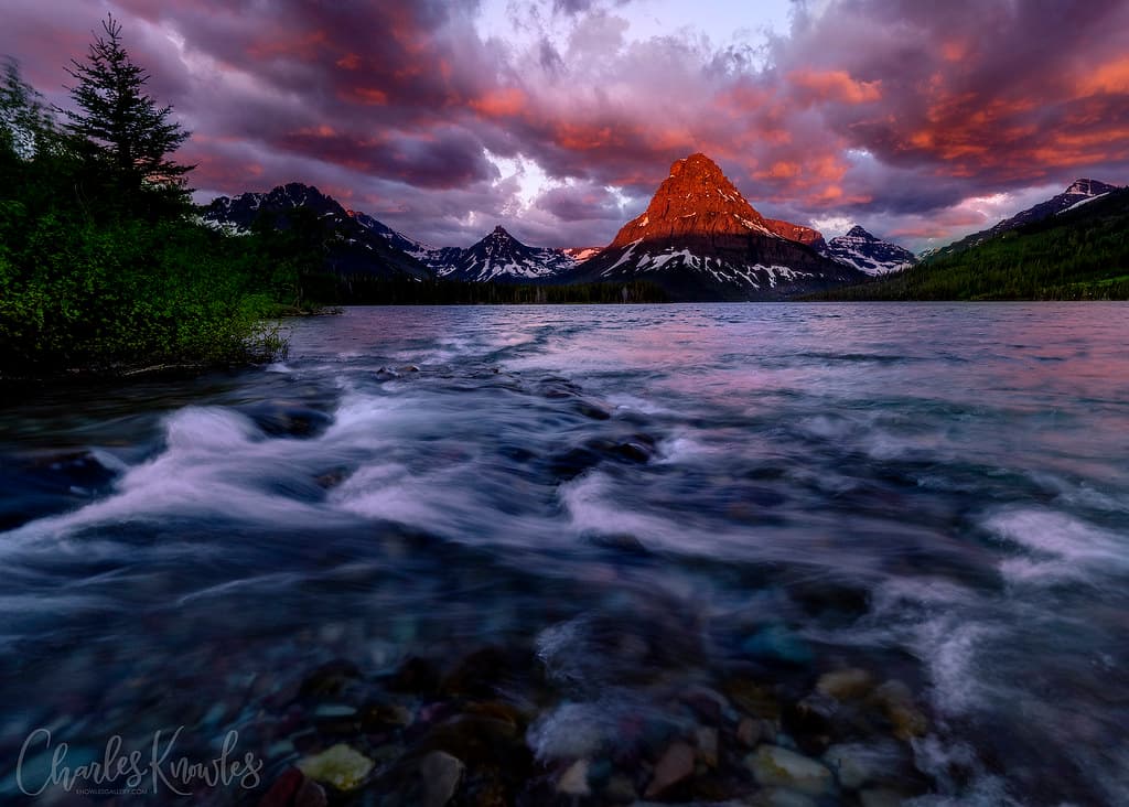
Sweet Grass Hills, Montana
Whitlash, Montana, United States
17.4 km away
Two Medicine Lake, Montana
East Glacier Park, Montana, United States
144.0 km away
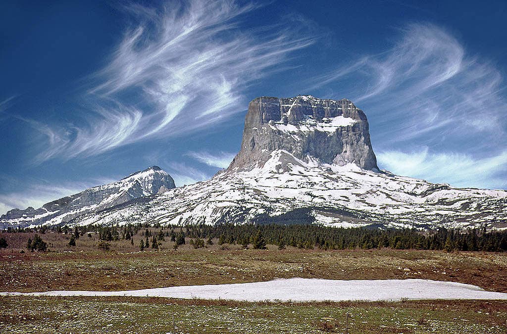
Chief Mountain (Ninaistakis), Glacier County, Montana
Babb, Montana, United States
165.0 km away
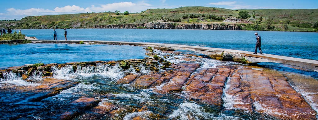
Giant Springs, Great Falls, Montana
Great Falls, Montana, United States
176.7 km away
References
Sources consulted when researching this page. Independent verification by readers is welcome.
- 01Writing-on-Stone / Áísínaiʼpi - UNESCO World Heritage Centre — UNESCO World Heritage Centrehigh-reliability
- 02Áísínaiʼpi National Historic Site of Canada — Parks Canadahigh-reliability
- 03Writing-on-Stone / Áísínaiʼpi, Alberta — Parks Canadahigh-reliability
- 04Áísínaiʼpi (Writing-on-Stone) | The Canadian Encyclopedia — The Canadian Encyclopediahigh-reliability
- 05Writing-on-Stone PP - Alberta Parks — Alberta Parkshigh-reliability
- 06Public Tours & Programs - Writing-on-Stone Provincial Park — Alberta Parkshigh-reliability
- 07World Heritage Designation - Writing-on-Stone Provincial Park — Alberta Parkshigh-reliability
- 08The Future in Stone: Rock Art and Modern Messages at Áísínaiʼpi / Writing-on-Stone UNESCO World Heritage Site — National Trust for Canadahigh-reliability
- 09Matapiiksi (Hoodoo) Interpretive Trail - Writing-on-Stone Provincial Park — Alberta Parkshigh-reliability
- 10Rock Art Preservation - Writing-on-Stone Provincial Park — Alberta Parkshigh-reliability
Key questions
What pilgrims usually ask
- Why is Writing-on-Stone Provincial Park considered sacred?
- Visit Writing-on-Stone Provincial Park, home to the Great Plains' largest rock art concentration. Plan your trip to this Blackfoot sacred landscape.
- What should I wear at Writing-on-Stone Provincial Park?
- No formal requirements. Sturdy walking shoes or hiking boots are recommended for uneven terrain. Sun protection is important — the prairie offers little shade. Layers for changeable weather. A hat and water bottle are essential in summer.
- Can I take photos at Writing-on-Stone Provincial Park?
- Photography is permitted in the park and on guided tours. Do not touch the rock art for any reason, including to pose for photographs. Do not use flash directly on rock art surfaces. Early morning and evening light provide the best conditions for photographing hoodoos and rock formations. Drone use is prohibited in Alberta Provincial Parks.
- How long should I spend at Writing-on-Stone Provincial Park?
- Half day minimum for the Matapiiksi (Hoodoo) Interpretive Trail and Visitor Centre. A full day recommended to include a guided tour of the Archaeological Preserve. Multiple days ideal if camping and exploring the valley at different times of day, hiking the Haffner Coulee trail, and experiencing the night sky.
- What offerings are appropriate at Writing-on-Stone Provincial Park?
- Do not leave offerings, objects, coins, or materials at rock art sites or on hoodoos. The appropriate way to honor this site is through respectful attention and leaving no trace.
- What etiquette should visitors follow at Writing-on-Stone Provincial Park?
- Áísínaiʼpi is a living sacred landscape for the Blackfoot people and a protected archaeological preserve. Do not touch the rock art or climb the hoodoos. Access the Archaeological Preserve only through guided tours. Keep noise to a minimum near the rock art areas. This is a place where people have prayed for six thousand years — approach it accordingly.
- What is the history of Writing-on-Stone Provincial Park?
- In Blackfoot cosmology, spiritual powers inhabit the earth, and the characteristics of the landscape reflect permanent links with the spirit world. The hoodoos of Áísínaiʼpi are not formations — they are matapiiksi, the people, inhabited by Spirit Beings. The clay domes above them are spirit lodges. The Sweetgrass Hills visible to the south are the resting place of a culture hero who freed the bison and made the world safe for the Niitsitapi. The geological story is older still. The sandstone of the Milk River Formation was deposited 84 million years ago along the edge of a vast inland sea during the Late Cretaceous. After the last Ice Age, glacial meltwater carved the Milk River valley, and thousands of years of erosion by water, ice, and wind sculpted the hoodoos and cliffs. Human habitation in the valley reaches back approximately 9,000 years. Rock art creation spans from approximately 4000 BCE to the early twentieth century. These two stories — the sacred and the geological — are not in competition. The Blackfoot do not separate the physical landscape from its spiritual significance. The sandstone is 84 million years old and inhabited by Spirit Beings. Both are true at once.
- Who is associated with Writing-on-Stone Provincial Park?
- The Niitsitapi Rock Art Creators (Generations of Blackfoot (Niitsitapi) vision seekers, warriors, and community members who created thousands of petroglyphs and pictographs over approximately six thousand years, recording spiritual encounters, battles, and biographical events on the sandstone walls.), Bird Rattle (Aamsskáápipikani elder who provided the oral tradition connecting the Battle Scene panel — over 250 carved characters — to the Retreat Up The Hill Battle, a documented historical event. His testimony linked rock art directly to Blackfoot collective memory.), Kanai Spiritual Advisers (Spiritual leaders of the Kainai (Blood) Nation who contributed to the UNESCO World Heritage nomination and articulated the site's living significance: 'The rock art, the Sacred Beings, and our continuing traditions at Writing-on-Stone / Áísínaiʼpi give us a picture of our future.'), The Blackfoot Confederacy (Siksikáíítsitapi) (The four Blackfoot-speaking nations — Siksika, Kainai (Blood), Piikani (Peigan), and Aamsskáápipikani (Blackfeet) — who partnered with the Government of Alberta in the UNESCO World Heritage nomination, ensuring the site would be recognized as a living sacred landscape, not merely an archaeological resource.)