Burroughston Broch
An Iron Age tower on Shapinsay's northern headland, where solitude and sea meet walls built two thousand years ago
Understand sacred places, explore living traditions, and learn how to engage respectfully with Pilgrim Map.
Access has not been verified. Check current local guidance before planning a visit.
Shapinsay, Scotland, United Kingdom
Read the sources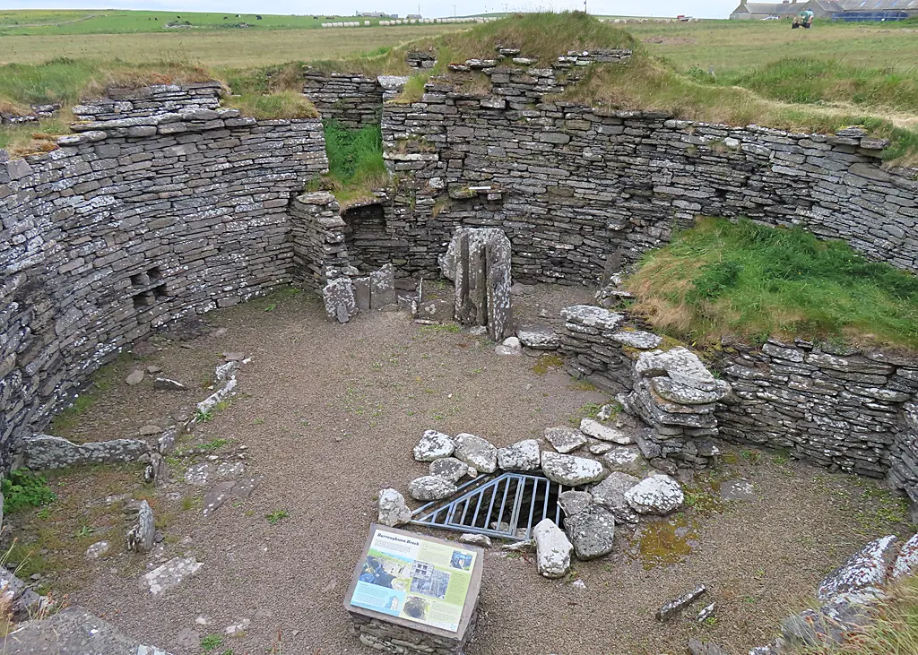
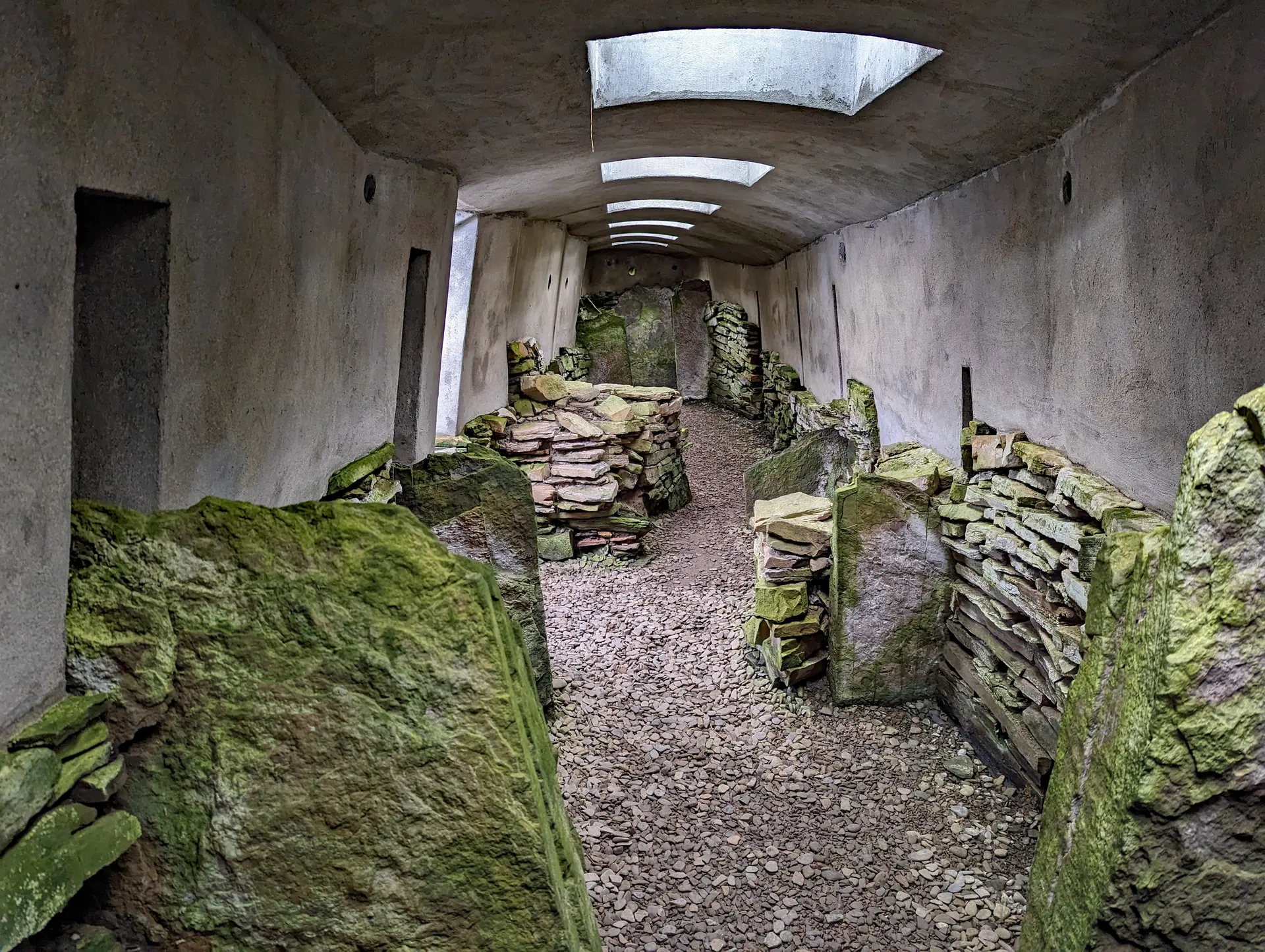
Image of Burroughston Broch. Image source · CC-BY-SA-2.0
Visit essentials
A quick read before you go
- Duration
- A full half-day for a relaxed visit with time at the broch.
- Access
- Orkney Ferries from Kirkwall to Shapinsay (approximately twenty-five-minute crossing).
Overview
A four-mile walk from Shapinsay pier passes Balfour Castle and farmland to a remote northeastern hillock above the North Sea. Burroughston Broch's approximately four-metre-thick walls enclose a roughly ten-metre circle. Its controlled entrance retains a guard chamber; inside double walls, an intramural-stair base shows a multi-storey tower, and scarcements once held an upper timber floor.
George Petrie's 1862 excavation was competent for its era but preceded stratigraphic recording and scientific dating. Sir Henry Dryden's detailed plans remain the primary record. Ox and sheep bones, deer horn, and stone vessels indicate pastoral farming supplemented by hunting.
Only the interior was excavated. The Hillock of Burroughston's surrounding mound almost certainly hides outbuildings and occupation layers, so exposed inner walls rise from an unexcavated settlement.
North Sea horizon, constant wind, cliff seabirds, and difficult access define the place. Inside two-thousand-year-old walls, isolation makes encounter with Orkney's past unusually direct.
Why this place is sacred
The thinness at Burroughston is earned through effort. The ferry crossing, the four-mile walk, the gradual transition from farmland to open headland, all serve as a kind of secular pilgrimage, stripping away the ordinary world before the encounter with the ancient.
The isolation of the site is integral to its power. Most visitors have the broch entirely to themselves. There are no interpretive panels, no audio guides, no other visitors discussing lunch plans. The experience is unmediated: you, the stone, the wind, the sea.
Looking down into the excavated interior from the surrounding mound creates an unusual perspective. You peer into a space that was once enclosed, roofed, inhabited. The entrance passage, guard chamber, and staircase base are all visible. The precision of the drystone construction is evident even after two thousand years of exposure. These walls were built by people who understood stone as intimately as we understand our most familiar materials.
The unexcavated mound adds a dimension of mystery. Beneath the grass, buildings remain hidden, their contents unknown. The broch you see is only part of a larger settlement, the revealed portion of a community whose full extent remains concealed. This incompleteness is itself a source of contemplative power. The site invites imagining as much as observing.
The North Sea provides a constant backdrop. Its sound carries from below the headland. Its light shifts with weather and season. The Iron Age inhabitants of Burroughston lived with this same sea, its dangers and resources shaping their daily existence. To hear it now, from the same vantage point, is to share something with them across the centuries.
Archaeological evidence indicates Burroughston functioned as a fortified dwelling, combining residential and defensive purposes. The thick walls, controlled entrance with guard chamber, and intramural staircase are characteristic of brochs across Atlantic Scotland. The finds suggest a pastoral farming community supplemented by hunting.
Built during the Iron Age, approximately 200 BCE to 200 CE. Excavated in approximately 1862 under George Petrie's direction. Sir Henry Dryden produced architectural plans. Scheduled as an Ancient Monument (SM1421) on 15 December 1953. Now under the protection of Historic Environment Scotland.
Experience and orientation
The journey begins at Kirkwall, where the Orkney Ferries service crosses to Shapinsay in approximately twenty-five minutes. From the pier at Balfour, the walk leads northeast through quiet farmland. The initial stretch passes Balfour Castle, built in the Scottish Baronial style by the Balfour family who once owned the island. Beyond the castle grounds, the landscape opens and the road becomes a track.
The final approach crosses rough grassland with no formal path. The hillock that gives the broch its name becomes visible, rising above the coastal terrain. As you approach, the excavated interior comes into view, walls rising from a grassy mound, the entrance passage facing south.
The experience of arrival is quietly dramatic. After an hour or more of walking, the broch appears as a solid, compact presence on the headland. You climb the mound and look down into the interior, where the circular chamber, entrance passage, guard cell, and staircase base are all visible. The drystone construction is remarkably tight, each stone fitted to its neighbour without mortar. The walls have stood for two thousand years through Orkney's relentless weather.
The coastal setting dominates the experience. The North Sea extends in every direction from the headland. On clear days, other Orkney islands are visible. On stormy days, the waves crash below and spray carries on the wind. The wind itself is almost always present, a constant companion that links your experience to that of the broch's original inhabitants.
There are no facilities at the site. No interpretive panels, no shelters, no other visitors. The experience is entirely self-directed, which many find to be Burroughston's greatest virtue. You bring your own knowledge, your own attention, and the broch gives back in proportion to what you offer.
Shapinsay is reached by Orkney Ferries from Kirkwall (approximately twenty-five minutes). From the pier at Balfour, the broch is approximately four miles northeast. The walk takes one to one and a half hours each way on road and rough track. A bicycle, which can be taken on the ferry, would reduce the walking time. There is no public transport on Shapinsay.
Context and lineage
No origin narrative survives. The broch was constructed by Iron Age inhabitants of Shapinsay, part of the broader Atlantic Scottish broch-building culture. The name Burroughston derives from Old Norse borg (fort or stronghold) combined with tun (farmstead), indicating that later Norse settlers recognised the structure as an ancient fortification. The Iron Age builders' own name for the site is unknown.
No continuous tradition connects the present to the Iron Age broch builders. The cultural lineage was disrupted by the Pictish period and subsequent Norse colonisation. The broch's significance today is primarily archaeological and experiential.
George Petrie
Sir Henry Dryden
Colonel David Balfour
Traditions and practice
Daily life within and around the broch involved pastoral farming (ox and sheep), hunting (deer), and food preparation using stone vessels. The entrance passage with guard chamber indicates that defence was a concern. No specific ritual practices have been identified from the archaeological record, though recent scholarship on other Orkney brochs suggests that the boundary between domestic and ritual space may have been more permeable than previously assumed.
No organised spiritual community is associated with the site. Some visitors with interests in earth-based spirituality or ancestral connection engage in personal contemplation.
The four-mile walk to the broch is itself a contemplative practice. Allow the journey to serve as preparation. At the site, take time to observe the construction, the precision of the drystone work, the engineering of entrance and staircase. Consider the community that chose this exposed headland as their home.
Iron Age Atlantic Scotland (Broch-Building Culture)
HistoricalBurroughston belongs to the broch-building tradition unique to Scotland, representing one of the most sophisticated forms of drystone construction in prehistoric Europe. The Shapinsay community invested substantial labour in constructing a fortified dwelling on this remote headland, indicating both defensive concerns and the skills to address them.
Daily life involved pastoral farming, hunting, food preparation, and defence. The guard chamber and controlled entrance indicate security concerns. The intramural staircase and scarcements indicate multi-storey use. The community was self-sufficient on this exposed coastal headland.
Perspectives and open questions
Burroughston Broch offers an encounter with Iron Age engineering in one of Orkney's most remote accessible settings. The effort required to reach it creates a self-selecting visitor experience that rewards commitment with solitude and authenticity.
Scholarly perspective
Archaeologists classify Burroughston as a solid-based or ground-galleried broch, one of approximately five hundred to seven hundred brochs identified across Scotland. The external diameter is approximately eighteen metres, the internal diameter approximately ten metres, with wall thickness reaching four metres. The entrance passage with guard chamber, intramural staircase, and scarcements are characteristic broch features. The 1862 excavation under George Petrie, while competent for its era, predates modern stratigraphic recording and scientific dating.
Animal bones from ox, sheep, and deer indicate pastoral farming and hunting. Stone vessels suggest food preparation and storage. The surrounding unexcavated mound almost certainly contains additional structures that could provide crucial evidence about the broch community.
Living and traditional perspectives
No oral tradition from the Iron Age builders survives. The Norse place name preserves recognition of the structure as a fortification but carries no deeper cultural memory.
Alternative interpretations
Some writers within the sacred landscape tradition perceive brochs as expressions of cosmological belief. The circular form, controlled entrance, and enclosure of domestic space are interpreted as symbolic references to sacred enclosures or the relationship between inner and outer worlds. The discovery at Minehowe in Orkney of an Iron Age subterranean structure with apparent ritual function suggests that the boundary between the practical and the sacred in Iron Age Orkney was permeable.
However, no specific ritual claims have been made about Burroughston.
Open questions
The full extent of the settlement around the broch remains unknown. Modern non-invasive survey techniques could potentially reveal the hidden structures without disturbing the scheduled monument, but no such survey has been reported. Precise dating of the construction and occupation within the Iron Age remains uncertain. Whether any ritual deposits or features of sacred significance exist within the unexcavated mound cannot be determined.
Plan your visit
Access and arrival
Orkney Ferries from Kirkwall to Shapinsay (approximately twenty-five-minute crossing). From the pier at Balfour, approximately four miles northeast on road and rough track. No public transport on the island. Walking takes one to one and a half hours each way. Bicycles can be taken on the ferry. The terrain around the broch is uneven grassland with no formal paths. Not wheelchair accessible. No facilities at the site.
No accommodation at or near the broch. A shop and post office exist at Balfour village near the pier. Accommodation options on Shapinsay are very limited. Most visitors use Kirkwall on Mainland Orkney as a base.
Respectful visit
Sturdy waterproof walking boots essential. Windproof and waterproof outer layers required. Bring warm layers even in summer.
Photography is unrestricted. The elevated mound provides excellent vantage points for the interior. Coastal and landscape photography can be exceptional in dramatic weather.
No tradition of offerings. Do not leave objects at the site.
Do not damage, disturb, or remove any material. Do not climb on the walls. Take all litter. Close gates. Keep dogs under control.
The site has no facilities. Bring water and supplies. The walk is long and the terrain can be rough. Weather at the exposed headland can change rapidly. Inform someone of your plans before walking to the site.
Current practical details
Address
Shapinsay, Orkney KW17 2EB, UK
Hours
Hours, fees, and access can change — verify on the official source before you travel. Practical details last checked Jun 2026.
Location
Map loads as you approach this section.
Pilgrim reflections
A portrait of encounter, not a score
Pilgrims describe what they felt, how present they could become, and whether the place would shape a journey. There are no stars and no ranking of traditions.
No reviewed reflections yet
The first pilgrims can help describe the character of being here.
Share a reflection
Available after an account-backed “Been there.” Every reflection is reviewed before publication.
Nearby sacred places
Explore other sacred places in the region. Proximity does not establish access or travel time; check each place’s guidance.
References
Sources consulted for this page. Source categories describe the publication, not a guarantee that every claim is verified. Traditional accounts and outside interpretations may differ.
- 01Shapinsay, Hillock Of Burroughston - Canmore — Historic Environment Scotland / RCAHMSacademicNational Record of the Historic Environment; authoritative archaeological record
- 02Hillock of Burroughston, broch - Scheduled Monument SM1421 — Historic Environment ScotlandofficialOfficial scheduled monument designation record
- 03Hillock of Burroughston, broch - Designation SM1421 — trove.scotofficialScottish heritage designation database
- 04Burroughston Broch - WikipediaSource contextGeneral overview with key dimensions and excavation history
- 05Burroughston Broch Feature Page - Undiscovered Scotland — Undiscovered ScotlandSource contextDetailed visitor-oriented description with historical context
- 06Burroughston Broch - Orkney.com — Orkney.comSource contextLocal tourism authority listing
- 07Burroughston Broch - The Megalithic Portal — The Megalithic PortalSource contextCommunity archaeological database with visitor reports
- 08Burroughston Broch - Saints and Stones — Saints and StonesspiritualExperiential account of visiting the broch and its landscape
- 09Burroughston Broch - Shapinsay Development Trust — Shapinsay Development TrustSource contextLocal community organization with site information
- 10Hidden Brochs in Orkney - NorthLink Ferries — NorthLink FerriesSource contextContext on Orkney lesser-known brochs including Burroughston
Share a photo
Help visitors recognize Burroughston Broch. Every submission is reviewed before publication.