Bunjil's Shelter
The only known rock painting of Bunjil, creator of the land
Understand sacred places, explore living traditions, and learn how to engage respectfully with Pilgrim Map.
Access has not been verified. Check current local guidance before planning a visit.
Stawell / Black Range, Victoria, Victoria, Australia
Read the sources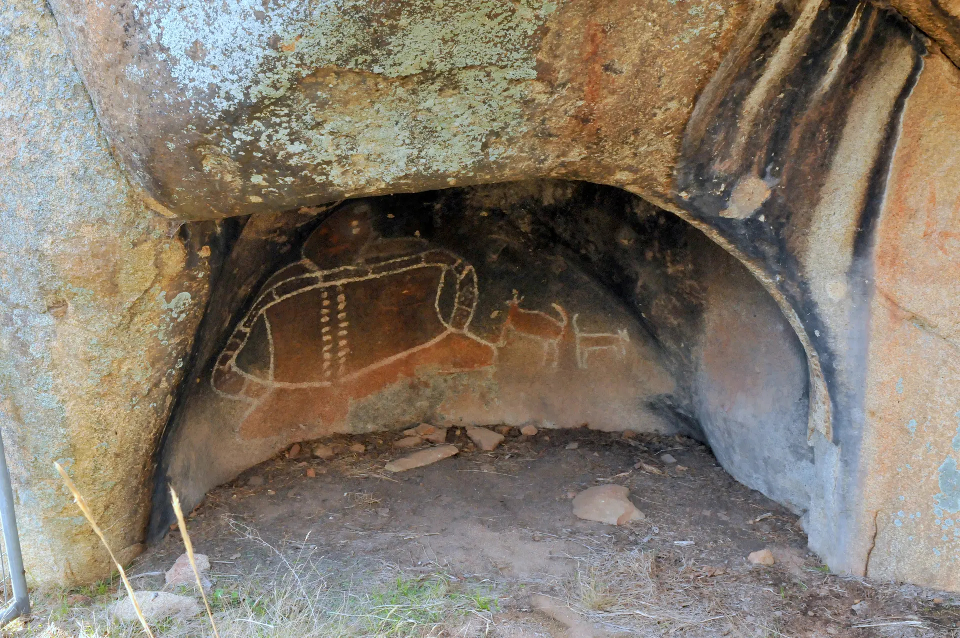
Image of Bunjil's Shelter. Image source
Visit essentials
A quick read before you go
- Duration
- A short visit — the walk from the car park to the shelter covers roughly 100 metres with a…
- Access
- Located in the Black Range Scenic Reserve, approximately 10 km south of Stawell, Victoria,…
Overview
Bunjil's Shelter lies against a granite outcrop in the Black Range Scenic Reserve, a short walk from the road south of Stawell toward the Grampians. Behind a protective fence, a modest painting shows a human-like figure with two dingoes. Its age is uncertain: over a thousand years by some estimates, thousands by others. Aboriginal people of the region identify it as the only known rock-art depiction of Bunjil, south-eastern Australia's principal creator-being.
In the Gariwerd Creation Story, Bunjil descended from the ranges' eastern cliffs, shaped sandstone escarpments, waterways, plants, and animals, gave each people their Country, and established society's laws. This connection remains living for Djab Wurrung, Jardwadjali, and Traditional Owners represented by the Barengi Gadjin Land Council and Eastern Maar Aboriginal Corporation. Delisted in 1979 amid authenticity doubts, the painting was reinstated in 1983 after laboratory analysis confirmed genuine ochre beneath later overpainting.
Open to the public and cared for by the people whose ancestor it shows, it is one of the state's most significant Aboriginal cultural sites.
Why this place is sacred
What makes this shelter unusual is not its scale — it is a shallow recess in a boulder, easily passed without notice — but the specificity of what it depicts. Rock art across south-eastern Australia includes many figures, animal tracks, and hand stencils, but only here has an identified image of Bunjil been recorded. The distinction matters to how the site is understood.
This is not a generalized sacred landscape feature; it is a particular ancestral figure, rendered in ochre, in a particular place, and the place itself sits inside the wider Gariwerd cultural landscape that Traditional Owners understand as having been physically formed by that same figure. The shelter and the story it depicts are not separable. To stand before the painting is to stand inside the narrative it commemorates, in the range that narrative describes Bunjil as having descended and shaped.
Academic reinterpretation in recent decades has added a further layer of specificity. Drawing on a 1924 account given by a Wimmera Aboriginal woman and recorded by the Reverend John Mathew, researcher Ian D. Clark proposed in 2017 that the painting relates to a particular episode — Bunjil's descent from the Gariwerd cliffs and a conflict with the Bunyip at the nearby Mokepilly waterhole — interwoven with the Aboriginal custom of mother-in-law avoidance.
That deeper narrative thread touches on culturally regulated knowledge, and this account does not attempt to unpack it further than what Traditional Owners and published scholarship have already made public. What can be said plainly is this: the site holds a physical trace of a story still living in the people who tell it, in a landscape they still care for.
The painting appears to have been made to record, mark, or commemorate the presence and actions of Bunjil in this specific location — understood by Traditional Owners as the place tied to his descent from the cliffs of Gariwerd and, per recent scholarship, to a specific narrative episode involving conflict with the Bunyip.
European settlers in the district became aware of the shelter in 1911, but it was not shown to the wider public until 1957. Its authenticity was challenged in 1979, when the Victorian Archaeological Survey delisted it over inconclusive pigment analysis; in 1983, scanning electron microscope testing found genuine ochre beneath a layer of later, non-Indigenous touch-up paint, and the site was reinstated.
It has since been fenced to prevent further damage and vandalism, and it appeared on an Australian postage stamp in recognition of its cultural standing.
Experience and orientation
The approach is short: a car park off Bunjil Cave Road, then perhaps a hundred metres of track rising gently over granite and a run of steps toward the base of the outcrop. The Black Range holds none of the height or drama of the main Grampians ranges nearby, and the shelter itself gives away little from a distance — a shadowed recess low in a large boulder, easy to walk past if you didn't know to look.
Fencing installed to prevent contact and further damage stands between visitor and rock face, close enough to see clearly, far enough to remind you that looking is the visit, not touching. The figure is small. Reviewers and visitors consistently note this: the painting itself is modest next to the weight of what it represents, and there is a kind of readjustment that happens standing there, recalibrating scale against significance.
The Black Range around the shelter is quiet, dry sclerophyll country, granite boulders scattered through it, and the same terrain that Traditional Owners understand as itself shaped by the figure painted on the rock. No signage narrates a ceremony or invites participation; this is a heritage visit, not a devotional one, and it asks for attentiveness rather than performance. People pause. Some read the interpretive material at the site or beforehand.
Few sources describe anything beyond that quiet, considering stillness — no accounts of transformation or revelation attach themselves to this place in the record, only the recurring note that its importance outweighs its size.
Arrive expecting a brief, unspectacular walk to a small, carefully protected painting — the significance is historical and cultural rather than scenic, and the shelter rewards attention rather than awe.
Context and lineage
In the Gariwerd Creation Story, Bunjil descended from the eastern cliffs of the Grampians ranges and shaped the sandstone escarpments, the rivers and waterholes, the plants and animals of the region, before allocating each people their own Country and establishing the customs by which society was organised. The painting at this shelter is understood by Traditional Owners as connected to that same figure and, per Ian D.
Clark's 2017 reinterpretation of a 1924 ethnographic account, may specifically commemorate an episode of Bunjil's descent and his conflict with the Bunyip at the nearby Mokepilly waterhole — a narrative thread bound up with the custom of mother-in-law avoidance, details of which are not elaborated here out of respect for its culturally regulated nature.
Custodianship of the site and the wider Gariwerd cultural landscape rests today with Djab Wurrung and Jardwadjali people, represented by the Barengi Gadjin Land Council Aboriginal Corporation and Eastern Maar Aboriginal Corporation, alongside the Gunditj Mirring Traditional Owners Aboriginal Corporation across the broader region. Traditional Owner sovereignty over this Country has never been surrendered.
Bunjil
Creator-being / principal Dreaming Being
Credited with descending from the Gariwerd cliffs and shaping the land, waters, plants and animals of the region, allocating Country to its peoples, and establishing their laws and customs, including a role in boys' initiation.
Ian D. Clark
Researcher
Published a 2017 peer-reviewed reinterpretation in Rock Art Research connecting the painting to a specific narrative of Bunjil's descent and conflict with the Bunyip, drawing on a 1924 account recorded by Rev. John Mathew from a Wimmera Aboriginal woman.
John Mathew
Ethnographic recorder
Recorded the 1924 account from a Wimmera Aboriginal woman that later informed Clark's 2017 reinterpretation of the site's meaning.
Traditions and practice
General ethnographic sources describe Bunjil's broader role in south-eastern Aboriginal cultures, including a place in boys' initiation into manhood and as guardian of secret or sacred lore, but no source consulted states that specific ceremonies were or are conducted at this shelter itself. This account does not speculate beyond what has been published.
Traditional Owner corporations for this part of Gariwerd maintain active cultural responsibility for the site and the surrounding landscape, including practices such as cultural burning across the Black Range area, as part of broader Country Plans.
Approach the shelter as you would any place of active custodianship: walk the short track at an unhurried pace, read what interpretive material is provided, and give the painting time rather than a glance. Let the modest scale of the image sit against what it represents rather than looking past it for something more visually dramatic.
Djab Wurrung / Jardwadjali / Gariwerd Aboriginal tradition (Kulin-cosmology-linked Bunjil narrative)
ActiveBunjil's Shelter contains the only known rock art figure of Bunjil, the principal creator-being of south-eastern Australia, shown with two dingoes. Bunjil shaped the region's ranges, waterways, plants and animals, allocated Country to the various peoples, and established the laws and customs organising Aboriginal society, including a role in boys' initiation.
No current ceremonial practice at the shelter itself is documented as open to public observation. Traditional Owners maintain ongoing connection to and cultural authority over the site, including cultural land management such as cultural burning across the surrounding Black Range/Gariwerd landscape.
Perspectives and open questions
Bunjil's Shelter is read differently depending on where you stand — as a contested and later vindicated archaeological artifact, as a living ancestral presence, and, in some respects, as a site whose deepest meaning is deliberately left unresolved in the public record.
Scholarly perspective
Heritage authorities and rock art researchers regard the shelter as one of the most significant Aboriginal cultural sites in south-eastern Australia, being the only known rock art depiction of Bunjil. Its authenticity was disputed for a period — delisted from the Victorian Archaeological Survey register in 1979 over inconclusive pigment analysis — then reinstated in 1983 after scanning electron microscope testing confirmed genuine Aboriginal ochre beneath later, non-Indigenous overpainting. Ian D.
Clark's 2017 peer-reviewed reinterpretation, drawing on a 1924 ethnographic account, proposes a specific narrative reading — the Bunjil-Bunyip conflict at Mokepilly waterhole, linked to mother-in-law avoidance custom — that deepens the earlier, more general identification of the figure as simply 'the creator being.'
Living and traditional perspectives
For Djab Wurrung, Jardwadjali and other Gariwerd Traditional Owners, Bunjil is the principal Dreaming Being — the ancestor who shaped the land, waters, plants, animals and laws of the region and allocated Country to its peoples. The site holds exceptional, ongoing spiritual significance, and Traditional Owner corporations continue to assert unceded sovereignty over the land and active responsibility for its care, while permitting respectful public access to the shelter.
Alternative interpretations
No distinct alternative or esoteric interpretive tradition outside Indigenous and academic readings was found in sources consulted. Unlike some sacred sites, Bunjil's Shelter does not appear to have attracted New Age or alternative-history reinterpretation in available material.
Open questions
The precise age of the painting remains scientifically undetermined, estimated only as somewhere between one thousand and several thousand years old. The exact extent of European-era touch-up overpainting versus original Aboriginal pigment is confirmed in general terms by SEM analysis but not fully quantified in public sources.
And the fuller narrative connecting the site to mother-in-law avoidance custom, as proposed by Clark, remains only partially disclosed — a reminder that not every dimension of this place is, or should be, available to a public account.
Plan your visit
Access and arrival
Located in the Black Range Scenic Reserve, approximately 10 km south of Stawell, Victoria, signposted off the Stawell-Pomonal Road via Bunjil Cave Road. Entry is free and no permit is required. The path involves steps and uneven, sometimes slippery granite terrain and is not suitable for wheelchairs or prams. For current conditions or closures, contact the Parks Victoria Information Centre on 13 1963.
Respectful visit
No dress code is specified in official sources. Footwear suited to uneven, sometimes slippery granite terrain and a short flight of steps is advisable.
Photography is not explicitly restricted by Parks Victoria, and no source indicates it is prohibited. Given the site's cultural significance, respectful and non-intrusive photography is the appropriate approach.
No tradition of visitor offerings is documented for this site.
No dogs apart from assistance animals under standard conditions, no camping, no bicycles, no horses, no generators. Visitors must not touch the rock art; the shelter is fenced specifically to prevent contact and further damage.
This site holds a Dreaming narrative with dimensions — particularly around mother-in-law avoidance custom and initiation lore — that are culturally regulated and not fully disclosed in public sources. Visitors and writers alike should avoid speculating about or elaborating on that deeper narrative beyond what Traditional Owners and published scholarship have already made public.
Location
Map loads as you approach this section.
Pilgrim reflections
A portrait of encounter, not a score
Pilgrims describe what they felt, how present they could become, and whether the place would shape a journey. There are no stars and no ranking of traditions.
No reviewed reflections yet
The first pilgrims can help describe the character of being here.
Share a reflection
Available after an account-backed “Been there.” Every reflection is reviewed before publication.
Nearby sacred places
Explore other sacred places in the region. Proximity does not establish access or travel time; check each place’s guidance.
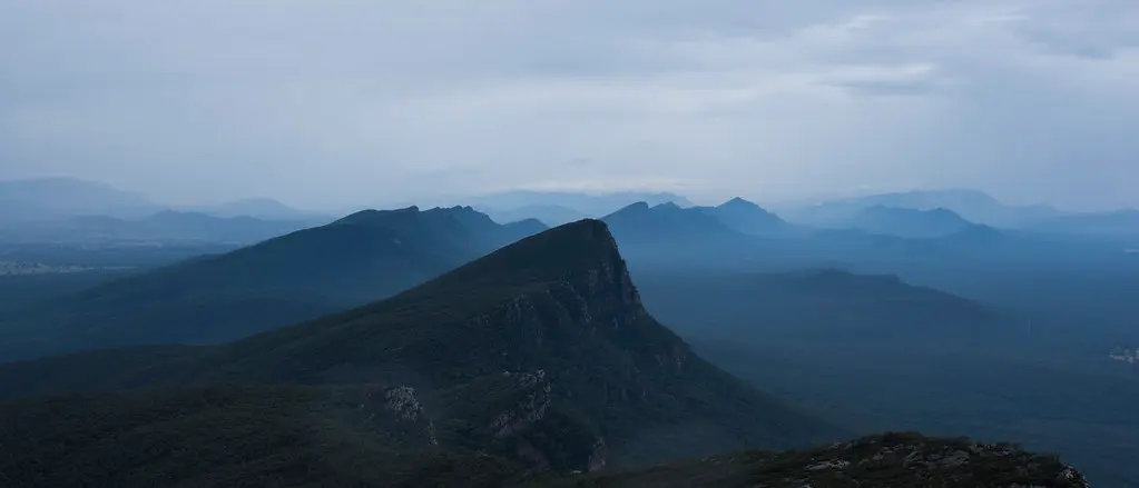
Grampians National Park
Shire of Northern Grampians, Victoria, Australia
45.3 km away
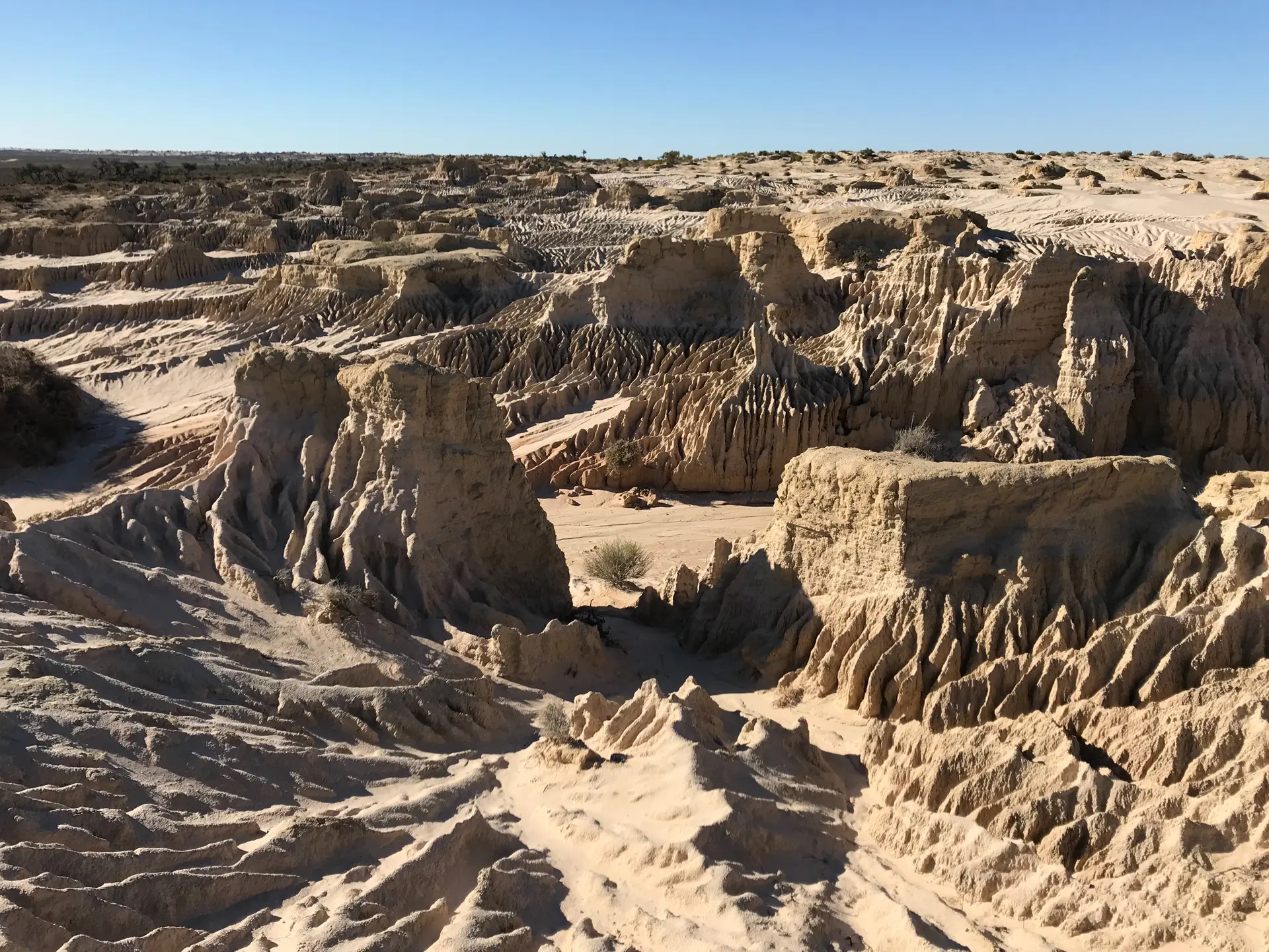
Lake Mungo
Willandra Lakes, New South Wales, Australia
374.6 km away
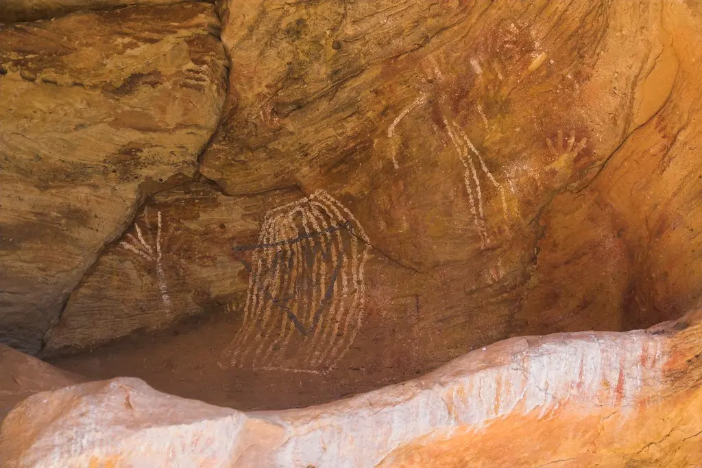
Mutawintji Historic Site
Mutawintji / Broken Hill region, New South Wales, New South Wales, Australia
641.5 km away

Wilpena Pound
Pastoral Unincorporated Area, South Australia, Australia
731.9 km away
References
Sources consulted for this page. Source categories describe the publication, not a guarantee that every claim is verified. Traditional accounts and outside interpretations may differ.
- 01Bunjils Cave Heritage Site (Black Range Scenic Reserve) — Parks VictoriaofficialOfficial park management page: coordinates, access rules (no dogs, camping, bicycles, horses, generators), safety notes, acknowledgment of Traditional Owner connection and ongoing care of Country.
- 02Fact sheet: Aboriginal rock art — First Peoples – State Relations, Victorian GovernmentofficialState government cultural heritage authority. Confirms Bunjil's Shelter as the only site with a recorded Aboriginal interpretation of a figure (Bunjil), states the painting has 'exceptional significance for the present Aboriginal people of western Victoria,' and directs inquiries about restricted/sacred protocols to First Peoples–State Relations directly rather than detailing them publicly.
- 03Bunyip, Bunjil and mother-in-law avoidance: New insights into the interpretation of Bunjil's Shelter, Victoria, Australia — Ian D. ClarkacademicPeer-reviewed article, Rock Art Research, Vol. 34(2):189-192, Nov 2017. Reinterprets the site using a 1924 account (via Rev. John Mathew, 1925) from a Wimmera Aboriginal woman: links the painting to a narrative of Bunjil's descent from Gariwerd cliffs, a conflict with the Bunyip at Mokepilly waterhole, and the custom of mother-in-law avoidance. Full text not fully retrievable (paywalled); summary drawn from abstract/secondary description.
- 04Bunyip, Bunjil and mother-in-law avoidance (journal abstract page) — Rock Art Research / Australian Rock Art Research AssociationacademicJournal's own abstract listing for the Clark (2017) paper, corroborating the mother-in-law avoidance and Bunjil-Bunyip conflict interpretation.
- 05Histories of Australian Rock Art Research (Ch. 7) — ANU PressacademicAcademic press chapter on Australian rock art research history; contextualizes the disputed authentication history of sites like Bunjil's Shelter within broader Victorian rock art scholarship.
- 06Bunjil's Shelter — Wikipedia — Wikipedia contributorsacademicGeneral overview: location, discovery history (known to Europeans since 1911, public since 1957), authenticity dispute and SEM re-authentication (1979 delisting, 1983 reinstatement), postage stamp feature. Encyclopedic tertiary source.
- 07Traditional owners — Black Range Land Management GroupofficialLocal land management group page acknowledging that Traditional Owner sovereignty over Black Range/Gariwerd has never been surrendered; names Barengi Gadjin Land Council Aboriginal Corporation and Eastern Maar Aboriginal Corporation as the represented communities; describes Country Plans and cultural burning practices.
- 08Bunjil's Shelter and its cultural importance — Visit GrampiansSource contextRegional tourism board content. Describes Bunjil as Werpil the Eagle in the Gariwerd Creation Story, notes Djab Wurrung and Jardwadjali habitation of the region for over 40,000 years, and gives basic access directions (Bunjil Cave Road off Stawell-Pomonal Road).
- 09Grampians National Park — Wikipedia — Wikipedia contributorsacademicConfirms the dual name Gariwerd/Grampians and identifies Jardwadjali, Djab Wurrung and Gunditjmara peoples as traditional custodians of the greater region, represented today by Barengi Gadjin Land Council, Eastern Maar Aboriginal Corporation, and Gunditj Mirring Traditional Owners Aboriginal Corporation.
- 10Park note: Black Range Scenic Reserve — Bunjil Shelter — Parks Victoria (park note, hosted via The Nomadic Explorers)Source contextOriginally a Parks Victoria park note (mirrored by a travel blog); provides walk distance/terrain details and basic visitor orientation. Treated as medium reliability since accessed via third-party mirror rather than the live official page.
Share a photo
Help visitors recognize Bunjil's Shelter. Every submission is reviewed before publication.