St Catherine's Hill and Chapel
A ruined hilltop chapel on the Pilgrim's Way, above a hidden medieval cave shrine in the Surrey sandstone
Understand sacred places, explore living traditions, and learn how to engage respectfully with Pilgrim Map.
Access has not been verified. Check current local guidance before planning a visit.
Guildford, England, United Kingdom
Read the sources
Visit essentials
A quick read before you go
- Duration
- 30–60 minutes for the ascent, time at the ruins, and descent, as a standalone visit.
- Access
- Address: Old Portsmouth Road, Artington, Guildford GU3 1LJ.
Overview
Drakehull—Dragon Hill—holds evidence of human presence reaching back to the Mesolithic. In the early 14th century, Richard de Wauncey, rector of St Nicholas Church in Guildford, built a chantry chapel on ground that had drawn people for perhaps nine thousand years. Dedicated to Saint Catherine of Alexandria, patroness of scholars and the dying, it stood on a high point visible for miles above the River Wey valley and one of its historic crossings.
The chapel served both as a chapel of ease for Artington and a waypoint on the Pilgrim's Way between Winchester and Canterbury. Edward II's grant of a five-day fair in 1308 is the earliest documentary record of its significance. Ruined after the Dissolution of the Monasteries, it was partly consolidated by the late 18th century as a picturesque Romantic feature; J.M.W. Turner painted it twice.
In April 2020, railway workers repairing a landslip below the hill broke into a cave containing carved Gothic niches, a Calvary cross, soot from long-burning fires, and remnants archaeologists assessed as a medieval hermitage or shrine. Hidden in the same sandstone outcrop as the chapel ruins above, it showed that St Catherine's Hill's devotional landscape was richer and stranger than its visible stones implied.
Why this place is sacred
The quality that draws seekers to St Catherine's Hill is inseparable from its position. The hill stands at a natural inflection point: the River Wey runs below, the Surrey Hills extend eastward, and Guildford lies less than a mile to the north. For anyone travelling the Pilgrim's Way on foot, the ruined chapel on the summit appears as a landmark long before it is reached — a silhouette against the sky that functions as both orientation and invitation.
The pre-Christian record reinforces this sense of a place that has persistently attracted human attention. Mesolithic flint material recovered in the 2010 Surrey Archaeological Society excavation places human activity on the hill around 9,000 BCE. Bronze Age and Iron Age traces follow. The hill's name — Drakehull, 'Dragon Hill,' recorded in 1318 — points to a folk geography in which the site held significance that preceded its Christian dedication by centuries.
In Old English tradition, dragons were guardians of liminal, significant, or boundary places rather than merely destructive beasts; naming a hill thus was a way of marking it as charged, as set apart.
The 2020 cave discovery intensifies all of this. The cave was likely cut into the sandstone in the medieval period, approximately contemporary with the chapel above. Its carved niches, Gothic cross, and evidence of sustained burning suggest a space used for private devotion — possibly by a hermit associated with the chapel, or by pilgrims seeking something more withdrawn than a public wayside chapel could offer.
Whether the cave and the chapel functioned as a coordinated sacred complex, or as independent expressions of the same devotional impulse, remains unresolved. Radiocarbon analysis of charcoal and soot was planned following the discovery; findings had not been publicly released as of July 2026.
The medieval chapel served as a chantry chapel of ease, with masses said for the souls of the dead. It simultaneously functioned as a waypoint chapel for pilgrims travelling the road from Winchester to Canterbury. The adjacent or nearby fair ground, licensed from 1308, combined commercial, festive, and devotional activity in the manner typical of medieval English holy sites.
The chapel's period of active use lasted roughly two centuries, from its construction around 1308–1317 until the Dissolution of the Monasteries in the mid-16th century. It then fell into progressive ruin. In 1793 Robert Austen undertook partial consolidation works, deliberately framing what remained as a 'romantic ruin' — a common Picturesque-era response to medieval fabric. Since then the site has been managed as a Scheduled Ancient Monument and Grade I listed building, open to walkers and heritage visitors.
The contemporary Pilgrim's Way walking route follows the medieval road past the hill, making the site a living waypoint even as the chapel itself remains silent.
Experience and orientation
The approach from the north follows the footpath from Guildford town centre, dropping toward the River Wey before rising again toward the hill. The sandstone outcrop that carries the chapel is not immediately visible from the valley; it appears as a sudden height once the path begins to climb. The ascent is steep and loose underfoot — compacted sand rather than turf — and demands attention to footing in a way that focuses the body before the summit opens.
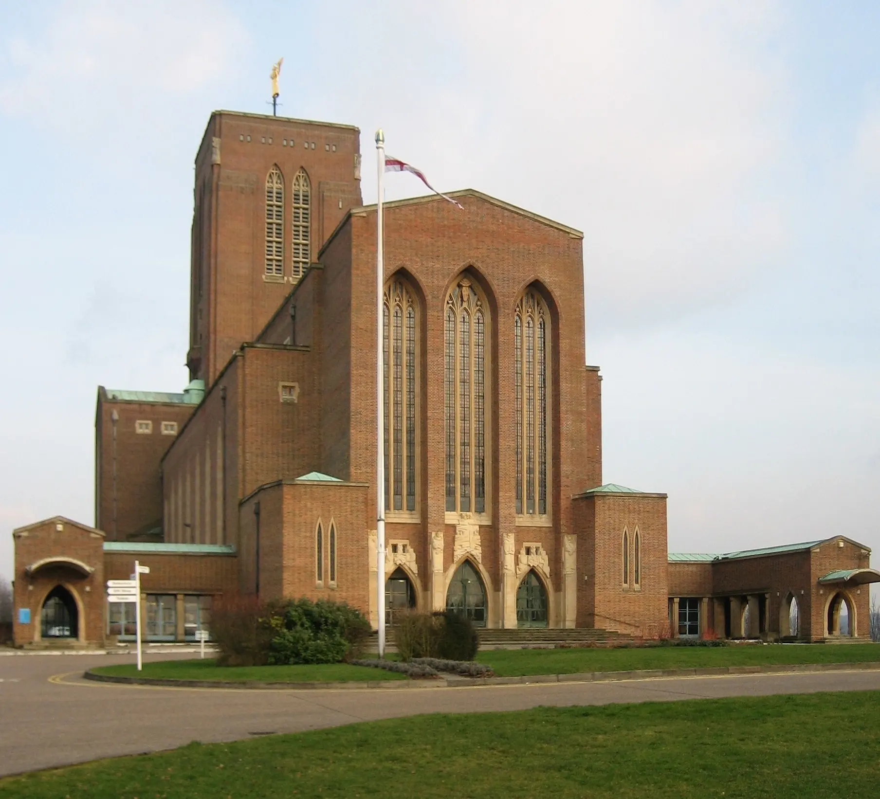
At the top, the chapel ruins occupy the highest point. The walls stand to varying heights, roofless and open to the sky. The quality of light inside the roofless nave changes with the time of day: morning light rakes across the stonework from the east; afternoon sun warms the western face. The Surrey Hills extend to the south and east. Guildford Cathedral is visible to the northwest. On clear days the view extends well beyond the town.
Standing within the chapel's outline, it is possible to sense something of what the site would have meant to a medieval pilgrim arriving from the west: an elevated station with long views before descending to the river crossing at Artington, a moment of orientation before the road continued toward Canterbury. The chapel would have been roofed and intact, its dedication to Saint Catherine visible in windows or imagery now long gone.
What remains is the bones of that structure — enough to locate oneself in relation to it.
The cave below the hill cannot be visited; it sits within Network Rail's managed railway embankment. But knowing it is there — knowing that sometime in the 14th century a person, perhaps a hermit, cut niches into the sandstone and maintained a fire in the darkness under the hill — gives the site a quality of layered interiority that the visible ruins alone would not supply.
The ruined chapel sits atop a sandstone outcrop south of Guildford, approached on foot from the town centre or along the Pilgrim's Way path. There is no formal entrance; the surrounding fence can be observed from the path, with the ruins visible from outside. Some walkers report being able to access the interior of the ruins by climbing the sandy hillside. Information boards are present at the site.
The nearby cave shrine is within the railway embankment and entirely inaccessible to visitors.
Context and lineage
The documented history of the chapel begins with Richard de Wauncey, rector of St Nicholas Church in Guildford, who built it as a chapel of ease in the early 14th century. The earliest surviving documentary evidence is a licence granted by Edward II in 1308 for a five-day fair at the site; the chapel itself was probably built sometime between 1308 and 1317, though the precise date is not recorded.
The dedication to Saint Catherine of Alexandria was deliberate: Catherine was one of the most widely venerated saints in medieval England, her feast day falling on 25 November, and her patronage extending to scholars, the dying, and those seeking wisdom at a threshold.
The hill the chapel was built on had been called Drakehull — Dragon Hill — since at least 1318, and the name is likely considerably older. Whether this reflected a genuine pre-Christian sacred tradition or a more diffuse folk designation for a prominent, liminal hill is unknown. Archaeological evidence shows Mesolithic flint-working activity on the summit and broader Bronze Age and Iron Age presence across the area. The 2010 Surrey Archaeological Society excavation, directed by D.
Calow following a 2008 resistivity survey, recovered this Mesolithic material alongside 18th-century pits likely associated with the fair ground.
The chapel served the Pilgrim's Way by physical positioning as much as by intent — the hilltop is visible for miles to approaching travellers, and the route south of Guildford naturally passes at the foot of the sandstone outcrop. After the Dissolution of the Monasteries in the mid-16th century the chapel was abandoned.
By 1793 it had become a ruin of sufficient picturesque quality that Robert Austen undertook partial consolidation works — preserving what remained while accepting its ruined state as the building's permanent form. J.M.W. Turner painted the chapel in this ruined condition, embedding it in the visual culture of the Romantic period.
The chapel passed from active use at the Dissolution to managed ruin status by the 18th century. English Heritage (now Historic England) designates it as both a Scheduled Ancient Monument and a Grade I listed building. The contemporary North Downs Way and Pilgrim's Way walking route passes by the site, maintained by National Trails. The Surrey Archaeological Society holds the most recent excavation record. Network Rail now manages the section of embankment containing the 2020 cave discovery.
Richard de Wauncey
Founder
Edward II
Royal patron
Robert Austen
18th-century consolidator
J.M.W. Turner
Artist and documentarian
D. Calow / Surrey Archaeological Society
Modern excavators
Traditions and practice
The medieval chapel held chantry masses for the souls of the dead — prayers and liturgy said specifically for the deceased, a practice central to medieval Catholic devotional life. On five days each year, from 1308 onward, a fair brought together commercial and festive activity alongside religious observance. Pilgrims travelling the road from Winchester to Canterbury would have paused at the hilltop chapel, some descending to cross the River Wey at Artington, others following the ridge.
The cave shrine, whether used by a resident hermit or by visiting pilgrims, likely offered a space for more private, sustained prayer than the public chapel could provide.
The site carries no formal religious programme. Walkers on the Pilgrim's Way stop at the chapel as a waypoint — some briefly, some for longer rest and reflection. Organised pilgrimage groups using the North Downs Way occasionally treat the hill as a significant station. Heritage tourism and landscape photography are the most common activities. The feast day of Saint Catherine of Alexandria on 25 November holds historical significance but is not currently marked by any organised observance at the site.
The steep climb is itself a preparation — the loose sand underfoot slows the ascent and focuses attention on the body's engagement with the hill. At the summit, time spent simply looking — across the Surrey Hills to the south, toward Guildford to the north, tracing the line of the river valley below — follows naturally from the effort of arrival.
The ruined walls offer a sense of enclosure without confinement; standing inside the chapel outline is different from standing outside it, even with no roof overhead. For walkers continuing east toward St Martha's Hill, the Chapel of St Catherine is a natural moment of reorientation before the next stage of the route.
Christianity (Medieval Catholic)
HistoricalThe chapel was a chantry chapel of ease licensed in the early 14th century, serving pilgrims en route to Canterbury and the local community at Artington. It was dedicated to Saint Catherine of Alexandria, one of the most widely venerated saints in medieval England. A licensed five-day fair at the site from 1308 combined commercial and devotional activity. After the Dissolution of the Monasteries in the mid-16th century the chapel fell into ruin and active worship ceased.
Christian pilgrimage (contemporary, informal)
ActiveSt Catherine's Hill sits at position 16 of Stage 03 (Farnham to Guildford/Shere) on the Pilgrim's Way walking route from Winchester to Canterbury. Modern pilgrims and long-distance walkers continue to pass through the site as a waypoint, pausing to reflect at the ruined chapel. The route is maintained by National Trails and recognised by the British Pilgrimage Trust.
Pre-Christian and folk sacred landscape
HistoricalThe hill was recorded as 'Drakehull' in 1318, indicating a pre-Christian designation that connected the site to Old English traditions around dragons as guardians of liminal and significant places. Archaeological evidence of Mesolithic through Iron Age human activity confirms that the hill attracted attention for nine thousand years before the medieval chapel was built. Some researchers in sacred landscape traditions identify the hill as part of a wider Surrey alignment.
Archaeological and heritage stewardship
ActiveThe site is a Scheduled Ancient Monument and Grade I listed building, under the care of Historic England. The 2010 excavation by the Surrey Archaeological Society and the 2020 cave discovery represent two significant moments in the ongoing scholarly engagement with the site. The cave discovery in particular opened a new chapter of research that had not concluded as of 2026.
Perspectives and open questions
St Catherine's Hill draws interpretation from several directions: the documentary and archaeological record of the medieval chapel, the pre-Christian evidence in the landscape and naming, the 2020 cave discovery that has not yet yielded its full account, and a longer tradition of sacred landscape reading that sees the hill in relation to a wider Surrey alignment.
Scholarly perspective
The academic consensus treats St Catherine's Chapel as a well-attested early 14th-century chantry chapel of ease. The 1308 fair licence from Edward II is the earliest documentary reference; the chapel was likely built around the same period. The builder, Richard de Wauncey, is documented through the connection to St Nicholas Church, Guildford.
The Surrey Archaeological Society's 2010 excavation established Mesolithic human activity on the hilltop from approximately 9,000 BCE, confirming that the hill has been a site of human attention for the deepest part of the archaeological record. The 2020 cave discovery, assessed by specialists, points to a medieval hermitage or shrine within the sandstone embankment — the cave's dimensions, carved Gothic niches, Calvary cross, and evidence of sustained burning are consistent with a small private devotional space of 14th-century date.
The scholarly position is that this cave is approximately contemporary with the chapel, and may represent an associated hermitage rather than a separate institution. Radiocarbon results had not been published as of July 2026.
Living and traditional perspectives
The Catholic tradition of venerating Saint Catherine of Alexandria gives the site its primary historical meaning. Catherine was martyred in Alexandria in the early 4th century and was venerated across medieval Europe as a protector of scholars, philosophers, and the dying — a saint of threshold crossings. The choice to dedicate a Pilgrim's Way chapel to her was resonant: pilgrims to Canterbury were themselves crossing a threshold between the ordinary and the sacred.
No active Catholic or Anglican community currently maintains devotion at the ruined chapel, though the British Pilgrimage Trust recognises the site within the contemporary Pilgrim's Way tradition.
Alternative interpretations
The pre-14th-century name Drakehull draws sustained interest from researchers in sacred landscape and ley-line traditions. In Old English, a 'drake' or 'draca' carried associations with guardianship, liminality, and boundary-marking rather than simple destruction. Communities working in the tradition of Alfred Watkins' ley-line framework identify St Catherine's Hill as part of a south-line alignment across Surrey.
The Mesolithic and later prehistoric activity on the hill provides archaeological weight to the idea that the site has been recognised as significant for reasons that predate and potentially exceed any single religious tradition. The interpretive gap between 'dragon' as folk geography and 'dragon' as encoded spiritual meaning remains genuinely open.
Open questions
Several significant unknowns remain at the time of writing. The radiocarbon analysis of charcoal and soot from the 2020 cave has not been published; the cave's precise dating, and the question of whether it was a hermitage associated with the chapel or something else entirely, remains open. The full extent of the cave system is unknown — the discovered space may be a surviving fragment of a larger complex severed by the 19th-century railway cutting.
The connection between the hill's pre-Christian name and any actual religious practice before the medieval chapel remains entirely speculative. The 14th-century fair and any surviving community memory of it have no documented contemporary continuation.
Plan your visit
Access and arrival
Address: Old Portsmouth Road, Artington, Guildford GU3 1LJ. Grid reference: SU993481. Coordinates: 51°13'27"N, 0°34'43"W. The site is approximately 0.5 miles south of Guildford town centre and is reached on foot. There is no dedicated parking at the chapel; visitors typically approach from Guildford or join the North Downs Way / Pilgrim's Way footpath. The ascent to the summit is steep and sandy — grippy footwear is essential. The site is not wheelchair accessible.
Mobile signal may be limited on the hilltop; the nearest settlement with reliable coverage is Guildford town centre to the north.
No facilities are available at the site itself. Guildford town centre, less than a mile to the north, provides the full range of accommodation, food, and transport options. The nearest public toilets are in Guildford. For Pilgrim's Way walkers continuing east, the next significant settlement is Shere, approximately 5 miles further along Stage 03.
Respectful visit
No dress code applies. Sturdy footwear with grip is strongly advisable — the approach to the summit is steep, with loose compacted sand that becomes particularly treacherous in wet conditions.
Photography is freely permitted throughout the site.
No tradition of offerings is currently practised at the ruined chapel. There is no established point for leaving votive objects.
Climbing on the chapel walls is prohibited under Scheduled Monument legislation. No material — stone, turf, vegetation, or structural fabric — may be removed. The cave shrine within the railway embankment below is not accessible and should not be approached; it is an active archaeological site under Network Rail management.
The chapel ruins are a Scheduled Ancient Monument. Climbing on the walls or removing any material — stone, mortar, or vegetation growing within the structure — is prohibited and constitutes a criminal offence under heritage legislation. The cave shrine is entirely inaccessible and is not sign-posted from the public path.
Location
Map loads as you approach this section.
Pilgrim reflections
A portrait of encounter, not a score
Pilgrims describe what they felt, how present they could become, and whether the place would shape a journey. There are no stars and no ranking of traditions.
No reviewed reflections yet
The first pilgrims can help describe the character of being here.
Share a reflection
Available after an account-backed “Been there.” Every reflection is reviewed before publication.
Nearby sacred places
Explore other sacred places in the region. Proximity does not establish access or travel time; check each place’s guidance.


References
Sources consulted for this page. Source categories describe the publication, not a guarantee that every claim is verified. Traditional accounts and outside interpretations may differ.
- 01St Catherine's Hill, Surrey — Wikipedia — Wikipedia contributorsacademicPrimary reference for history, architecture, dates, Turner artworks, and cave discovery overview
- 02St Catherine's Hill and Chapel — National Trails — National TrailsofficialOfficial North Downs Way / National Trail listing confirming site address (Old Portsmouth Rd, Guildford GU3 1LJ) and Pilgrim's Way association
- 0314th century cave and drawings discovered during landslip repair works near Guildford — Network Rail Media Centre — Network RailofficialOfficial Network Rail press release detailing the April 2020 cave discovery: dimensions, niches, Gothic cross, soot deposits, specialist assessment, and preservation commitment
- 04St Catherine's Chapel, Guildford — Surrey Archaeological Society — Surrey Archaeological SocietyacademicDocuments the 2010 excavation directed by D. Calow following a 2008 resistivity survey; recovered Mesolithic flint material and 18th-century fair-related pits; NGR SU993481
- 05Pilgrims' Way — Wikipedia — Wikipedia contributorsacademicContextualises the Pilgrim's Way from Winchester to Canterbury; confirms St Catherine's chantry chapel as a feature on the route south of Guildford
- 0614th century cave discovered in England — Medievalists.net — Medievalists.netacademicSummary of cave discovery with academic framing; corroborates Network Rail findings and pre-Christian Drakehull name significance
- 07St Catherine's Hill, Surrey — Wikishire — Wikishire contributorsacademicProvides grid reference SU993481, elevation (213 feet), Turner artworks reference, and 1793 Robert Austen restoration details
- 08Railway workers discover 14th century cave with medieval shrine or hermitage — Heritage Daily — Heritage DailyacademicDetailed summary of cave features, fire pits, radiocarbon analysis plans, and Drakehull pre-Christian significance discussion
Share a photo
Help visitors recognize St Catherine's Hill and Chapel. Every submission is reviewed before publication.