Macleod's Stone
A Neolithic standing stone on Lewisian gneiss, watching over the Atlantic from Harris for five thousand years
Tarbert, United Kingdom
Plan this visit
Practical context before you go
1 to 1.5 hours, allowing time for the beach crossing, unhurried time at the stone, and the return
Respect the scheduled monument. Do not climb on or touch the stone roughly. Leave nothing behind.
At a glance
- Coordinates
- 57.8659, -6.9922
- Type
- Standing Stone
- Suggested duration
- 1 to 1.5 hours, allowing time for the beach crossing, unhurried time at the stone, and the return
Pilgrim tips
- Dress for exposed Hebridean coastal weather. Waterproof layers are essential. The wind on this stretch of coast is persistent and can be fierce. Sturdy footwear is recommended for the beach crossing and the grassy hillock ascent, though sandals or bare feet may be appropriate for the beach itself in warmer months.
- Photography is freely permitted and the setting rewards it generously. The stone photographs well from the south, with Traigh Iar and the turquoise water as background. From the west, it stands against the sky. Dawn and dusk light on this Atlantic-facing coast can be extraordinary. The view toward Taransay is particularly striking.
- The beach crossing can be affected by high tide. Check tide times before setting out. The grassy slope of Cnoc Dubh can be slippery when wet. The site is fully exposed to Atlantic weather, which changes rapidly. There is no shelter at or near the stone.
Overview
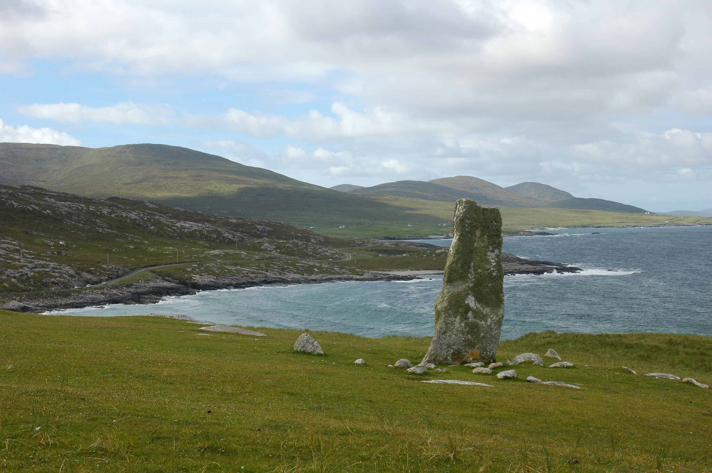
On a small hillock above Traigh Iar beach on the west coast of Harris, a single standing stone has held its ground for approximately five thousand years. Carved from Lewisian gneiss that formed when the Earth was young, it rises over three metres against the Atlantic sky. Below it, white sand. Beyond it, the Sound of Taransay and the open ocean. The Neolithic farming community that raised it is gone. Their stone remains, still marking this place as significant.
You come to Macleod's Stone by crossing a beach. This matters. The approach is not through a gate or along a managed path but across Traigh Iar, one of the most striking stretches of sand in the Outer Hebrides, where the water runs turquoise over white shell sand and the wind is a constant companion. Then you climb. The hillock called Cnoc Dubh rises at the north end of the beach, and the stone stands on its summit, visible from a distance but revealing its true scale only as you draw close.
The stone is a slab of Lewisian gneiss, roughly 3.2 metres tall, 1.37 metres broad, and a hand's breadth deep. Lewisian gneiss is among the oldest rock on Earth, formed approximately three billion years ago in the deep crust of an ancient continent. The builders who selected and raised this particular piece of the world's foundation did so around 3000 to 2500 BCE. They were farmers who knew this coast intimately, who cultivated small fields in what was then a more wooded and sheltered landscape. The stone was their declaration: this place is ours, and has been, and will be.
Two flanking slabs, each over a metre long, stand on edge at right angles to the main stone. A ring of rubble approximately six metres across surrounds the base. These features suggest a burial cairn, though no excavation has confirmed this. A human cranium was found eroding from a nearby cliff section. The dead were here, close to the stone. Whatever purpose it served, the relationship between monument and mortality seems present.
In Gaelic tradition, the stone carries two names. The older is Ord Bhairnich, the Limpet Hammer, a fragment of a giant's tool shattered on the rocks. The later name, Clach Mhic Leoid, ties it to the MacLeod clan who ruled Harris from the thirteenth century. The stone predates both names by millennia. It predates the Gaelic language itself. It stands in a time before names, marking a place that needed marking.
Context and lineage
Around five thousand years ago, on the Atlantic coast of what is now the Isle of Harris, a community of Neolithic farmers selected a piece of Lewisian gneiss and raised it on a hillock above the beach. The landscape they knew was different from today's: more trees, less peat, a warmer and drier climate, small fields of barley and pasture for livestock. The sea was at a different level. The coast had a different shape. But the hillock was already there, rising above the shore, offering views across the Sound of Taransay and along the coast in both directions.
They chose their stone with purpose. Lewisian gneiss is the bedrock of the Outer Hebrides, the foundation on which everything rests. To raise a piece of that foundation into the vertical was to make a statement about permanence, about belonging, about the relationship between a community and the land that sustained them. The stone said: we are here. We have been here. Our dead are here. This place is marked.
The two flanking slabs and the ring of rubble around the base suggest the stone may have stood at the centre of a burial cairn, though no excavation has confirmed this. A human cranium found eroding from a cliff section nearby adds weight to the funerary interpretation. The stone may also have served as a navigational marker, visible to boats moving along the inner sea route on the Atlantic side of Harris.
Millennia passed. The trees disappeared. The peat grew. The climate cooled and wetted. New peoples came, bringing new languages. The Gaelic speakers who arrived sometime in the early medieval period found the stone already ancient, already nameless, and gave it a name from their mythology: Ord Bhairnich, the Limpet Hammer, a fragment of a tool wielded by the Cailleach, the divine hag of Gaelic tradition. Later, the MacLeods of Harris claimed the stone for their clan, renaming it Clach Mhic Leoid. Each naming was an act of appropriation, a new community asserting its relationship with an ancient landmark. The stone absorbed each name without comment.
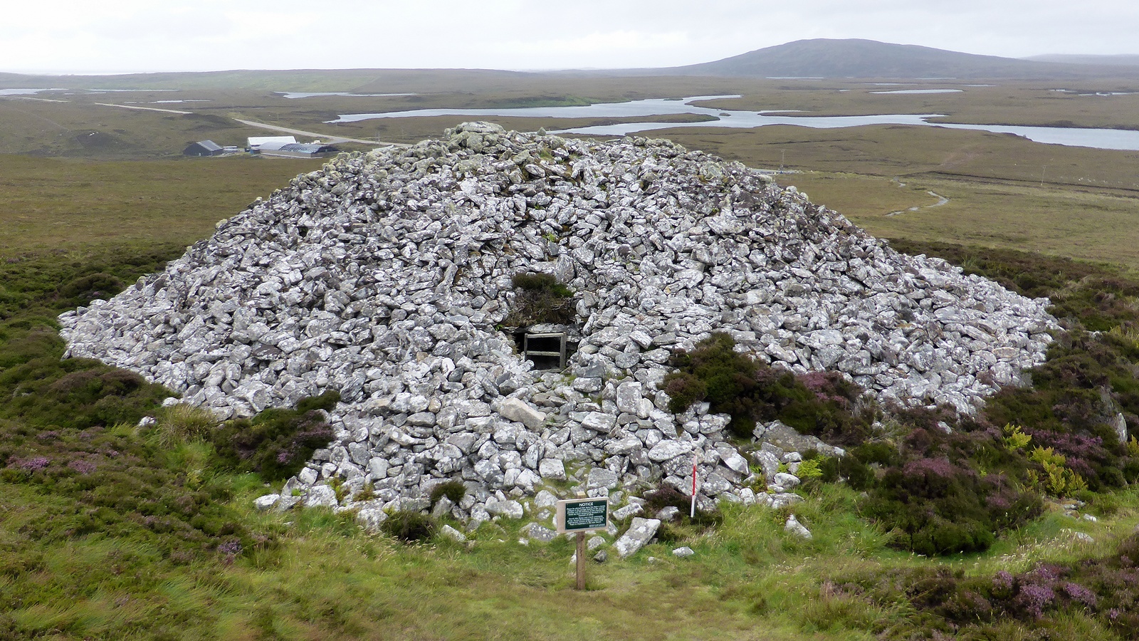
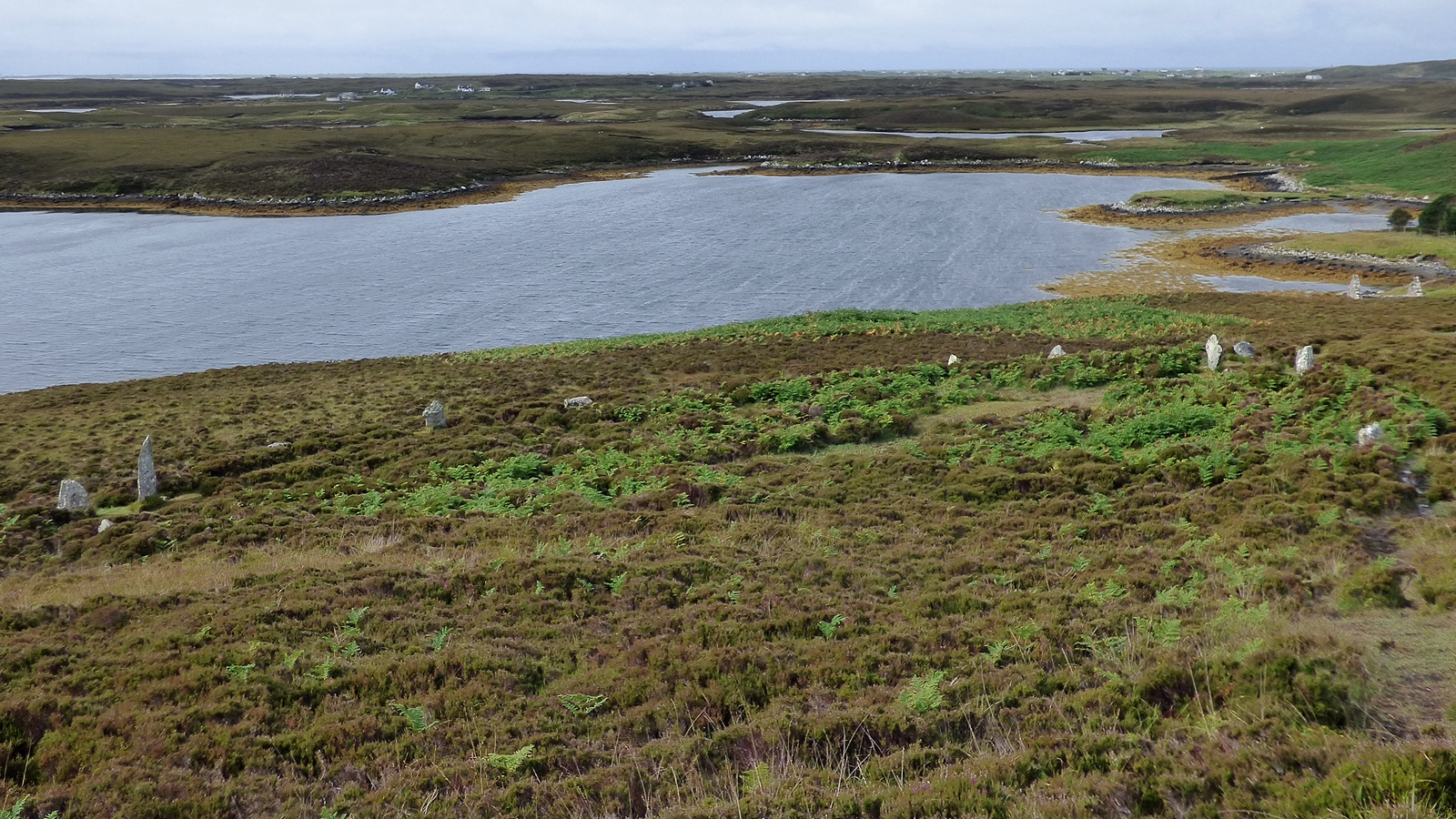
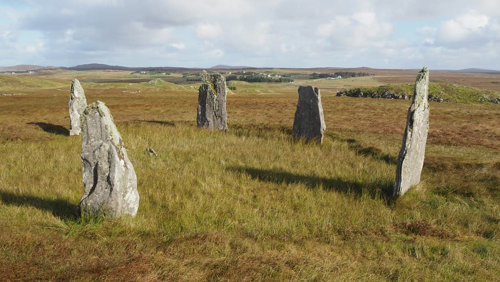
Macleod's Stone belongs to the megalithic tradition of Atlantic Europe, a practice of erecting large stones that spans from Portugal to Scandinavia and from the fifth to the second millennium BCE. In the Outer Hebrides, this tradition produced some of the most significant megalithic monuments in Britain, including the Callanish stone circle complex on Lewis, thirty miles to the north. Harris itself has several standing stones, including Clach Steineagaidh near Borve and the Borve standing stone. These were not isolated monuments but elements in a sacred landscape, positioned in relation to each other, to the coast, to the mountains, and possibly to celestial events. Macleod's Stone, standing alone on its Atlantic hillock, occupied a specific place in that landscape, a place we can see but can no longer fully read.
RCAHMS surveyors
Harris Archaeological Survey team
Why this place is sacred
The thinness of Macleod's Stone is not subtle. It does not require interpretation or imagination. It is physical, spatial, elemental.
You stand on a hillock between two beaches, between land and ocean, between earth and sky. The stone rises beside you, taller than you are, thinner than your arm span, a flat blade of gneiss angled against the wind. To the west, the Sound of Taransay and then the Atlantic, uninterrupted until Newfoundland. To the east, the machair and the hills of Harris. Below, the white sand of Traigh Iar. Above, whatever the Hebridean sky has chosen to offer: storm light, midsummer gold, the grey luminosity of a day that cannot decide what it wants to be.
The stone itself carries a doubled antiquity. The Lewisian gneiss from which it is made formed approximately three billion years ago, during the Archaean eon, when life on Earth consisted of single-celled organisms and the atmosphere held no oxygen. This rock is among the oldest exposed surface material on the planet. The act of raising it as a standing stone occurred roughly five thousand years ago. These two timescales, the geological and the human, converge in the same object. Your hand on the stone touches both.
The possible funerary associations deepen the thinning. The scattered rubble ring at the base may be the remains of a cairn. The flanking slabs resemble kerb stones. A human skull was found eroding from the cliff nearby. If this was a place of the dead, the stone marks a threshold between the living world and wherever the Neolithic community believed the dead went. That threshold remains unmarked by any modern sign or fence. You simply stand beside it.
There is also the matter of sound. On a calm day, which is rare on the Atlantic coast of Harris, the silence is extraordinary. On a windy day, which is most days, the sound is the wind itself, and the surf, and nothing else. No traffic. No machinery. No recorded interpretation. The stone stands in sound that has not fundamentally changed in five thousand years.
The stone's original purpose remains debated. It may have served as a territorial marker, asserting a community's claim to this stretch of coast. It may have functioned as a navigational aid, visible to boats entering the bay from the Sound of Taransay. The possible cairn remains suggest funerary use. Some scholars propose astronomical or calendrical alignment, though no specific alignment has been confirmed. Most likely, the stone served several of these purposes simultaneously. Neolithic monuments rarely had a single function.
The stone has remained in its original position for approximately five thousand years. Unlike many prehistoric sites, it has not been excavated, restored, or substantially altered. The Royal Commission on the Ancient and Historical Monuments of Scotland surveyed the site in the twentieth century, documenting the stone's dimensions and the surrounding features. The Harris Archaeological Survey of 2004 to 2006 included the site. It was designated as Scheduled Monument SM5337 by Historic Environment Scotland. The Gaelic naming traditions represent cultural evolution around the stone rather than physical alteration of it. The stone itself has simply endured.
Traditions and practice
Original Neolithic practices at the stone are unknown. The possible cairn and nearby human remains suggest funerary rites. The stone's position as a coastal landmark suggests it may have marked seasonal gatherings, navigational routes, or territorial boundaries. In the medieval period, it may have served as a gathering point for Clan MacLeod. Gaelic oral tradition preserved the stone's significance through the Cailleach legend, a form of cultural practice that kept the monument alive in communal memory.
No formal ceremonies or organised practices take place at the stone. It functions as a heritage site, freely accessible and unattended. Contemporary visitors include walkers on the Hebridean Way, photographers drawn to the dramatic coastal setting, and those with an interest in megalithic heritage and the deep history of the Outer Hebrides.
Begin at the beach. The approach across Traigh Iar is not an inconvenience but an essential part of the experience. Walking on sand slows you down, changes your gait, requires a different kind of attention. If the tide allows, walk barefoot. The cold of Atlantic sand against skin is a form of arrival.
Climb the hillock slowly. As the stone comes into view, notice the moment it becomes recognisable as a monument rather than a natural feature. This threshold, the moment a shaped stone declares itself as shaped, is the threshold between landscape and meaning.
Stand beside the stone. Place your hand on it if you wish. The gneiss is rough, cold, and ancient beyond comprehension. The rock itself formed three billion years ago. The act of raising it occurred five thousand years ago. Your touch occurs now. Three points on a timeline that the mind cannot hold simultaneously, yet the stone holds them all.
Face west. The Sound of Taransay, the Atlantic, the edge of Europe. The Neolithic farmers who raised this stone looked at this same horizon, though the details were different. The horizon itself has not changed.
Look down at the base. The packed stones, the flanking slabs, the rubble ring. Consider the possibility that the dead rest here. If so, this is a place of both assertion and grief, a monument to presence and to absence.
If time permits, walk the circular route via Traigh Nisabost. The full loop is approximately 2.9 kilometres and returns you to the road with the stone behind you, a dark shape on the hillock, watching the sea as it has watched for fifty centuries.
Neolithic Megalithic Tradition
HistoricalMacleod's Stone was erected approximately 3000 to 2500 BCE by a Neolithic farming community on Harris. The stone belonged to the wider megalithic tradition of Atlantic Europe, which produced standing stones, stone circles, and chambered cairns across the western seaboard from Iberia to Scandinavia. In the Outer Hebrides, this tradition reached its most elaborate expression at Callanish on Lewis, but solitary standing stones like Macleod's Stone were more common and may have served more local, intimate purposes.
Original practices are unknown. The stone may have served as a territorial marker, a navigational aid, a focus for funerary rites, or a calendrical reference point. The possible cairn remains and nearby human skull suggest a relationship with death and burial.
Gaelic Folklore Tradition
ActiveThe Gaelic naming traditions for the stone represent two distinct phases of cultural interpretation. The name Ord Bhairnich connects the stone to the Cailleach, the divine hag figure of Gaelic cosmology, placing it within a mythic geography that extends across the Gaelic-speaking world. The name Clach Mhic Leoid represents the medieval MacLeod clan's appropriation of ancient landmarks as symbols of territorial authority.
Oral storytelling traditions, particularly the Cailleach legend, have been transmitted through Gaelic-speaking communities and are preserved in contemporary retellings. The stone functions as a tangible connection to the Gaelic mythological landscape.
Heritage Conservation and Stewardship
ActiveThe stone is designated as Scheduled Monument SM5337 and recorded as Canmore site 10532. It is protected under the Ancient Monuments and Archaeological Areas Act 1979 and managed by Historic Environment Scotland. The site is featured on the Hebridean Way walking route and promoted by Visit Outer Hebrides.
Archaeological survey, heritage protection, public access management, and integration into the cultural tourism landscape of the Outer Hebrides.
Experience and perspectives
The most natural approach begins at the informal parking near Horgabost, where the road bends along the coast. From here you walk west toward Traigh Iar, and the beach opens before you. On a clear day, the sand is white, the water is turquoise, and the island of Taransay sits on the horizon like something dreamed. On a grey day, which is equally likely, the colours mute to silver and pewter and the beach feels larger, more elemental.
Crossing Traigh Iar takes ten to fifteen minutes, depending on tide and pace. The sand is soft in places. You may need to remove your shoes. This is not a hardship but a gift: the feel of cold Atlantic sand underfoot, the transition from the ordinary world of car and road to the older world of stone and shore.
At the north end of the beach, the hillock of Cnoc Dubh rises above the dunes. The climb is short but steep, through grass and windblown turf. The stone appears gradually as you ascend, first as a dark shape against the sky, then as a recognisable monolith, then as a physical presence beside you, three metres of ancient gneiss set firmly into the earth.
Stand with the stone. Face west, toward the Atlantic. The Sound of Taransay lies before you, and on clear days the island itself is visible, uninhabited since 1974, its outline familiar from the castaway television series that brought temporary fame to this coast. But the stone was here long before television and long before the last inhabitants left Taransay. It was here before the MacLeods. It was here before the Gaelic language reached these shores. It was here before the peat formed and the trees disappeared. It was here when the landscape was different, the shoreline was different, the climate was different, and a community of farmers looked out at a world we would not recognise and decided that this hillock needed a stone.
Look down at the base. The packed boulders that support the stone are visible. The two flanking slabs, each over a metre long, stand at right angles. The ring of rubble extends roughly six metres in diameter. Whether this was a cairn is unknown. What is known is that someone placed these stones with care, that the arrangement was deliberate, that the dead may rest here.
The wind will likely be strong. It is almost always strong on the Atlantic coast of Harris. Let it be. The stone has stood in this wind for five thousand years. Your visit is a moment in its life.
Macleod's Stone stands on the hillock of Cnoc Dubh at the north end of Traigh Iar beach, on the west coast of the Isle of Harris between the settlements of Horgabost and Nisabost. The stone faces the Sound of Taransay and the open Atlantic to the west. The beaches of Traigh Iar and Traigh Nisabost lie to the south and southeast. The hills of Harris rise to the east.
Macleod's Stone is understood through several overlapping lenses: archaeological, folkloric, and experiential. Each reveals a different dimension of the monument's significance.
Archaeological understanding of Clach Mhic Leoid is based primarily on surface survey rather than excavation. The Royal Commission on the Ancient and Historical Monuments of Scotland recorded the stone's dimensions at 10 feet 6 inches in height, 4 feet 6 inches in breadth, and 10 to 16 inches in depth. The two flanking slabs, each over 3 feet long and set at right angles to the main stone at a distance of 8 feet 6 inches, were noted as resembling kerb stones of a cairn. A ring of rubble stones approximately 6 metres in diameter reinforces this interpretation. The stone is classified as Canmore site 10532 and designated Scheduled Monument SM5337.
The Harris Archaeological Survey of 2004 to 2006 placed the stone within the broader context of Harris's archaeological landscape. The Neolithic date of approximately 3000 to 2500 BCE is based on comparative analysis with other standing stones in the Outer Hebrides rather than direct dating. The human cranium found eroding from a nearby cliff has not been formally dated or conclusively linked to the stone.
Scholars note the stone's position on what appears to be an inner sea route along the Atlantic coast of Harris, suggesting a navigational function alongside any ceremonial or funerary purpose. The relationship between Macleod's Stone and other Harris standing stones, particularly Clach Steineagaidh and the Borve stone, remains an open question in the archaeology of the Western Isles.
Gaelic oral tradition preserves two layers of meaning for the stone. The older name, Ord Bhairnich, translates as Limpet Hammer and connects the stone to the Cailleach, one of the most widespread and ancient figures in Gaelic mythology. In the Harris version of the legend, the Cailleach was a giant or divine hag who lived on the island before the time of humans. She possessed a massive stone hammer, the size of a bus, which she used to knock limpets from the rocks as she walked the shore. One day, striking a particularly stubborn limpet at Nisabost, the hammer split into three pieces. The largest fragment became Macleod's Stone. The two flanking slabs are the other fragments.
This legend does what good mythology does: it explains a visible feature of the landscape while connecting it to a deeper cosmological framework. The Cailleach is not merely a local character but a pan-Celtic figure associated with winter, wildness, sovereignty, and the shaping of the land itself. To call the stone her hammer is to place it in a mythic geography that extends far beyond Harris.
The later name, Clach Mhic Leoid, represents the medieval MacLeod clan's claim on the landscape. The MacLeods held the chieftainship of Harris from the thirteenth or fourteenth century until the late eighteenth century. Naming the stone for the legendary ancestor Leod was an assertion of authority, a way of inscribing the clan's presence onto a monument that long predated their arrival.
Some visitors approach the stone from perspectives grounded in earth-based spirituality, geomancy, or megalithic research. The stone's position on a hillock between two beaches, at the threshold of land and sea, is noted as characteristic of liminal or transitional sacred spaces. The use of Lewisian gneiss, among the oldest rock on Earth, may have held specific significance for the builders that extended beyond the practical qualities of the material.
The stone's relationship to the wider megalithic landscape of the Outer Hebrides, including the Callanish complex on Lewis, is sometimes interpreted through frameworks of energetic connection or landscape alignment. While these interpretations go beyond what archaeological evidence can confirm, they reflect a genuine attempt to understand why Neolithic communities invested such effort in the selection, transport, and erection of specific stones in specific locations.
Significant questions remain unanswered. Whether the rubble ring at the stone's base represents a genuine burial cairn cannot be determined without excavation. The identity, date, and cultural context of the human cranium found eroding nearby are unknown. Whether the stone had any astronomical alignment or calendrical function has not been investigated. The original relationship between Macleod's Stone and the other standing stones on Harris is unclear. Whether the Gaelic name Ord Bhairnich preserves a folk memory older than the MacLeod association, or whether it reflects a later medieval interpretation, is debated. The nature of the Neolithic landscape around the stone, before peat formation altered the terrain and sea-level changes reshaped the coast, can only be partially reconstructed.
Visit planning
Limited accommodation is available in the Horgabost and Seilebost area, including self-catering cottages and bed-and-breakfast establishments. Horgabost campsite is adjacent to the beach. More options exist in Tarbert and Leverburgh. Booking well in advance is advisable for summer visits, as accommodation on Harris is limited and demand is high.
Respect the scheduled monument. Do not climb on or touch the stone roughly. Leave nothing behind.
Dress for exposed Hebridean coastal weather. Waterproof layers are essential. The wind on this stretch of coast is persistent and can be fierce. Sturdy footwear is recommended for the beach crossing and the grassy hillock ascent, though sandals or bare feet may be appropriate for the beach itself in warmer months.
Photography is freely permitted and the setting rewards it generously. The stone photographs well from the south, with Traigh Iar and the turquoise water as background. From the west, it stands against the sky. Dawn and dusk light on this Atlantic-facing coast can be extraordinary. The view toward Taransay is particularly striking.
The stone has no tradition of offerings. Nothing should be left at or around the monument. Presence and attention are sufficient.
Do not climb on, lean against, or strike the stone. Do not dig around the base or move any of the surrounding stones. As a Scheduled Monument, it is a criminal offence to damage, alter, or excavate the monument or its setting without consent from Historic Environment Scotland. Leave no trace.
Plan your visit
Address
Harris, Isle of Harris HS3 3AE, UK
Hours
Hours, fees, and access can change — verify on the official source before you travel. Practical details last checked Jun 2026.
Nearby sacred places
Sacred places within a half-day’s reach. Pilgrims often visit them together: walk one, stay for the other.

References
Sources consulted when researching this page. Independent verification by readers is welcome.
- 01Harris, Clach Mhic Leoid — Canmore / Historic Environment Scotlandhigh-reliability
- 02Clach Mhic Leoid, standing stone (SM5337) — Historic Environment Scotlandhigh-reliability
- 03CLACH MHIC LEOID, HARRIS (Monument Record 1359) — Comhairle nan Eilean Siar Historic Environment Recordhigh-reliability
- 04Clach Mhic Leoid — Isle of Harris
- 05Macleod Standing Stone (Clach Macleoid) — Visit Outer Hebrides
- 06Macleod's Stone — Atlas Obscura
- 07Clach Mhic Leoid [MacLeod's Stone, Nisabost] Standing Stone (Menhir) — The Megalithic Portal
- 08The Macleod Stone (Standing Stone / Menhir) — The Modern Antiquarian
- 09Clach Mhicleoid, Harris - standing stone — Stones of Wonder
- 10Macleod's Stone and Traigh Iar — WalkHighlands
Key questions
What pilgrims usually ask
- Why is Macleod's Stone considered sacred?
- Visit Macleod's Stone (Clach Mhic Leoid), a 5,000-year-old Neolithic standing stone above Traigh Iar beach on the Isle of Harris, Outer Hebrides. Free access ye
- What should I wear at Macleod's Stone?
- Dress for exposed Hebridean coastal weather. Waterproof layers are essential. The wind on this stretch of coast is persistent and can be fierce. Sturdy footwear is recommended for the beach crossing and the grassy hillock ascent, though sandals or bare feet may be appropriate for the beach itself in warmer months.
- Can I take photos at Macleod's Stone?
- Photography is freely permitted and the setting rewards it generously. The stone photographs well from the south, with Traigh Iar and the turquoise water as background. From the west, it stands against the sky. Dawn and dusk light on this Atlantic-facing coast can be extraordinary. The view toward Taransay is particularly striking.
- How long should I spend at Macleod's Stone?
- 1 to 1.5 hours, allowing time for the beach crossing, unhurried time at the stone, and the return
- What offerings are appropriate at Macleod's Stone?
- The stone has no tradition of offerings. Nothing should be left at or around the monument. Presence and attention are sufficient.
- What etiquette should visitors follow at Macleod's Stone?
- Respect the scheduled monument. Do not climb on or touch the stone roughly. Leave nothing behind.
- What is the history of Macleod's Stone?
- Around five thousand years ago, on the Atlantic coast of what is now the Isle of Harris, a community of Neolithic farmers selected a piece of Lewisian gneiss and raised it on a hillock above the beach. The landscape they knew was different from today's: more trees, less peat, a warmer and drier climate, small fields of barley and pasture for livestock. The sea was at a different level. The coast had a different shape. But the hillock was already there, rising above the shore, offering views across the Sound of Taransay and along the coast in both directions. They chose their stone with purpose. Lewisian gneiss is the bedrock of the Outer Hebrides, the foundation on which everything rests. To raise a piece of that foundation into the vertical was to make a statement about permanence, about belonging, about the relationship between a community and the land that sustained them. The stone said: we are here. We have been here. Our dead are here. This place is marked. The two flanking slabs and the ring of rubble around the base suggest the stone may have stood at the centre of a burial cairn, though no excavation has confirmed this. A human cranium found eroding from a cliff section nearby adds weight to the funerary interpretation. The stone may also have served as a navigational marker, visible to boats moving along the inner sea route on the Atlantic side of Harris. Millennia passed. The trees disappeared. The peat grew. The climate cooled and wetted. New peoples came, bringing new languages. The Gaelic speakers who arrived sometime in the early medieval period found the stone already ancient, already nameless, and gave it a name from their mythology: Ord Bhairnich, the Limpet Hammer, a fragment of a tool wielded by the Cailleach, the divine hag of Gaelic tradition. Later, the MacLeods of Harris claimed the stone for their clan, renaming it Clach Mhic Leoid. Each naming was an act of appropriation, a new community asserting its relationship with an ancient landmark. The stone absorbed each name without comment.
- Who is associated with Macleod's Stone?
- RCAHMS surveyors, Harris Archaeological Survey team