Pla de Petracos Sanctuary
Where Neolithic farmers painted their gods on limestone — the oldest pictorial sanctuary in Mediterranean Iberia
Understand sacred places, explore living traditions, and learn how to engage respectfully with Pilgrim Map.
Access has not been verified. Check current local guidance before planning a visit.
Castell de Castells, Alicante, Spain
Read the sources
Visit essentials
A quick read before you go
- Duration
- Allow one to two hours at the site itself.
- Access
- The site is on the CV-720 road between Benigembla and Castell de Castells at kilometer 7.
Overview
The limestone cliffs above Barranc de Malafí have held these figures for approximately seven thousand years. Mediterranean Iberia's first farming communities painted Pla de Petracos's orants—upright forms with raised arms that archaeologists read as prayer or invocation. This type site for Macro-schematic art represents the Valencian region's earliest identified pictorial tradition. Predating better-known Levantine hunting art, it comes from a time when human labour and natural fertility were understood cosmologically.
Researchers describe the shelters not as a gallery but as a spatial altarpiece: a cliff-face liturgical space where community gathered and painting itself was ritual. Nine shelters are identified; five bear visible motifs. Serpentiform lines, stacked figures, and abstract plant forms use red ochre, a pigment associated with blood, life, and the sacred across many prehistoric traditions.
The site preserves a rare complete spatial experience rather than a fragment. Ravine, water, overhanging rock, and painted surface remain related. Water, geological shelter, or some earlier quality may have drawn Neolithic farmers to this cliff; part of what preceded the paintings remains present.
Why this place is sacred
The sacred quality of Pla de Petracos is partly geological and partly constructed — and the Neolithic painters seem to have understood that distinction and worked with it. The overhanging limestone shelters create a natural architecture of enclosure, set apart from the open hillside, facing a ravine through which a seasonal stream flows.
For farming communities whose survival depended on rainfall in a dry Mediterranean landscape, a place where water emerged reliably from rock would have carried its own numinosity before a single figure was painted.
The painters did not treat the rock as a neutral surface. The natural protrusions, cavities, and colour variations in the limestone are woven into the compositions — the boundary between painted image and living rock is intentionally dissolved. This integration of natural form and human mark is a characteristic of prehistoric sanctuary art across Europe and represents a specific theological position: the sacred is not imposed on the landscape, it is drawn out of it.
A large natural stone at the base of the cliff, emerging from the ground near the shelters, is thought by archaeologists to have held ritual significance — possibly functioning as an altar or a point of focal gathering. Its position, at the threshold between the open valley and the sheltered cliff face, suggests it may have marked the entrance to the sanctuary zone.
The scale of the orant figures — their commanding vertical presence on the cliff — creates a theatrical sacred space. Painted in vivid red and visible from a distance, they announce the site as a place set apart. Entering the space below them, even today from behind a protective fence, carries a sense of coming before something that addressed itself to very large concerns.
Communal sanctuary for early Neolithic farming communities, serving as a site of ritual petition, seasonal gathering, and collective expression of cosmological relationship between human communities and the forces of fertility, fecundity, and the agricultural cycle.
The primary sanctuary function belongs to the Macro-schematic tradition, dated approximately 7,500–6,000 BP. One shelter shows a later Levantine Art depiction of a wounded deer, suggesting continued ritual or commemorative use of the location across different prehistoric cultural phases. After the Neolithic and Bronze Age periods, the site appears to have passed out of active sacred use.
It re-entered human attention in 1980 when local researchers Pere Ferrer and Enrique Catalá rediscovered and documented it; since 1998 it has held UNESCO World Heritage status as part of the Rock Art of the Mediterranean Basin on the Iberian Peninsula.
Experience and orientation
The approach is deliberately understated. A small parking area beside the CV-720 gives way to a ten-minute walk across the valley floor toward the cliff. The scale of the landscape — the Malafí ravine dropping below, the dry Mediterranean hillside, the limestone face catching morning light — precedes the paintings and establishes the context in which they were made.
The shelters come into view from the path as you near the base of the cliff. The protective walkways and fencing keep visitors at a respectful distance, and the explanatory panels in Spanish and English provide orientation. The paintings themselves occupy natural overhangs at heights that suggest they were made by people standing on the ground or on simple scaffolding — close enough to be worked carefully, high enough to be seen from below.
First-time visitors often note that the figures are smaller than expected. Photographs circulated in publications and online tend to be taken close and enlarged; in person, binoculars are recommended and genuinely improve the experience. What resolves at magnification is the quality of the ochre line — the deliberate, steady marks of a hand working on stone — and the compositional relationships between figures that are harder to grasp from a distance.
The ambience of the site is rated 5/5 by the Megalithic Portal community, an assessment that reflects less the visual drama of the paintings than the rare coherence of the place. The ravine, the water sound, the sheltered stone, and the figures have not been separated from one another by centuries of overlay. The site reads as a sanctuary rather than a ruin.
Begin at the explanatory panels before approaching the cliff — they identify each shelter's motifs and give the chronological context necessary for the paintings to be legible. The Castell de Castells museum, three kilometers away in the village, provides reproductions at eye level and audiovisual presentations that make the forms far easier to study than they are at distance on the cliff.
Visiting the museum before or after the site transforms the encounter from a general impression into a grounded one. The walk itself is short and manageable on any level of fitness; footwear suitable for uneven rocky ground is sufficient.
Context and lineage
No mythological origin narratives survive from the Neolithic creators, and no oral tradition has been documented from any group claiming cultural descent from them. Archaeological interpretation fills the gap. The site appears to have been deliberately chosen for its geological character — the overhanging limestone shelters facing the Barranc de Malafí create a natural enclosure, and the seasonal stream in the ravine below would have been a significant resource for early farming communities in an otherwise arid landscape.
The association between water emergence and sacred location is well-documented in Neolithic religion across the Mediterranean.
The paintings were made by communities that had recently transitioned from hunter-gatherer to agricultural life. The first farmers of the Iberian Mediterranean coast — identified archaeologically through cardial ceramics, ground stone tools, and evidence of cereal cultivation — arrived in this region approximately 7,500–7,000 years ago.
Their spiritual concerns centred, as far as the material record allows us to reconstruct, on the forces that governed crop success: rainfall, soil fertility, the regularity of seasons, and the relationship between human labour and natural abundance. At Pla de Petracos, those concerns were given monumental visual form.
Pla de Petracos belongs to the Macro-schematic pictorial tradition, which is found exclusively in the Mediterranean zone of Valencia and represents the earliest known rock art tradition of the region. The stratigraphic relationship between styles was established at La Sarga, Alcoy, where Macro-schematic figures were found preserved beneath Levantine art — confirming that the orant tradition predates the later naturalistic hunting scenes by approximately 3,000–4,000 years.
The site's UNESCO inscription in 1998 placed it within a serial World Heritage designation covering multiple rock art locations across Spain, recognising the Mediterranean Basin as a coherent zone of prehistoric pictorial culture.
Pere Ferrer and Enrique Catalá
Discoverers
Mauro Hernández Pérez
Lead researcher
Jorge Soler
Conservation supervisor
Joaquim Bolufer Marqués et al.
Researchers
Neolithic Macro-schematic painters
Original creators
Traditions and practice
The Neolithic painters created large orant figures in red ochre as acts of collective ritual, likely seasonal and tied to agricultural cycles. Communal gathering at the cliff sanctuary is inferred from the scale and organisation of the work. A large natural stone at the cliff base appears to have functioned as a ritual focal point.
At contemporary sites connected to the sanctuary complex, cardial ceramics, musical instruments, and ritual objects have been deposited, suggesting an extended material culture of worship that accompanied the painting tradition.
Academic research, conservation monitoring, and heritage interpretation constitute the ongoing relationship with the site. MARQ (the Provincial Archaeological Museum of Alicante) and the Diputación de Alicante maintain conservation supervision. The Castell de Castells Ethnographic and Macro-Schematic Art Museum provides public interpretation. No religious or spiritual communities conduct ceremonies at the site.
Walk to the site in the morning, when the light falls across the cliff face at an angle that reveals the texture of the painted surfaces. Stand for a time at the base of the cliff before reading the explanatory panels — allow the spatial organisation of the shelters to register as a whole before the labels divide them. Notice the natural stone at the cliff base and consider its relationship to the painted figures above.
When looking at the orant forms, attend to the posture itself — arms raised, body upright — and consider what that gesture communicates across seven thousand years without language.
Neolithic Macro-Schematic Ritual Tradition
HistoricalThe site represents the spiritual and cosmological world of the first farming communities in the Mediterranean Iberian Peninsula, dated to approximately 7,500–6,000 BP. The sanctuary functioned as a communal gathering and worship site where fertility, agricultural cycles, family ties, and the sacred character of farming were expressed through monumental painted figures. The macro-schematic style — defined by large simplified orant figures with raised arms and serpentiform geometric motifs — is found only in the Mediterranean areas of Valencia and is considered the earliest known pictorial tradition in the region, predating Levantine art.
Creation of large orant figures in red ochre as ritual acts of collective petition or veneration; communal seasonal gathering at the cliff sanctuary; possible use of the large natural stone at the cliff base as a ritual focal point; deposition of cardial ceramics, musical instruments, and ritual objects at nearby contemporary sites.
Levantine Art Tradition
HistoricalOne shelter at Pla de Petracos contains a Levantine Art depiction of a wounded deer, representing a chronologically later tradition (approximately 3,000 BP). Levantine art typically depicts naturalistic hunting scenes and animals, and its presence at the site suggests continued ritual or commemorative use of the sanctuary across different prehistoric cultural phases.
Naturalistic depiction of a hunting scene in red pigment, inserted into a space already carrying the earlier macro-schematic program.
Archaeological and Heritage Stewardship
ActiveSince the 1980 discovery and 1982 formal presentation to the scientific community, Pla de Petracos has been the subject of ongoing archaeological research and conservation stewardship. MARQ (the Provincial Archaeological Museum of Alicante) manages the site in partnership with the Diputación de Alicante. The UNESCO inscription in 1998 formalised international recognition. Conservation monitoring, protective infrastructure, and public interpretation constitute the active living relationship with the site.
Conservation monitoring of painted surfaces; protective infrastructure maintenance; academic publication and conference presentation; public museum interpretation at Castell de Castells; guided educational programs for schools and heritage tourists.
Perspectives and open questions
The paintings at Pla de Petracos have attracted several competing interpretive frameworks — archaeological consensus, Mother Goddess theology, and a set of genuinely unresolved questions that current evidence cannot close.
Scholarly perspective
Scholarly consensus holds that Pla de Petracos is the defining site of Macro-schematic art, the earliest identified rock art tradition in the Valencian Mediterranean region. The orant figures — large, simplified human forms with arms raised — are consistently interpreted as expressions of ritual activity: invocation, petition, or veneration. The serpentiform motifs that accompany them are generally read as symbols of fertility and renewal. The stratigraphic evidence from La Sarga, Alcoy, places this tradition before Levantine art by several millennia.
The site's function as a communal sanctuary, rather than a private or specialist religious space, is supported by the scale of the painted program — eight shelters, systematic in their organisation along the cliff, represent considerable communal labour. The connection to Neolithic agricultural spirituality is well-evidenced by the broader material culture of the period: cardial ceramics, ground stone tools for grain processing, and ritual objects found at contemporary sites.
Living and traditional perspectives
No living tradition claims direct descent from the Neolithic creators of the paintings, and no oral narrative associated with the site has been documented from any surviving cultural group. The Valencian and Spanish regional communities treat the site as shared human heritage. The relationship between contemporary visitors and the site is therefore one of historical curiosity and aesthetic encounter rather than living religious continuity.
Alternative interpretations
Bolufer Marqués et al. (MDPI Religions, 2020) advance the most developed alternative interpretation: that the orant figures represent a Mother Goddess or Great Mother deity, and that the act of painting constituted hierogamic ritual in which early farmers symbolically united with the fertilising force of the Earth. This reading draws on comparative Neolithic religion — Old European goddess traditions, Çatalhöyük, the broader literature on prehistoric feminine divinity — and situates the paintings within a pan-Mediterranean Neolithic fertility cult.
The interpretation is published in a peer-reviewed journal but goes beyond what the visual evidence alone can demonstrate, and it should be held as an illuminating hypothesis rather than established fact. The popular description of the site as the 'Sistine Chapel of Levantine Art' is evocative but technically inaccurate — the art is Macro-schematic, a distinct and chronologically earlier tradition than Levantine.
Open questions
The identity and social structure of the specific communities who made the paintings remains unknown. Whether the sanctuary was in continuous use or activated episodically over centuries cannot be determined from the paintings alone. The function of the large natural stone at the cliff base has not been established by excavation. Whether the site's orientation relates to seasonal, astronomical, or agricultural calendar events has not been formally studied.
The cosmological identity of the orant figures — a goddess, a shaman, an ancestor, a generic divine form — cannot be resolved with current evidence. And the floor of the shelters has not been formally excavated, meaning the full range of material culture associated with sanctuary use remains undocumented.
Plan your visit
Access and arrival
The site is on the CV-720 road between Benigembla and Castell de Castells at kilometer 7. From Dénia or Xàbia, travel via Pedreguer, Alcalalí, and Benigembla. Coordinates: 38°45'37"N, 0°10'59"E. Altitude: 485 meters. A small parking area accommodates two to three vehicles directly at the site; an overflow area is 200 meters downhill. The walk from the parking area to the shelters takes approximately ten minutes across the valley.
The path is unpaved and uneven — the site is not wheelchair accessible. Admission is free. No guided tours operate at the site itself; interpretation is via explanatory panels on the viewing platforms. Mobile signal may be unreliable in the ravine; check route details and download offline maps before leaving Benigembla. For emergencies, the nearest settlement with reliable signal is Benigembla, approximately seven kilometers via the CV-720.
Castell de Castells is a small mountain village with limited accommodation — rural houses and a small number of guesthouses. Broader accommodation options are available in Dénia (approximately 25 km) and Xàbia (Jávea), which offer full tourism infrastructure and are within comfortable driving distance for a day visit to the site.
Respectful visit
No dress code applies. The walk to the site is short but crosses uneven rocky terrain; footwear with grip is appropriate. The site sits at 485 meters elevation on an exposed hillside — weather-appropriate layers are advisable in cooler months, and sun protection is necessary in summer.
Photography is permitted throughout the site. Binoculars are strongly recommended for viewing the paintings, which are small and located at a distance behind protective fencing. The best photographic light is typically in morning hours when the sun is lower and shadows reveal the rock's texture.
No offerings are appropriate or permitted. The site is a protected archaeological monument and no tradition of votive deposit at this location has been documented in modern times.
Visitors must remain behind all protective fencing and stay on marked paths and viewing platforms. No touching, approaching, or marking of any rock surface is permitted. The paintings are irreplaceable — the ochre pigment has survived seven millennia under overhanging rock, and physical contact accelerates deterioration. Respect for the surrounding natural environment of the ravine and landscape is expected.
The paintings are behind protective fencing and must not be approached or touched. The rock surfaces are genuinely fragile — ochre on limestone weathers continuously, and the fencing represents decades of conservation effort. Visitors who have read accounts of previous generations accessing the cliff face directly should understand that such access is now prohibited and harmful to the site's survival.
Location
Map loads as you approach this section.
Pilgrim reflections
A portrait of encounter, not a score
Pilgrims describe what they felt, how present they could become, and whether the place would shape a journey. There are no stars and no ranking of traditions.
No reviewed reflections yet
The first pilgrims can help describe the character of being here.
Share a reflection
Available after an account-backed “Been there.” Every reflection is reviewed before publication.
Nearby sacred places
Explore other sacred places in the region. Proximity does not establish access or travel time; check each place’s guidance.

Monastery of Santa María de la Valldigna
Simat de la Valldigna, Valencia, Spain
43.9 km away

Basilica of Santa María, Elche
Elche, Alicante, Spain
68.3 km away
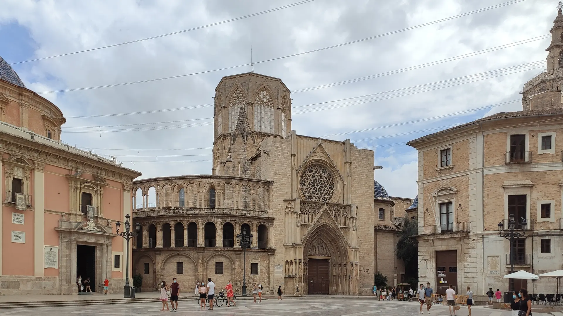
Valencia, Valencia Cathedral, Chalice of the Holy Grail
Valencia, Valencia, Spain
84.1 km away

Orihuela Cathedral
Orihuela, Alicante, Spain
98.9 km away
References
Sources consulted for this page. Source categories describe the publication, not a guarantee that every claim is verified. Traditional accounts and outside interpretations may differ.
- 01Santuario de Pla de Petracos — MARQ Museo Arqueológico de Alicante — MARQ Alicante (Provincial Archaeological Museum)officialOfficial description from the provincial archaeological museum responsible for site management. Confirms 8 shelters, 5 with visible motifs, discovery in 1980, UNESCO status, and sanctuary interpretation.
- 02Images of the Mother Goddess in the Neolithic Sanctuary of Pla de Petracos (Alicante, Spain) — The Sacralization of Agriculture — Bolufer Marqués, Joaquim et al.academicPeer-reviewed article in MDPI Religions (2020). Argues the orant figures represent a Mother Goddess linked to Neolithic agricultural fertility cults. Notes cardial ceramics and ritual objects found in surrounding archaeological sites. Contested interpretation but important primary academic source.
- 03Rock-Shelters of Pla de Petrarcos and Interpretation Centre — PRAT/CARP Rock Art Routes in Spain — PRAT Cultural Routes of SpainofficialOfficial heritage route documentation. Confirms 8 shelters (later expanded to 9), macro-schematic style predates Levantine art, confirmed stratigraphy at La Sarga Rock-Shelter in Alcoy. Documents visitor center hours and booking contact.
- 04MARQ Reaffirms Its Commitment to Pla de Petracos on the 40th Anniversary of Its Discovery — MARQ Alicante / Diputación de AlicanteofficialInstitutional press release on the 40th anniversary (2020). Names discoverers Pere Ferrer and Enrique Catalá of Centre d'Estudis Contestans; names researcher Mauro Hernández Pérez (University of Alicante); confirms Jorge Soler as conservation supervisor.
- 05Santuari del Pla de Petracos — MACMA Descobrim la Marina Alta — MACMA (Museu Arqueològic Comarcal de la Marina Alta)officialMunicipal archaeological museum documentation. Confirms site description, cultural context, and dual designation as Asset of Cultural Interest and UNESCO World Heritage Site.
- 06Pla de Petracos — Comunitat Valenciana Tourism — Generalitat Valenciana / Turisme Comunitat ValencianaofficialRegional government tourism and heritage portal. Confirms UNESCO status, macro-schematic art style, and site's standing as one of the most prominent European examples of schematic art.
- 07El Pla de Petracos in Castell de Castells: How to Get There, Route and What to See — La Marina Alta (regional tourism guide)Source contextDetailed practical visitor guide. Confirms free admission, CV-720 access at km 7, coordinates 38°45'37"N 0°10'59"E, altitude 485m, protective walkways and explanatory panels, and nearby sites Bitla and Espetla.
- 08Caves of Spain: Santuario del Pla de Petracos — Showcaves.comSource contextDetailed site description with access notes, parking information, art style descriptions, and visitor experience details. Notes a large stone near the cliff base may have had ritual significance. Documents the wounded deer motif as Levantine Art, chronologically later than macro-schematic paintings.
- 09Pla de Petracos Rock Art — The Megalithic Portal — Megalithic Portal contributorsacademicCommunity archaeological database entry. Rates site condition as 4/5 (Almost Perfect) and ambience 5/5 (Superb). Notes human figures in dancing poses and abstract plant-like depictions alongside one later deer image.
Share a photo
Help visitors recognize Pla de Petracos Sanctuary. Every submission is reviewed before publication.